
Russian Championship 2009. High-Altitude Technical Climbing Category
Report
Combined team of Novosibirsk region, Peak Pobeda Zapadnaya 6918 m, via the counterfort of the northwest wall (the "Camel" gendarme). Approximately 6B category of difficulty, first ascent.
Climbing Passport
-
Region — Central Tien Shan, №7.5.
-
Peak — Pobeda Zapadnaya (Vazha Pshavela) 6918 m, via the counterfort of the "Camel" gendarme on the north wall.
-
Proposed category — 6B, first ascent.
-
Route type — combined.
-
Route characteristics:
elevation gain — 2218 m, wall section elevation gain — 2100 m, route length — 4000 m, sections with 6th category difficulty — 620 m, 5th category difficulty — 880 m, average steepness of the wall section — 65°.
-
Equipment left on the route: pitons — 0; including bolt pitons — 0.
Pitons used on the route:
- stationary bolt pitons — 0;
- removable bolt pitons — 0.
Total number of used ITC — 7.
-
Climbing hours — 113, days — 9.
-
Team leader: Sokolov Gleb Anatolyevich, Master of Sports.
Team members: Gorelik Vitaly Romanovich, Candidate Master of Sports.
-
Team coach: Sokolov Gleb Anatolyevich, Master of Sports.
-
Departure date:
to the route — August 20, 2009, 05:00; to the summit — August 28, 2009, 17:00; return — August 29, 2009, 00:00.
-
Organizing body: Novosibirsk Region Alpine Federation.
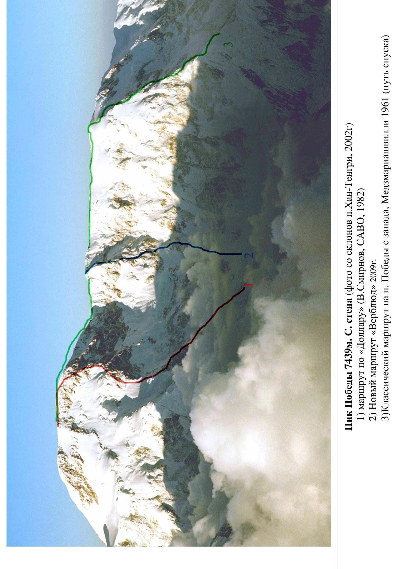
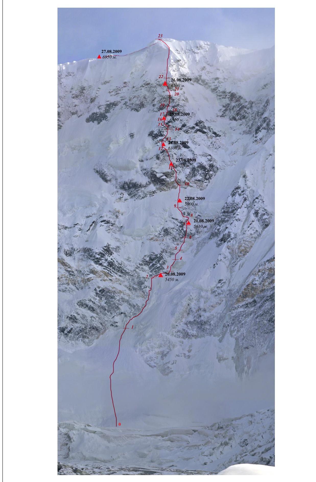
Peak Pobeda 7439 m. North wall (photo taken from the slopes of Khan-Tengri, 2002)
- Route via the "Dollar" (V. Smirnov, SAVO, 1982)
- New route "Verblud" (Camel) 2009
- Classic route to Peak Pobeda from the west, Medzmariashvili 1961 (descent route)
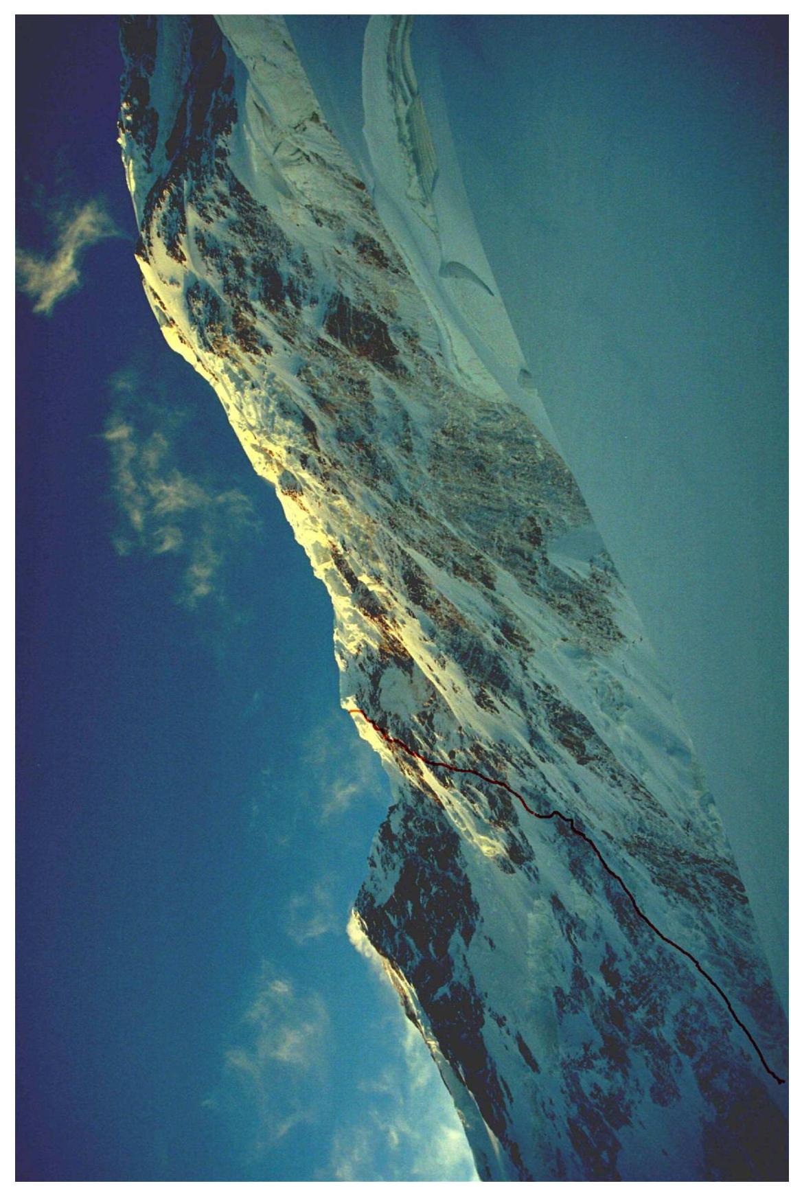
Route profile from the right (taken from Dikiy Pass (5300))
Ascent Graph
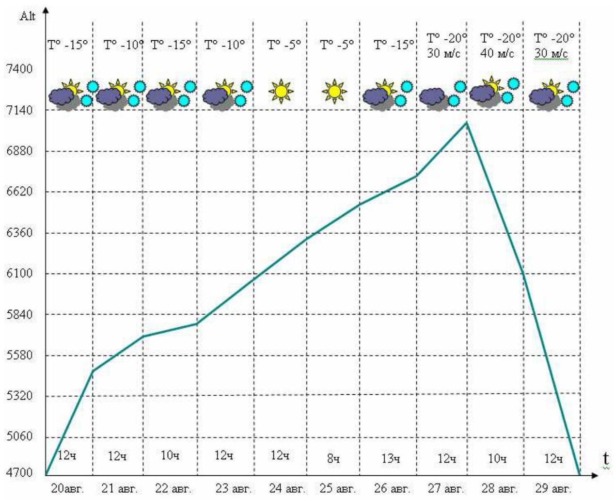
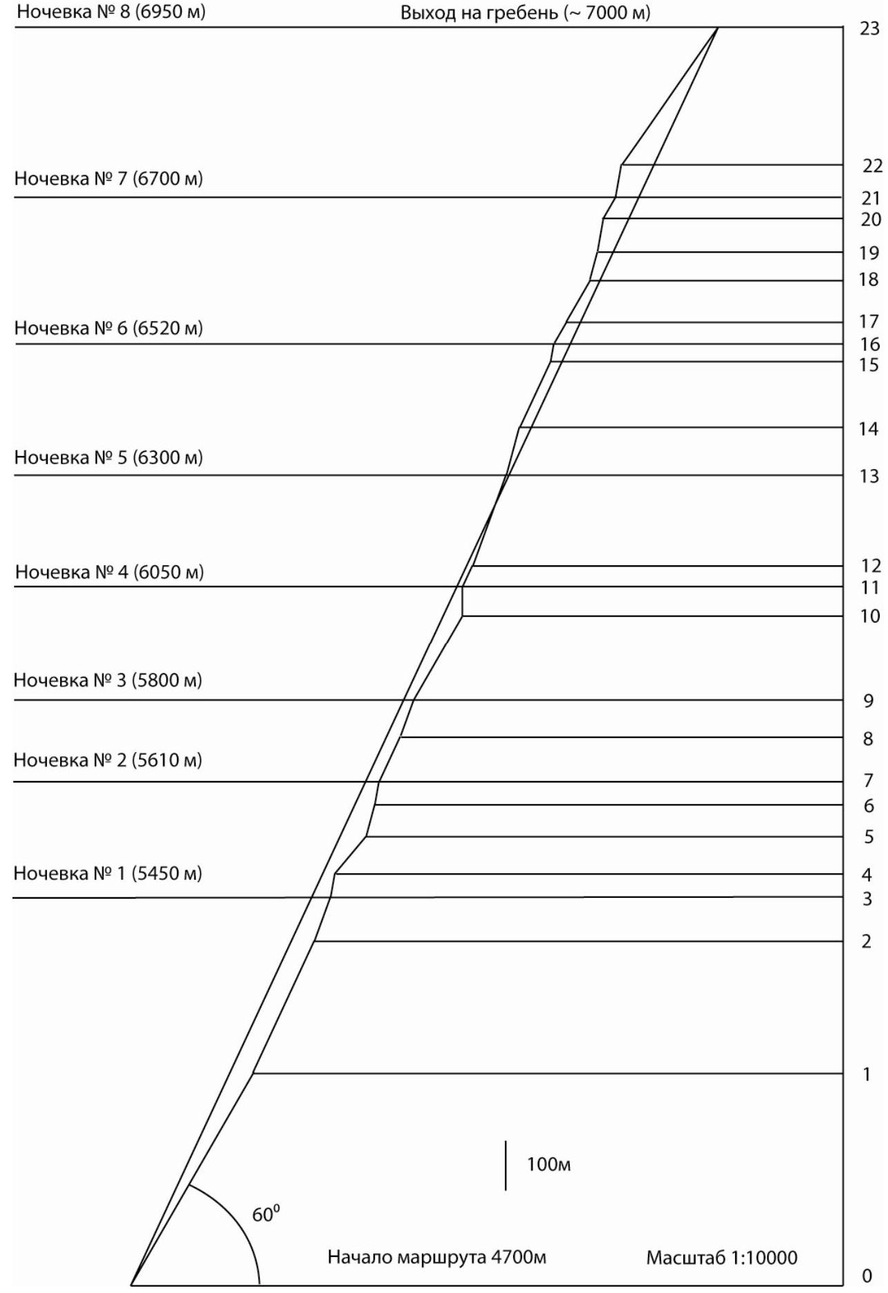
Start of the route at 4700 m
Scale 1:10000

Panorama of Peak Pobeda massif from the north
- Pobeda V. 7060 m.
- Pobeda Gl. 7439 m.
- Pobeda Z. 6918 m
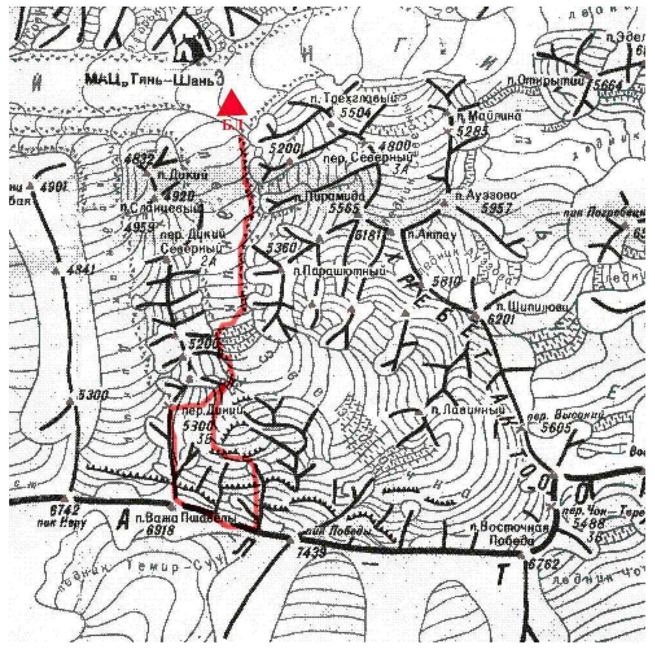
Map of the area
Approach from the base camp on the moraine of the South Inylchek glacier to the advanced base camp ABC via the Zvezdochka glacier — 3 hours.
From ABC:
- Ascent to the icefall — 2 hours
- Then exit to the plateau under the Dikiy Pass.
Along the plateau, following the NW wall of Peak Pobeda, bypassing the icefall — approach to the route, ~1.5 hours.
Route Description by Sections
Section 0. From the plateau under the Dikiy Pass, hugging the northwest wall of Pobeda, bypassing the icefall (on the left) via a large snow shelf to the start of the route — 1.5 km.
- Danger of rockfall from the wall!
- Better to pass early in the morning and in daylight
- Deep snow.
Section 1. Wide snow and ice slope, crossing a large bergschrund using ITC, direction right to left under the cover of rocks — 500 m. Deep snow.
Section 2. Hugging the left rocks, ascending a wide snow and ice couloir in the direction up and to the right towards the right hanging glacier — 300 m. Under the relative cover of rocks, a small platform is carved out for the night.
Hazards:
- Constant, quite powerful powder snow avalanches from the rocks in bad weather
- Danger of icefall from the left hanging glacier!
Section 3. Traverse from left to right across frozen rocky outcrops, 100 m. General direction of movement is up and to the right.
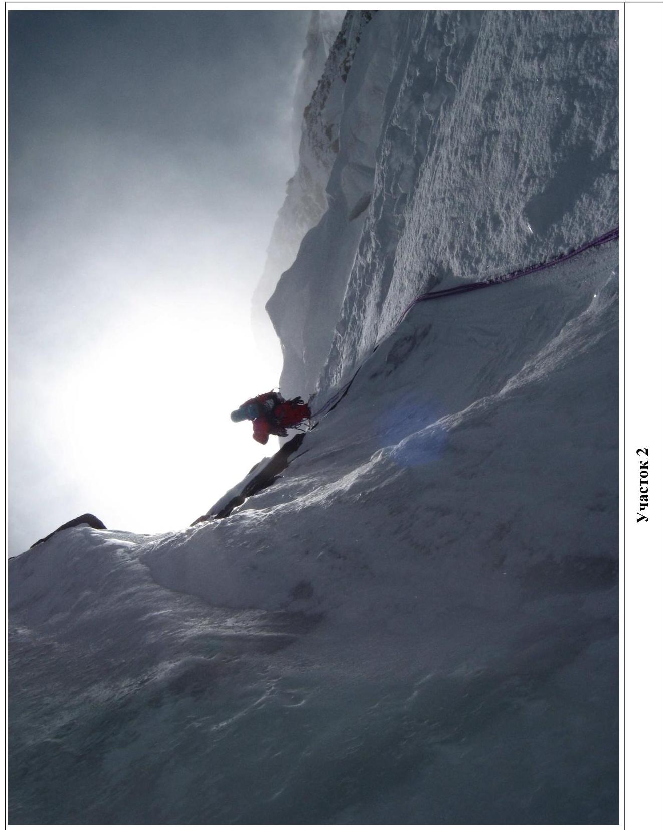
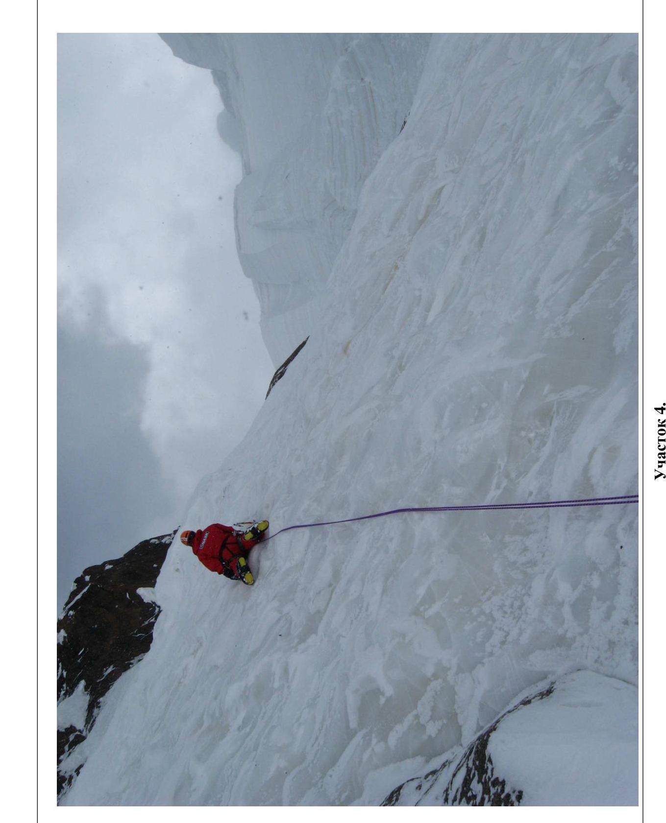
Section 4. Ice wall, 50 m. Section 5. Firn slope, 100 m. Section 6. Ice wall, 70 m. Section 7. Frozen inner corner, rocks, 50 m. Direction of movement straight up.
Section 8. Frozen rocky outcrops, interspersed with ice sections, 100 m. Direction — up and to the right. The right hanging glacier remains on the right and is no longer hazardous, but there is still a risk of icefall from the left glaciers and cornices. Night bivouac in a semi-reclining position on an inclined rock and ice ledge.
Section 9. Traverse from right to left across frozen rocky outcrops — 100 m, leading to a steep firn-filled couloir (80 m).
Section 10. Snow and ice slope, 200 m, third night bivouac on a platform carved into the ice. Exit to the counterfort, danger of icefall is absent, but powder snow avalanches are constant.
Section 11. Belt of yellow, heavily deteriorated, frozen rocks, 60 m. Climbing is very delicate.
Section 12. Frozen rocks, 50 m. Direction — straight up. Very uncomfortable semi-reclining night bivouac on a small ice platform.
Section 13. Belt of brown rocks. Straight up, slightly deviating to the left, 200 m.
Section 14. Snow and ice slope, 100 m. There is a convenient spot for a bivouac.
Section 15. 50 m of climbing on frozen rocky outcrops leading to a wide snow and ice couloir, 100 m. Direction of movement slightly to the right and up.
Section 16. Narrow, steep couloir filled with deep, loose snow, 40 m. Organizing protection is challenging. Very careful climbing. Protection only at the end of the couloir on rocks.
Section 17. Frozen rocky outcrops, 50 m.
Section 18. Snow and ice slope, 100 m. Night bivouac is relatively comfortable on a platform carved into the firn.
Section 19. Rocky wall with ice rivulets, 20 m. Pendulum swing to the left onto an inclined rocky, frozen ledge, followed by climbing on frozen rocky outcrops (40 m) in the direction left and up to the base of a huge frozen inner corner-couloir.
Section 20. Frozen inner corner, 70 m:
- initially on ice on the left wall,
- about two-thirds of the way up — transition to the right wall — rocks covered with a thin layer of ice. Very delicate climbing. Protection is problematic.
Section 21. Simple snow slope (50 m), leading to a group of rocks where it was possible to:
- dig a snow anchor;
- establish a comfortable lying bivouac.
Section 22. Rocky inner corner with ice rivulets (50 m), leading to frozen rocky outcrops (20 m).
Section 23. Bypassing a snow overhang (avalanche hazard!), via the last section of frozen rocks (100 m), exit to a wide firn slope (250 m), leading directly to the "Camel" — two huge snow cornices on the ridge of Pobeda. Direction of movement — from right to left into the gap between the cornices. Night bivouac in a hollow near the "Obelisk".
Section 24. Simple ridge — 2 km to the summit of Pobeda Zapadnaya.
Descent via the classic route through the Dikiy Pass.
| № | Ice screws | Firn anchors | Pitons, nuts | Characteristics |
|---|---|---|---|---|
| Total | 33 | 32 | ||
| R24 | −2000 m, II | |||
| R23 | 1 | 7 | 350 m, 55°, IV | |
| R22 | 7 | 70 m, 80°, VI | ||
| R21 | 1 | 50 m, 60°, IV | ||
| R20 | 1 | 6 | 70 m, 80°, VI | |
| R19 | 2 | 4 | 60 m, 75°, VI | |
| R18 | 2 | 100 m, 60°, IV | ||
| R17 | 3 | 50 m, 60°, V | ||
| R16 | 1 | 40 m, 80°, VI | ||
| R15 | 2 | 3 | 150 m, 65°, V | |
| R14 | 2 | 100 m, 65°, IV | ||
| R13 | 10 | 200 m, 70°, V | ||
| R12 | 2 | 4 | 50 m, 65°, VI | |
| R11 | 13 | 60 m, 90°, VI | ||
| R10 | 2 | 4 | 200 m, 60°, IV | |
| R9 | 2 | 2 | 80 m, 70°, V | |
| R8 | 2 | 2 | 100 m, 65°, VI | |
| R7 | 3 | 50 m, 80°, VI | ||
| R6 | 3 | 70 m, 75°, VI | ||
| R5 | 2 | 100 m, 50°, IV | ||
| R4 | 2 | 50 m, 80°, VI | ||
| R3 | 4 | 100 m, 70°, V | ||
| R2 | 10 | 2 | 300 m, 65°, V | |
| R1 | 2 | 13 | 500 m, 60°, IV |
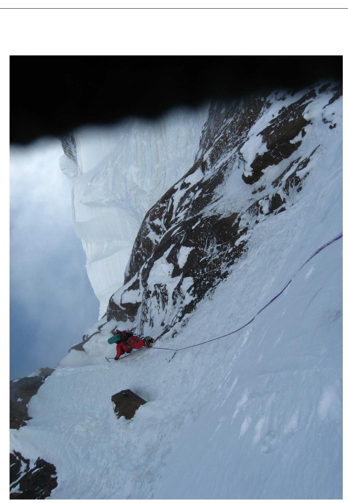
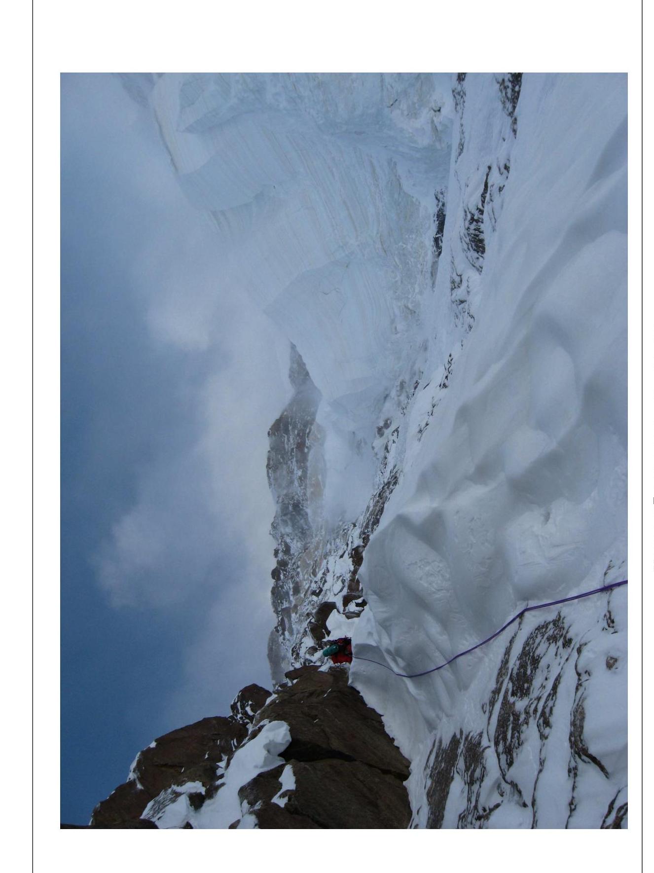
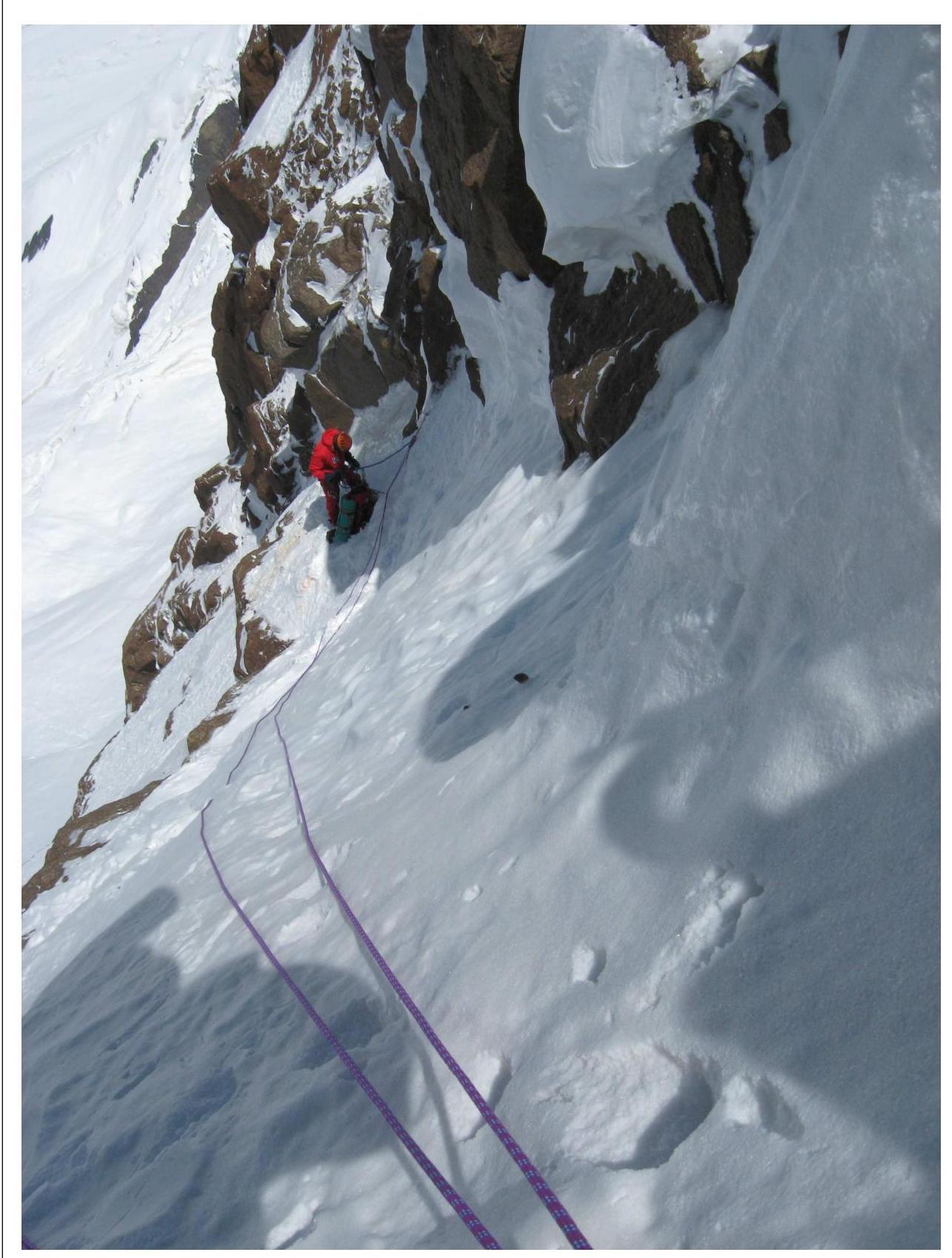
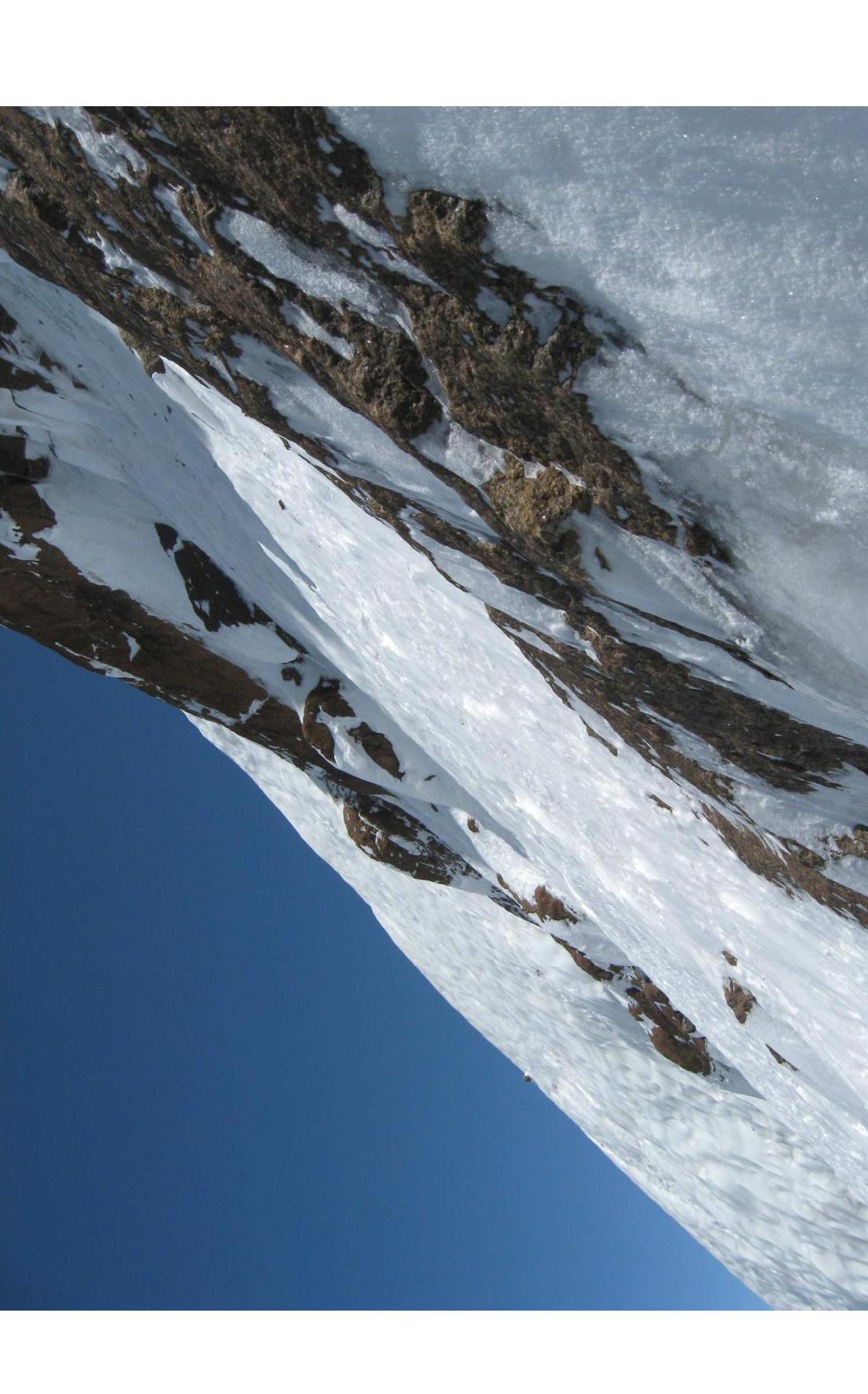
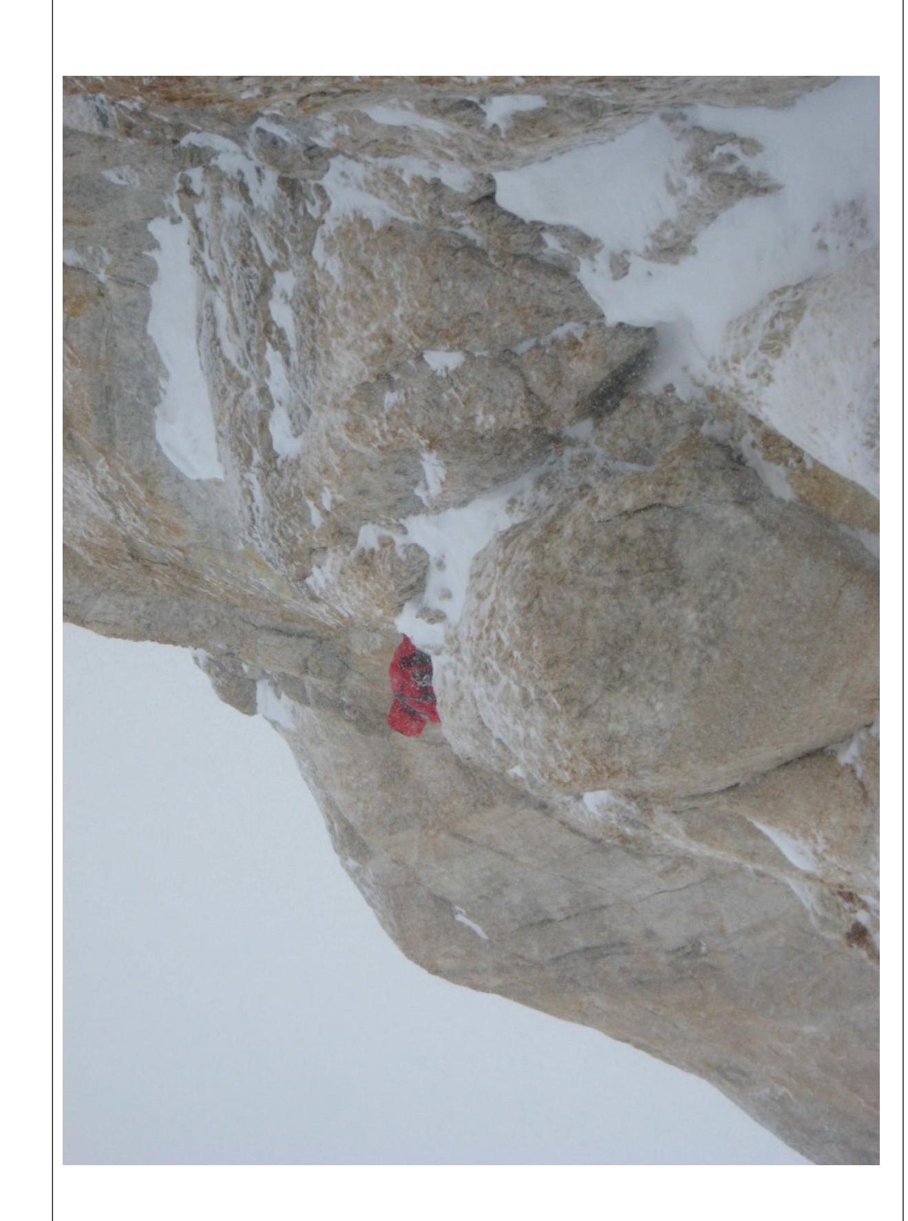
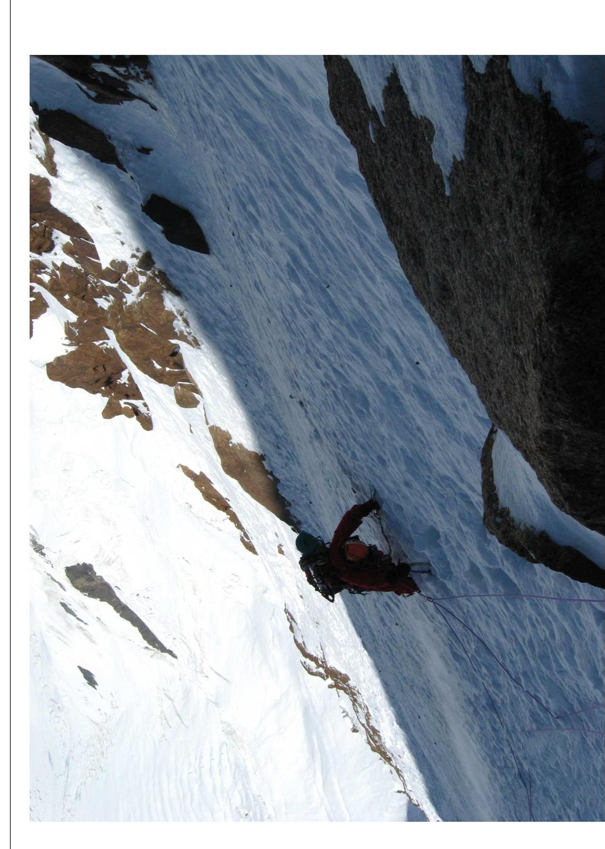
Technical photo of the route
Section 2

Section 5. Traverse along the rocks.
Section 4.
Section 6.
Section 7, before entering the couloir.
Section 8. Rocks below, under the second night bivouac site.
Section 9. Traverse to the left and along the boundary between ice and rocks straight up.
Section 11. Belt of yellow rocks.

Section 13. Belt of brown rocks.
Section 15.

Section 19.
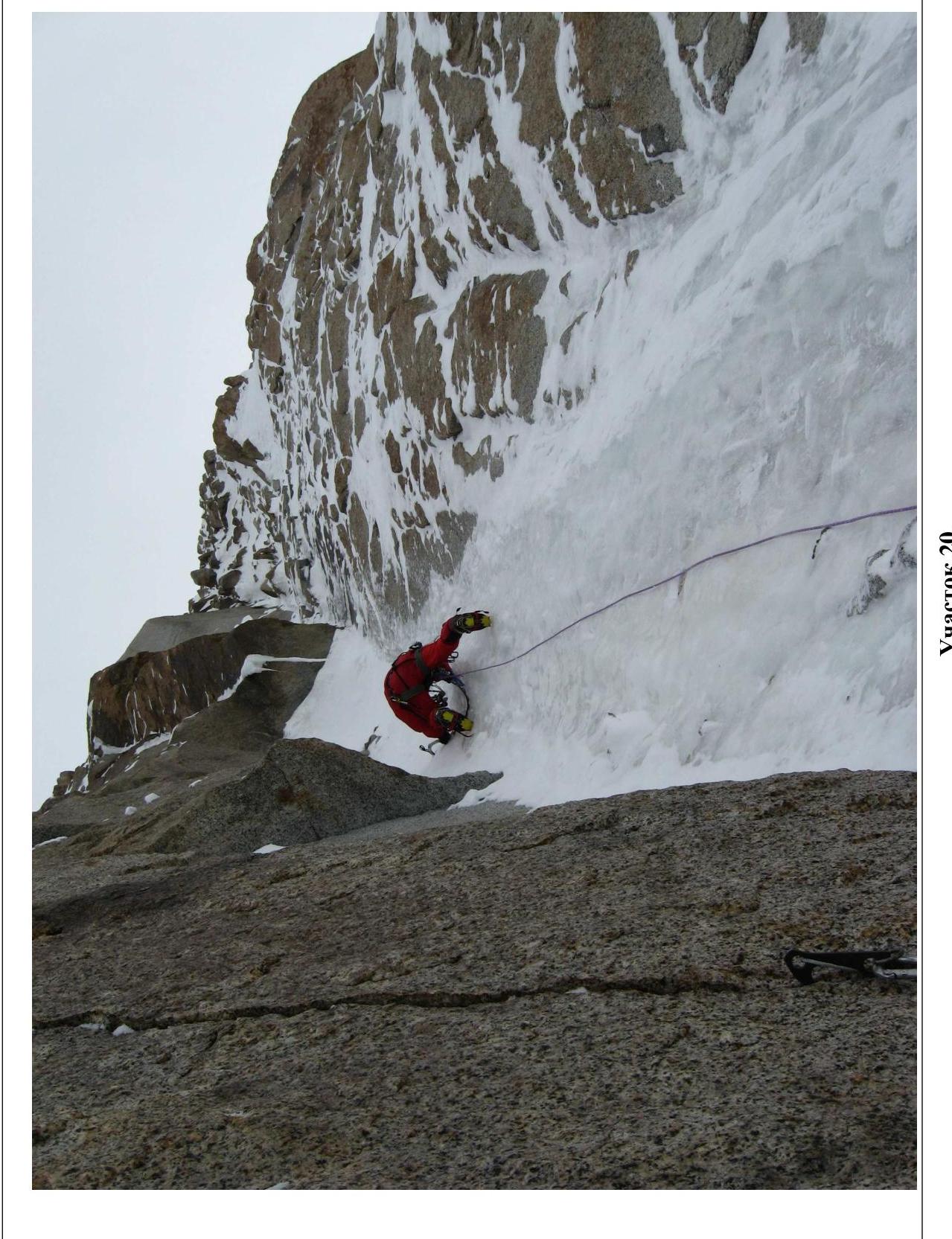
Section 20.
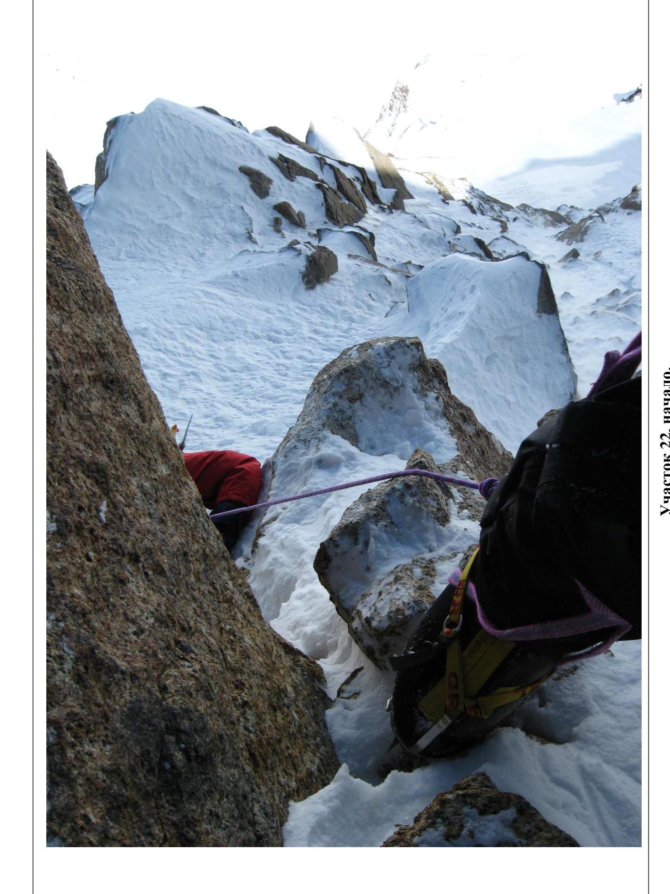
Section 22, beginning.