
MOSCOW ALPINISM AND ROCK CLIMBING FEDERATION
Report
On the ascent of the CSKA team named after Demchenko
To the summit of Pamyati Druzey Peak (4990 m)
Central Tien Shan, Western Kokshaal-Too (41°1′3.31″ N. 77°31′55.82″ E)
via the northwestern ridge
First ascent
Presumably 3A category of difficulty
Galimzyanov T.R. + 2 2015
Ascent participants
- Team leader — Galimzyanov Timur Ravilievich. 2nd sports category
Coach: Kuznetsova E.V.
Address: 115193, Moscow, Leninsky prospect, 35, apt. 33.
gal_timur@yahoo.com, +79164339820
- Grigoryev Dmitry Ryurikovich. 1st sports category
Coach: Kuznetsova E.V.
- Nikitin Vladimir Valerievich. 2nd sports category
Route 3A to Pamyati Druzey Peak via the northwestern ridge
Ascent passport
- Central Tien Shan, Western Kokshaal-Too region, Sarychat gorge, classifier section: 7.5.
- Pamyati Druzey Peak 4990 m (41°1′3.31″ N. 77°31′55.82″ E) via the northwestern ridge
- Proposed category — 3A, first ascent
- Route type: snow-ice
- Route elevation gain: 600 m
Route length: 1400 m
Average slope:
- main part of the route – 40 °
- entire route – 30 °
- Pitons left on the route:
total – 0; including bolted pitons – 0.
- Team's climbing hours: 6 hours (excluding descent), 1 day
- Team leader: Galimzyanov T.R., 2nd sports category
Team members:
- Grigoryev D.R., 1st sports category
- instructor № 1110 Nikitin V.V., 2nd sports category
-
Coach: Kuznetsova E.V.
-
Exit to the route from overnight stay in the Gori Peak cirque, Sarychat glacier: 06:00, August 12, 2015. Route started: 06:00, August 12, 2015. Summit reached: 12:00, August 12, 2015. Return to base camp: 16:15, August 12, 2015. Descent from the summit: via the ascent route.
-
Organization: Moscow Alpinism and Rock Climbing Federation, CSKA named after Demchenko
-
Responsible for the report: Galimzyanov Timur Ravilievich. gal_timur@yahoo.com, +79164339820
Overall summit photo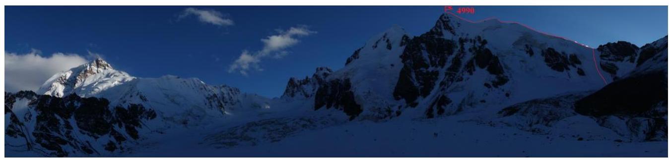
Fig. 1. View of Pamyati Druzey Peak from Sarychat glacier.
Route profile photo.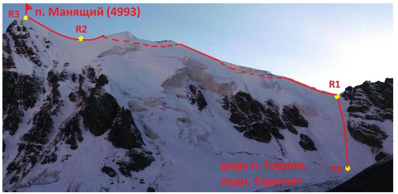
Fig. 2. Pamyati Druzey Peak. Photo from Sarychat glacier, taken on August 12, 2015. Route via NW ridge (3A).
Area photopanorama
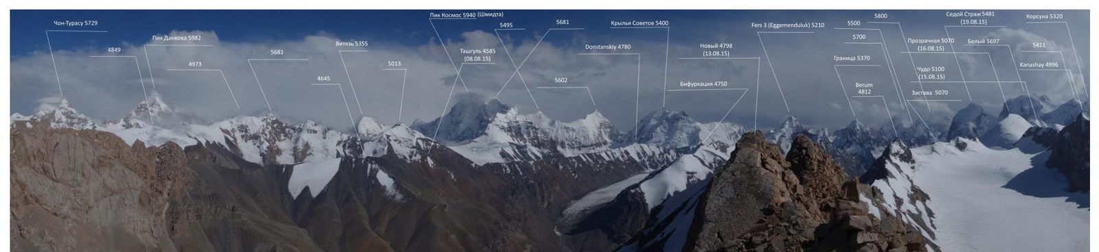
Fig. 3. Photopanorama taken from Novy Peak to the south.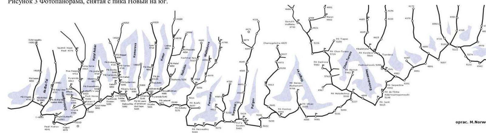
Fig. 4. Area diagram.
Central Tien Shan, Western Kokshaal-Too ridge, Beliy Peak area (5486 m)
Brief area description
Western Kokshaal-Too is the southernmost ridge in Kyrgyzstan. This ridge is located in Central Tien Shan between Lake Issyk-Kul and the Takla-Makan desert, on the border with China. To the north, the Kokshaal-Too ridge borders the Uzengi-Kuush and Myudyryum rivers, to the south — the Kokshaal river.
The area has many peaks around 6000 m high. The most interesting among them:
- Kyzyl-Asker Peak (5842 m)
- Krylya Sovetov Peak (5800 m)
- Schmidt Peak (5954 m, unclimbed)
- Dankov Peak (5982 m)
- Chon-Turasu or Joldash Peak (5729 m)
- Alpinist Peak (5641 m)
- Sergei Korolev Peak (5816 m)
The area is characterized by a combination of typical alpine forms (many vertical rock walls with a height difference of about 1.5–2 km) and vast glaciation, second only to the Peak Pobeda area in Tien Shan. The entire area, including the lowlands, is a permafrost zone. Marshy areas are common up to 4000 m.
The snow line is at an altitude of about 4000–4500 m above sea level. River valleys have a high absolute height of about 3000–3500 m above sea level. The climate in the valley is harsh. The average monthly temperature in summer is around 5–8 °C, with unstable weather.
Approach
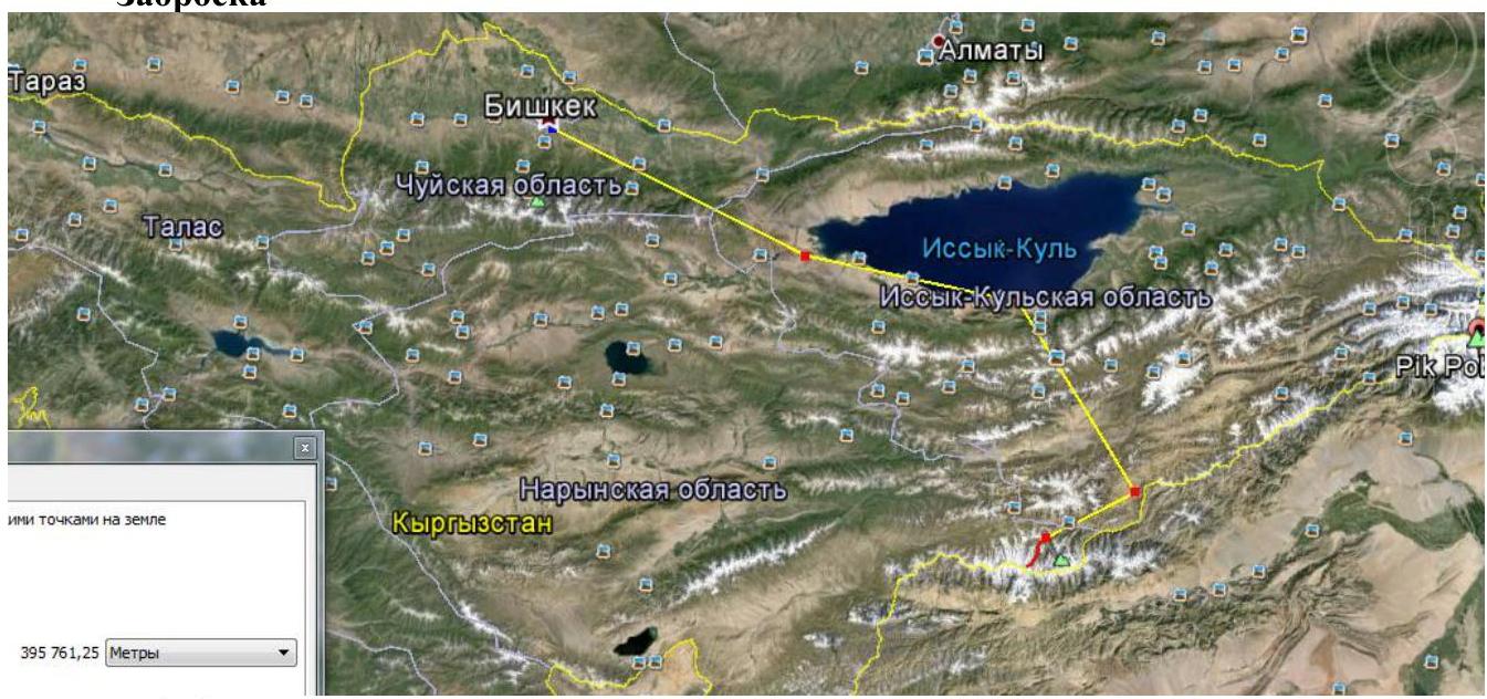
Figure 5. Route diagram from Bishkek to the base camp in Sarychat gorge.
Approach from Bishkek by car:
- Along the southern shore of Issyk-Kul on the A363 highway to the village of Barsko-on.
- Further on the A364 road. After 20 km, the asphalt ends, and a dirt road begins, leading to a gold mining settlement through a pass to the village of Kara-Say.
- The A364 road to the gold mines turns north.
- First border post, crossing the wide Naryn river, further there is practically no road.
- Through passes and rivers to the border post.
- After the border post, along the Uzengeegush river to the south to the Bulat-M hunting farm.
- From the hunting farm, a very dangerous road runs along the river slope, sometimes requiring clearing of debris.
- To the hunting farm — 20 hours drive.
From the hunting farm on foot:
- Along the left bank of the Uzengeegush river (crossing from the hunting farm via the remains of a bridge).
- Reach the Autali river (fording in case of flooding or crossing over stones upstream or downstream — depending on the weather).
- Further along the Sarychat river to the last grassy areas on the slope, one hour short of the stretched glacier tongue.
Base camp:
- Set up high above the river, in a flat hollow, protected from the wind.
- In front of the hollow — 100 m of a stream flowing in the grass.
- In the hollow, water is found in crevices between large stones, often drying up and stagnant.
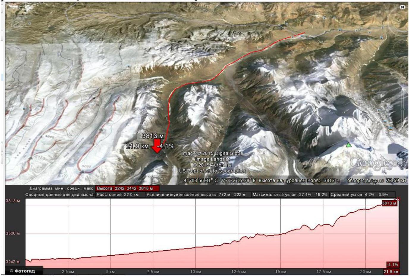
Figure 6. Path diagram from the hunting farm to the base camp in Sarychat gorge.
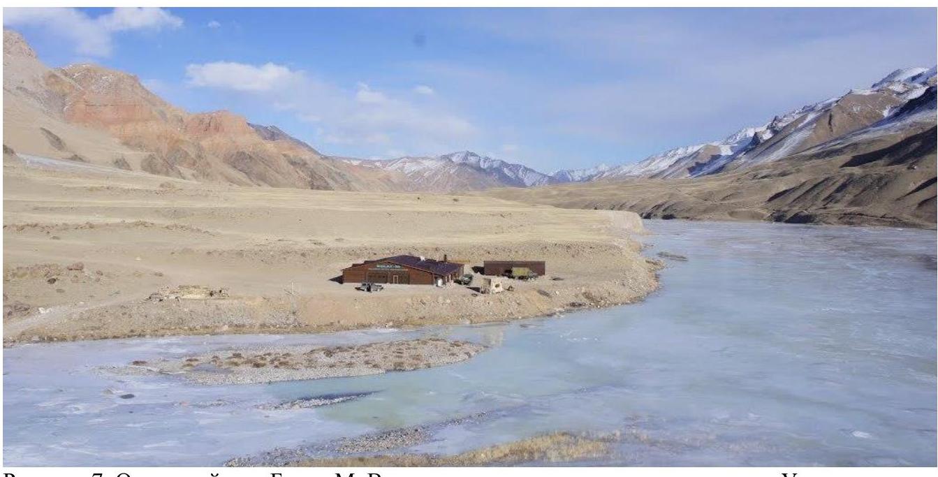
Figure 7. Bulat-M hunting farm. View from the southeast downstream along the Uzengeegush river.
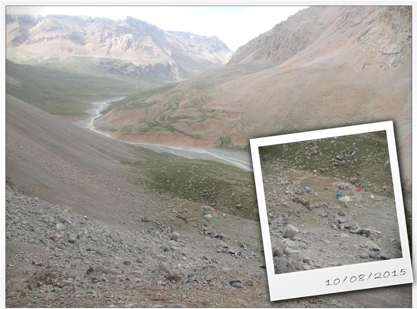
Figure 8. Base camp in Sarychat gorge.
Weather
The optimal time for expeditions here is considered to be the second half of July to the first half of September. The weather is unstable but with prolonged clear periods.
Bad weather is short-lived, almost always accompanied by strong stormy winds. Due to this, there are certain requirements for the base tent: it must be sufficiently wind-resistant.
In August, the weather cannot drastically affect ascents, considering the nature of the routes. Even with good weather, it gets quite cold in the mountains. Taking this into account, it is necessary to have:
- appropriate clothing
- the right mindset.
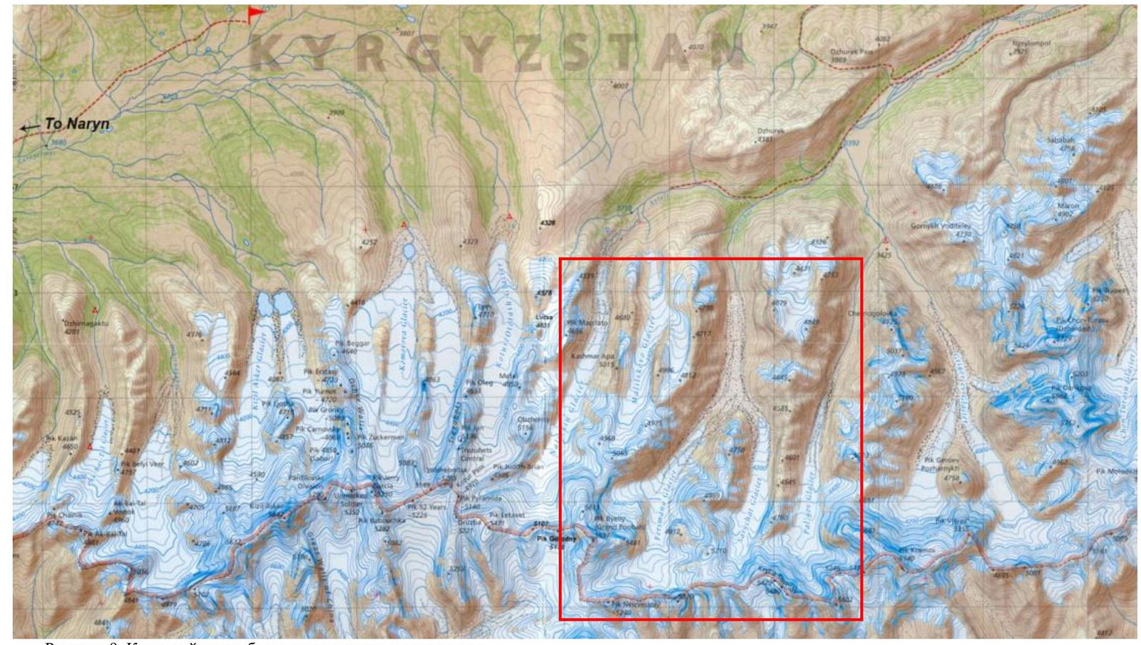
Figure 9. Area map with the ascent location marked.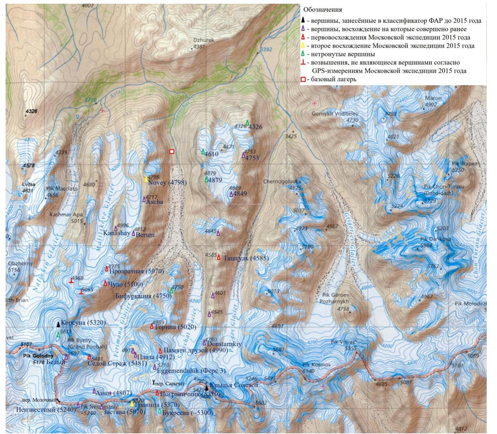
Figure 10. Map with peaks marked where ascents were made during the 2015 Moscow team expedition.
Approach to overnight stay
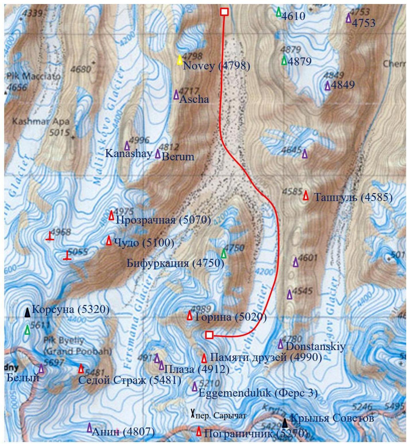
Figure 11. Path from the base camp to overnight stay is marked with a red line.
Path from the base camp to overnight stay in the cirque:
- From the base camp, descend to the Sarychat riverbed.
- Ascend along the riverbed to the moraine pocket on the left bank of the Sarychat glacier (1 hour walk).
- Continue ascending the moraine pocket until the walls significantly lower (0.5 hours).
- Then cross the glacier moraine (1–1.5 hours) to the right bank. The moraine is covered with large stones and is very rugged — regular ups and downs of 30–50 m.
- The Sarychat river cuts through the moraine, sometimes disappearing under its surface, where it can be crossed.
- The right bank of the moraine is very convenient for walking and leads (1.5 hours) to campsites by a stream, within half an hour's walk from the right (orographic) tongue of the glacier.
- From the campsites, ascend to the moraine pocket, follow it along the glacier to the passage to the ice (1 hour).
- Walk on the open glacier to the passage to the cirque under Pamyati Druzey Peak and Gori Peak (1–1.5 hours), then into the cirque.
Approach duration: 7 hours. Path length: 12 km. Elevation gain: 800 m.
Route recommendations
It is recommended to set up cairns when crossing the main glacier. It is not recommended to cross it in poor visibility — it's very easy to get lost.
- The right tongue of the glacier is open, crevasses are easily avoided.
- The passage to the cirque is moderately destroyed — requires finding a path through the labyrinth of crevasses.
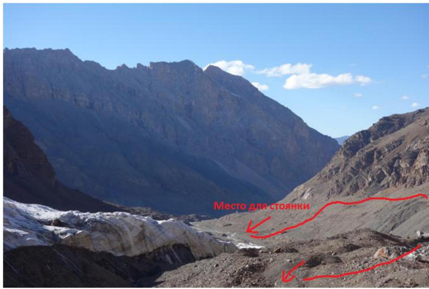
Figure 12. View from the start of the right tongue of Sarychat glacier towards the valley. The path to the glacier is marked with a red line.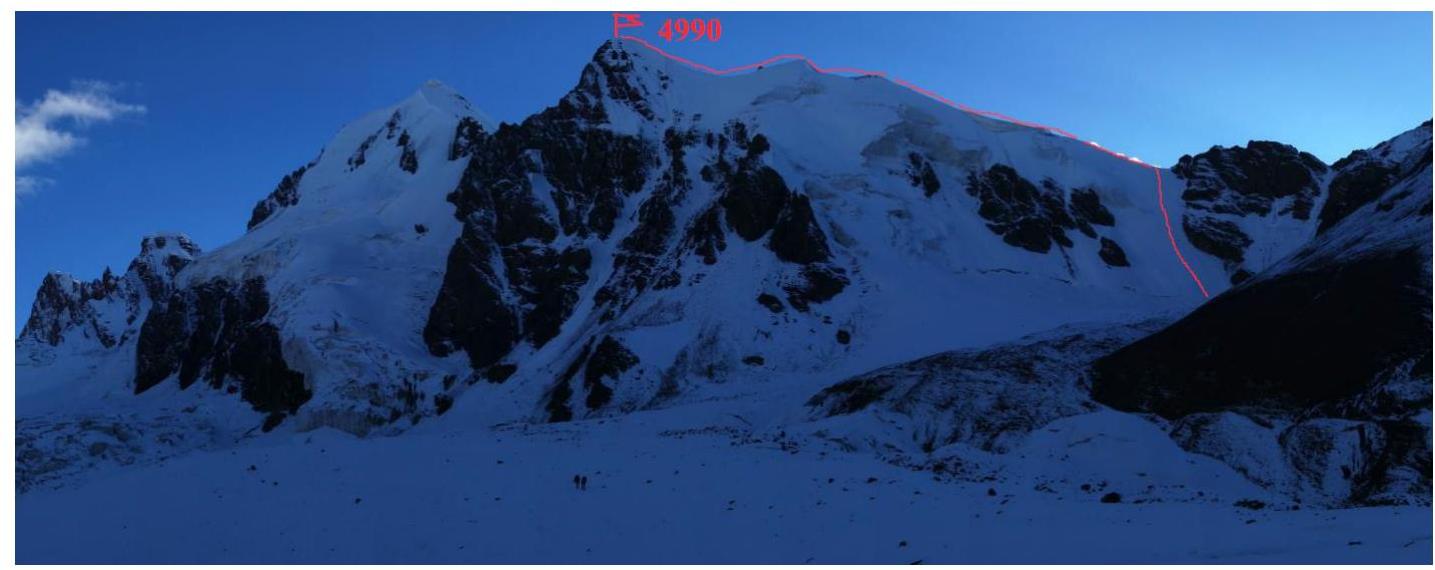
Figure 13. View of Pamyati Druzey Peak from Sarychat glacier. The partially destroyed passage to the cirque is visible.
Technical summit photo
{"width":1323,"height":648,"format":"Jpeg","uri":"https://summitx.info/media/1/EYpWDk6L4M8o1zYMVmrc6UpOyOodrSZv/img-14.jpeg","id":64779667}↗)
Figure 14. Pamyati Druzey Peak. Photo from Sarychat glacier, taken on August 12, 2015. Route via NW ridge (3A).
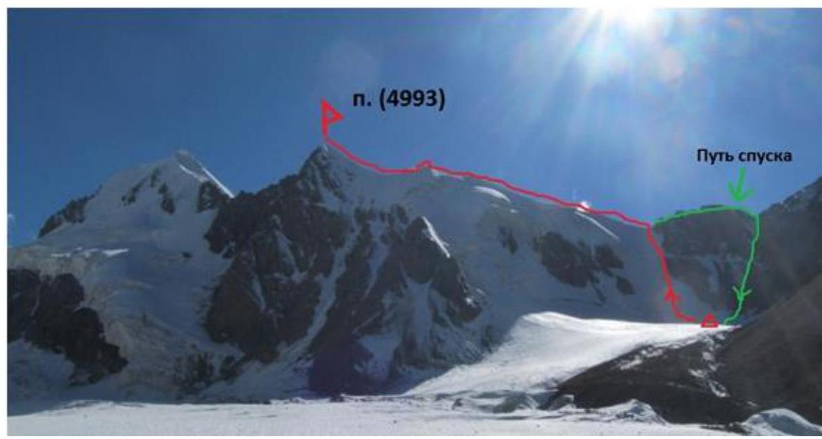
Figure 15. View of Pamyati Druzey Peak from Sarychat glacier. A possible descent route is indicated, including a section of the rocky ridge and a scree couloir.
Description of route difficulty sections
| Section № | Length | Steepness | Relief type | Category | Pitons |
|---|---|---|---|---|---|
| R0–R1 | 300 m | 40–45° | Ice slope | 3+ | 0 |
| R1–R2 | 1000 m | 25° | Snow-ice ridge | 2 | 0 |
| R2–R3 | 100 m | 40° | Firn slope | 3+ | 0 |
Brief description of route passage by sections
The overnight stay is located 300 m from the slope leading to the snow-ice pass between Pamyati Druzey Peak and Gori Peak. The route begins from the pass slope.
R0–R1. Snow-ice slope leading to the pass. The key section of the route. Movement in rope teams with simultaneous belay. The last 50–70 m may require alternate belay.
- Category: 2
- Angle: 40 °
- Length: 300 m
R1–R2. From the pass, movement along the snow ridge towards Pamyati Druzey Peak to a 40° firn slope; simultaneous movement in rope teams. Cornices are possible on the ridge!
- Category: 2
- Angle: 20 °
- Length: 1000 m
R2–R3. Firn slope. Simultaneous movement in rope teams. If necessary, alternate belay is possible on ice under a deep layer of firn.
- Category: 2
- Angle: 40 °
- Length: 100 m
Descent
Descent from the route is made via the ascent path. It is also possible to descend via a couloir leading from the cirque to the rocky ridge between Pamyati Druzey Peak and Gori Peak.
From the pass, it is necessary to:
- continue along the ridge (rocky sections of 2nd category, simultaneous belay, loops, 2–3 medium-sized chocks) to the scree couloir;
- down the couloir to the cirque.
Route recommendations
The route can be considered generally safe in the absence of factors initiating avalanche danger on the slope leading to the pass. Belaying on sections R0–R1 and R1–R2 is organized without particular problems. Belaying on section R2–R3 is complicated due to a significant layer of firn, but if necessary, it is possible to find ice sections under the layer of firn and snow. Key hazardous moments on the route:
- Movement along the snow ridge where cornices are possible.
- Movement on a partially closed (crevasses!) glacier on the approach to overnight stay.
- A large glacier area where it is easy to get lost in poor visibility (GPS recommended).
Route length: 1.4 km, elevation gain: 600 m.
Report photo illustrations
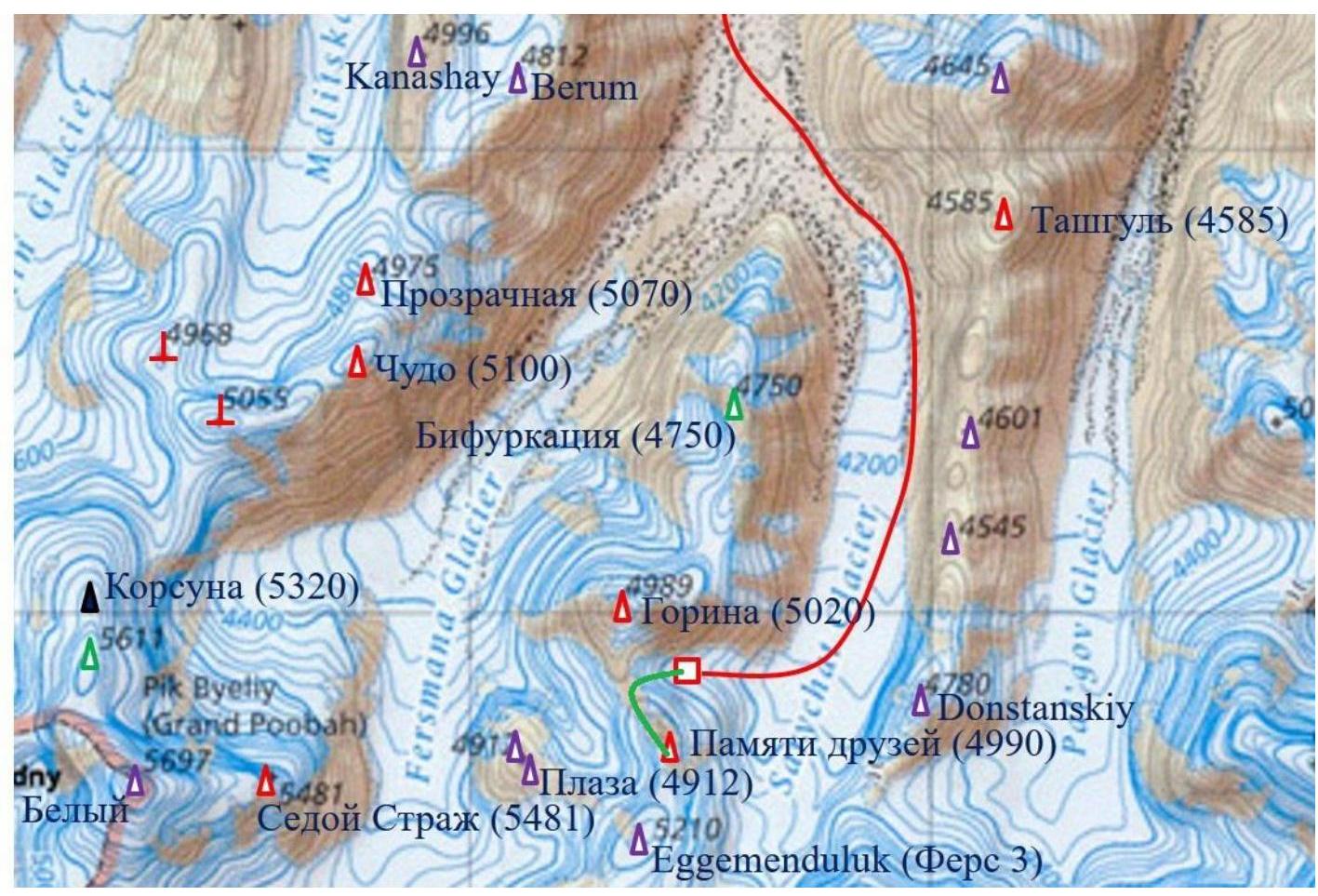
Figure 16. Ascent path is marked with a green line.
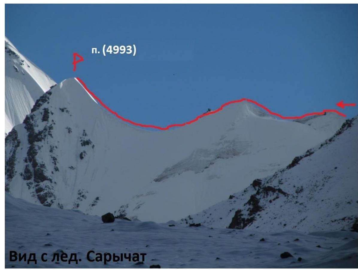
Figure 17. View of part of the firn ridge.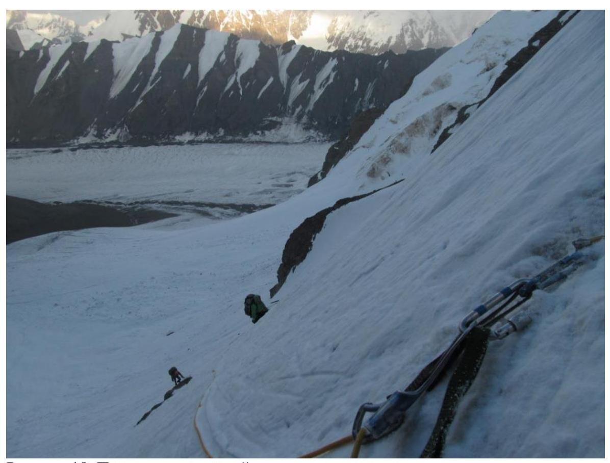
Figure 18. Passing the first part of the ice slope.
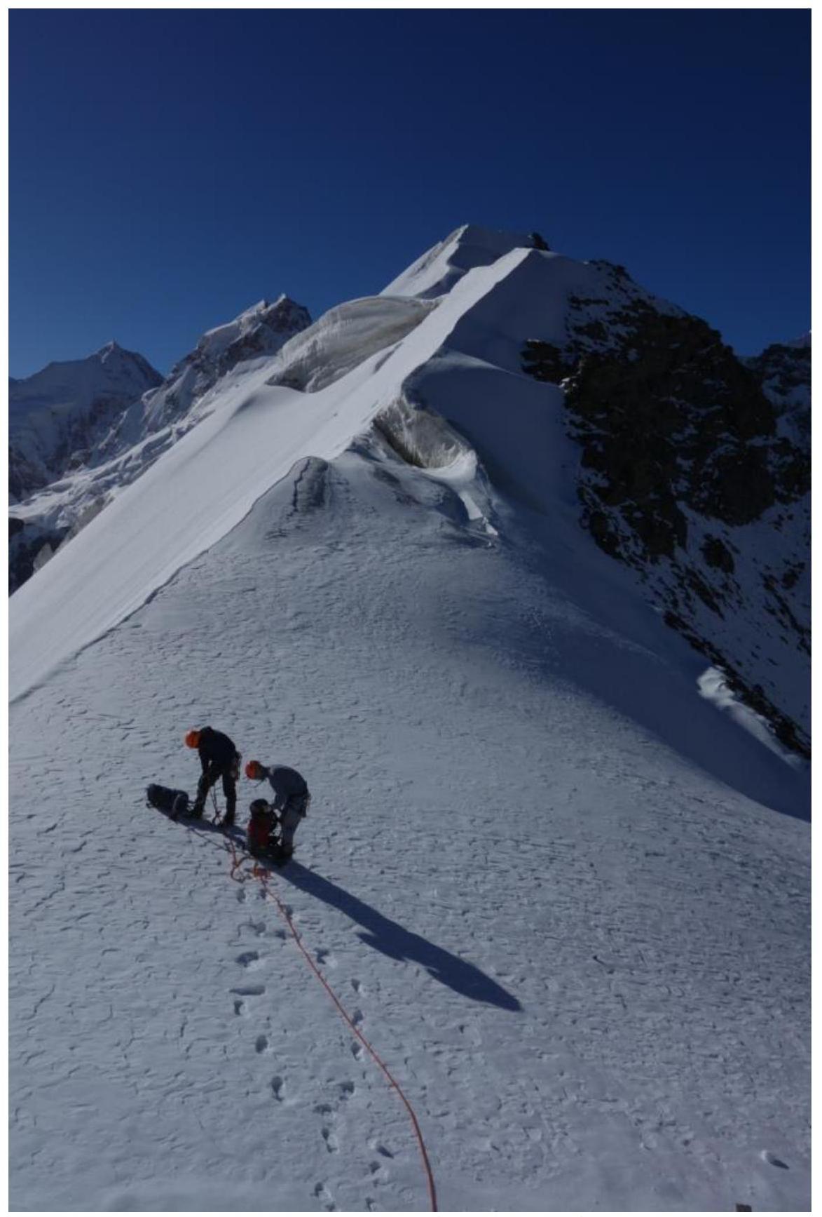
Figure 19. View from the pass saddle to the firn ridge (sections R1–R2–R3).
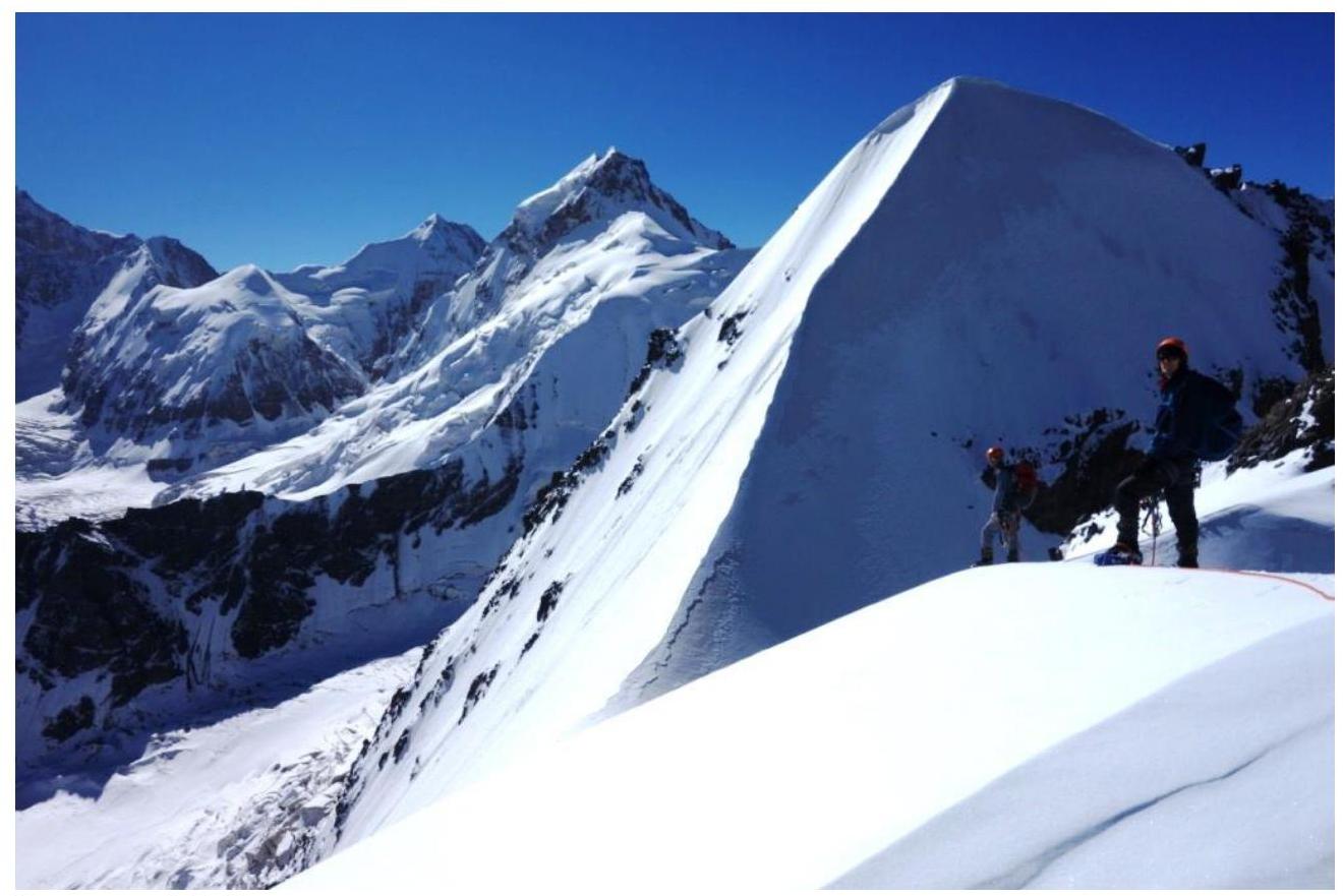
Figure 20. View of section R2–R3 of the ridge from section R1–R2.
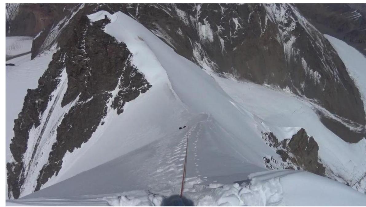
Figure 21. Section R2–R3 of the ridge.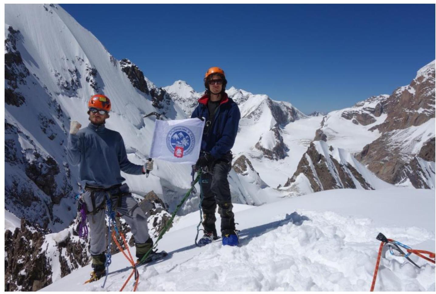
Figure 22. Team members Nikitin V.V. and Galimzyanov T.R. on the summit.
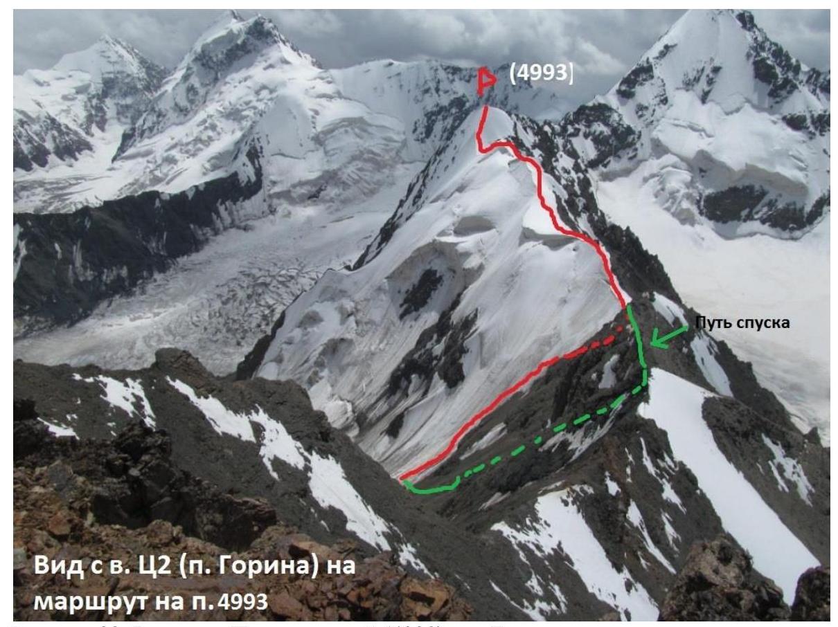
Figure 23. View of Pamyati Druzey Peak (4990) from Gori Peak.
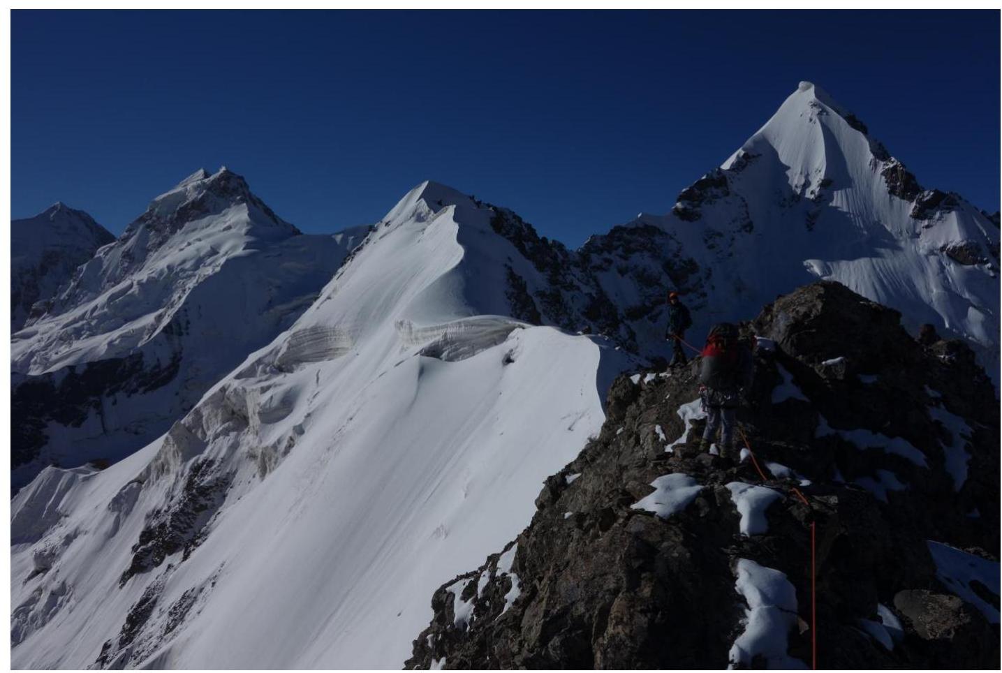
Figure 24. Passing the rocky ridge on the way to the descent couloir.