I. High-altitude category
- Central Tien Shan, Kokshaal-Tau ridge
- Peak Neru via the left part of the northeast face
- Proposed 6th category of difficulty, first ascent
- Elevation gain – 2430 m, route length – 2960 m
Average steepness of the main part of the route – 55° (4300–6744), including 360 m of 6th category of difficulty
-
Pitons hammered: rock 65, bolts – 0, protection 27, ice screws 145.
-
Team's total climbing hours – 45 5 days ascent, 2 days descent
-
Night bivouacs: 1 – in an ice crevasse, 2 – under a serac, 3, 4 – on platforms carved in the snow-ice slope
-
Team leader – Gurov Vladimir Nikolaevich, Master of Sports team members:
- Grebennikov Alexander Andreevich, Master of Sports
- Gorbach Vladimir Ivanovich, Candidate for Master of Sports
- Goncharov Alexey Petrovich, Candidate for Master of Sports
- Vorontsov Sergey Grigorievich, Candidate for Master of Sports
- Kopasov Oleg Mikhailovich, Candidate for Master of Sports
- Klindukh Sergey Vasilievich, Candidate for Master of Sports
- Chizmar Evgeny Yulievich, Candidate for Master of Sports.
- Coaches:
- Grishchenko Viktor Ivanovich, International Master of Sports
- Verba Alexander Andreevich, Master of Sports.
-
Departure to the route: August 5 Summit – August 9. Return – August 12.
-
Organization: State Committee for Sports of the Ukrainian SSR
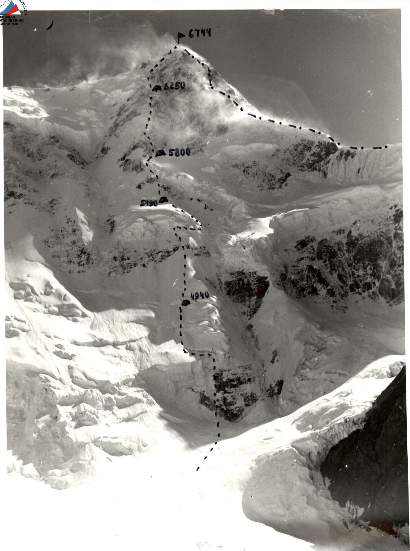
General photo of the summit. July 14, 1988, 17:00. Shot point # 1. Distance 4 km. Height 4600 m.
Amateur.
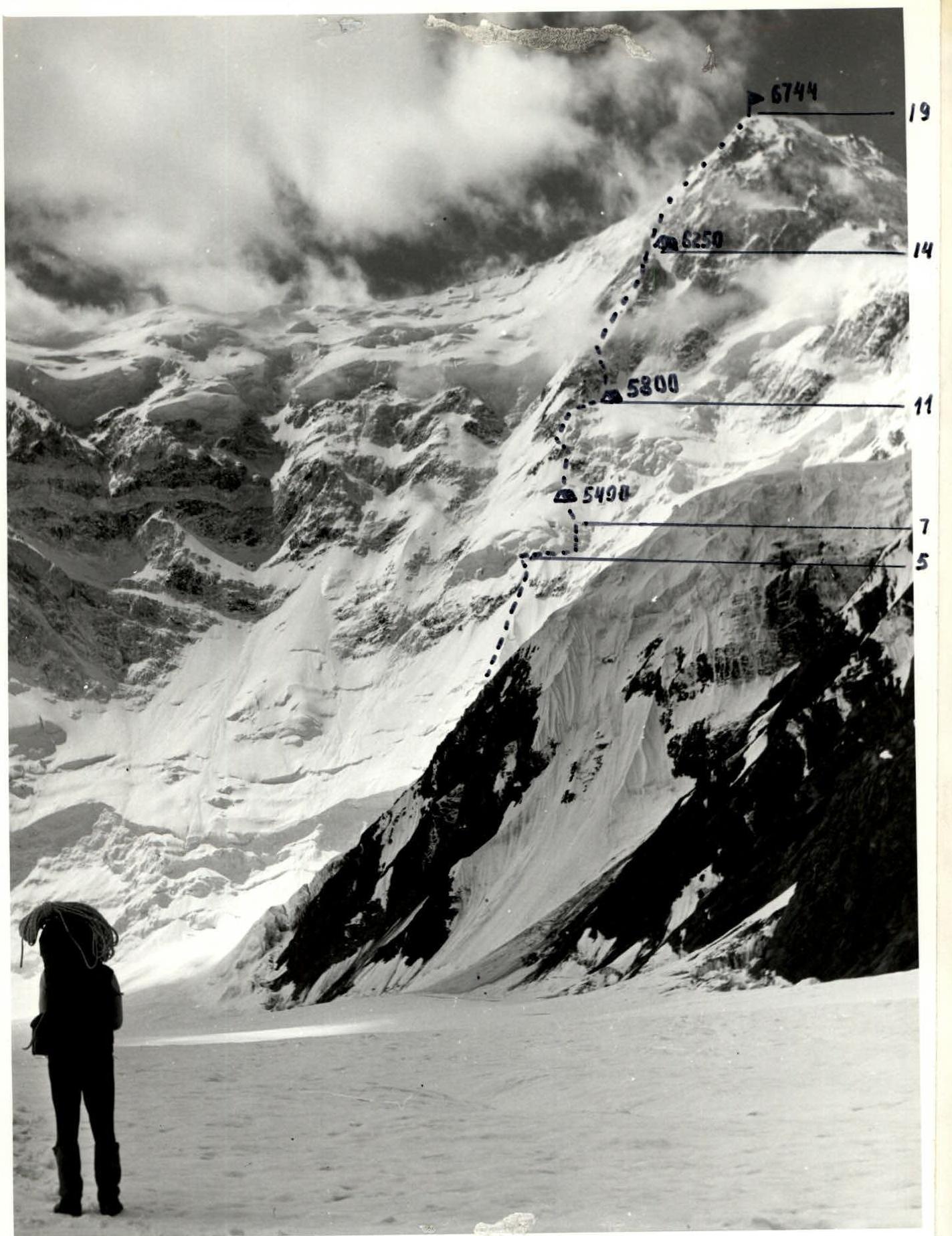
Photo of the wall profile from the right. July 14, 1988, 12:00. Shot point # 2. Distance 5 km. Height 3900 m.
Amateur.

Photo of the wall profile from the left. August 9, 1988, 10:00. Shot point # 3. Distance 3 km. Height 5200 m. Amateur. Given the current trend in the development of alpinism (high-speed high-altitude ascents), the physical and technical preparation of the participants, the team was tasked with completing the route at a high pace within 5 days.
The planned tactical plan was executed. The planned bivouac sites proved to be convenient for setting up camp.
Organization and rotation of rope teams, rotation of leads:
-
Day 1:
- Kopasov (leading section R0–R1, R3–R4)
- Gurov (leading section R1–R2, R2–R3)
-
Day 2:
- Klindukh (leading section R4–R5)
- Goncharov (leading section R5–R6)
- Gurov (leading section R6–R7, R7–R8)
- Kopasov (leading section R7–R8)
- Chizmar (leading section R7–R8)
- Vorontsov (leading section R7–R8)
-
Day 3:
- Grebennikov (leading section R8–R9, R9–R10)
- Gorbach (leading section R10–R11)
-
Day 4:
- Gurov (leading section R11–R12, R12–R13)
- Vorontsov (leading section R12–R13, R13–R14)
- Chizmar (leading section R12–R13, R13–R14, R14–R15)
-
Day 5:
- Gurov (leading section R15–R16)
- Kopasov (leading section R16–R17)
- Goncharov (leading section R16–R17)
- Vorontsov (leading section R16–R17)
- Gorbach (leading section R16–R17)
- Goncharov (leading section 17–18, 18–19)
- Gurov (leading section 17–18, 18–19)
In areas where fixed ropes were set up for safety, an additional rope was used. The regime of movement, rest, nutrition, and complete interchangeability allowed for the necessary rotation of leads and brought up the rear, maintaining a high pace throughout the ascent, and dosing physical and psychological loads. The load on participants was approximately evenly distributed. Each participant had an individual ration. Common breakfasts and dinners were organized at the bivouacs. To improve the quality of food preparation and save fuel, autoclaves were used.
The team had 4 night bivouacs on the route. The number and locations of the bivouacs corresponded to the tactical plan. All bivouac sites were safe and conducted in tents. Planned safety measures were constantly observed:
- When moving on fixed ropes – double ropes or a rope and a safety rope.
- Use of "Jumar" clamps with a prusik knot.
Out of two possible ascent options to the summit, the left one was chosen as safer and more logical (no need to traverse a couloir).
There were no falls or injuries. On steep ice sections, crampons and ice axes with special sharpening were used.
On rocks with rimed ice, shortened ice screws were used.
The lead climber worked without a backpack or with a lightened backpack.
Movement on the route did not stop even in bad weather (which usually started in the second half of the day).
There was fairly stable communication with the base camp and observers.
Moreover, the team was within visual sight of observers for almost the entire route.
After the team completed the main part of the route:
- a rescue team ascended to the Diky Pass,
- then to Peak Vazha Pshavela,
- where they met.
Unfortunately, the failure to properly process the film shot on the route did not allow for the presentation of photographic materials of the route.
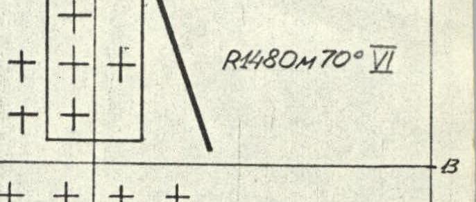
Route diagram in M 1:2000 symbols
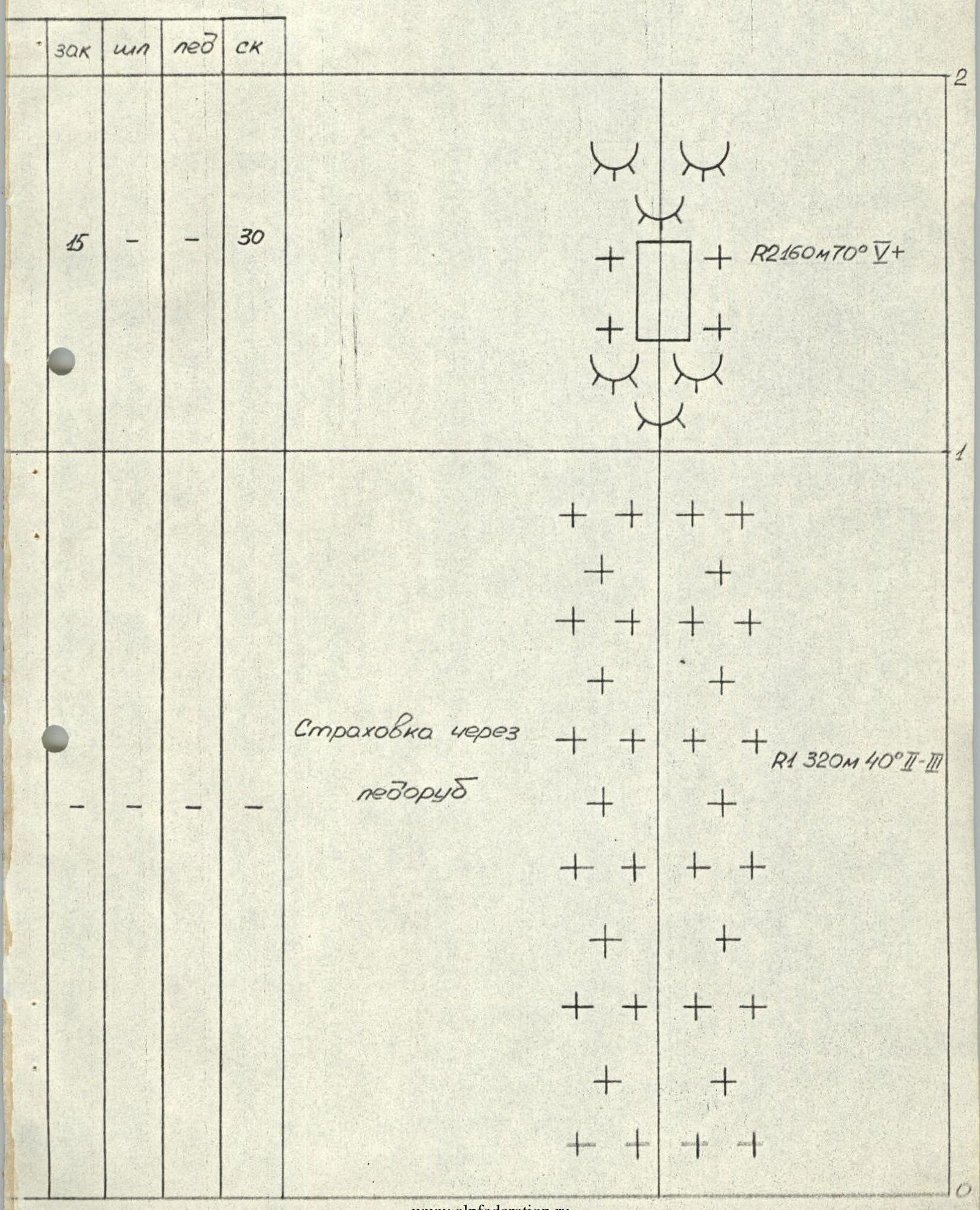
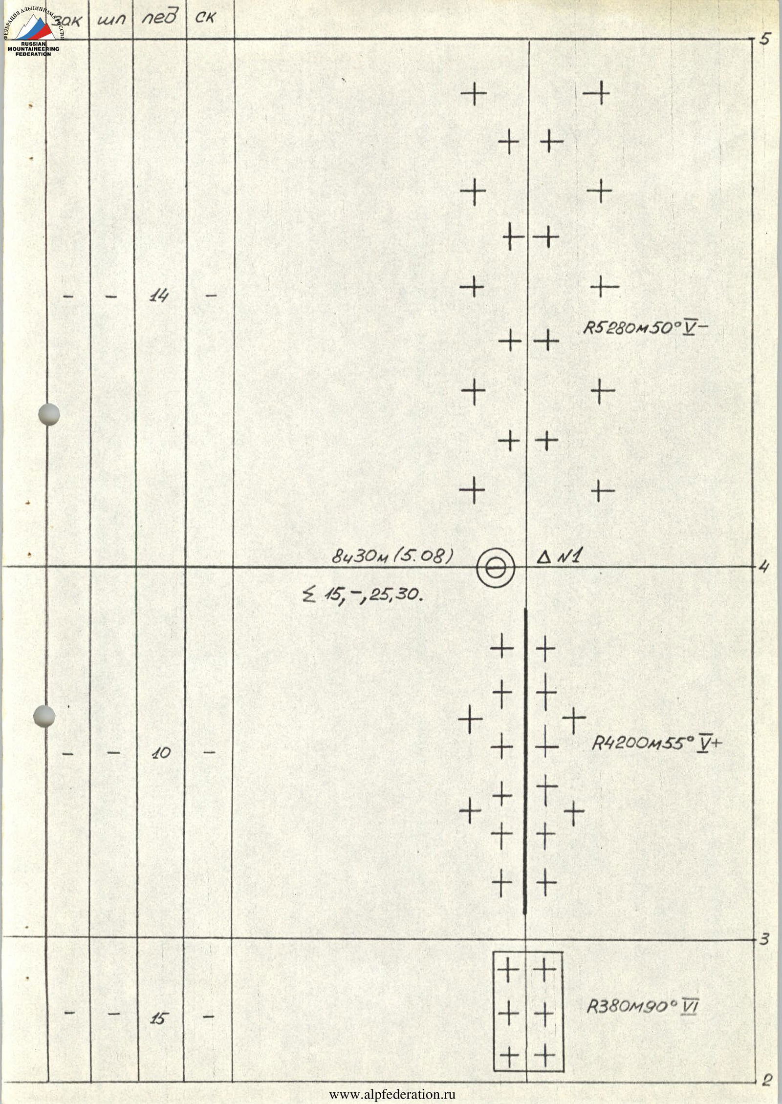
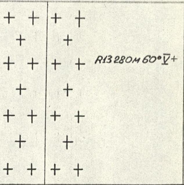
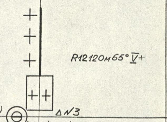
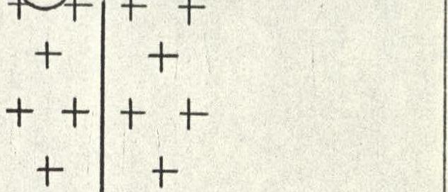
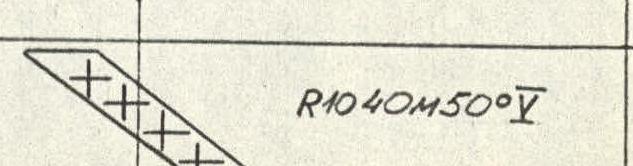
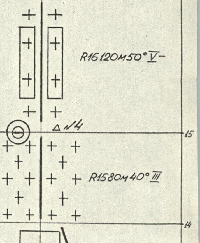
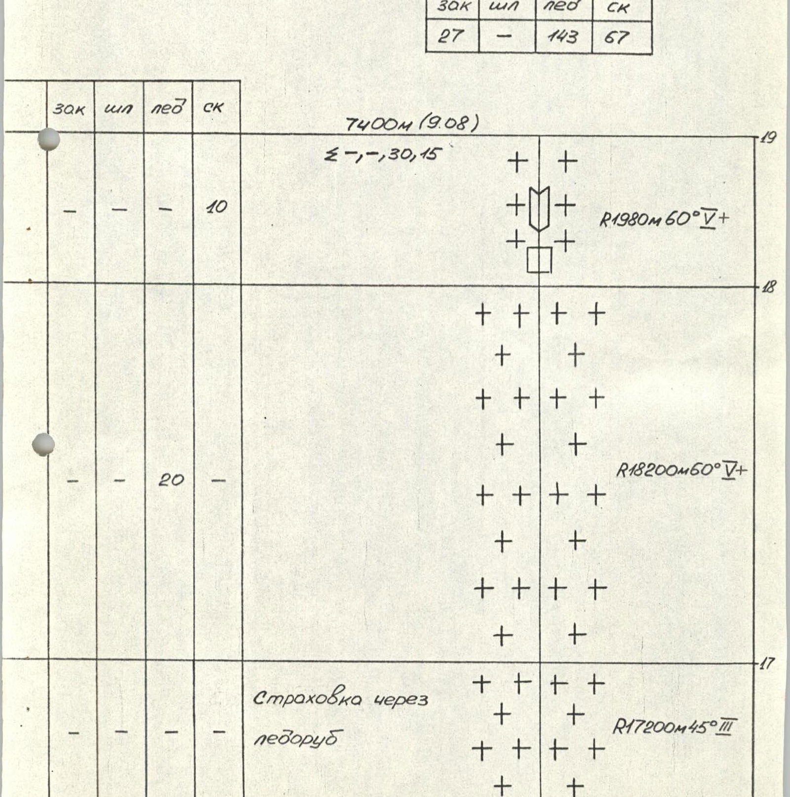
On the route: total climbing hours – 45 h
| protection | bolts | ice screws | rock |
|---|---|---|---|
| 27 | - | 143 | 67 |
The team departed from the base camp at the foot of Peak Gorky on the South Inylchek Glacier at 12:00 on August 4, 1988. The transition to the Diky Pass took 4–5 hours.
August 5
The rope team Gurov – Kopasov departed from the camp at 6:00. The rest of the team followed two hours later, carrying the first rope team's gear loaded with ropes and equipment for rock and ice climbing.
Initially, Gurov led.
Section R1–R2: rocks were snow-covered, crevasses were filled with ice.
Section R2–R3: icefall was climbed using crampons. The ice was hard, winter-like.
After the icefall, there was a change of lead: Kopasov took the lead. By this time, the six-member team began to ascend using the fixed ropes. The weather deteriorated. It started snowing.
Section 3–4:
- Snowfall intensified.
- Small avalanches started coming down from the left of the route.
At 16:00, the first rope team began preparing bivouac sites in an ice crevasse.
August 6
Movement on a snow-ice slope. The rope team Goncharov–Klindukh led. Under the "second icefall," the freshly fallen snow held poorly. To find reliable support, Goncharov ascended to the edge of the icefall and traversed it to the right (section R5–R6). The ice was very hard – winter-like. Ice screws were screwed in with difficulty.
On section R6–R7, the rope team Gurov – Kopasov took the lead. Gurov climbed the "second" icefall using crampons. The ice was over-frozen. It shattered under the crampons in slabs.
On section R7–R8:
- the snow was loose, above waist-deep;
- there were frequent changes of lead;
- the weather did not improve.
Bivouac under a large ice wall, somewhat overhanging the platforms. Small avalanches jumped over this "trampoline" behind their backs.
August 7
Clouds in the morning. Snow started falling. Gradually intensified. The rope team Grebennikov – Gorbach led. Due to bad weather, the pace of movement slowed down. At 20:00, a bivouac was set up under the rocks.
August 8
Section R11–R12. Entrance to the rocky ridge. Rocks were heavily snow-covered.
- Initially, the rope team Gurov – Kopasov led.
- Then, on section R12–R13, they were replaced by the rope team Vorontsov – Chizmar.
Before reaching the shoulder, the rocks became very steep. The passage was complicated by rimed ice. Chizmar used shortened ice screws for protection. Bivouac on a narrow snow ridge. To equip comfortable platforms, they had to be built up by "freezing snow".
August 9
The rope team Gurov – Kopasov led first. On section R16–R17, the snow was very deep (chest-deep). There were frequent changes of lead. Section 17–18 was first climbed by Goncharov – Klindukh. The rope team reached the summit at 16:00. Descent to the col between Peak Vazha Pshavela and Peak Neru. Bivouac on the col.
August 10
Ascent to Peak Vazha Pshavela along the ridge. The ridge was very narrow in places. Many cornices. An X-shaped cornice was bypassed from below on the left on ice. Descent from Peak Vazha Pshavela along the edge (5B category of difficulty).
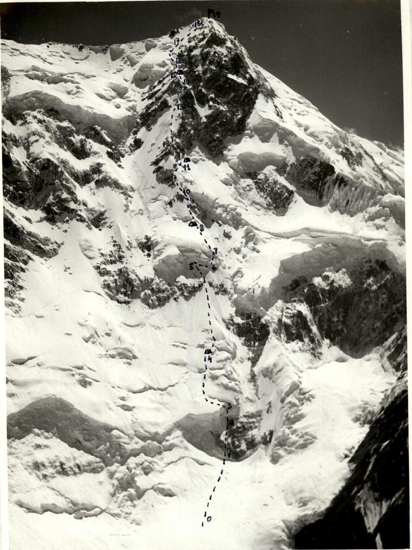
Technical photo of the route. July 14, 1988, 14:00. Shot point # 1. Distance 4 km. Height 4600 m. Praktica Super-TL (Zenitar, 50 mm)
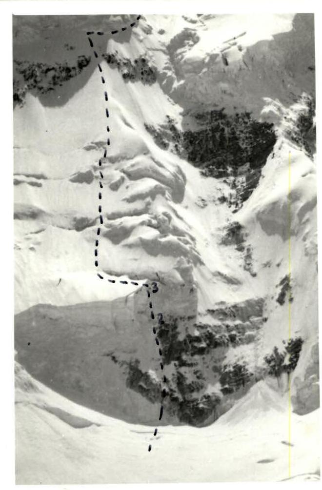
Photo 1. Section R2–R3. Shot point # 1. Distance 4 km. Height 4600 m. July 14, 1988, 14:00. Praktica Super-TL (Zenitar, 50 mm)
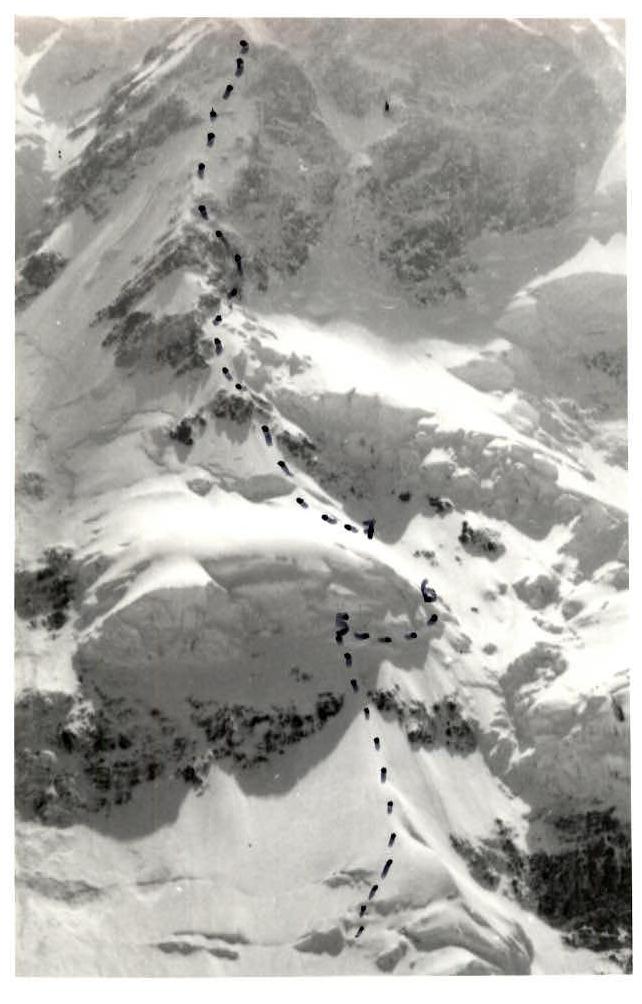
Photo 2. Section R5–R7. July 14, 1988, 17:00. Shot point # 1. Distance 4 km. Height 4600 m.
Amateur.
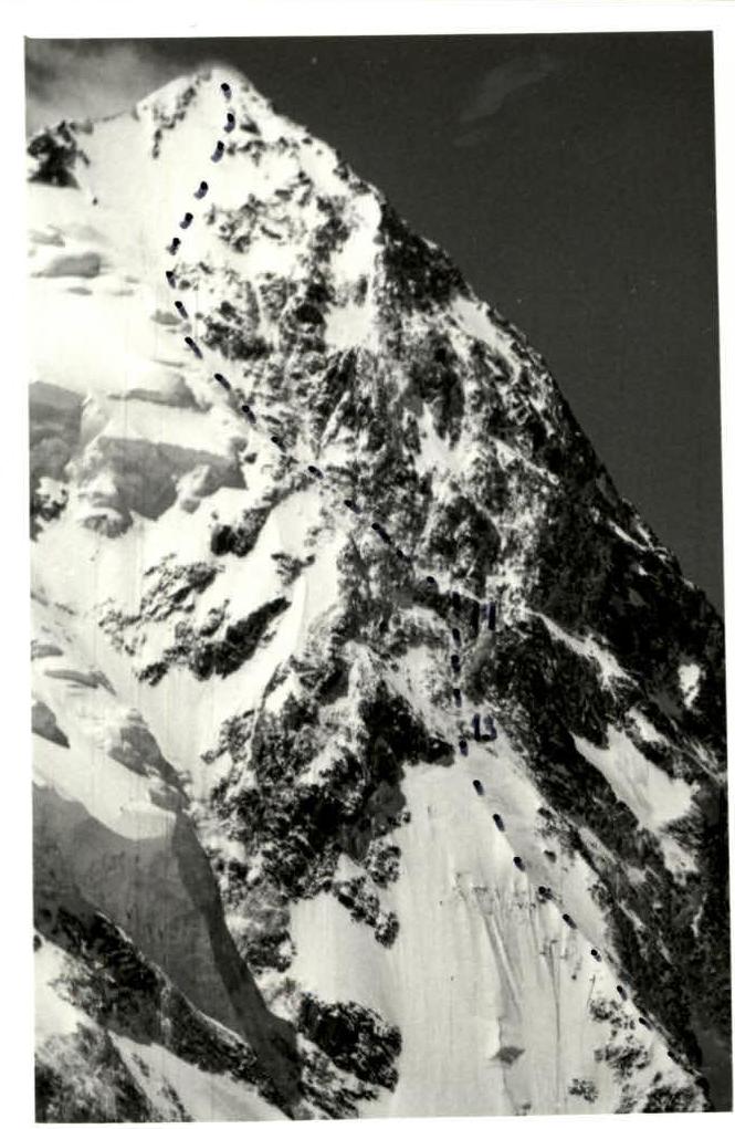
Photo 3. Section 14–13. August 9, 1988, 10:00. Distance 3 km. Height 5300 m. Amateur.