Ascent Passport
- Ascent category — winter
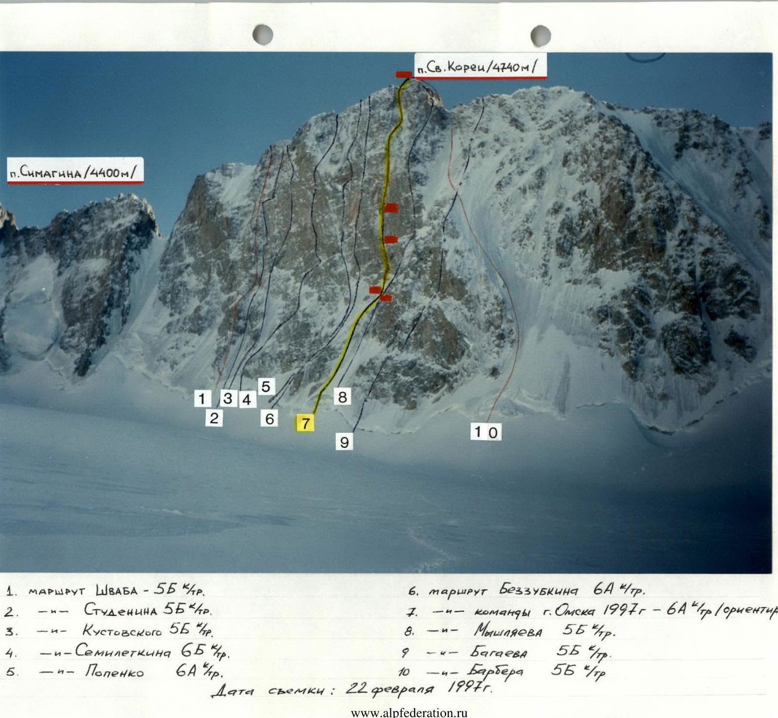
- Ascent area — Tian Shan, Kyrgyz Range, Ak-Sai gorge
- Peak Svobodnaya Korea (4740 m), direct route up the N wall
- Category 6A difficulty. First ascent.
- Height difference — 890 m.
Distance — 910 m. Length of category 6 sections — 180 m. Average slope of the wall — 68°
- Number of pitons left on the route — x
- Number of climbing hours/days — 30.5/5
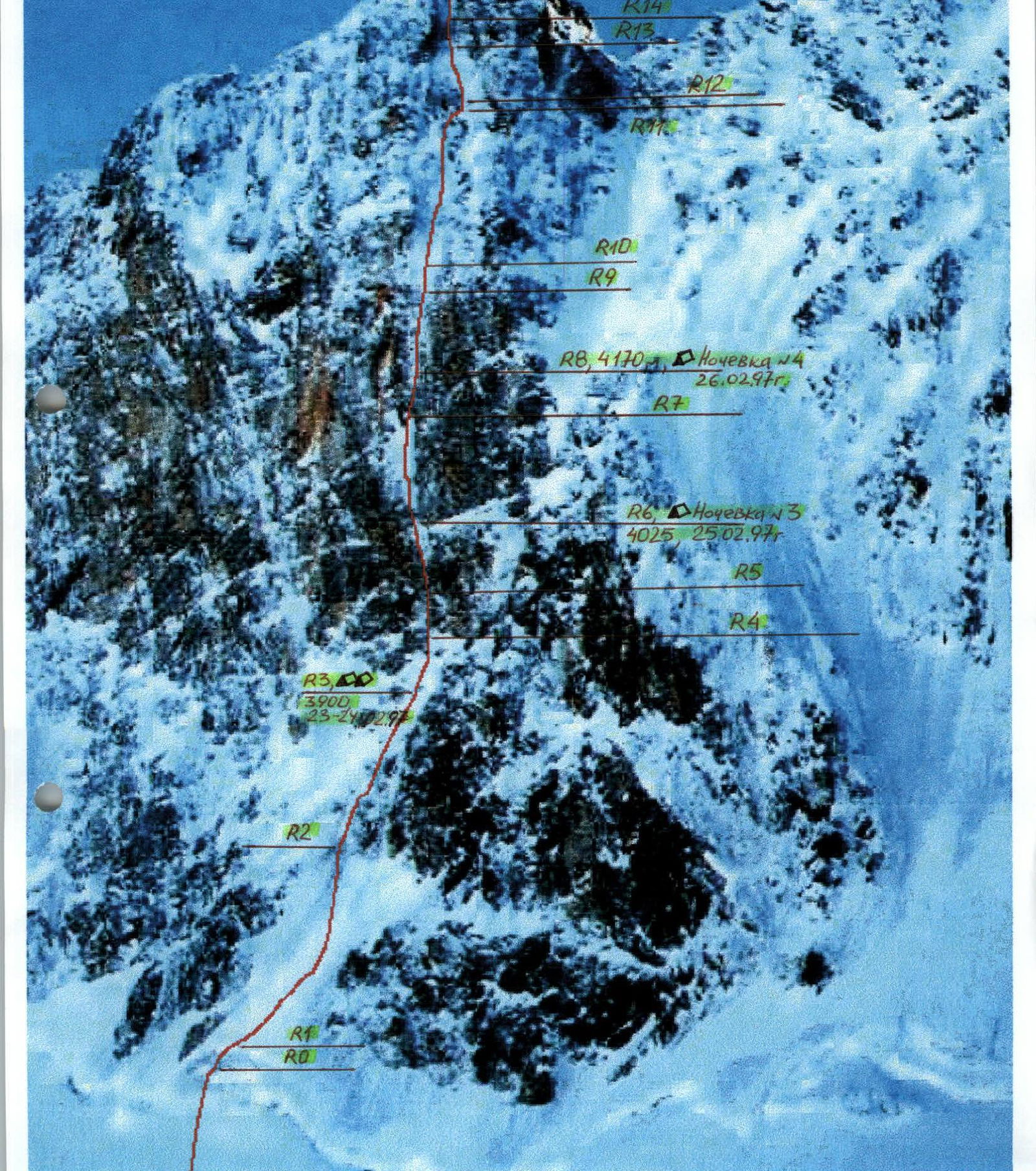
- Bivouacs 1–4 in a platform-tent on the wall,
5 — in a tent on the ridge
- Leader — Ruchkin Alexander Alexandrovich — International Master of Sports
Puchinin Andrey Albertovich — Candidate Master of Sports
- Coach — Ruchkin Alexander Alexandrovich — International Master of Sports
- Departure to the route — February 23, 1997.
Summit — February 27, 1997. Return — February 28, 1997.
-
Team from Omsk city.
-
Shvab route — category 5B difficulty.
-
Studenina — category 5B difficulty.
-
Kustovsky route — category 5B difficulty.
-
Semiletkin route — category 6B difficulty.
-
Popenko route — category 6A difficulty.
-
Bezzubkin route — category 6A difficulty.
-
Omsk city team 1997 — category 6A difficulty (approximately)
-
Myshlyaev route — category 5B difficulty.
-
Bagaev route — category 5B difficulty.
-
Barber route — category 5B difficulty. Photo date: February 22, 1997. The tactical plan for the ascent was based on personal climbs and observations from 1989–1996 on this wall in winter and summer.
The BIG WALL tactic was used on the wall.
The leader climbs on a double rope, sets up a belay station. One rope is used as a handrail, and the other is used to pull up the haul bag and serves as a backup for the second climber.
The leader uses a pulley system to pull up the haul bag with all the equipment using their body weight. The second climber follows on the handrail without a load, retrieves all intermediate anchors, and accompanies the haul bag. When the load gets stuck under a cornice, the second climber helps the leader to free it.
The weather conditions affected the team's actions on the route. It snowed for two days. The heavily iced and snow-covered rocks required more time than planned.
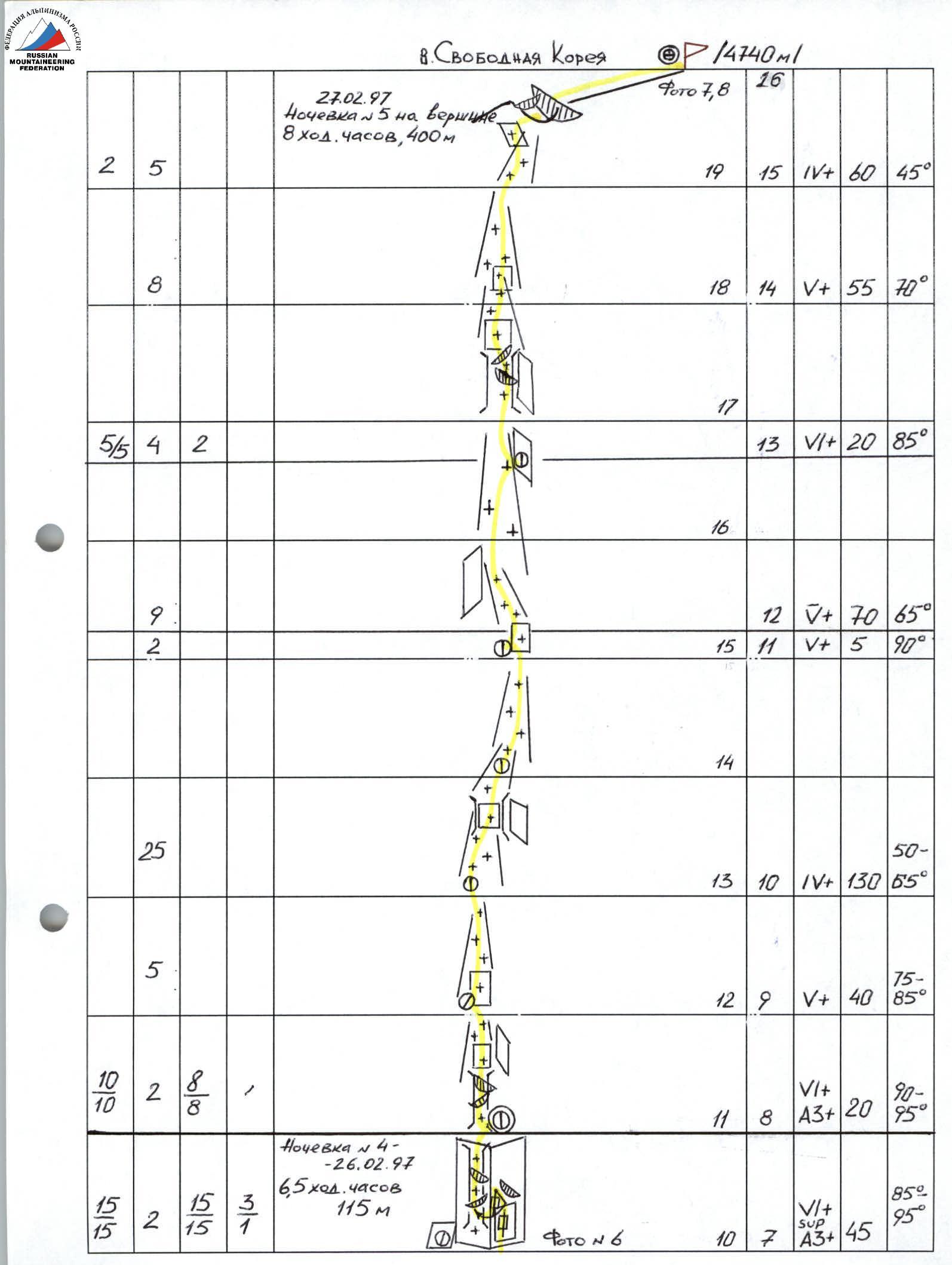
As a result, we reached the summit on the fifth day at 18:30.
The next morning, we started descending.
Alternating leaders daily allowed for rest and work on alternate days. On the first day, Ruchkin A.A. led. We departed early in the morning to climb as many pitches as possible and get stuck under a cornice.
Notable equipment used:
- STREGOR "UKRAINE" friend set;
- CAMALOTS;
- Ice screws in special winter design, nitrided, suitable for both ice and rock.
UIAA ropes, GRI-GRI belay device by PETZL, drill kit — all have been used multiple times on previous climbs.
The platform-tent weighs 5–6 kg. There are no ledges for bivouacs on the entire route. The platform allows for bivouacs anywhere, regardless of the terrain.
Gas was used for cooking (hot meals in the morning and evening).
During the day, individual snacks were consumed.
The team worked autonomously on the route (without radio communication or rescue team).
An observer was stationed at the hut.

4740 m, Bivouac #5, February 27, 1997.
Route diagram in M symbols 1:4000
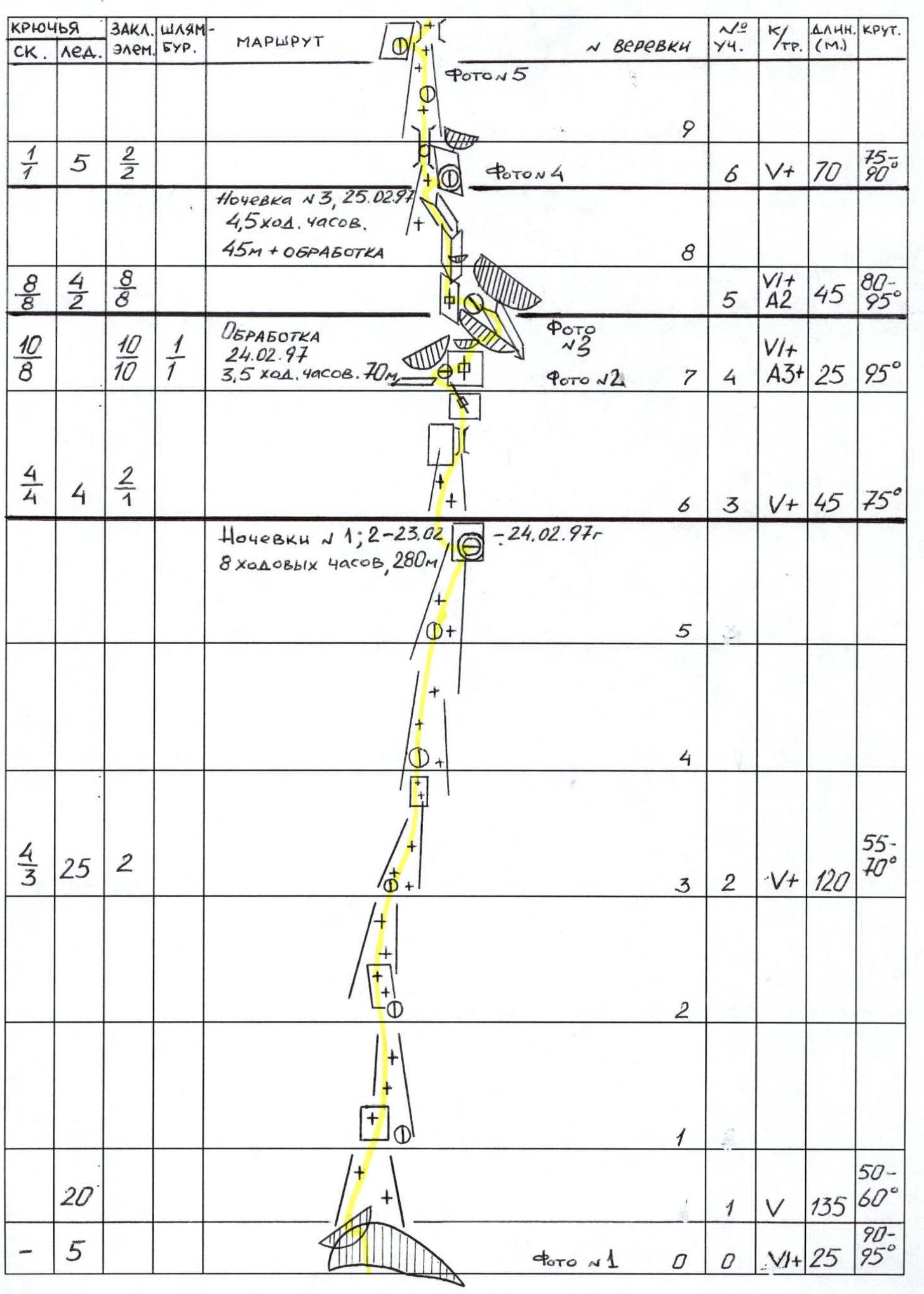
 0–1 The route starts from the bergschrund, in a narrow place filled with snow. The steep ice wall of the bergschrund is climbed vertically. The cornice is traversed from right to left towards the snow overhang. Exit from under the cornice is difficult due to a thick layer of snow — firn above it.
4–5 A sheer slab is climbed from left to right upwards. 10 m, 90°, VIA2+. Cracks are blind or a series of destroyed blocks. Artificial anchors. Organization of reliable anchors is minimal.
A cascade of small cornices leads to a large cornice with a 2 m overhang, which is bypassed on the right, 5 m, 95°, VI+A3+.
Exit from under the cornice into an inclined internal corner 10 m, 75°, VI+A2+, under a huge overhanging cornice.
5–6 To bypass the cornice on the left, a slab is climbed 5 m, 90°, VI+, into an internal vertical corner 10 m, 90°, VIA2. Many loose rocks. Further, an inclined corner leads to an ice formation 20 m, 80°, VIA1.
7–9 An overhanging internal corner 65 m, 85–95°, VIA3+. First, climb the right crack 10 m, then pendulum left. Into a narrow chimney with ice formations, cornices, and plugs. This is the key section of the route.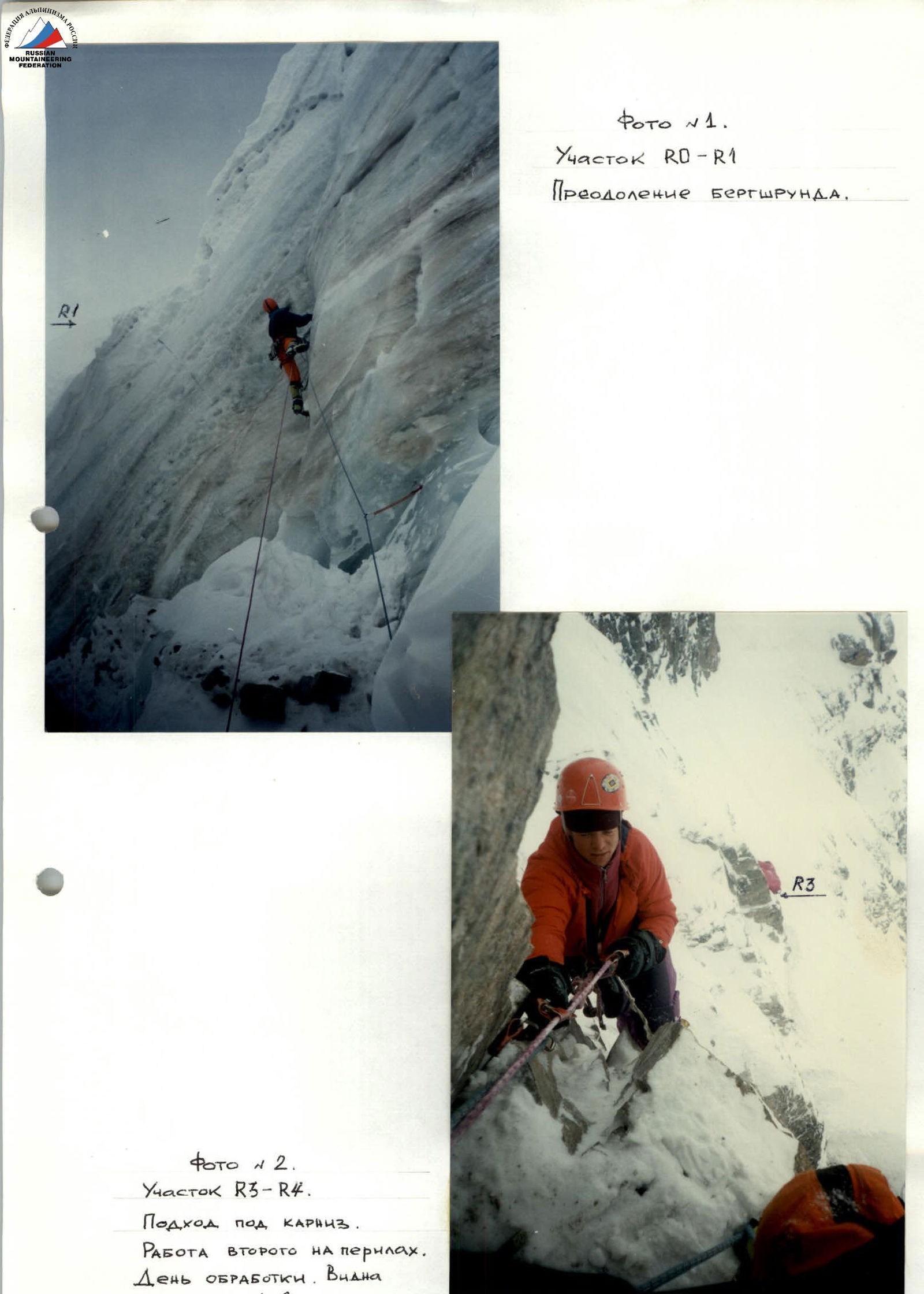
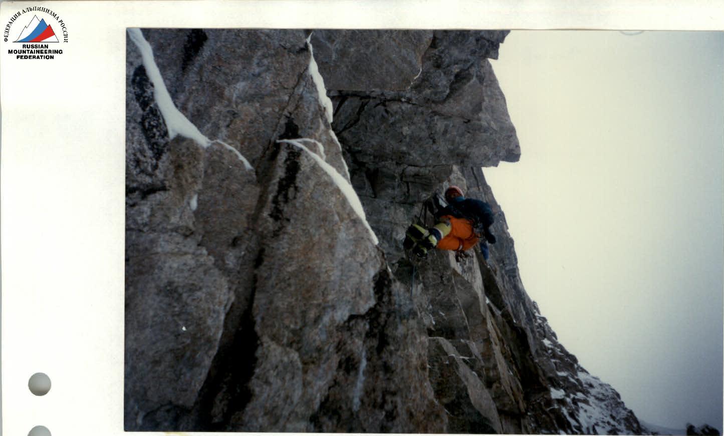
Photo #3. Section R4–R5. Cornice processing.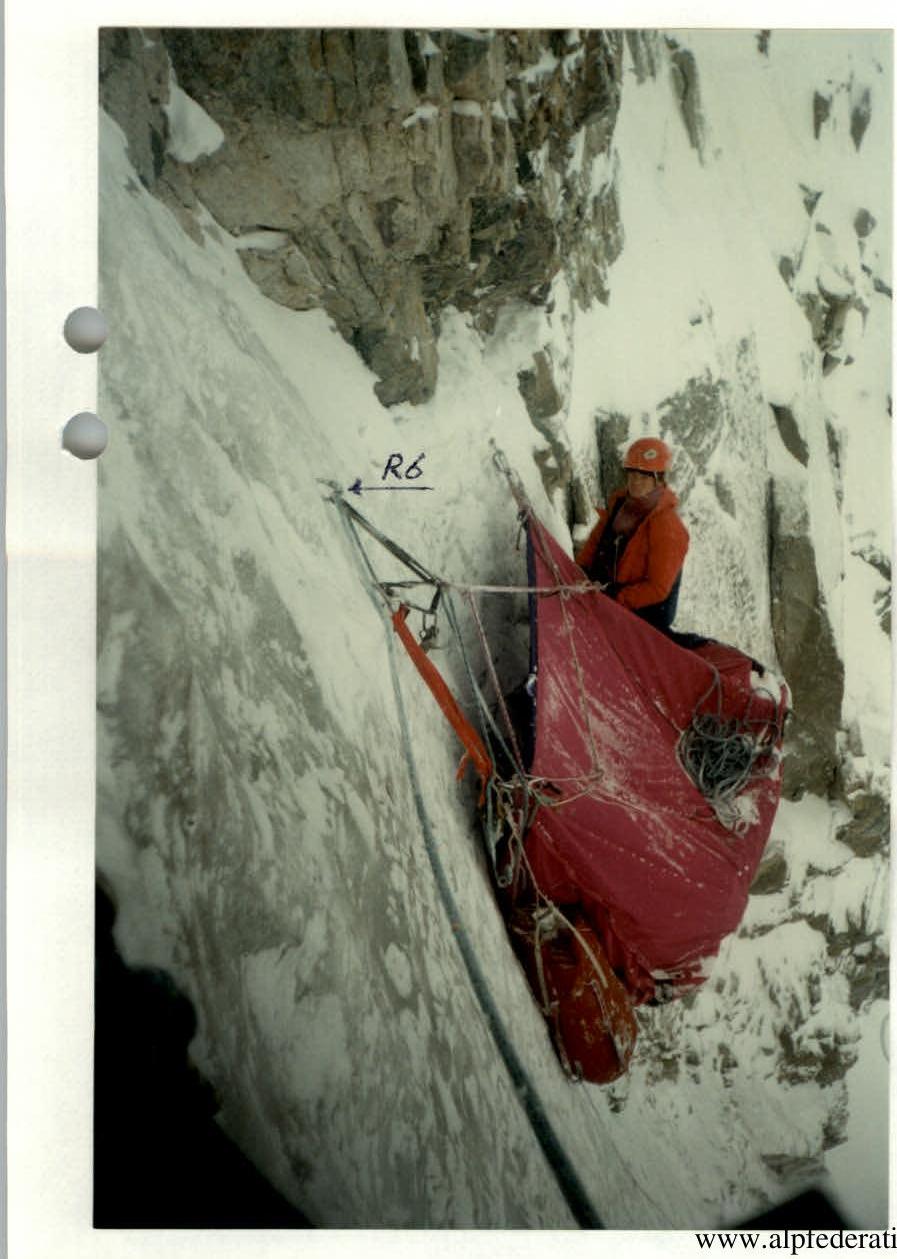
Photo #4. Section R6–R7. Bivouac #3.
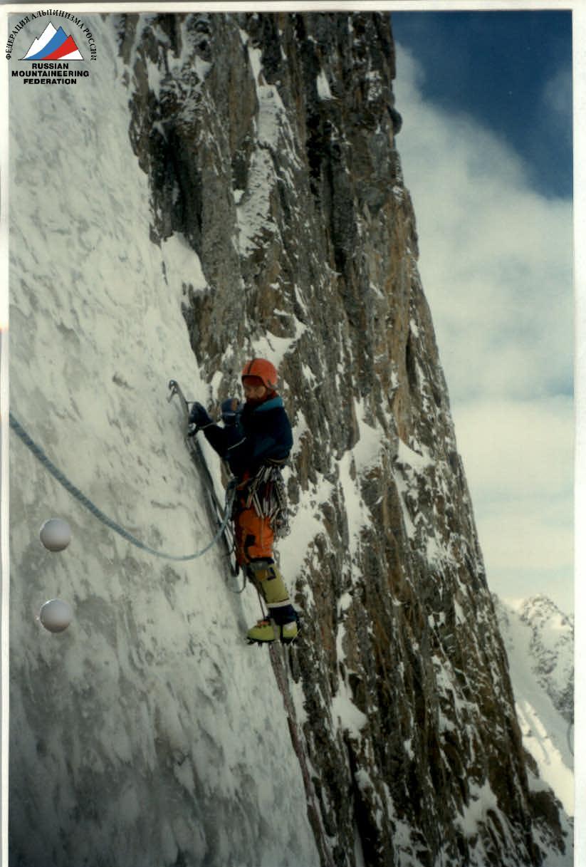
Photo #5. Section R6–R7.
The average slope of the route is visible in the photo.
Predominating on almost half of the route.
Approach to the "key" section of the route.
