Ascent Passport
-
Region — Tian-Shan, Kyrgyzsky Ridge, 7.4.
-
Peak — Svobodnoy Korei 4740 m, left of the central "triangle" and via the central couloir of the S wall
-
Category of difficulty — 5B, variation
-
Route character — combined
-
Route characteristics:
height difference of the route — 750 m, route length — 985 m, length of 6th category sections — 15 m, 5th category — 765 m, average steepness of the route — 64°
Pitons left on the route: total — 0.
Pitons used on the route:
- stationary pitons — 0, including ITO — 0; rock hooks — 12; stoppers — 16; ice screws — 65
- removable pitons — 0.
Total ITO used — 4.
-
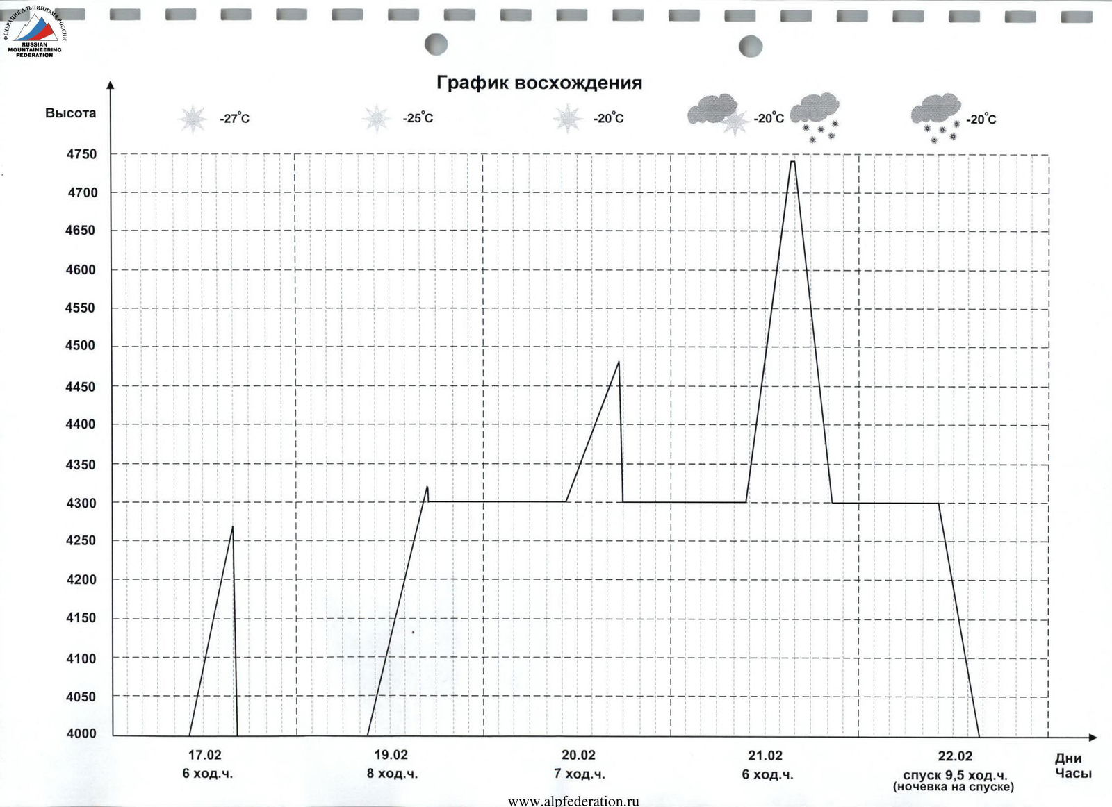
Number of climbing hours — 27, days — 4 (including the processing day)
-
Leader: Akhmadiev Aidar Gapтельнурович, Candidate Master of Sports
Participants:
- Rozhnov Evgeny Aleksandrovich, Candidate Master of Sports
- Kruglov Yuri Igorevich, Master of Sports
- Team coach: Kudryashov Valery Sergeevich, Candidate Master of Sports, 1st category.
Departure for route processing — February 17, 2005 at 10:00
Departure for the ascent — February 19, 2005 at 9:00
Return to Base Camp — February 22, 2005 at 16:00
-
Organization: Ministry of Youth and Sports of the Republic of Tatarstan
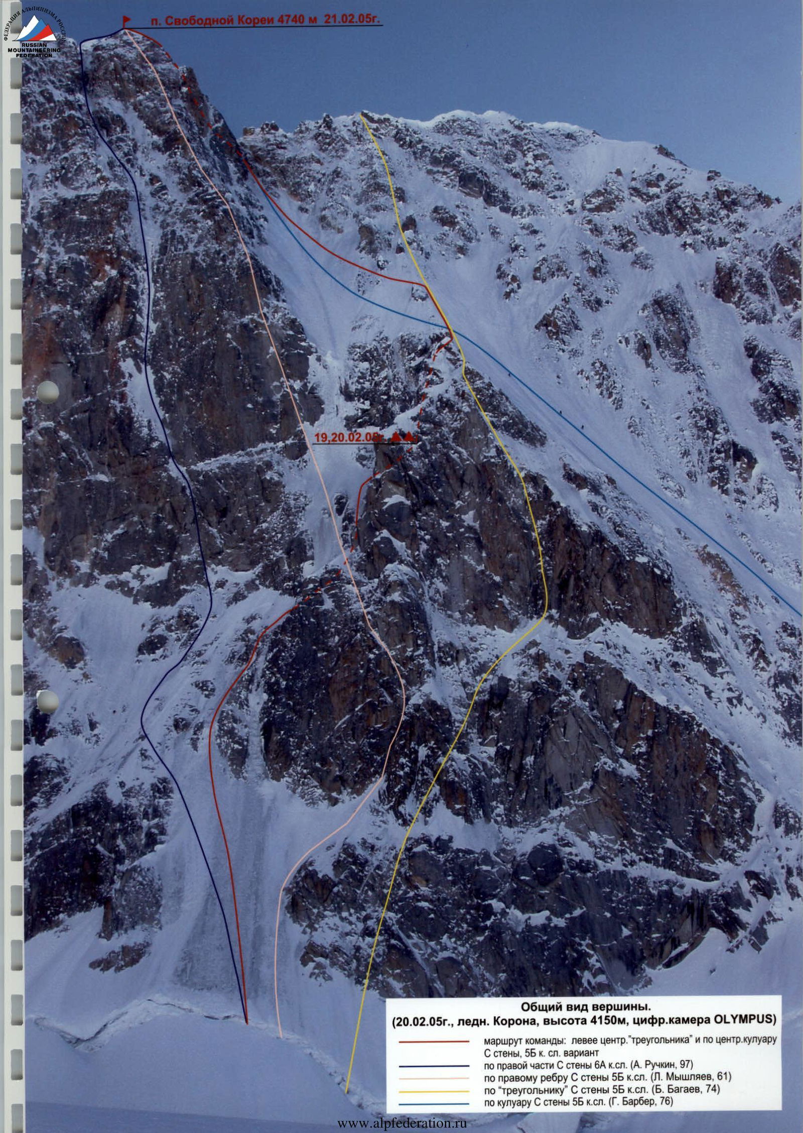
General view of the summit. February 20, 2005, Korona glacier, altitude 4150 m, digital camera OLYMPUS
Team's route:
- left of the central "triangle" and via the central couloir of the S wall, 5B category of difficulty, variation
- via the right part of the S wall 6A category of difficulty (A. Ruchkin, 97)
- via the right edge of the S wall 5B category of difficulty (L. Myshlayev, 61)
- via the "triangle" of the S wall 5B category of difficulty (B. Bagaev, 74)
- via the couloir of the S wall 5B category of difficulty (G. Barber, 76)
p. Svobodnoy Korei 4740 m February 21, 2005
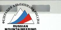
Route profile from the left. February 21, 2005, Korona 2 tower, altitude 4750 m, digital camera OLYMPUS
Route profile.
Ascent graph
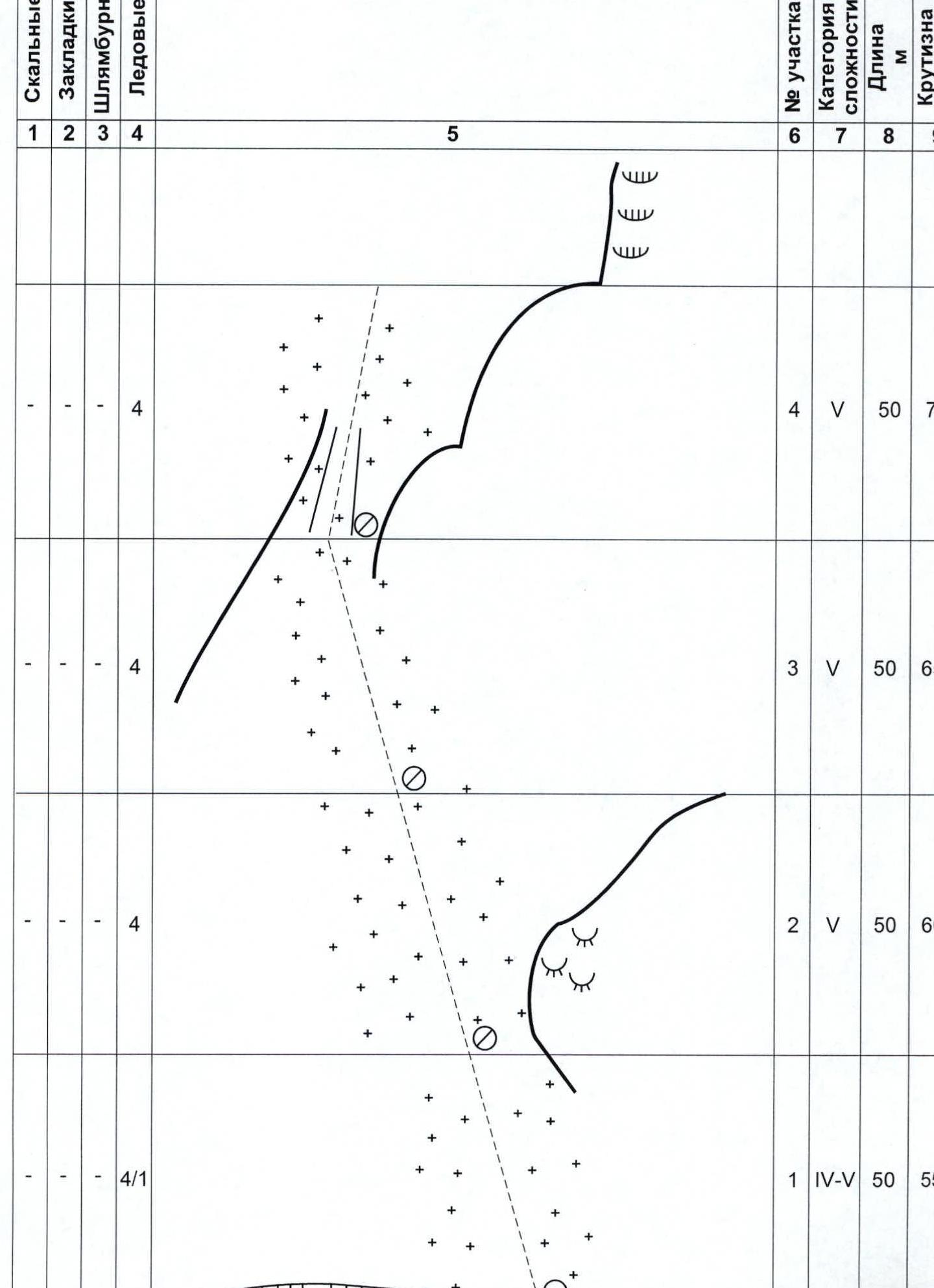
Route scheme in UIAA symbols
| 1 | 2 | 3 | 4 | 5 | 6 | 7 | 8 | 9 |
|---|---|---|---|---|---|---|---|---|
| - | 1 | - | 1 | R14 | VI | 3 | 90 | |
| 1 | 2 | - | 1 | R13 | IV | 5 | 40 | |
| - | 1 | - | - | R12 | IV | 5 | 45 | |
| 1 | 2 | - | 1 | R11 | VI | 7 | 75 | |
| 1 | 2 | - | - | February 19 – 8 climbing hours | R10 | V | 15 | 65 |
| 1 | 5 / 3 | - | - | R9 | VI A2 | 5 | 90 | |
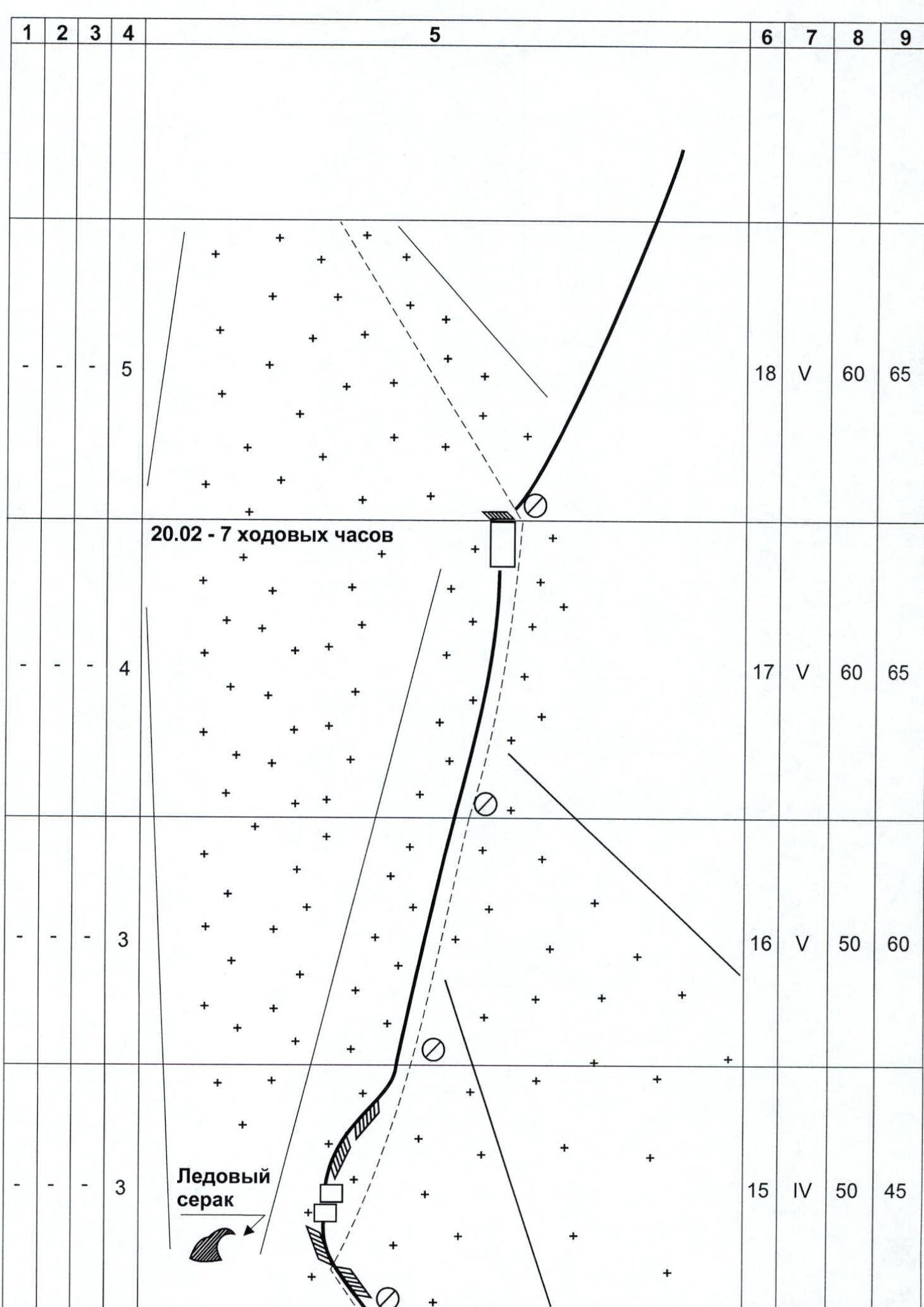
| 7 | - | - | 2 | 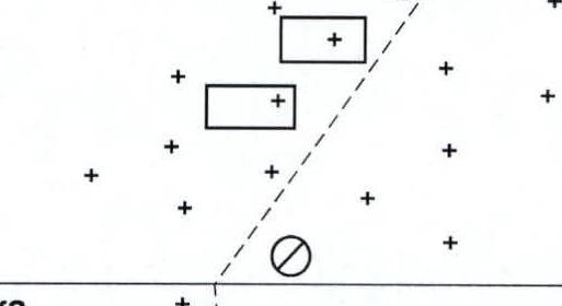 {width=513 height=280} {width=513 height=280} | R8 | V | 45 | 55 |
| - | - | - | 5 | 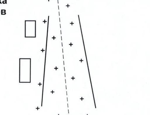 {width=513 height=393} {width=513 height=393} | R7 | V | 60 | 75 |
| - | - | - | 4 | 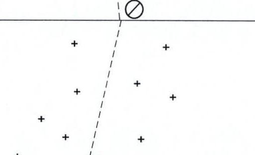 {width=513 height=313} {width=513 height=313} | R6 | V | 50 | 60 |
| - | - | - | 5 |  {width=513 height=479} {width=513 height=479} | R5 | V | 50 | 60 |
| 1 | 2 | 3 | 4 | 5 | 6 | 7 | 8 | 9 |
|---|---|---|---|---|---|---|---|---|
| Summit at 15:30 | ||||||||
| - | 1 | - | - | February 21 – 6 climbing hours | R24 | III | 60 | 40 |
| 1 | 2 | - | - | R23 | IV | 40 | 60 | |
| - | - | - | 5 | R22 | V | 40 | 75 | |
| - | - | - | 4 | R21 | V | 60 | 70 | |
| - | - | - | 3 | R20 | V | 60 | 65 | |
| - | - | - | 3 | R19 | V | 60 | 65 |
Route description by sections
On February 17, 2005 at 10:00 our team consisting of:
- Aidar Akhmadiev
- Yuri Kruglov
- Evgeny Rozhnov started processing the lower part of the route.
Sections R1–R7. From the bergschrund upwards to the right from Ruchkin's initial route thread via an ice slope with steepness from 55° (in the lower part) to 75° (in the upper part) 360 m. Ice is bottle-shaped, hard. Akhmadiev works first with an ice tool. Kruglov and Rozhnov carry ropes. We finish processing at 16:00, descend to the bergschrund by 16:30, and then to Base Camp located near the "Korona" hut on the Ak-Sai glacier.
- February 18 — rest day and preparation, we test the platform, prepare equipment.
- February 19 — we start with full gear from the bergschrund at 9:00.
Section R8. Kruglov works first. Upwards to the right 45 m 55°. We exit under a rock wall leading to the "triangle" summit of the Bagaev route. At the base of the wall on the ice slope, we hang a lightweight 2-person American-made platform. We set up a bivouac, continue working.
Section R9. From the platform, a small traverse to the right to a vertical crack. The crack is climbed using ITO. Kruglov works first. Rocks are heavily snow-covered and icy.
Section R10. Then a snow-covered internal corner leads to a chimney. Free but very tense climbing with constant clearing of rocks from snow.
We finish work at 17:00 and descend to the bivouac platform. We have passed 7 rope lengths during the day, removed the lower 4 ropes for further work, set up a platform, and prepared for the ascent to the "triangle" summit. February 20 — we start working at 10:30. Rozhnov works first.
Section R11. The chimney is clogged with snow and ice, free and tense climbing. Sections R12–R13. Then a series of small walls leads to a snow-covered inclined ledge. Along the ledge to the right to a wall.
Section R14. A three-meter vertical wall with an overhanging snow cornice above leads to the cornice ridge of the "triangle" summit. Extremely tense free climbing.
Section R15. After 10 m of movement along the ridge, Zhenya breaks through the cornice and exits to the right side of the ridge. Along the ice-firn slope, we exit to the saddle between the upper and lower couloirs of the north wall.
Sections R16–R17. From the saddle straight up, two rope lengths via a steep ice ridge to the summit of a rock gendarme.
Section R18. Then a traverse along the ice slope to the left and upwards into the central couloir of the north wall.
We finish work at 17:30 and descend to the platform for the 2nd bivouac by 18:00 via fixed ropes. From the start of the chimney, we have passed 240 m on this day.
February 21 — we start at 9:30 with light packs, carrying:
- warm clothes,
- gas burner,
- thermos with tea,
- snack.
The plan is to reach the summit and descend to the platform today. Akhmadiev works first.
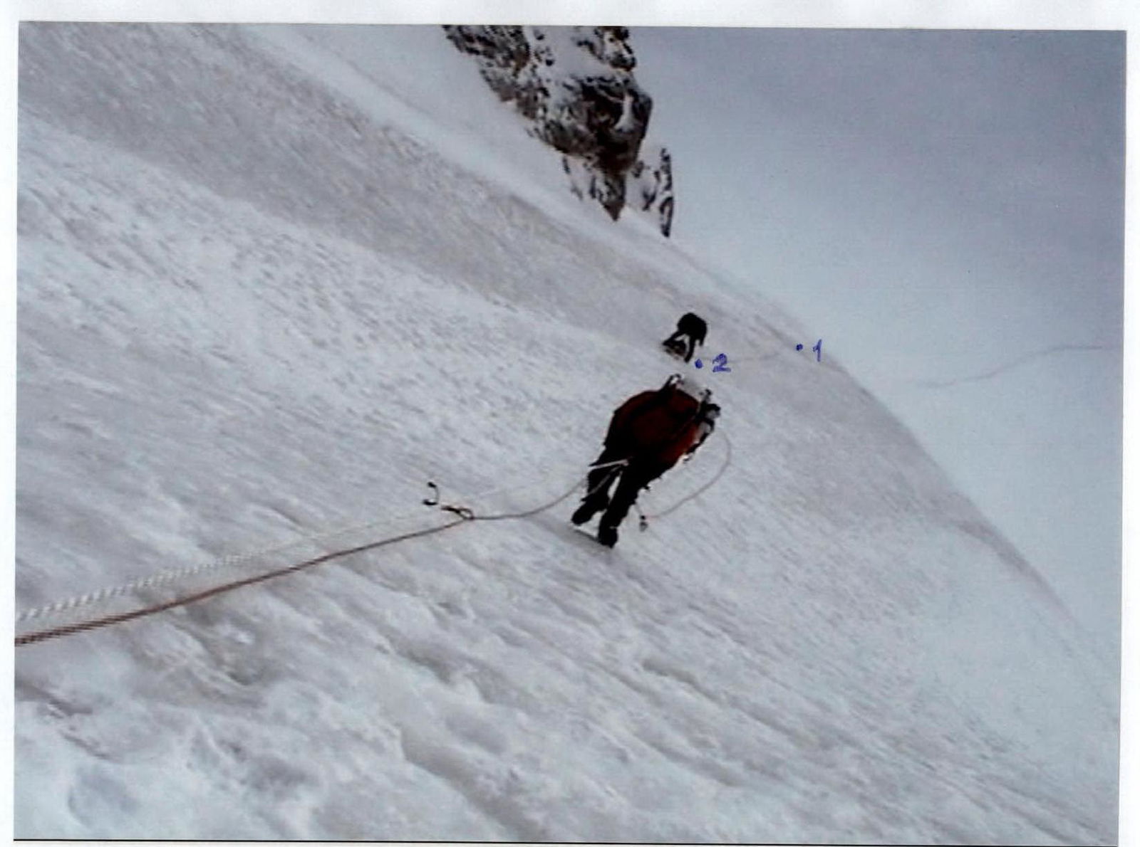
Sections R19–R21. 220 m of a steep ice couloir lead to the saddle of the main ridge of Svobodnaya Koreya peak. The last 40 m to the saddle are climbed using pitons because the hard bottle-shaped ice shatters under ice axe blows.
We reach the saddle at 14:00. Sections R22–R23. 100 m of snow-covered rocks of medium difficulty lead to the summit.
We are on the summit at 15:40. After waiting for the next radio communication session at 16:00, we begin descending via the ascent route. We descend to the platform by 20:30. Bivouac. February 22 — we continue descending at 10:00, reach Base Camp by 16:00.
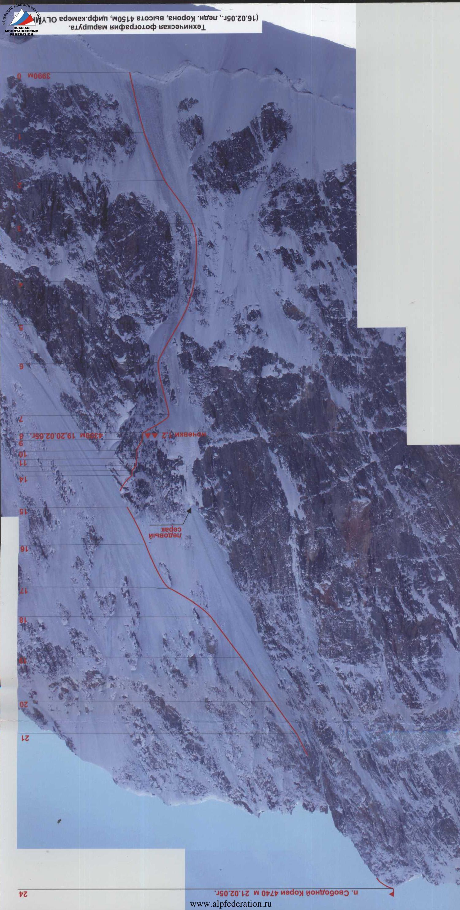 Technical photograph of the route. February 16, 2005, Korona glacier, altitude 4150 m, digital camera OLYMPUS
 Section R3.
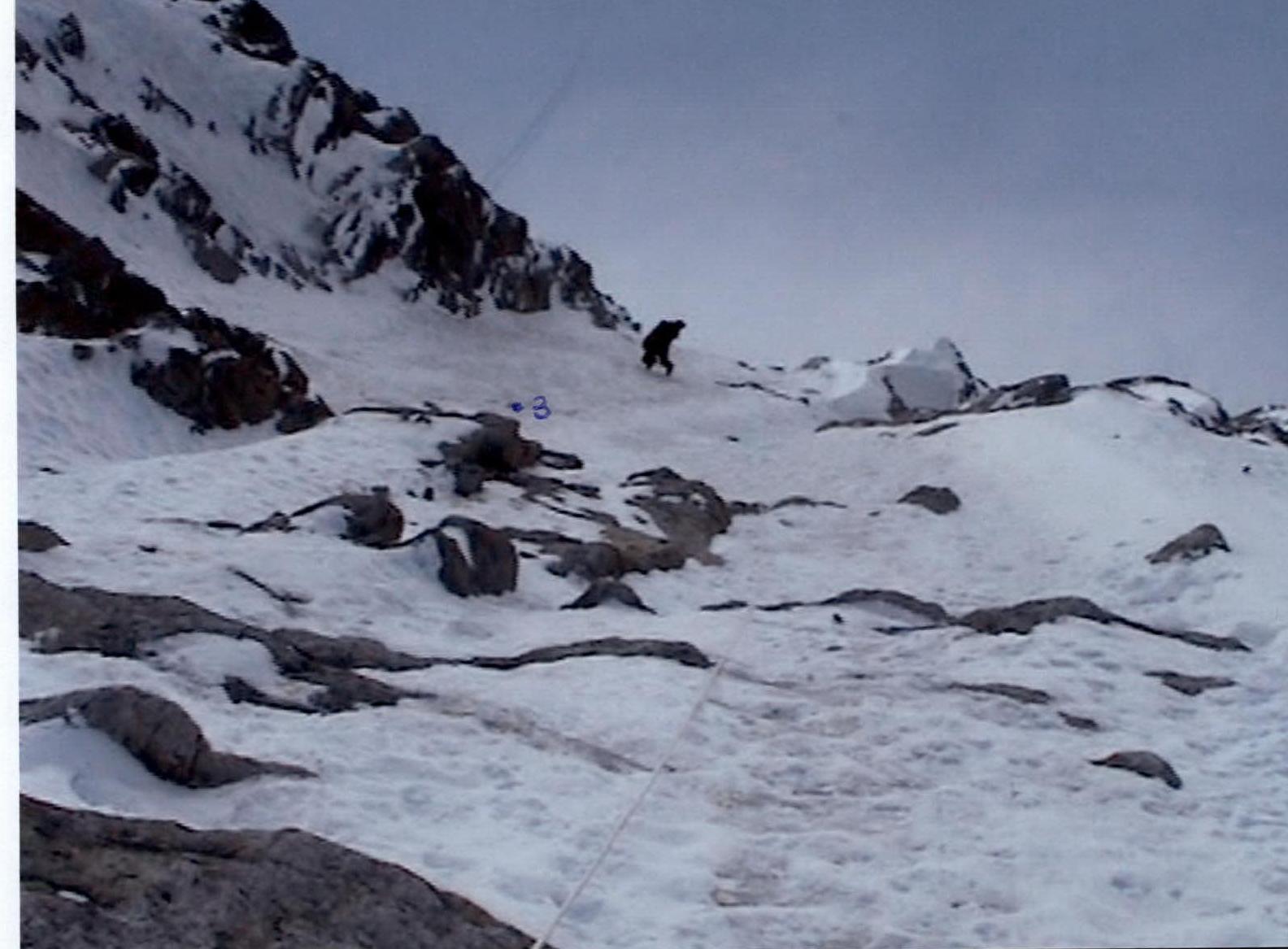 Sections R3–R4.
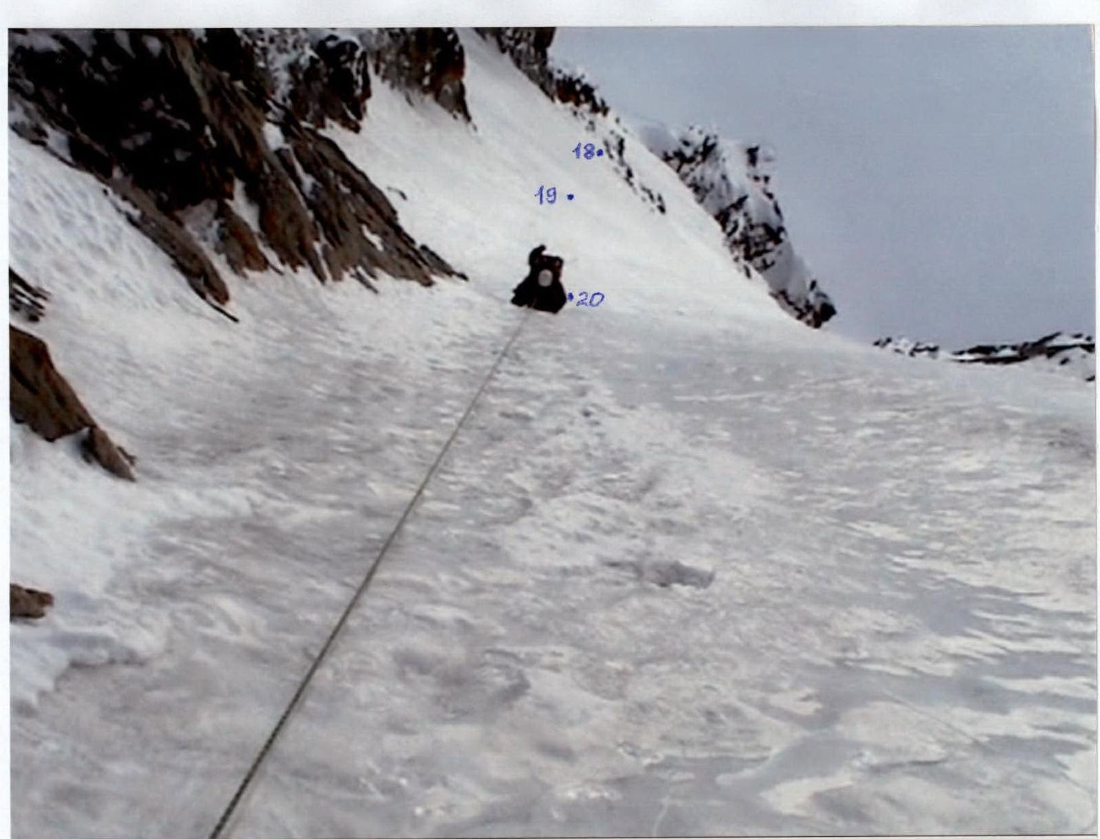 Section R21.