- Ascent class — Technical
- Ascent area — Western Tian Shan, Kyrgyz Ala-Too range, Tuyuk-Shamsin gorge
- Peak, its height — Peak "Peredovoy" — 3960 m, ascent route — along the 3rd ridge.
- Proposed difficulty category — 2A cat. diff.
- Route characteristics — Height difference — 1460 m, average steepness — 40°, length of complex sections: R1–1380 m, R2 ±155 m.
- Pitons hammered — 2 pcs. rock
- Number of travel hours — 9 hours
- Number of overnight stays — none
- Full name of the leader, participants and their sports qualification:
- Kolva V.A. — II sports category (leader)
- Matygin S.V. — II sports category
- Team coach — Guber G.D. — Candidate Master of Sports, instructor II category
- Date of departure on the route — May 3, 1983 Return — May 3, 1983
Ascent Route
to peak "Peredovoy" 3960 m along the 3rd ridge 2A cat. diff.
Nature of the route to peak "Peredovoy" 3960 m. 2A cat. diff.
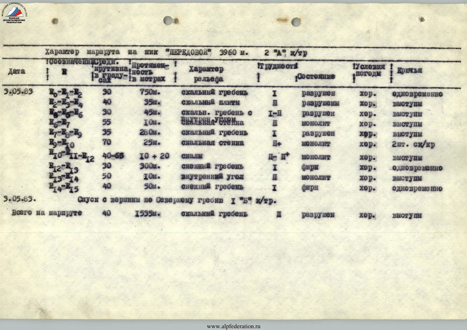
| Date | Designations | Average steepness in degrees | Length in meters | Nature of terrain | Difficulty | Condition | Weather conditions | Pitons |
|---|---|---|---|---|---|---|---|---|
| May 3, 1983 | R0–R2 | 30 | 750 m | rocky ridge | 1 | destroyed | good | simultaneously |
| R2–R4 | 40 | 35 m | rocky slabs | 2 | destroyed | good | ledges | |
| 30 | 45 m | rocky ridge with | 1–2 | destroyed | good | ledges | ||
| R6–R7 | 55 | 10 m | inner corner, rocky wall | 2 | monolith | good | ledges | |
| R8–R9 | 35 | 280 m | rocky ridge | 1 | destroyed | good | ledges | |
| R9–R10 | 70 | 25 m | rocky wall | 2 | monolith | good | 2 pcs. rock pit | |
| R10–R12 | 40–65 | 10 + 20 | rocks | 2 | monolith | good | ledges | |
| R12–R13 | 30 | 300 m | snowy ridge | 1 | firn | good | simultaneously | |
| R13–R14 | 50 | 10 m | inner corner | 2 | monolith | good | ledges | |
| R14–R15 | 40 | 50 m | snowy ridge | 1 | firn | good | simultaneously | |
| Total on the route | 40 | 1535 m | rocky ridge | destroyed | good | ledges |
May 3, 1983. Descent from the summit along the North ridge 1B cat. diff.
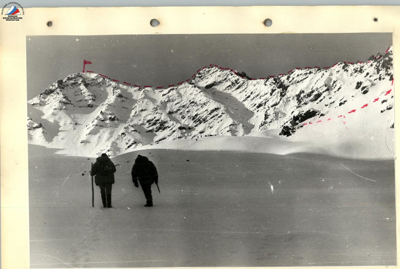
Ascent route to peak "Peredovoy" 3960 m along the 3rd ridge 2A cat. diff.
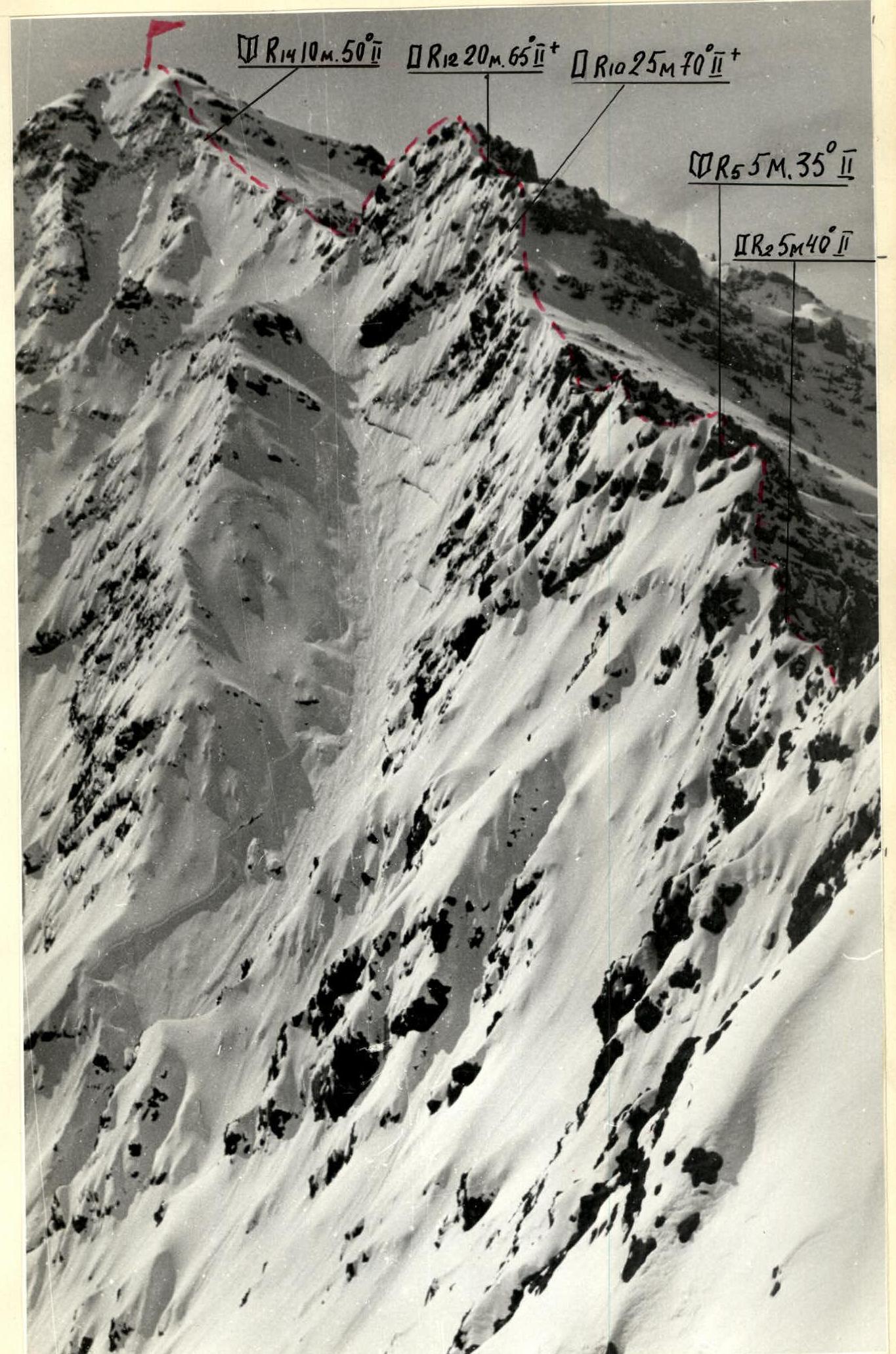
Ascent route to peak "Peredovoy" 3960 m along the 3rd ridge 2A cat. diff.