Ascent Passport
- Tian-Shan, Kyrgyz ridge, 7.4
- Name of the peak: Korona (5th), center of the SW wall
- 6A category of difficulty
- Route type: rock
- Height difference: 838 m
Route length: 892 m Length of sections: V category of difficulty 533 m VI category of difficulty 102 m Average steepness: — main part of the route 81° — entire route 75°
- Number of pitons hammered on the route: total 290, including stationary bolted pitons: –2, including A.P. –1 removable bolted pitons: —, including A.P. – total artificial points of support (A.P.) used –22
- Team's travel hours: 33 h
- Leader: Pavel'ev Anatoliy Vasil'evich, Candidate Master of Sports
Participants: — Pavel'eva Nelya Abbasovna, Candidate Master of Sports — Rafikova Natal'ya Vladimirovna, Candidate Master of Sports — Lapaev Dmitriy Viktorovich, Candidate Master of Sports — Toporkov Aleksandr Viktorovich, 1st sports category
-
Coach: Pavel'ev Anatoliy Vasil'evich
-
Departure to the route from Base Camp: 13:00, August 4, 2004 (reconnaissance) Summit ascent: 14:00, August 7, 2004 Return to Base Camp: 19:00, August 7, 2004 (descent via 3A category of difficulty)
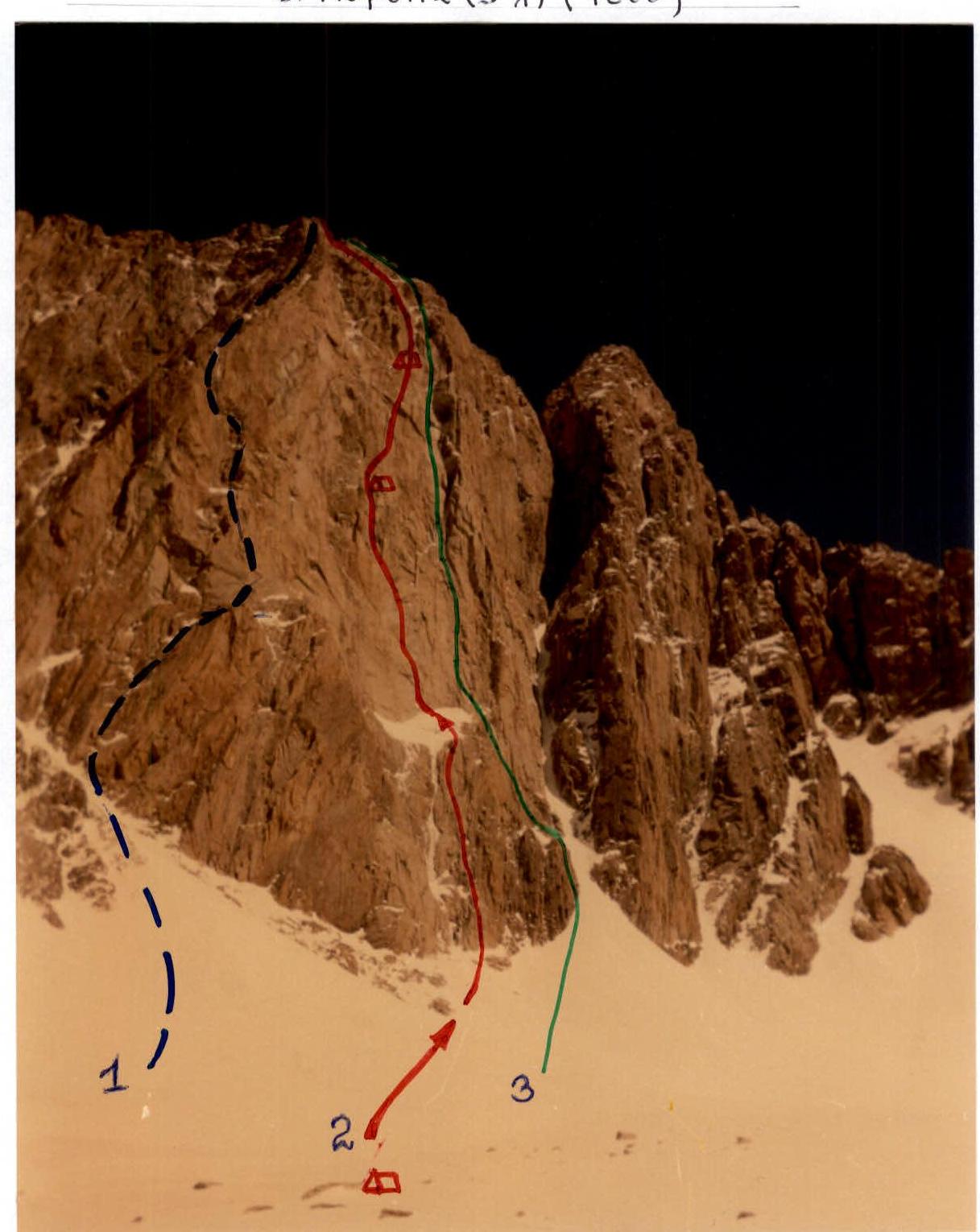
- V. Sadovskiy's route, 1968, 5B category of difficulty via SW wall
- Route ascended by the team, 2004 (V. Balezin's route, 1994, 6A category of difficulty via center of SW wall)
- V. Ruzhevskiy's route, 1976, 5B category of difficulty via 3rd ridge
Photo from August 4, 2004 from bivouac below Korona peak (5th)
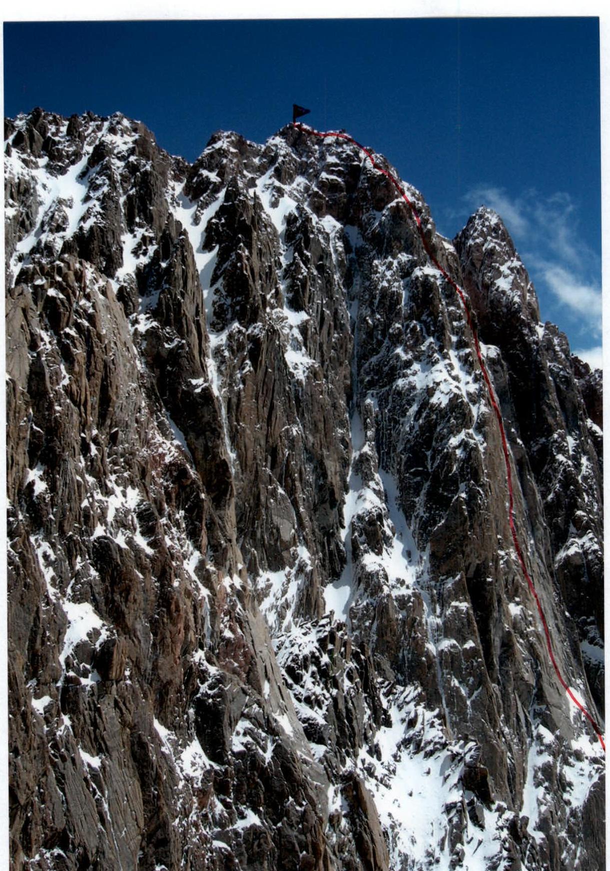
Photo of the wall profile from the left.
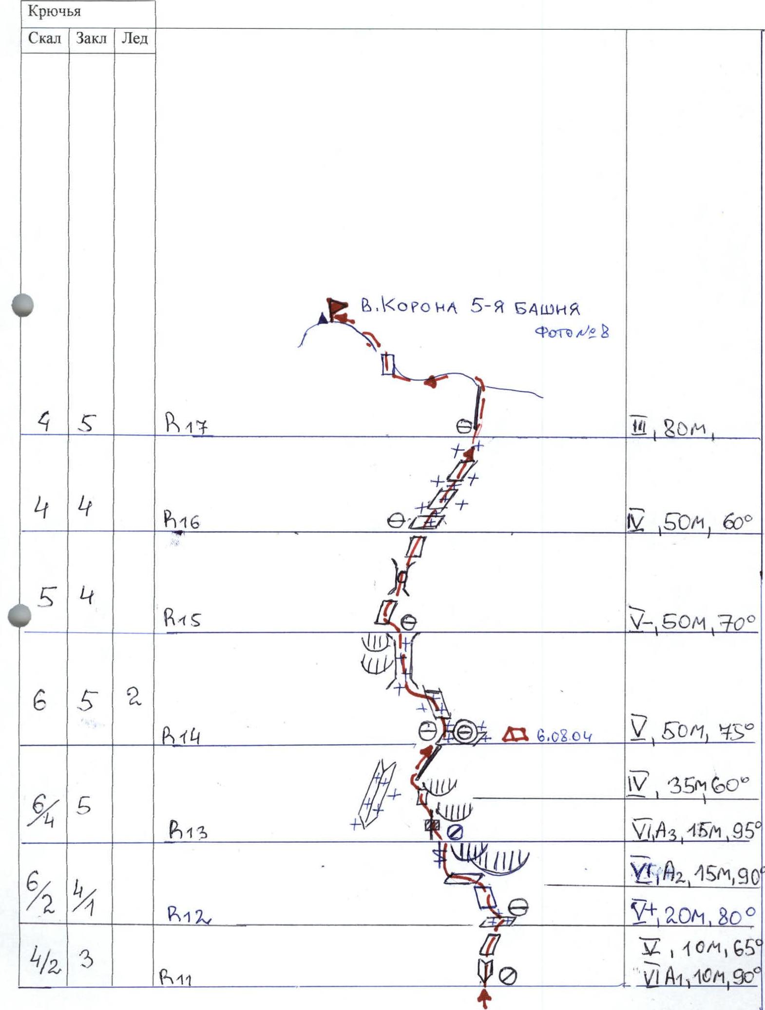
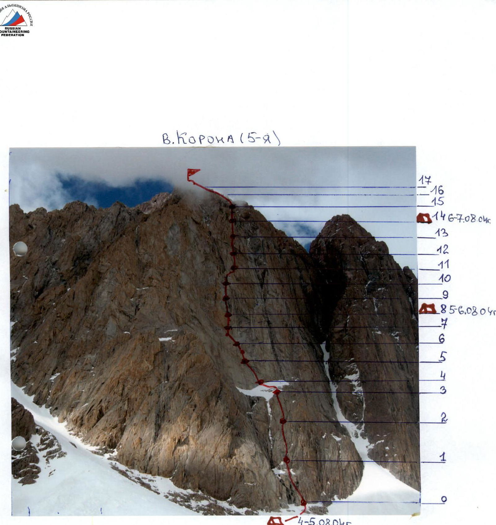
Route diagram in UIAA symbols for Korona 5th Tower, M 1:2000 via center of SW wall
| Rock | Cams | Ice | Section | Description |
|---|---|---|---|---|
| 8 | 7 | R0 | V, 50 m, 80° | |
| 6 | 10 | R1 | V+, 50 m, 85° | |
| 2 | 6 | R2 | V, 20 m, 80° | |
| 2 | R3 | III, 40 m, 40° | ||
| 11 | 5/2 | R4 | ∇, 15 m, 95°, A1; Photo №1 V+, 35 m, 90° | |
| 7/2 | 5/1 | R5 | ∇, 35 m, 65°, VI A1, 15 m, 95° | |
| 8 | 4 | R6 | Photo №3 ∇, 50 m, 80° | |
| 19/2 | 4 | R7 | Photo №5 ∇, 38 m, 75°; Photo №4 | |
| 8 | 4 | R8 | Photo №6 VI A2, 12 m, 90°; ∇, 45 m, 80° | |
| 9 | 6 | R9 | Photo №7 V+, 50 m, 80° | |
| 12/6 | 4 | R10 | ∇, 10 m, 80°, V+, 20 m, 85°, VI A2, 20 m, 90° | |
| 4/2 | 3 | R11 | V, 10 m, 65°, VI A1, 10 m, 90° | |
| 6/2 | 4/1 | R12 | VI A2, 15 m, 90°, V+, 20 m, 80° | |
| 6/4 | 5 | R13 | IV, 35 m, 60°, VI A3, 15 m, 95° | |
| 6 | 5 | 2 | R14 | August 6, 2004 V, 50 m, 45° |
| 5 | 4 | R15 | V–, 50 m, 70° | |
| 4 | 4 | R16 | IV, 50 m, 60° | |
| 4 | 5 | R17 | II, 80 m |
TECHNICAL PHOTOGRAPHY OF THE ROUTE
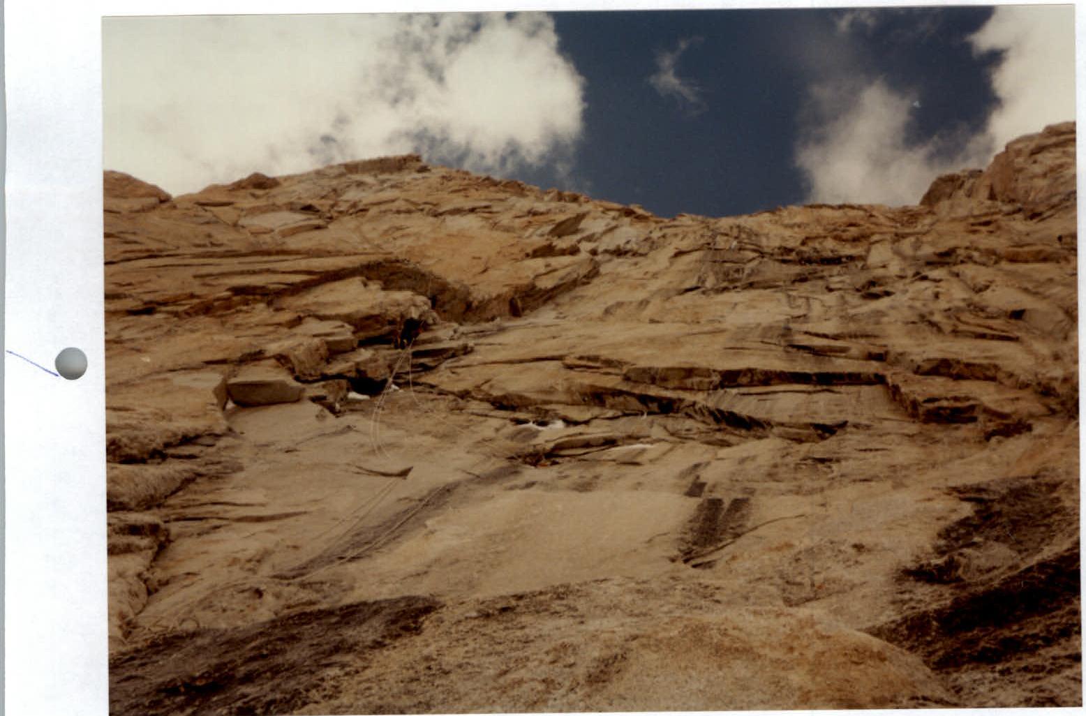
Photo №1
Photo №1. Section R4. Movement on fixed ropes
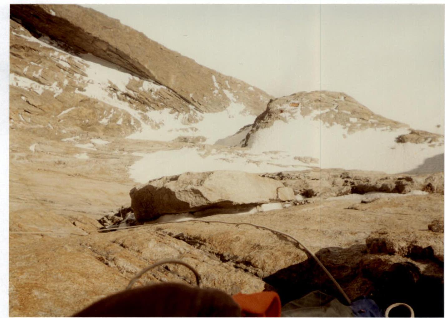
Photo №2
Photo №2. Section R5. View from the belay station downwards
Photo №3
Photo №3. Sections R5–R6. View from the belay station
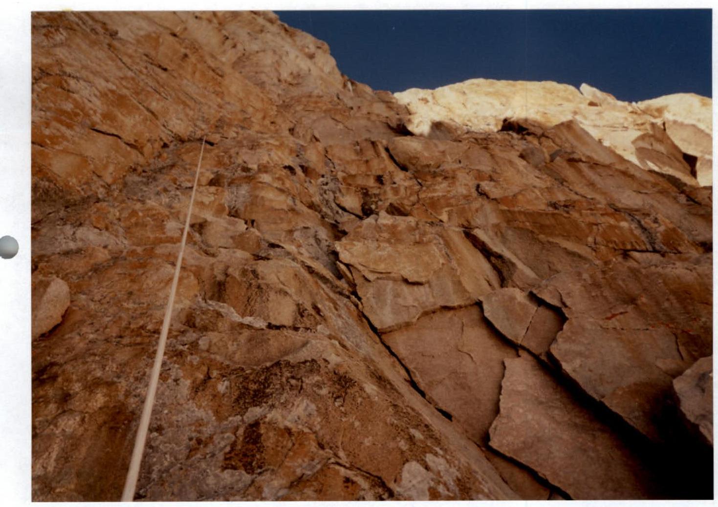
Photo №4
Photo №4. Section R6. Fixed ropes hung
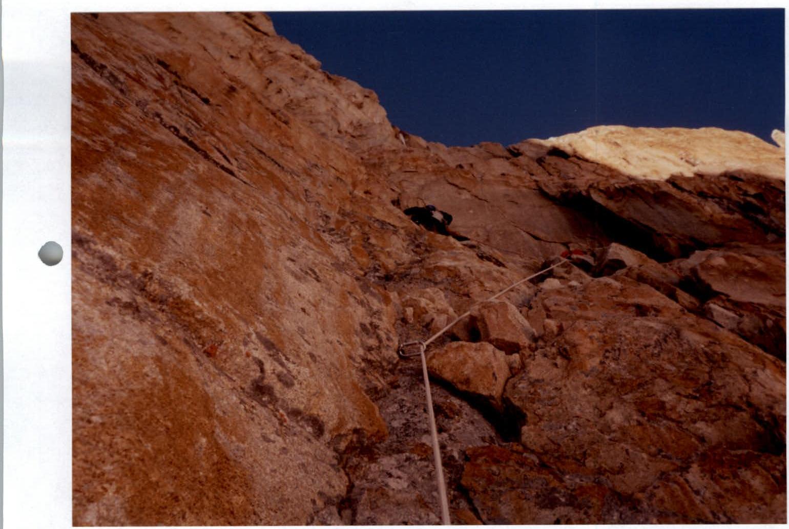
Photo №5
Photo №5. Reconnaissance of sections R6–R7
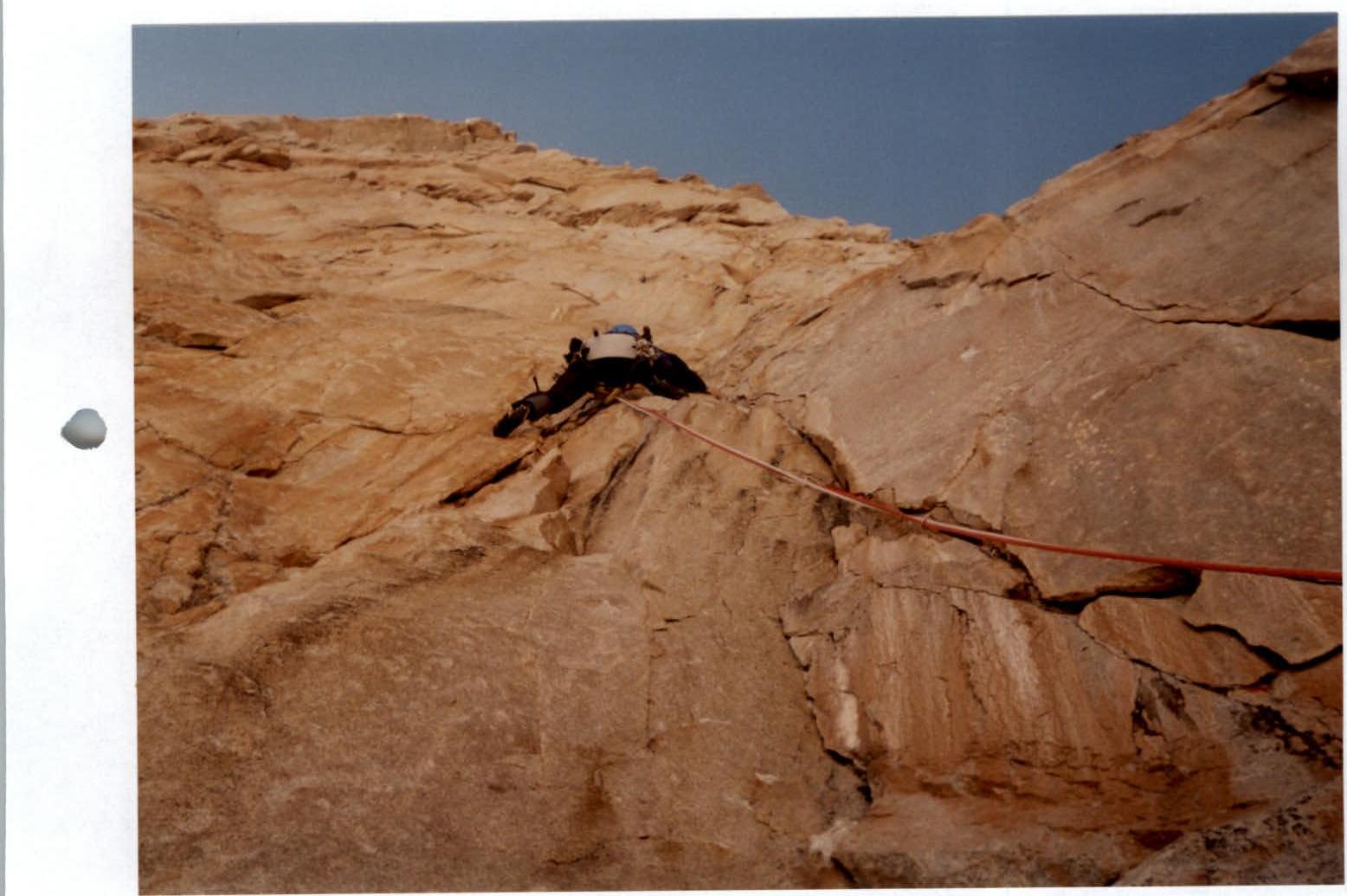
Photo №6
Photo №6. First climber working on section R7