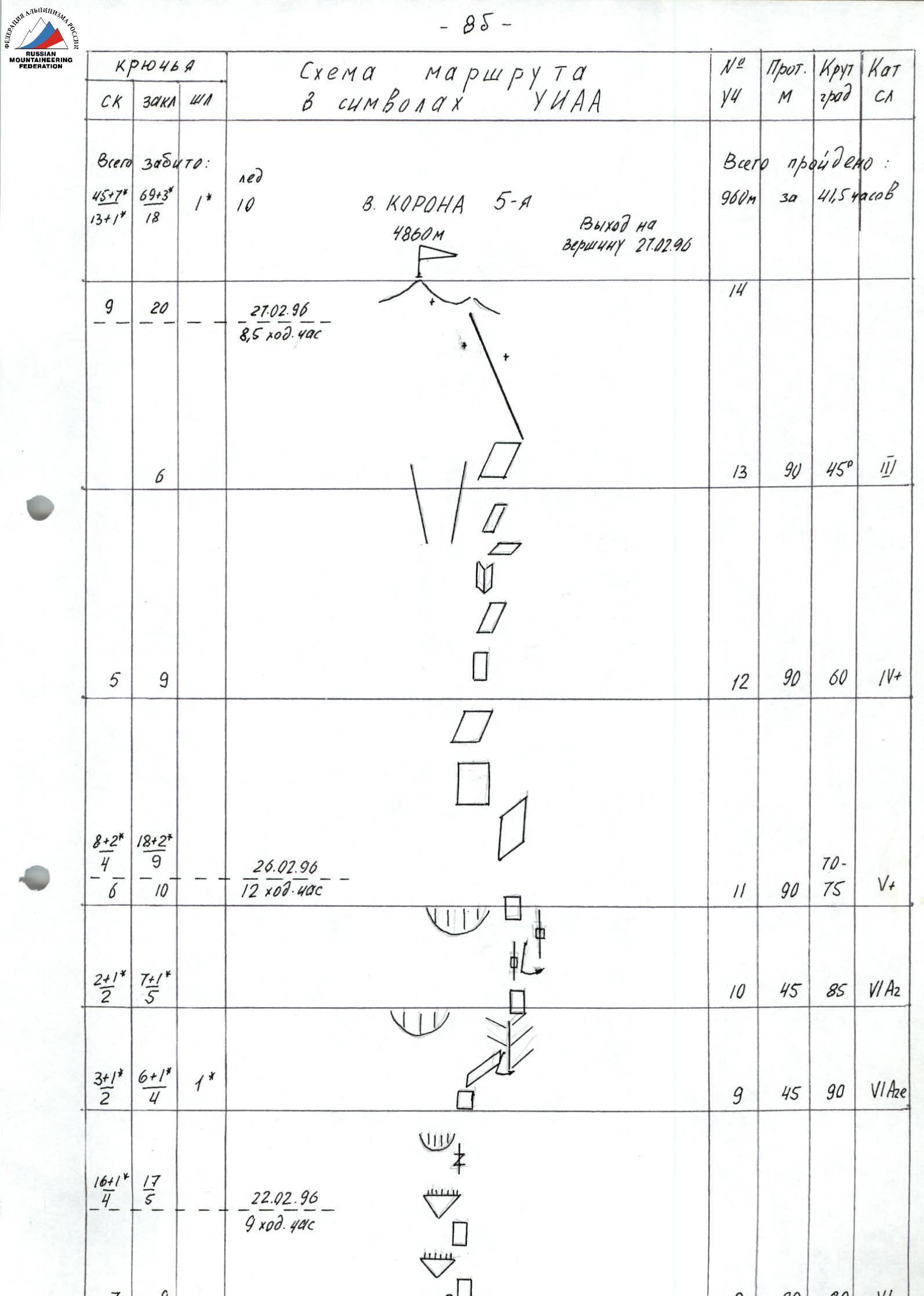
Ascent Passport
- Ascent class — winter
- Ascent area — Tian Shan, Kyrgyzsky Ridge
- Peak Korona 5-ya (4860 m) — via the center of the S wall
- Complexity category — 6A
- Height difference — 810 m
Length — 960 m. Length of sections with 5–6 difficulty category — 580 m, of which:
- 6 category — 360 m (4260–4600). Average steepness of the route — 66° (4050–4860). Wall steepness — 81° (4260–4600)
- Pitons driven:
| rock | chocks | bolt | ice |
|---|---|---|---|
| 45+7* | 69+3* | ||
| 1* | 10 | ||
| 13+1* | 18 |
- Team's man-hours: 41.5 hours and 2 days + 2 return days.
- Overnight stays: 2 — lying in a tent
- Leader — Bernatsky Sergey Igorevich — MS
Team members:
- Ilyushchenko Alexey Valentinovich — CMS
- Babkin Vyacheslav Viktorovich — CMS
- Klepikov Andrey Igorevich — CMS
- Team coach — Bernatsky Sergey Igorevich — MS
- Approach to the route — February 21, 1996
Summit — February 27, 1996. Return — February 27, 1996.
- Organization — Combined team of "Ritur" SC St. Petersburg and Sverdlovsk region
 www.apfederation.ru↗
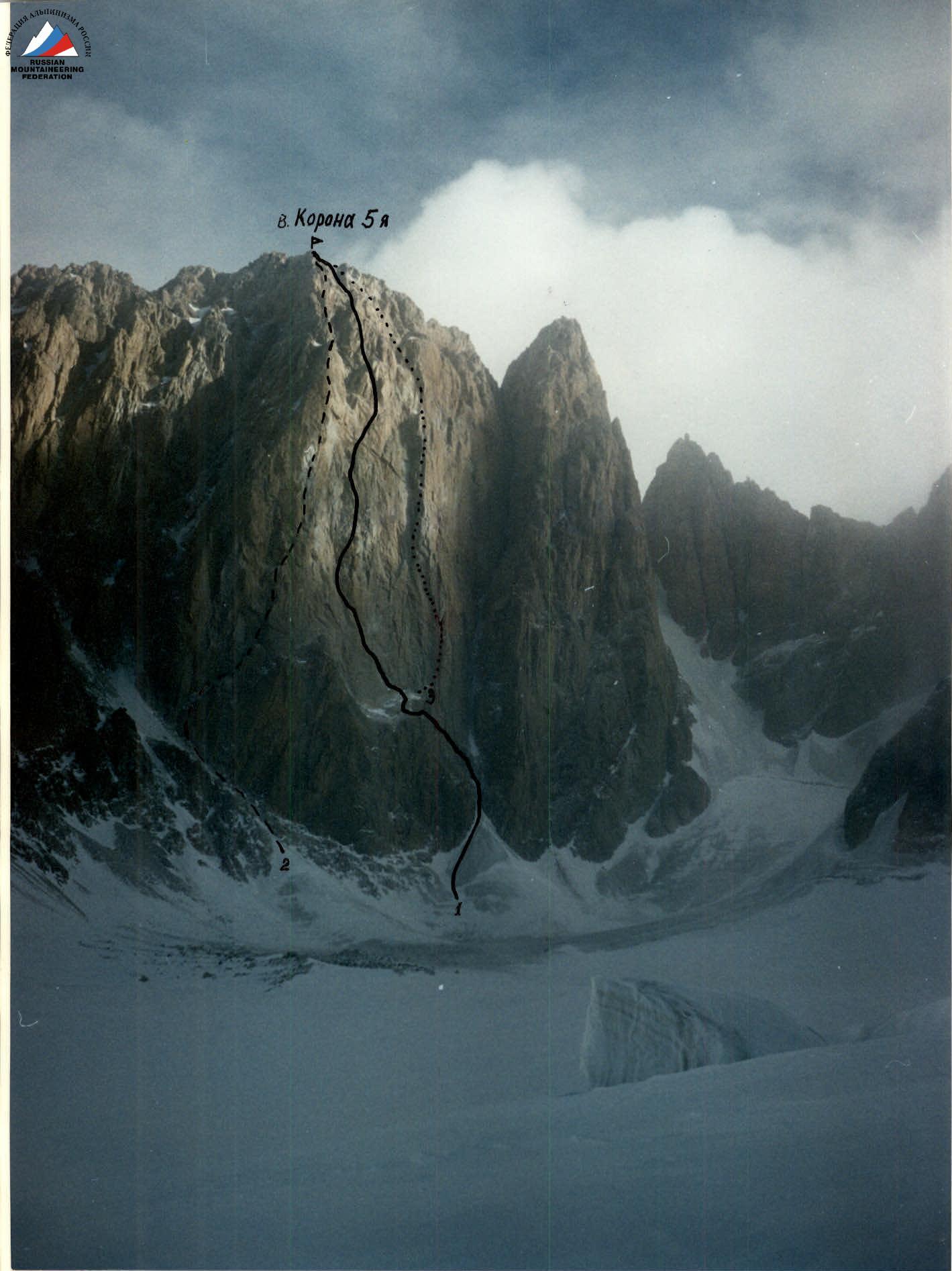
Photo date — February 28, 1996. Distance — 2 km. Photo height — 3800 m. Photo number — 1.
1 — Balezin's route via the Central S wall 6A category 1994. PHOTO — 1. 2 — Sadovsky's route via the SW wall 5B category 1968. 3 — Ruzhevsky's route via the W edge 5B category 1976.
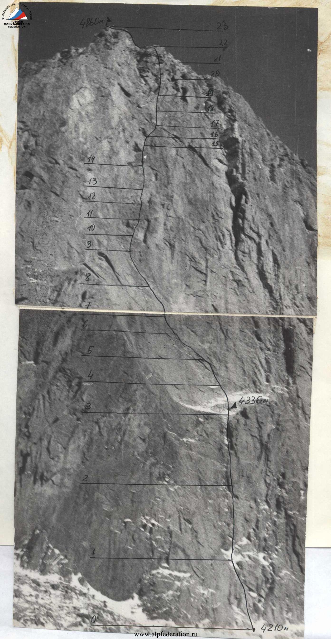
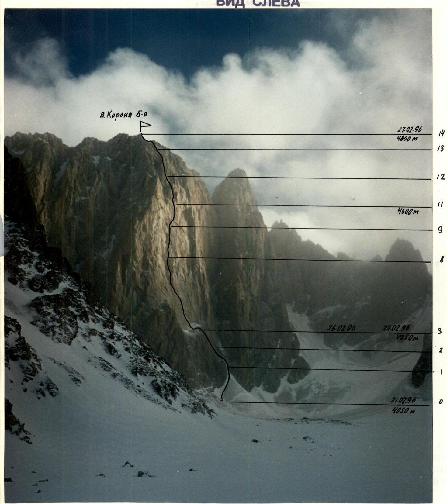
Route profile on peak Korona 5-ya (4860 m) via the center of the S wall. View from the right.
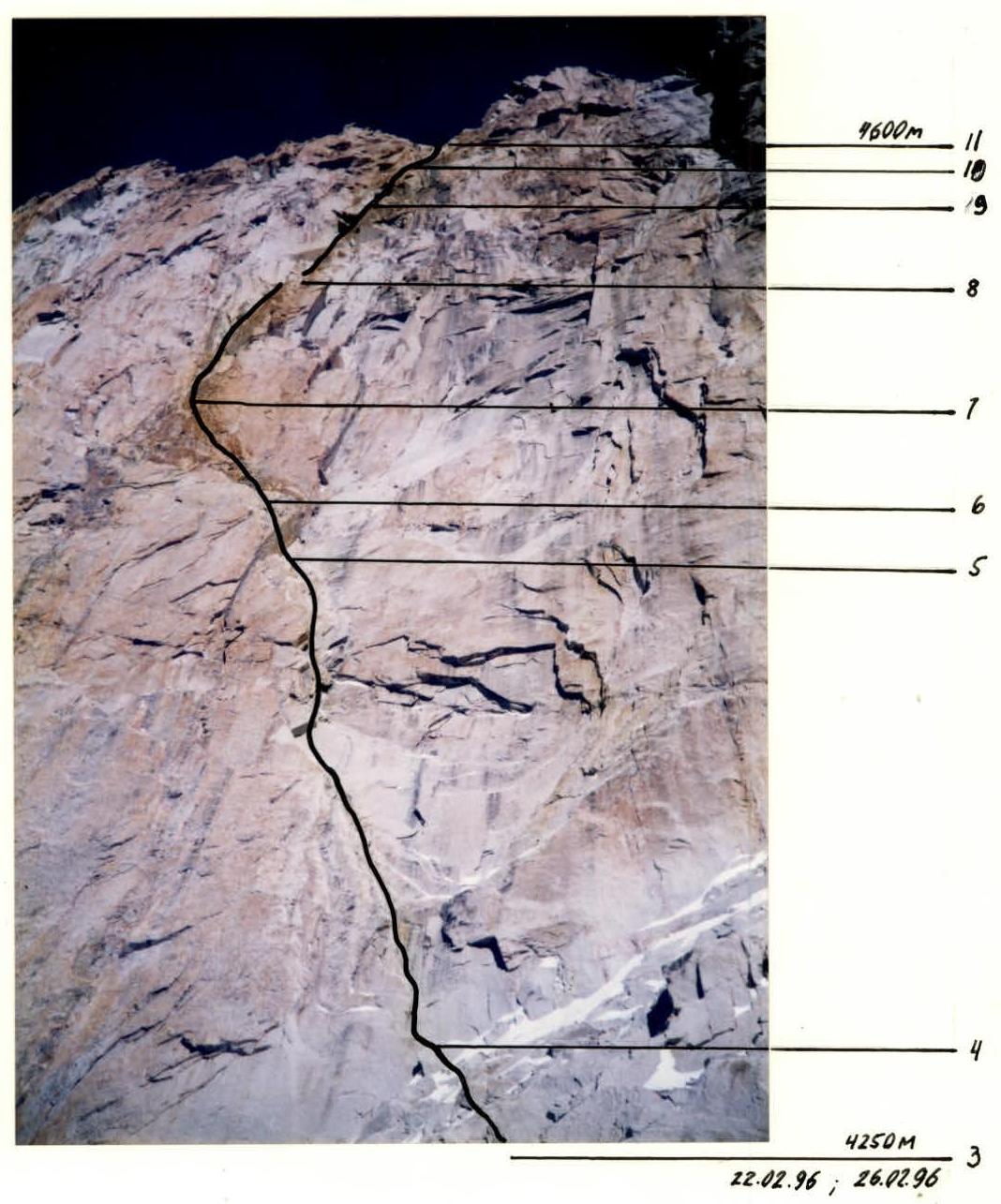
PHOTO — 2. Photo date — February 21, 1996. Photo number — 2
Distance — 50 m. Photo height — 4200 m.
Route profile on peak Korona 5-ya (4860 m) via the center of the S wall. View from the left.
- Photo — 3
- Photo date — February 28, 1996.
- Photo number — 3
Distance — 2.5 km. Photo height — 3700 m
Team's tactical actions
Observations of the route, photographic materials, and consultations with team members who made the 1st and 2nd ascents formed the basis of the tactical plan. Considering the unstable weather that winter, it was planned to complete the route with 1 overnight stay and 2 days of processing, which corresponded to the actual ascent. The route was completed in 4 man-days (41.5 hours). The descent took 6 hours. The team consisted of both experienced and young athletes: Bernatsky S.I. — captain, Ilyushchenko A.V. — deputy captain, Babkin V.V., Klepikov A.I. All team members have climbing ranks and experience in winter ascents. This composition allowed for regular rotation of the lead pair, ensuring an even workload and timely rest for all team members.
The ascent schedule was as follows:
February 21 — processing the route. At 7:00, the entire team was under the route. They brought ropes and equipment. The Babkin–Klepikov pair ascended the ice couloir and rocks. By 10:00, they were on a large ledge. By 15:00, they completed the first rope on the wall and by 17:00, they passed the overhang — another half rope. In the twilight, the pair reached the glacier.
February 22 — early departure from the hut. At 6:00, the Bernatsky–Ilyushchenko pair began moving on the fixed ropes. The main task was to reach the R9–R10 section. The second pair organized a bivouac on the large ledge, arriving later. At 8:00, they started work. Some wind, the wall was already sunlit, with slight cloud cover.
They bypassed the overhanging section of yellow color to the left and upwards along a discontinuous crack. Then, almost straight up steep rocks with good relief for protection. By 12:00, they completed 2.5 ropes, 5 meters to the right, with a control cairn tied to a piton. The wind strengthened, and the cloud cover became almost solid.
They continued working and by 14:00, they completed another rope. One more rope was left to reach the planned section, but bad weather forced them to start descending. By 15:00, everyone gathered on the large ledge by the tent.
February 23 — at night, the weather continued to deteriorate; by morning radio communication, they received a storm warning. They secured the tent and descended to the glacier from 8:00 to 9:00.
February 24 — bad weather continued.
February 25 — an attempt was made to exit, but hurricane-force wind with snow literally "blew" them off the route.
February 26 — early departure. The wind had subsided somewhat, but it was still cloudy. By 6:00 — at the start of the fixed ropes.
Main task of the day — to pass the main part of the wall (up to section R10–R11).
Decision on overnight stay:
- If we reach the traverse (section R9–R10) by 13:00 — we bivouac on the "roof".
- Otherwise — descend to the large ledge.
After 8:00, they began work; it was very cold. They bypassed a series of overhangs to the right. By 11:30 — at the start of the traverse. They approached a bolt piton with a "friend" in a crack. Then, several challenging meters on balance. At the end of the section — a small pendulum around the corner. They completed the rope by 14:00.
The weather improved, allowing them to work throughout the daylight. They ascended on aid climbing along a crack, swung right to another crack, and continued upwards. By 17:00, one of the key sections of the wall (R10–R11) was completed.
They descended in the darkness to the large ledge. The starry sky gave hope for good weather the next day.
February 27 — at 3:00, they began preparing to exit and at 5:00, they started on the route. Clear sky, but very cold. On the fixed ropes, they warmed up quickly, and by 7:00, the leading pair Babkin–Klepikov was at the end of the ropes. Then, they ascended to a large fracture along steep rocks with good climbing relief. By 11:00, they completed two ropes. The steepness decreased; along stepped rocks and ridges along the fracture, they reached the pre-summit ridge by 13:00 (after two ropes). Here, they felt strong gusts of wind. To the summit, they ascended another two ropes along a relatively easy ridge. They reached the summit at 13:20. Around 14:00, they began descending via the 3rd tower. The descent to the hut took 6 hours.
Safety measures during the ascent included:
- high physical, technical, and psychological preparedness;
- a tactical plan considering the specifics of the ascent area in winter;
- modern equipment.
| Pitons: rock | Pitons: chock | Pitons: ice | UIAA route diagram | Section # | Length, m | Steepness, ° / Difficulty category | |
|---|---|---|---|---|---|---|---|
| 8/2 | 7/3 | 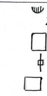 | 7 | 80 | 75° / VI– A1 | ||
| 4+1* | 6/2 | 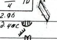 | 6 | 6 | 30 | 80° / VI A1 | |
| 3+1* | 2+1* | 5 | 5 | 15 | 95° / VI A3 | ||
| 6/3 | 1/3 | 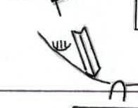 | 4 | 4 | 50 | 85° / VI A2 | |
| 2 | 3 | 3 | 20 | 30° / III | |||
| 2* | 3 | 2 | 2 | 50 | 60° / V– | ||
| 1* | 1 | 2 | 1 | 1 | 40 | 50° / IV+ | |
| 1 | 1* | 8 | 0 | 180 | 45° / IV |
Route description by sections:
SECTION R0–R1. A couloir narrowing upwards. Firm snow at the bottom, ice above. 180 m, 45°, IV.
SECTION R1–R2. "Ram's foreheads," ice-covered and broken rocks. 40 m, 50°, IV+.
SECTION R2–R3. Alternating walls and ledges covered with snow. 50 m, 60°, V–.
SECTION R3–R4. A large inclined ledge, talus slope. Convenient area for overnight stay. 20 m, 30°, III.
SECTION R4–R5. Inner corner and a small crack, passable with aid climbing. Small stoppers and pitons were used. 50 m, 85°, VI A2.
SECTION R5–R6. Exit from the inner corner through the overhanging left side using aid climbing. 15 m, 95°, VI A2.
SECTION R6–R7. Movement left and upwards along a blind crack, past a "flake" and vertically up the wall. 30 m, 80°, VI A1.
SECTION R7–R8. Up and right along steep rocks, good relief for climbing and chocks. In the middle part, to the right, a control cairn is tied to a piton. 80 m, 75°, VI– A1.
SECTION R8–R9. Up to a triangular overhang through a "flake," passing a series of overhangs to the right along rocks with convenient climbing relief. A sitting bivouac is possible on a ledge to the right. 90 m, 80°, VI.
SECTION R9–R10. Movement to the right through dark streaks along a crack-ledge, a small pendulum up and to the right around an outer corner, aid climbing. 45 m, 90°, VI A2e.
SECTION R10–R11. Up along a crack using aid climbing, transition to the right to another crack with a pendulum. Continuation of movement upwards. 45 m, 85°, VI A2.
SECTION R11–R12. Steep rocks with small ledges and inner corners. Convenient relief for protection. 90 m, 70°, V+.
SECTION R12–R13. Stepped rocks with good relief. Movement through a series of walls, along an inner corner. 90 m, 60°, IV+.
SECTION R13–R14. Broken, snow-covered rocky ridge leading to the summit. 90 m, 40–50°, III.
Descent from the summit via the 3rd tower of peak Korona
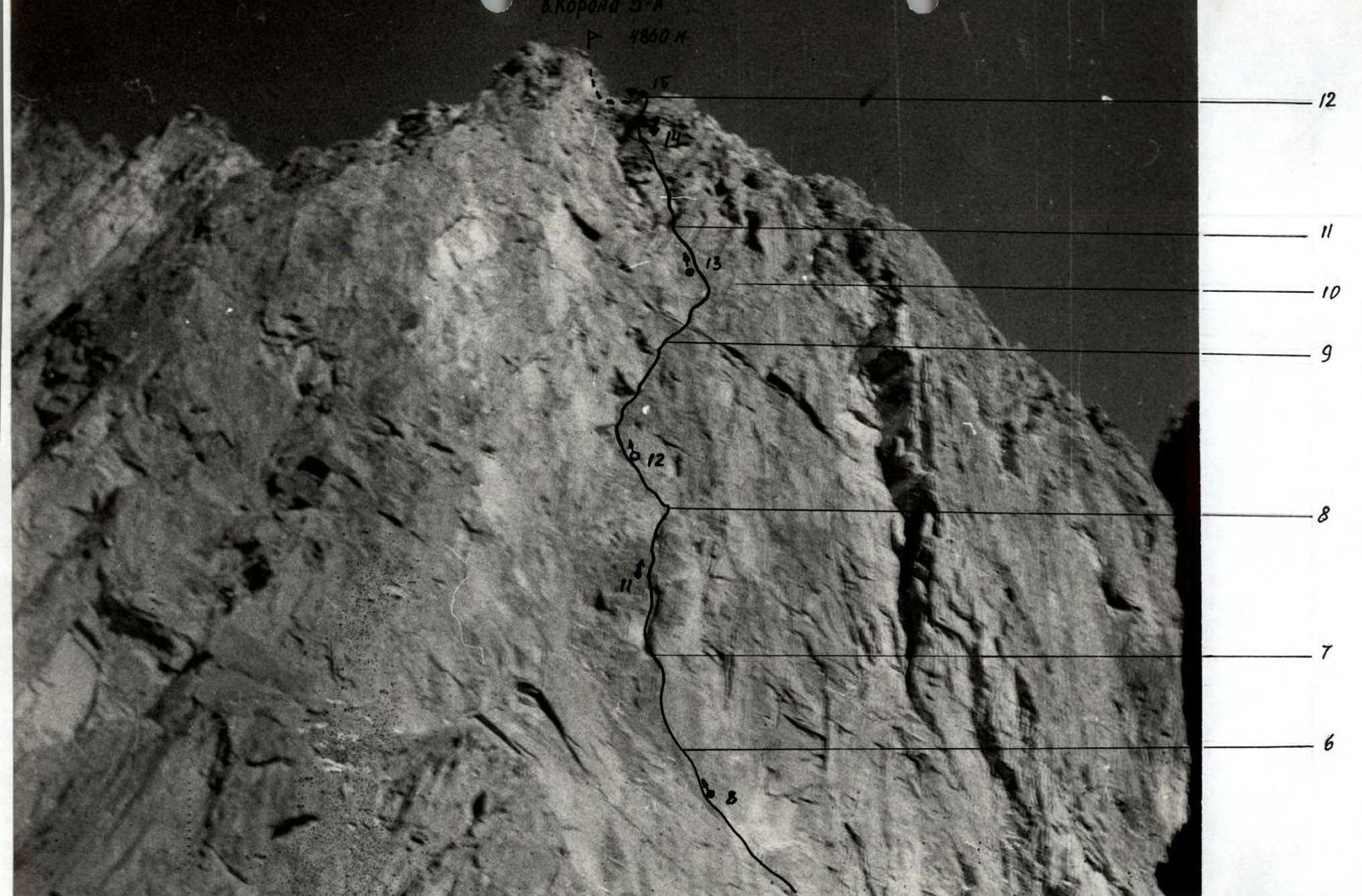
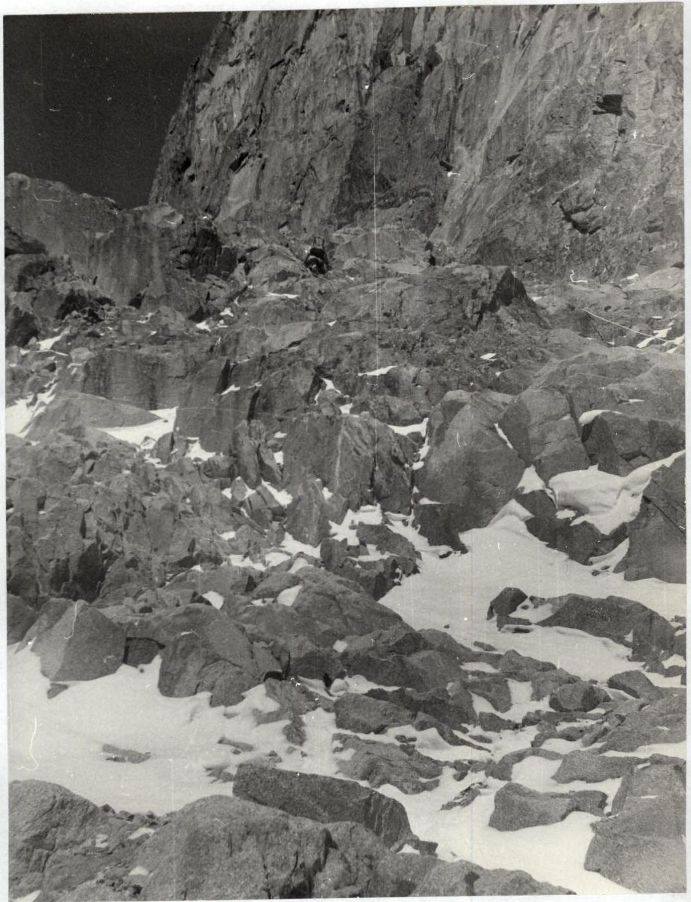
PHOTO — 6. Before reaching the large ledge. Section R2–R3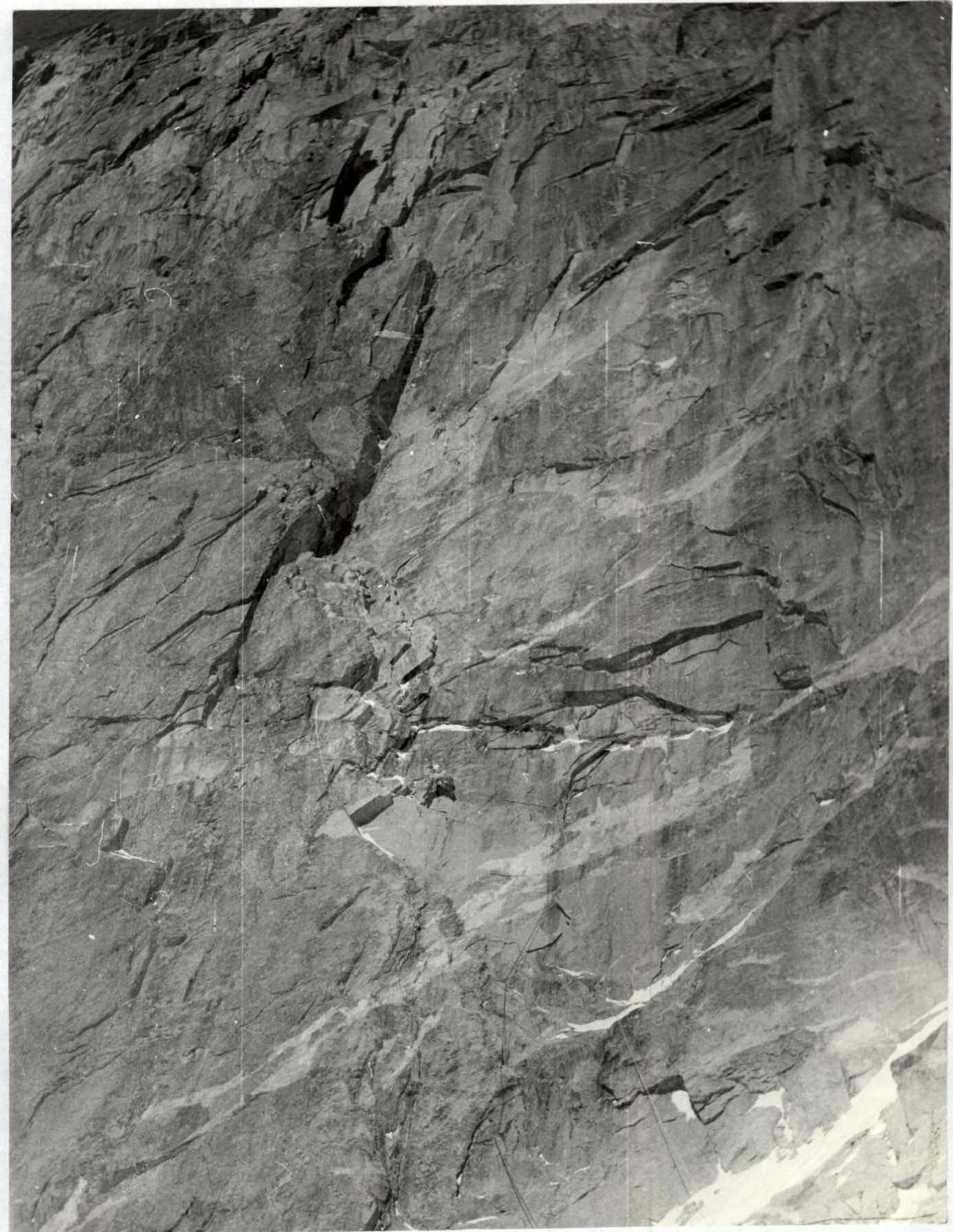
PHOTO 7. Start of work on the wall. Section R4–R5
PHOTO 8. Klepikov under the overhang. Section R5–R6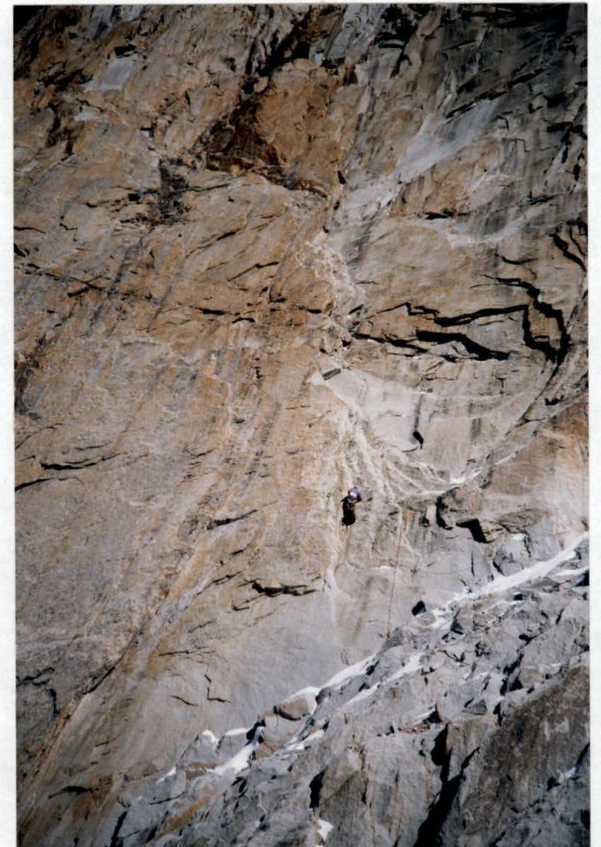
PHOTO 9. Ascending on fixed ropes on section R4–R5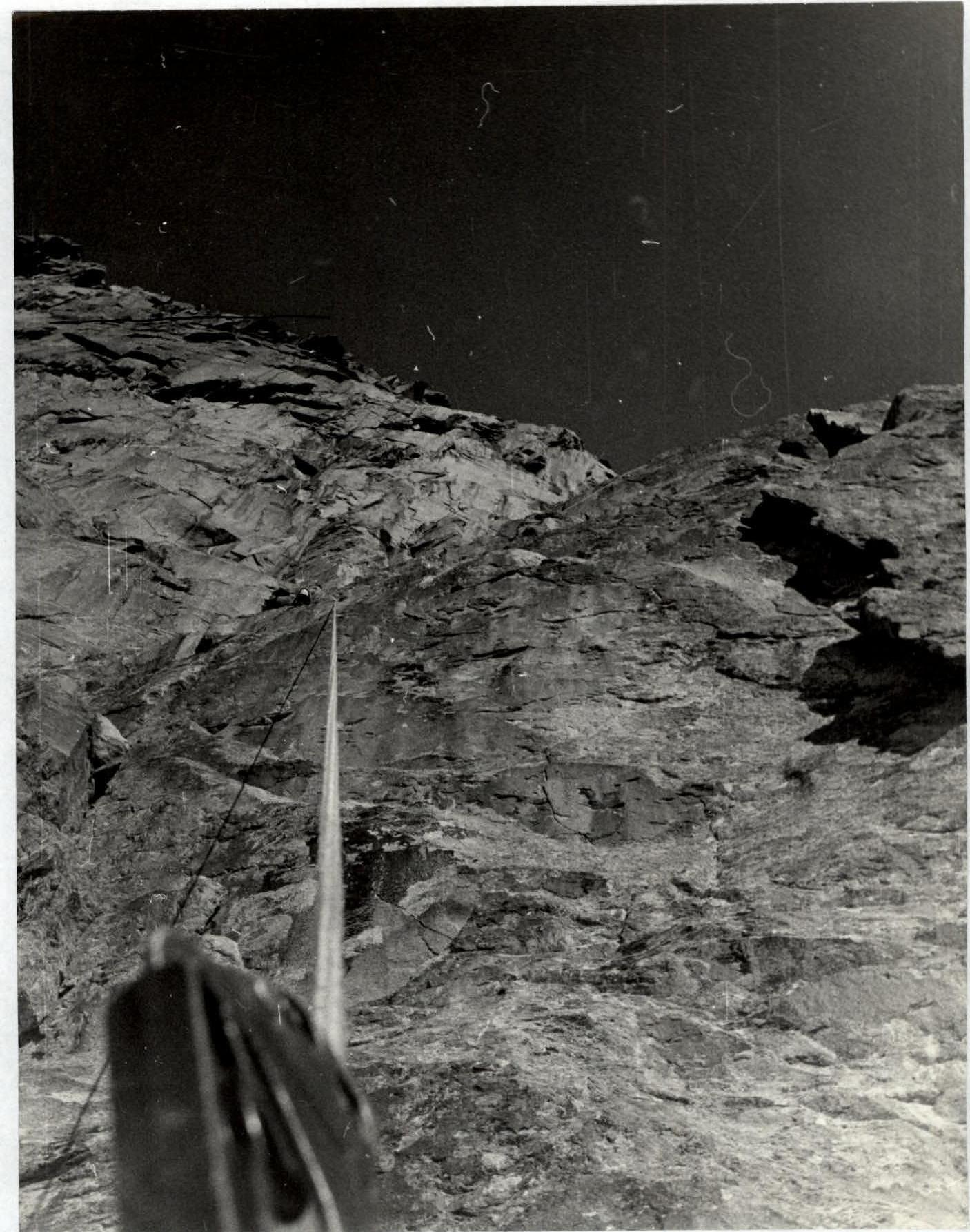
PHOTO 10. Section R6–R7. Bypassing the rusty overhang with a flake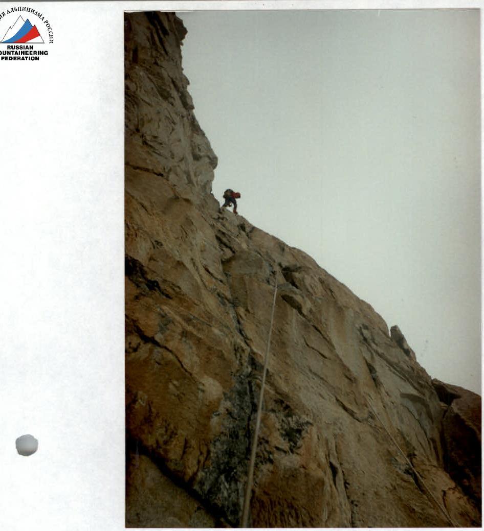
PHOTO 11. Section R7–R8. Approaching the control cairn
PHOTO 12. Section R8–R9. Under the triangular overhangs
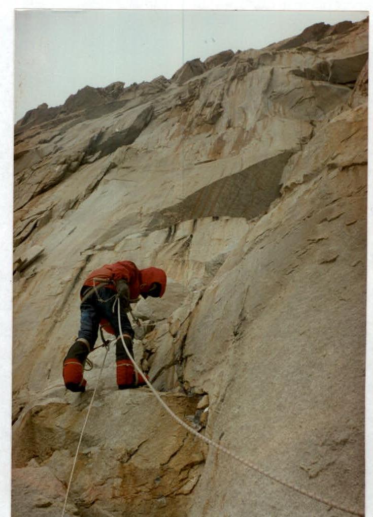
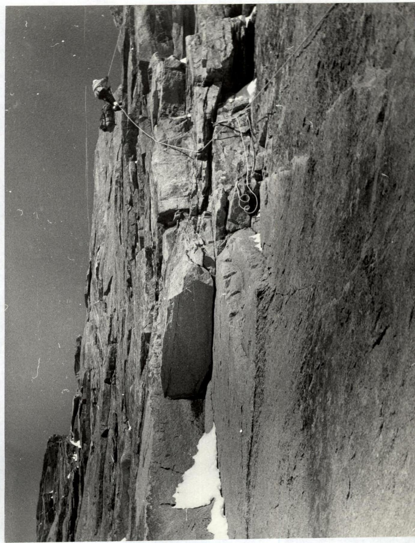
PHOTO 13. Section R10–R11. Ascending on fixed ropes.


