
Report on the first ascent of the route to the peak Izyiskatel via the southern ridge.
Ascent Passport
- Tian-Shan, Kyrgyz ridge, Ala-Archa gorge.
Peak Izyiskatel 4400 m. Proposed category 4B, first ascent. The nature of the route is rocky. The height difference of the route is 500 m. The length of the route is 1050 m.
- Length of sections: II — 500 m, III — 350 m, IV — 150 m, V — 50 m,
- Average slope: main (wall) part of the route — 60°
Total route — 30°
- Hooks left on the route: total — 0;
- Used in total on the route: rock pitons — 7, chocks — 20.
- Used in total artificial climbing holds (ACH) — 0 pcs.
- Team's climbing hours: 14 hours, 1 day (without overnight stays)
- Team:
Sergey Seliverstov (leader), Viktor Filinov.
- Senior coach: Fyodor Popov
- Exit to the route: 6:00, May 18, 2014.
Ascent to the summit: 17:00, May 18, 2014. Return to Base Camp: 20:00, May 18, 2014.
General view
of the summit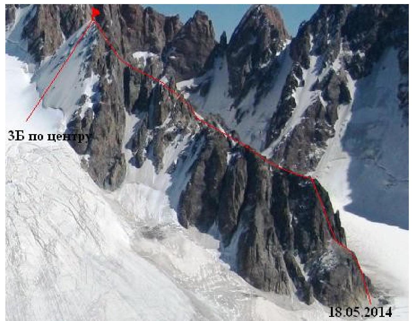
Scheme
of the route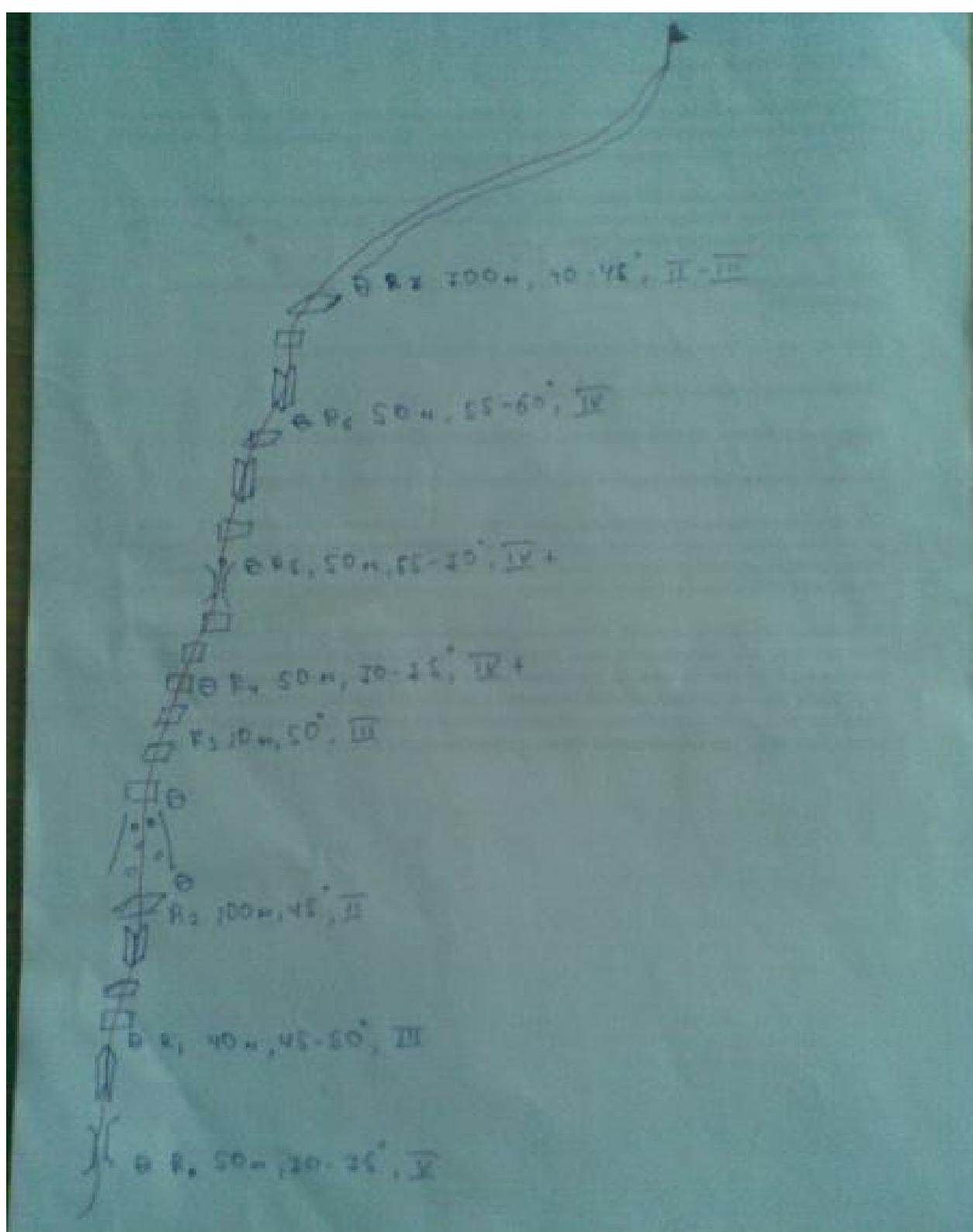
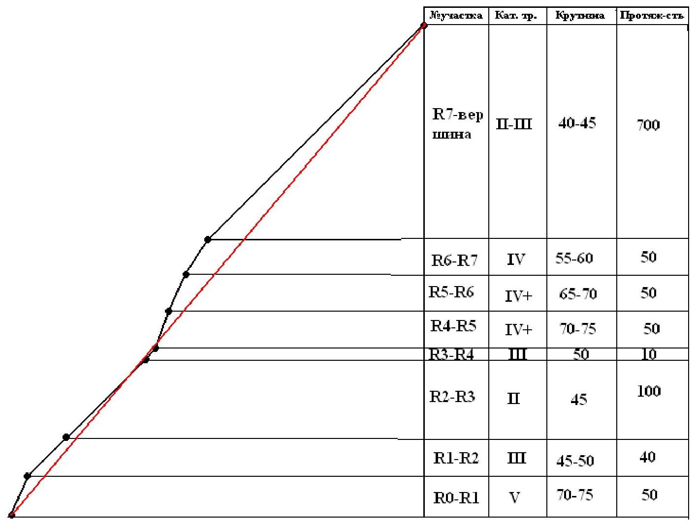
Profile of the route
Description of the route
Exit from "Ratsek" campsite 6:00. Approached the route 8:00. Passed the wall section 13:00. Ascent to the summit 17:00. Descent to "Ratsek" campsite 20:00. Approach along Ak-Sai glacier past "Korona" hut. Approached the rocks in 2 hours.
R0–R1. Movement along a wide steep chimney. From it, we exit to the right wall, which ends with a small counterfort. 50 m, 70–75°, V.
R1–R2. Through the wall, we exit to a ledge, which rests against an internal corner. From the corner, exit to a scree ledge. 40 m, 45–50°, III.
R2–R3. Through a small wall up along scree ledges, then to the right towards the rock wall. 100 m, 45°, II.
R3–R4. Along an oblique ledge to the left. We make a belay station. 10 m, 50°, III.
R4–R5. On the wall to the left in a huge chimney. Before exiting into the chimney, a steep wall. Further along the chimney to a cork. There are loose rocks. 50 m, 70–75°, IV+.
R5–R6. Through the cork, quite complex climbing. Further movement along the internal corner to the exit to a ledge. 50 m, 65–70°, IV+.
R6–R7. Along the internal corner to the exit to the ridge. The most dangerous rope in terms of loose rocks and blocks! 50 m, 55–60°, IV.
R7–summit. Long, broken ridge. Walls with difficult climbing in some places.
- The first huge gendarme is bypassed on the left
- The second on the right
700 m, 40–45°, II–III.
Descent from the summit either via 2A or central 3B. We descended via the central route.
- On the glacier, we move tied — many crevasses
- Descend to "Korona" hut
- Remove crampons, harnesses
- Further descent to Ratsek
Section
R0–R1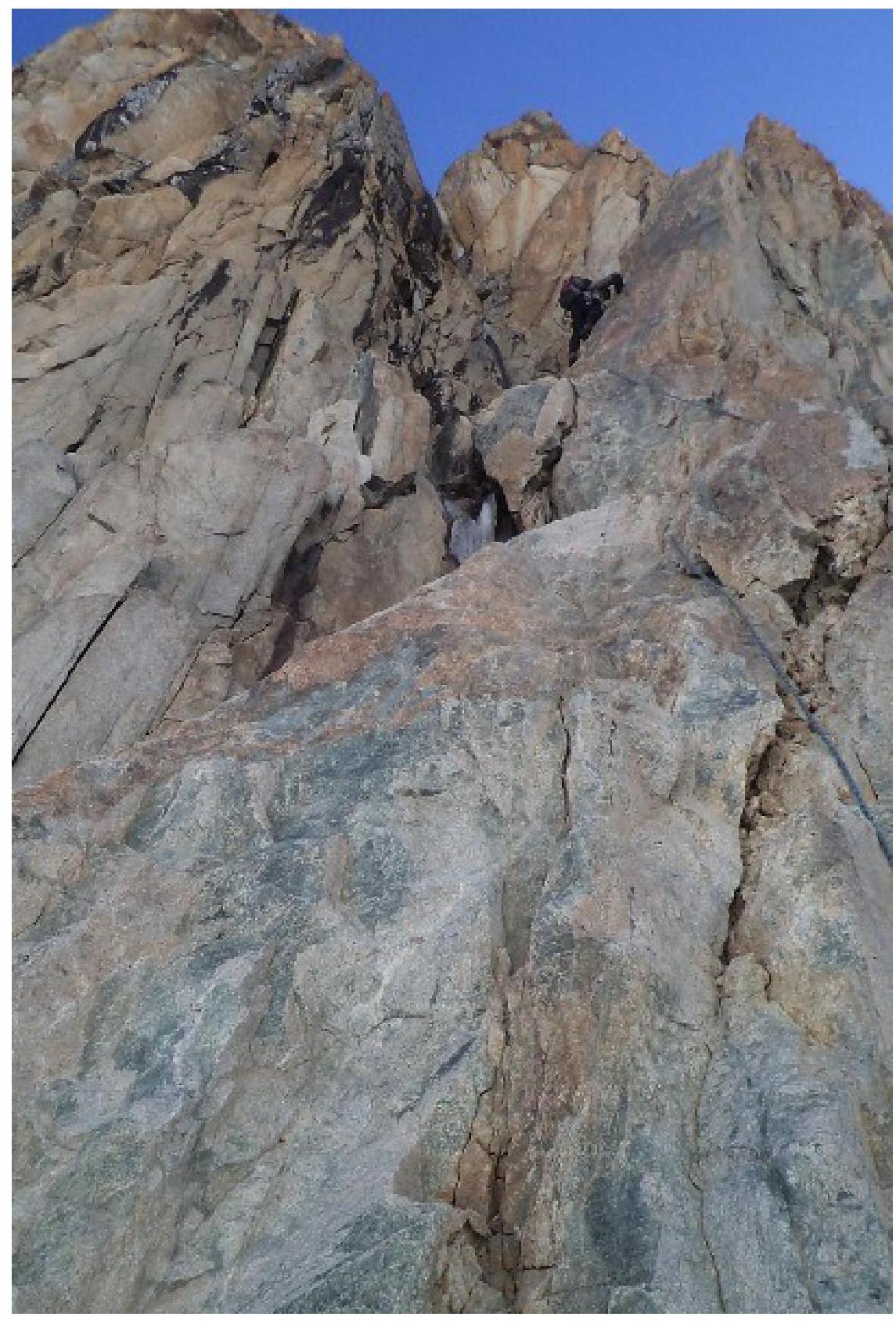
Section
R2–R3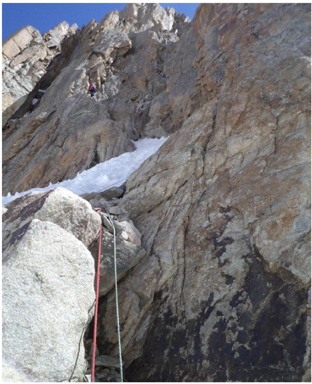
Section
R5–R6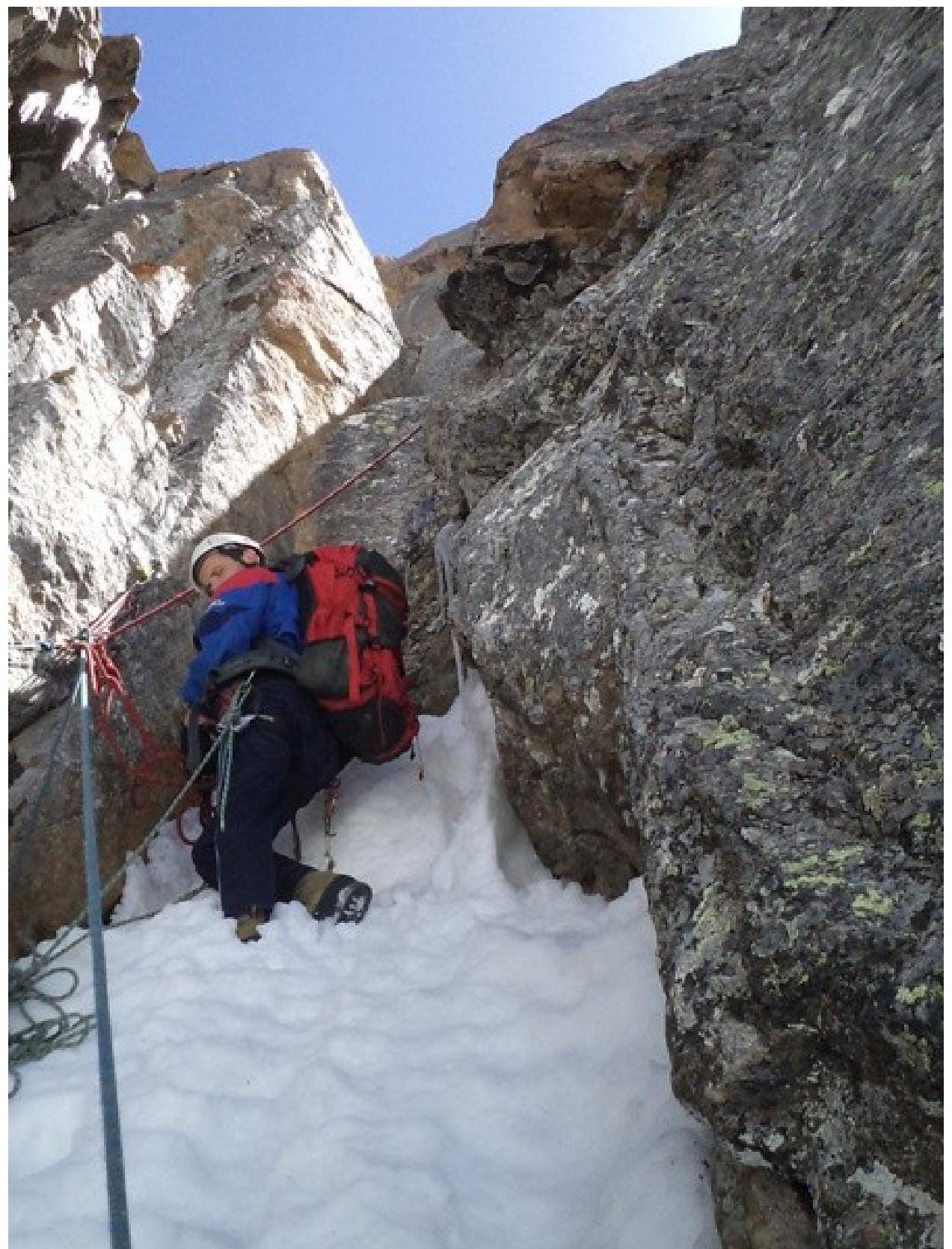
Digitized by Google Start
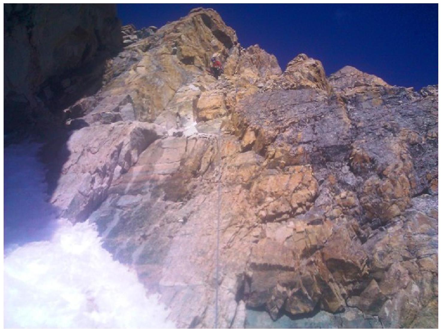
of the ridge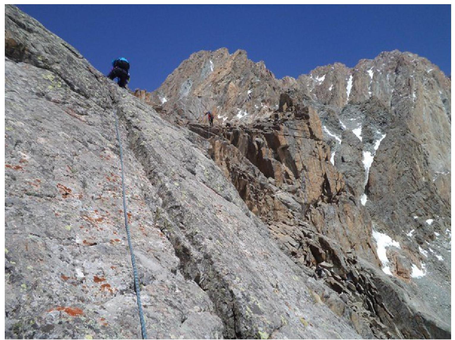
Ridge
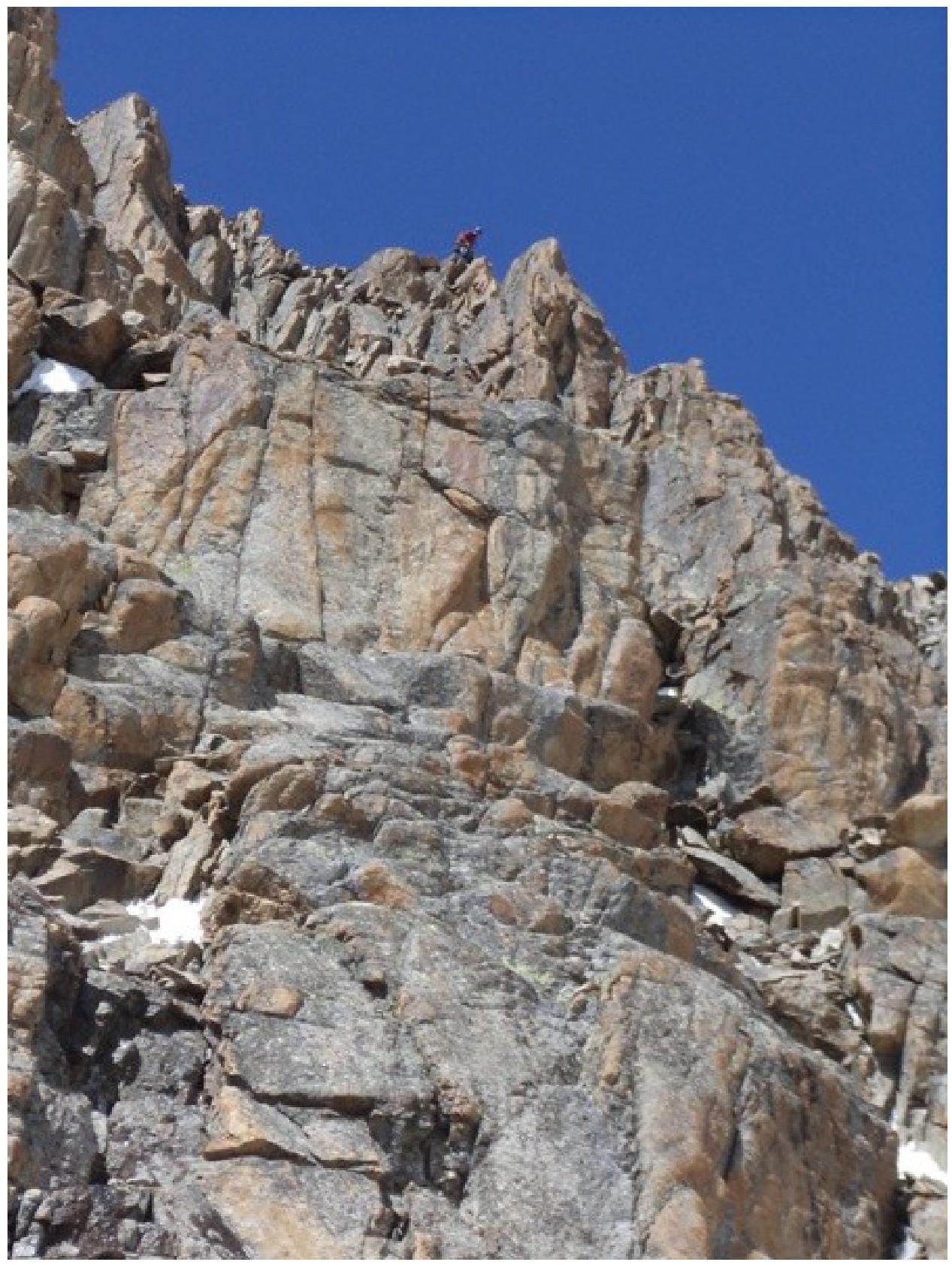
Before exiting to the summit
Comments
Sign in to leave a comment