Report
On ascending peak Bokh via the route on the left part of the S wall (Mikhailova M.M.) 5B category of complexity by the team of a/c Black Ice for the period from January 4 to January 6, 2020
I. Climbing Report
| 1. General Information | ||
|---|---|---|
| 1.1 | Full name, sports rank of the leader | Stepanov Nikolay Anatolyevich, CMS. |
| 1.2 | Full name, sports rank of the participants | Lebedev Nikolay Mikhailovich, CMS. |
| 1.3 | Full name of the coach | - |
| 1.4 | Organization | a/c Black Ice |
| 2. Characteristics of the Climbing Object | ||
| 2.1 | Region | Tian-Shan, Kyrgyzsky ridge |
| 2.2 | Valley | Ak-Sai |
| 2.3 | Section number according to the classification table | 7.19 At-Bashi ridge |
| 2.4 | Name and height of the summit | p. Bokh, 4293 m |
| 3. Characteristics of the Route | ||
| 3.1 | Name of the route | On the left part of the S wall (Mikhailova) |
| 3.2 | Category of complexity | 5B |
| 3.3 | Degree of route exploration | excellent |
| 3.4 | Nature of the route terrain | Rocky |
| 3.5 | Elevation gain of the route (data from altimeter or GPS) | 700 (by GPS) |
| 3.6 | Length of the route (in m) | 1300 m |
| 3.7 | Technical elements of the route | IV cat. Ice — 55 m. V cat. rocky — 340 m. VI cat. rocky — 280 m. |
| 3.8 | Average steepness of the route, (°) | 68° |
| 3.9 | Average steepness of the main part of the route, (°) | 76° |
| 3.10 | Descent from the summit | Via route 1B |
| 3.11 | Additional characteristics of the route | |
| 4. Characteristics of the Team's Actions | ||
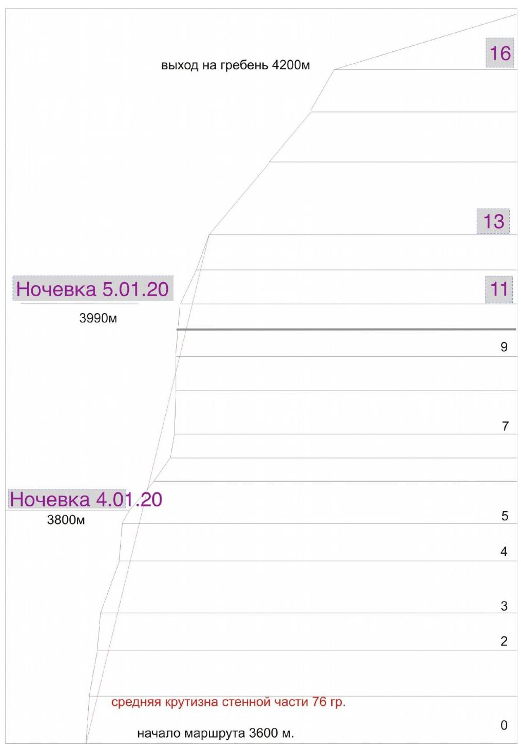
| 4.1 | Time of movement | 29 h, 3 days (including movement on fixed ropes) |
| 4.2 | Overnights | 1) Shelf at the end of R5 2) Shelf at the end of R11 |
| 4.3 | Time for route preparation | Not prepared |
| 4.4 | Start of the route | 8:10, January 4, 2020 |
| 4.5 | Reaching the summit | 16:30, January 6, 2020 |
| 4.6 | Return to the base camp New Ala-Archa | 18:10, January 6, 2020 |
| 6. Responsible for the Report | ||
| 6.1 | Full name, e-mail | Stepanov N.A., kinonikolay@gmail.com |
II. Description of the Ascent
1. Characteristics of the Climbing Object
1.1–1.2. General photographs of the summit (taken from the report of the Krasnoyarsk team, 2015)

1.3. Hand-drawn profile of the route
1.4–1.5. The Ak-Sai region is very popular, with many descriptions available online for approaches to the Ratsek camps. Approach to the route: from the Ratsek camps, cross the glacier towards p. Bokh, ascend along the rocks to the route. The landmark is a black streak under a giant cornice.
2. Characteristics of the Route
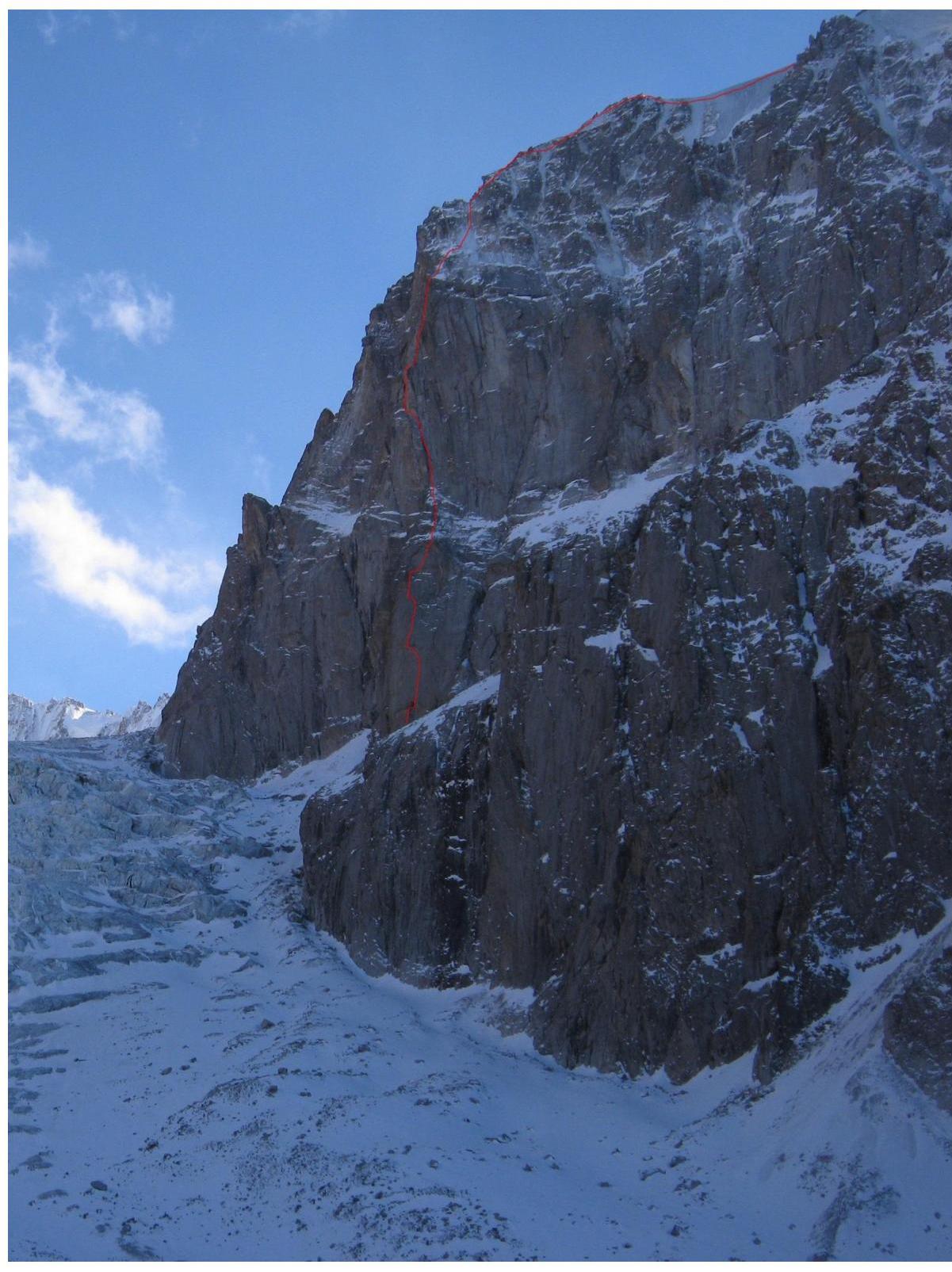
2.1. Technical photograph of the route
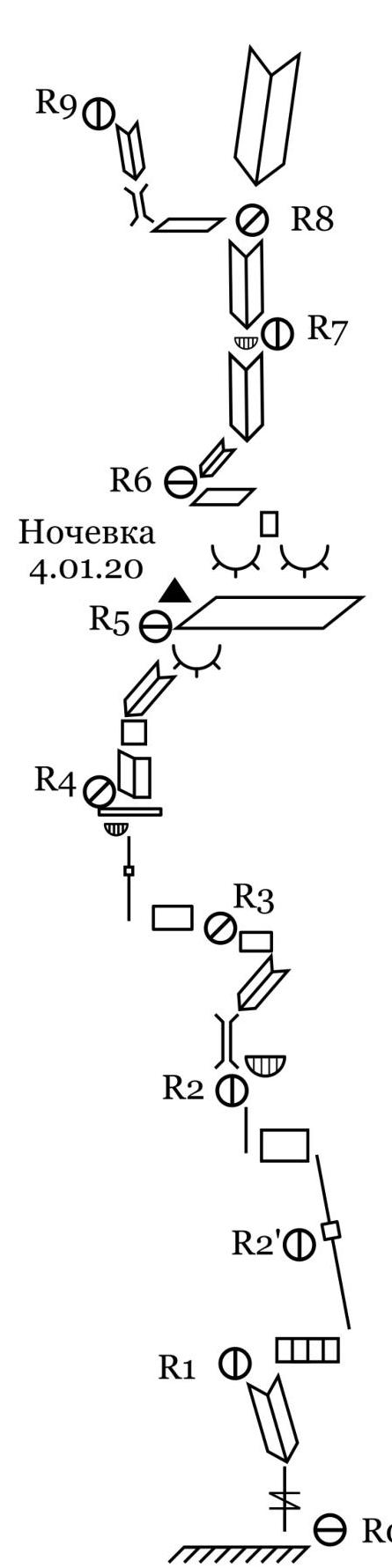
2.3. Route scheme in UIAA symbols
| Section | Friends | Nuts | Bolts | Ice screws | Length, m | UIAA | Steepness |
|---|---|---|---|---|---|---|---|
| R20 | 1 | 20 | II | 40° | |||
| R19 | 60 | III | 50° | ||||
| R18 | 1 | 2 | 2 | 30 | IV–V | 55° | |
| R17 | 2 | 2 | 2 | 4 | 55 | IV | 50° |
| R16 | 2 | 1 | 0 | 30 | III | 50° | |
| R15 | 1 | 1 | 0 | 30 | III | 50° | |
| R14 | 2 | 30 | III | 50° | |||
| R13 | 5 | 2 | 2 | 30 | IV | 60° | |
| R12 | 5 | 4 | 1 | 1 | 40 | V+ | 70° |
| R11 | 8 | 6 | 6 | 5 | 15 | V | 70° |
| 10 | VI/A2–3 | 95° | |||||
| R10 | 6 | 8 | 6 | 8 | 25 | VI/A2 | 90° |
| R9 | 4 | 3 | 0 | 30 | IV | 60° | |
| R8 | 6 | 13 | 6 | 11 | 30 | VI/A2 | 85° |
| R7 | 5 | 9 | 3 | 7 | 20 | VI/A2 | 75° |
| 20 | V | 50° | |||||
| R6 | 2 | 2 | 1 | 45 | III–IV | 50° | |
| R5 | 8 | 2 | 9 | 6 | 45 | V–VI/A2 | 70° |
| R4 | 7 | 11 | 7 | 11 | 25 | VI/A2 | 85° |
| 8 | VI/A2 | 80° | |||||
| R3 | 11 | 1 | 2 | 8 | 35 | V–VI/A2 | 65° |
| 5 | VI+/A2–3 | 95° | |||||
| R2 | 12 | 1 | 4 | 12 | 50 | VI/A2 | 80° |
| R2' | 10 | 2 | 10 | 2 | 15 | VI/A2 | 80° |
| 6 | VI+/A2–3 | 95° | |||||
| R1 | 7 | 3 | 7 | 7 | 35 | VI/A2 | 90° |
| R0 | 15 | V/A1 | 80° |

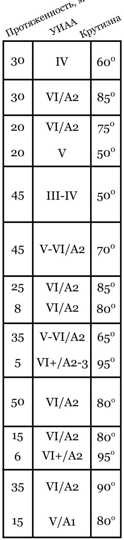
The denominator (lower number) indicates points for artificial climbing (AITO).
3. Characteristics of the Team's Actions
3.1. Mikhailov's route on Bokh is considered interesting and technically challenging, yet comfortable for winter ascents due to numerous ledges for overnight stays and no need for a platform. The route is also relatively monolithic and safe. For a winter ascent, one needs to possess ice climbing techniques, the ability to move on snowy rocks, and ice climbing skills, especially in the upper part of the "roof."
The leader climbed with a light backpack of 5–7 kg on two dynamic ropes, both primary (10 mm). The second climber followed on fixed ropes with a haul bag containing the main bivouac gear. Movement was simultaneous: the leader worked on two ropes, alternating between the safety and fixed ropes, while the second climber moved on the fixed ropes and simultaneously belayed the leader. Team members met only at the end of the working day.
Safety Margin:
We took the following in our haul bag: a first-aid kit, food for two people for 4 days (with one day's reserve), 2 gas canisters weighing 450 g each. Some extra warm clothing.
| Leader on sections: | |
|---|---|
| R0–R13 | Stepanov |
| R13–R16 | Lebedev |
| R16–R20 | Stepanov |
| R20–summit | Simultaneously |
Timeline:
January 4, 2020
Departure from camp to Ratsek camps at 6:00. Start of work on the route at 8:10. Reached the ledge for overnight stay (R5) at adjusted altitude of 15:10. Continued processing for another two sections until 18:05 (up to R7).
January 5, 2020
Ascent at 5:30, started moving on fixed ropes at 7:40. Began work on the route at 9:00. Reached the ledge for the second overnight stay (R11) at 14:00, continued processing up to the "roof" until 17:40 (R13).
January 6, 2020
Ascent at 5:00, started moving on fixed ropes at 7:20. Began movement on the "roof" at ~8:40. Reached the summit of p. Bokh at 16:30. Descent to the New Ala-Archa camp on Ratsek camps at 18:10.
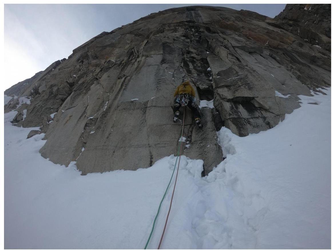
Photo 1. Start of the route R0–R1.
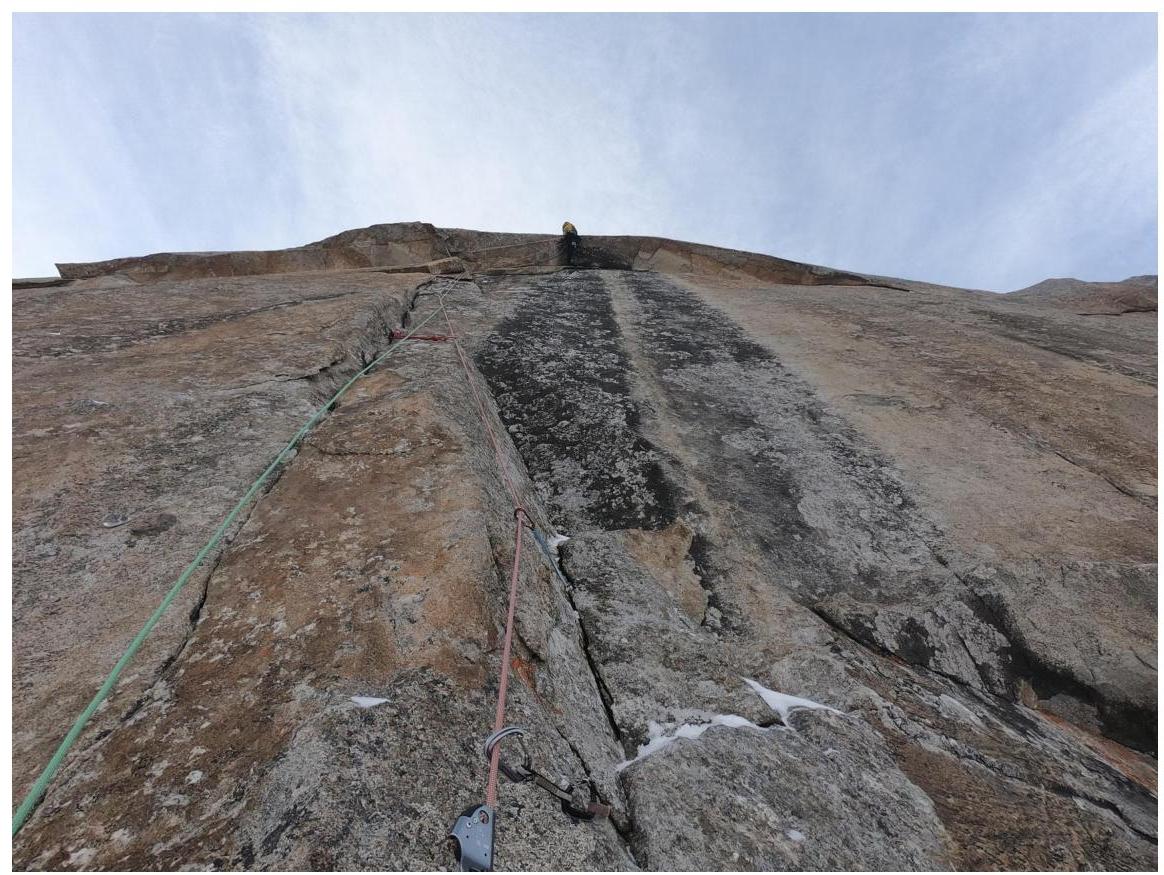
Photo 2. R1–R2' (Big cornice).
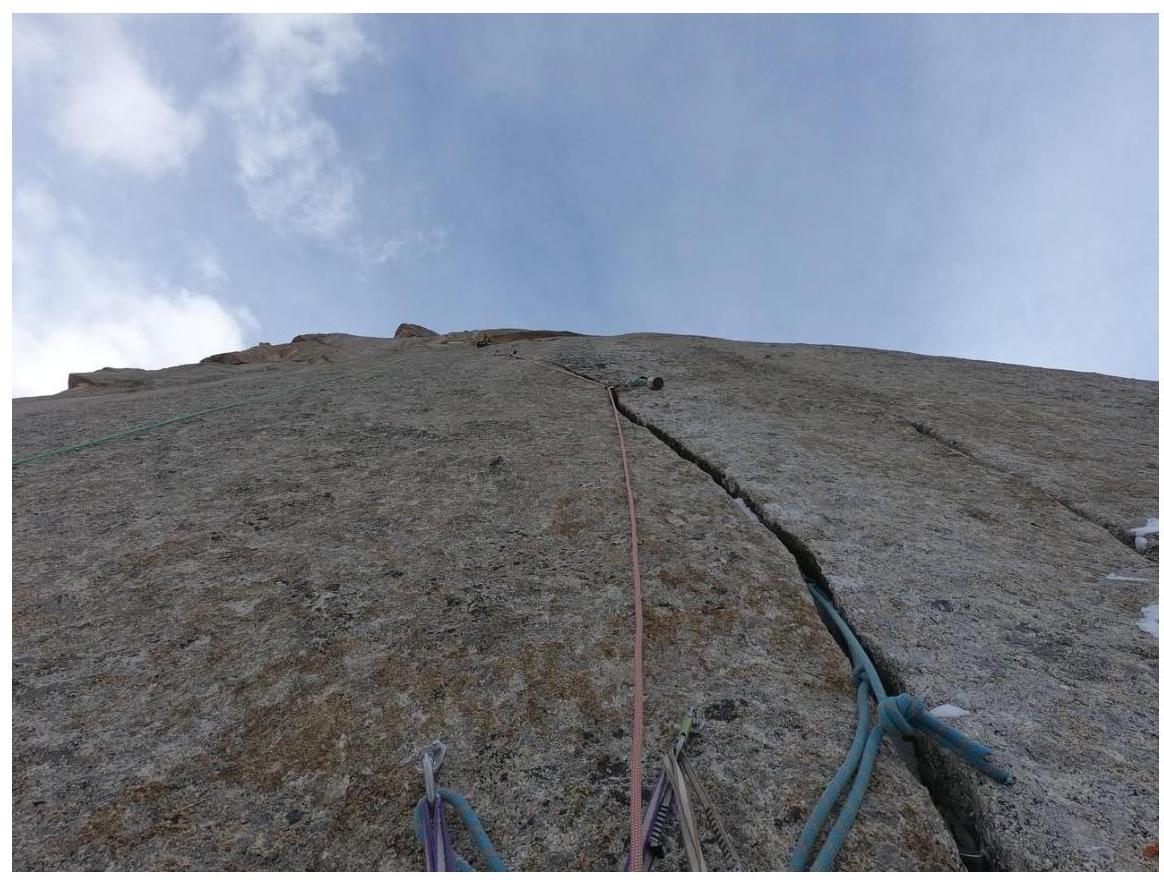
Photo 3. Section R2'–R2.
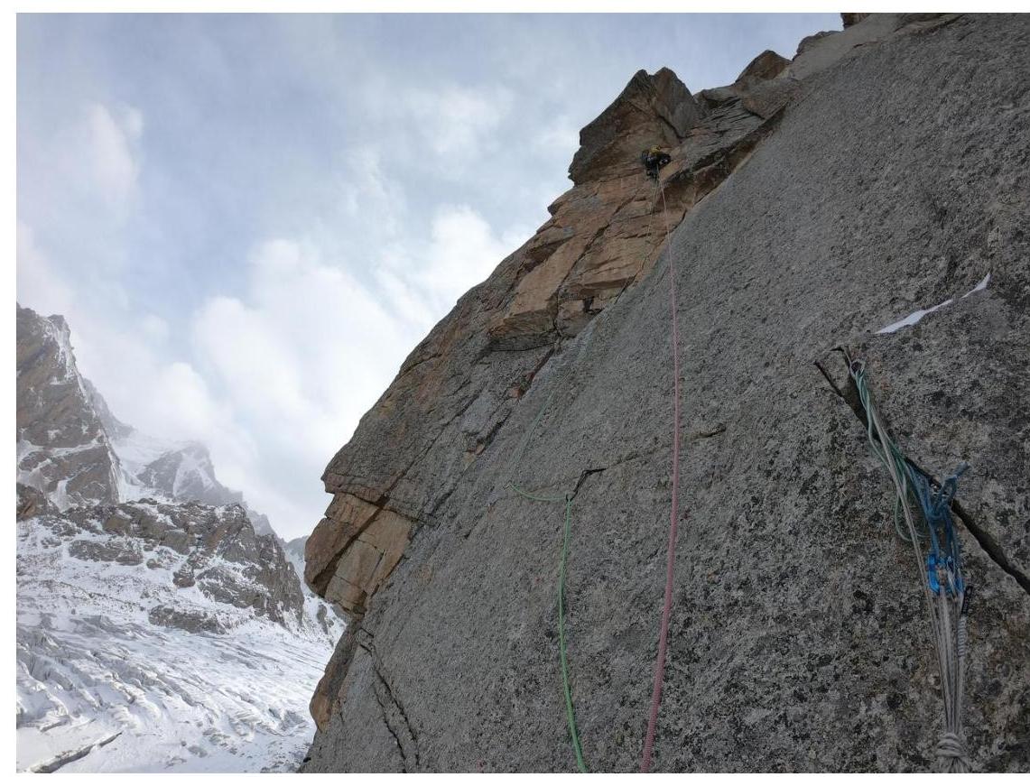
Photo 4. Section R3–R4. View on the traverse left.
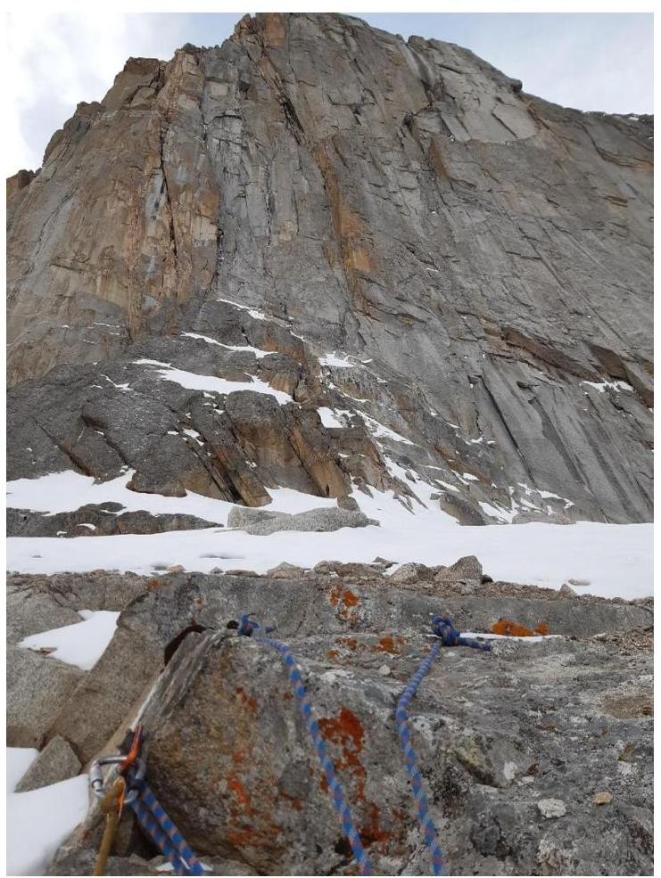
Photo 5. View from R5 on the macroledge where the first overnight stay was set, view on the second bastion.
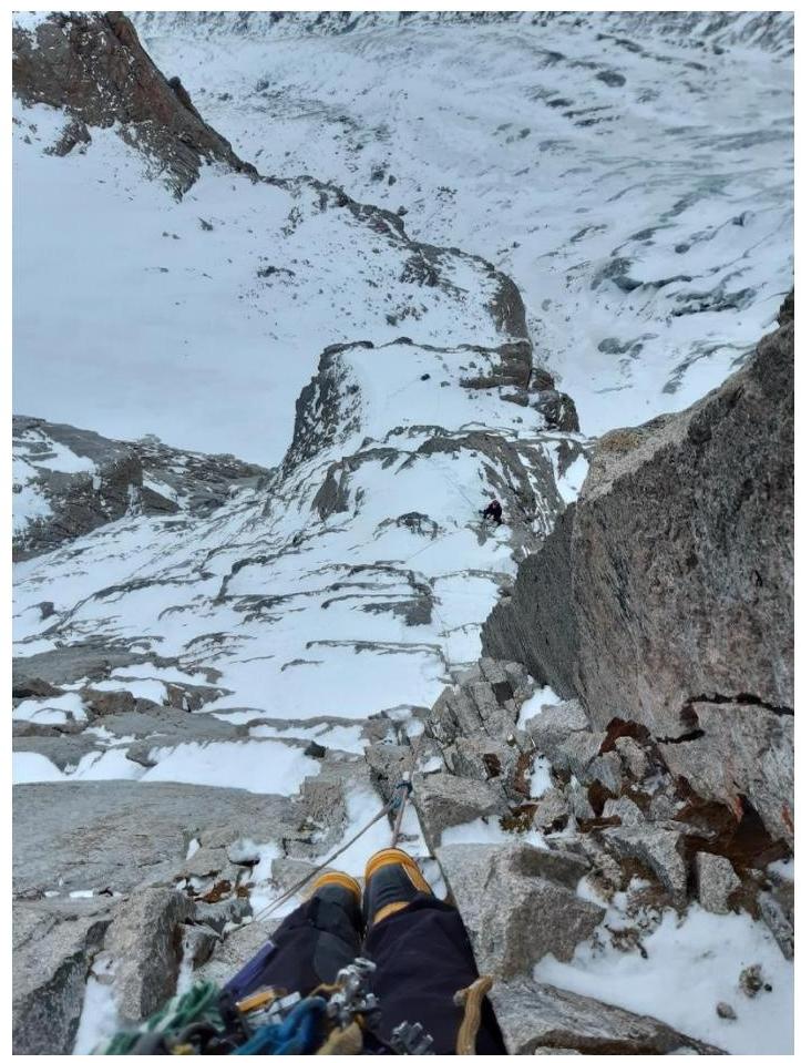
Photo 6. View down from section R6–R7.
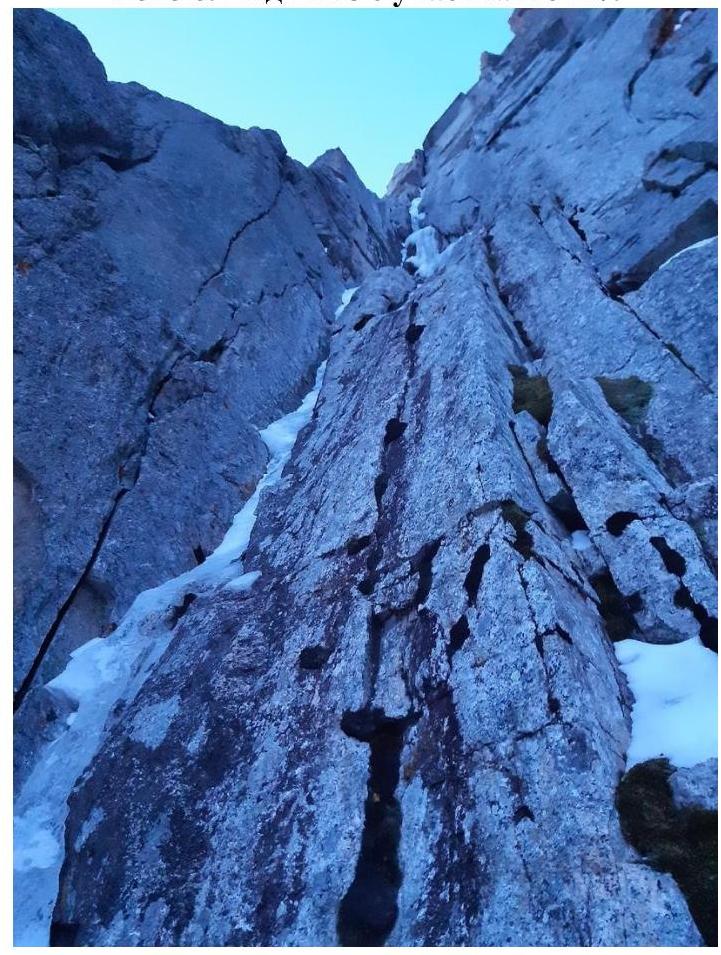
Photo 7. Inner corner of section R7–R8.
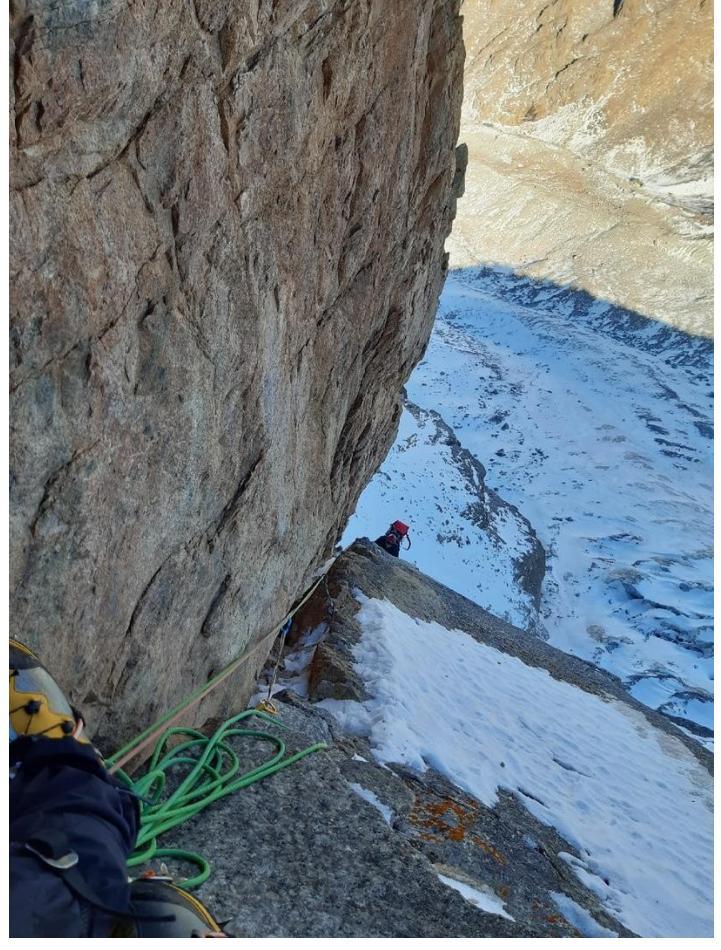
Photo 8. View from station R9 down. Here we had a stuck rope in the chimney, required waiting for the second.
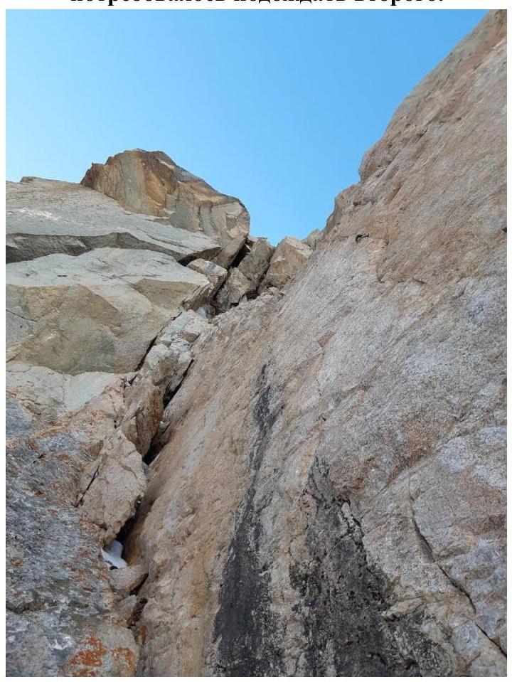
Photo 9. Section R9–R10. Above are destroyed cornices.
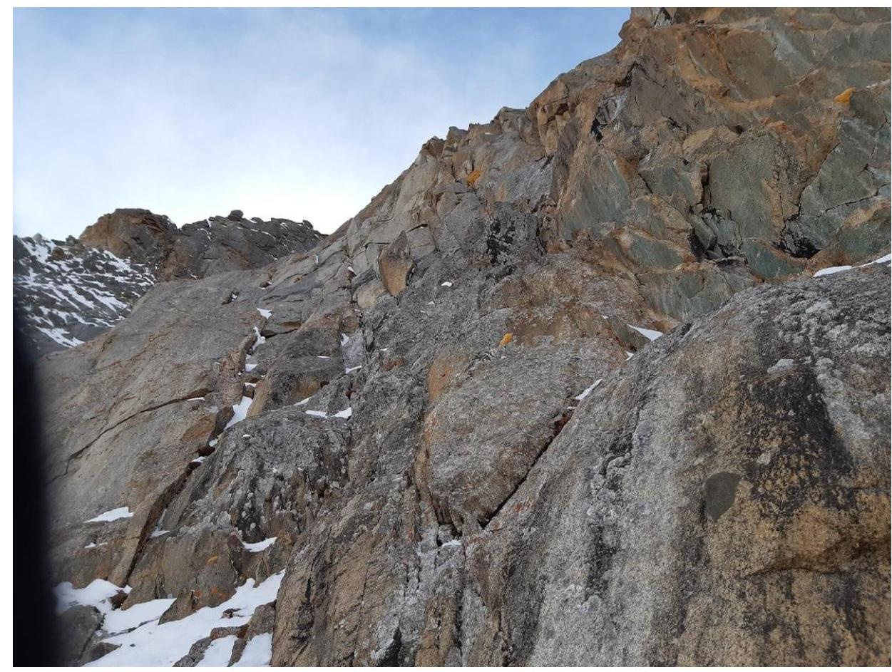
Photo 10. Section R11–R12. View from the second overnight stay ledge.
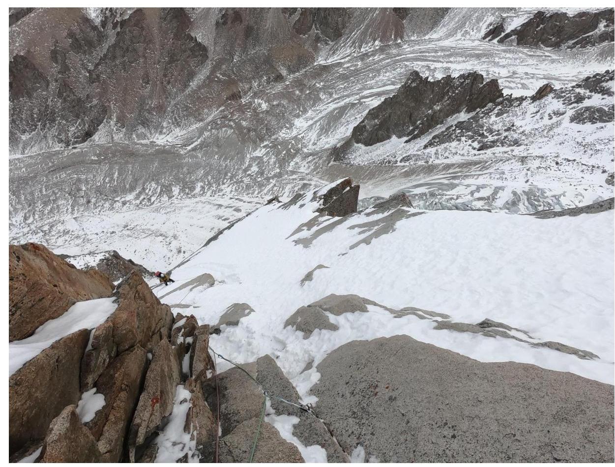
Photo 11. Section R13–R14. Snow-covered slabs.
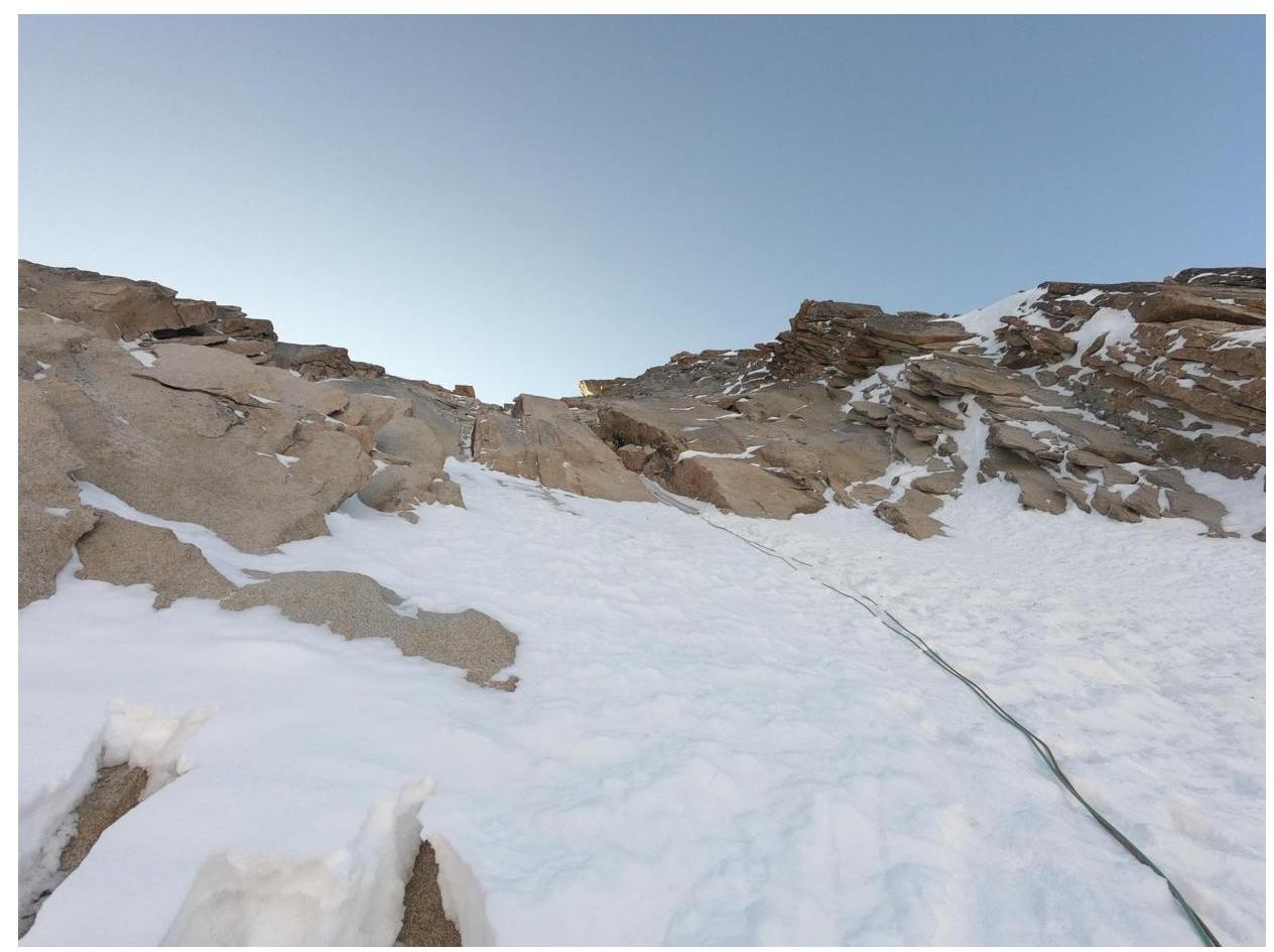
Photo 12. Section R16–R17. Ice stream.
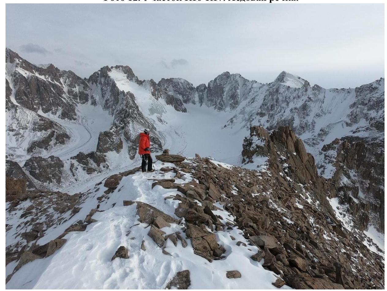
Photo 13. Stepanov on the summit.
Description of the route by sections:
R0–R1. Through the center of the slab, along a black streak directly under the cornice. Initially, 15 m (V, 90°) through a system of cracks. Then, along the relief to the left part of the giant cornice 35 m (VI, A1–A2, 90°). Sometimes there are small cornices. Station on local bolts + own friend.
R1–R2'. To the right along the cornice (4 m) and through the cornice (2 m) AITO A2 (friends). After the big cornice, AITO along a monolithic crack A1–A2 (about 15 m) to an intermediate station on two bolts.
R2'–R2. Continue movement along the crack (in the upper part, the crack is wider). Station on local iron + own friends. (50 m, 80°, VI/A2).
R2–R3. Bypass the cornice to the left along a very wide crack (friends 4–5 sizes + skyhook) (5 m, A2–A3 95°). Then move from left to right, through a system of cracks to the station; there is local iron (35 m, V–VI, A2).
R3–R4. Complex traverse left along a horizontal crack, bolts (5 m) to a vertical crack leading into a system of small cornices. Station on a ledge under 2 feet at the base of the inner corner. (35 m, VI/A2).
R4–R5. Initially, movement along the right wall, then transition into the inner corner, leading to the right until the relief flattens, here exit to a large ledge where the first overnight stay was set. (45 m, IV/A2 + underclimbs V, 80°).
R5–R6. Along snowy rocks, approach to the inner corner (40 m, III, sometimes V walls, average slope 40°). Station to the left of the corner on a comfortable ledge.
R6–R7. Straight up into the inner corner (20 m, V, 50–60°). Then along the inner corner, rocks are destroyed, there is ice (A1 20 m, 80–90°). Station is hanging, on anchors.
R7–R8. Continue movement along the inner corner, insurance mainly on anchor bolts, to a ledge before the traverse left. Local anchors for the station + own (30 m VI/A2 + small underclimbs, 85°).
R8–R9. Traverse left (8 m, IV), then up through a chimney to the base of an overhanging wall (20 m, IV, 60°). Station on friends (30 m).
R9–R11. Movement along a vertical wall to a niche before a destroyed cornice, here it's convenient to make an intermediate station R10. (25 m, A1–A2). The cornice is passed through a wide crack-chimney on the right (4–5 sizes of camalots) (10 m, VI, A2–A3, 95°), then along the wall, climbing to the right to a ledge for a comfortable overnight stay (15 m, V, 70°).
R11–R12. Along the ledge 3 m to the left to the inner corner, then up along snowy rocks, gradually moving to the right (35 m, drytooling IV–V, up to 90°). Station on a ledge, in a large corner.
R12–R13. Traverse along a slab to the right over a bend, then up and to the right along snowy rocks to the "roof" (30 m, IV, 60°).
R13–R16. "Roof", along snowy slabs up and to the left towards the ice stream, climbing. (90 m, III–IV).
R16–R17. Ice + mixed in the upper part (55 m, IV) insurance with ice screws + camalots in the narrow part of the stream.
R17–R18. Exit to the ridge (10 m, IV). Then along snowy slabs, along the ridge towards the summit (20 m, IV), station on a large boulder.
R18–R20. Along the ridge to the exit on the shoulder (80 m, III).
R20–Summit. Via route 1B cat. sl. to the summit, simultaneously.
3.2. Photo of the team on the summit (with p. Korona in the background):

Photo 14. Both participants on the summit.
3.3. Due to the fact that this route mainly passes through monolithic terrain and is frequently visited by climbers, it is safe. Descent is via route 1B cat. sl.
3.4. Note from the summit.
The control book was not found.
3.5. Miscellaneous.
Mikhailov's route 5B is considered one of the most challenging routes of this category in Ala-Archa, and "from the words of senior comrades," more difficult than some 6A routes in the same area.