Protocol №208 dated November 15, 1964 К-о Вгребно 3А
Description of the ascent to the 1st Botvey Tower
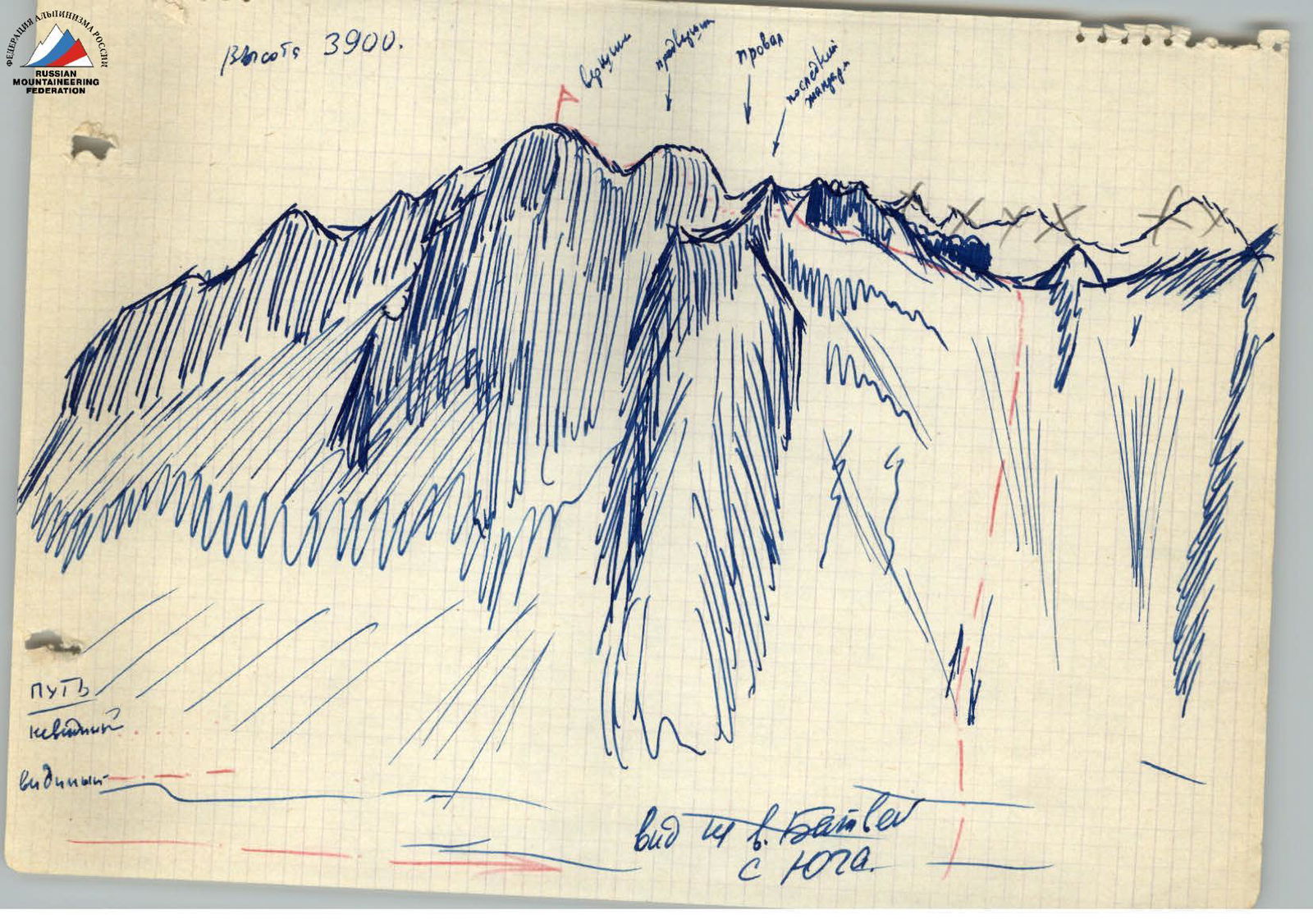
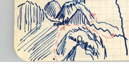
From the moraine campsite, we approach the saddle between the Botvey massif and Selmashevets. We move along the scree towards the saddle and, before reaching it, turn left (in the direction of travel) towards the "Window" between the first and second gendarmes.
Here is a cairn. Then we move along the ridge to the summit tower, bypassing all gendarmes on the right in the direction of travel. At the same time, we lose considerable height. When bypassing the first gendarme, we rappel 15 m from the "window" to the other side of the ridge. Two counterforts extend from the gendarme. We ascend the first counterfort along the scree and descend to its other side down a gully covered with flow ice, 6–7 m, using sports equipment.
We cross a wide couloir located between the 1st and 2nd counterforts. The second counterfort is passed in the same way as the first one. The gully down which we descend from it is much longer, 30 m, with an icy bottom covered with snow. We descend from it using sports equipment.
A hook with a loop is left here. The gully ends with a small ice wall, 6–7 m. Continuing to descend, we bypass the next gendarme and start ascending a wide couloir, which narrows in its upper part and increases its steepness to 70–75°. In the upper part, the couloir is covered with flow ice. This section should be passed early in the morning due to rockfall hazard. 3 hooks are driven in when passing this section. The length of this section is 15 m. Further, the couloir becomes gentler and leads to a wide ledge covered with medium scree with a steepness of 30°. We ascend along the ledge to a slab with a steepness of 45°, 30 m long. We pass these slabs with piton belay to the "window" located in the eastern counterfort of the summit tower between the summit and a small gendarme. 5 pitons are driven in.
Further, the path goes along a steep and complex ridge. This ridge is very sharp. On both sides, there are steep walls. We ascend along the ridge with careful piton belay. The ridge becomes steeper and then gentler. On gentle sections, we move astride.
In some places, the ridge consists of destroyed rocks.
Along the ridge, we reach a platform that can accommodate 3 people. The distance from the "window" to the platform is 30 m.
6 pitons are driven in when passing this section. From the platform, the ridge sharply increases its steepness, forming a wall 6–7 m with a steepness of 75–80° and a small number of holds. It can be passed directly or by moving 3 m to the right in the direction of travel and ascending along the corner.
2 pitons are driven in at this section. Having passed this section, we reach a wide platform. It remains to pass one more small wall, 10 m long, with a steepness of 85–90°.
3 pitons are driven in here. The summit is two adjacent teeth. On the first one, a cairn is built. Descent is made via the ascent route.
The passage of the route took 9 hours. The route is rated 3B category of difficulty. Description compiled by: Kannov
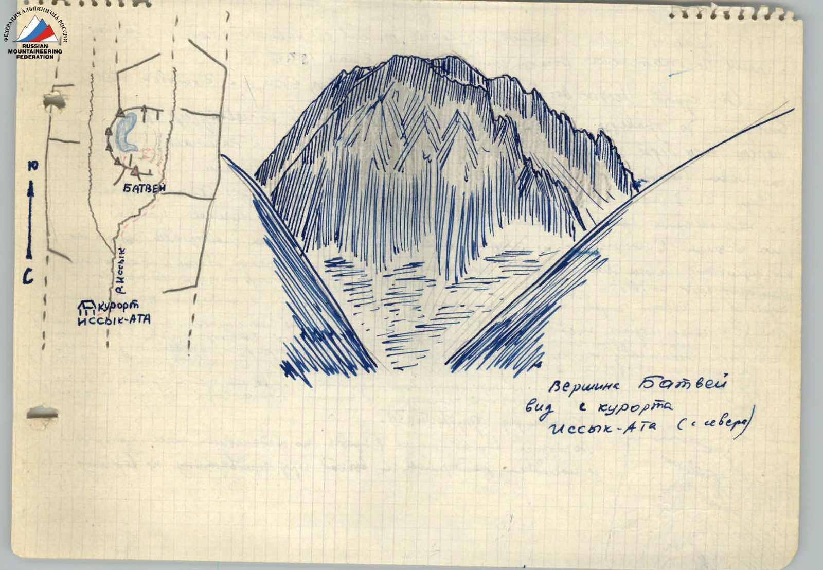
The summit has a local name; its massif overhangs the fork of the Issykatin gorge. The ascent was made in July 1967.
From the Issyk-Ata resort to the gorge fork, it's a weak 6 km, i.e., 2 hours of walking. Even before traversing the terminal moraine in the Batvey cirque, along the left (orographic) bank of the river. Before the moraine, it crosses to the other side of the river and begins along the left (in the direction of travel) part of the moraine. Without the moraine, it has three steps.
In 2.5–3 hours, we ascend to a small cirque with two or three small lakes and several formidable rocky summits. From the lake, we start ascending along the scree (in the direction of north) to the saddle between the rocky gendarmes. The height of this saddle is no more than 30 m. Turning from the saddle in the direction of west, we bypass the rocky gendarmes on the left in the direction of travel, and where we approach the chasm. It is necessary to bypass the gendarme standing above the chasm, a few meters from us, on the right in the direction of travel, along the couloir and wall, to reach the foot of the pre-summit tower. This is the most difficult place on the route.
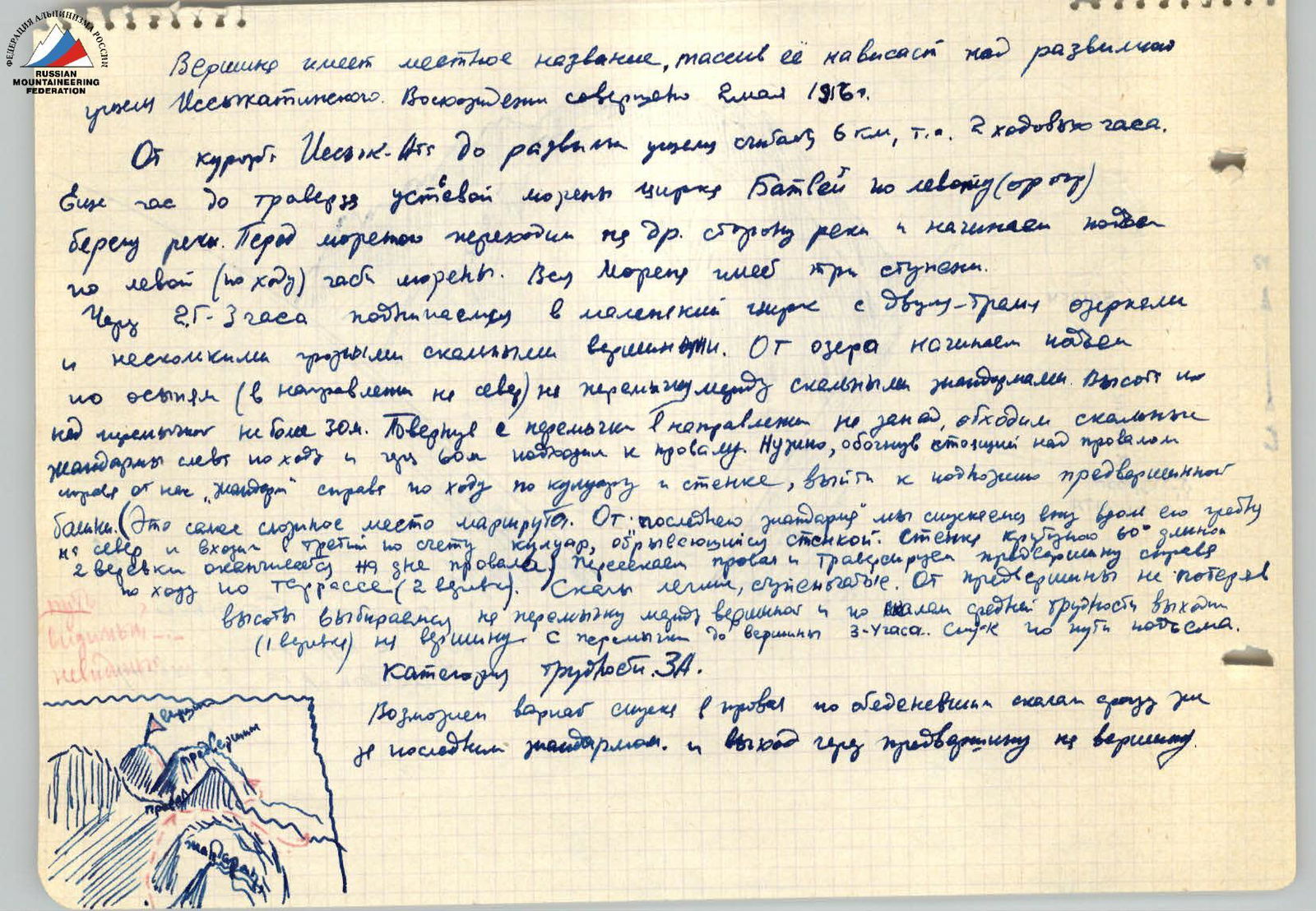 From the last gendarme, we descend down along its ridge towards the bottom of the chasm. We cross the chasm with the third couloir, which ends in a wall. The wall has a steepness of 60°, and we pass it along a terrace (2 ropes). The wall is easy, stepped. From the pre-summit, without losing height, we make our way to the saddle between the summit and a peak of medium difficulty (1 rope) to the summit. From the saddle to the summit, it's 3 hours. Descent is made via the ascent route.
Category of difficulty: 3A.
From the last gendarme, we descend down along its ridge towards the bottom of the chasm. We cross the chasm with the third couloir, which ends in a wall. The wall has a steepness of 60°, and we pass it along a terrace (2 ropes). The wall is easy, stepped. From the pre-summit, without losing height, we make our way to the saddle between the summit and a peak of medium difficulty (1 rope) to the summit. From the saddle to the summit, it's 3 hours. Descent is made via the ascent route.
Category of difficulty: 3A.
A variant of descent into the chasm is possible along icy rocks, 7 m, to the last gendarme, and exit through the pre-summit to the summit.
Description of approaches to the Batvey cirque
From the city of Frunze, one should reach the Issyk-Ata resort. The distance is 76 km. Excellent highway. The journey takes about 2 hours. From the resort, you can move up the gorge on either side. In 1.5–2 hours of walking, the gorge widens. Straight ahead, in the fork, the northern walls of the Batvey peak descend.
We turn into the right (in the direction of travel) gorge and bypass Batvey on the right. Immediately behind the Batvey massif, a steep terminal moraine is visible, emerging from a small gorge. It's along this moraine that we should ascend.
The gorge is narrow and passable everywhere, but it's easiest to move along its left (in the direction of travel) side, sticking to the southern walls of Batvey.
Having walked for 3 hours along gentle moraines, we reach a flat section. From here, the summits of the cirque become visible for the first time.
Here, you can make a campsite, but:
- there's no water here
It's better to walk another 1.5 hours and make a campsite at the foot of the Batvey summit itself, a little short of the Selmashevets peak.
Here, there's a small lake. Here, you can find good platforms.
The ascent from this site to the summit takes no more than 1.5 hours.
From the lake, all the summits of the cirque and the approach routes to the foot are visible.
The routes from the camp to the foot of all the summits lie across the moraines. It's impossible to get lost in the cirque.


