Ascent Passport
1. Ascent Class: Rock
- Ascent Region: Kyrgyz Republic, Inylchektau ridge, Maidaadyr tract.
- Peak, Route: First ascent of peak 4090 m, FALS (Federation of Alpinism, Rock Climbing, and Ice Climbing of the Kyrgyz Republic), from the north via the eastern ridge.
- Estimated Difficulty Category: 1B
- Elevation Gain: 1530 m.
- Total Route Length: 4240 m.
- Length of Key Sections: 48 m.
- Of which, 2 cat. diff. 48 m.
- Number of Pitons: rock, ice, and bolted.
- Number of Climbing Hours/Days: 8 hours.
- Leader: Bogolyubov V.V. CMS.
- Participants: Solomatin P.I. CMS.
- Coach: Bogolyubov V.V. CMS.
- Departure for the Route: 6:00 Date
- Reaching the Summit: 14:00 Date
- Return: 17:00 Date Route Description.
| Section # | K/tr. | Steepness | Length | Insurance | Notes |
|---|---|---|---|---|---|
| R0–R1 | 1 | 25 * | 1800 м | ||
| R1–R2 | 2 | 35 * | 20 м | Simultaneous for выступы | |
| R2–R3 | 1 | 30 * | 180 м | simultaneous | |
| R3–R4 | 1 | 20 * | 112 м | simultaneous | |
| R4–R5 | 2 | 40 * | 28 м | Simultaneous for выступы | |
| R5–R4 | 2 | 40 * | 28 м | Simultaneous for выступы | |
| R4–R6 | 1 | 30 * | 1100 м |
R0–R1 — The ascent begins from the north, across the pebble plateau and then along the scree couloir to the eastern ridge.
R1–R2 — Exit to the eastern ridge — the first key section, with a steepness of 35° and a length of 20 m.
R2–R3 — Then we move along the ridge to the exit to the wide scree ridge.
R3–R4 — Further along the wide scree ridge to the summit tower. R4–R5 — Ascent to the summit tower — the second key section with a steepness of up to 40° and a length of 28 m.
R4–R5 — Descent from the summit tower via the ascent path. R4–R6 — Descent in a western direction along the ridge to the scree couloir and further to the pebble plateau.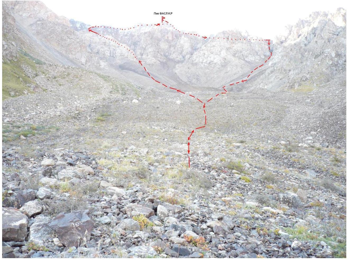
The
RECEIP