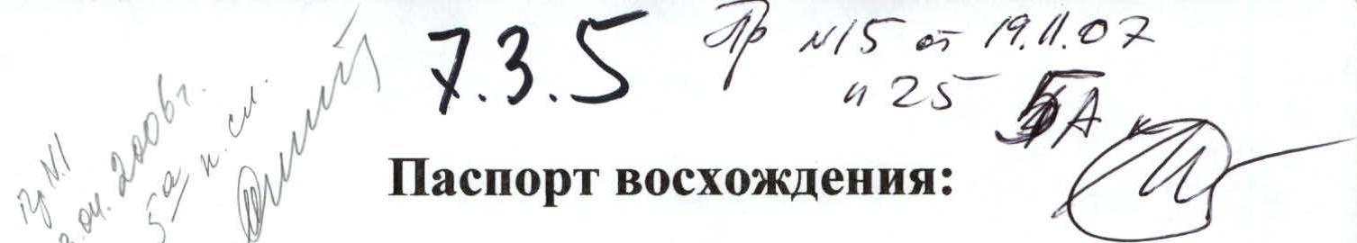
- Region: Eastern Tian Shan. Ridge: Inylchektau (Too). Section number according to the 2004 classification table: 7.3.5
- Peak name: Peak Nansen, 5697 m. Route name: via the East Face
- Proposed: Category 5B difficulty; first ascent
- Route character: combined
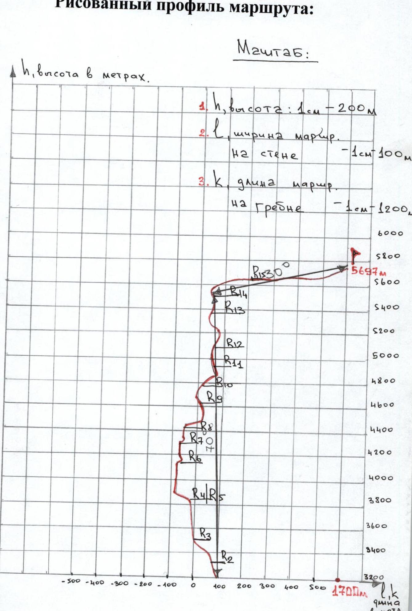
- Route elevation gain: 1497 m according to GPS. Route length: 3200–3500 m. Length of the section:
- A) Category 5 difficulty — 800 m
- B) Category 6 difficulty — 70 m
6 (A). Hooks left: * A) Rock hooks — 0 * B) Bolt hooks — 0
6 (B). Hooks used on the route: * A) Rock hooks — 0 * B) Bolt hooks — 0 * C) Nuts — 45 * D) Friends — 20 * E) Camalots — 7 * F) Ice hooks — 70 * G) Snow anchors — 3
6 (C). Artificial support points used: None
-
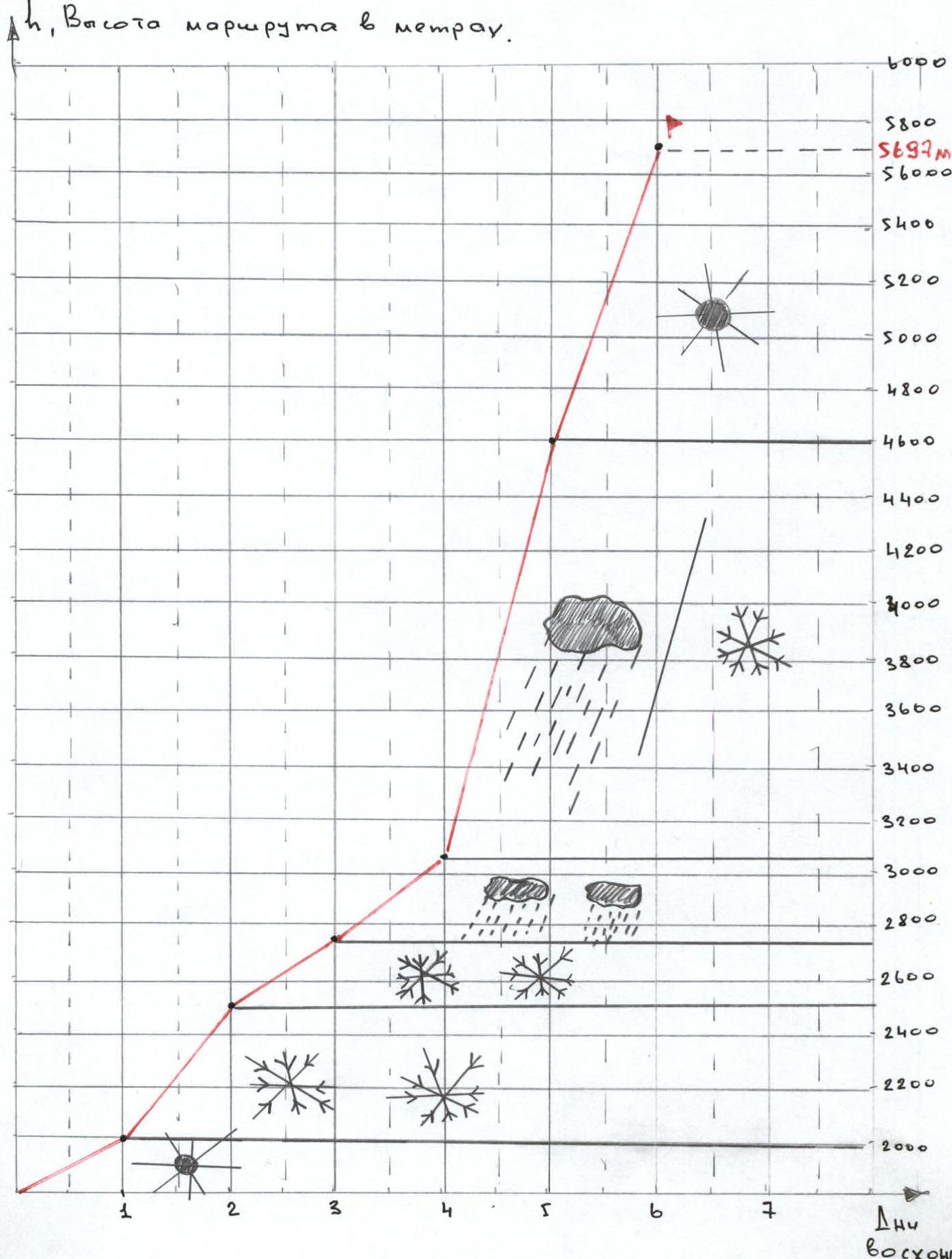
Team's travel hours: 52 hours. Travel days: 6.5
-
Leader: Ivan Anatolyevich Pugachov. Team members: Dmitry Nikolayevich Lapshukov, Olesya Yuryevna Vinnikova.
-
Departure to the route: August 16, 2004 at 8:00. Summit ascent: August 21, 2004 at 15:00. Return to Base Camp: August 23, 2004 at 16:00.
Hand-Drawn Route Profile
General Photograph of the Summit
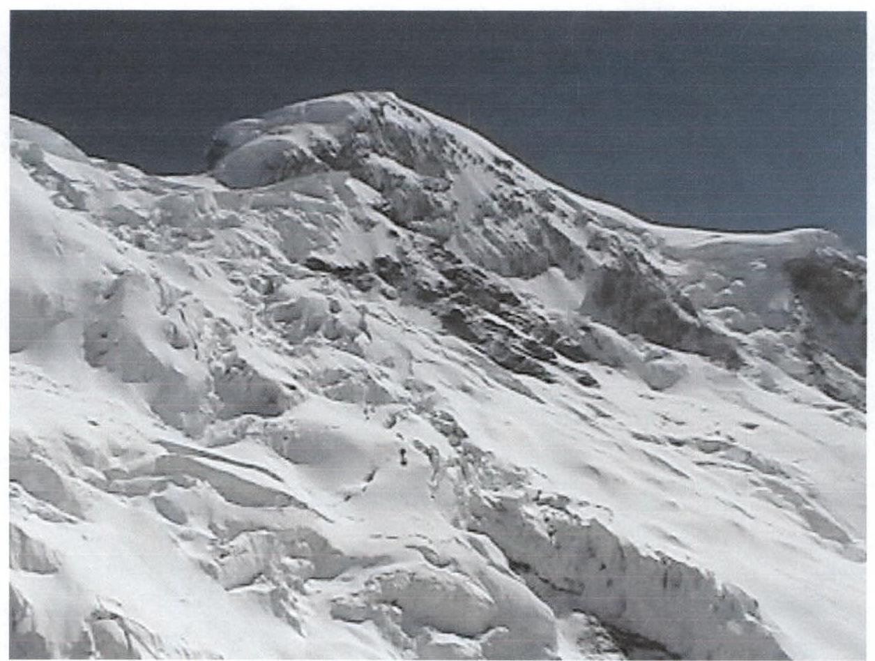
The photograph was taken from the second intermediate camp, at an altitude of 4245 m according to GPS. August 19, 2004.
Overview of the Area
Peak Nansen, with an elevation of 5697 meters, is located in the eastern part of the Inylchek-Tau (Too) ridge in the Central Tian Shan. Prior to our expedition, there were several attempts to ascend this peak via the East Face. The last attempt to climb this face was made in 2001 by a team from Germany, but it was not successful due to bad weather. Earlier, other attempts were also made to ascend via the East Face. The area around Peak Nansen is rarely visited by climbers, as the focus remains on Peak Khan-Tengri and Peak Pobeda, located approximately 70 km from Peak Nansen.
The approach to Peak Nansen ends in the settlement of Maida-Odyr, from where a dirt road leads to the private Tour Khan-Tengri camp, owned by Tatyana Ilyinichna Gribkovskaya and her husband. It is possible to stay at the camp for a fee.
Just five hundred meters from the camp, the Kann-Jailau (Kandjailyau, Kann-Jailoo) river flows. One needs to turn upstream along the river and move towards the tongue of the eponymous glacier. The path crosses from one bank to the other several times. The journey takes a full daylight day. It is advisable to stop for the night on the right moraine of the glacier and early in the morning cross to the left moraine. The path then continues along the Kann-Jailau glacier for two days, ending at the icefall. The icefall should be traversed on the left and only early in the morning. It was there that we first encountered signs of previous expeditions.
After passing the icefall, we arrive under the "Obkhodnoy" pass at 3450 m, Category 1B difficulty, with rocky and scree terrain. It is advisable to set up a base camp under the pass, which is what we did (the camp is marked with a three-meter cairn containing a note). The route actually begins from here. After ascending to the pass, we traverse diagonally towards the East Face of Peak Nansen and then proceed along ice and rock walls to the pre-summit tower. The tower is a 25-meter rock wall ending in an ice cornice. The descent follows the ascent route, using pre-established anchors.
Ascent Schedule
Route Diagram in UIAA Symbols
| № | Description | Route | Difficulty | Length | Steepness |
|---|---|---|---|---|---|
| 5697 m | |||||
| 7. | Ice ridge | 2B | 350 m | 30° | |
| 6. | Ice and snow wall | 5B | 309 m | 50° | |
| 5 | Rock wall | 5A | 1300 m | 65° | |
| 4 | Rock wall | 5A | 200 m | 70° | |
| 3. | Rock wall | 6 | 100 m | 90° | |
| 2. | Rock wall | 3A | 170 m | 45° | |
| 1. | Scree, large blocks | 1 | 200 m | 30° |
Scale 1:20000, 1 cm = 200 m
Technical Photographs of the Route
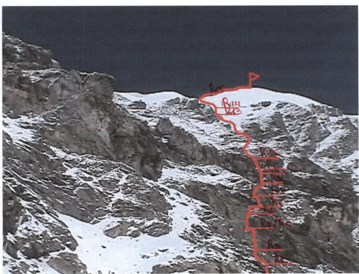
East Face of Peak Nansen. The photo was taken from the traverse from the pass to the wall.
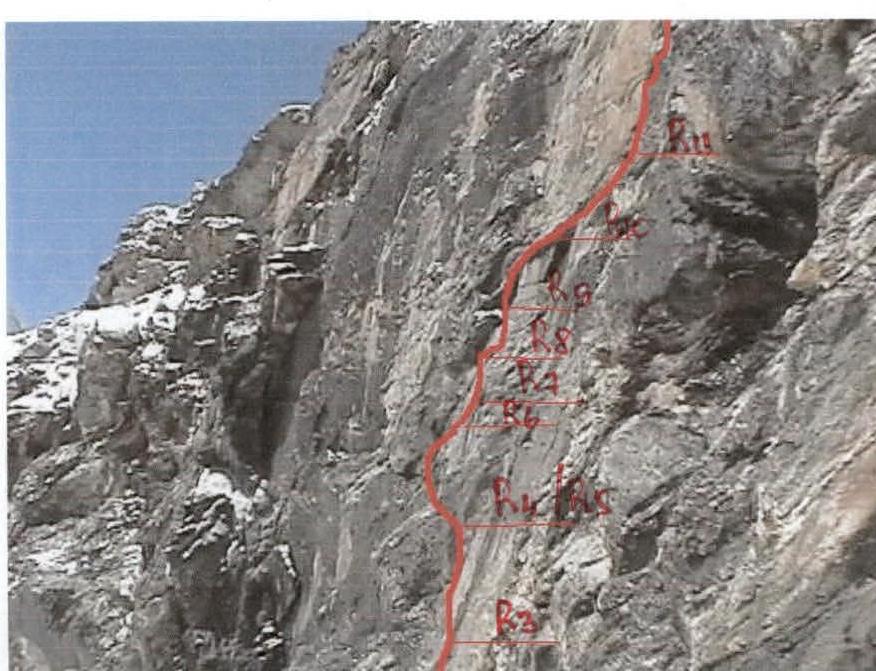
Key section.
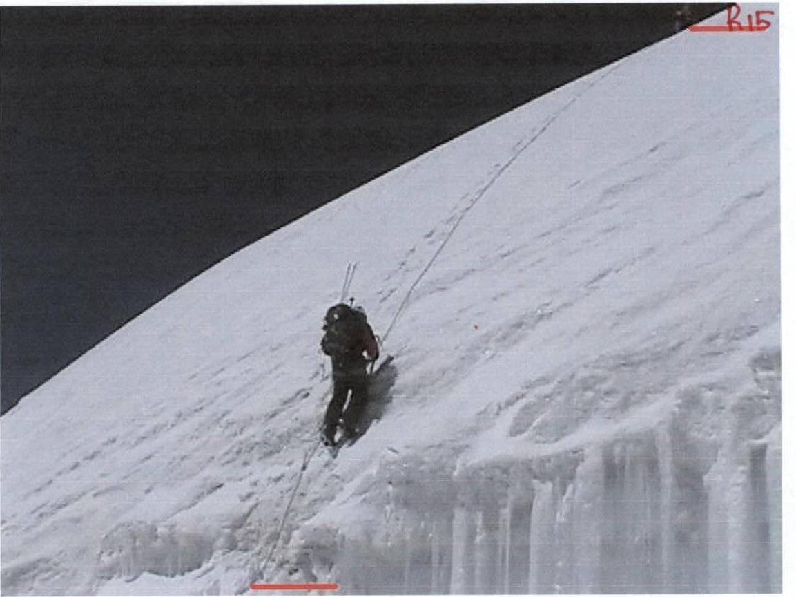
Ice exit onto the cap and then to the summit.
Photo Illustrations from the Report
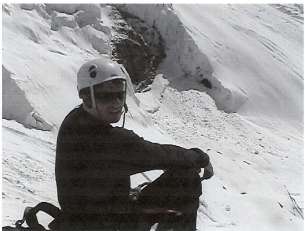
Dmitry Lapshukov at an altitude of 4350 m according to GPS. August 21, 2004.

Kan-Jailoo glacier, at an altitude of 5000 m according to GPS. August 21, 2004.
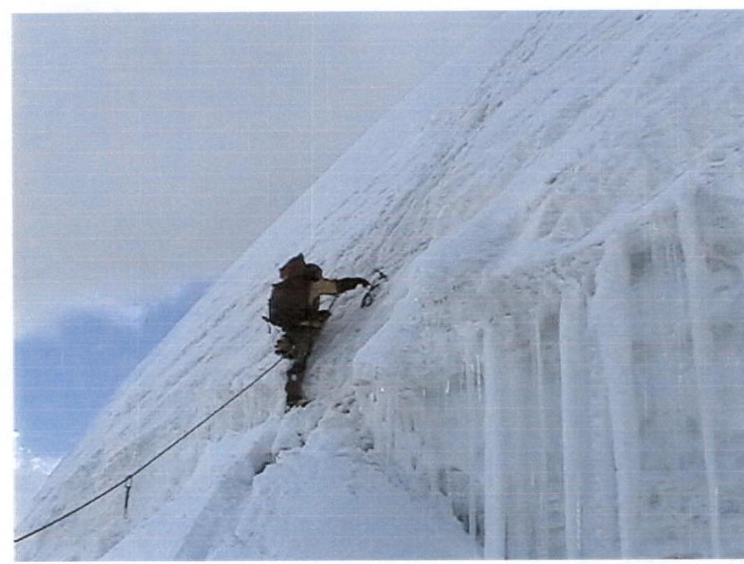
Passing the ice section after the bergschrund. Altitude 5400 m according to GPS. August 21, 2004.
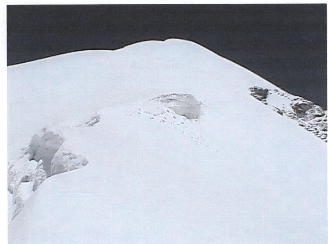
Ascent to the dome. Altitude 5640 m according to GPS. August 21, 2004.