215
Ascent Description to Peak Gagarina via
Verchina Uglovaya (Peak Pravdy)
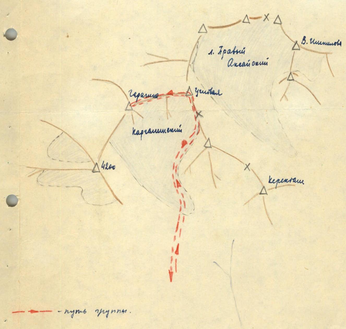
Verchina Uglovaya is located in the upper reaches of the Kargalinskoye gorge. The summit stands somewhat apart, west of the peaks that make up the Kargalinskaya horseshoe. From Verchina Uglovaya, the Main Ridge branches off to the north, ending at Peak Pervomayskiy. Uglovaya peak is named so because it is located in the southwest corner of the horseshoe. The height of the peak is 4100 m.
The route begins from the Kargalinsky glacier, where the climbers' camp is located. You should move along the glacier, leaving Peak 3950 m to the right (in the direction of travel), with a subsequent exit to the saddle between Verchina Uglovaya and Peak 3950 m. The ascent to the saddle is via a snowfield, and in the upper part - via scree. The path along the ridge to the first ice ascent is straightforward. The exit to the summit itself is via a steep glacier from the north.
Ice and rock sections of the route:
- The first ascent is 40 m. It is more convenient to go along the right ice part of the route via a rocky ridge. Steepness is 60°, in the upper part - 70°–75°. Insurance through ledges.
- The second ice section is a continuation of the first. Steepness 60°–65°, length - 30 m. You should go with insurance via pitons and chopping steps. In July, there is compacted snow in these areas, and it is not necessary to chop steps.
- The final section is an ascent along moderately difficult rocks to the summit tower (60°).
The ascent along the ridge takes 8–9 hours. Cat. diff. - 2A.
From Verchina Uglovaya to the east stretches a ridge with numerous snowy ascents and cornices. From Verchina Uglovaya (Pravdy Peak) to Peak Gagarina, the ascent along the ridge is relatively straightforward and takes 3–4 hours. The ridge becomes dangerous during snowfalls. The exit to the summit dome is via a steep snow slope (50°, 70 m).
Descent is via the ascent route through Verchina "Uglovaya" to the north to the saddle between "Uglovaya" and Peak "3950".
On the first ice section from Verchina "Uglovaya", pitons are driven and ropes are hung. The next ice section can be bypassed to the left (downhill) along a rocky ridge, where insurance is organized through a ledge. The ascent from the camp and descent takes 12 hours.
The route to Peak Gagarina can be rated as 2B cat. diff.
List of participants
who made the ascent to Peak Yu. Gagarina on February 2, 1962
- GLUBOKOVSKIKH V.K.
- KAZAULES A.V.
- KUKOVA V.V.
- TANYKAY N.V.
- STRELCHENYA N.
- KOROLEV E.
- TASKAROV A.
- SAKENOV A.
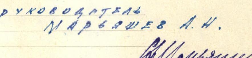
LEADER MARYASHOV A.N.
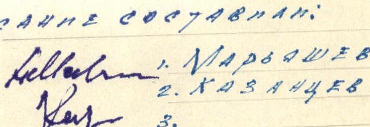
Description compiled by:
- MARYASHOV
- KAZAUTSEV
December 2, 1962