Northern Tien-Shan, Zailiyskiy Alatau
Peak Oktyabrenok
via the right edge of the first Bastion
3B category of difficulty
Climbing Passport
- Region, valley, section number according to the classification table of 20__ year — Northern Tien-Shan, Zailiyskiy Alatau, Maloe Almatinskoe valley.
- Name of the peak, its height, name of the route: Peak Oktyabrenok 3650 m, via the right part of the Western ridge
- Proposed: 3B category of difficulty
- Character of the route: rock
- Height difference of the route: 540 m
Length of the route: 700 m. Length of sections: V category of difficulty — 0 m. Average steepness:
- main part of the route — 70°
- entire route — 50°
- Number of "pitons" left on the route:
total 0; including drilled pitons — 0
- Team's walking hours: 6 hours
- Leader: Belotserkovskiy Kirill
Participants: Zhanbyrbaev Nuraly
- Coach: Ilyinskiy E.T.
- Exit to the route from Base Camp: August 31, 2009
Route started: 9:30 Reached the summit: 13:00 Returned to Base Camp: 15:00 Descent from the summit: via route 1B category of difficulty to Oktyabrenok pass
-
Organization: CSKA MO RK
-
Responsible for the report K. Belotserkovskiy
Email and phone: k.belotserkovskiy@gmail.com, +7 7017361887
Map-scheme
of the area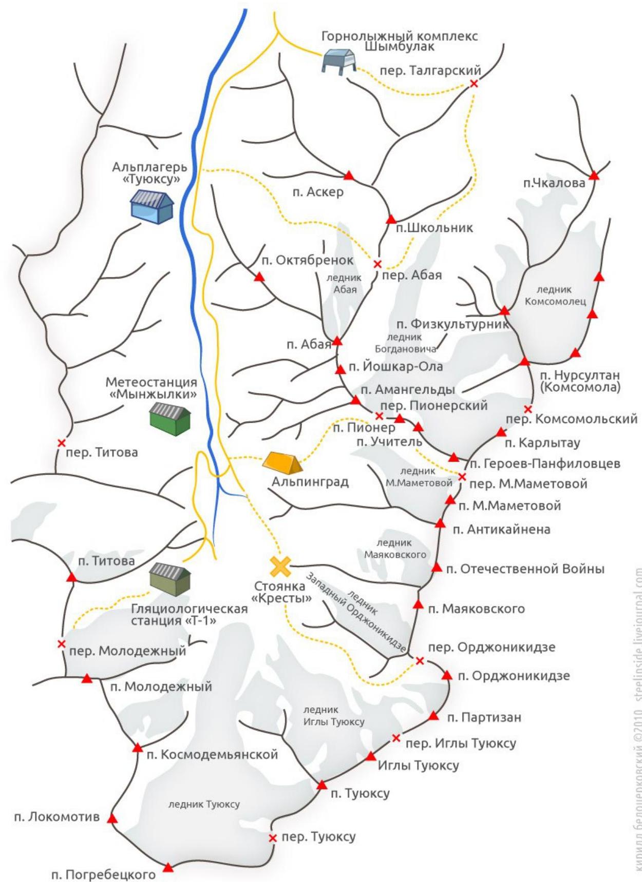
General photo
of the wall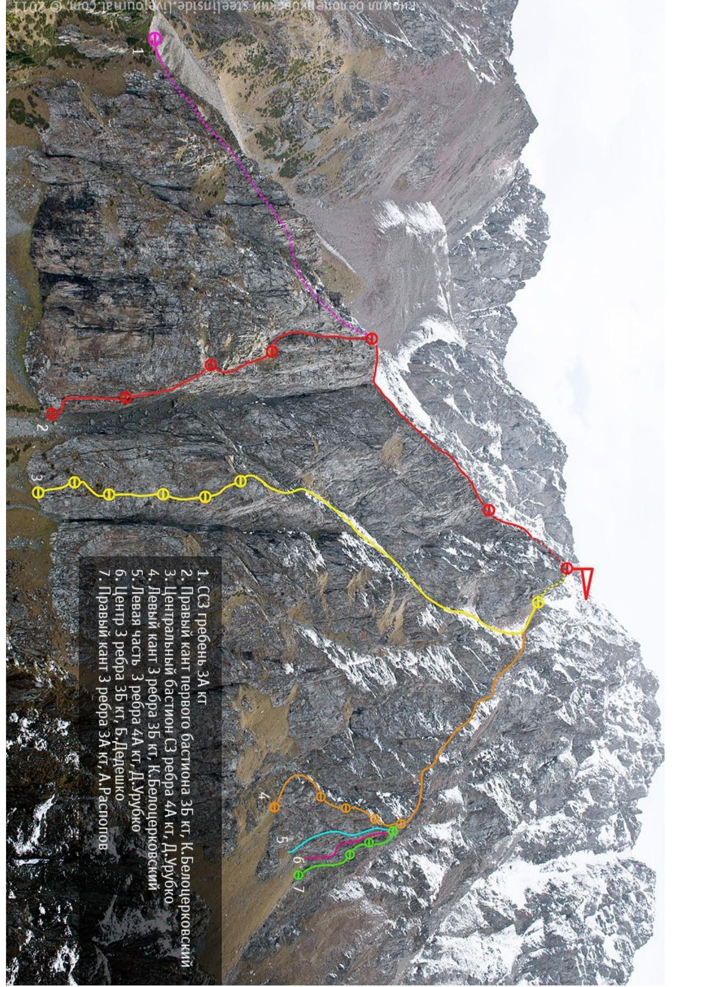
Scheme of the route Peak Oktyabrenok via the right edge of the first Bastion 3B
category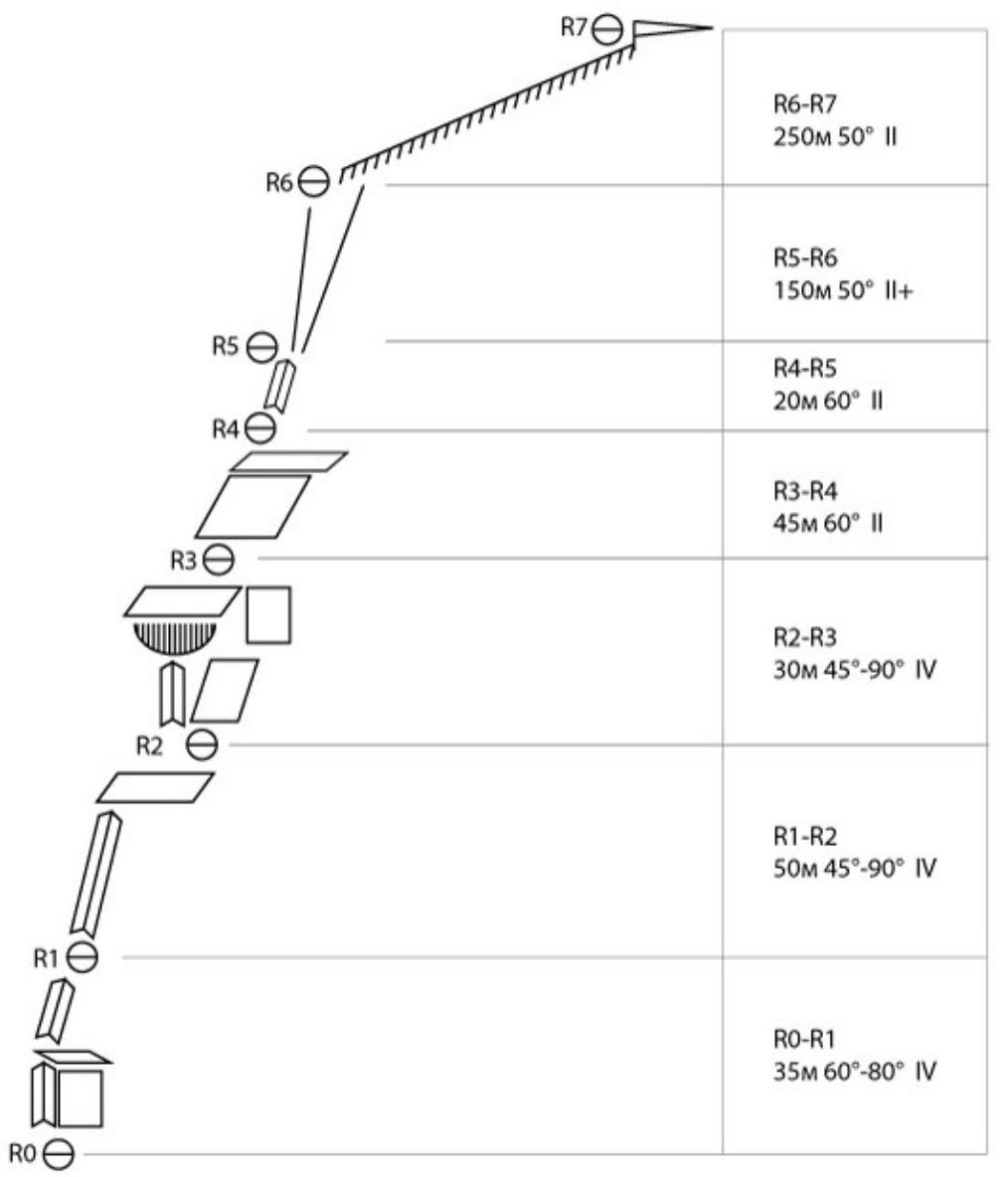
Description.
R0–R1
Movement up the wall to the left in the direction of the juniper bush. We climb through the bush, via an internal corner with a wide gap, to a ledge, then into an internal corner, where we make a belay station. There is a piton there, which I backed up with a friend and a nut. The rope length is 35 m.
R1–R2
Up the internal corner, bypassing the overhang to the right, climbing five meters and finding ourselves on steep grassy ledges, which we follow upwards to a good outcrop for a belay station. A long rope — 50 m unwound just enough.
R2–R3
Up the internal corner in the direction of the cornice. Do not climb onto it! Need to traverse to the right, where we continue moving up via "grade 3" rocks to a ledge. Belay station on the outcrop. Approximately 35 m.
R3–R4
From the ledge up via a large-block scree slope for 45 m. Belay station on a small ledge. I hammered in two pitons (later pulled out).
R4–R5
Then in a rope team to the top of the first bastion via grassy ledges, interspersed with small walls.
R5–R6
Further, need to go to the right, via a steep couloir, interrupted by short chimneys. Insurance is alternate or simultaneous, depending on the group's level.
R6–R7
Movement along the ridge to the summit. For a prepared rope team takes 25–30 minutes (in summer).
Descent to the pass and further via the couloir to the road leading to Mynzhylky.


