Northern Tien Shan, Trans-Ili Alatau
Peak Oktyabrenok
via the right part of the West Ridge
Category III difficulty
Ascent Passport
- Region, valley, section number according to the classification table of 20__ year — Northern Tien Shan, Trans-Ili Alatau, Maloye Almatinskoye valley.
- Name of the summit, its height, name of the route: Peak Oktyabrenok 3650 m, via the right part of the West Ridge
- Proposed: Category 3A
- Character of the route: rock
- Height difference of the route: 360 m
Route length: 500 m. Length of sections: Category V — 0 m. Average steepness: main part of the route — 70°; entire route — 45°
- Pitons left on the route:
total 4; including bolted — 0
- Team's travel hours: 6 hours
- Leader: Aleksey Raspopov, Master of Sports
Participants: — ( — )
- Coach: Aleksey Raspopov
- Exit to the route from the base camp: —
Route started:
- Ascent to the summit:
- Return to the base camp:
- Descent from the summit: via the Category 1B route to the Oktyabrenok pass
-
Organization: expedition club Khan-Tengri
-
Responsible for the report K. Belotserkovskiy
Email and phone k.belotserkovskiy@gmail.com, +7 7017361887
Map-diagram
of the area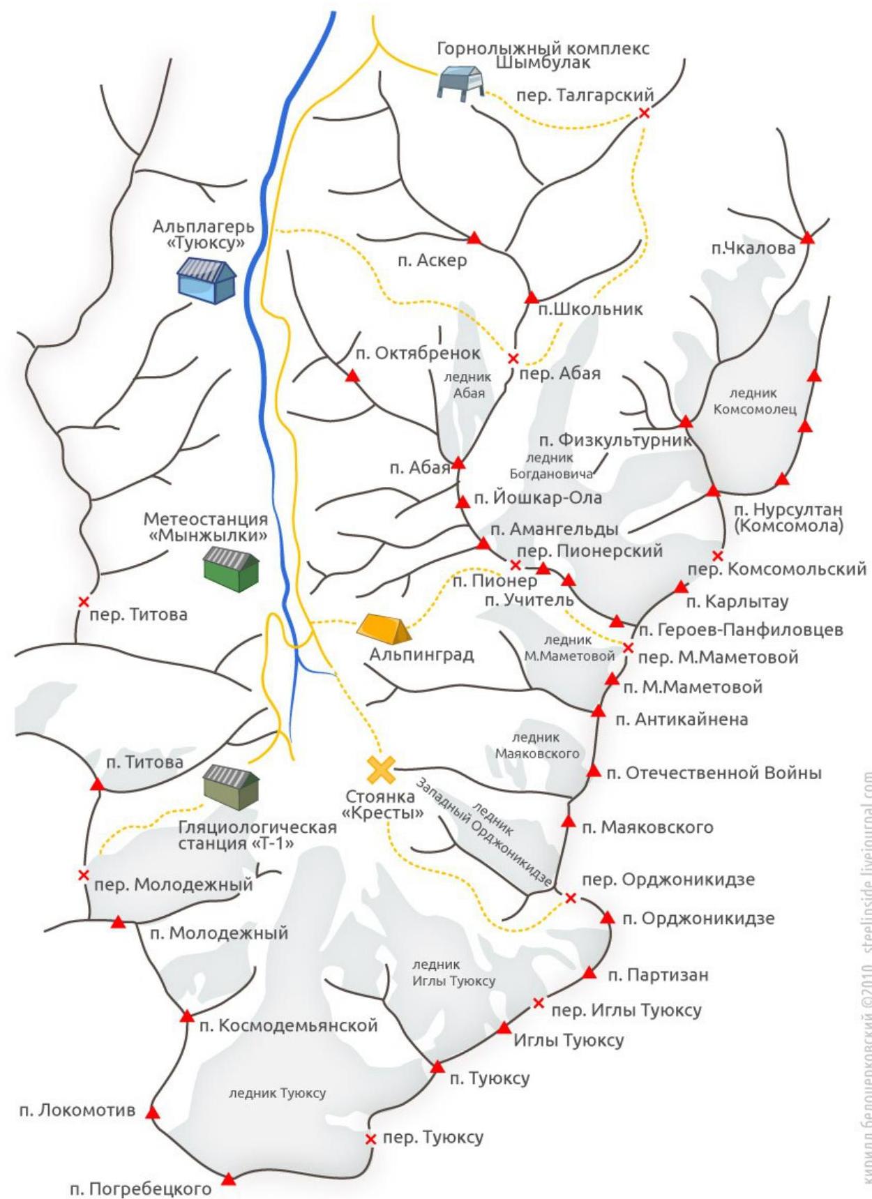
General photo
of the wall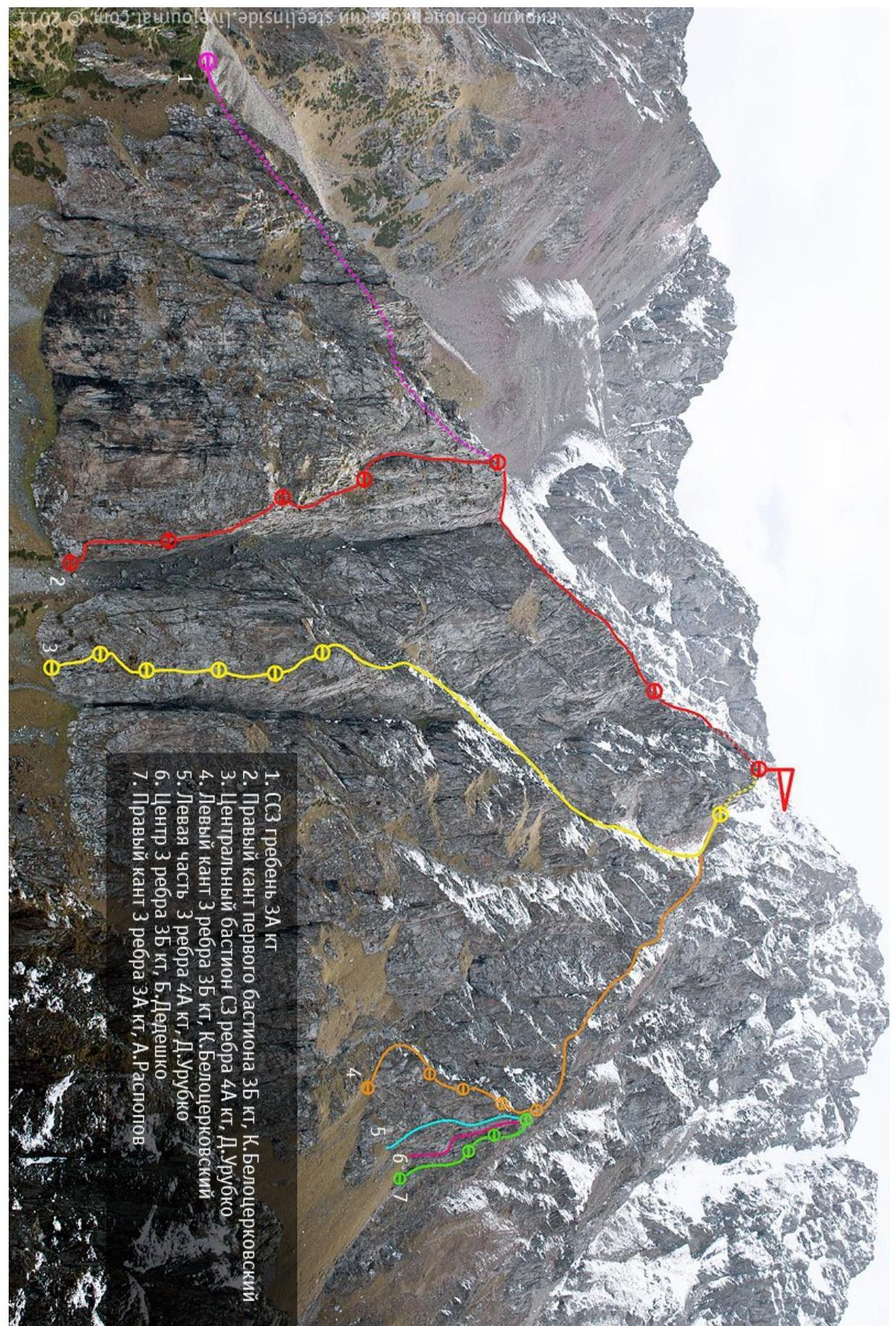
Diagram
of the route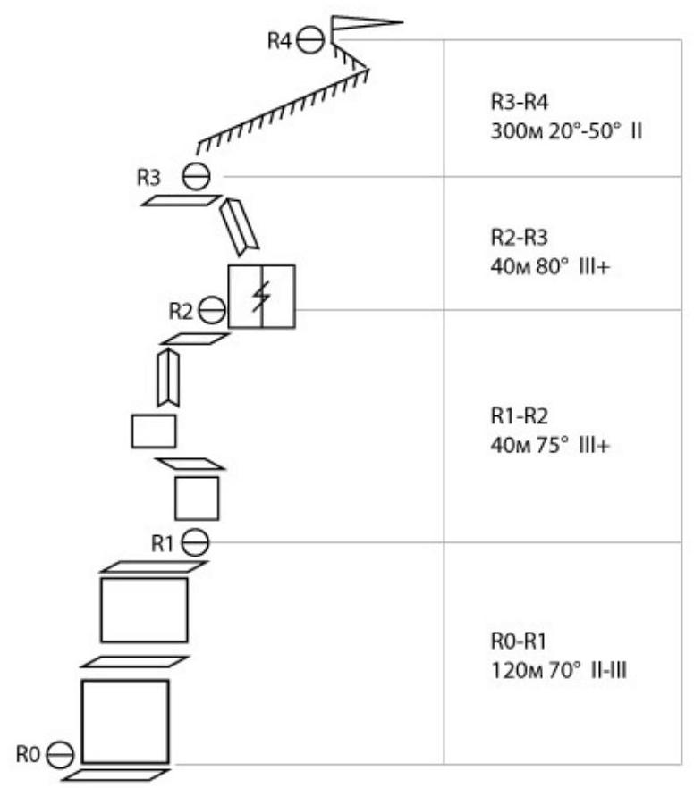
Description
R0–R1
Start by climbing the wall-shelves towards the ridge and then up along it to a convenient shelf. Station on a large separate lying stone.
R1–R2
From the station:
- Left — up towards the inner corner.
- Exit the corner onto a shelf, move left along it to the next inner corner.
- Up the corner to a shelf, where the station is located.
R2–R3
From the shelf, climb up a wide chimney. Then climb the wall to reach the ridge. Station on a convenient shelf on a narrow part of the ridge.
R3–R4
- Move along the ridge until reaching the scree (for a prepared duo, traversing the ridge takes 20 minutes)
- Climb up the scree to the pass
From the pass, ascend to the summit tower, bypassing it on the right. Descend via the couloir to the road leading to Mynzhylky.


