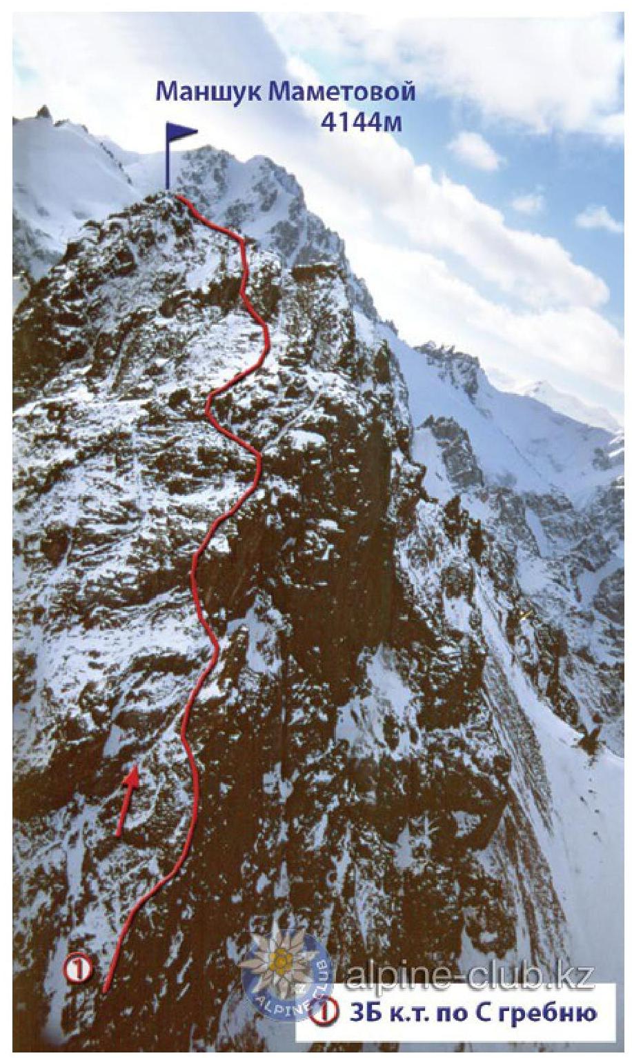
Description of Manshuk Mametova Route via the Ridge
To ascend the peak of Manshuk Mametova, it is advisable to organize the initial bivouac on the Alpine camp grounds or slightly higher - on a gravel site. From there, head to the Manshuk Mametova glacier and move along its right side in the direction of the eponymous pass.
The ascent to the pass (3750 m), which connects the upper reaches of the Malo-Almatinskoye valley with the middle part of the Leviy Talgar valley, is via a slope with a steepness of up to 40°, along loose scree and snow. From here, the ascent begins along the northern ridge, which is heavily damaged at the beginning. The first and second gendarmes are overcome head-on, the third is bypassed on the left, the fourth is taken head-on, and it has the first control cairn. The approach to the fifth gendarme is through an 8-meter gap along a very sharp ridge (overcome head-on, in a "konkovy" style). It has the second control cairn.
Then follows a rock (bypassed on the left along a snowy slope). A heavily damaged rocky ridge and the sixth gendarme (taken head-on). It has the third control point. Further movement is along the ridge, which has a sharp drop of 60–70 m to the foot of the seventh gendarme (up to 60 m high), composed of granite with red hues.
It is overcome along the north-eastern wall as follows:
- From the gap, go up to the left
- Traverse the wall to the right, in the direction of the crevices
- Along the crevice, reach a small chimney (insurance is hook-based, 3–4 hooks)
From the chimney, ascend to the left along the damaged part of the wall (sometimes icy) along the ridge with a jumble of rocky fragments to the fourth control cairn. Before the main tower, the ridge drops sharply. From here, the key point of the route is visible.
After the drop, the main ridge connects with the lateral - eastern ridge. At the junction, a 15-meter rocky tower rises. Then a short snowy ridge leads to the foot of the pre-summit wall (20 m), which drops sheer to the side of the ridge. It can only be overcome along a crevice filled with ice on the north-western side of the wall. Further - exit to a small site, above which the second wall rises. This is the last challenging section before the summit.
The danger of overcoming it lies in moving above the sheer drop. The first person to go here is not visible, so before the gap, observers should be left.
Traverse the wall from the north-west along the ice (8–10 m) to the crevice (insurance is hook-based, 4–5 hooks). After overcoming the next 5-meter wall - exit to the ridge. Along it, in 80–90 m, the summit is reached.
Descent is possible:
- via the peak of Antikainen
- along the Mametova glacier.
The ascent takes 12 hours, including 2–2.5 hours for the descent.
The first passage of the route was made on August 12, 1950, by a group of Almaty alpinists consisting of: A. Bitny, M. Grudzinsky, I. Tyutyunnikova under the leadership of V. Nearonsky.
Recommendations
- Number of participants - no more than 6 people.
- Initial bivouac - Alpine camp grounds.
- Departure from the bivouac at 5:00.
- Equipment for a group of 4 people:
- main rope - 2×40 m
- expendable rope - 12–15 m
- rock pitons - 12–15 pcs.
- hammers - 2 pcs.
36 c.t. via the ridge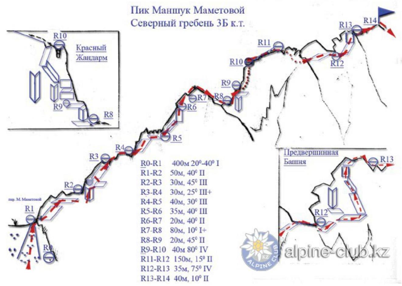
From Mountain.kz website