Ascent Log
- Area – Western Sayan, Ergaki ridge, p. 6.2
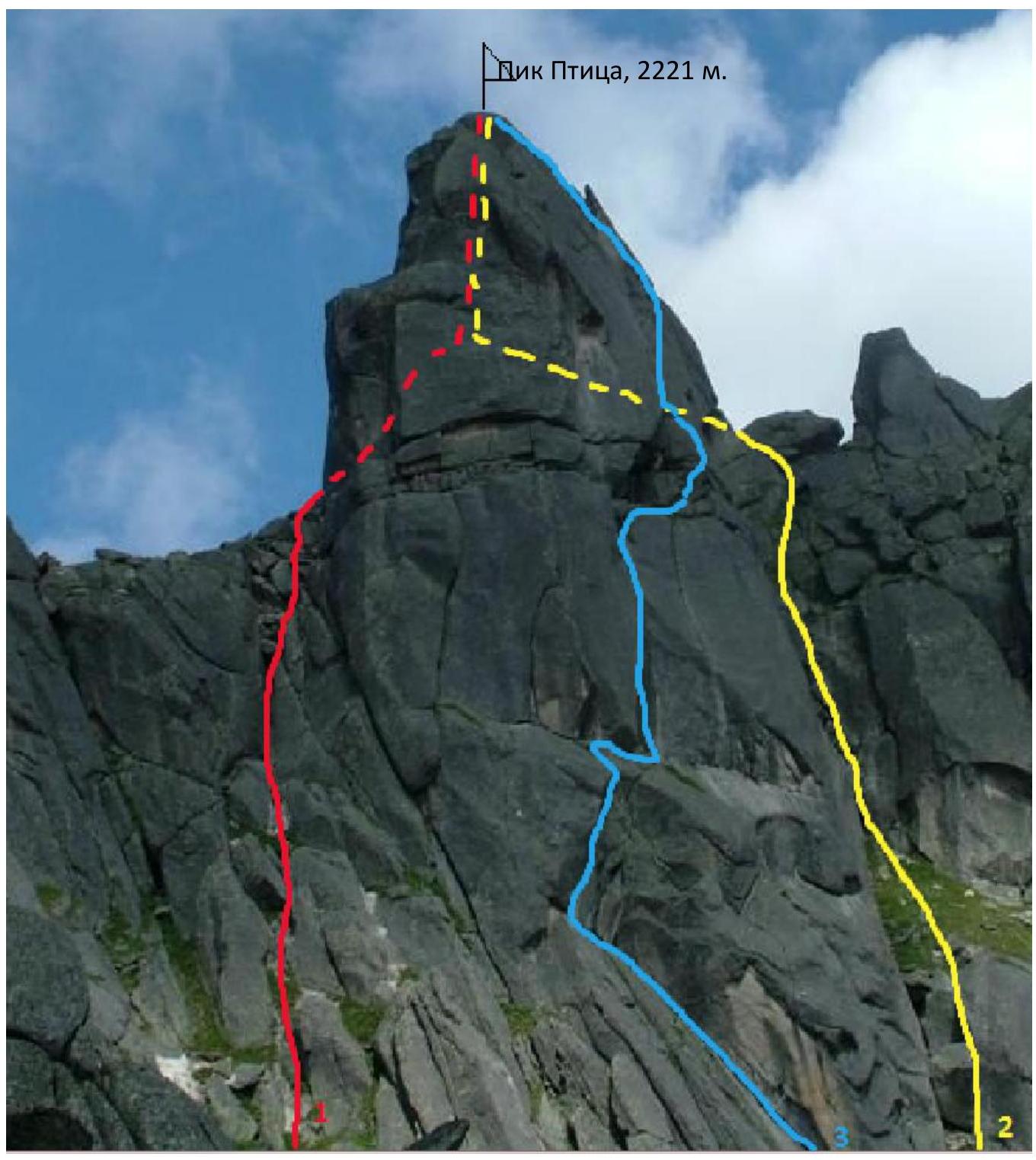
- Peak – Ptitsa, 2221 m, via the chimney of the South face.
- Claimed – 2B category of difficulty – first ascent
- Route nature – rock climbing
- Height difference – 160 m.
Total length – 200 m. Average slope of the entire route – 51°. Average slope of the key section – 60°. Length of sections with IV category of difficulty – 70 m.
- Equipment used on the route:
Stopper – 12 pcs, Cams – 18 pcs.
- Duration – 5 hours. Days – 1. No overnight stays on the route.
- Leader: Patutinskiy Aleksandr (1st sports category)
Team members: Nefedova Mariya (1st sports category)
-
Team coach: Suvorkina Lyudmila Davydovna, Candidate Master of Sports
-
Departure to the route: August 7, 2021, 10:00 AM
Summit: August 7, 2021, 3:00 PM. Return: August 7, 2021, 5:30 PM
- Person responsible for the report:
Patutinskiy Aleksandr Nikolayevich, phone: 8(977)2509085, aleks_patutinskii@mail.ru
-
Ascent organized by – Krasnoyarsk City Alpine Federation as part of the Ergaki Climbing Competition
-
Boyarskoy T., 2A, 1997
-
Borisova Yu., 2B, 1998
-
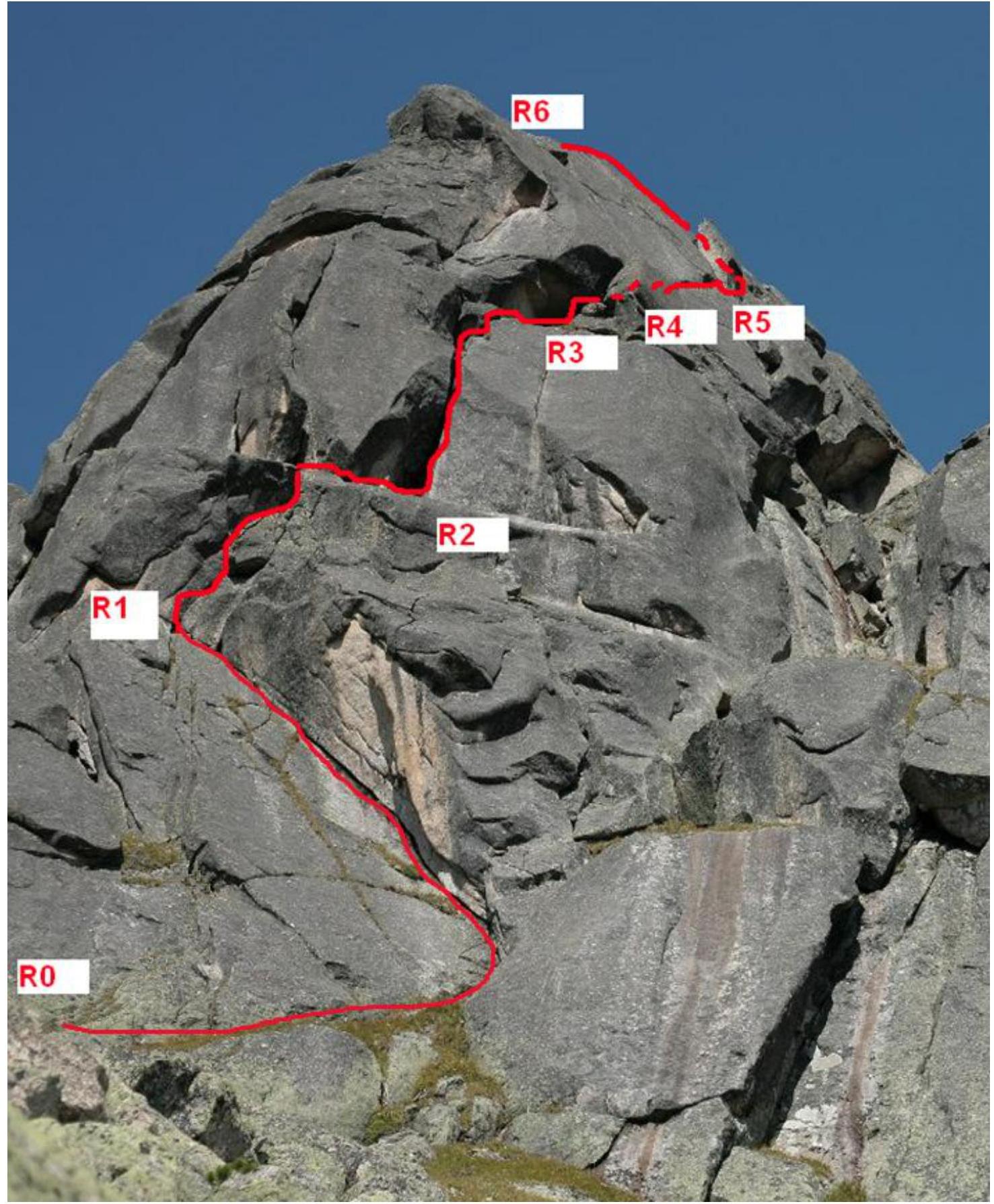
First ascent route line. Panoramic photo of the area

Tactical Actions of the Team
During the Ergaki Climbing Competition – 2021 training camp, the team of Patutinskiy Aleksandr and Nefedova Mariya completed an ascent of Ptitsa peak (2221 m) via a new route, "through the chimney of the South face".
The start is 5 m to the left of the beginning of Borisova Yu.'s route – 2B category of difficulty. The line runs between the routes:
- Boyarskoy T. – 2A, 1997
- Borisova Yu. – 2B, 1998
The route goes through the right chimney of the South face, exiting onto the right "edge – knife". The route is entirely on the South face, without exiting onto the northern ledge where all previous routes converge. The route is logical.
The route turned out to be more challenging than the existing routes to Ptitsa peak, Boyarskoy T. – 2A, 1997, and Borisova Yu. – 2B, 1998. The route features sections with good climbing, in particular:
- chimney 5C+
- edge 6A
Descent via the classic route – 2A or two 50 m rappels, then on foot.
Photo – route profile
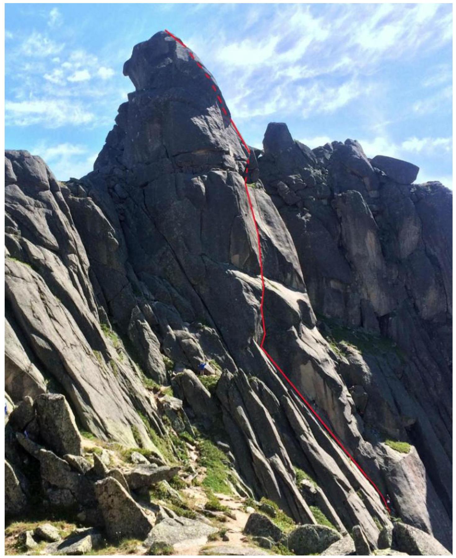 Route profile
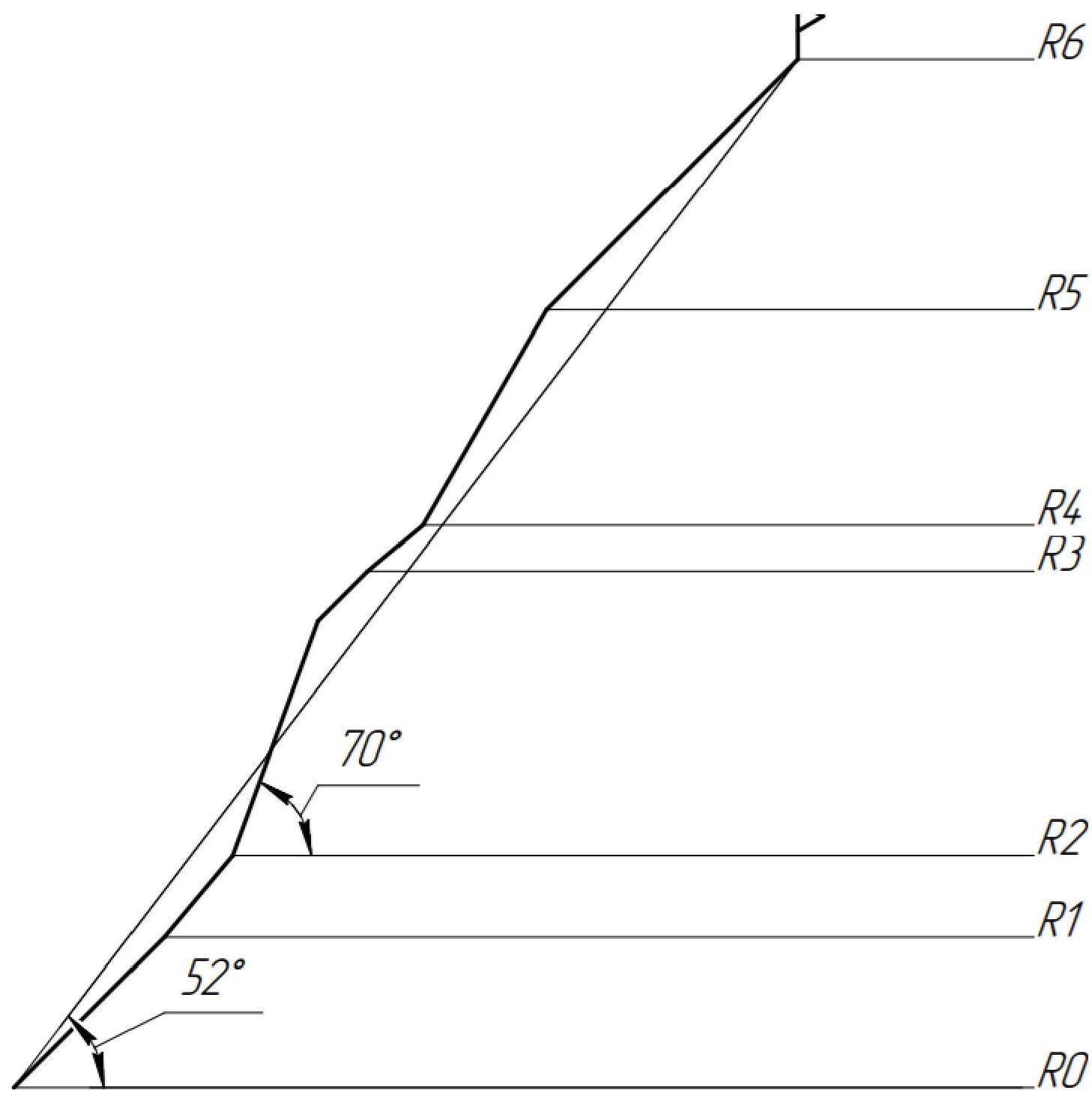
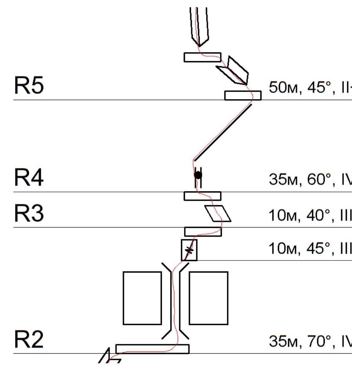
UIAA – route scheme
- R5: 50 m, 45°, II-
- R4: 35 m, 60°, I
- R3: 10 m, 40°, III
- 10 m, 45°, III
- R2: 35 m, 70°, IV
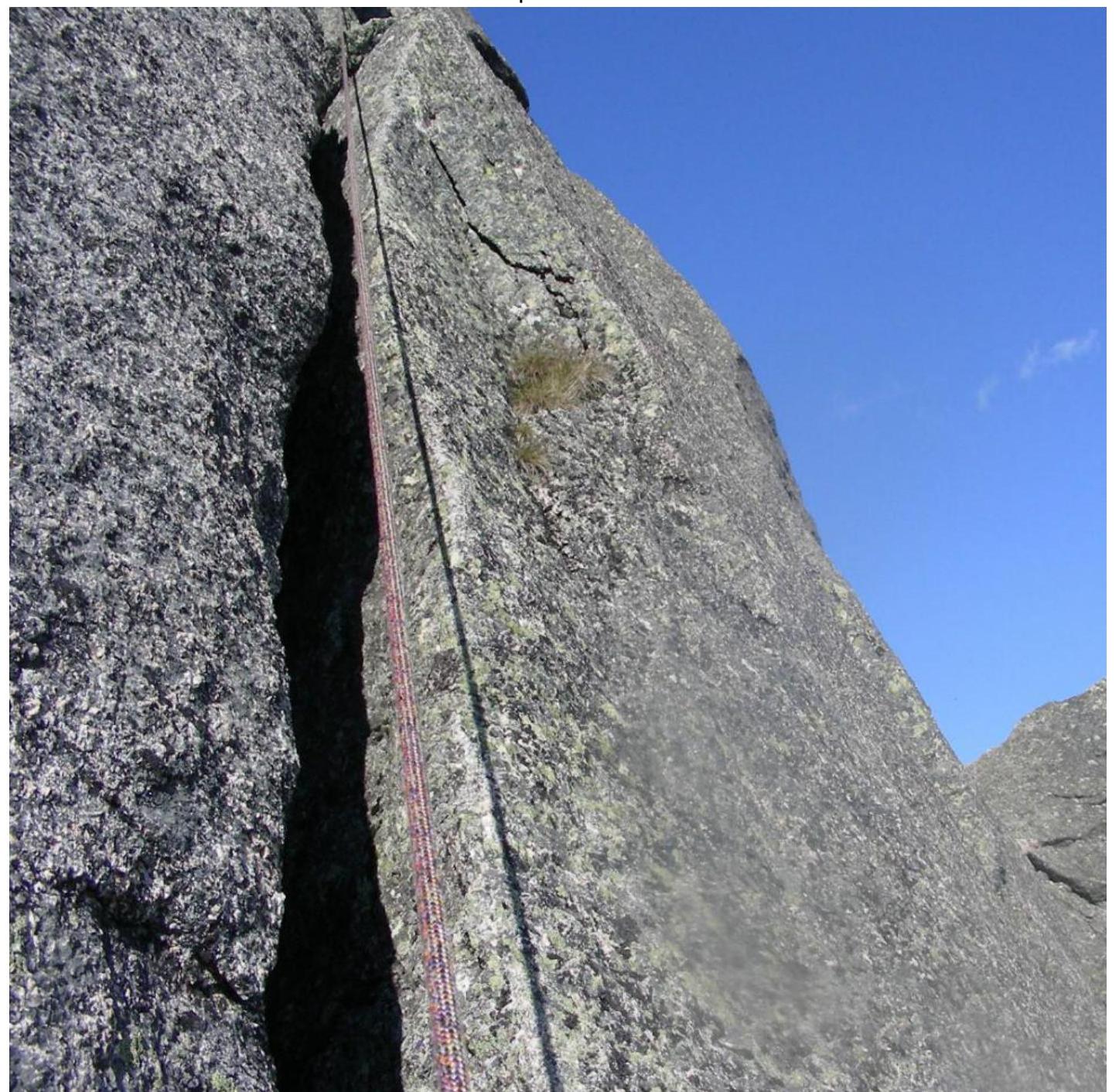
Brief description of the route: R0–R1. Start of the route. Crack. Free climbing.
R1–R2
- Crack bypassing the "overhanging" rock on the left
- Exit onto a sloping ledge
- Traverse right 3–4 m
- Exit onto a large grassy ledge
- Convenient spot for a belay station and gathering the team
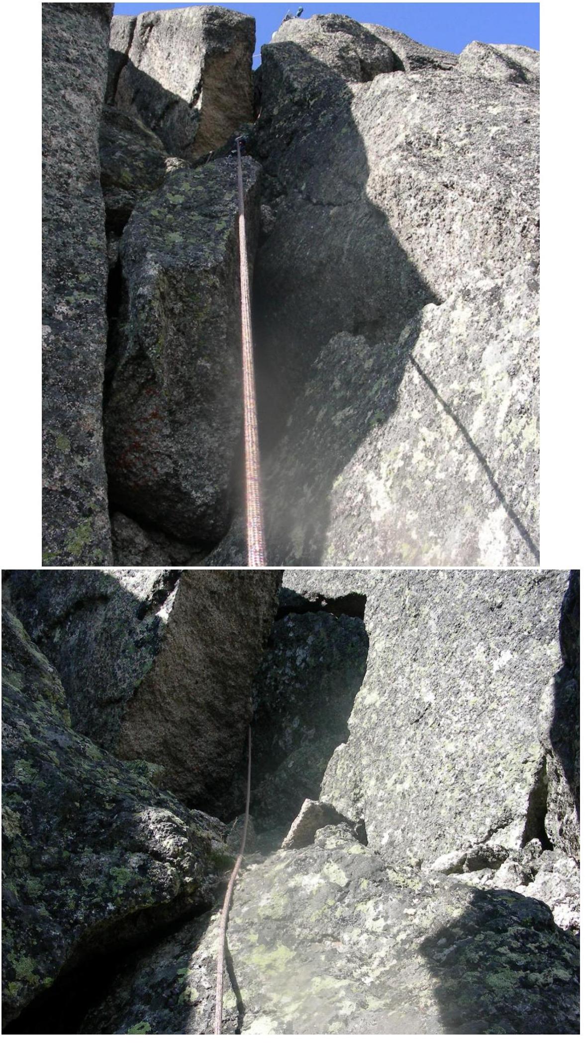
R2–R3
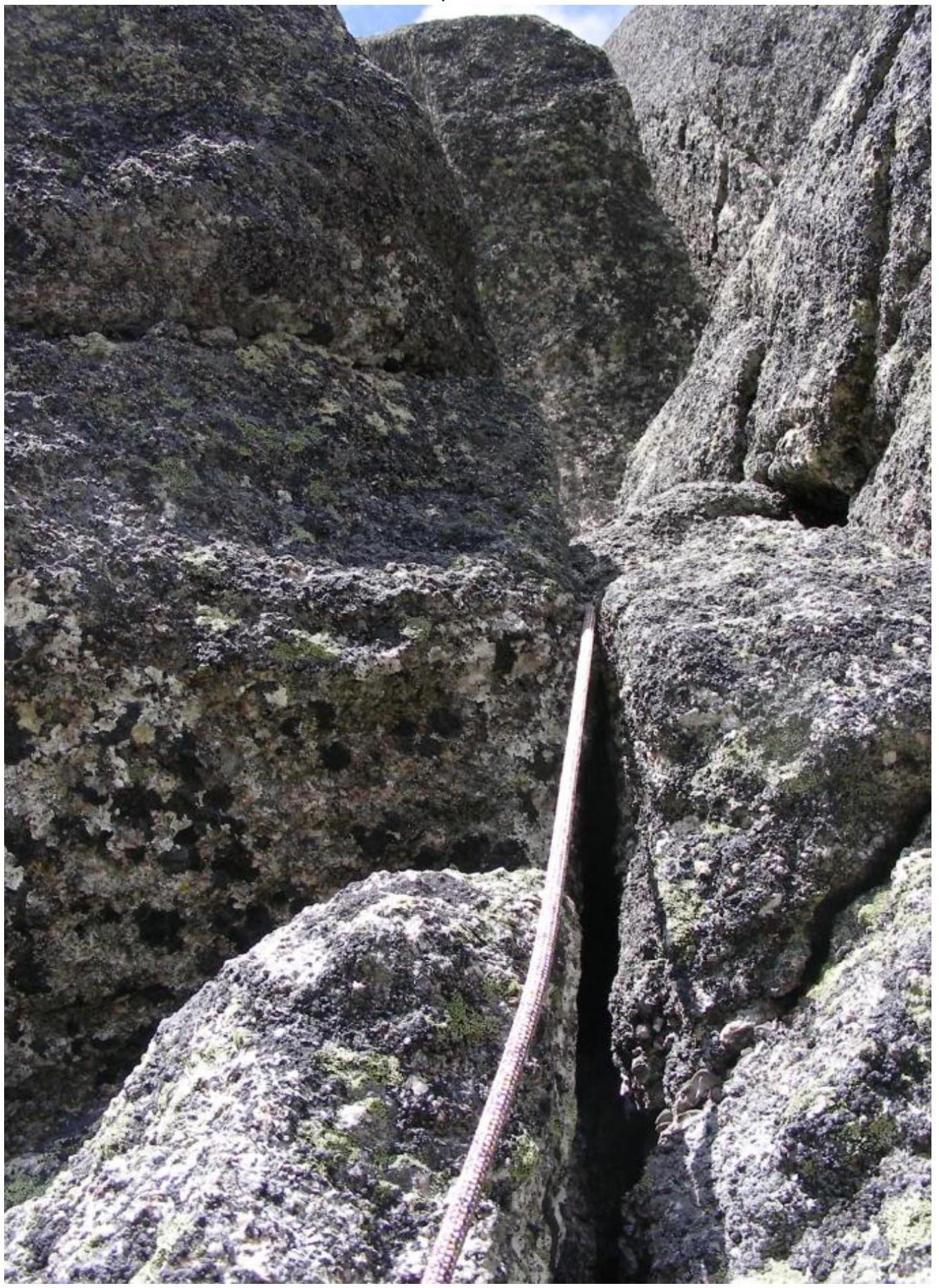
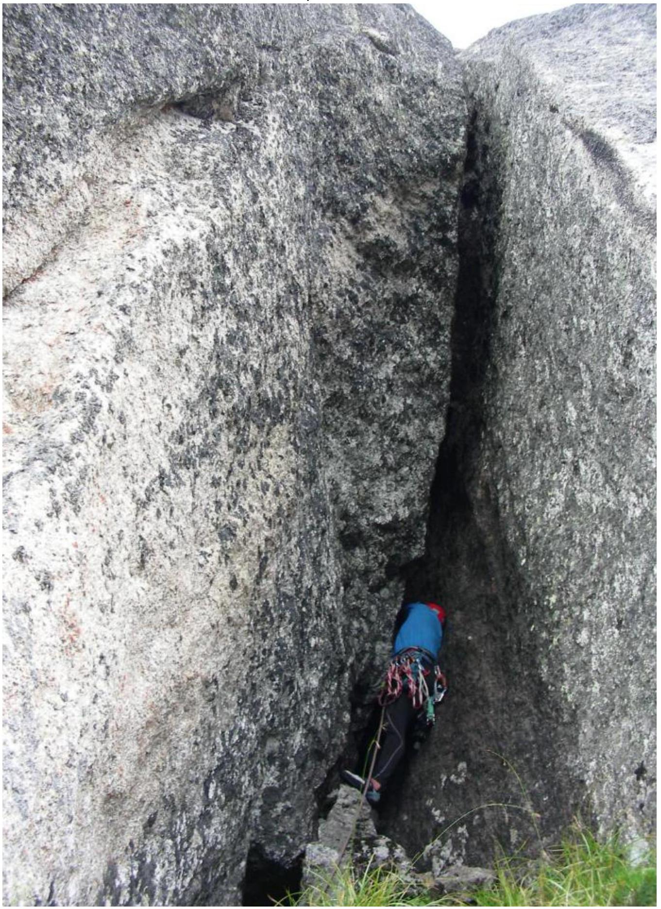
- Wet, deep, narrow chimney
- Stemming
- Little relief for intermediate protection
- Recommended to be climbed in climbing shoes and with a headlamp
- Upon exiting the chimney, organize intermediate protection on the "hourglass"
- Exit from the chimney to the right (when looking at the wall) – a crack passable by free climbing
- Exit onto a large ledge – a convenient spot for gathering the team
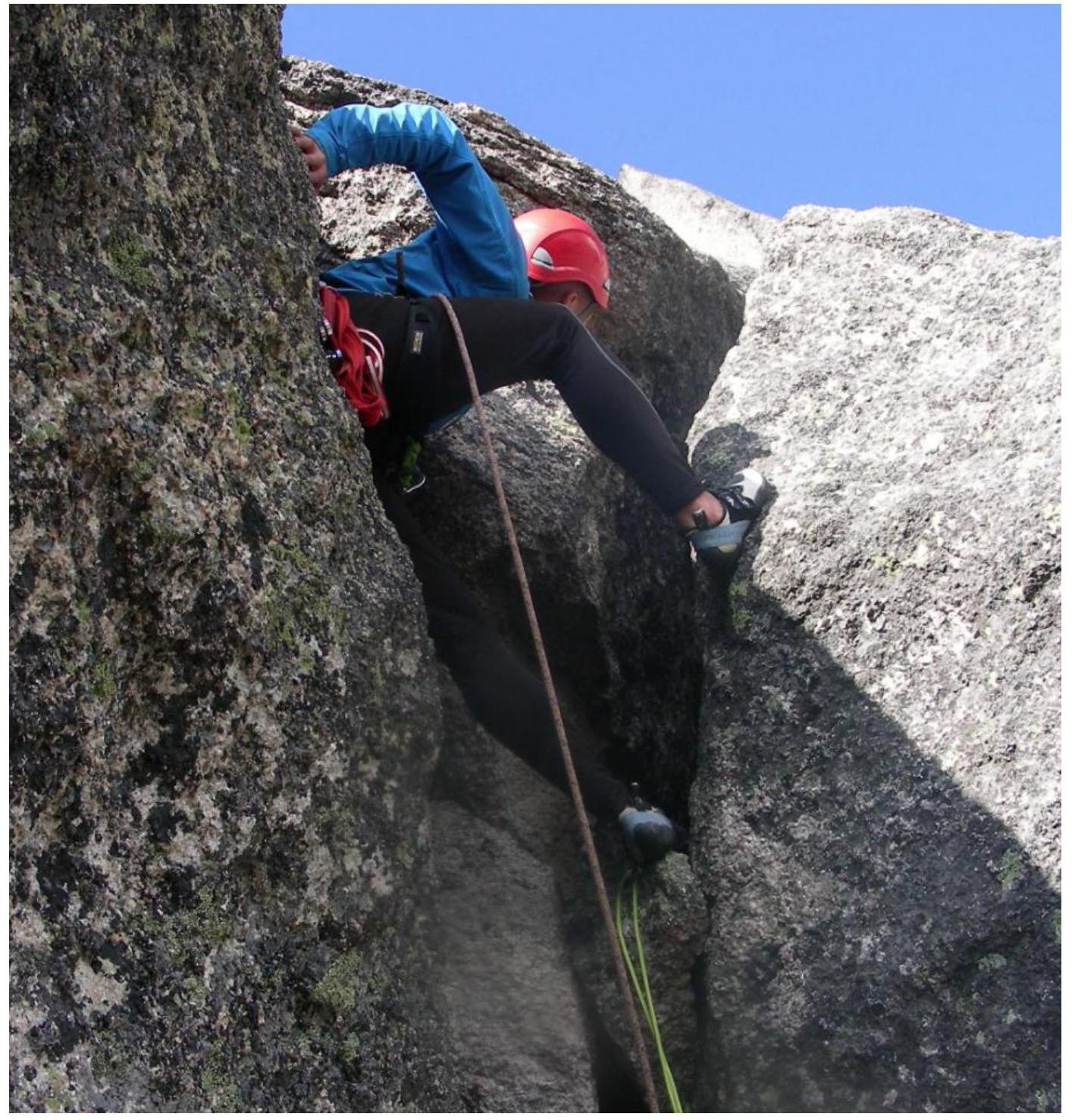
R3–R4
- Right along the ledge
- Pass a 2.5-meter bulge
- Exit onto a weakly inclined rocky ledge
- Organize protection for the next section
R4–R5
- Uncomfortable crack with a plug
- Exit onto the edge (to the right of the overhanging rock)
- Then along the edge for 30 m to a ledge
- Climb in climbing shoes
- Loose rocks
- Little relief for intermediate protection
R5–R6
- Series of internal corners separated by convenient ledges in the direction of the summit
- Exit onto the summit through a small "plug"
Descent via the classic route – 2A category of difficulty, Boyarskoy T., or 2 rappels of 50 m, then on foot.
Technical photo of the route:
- Start of the route. R0–R1:
- R1 towards R2:
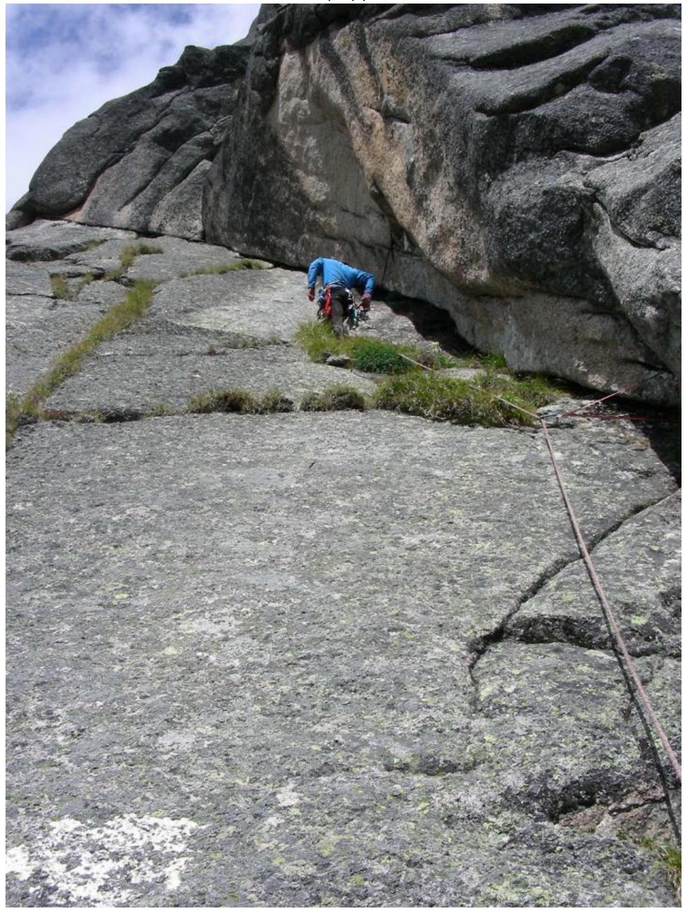
- Start of section R2–R3:
- Start of section R4:
- Edge R4–R5:
- R5–R6: