
6.2 Western Sayan Koshurnikova 2300 m, 1B category, From the ridge Zhigalov A.V. March 17, 2013
Climbing Passport
- Type of climb — combined
- Region — Western Sayan, Borus ridge
- Peak Koshurnikova, 2300 m, From the ridge
- Proposed — 1B first ascent
- Route characteristics:
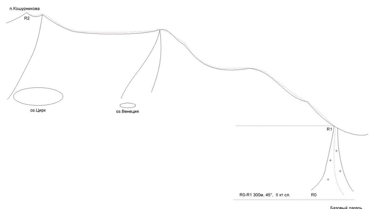
- height difference — 950 m
- total length 1700 m
- length of sections: 2nd category complexity — 100 m
- average steepness before reaching the ridge — 45°.
6. Equipment used on the route:
- placed elements — 0
- anchor pitons — 0
- including on ITO — 0
- left behind — 0.
- Number of walking hours — 3
- Team composition:
- Leader: Zhigalov Aleksandr Vladimirovich — Candidate Master of Sports
- Participant: Shevchenko Grigoriy Sergeevich — 1st class rank
9. Departure date:
- On the route March 17, 2013, 7:00
- Summit 10:00
- Return 11:15
10. Team coaches:
Zakharov Nikolay Nikolaevich, Balezin Valeriy Viktorovich
- Organized by:
- Krasnoyarsk city federation of mountaineering, within the framework of training camps
- "Borus 2013".
General photo
of the route 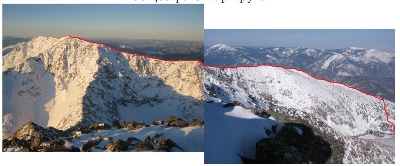
UIAA Scheme
Route Description
Approach along the trail to Pelekhov stream, from Cheremushki settlement takes about 3 hours. There are equipped campsites for tents in the forest zone — base camp.
The route starts from the base camp, moving west through a small section of forest, then ascent along a snowy couloir about 300 m, 45°, 2B category complexity, exit to the northern ridge of Koshurnikova peak.
Then movement along the ridge, with a gradual gain in height. About 650 m, height difference 300 m. Exit to the first "false" summit.
From the summit, a small descent, again movement along the ridge towards Koshurnikova. It is recommended:
- Move along the right part of the ridge, on rocks
- Avoid the left part of the ridge, where large snow cornices overhang
- Consider the high probability of cornice collapse
Exit to the second "false" summit, named Monkada peak. There is a plaque with data on the height and name of the summit.
Height difference about 130 m.
From Monkada, the cross installed on Koshurnikova summit is already visible.
Distance about 300 m, height difference — 150 m.
Descent along the ascent path. This is a classic descent from Koshurnikova summit.
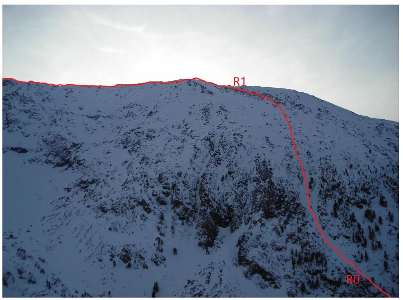
Section R0–R1. View from the
plateau. 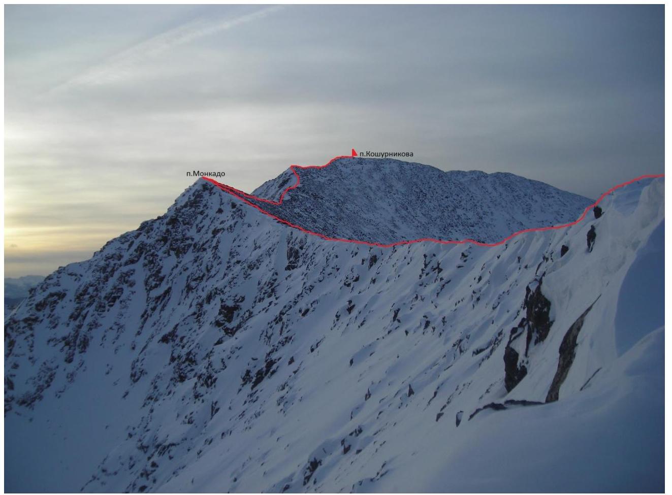
Section
R1–R2 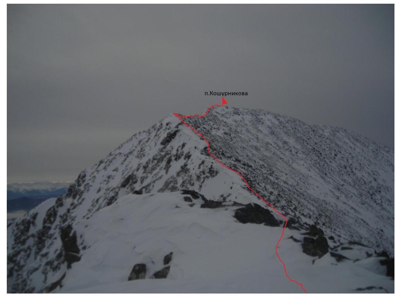
Pre-summit ridge. View from
Moncada. 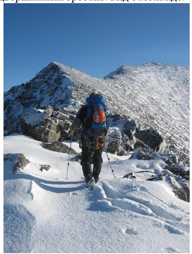
Movement along the
R1–R2 section 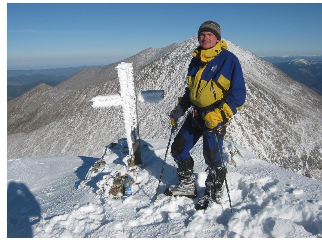
Koshurnikova summit
Comments
Sign in to leave a comment