Ascent Passport
- Ascent class — rock climbing
- Region — Western Sayan, Ergaki ridge
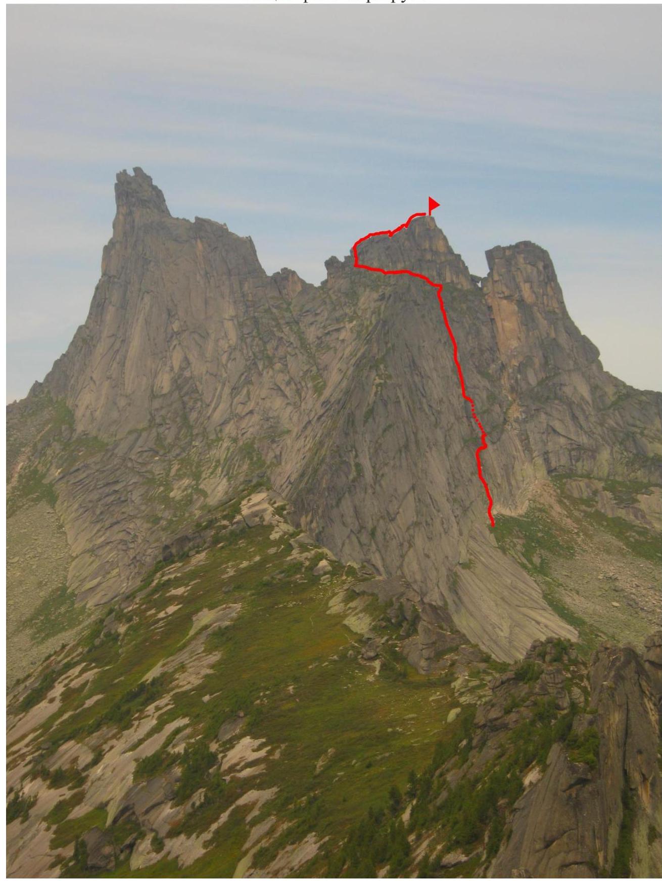
- Pik Vostochny Zvezdny, 2190 m via the center of the Eastern wall
- Proposed category — 4A first ascent
5. Route Characteristics
- Height difference — 280 m
- Total length — 345 m
- Length of sections: 5th cat. diff. – 40 m, 4th cat. diff. – 100 m, 3rd cat. diff. – 175 m, 2nd cat. diff. – 50 m
- Average steepness of the entire route — 60°
6. Equipment Used on the Route
- Placed protection — 27
- Pitons — 7
- including on ITO — 0
- Left behind — 0
7. Total Climbing Time — 11 hours
8. Team Composition
- Leader: Zhigalov Alexander Vladimirovich — 1st sports category
- Participant: Prokhorchuk Maxim Viktorovich — 1st sports category
9. Dates
- Departure on the route: August 10, 2012, 5:30 AM
- Summit: 2:10 PM
- Return: 4:30 PM
10. Organized by
Krasnoyarsk City Alpine Federation, as part of the "Sayanskaya Vertikal" Ergaki 2012 training camp.
General photo of the route
UIAA Scheme

Route Description
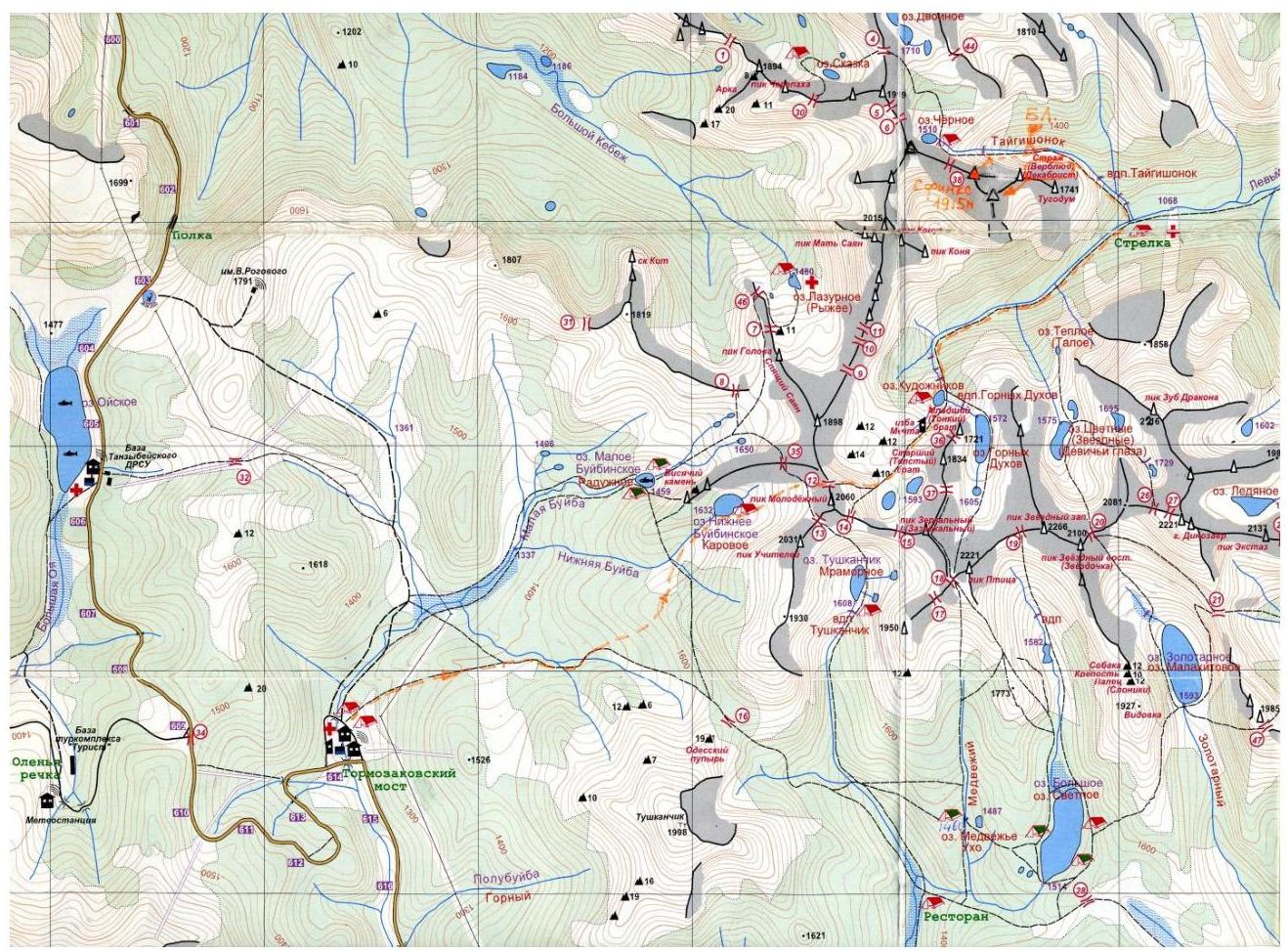
The approach to Svetloe Lake starts from the 622nd kilometer of the Krasnoyarsk — Kyzyl highway, from the bridge over the Tushkanchik River, and takes about 3 hours (approximately 9 km, 400 m elevation gain).
Then:
- From here to Zolotarnye Lake, it takes about 1.5 hours by trail
- From the lake to the foot of the eastern wall of Pik Vostochny Zvezdny, it takes about 40 minutes
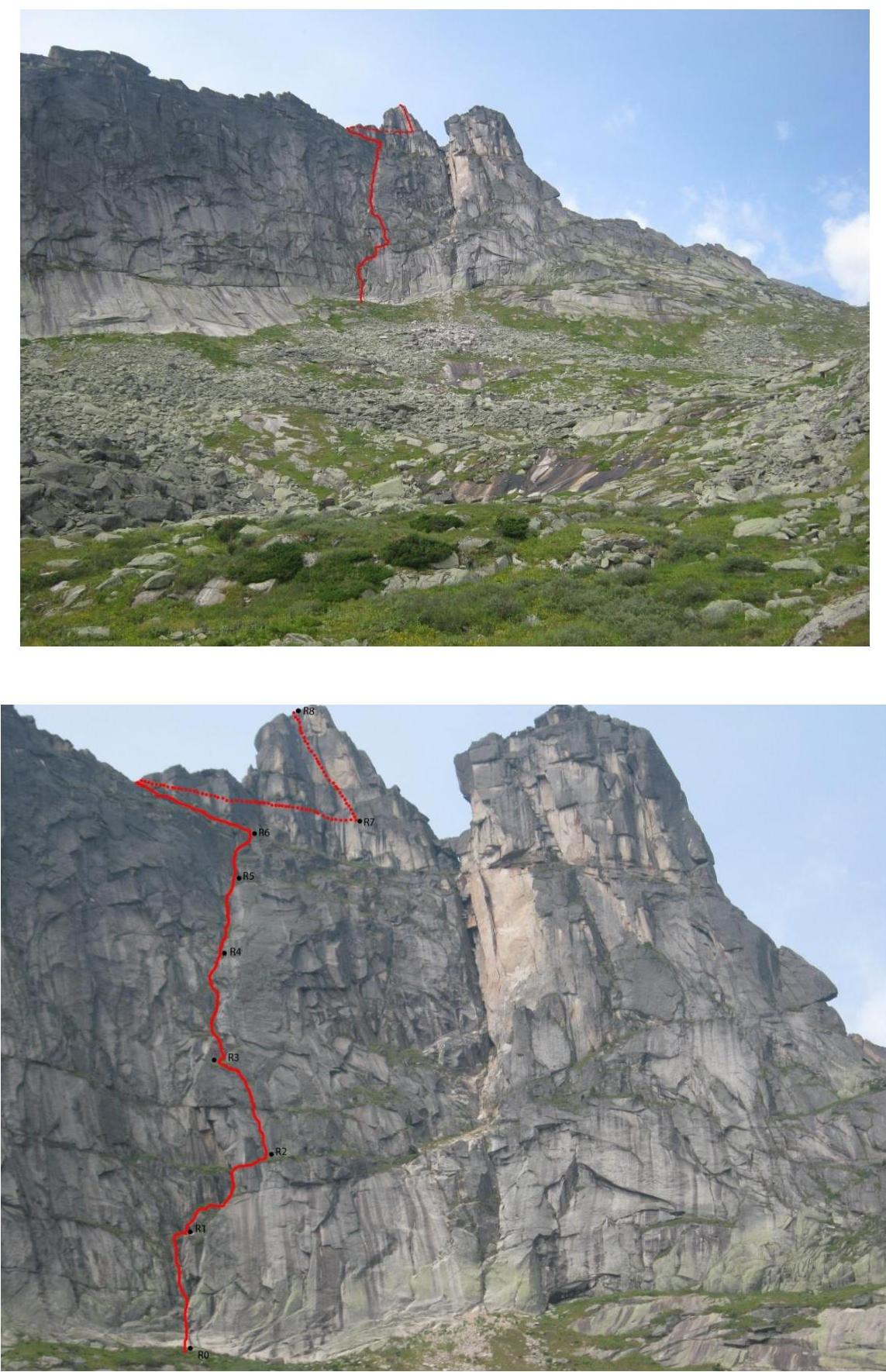
The route begins on a sloping wall without cracks or fissures.
Section R0–R1. 50 m, 70°, 4th cat. diff. A 6-meter sloping wall without relief, climbed using free climbing techniques, on friction. It leads to a wall with diagonal cracks overgrown with grass. To the right of the wall, there is an inner corner with grass. Large cams and pitons were used for protection. The belay station is on a large convenient ledge using eccentric bolts and pitons.
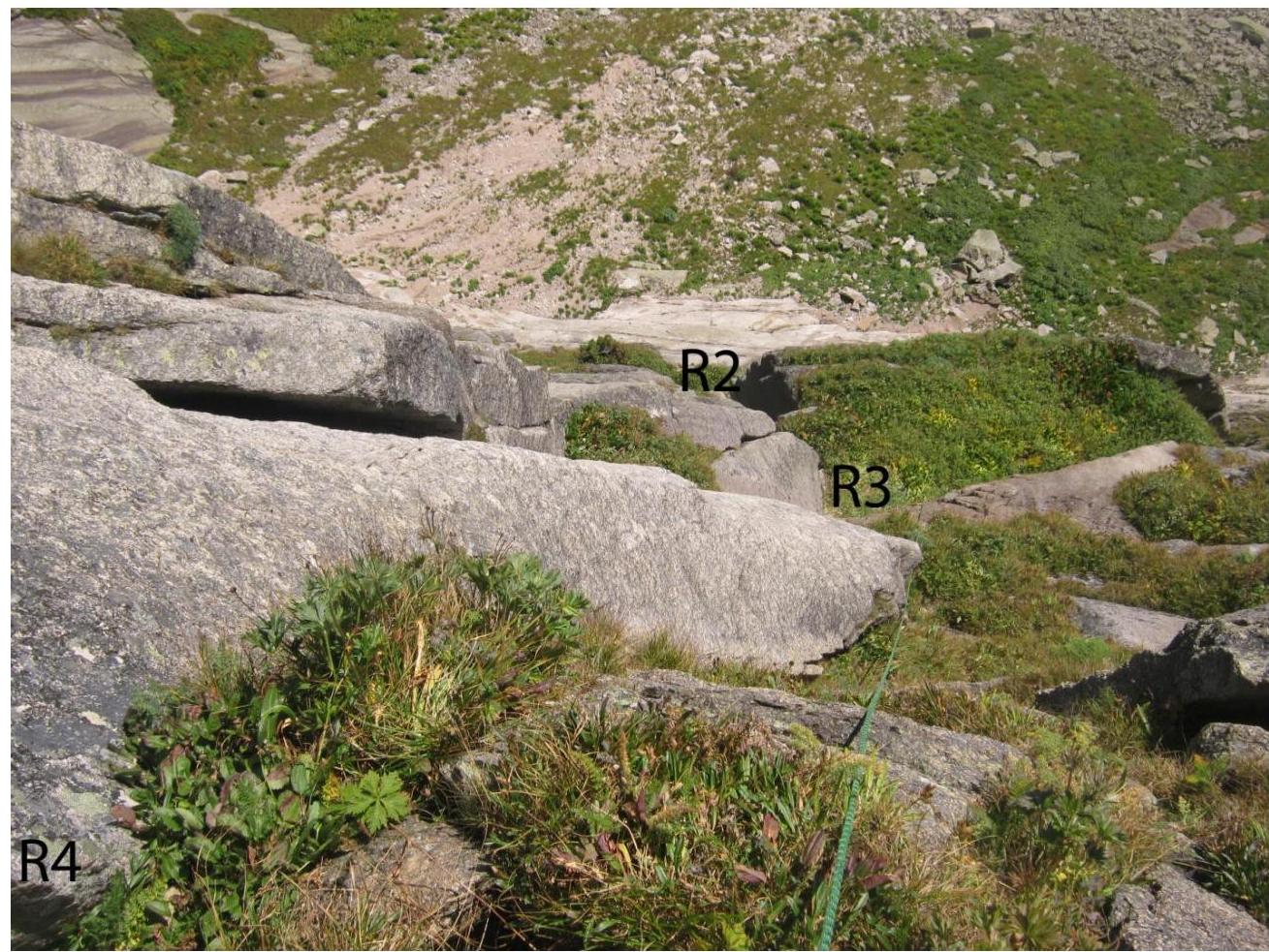
Section R1–R2. 45 m, 60°, 3rd cat. diff. Along the ledge to the right, transitioning to another sloping ledge behind the wall, then through a sloping inner corner overgrown with grass. The corner leads to a 5-meter wall with wide cracks, climbing at 4th cat. diff., leading to a convenient belay ledge. Cams were used for protection. The belay station is behind a "balda" (a type of rock formation).
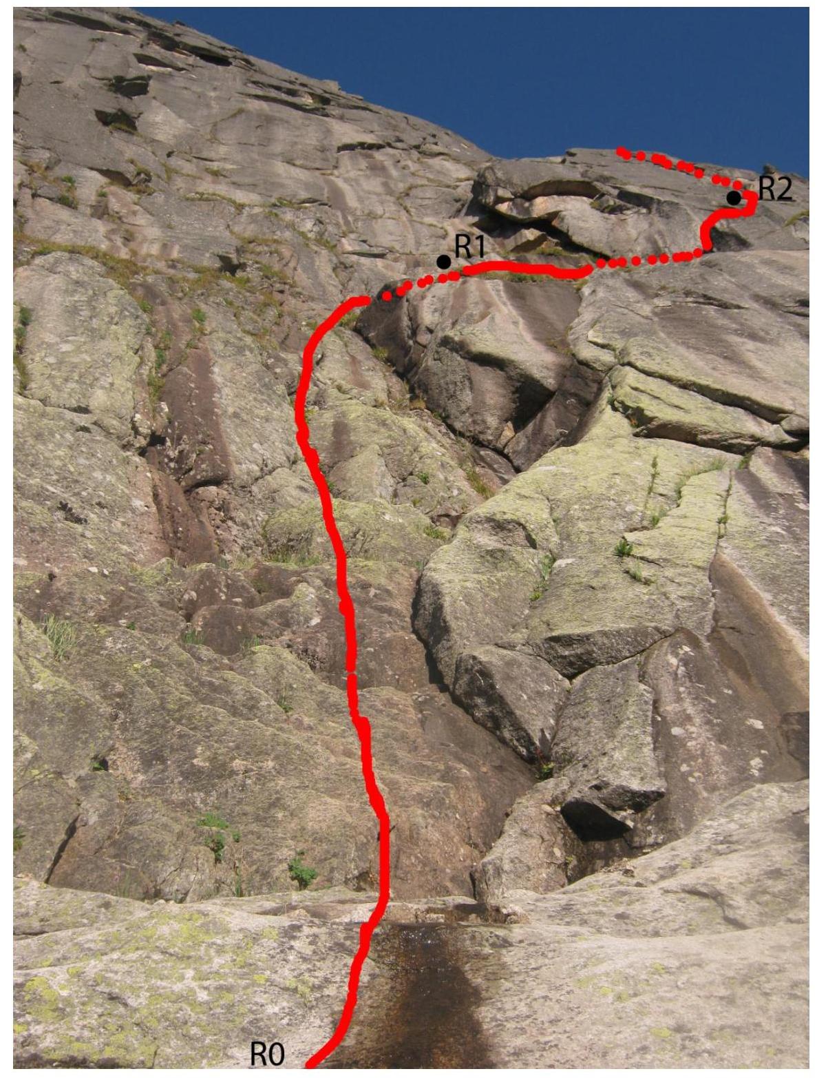
Section R2–R3. 40 m, 80°, 5th cat. diff. The key section of the route. A 7-meter slab leads to a wide chimney that widens towards the top. The chimney is climbed from the bottom, through rocks. It has two large jams and live rocks inside. It leads under a second chimney, climbed in a wide stem. At the exit from the chimney, there is a 1-meter cornice, bypassed on the left. It leads to a large grassy ledge. The belay station is in a crack using cams and medium-sized eccentric bolts. Cams and eccentric bolts were used for protection.
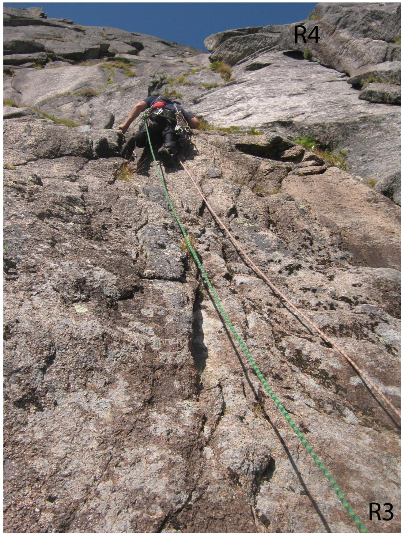
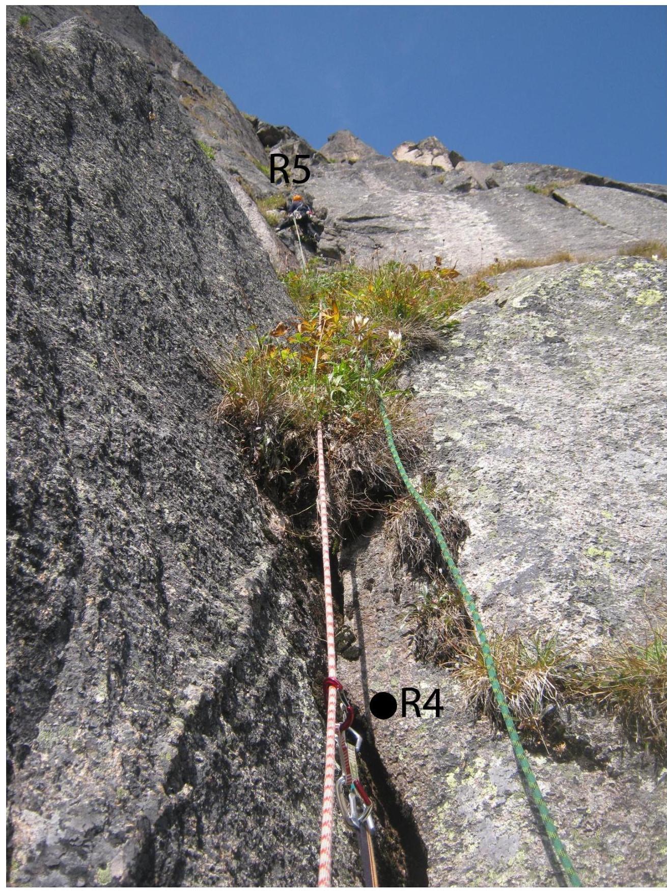
Section R3–R4. 50 m, 70°, 4+ cat. diff. An inner corner with grass, climbing at 4th cat. diff., leads to a steeper inner corner, ending with a small cornice bypassed on the right (85°, 5th cat. diff.). It leads to a sloping ledge. The belay station is semi-hanging using cams and stoppers. Cams and pitons were used for protection.
Section R4–R5. 50 m, 60°, 3rd cat. diff. Alternating between inner corners and sloping ledges overgrown with grass. Easy climbing ends on a sloping ledge; the belay station is semi-hanging using cams and eccentric bolts. Cams and pitons were used for protection.
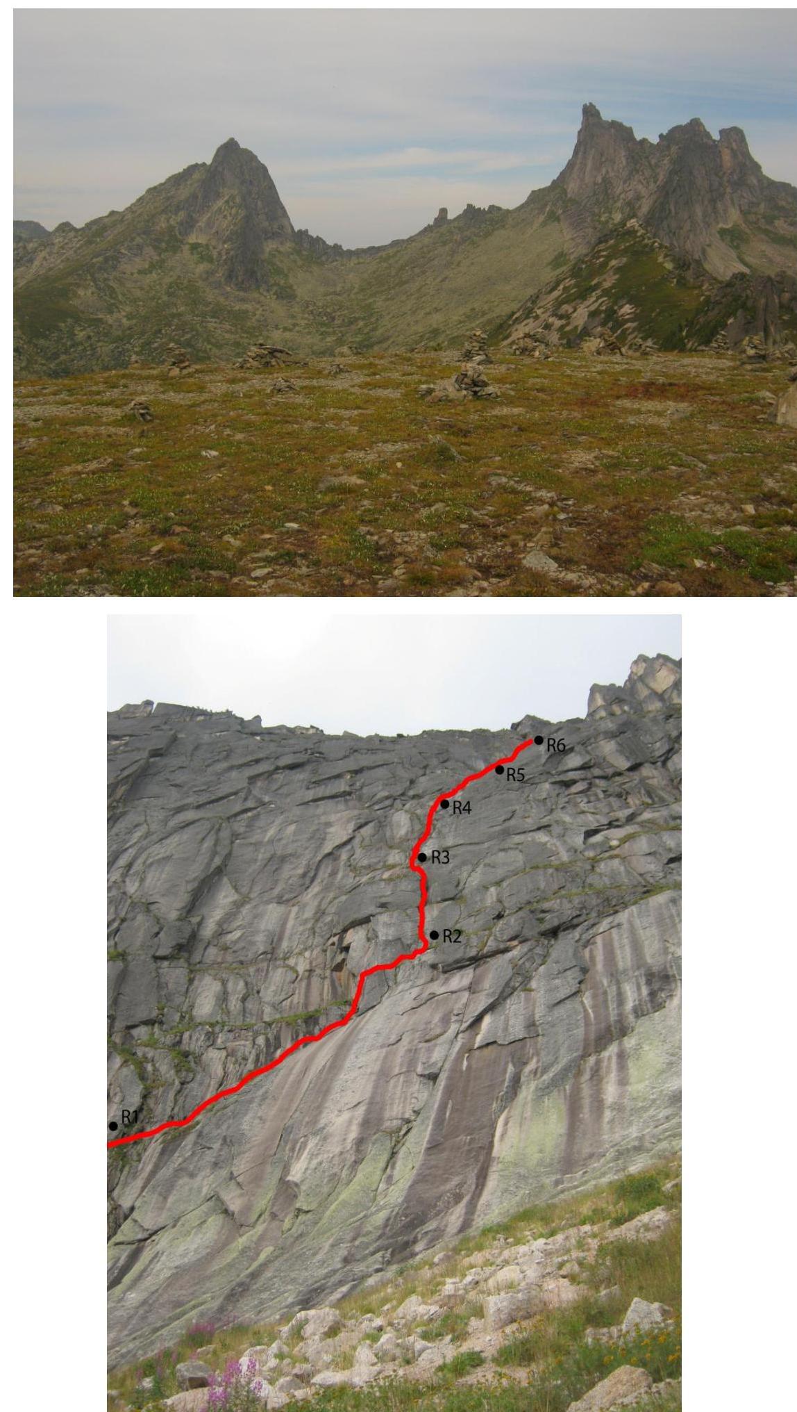
Section R5–R6. 30 m, 70°, 3+ cat. diff. A steep inner corner (70°, 10 m) at 4th cat. diff. leads to a ledge, then another inner corner overgrown with grass leads to a large pre-summit ledge.
- A convenient belay station behind a large rock
- Cams and pitons were used for protection
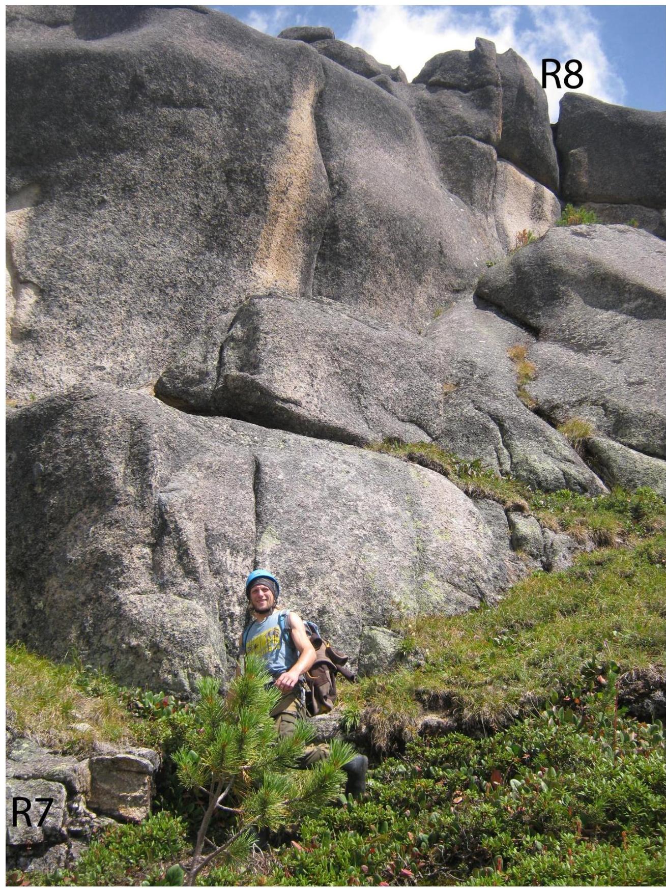
Section R6–R7. 50 m, 20°, 2nd cat. diff. Along the large pre-summit ledge, move left around the ridge to the southern side of the summit. On the southern side, about 25 meters of easy scrambling. Alternate or simultaneous protection using natural features. It leads under a chimney on the 3A cat. diff. route along the Western ridge.
Section R7–R8. 50 m, 50°, 3rd cat. diff. The chimney is climbed in a wide stem, then exit to the ridge and easy climbing with alternate protection using natural features to the summit.
The route can be climbed using free climbing techniques with a climbing level of 6B.
Descent is via the Western ridge, 3A category.
R0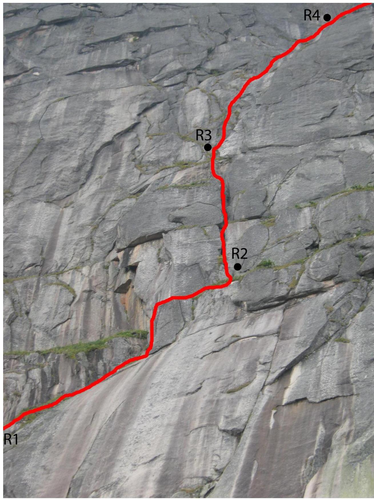 R1
R1
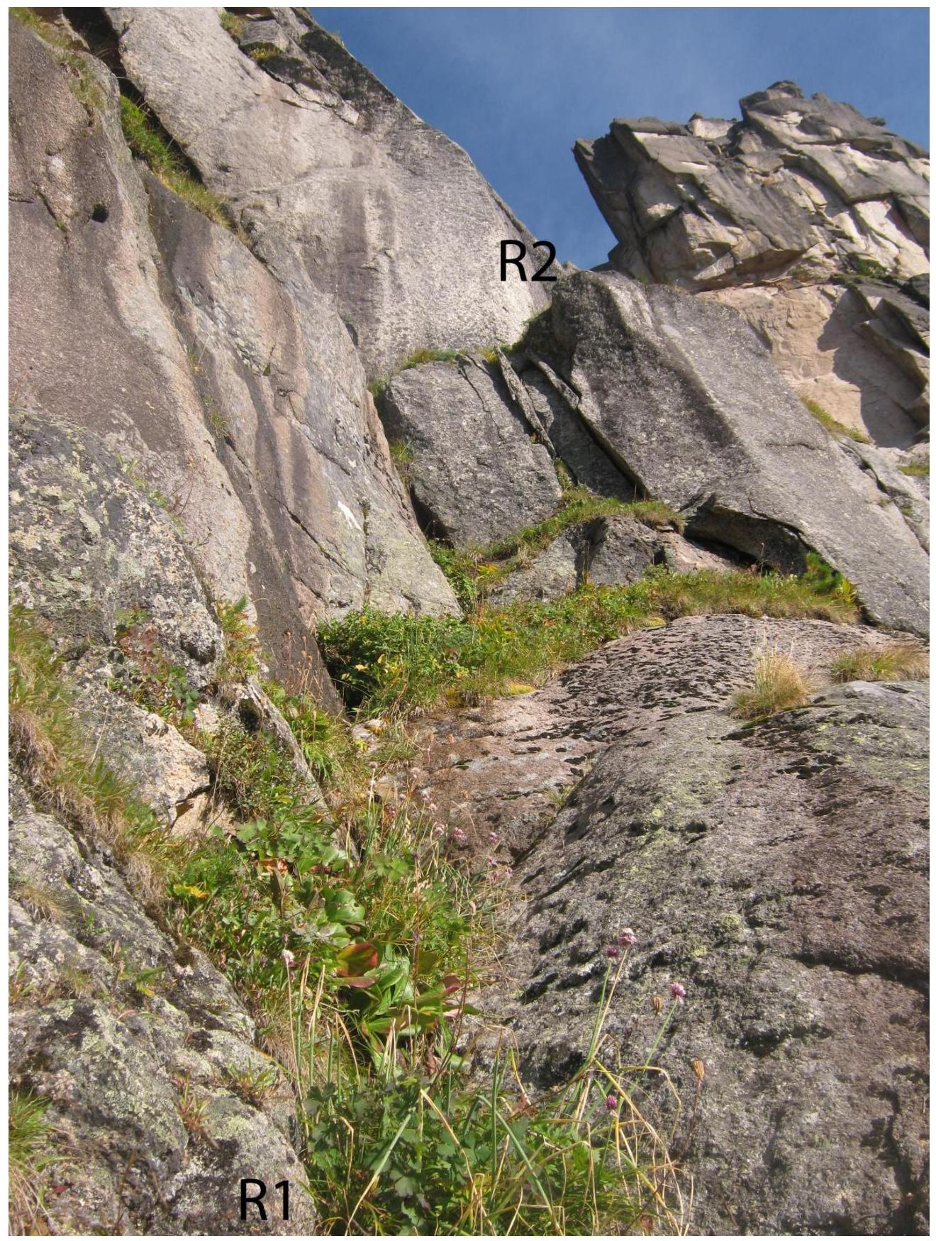
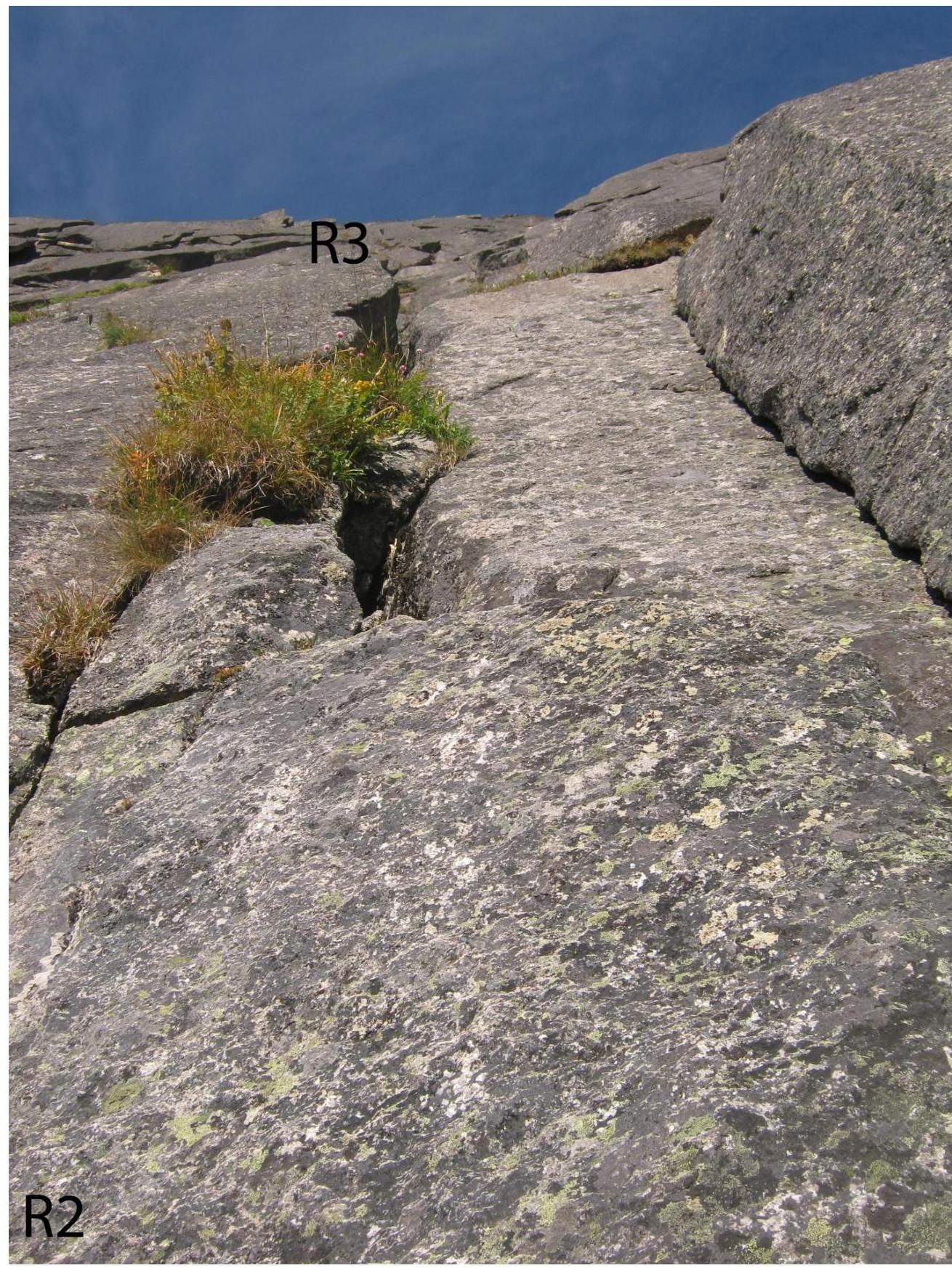
R2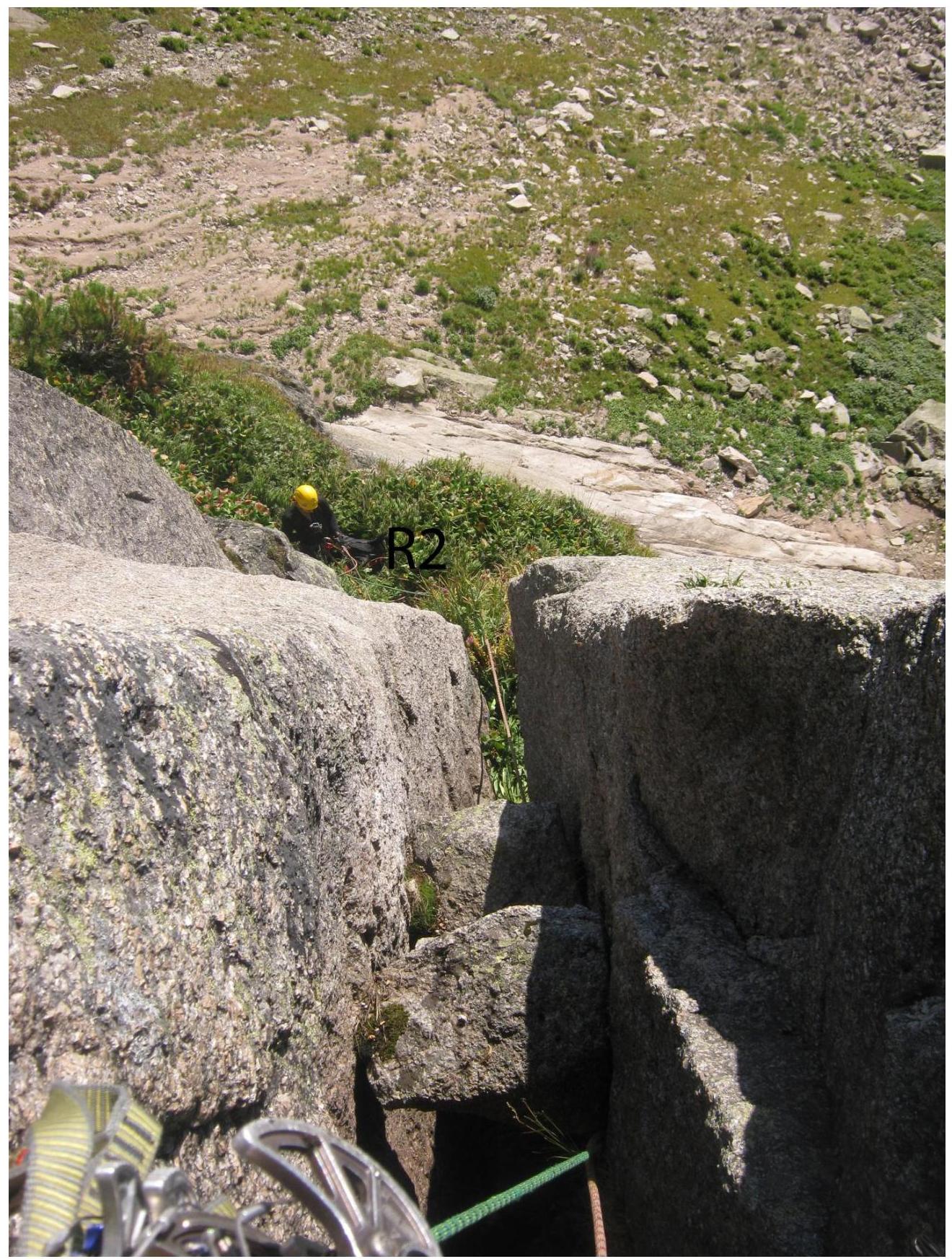
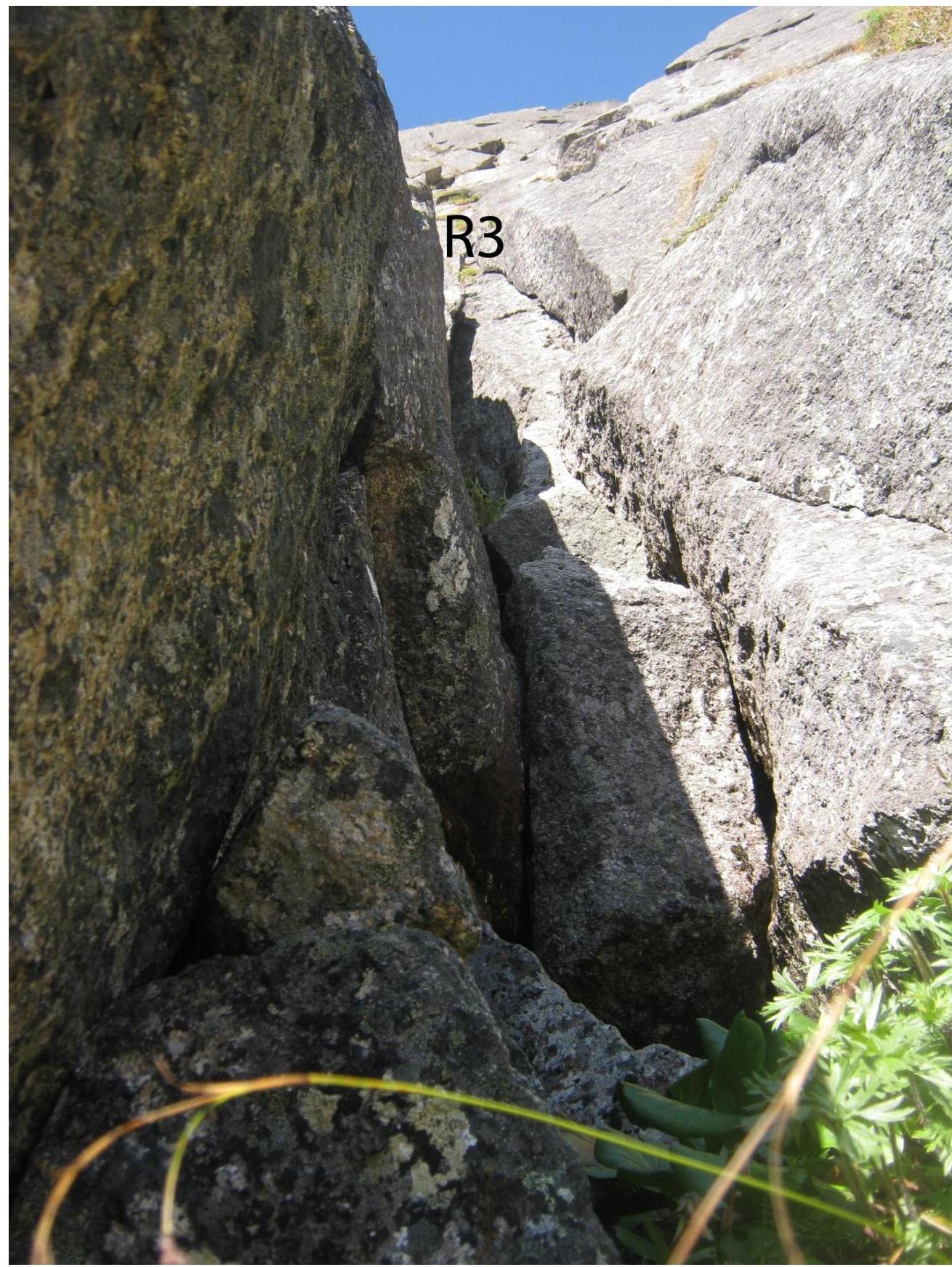
 R3
R3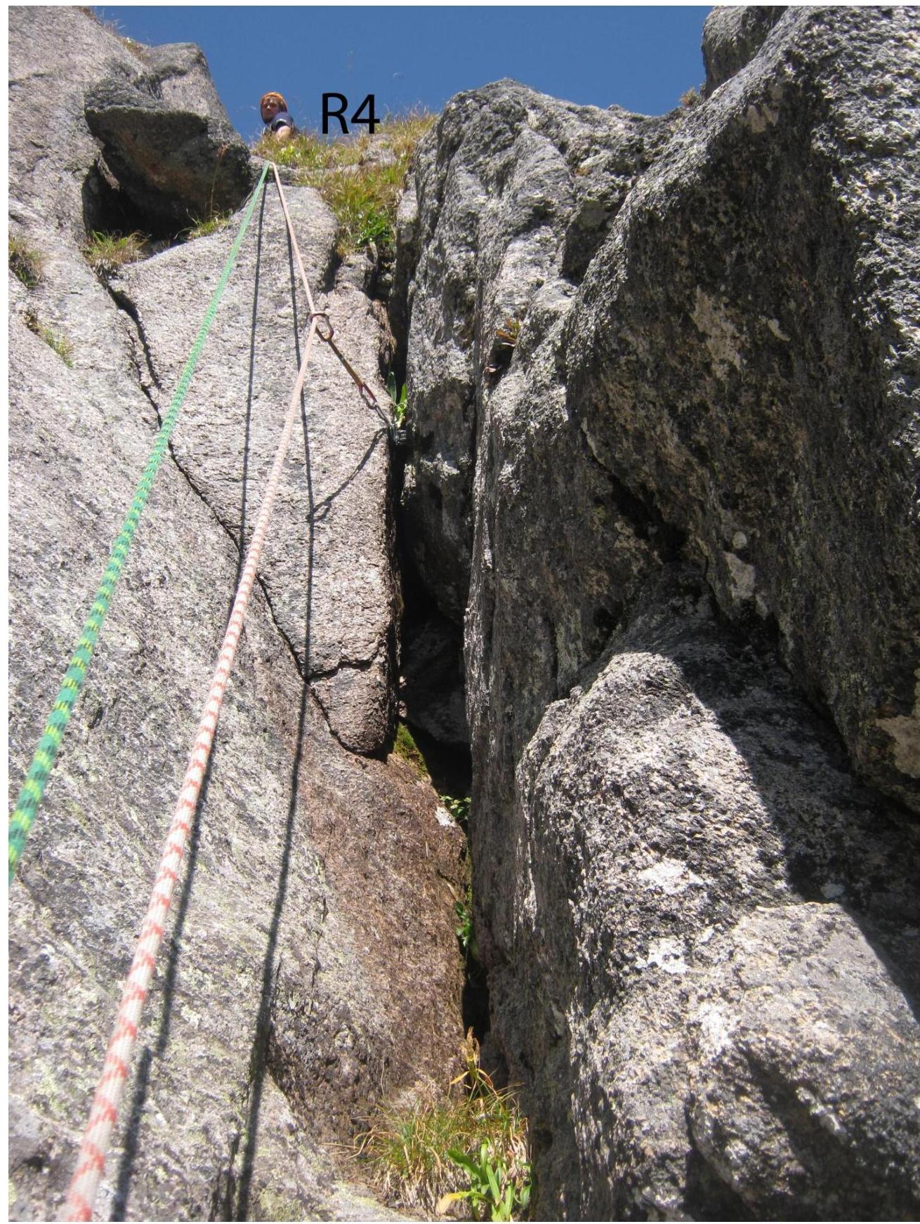
R4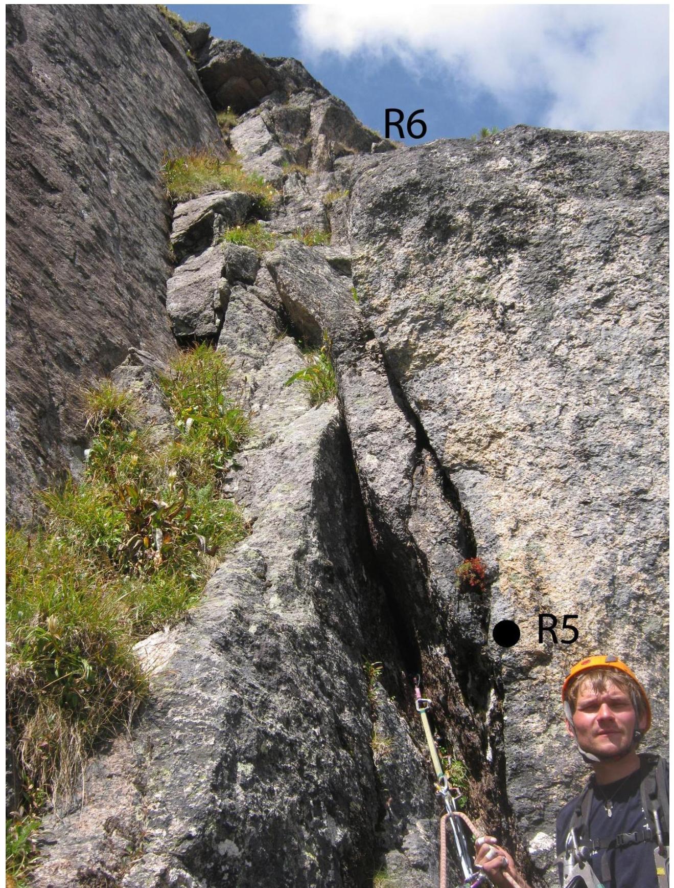

Map of the region
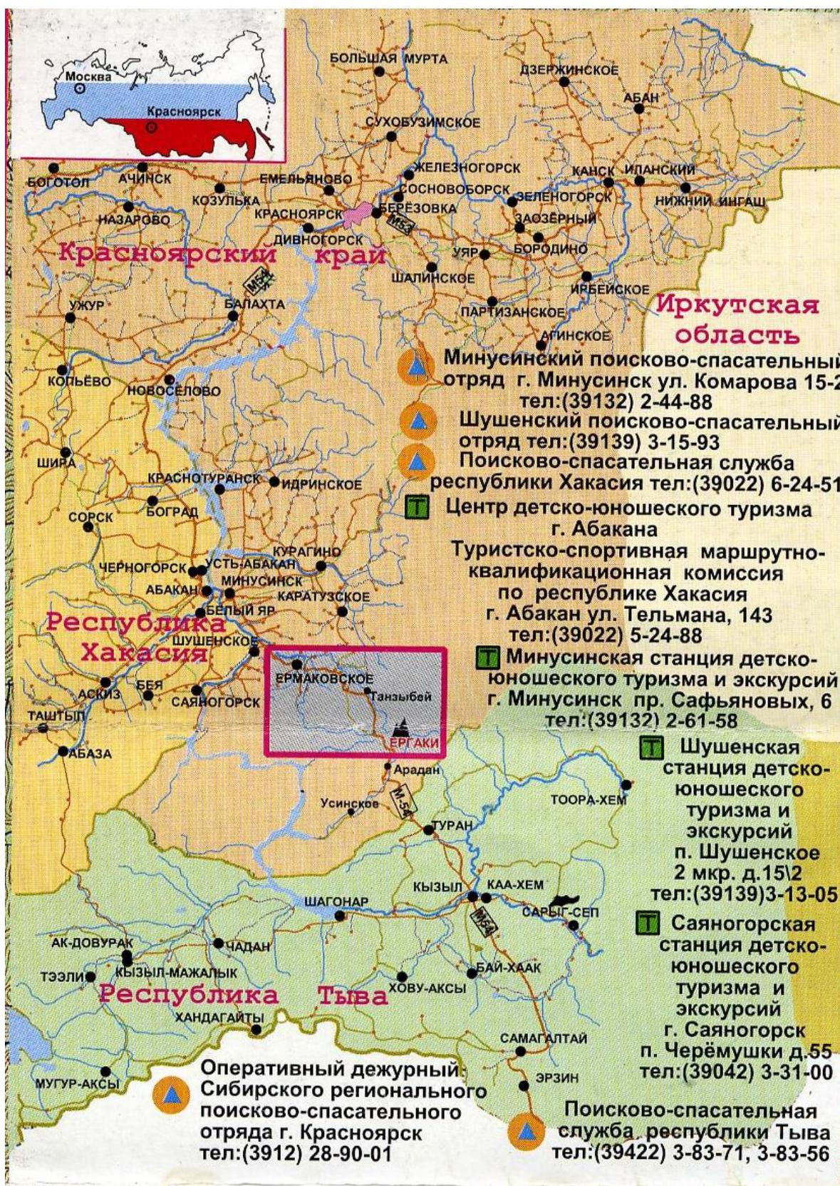
Contact Information
- Minusinsk Youth Tourism and Excursions Station, Minusinsk, Safyanov Street, 6, phone: (39132) 2-61-58
- Shushenskoye Youth Tourism and Excursions Station, Shushenskoye settlement, 2nd microdistrict, 15/2, phone: (39139) 3-13-05
- Sayano-Shushenskoye Youth Tourism and Excursions Station, Sayansk, Cheremushki settlement, 55, phone: (39042) 3-31-00
- Search and Rescue Service of the Republic of Tyva, phone: (39422) 3-83-71, 3-83-56
About the Region
The Sayan mountain system is located in southern Siberia, northeast of Altai, and west of Lake Baikal. The Sayan Mountains are divided into two separate mountain systems — the Eastern Sayan and the Western Sayan. The Ergaki mountain range is the central part of the Western Sayan. Alpine-type ridges are elevated on average more than 2000 meters. They are characterized by jagged forms with high peaks or saw-tooth outlines. The local peaks are sharp, difficult to access granite peaks. Rock formations resemble fingers pointing upwards. The name "Ergaki" is translated from ancient Turkic as "fingers".
Ergaki is the most visited part of the Western Sayan, a tourist center in the south of the Krasnoyarsk region. This is due to its transport accessibility, variety of tourist routes, and the beauty of the mountains in the area.
Ergaki is an excellent training ground for mountaineering and rock climbing. The rock climbing area is very similar to the famous Yosemite National Park in the USA — in terms of landscape and the possibility of extreme climbing. The rocks here are solid, steep, and sometimes overhanging, with no ice. Monolithic granite walls up to 600 meters high pose a serious challenge to ambitious athletes. In winter, climbing is complicated by temperatures as low as -40°C, and in summer, by frequent rains. Approaches to the rocks are short: within 3-4 hours, an athlete can approach the nearest walls from the highway.
Tourists began to appear in Ergaki in the mid-20th century. At that time, the peaks, passes, and lakes received their names. In the 1970s, the first ascents were made on the simplest routes to the main peaks. The most significant mountaineering development began in the 1990s.