Ascent Passport
- Ascent class — rock climbing.
- Ascent area: Western Sayan, Ergaki ridge.
- Peak Zvezdny Vostochny 2100 m from Piquantny pass.
- Proposed category of difficulty — 3B.
- Height difference 110 m, route length 450 m, average slope 35°.
- 18 (0) fixed protection elements used on the route.
- Number of climbing hours — seven.
- No overnight stays on the route.
- Group composition:
Vasiliev Vladimir Vladimirovich — leader, 2nd sports category. Borisova Yulia Vladimirovna — 2nd sports category. Litvinov Andrei Dmitrievich — 2nd sports category. Pugovkin Anton Nikolaevich — 2nd sports category.
-
Coach — Lebedev Vladimir Alexandrovich.
-
Departure on the route — June 27, 1997. Return — June 27, 1997.
-
Organization — Krasnoyarsk "Travelers' Center"
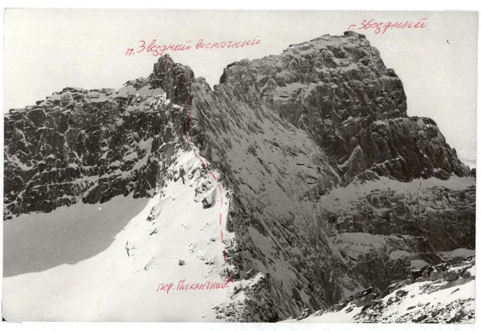
General view of the route (photograph taken in winter) 
2265 m 
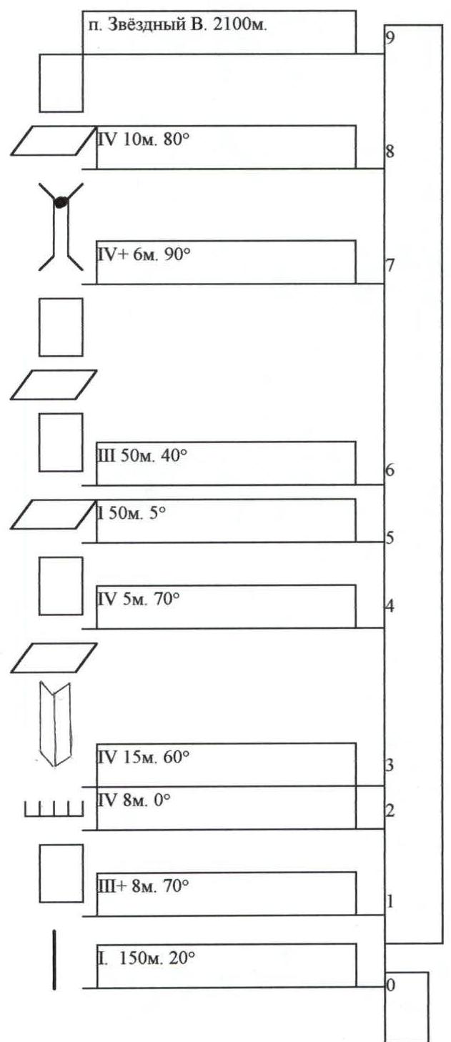
UIAA Scheme
Description of the approach to the route. Departure from the base camp located on Svetloe lake, at 6:00 am from the eastern side of the lake. The trail goes to the eastern ridge of p. Zvezdny Vostochny. Cross the ridge and descend to Zolotarnoe lake, walk along the lake and up the stream flowing into the western part of the lake to Piquantny pass. The path from Svetloe lake to Piquantny pass takes 1.5–2 hours.
Route description. R0–R1: 150 m. Along the eastern side of the ridge to a gendarme with a cornice. Tie in before the gendarme. R1–R2: Monolithic wall 8 m. With vertical cracks for protection. Approach under the left part of the cornice along the wall. R2–R3: Traverse under the cornice 8 m. Under the cornice, there is a convenient crack for hands 5–10 cm. R4–R3: To the right of the cornice, there is a 15-meter inner corner, with ice in places. At the end of the corner, climb left onto a ledge and set up a belay. R4–R5: "Spool" 5 m. No cracks, but with a rectangular ledge 10 × 15 cm in the middle, on which a ladder can be hung. R5–R6: Ledge 50 m. Along it, reach the lowering in the ridge, where a large stone is jammed below. R6–R7: Climb onto the stone jammed in the crack and up alternating low walls (3–4 m) and ledges to a chimney in the upper part of the ridge, set up a belay there. R7–R8: Chimney 6 m, with stones jammed at the top that may fall out. The chimney leads to a small ledge. R8–R9: From the ledge, move along the wall 3–4 m and up a vertical crack 4–5 m about 10 m, which leads to the summit. Descent from the summit via 2A from the western side.
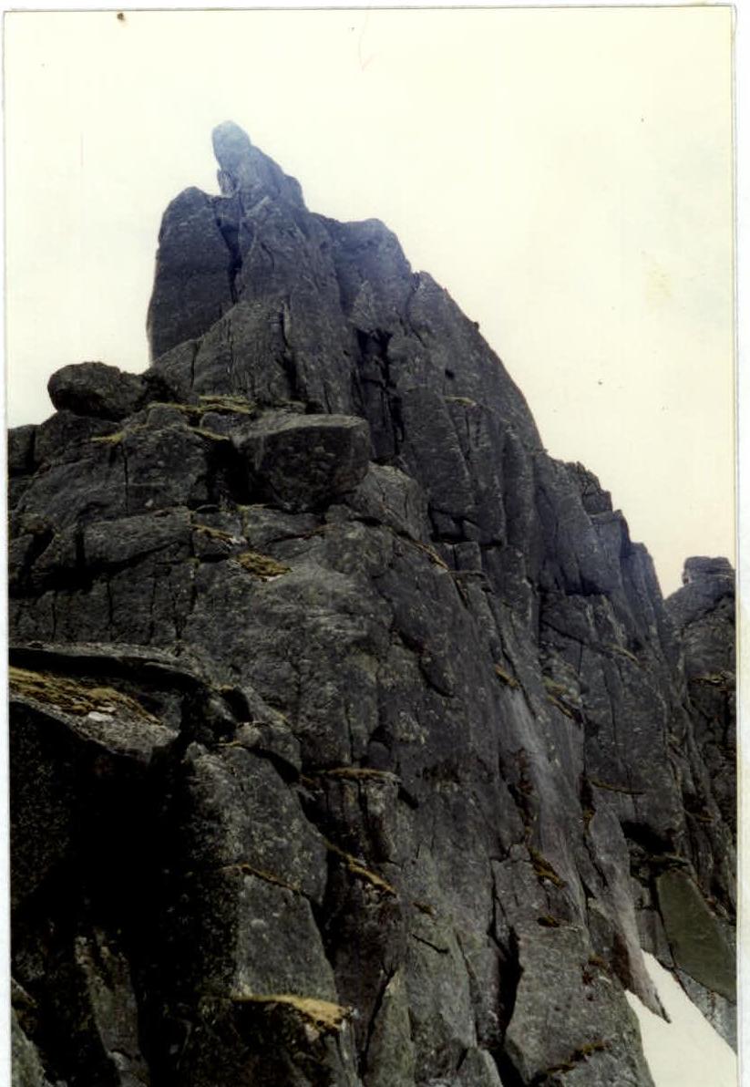
Route scheme (winter photo) 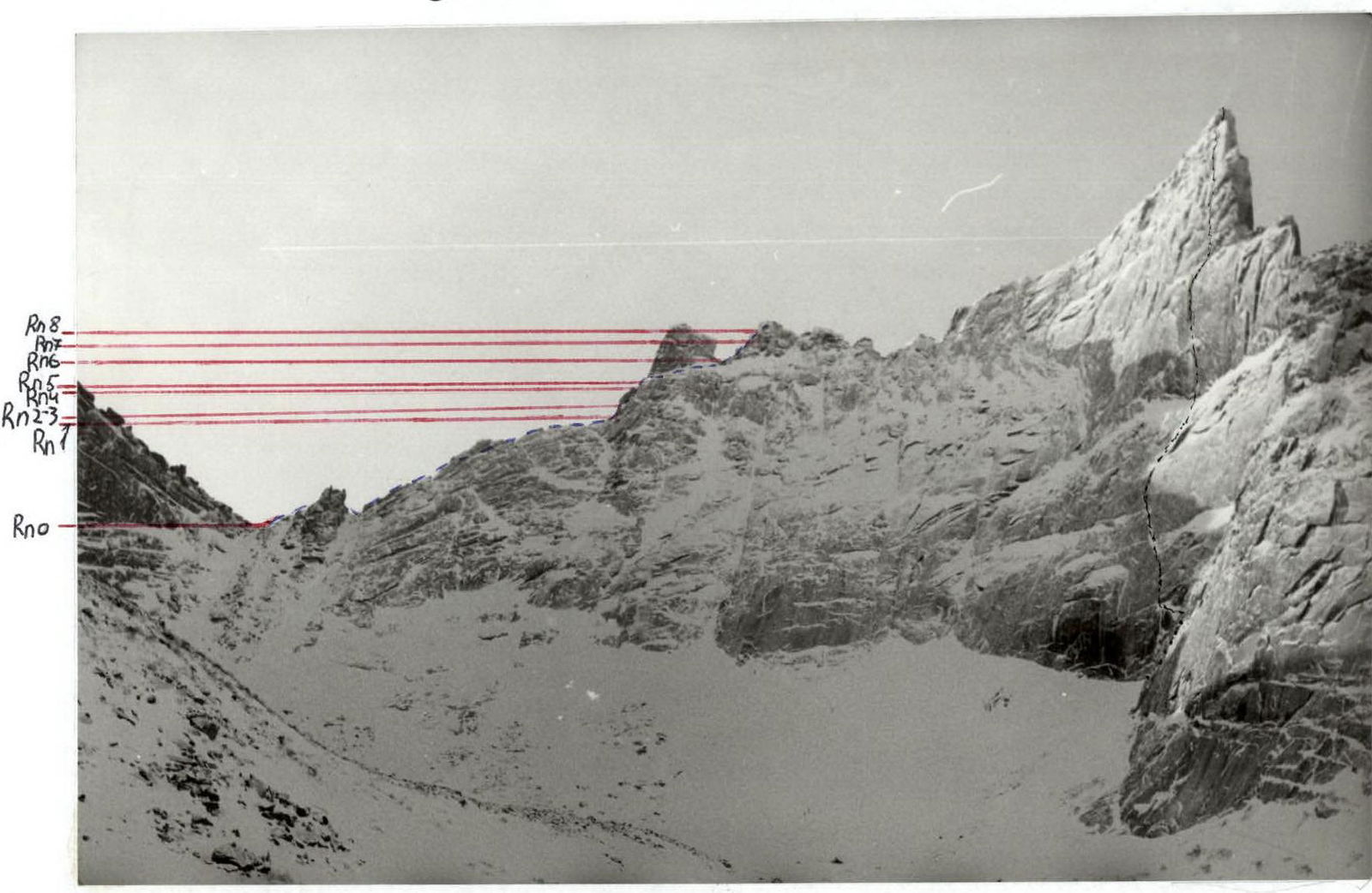 Section of the route R1–3
 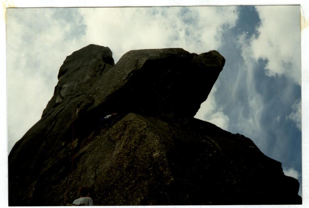 Section of the route R6–9