Ascent Passport
- Ascent category — combined
- Region — Western Sayan, Borus ridge
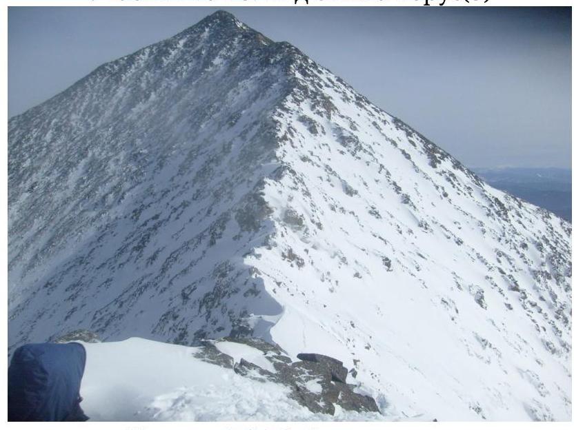
- Peak Borus, 2318 m, via 3rd ridge, through Borus (3)
- Proposed — 2A first ascent
- Route characteristics:
- elevation gain — 600 m.
- total length 1670 m.
- length of sections: 3rd cat. diff. — 50 m, 2nd cat. diff. — 770 m.
6. Equipment used on the route:
- chocks — 4,
- pitons — 5,
- including on ITO — 0,
- left behind — 0.
- Total climbing hours — 3.5
- Team composition:
- Leader: Zhigalov Aleksandr Vladimirovich — CMS (Candidate for Master of Sports)
- Participant: Shevchenko Grigoriy Sergeevich — 1st sports category
9. Team coaches:
- Zakharov Nikolay Nikolaevich
- Balezin Valeriy Viktorovich
10. Departure dates:
- On route March 15, 2013, 8:00
- Summit 11:30
- Return 13:10
-
Organized by: Krasnoyarsk City Alpinism Federation, as part of the training camps “Borus 2013”. General photo of the route
Route Description
Approach along the Pelekhov stream trail, from Cheremushki settlement takes about 3 hours. There are equipped campsites for tents in the forest zone.
Then, the trail goes upstream along the stream, passing:
- — by a small lake Venezia,
- — along the left bank of lake Tsirk,
- to the col between peaks Borus (3) and Koshurnikova.
Section R0–R1 – 170 m, 45°, II cat. diff.
Scree slope with alternating:
- "sheep's foreheads",
- different types of talus.
Approaches the wall.
Section R1–R2 – 100 m, 50°, III cat. diff. Wall with diverse relief, alternating large ledges. Reaches the ridge col. Passed by climbing.
Section R2–R3 – 200 m, 20°, II cat. diff. Exit to the ridge, simultaneous movement along the ridge. There are small walls and gendarmes, which are bypassed from different sides.
Section R3–R4 — 400 m, 30°, II+ cat. diff. Walls with alternating large rocks. Exit to the summit of Western Borus. In some places, movement is necessary along the rope. Stations are organized on large rocks and rock outcrops. Pitons and cams are used for belaying.
Section R4–R5 — 100 m, 30°, I cat. diff. From the summit, descend towards the main peak of Borus along the ridge.
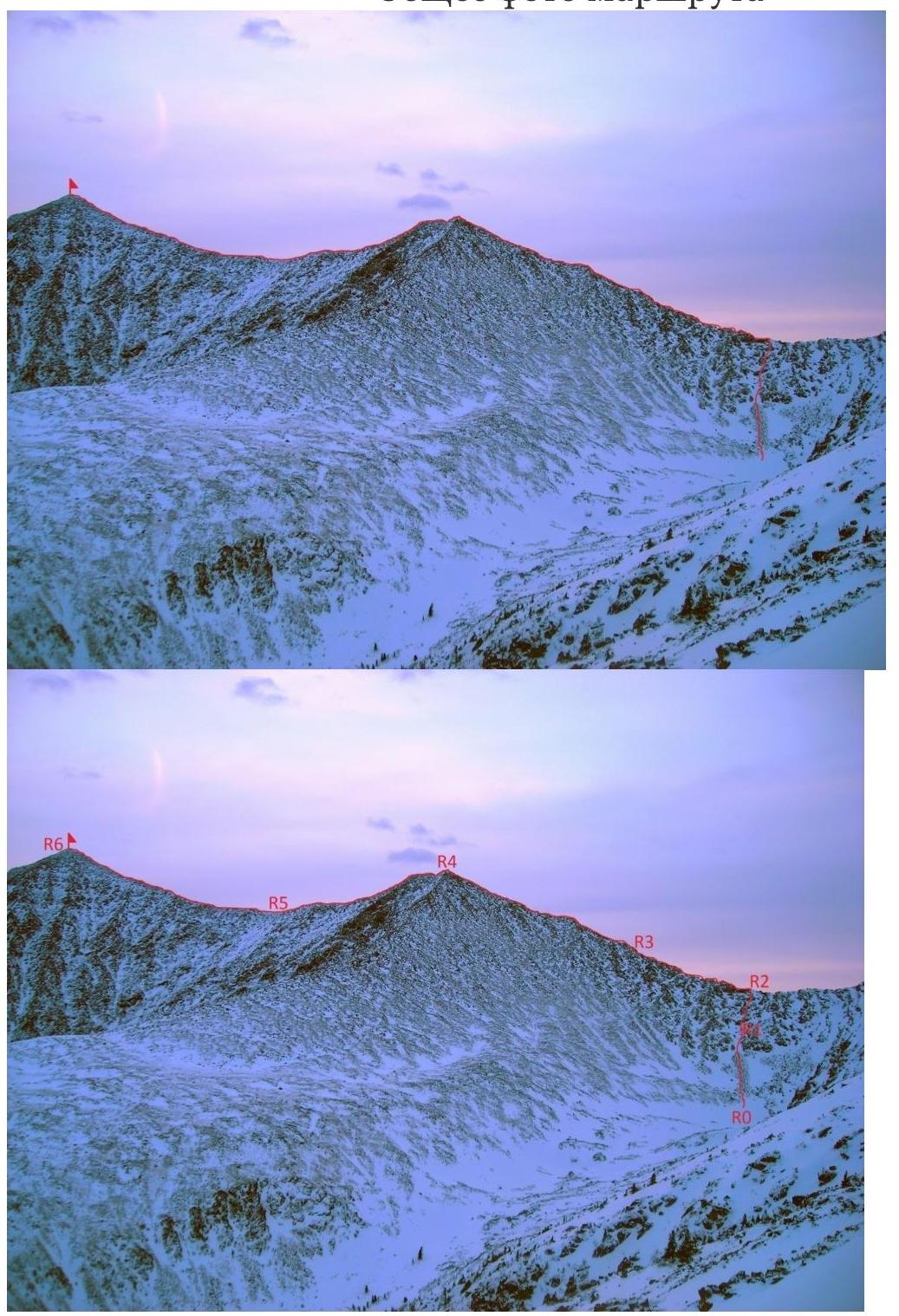
Section R5–R6 — 700 m, 25°, I cat. diff. Ascent to the summit along the ridge. In some places, it's necessary to bypass emerging walls on the right side.
Descent along the Western ridge
1B.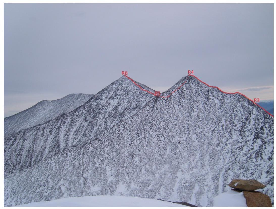
View of the route from
Koshurnikova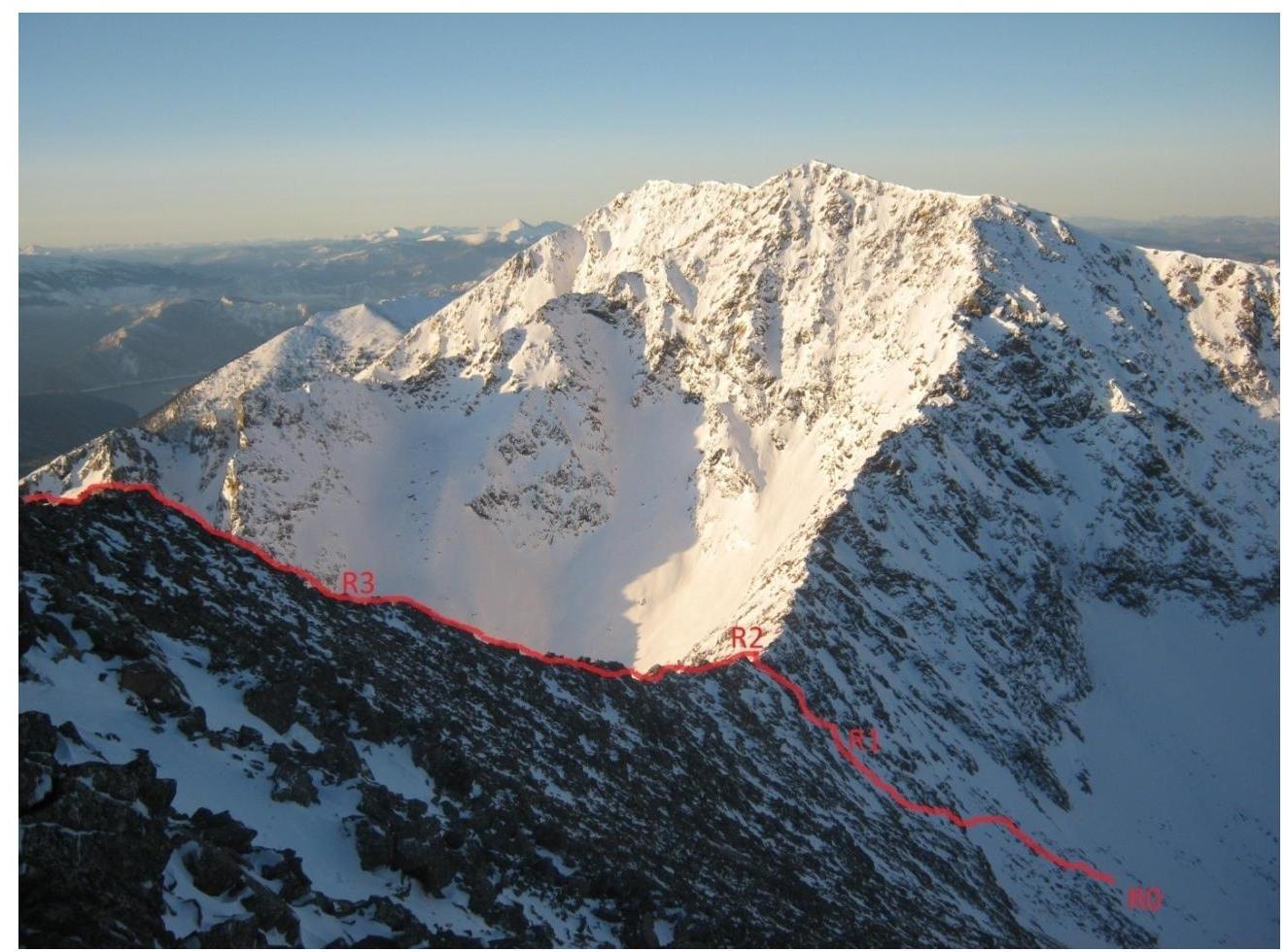
Sections R0–R3. View from peak Borus
(3)
Sections R2–R6. View from the west
- Map of the area