
Ascent record for v. Ospin Golets (Ospin-Ulan-Sar'dak) 3215 m, via the Southern ridge of the Eastern Bastion, category 2B.
-
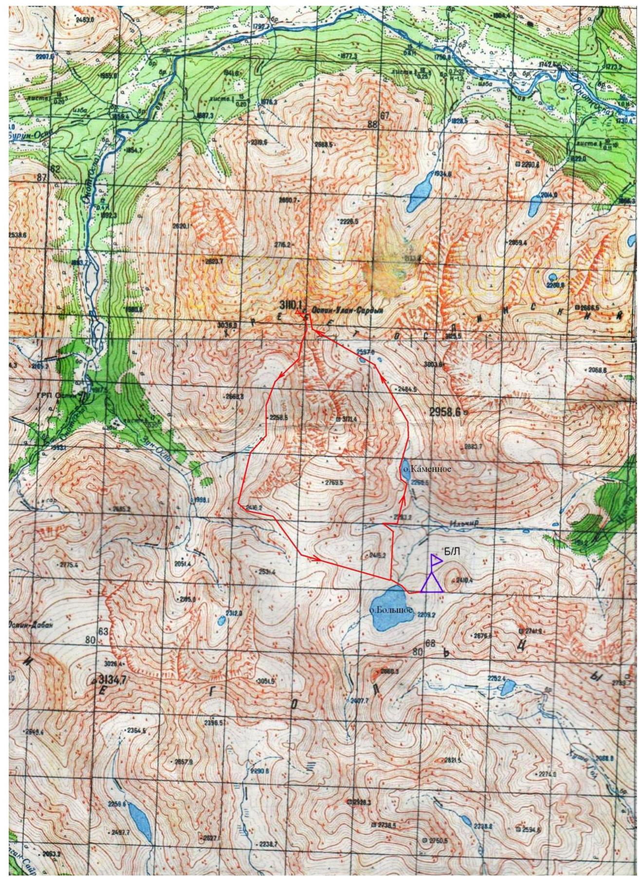
Eastern Sayan, Kitoyskie Goltsy ridge, Ilchir gorge, section 6.1.3.
-
Ospin Golets peak 3215 m, via the Southern ridge.
-
Category 2B, first ascent.
-
The route is rocky.
-
Height difference 315 m, length 560 m, average slope 40°.
-
7 pitons hammered: rock and wired 7 pcs.
-
Team's walking hours — 6 hours.
-
No overnight stays on the route.
-
Group:
Afanasyev A.E. MC Vasiliev M.Yu. 3rd sports category Budim V.V. 3rd sports category Marchukov K.F. 3rd sports category Prokhnitsky D.A. 3rd sports category
-
Coach Afanasyev A.E. MC
-
Ascent to the summit and return on August 20, 2010.
Description of the route to v. Ospin Golets (Ospin-Ulan-Sar'dak) 3215 m, via the Southern ridge of the Eastern Bastion, category 2B.
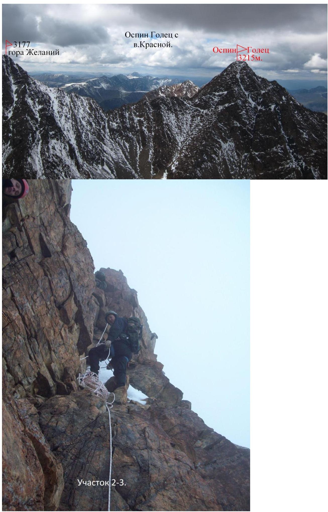
Ospin Golets mountain is the highest point of the Kitoyskie Goltsy ridge. It is located in the northern, highest, spur of the Kitoyskie Goltsy, the Ospin ridge. The Ospin ridge consists of only a few independent peaks with a large height difference and an absolute height of more than 3000 m, located in the watershed between the Onot and Ilchir rivers (right tributary of Onot). The upper Ilchir gorge is a large circus, uniting 3 sources: the right (orographic) one comes from the northern slopes of the Kitoyskie Goltsy and has Lake Bolshoye; the left (orographic) one flows from the southern slopes of the Ospin spur, and it has Lake Skalnoe and a small lake at the very head of the source; and the middle source originates from the eastern slope, above which, under the pass between the Kitoy and Ospin ridges, there is a drainage basin not filled with water. The height of Ospin Golets is indicated differently on different maps. According to QPS, its height corresponds to 3215 m above sea level. The rocks in the area are saturated with colored minerals. Gold and jade are mined in the area.
The approach from the base camp in the gorge along the left (along the way) bank of Skalnoe Lake and further along the sharp weathered stones of the kurumniks and rocks. The approach is tiring and takes 3 hours to the foot of the Eastern Bastion of Ospin Golets.
Further along the southeastern slope 300 m along the height difference from 2600 to 2900. Exit to the southern ridge. The first ascenders on this section got into thick fog.
- R0–R1: 90 m, 35°, 1 — Exit to the southern ridge.
- R1–R2: 30 m, 0°, 1 — Along the shoulder to the ridge's abutment against the rocky bastion. This is the February Pass.
- R2–R3: 120 m, 45°, 2 — Along the internal corners of the rocky bastion.
- R3–R4: 50 m, 55°, 3 — Large-block rocks. Exit to the gendarme.
- R4–R5: 25 m, 2 — Descent to the left of the black rocks of the gendarme's ridge along a 40° snowy slope.
- R5–R6: 25 m, 2 — Traverse along a 40° slope to the left of the ridge. Exit to the ridge. The ridge abuts against the eastern tower.
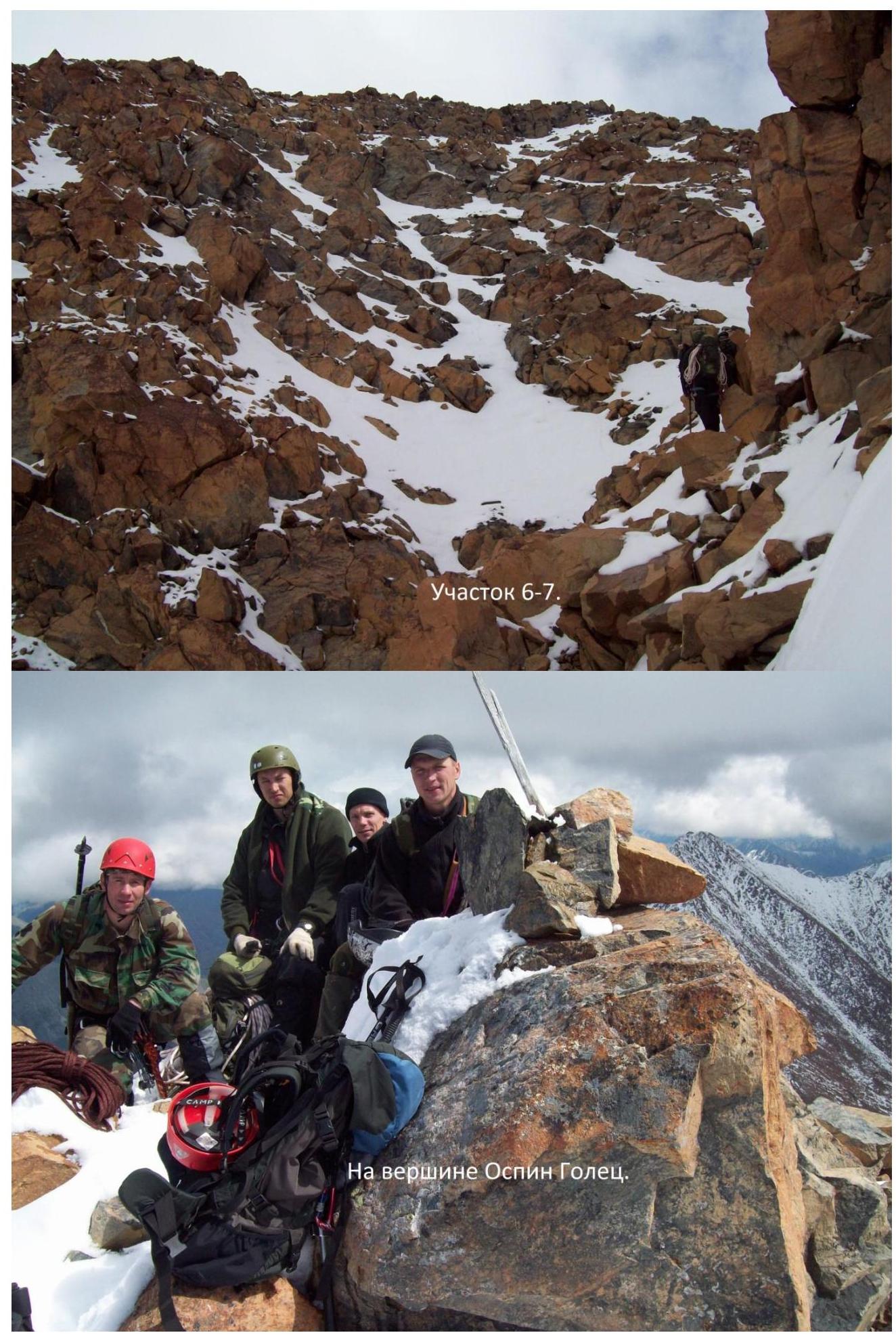
- R6–R7: 40 m, 1 — Along the 40° slope of the eastern tower, transition to the left into the couloir.
- R7–R8: 70 m, 40°, 1 — Along the southern couloir to the saddle between the eastern and summit towers.
- R8–R9: 80 m, 35°, 2 — Along the eastern ridge of the summit tower to the exit to the summit ridge.
- R9–R10: 30 m, 0°, 1 — To the left to the summit. A cairn was found on the summit, but no note was discovered.
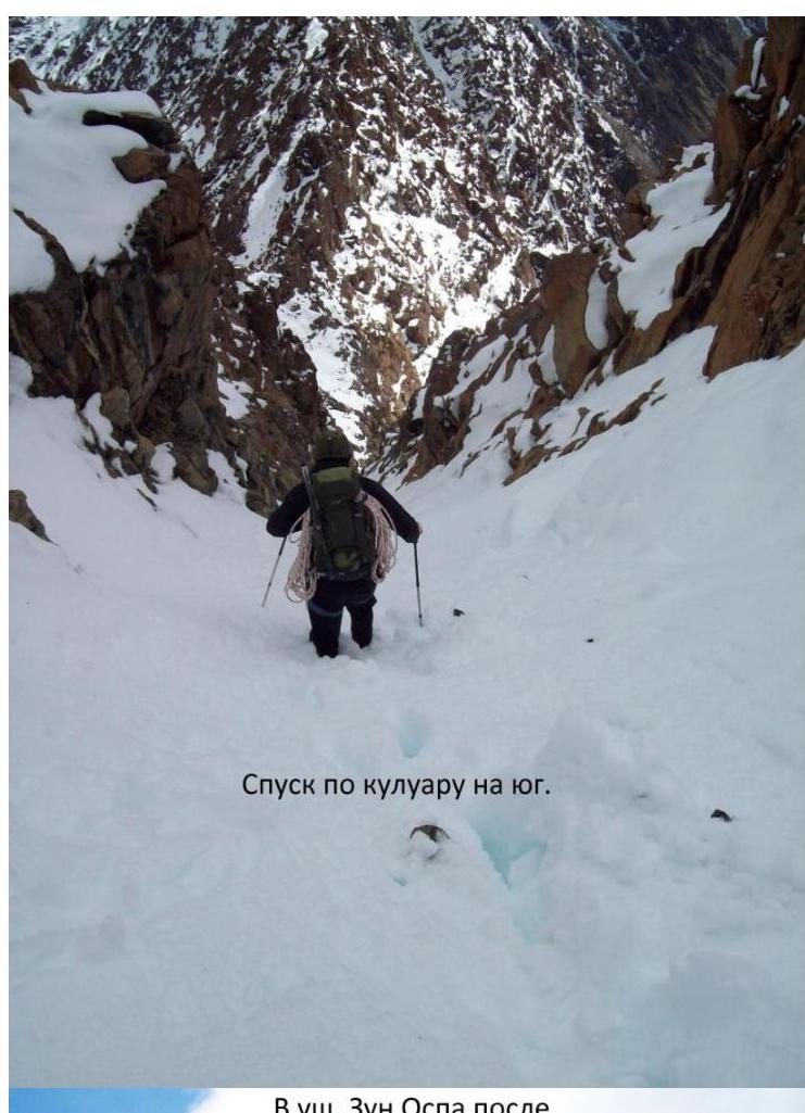
Descent to the southern couloir and along the southern couloir into the southwestern gorge of Ospin Golets peak. Return to the base camp through the valley of the Pravaya Zun Ospa river and crossing the flat green pass between the Kitoy and Ospin ridges.
 □
□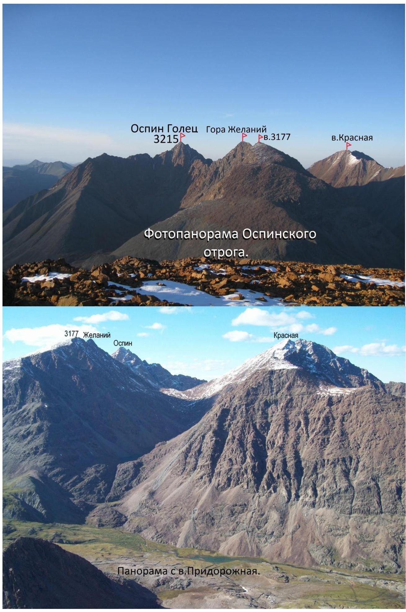 □
□ b. Ospin Golets from the shoulder of v. 3177
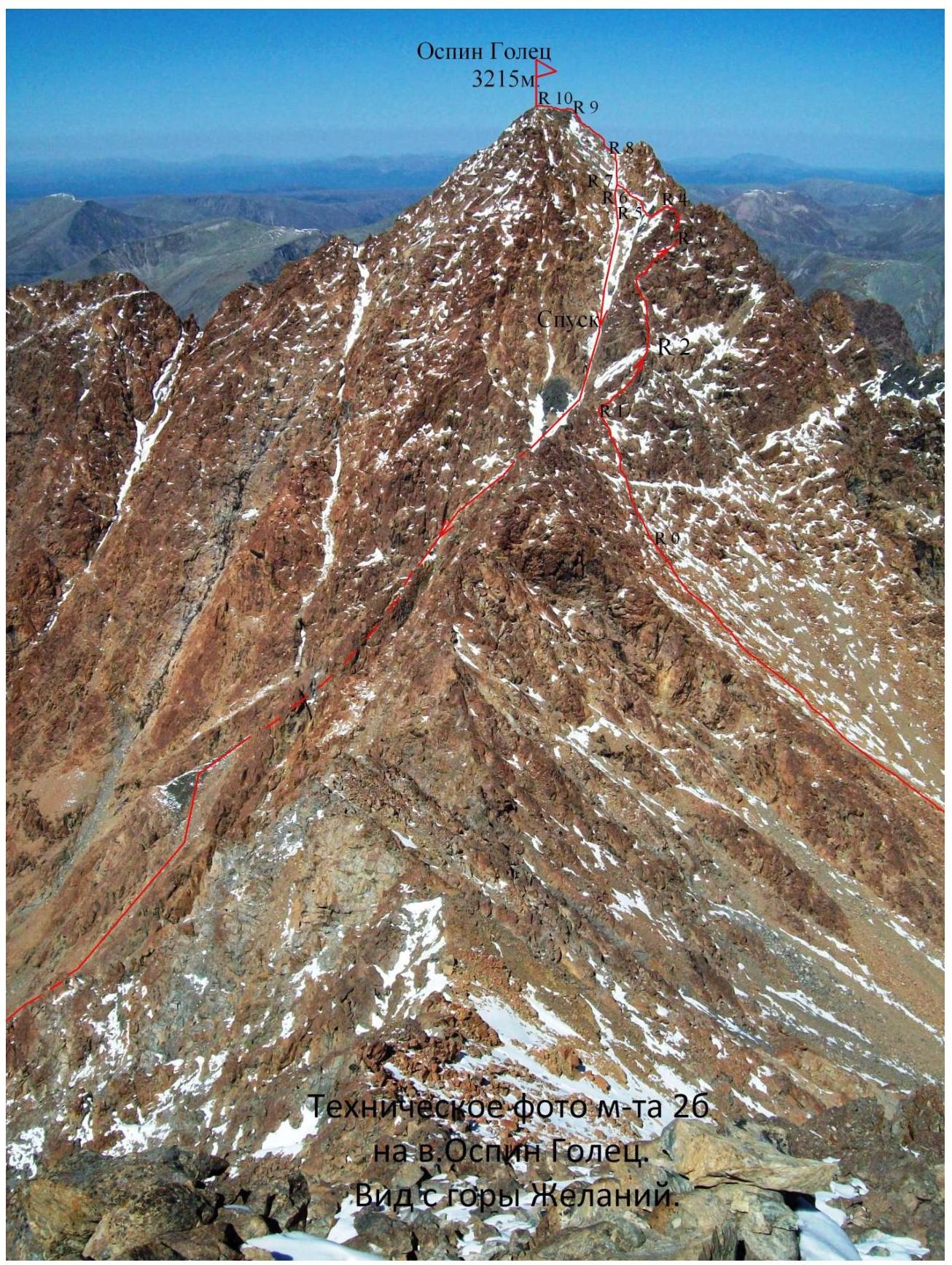 Technical photo of the route 26.
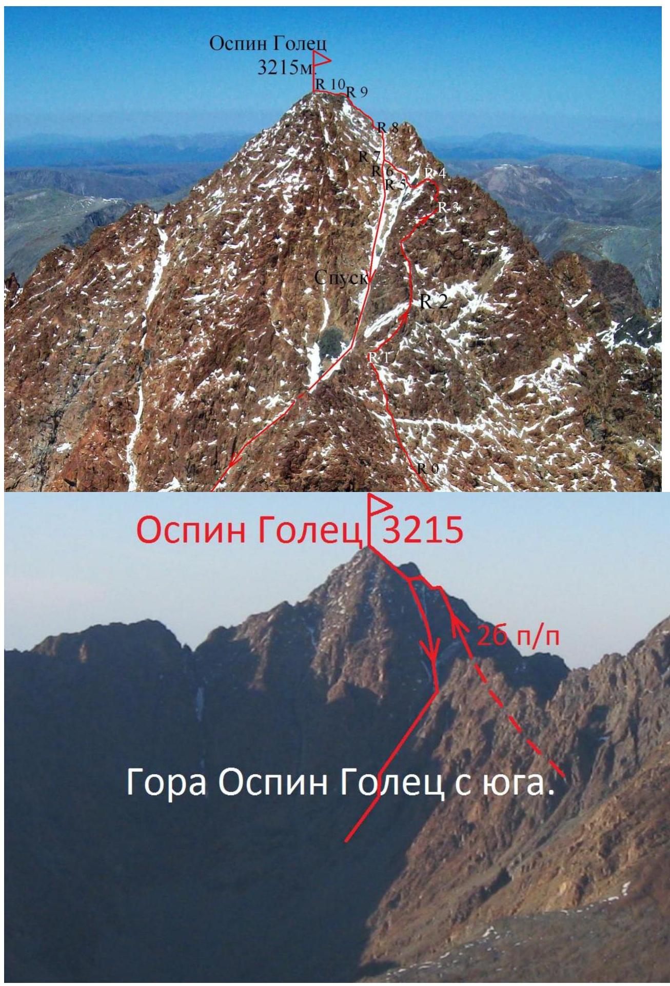 Mount Ospin Golets from the south:
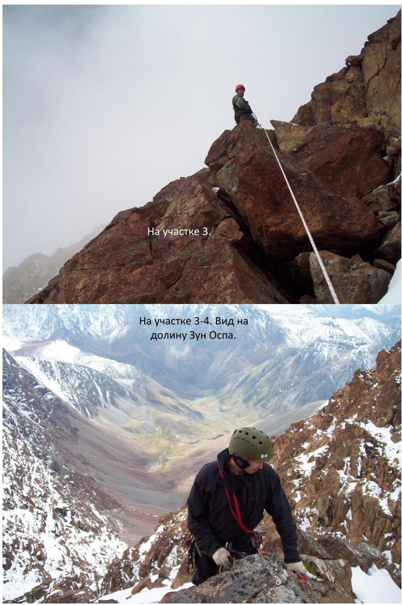 into the Zun Ospa valley.
 On section 5.
 □
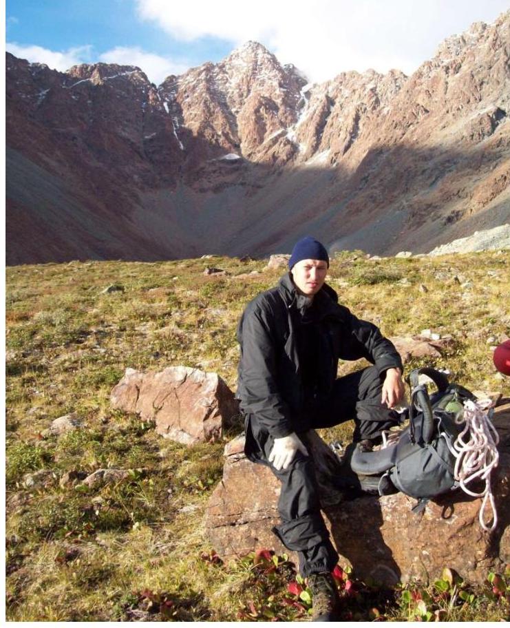
□ In the Zun Ospa gorge after descending from the mountain.
Comments
Sign in to leave a comment