
Report
On the first ascent
Gusar Peak 2540 Zgr
Route 2A cat. diff. (proposed), first ascent
Eastern Sayan, Tunka Goltsy ridge, Kharimta valley, 6.1.2
Leader: Klepikov A. A.
Participants:
- Drulis A. M.
- Lipchenko A. V.
- Oseyev D. N.
- Pechenin K. V.
- Buinevich A. A.
- Matveychuk E. O.
The ascent was made on November 2, 2022.
I. Ascent Passport
| № | 1. General Information | |
|---|---|---|
| 1.1 | Full name, sports rank of the leader | Klepikov Alexander Alexandrovich, Master of Sports, 3 cat. diff. |
| 1.2 | Full name, sports rank of the participants | Drulis Alexey Maximovich (2nd sports rank) Lipchenko Anastasia Vyacheslavovna (3rd sports rank) Oseyev Dmitry Nikolayevich (3rd sports rank) Pechenin Kirill Vadimovich (3rd sports rank) Buinevich Alexey Andreyevich (3rd sports rank) Matveychuk Elizaveta Andreyevna (3rd sports rank) |
| 1.3 | Full name of the coach | Afanasyev Andrey Evgenyevich, Master of Sports, 1 cat. diff. |
| 1.4 | Organization | FASIО |
| 2. Characteristics of the ascent object | ||
| 2.1 | Region | Eastern Sayan, Tunka Goltsy ridge, |
| 2.2 | Valley | Kharimta valley, |
| 2.3 | Section number according to the 2020 classification table | 6.1.2 |
| 2.4 | Name and height of the peak | Gusar (2540 m) |
| 2.5 | Geographic coordinates of the peak (latitude/longitude), GPS coordinates | Gusar 51.57.13.12N 102.34.10.51E |
| 3. Characteristics of the route | ||
| 3.1 | Route name | 3 ridge |
| 3.2 | Proposed category of difficulty | 2A |
| 3.3 | Degree of route development | first ascent |
| 3.4 | Character of the route relief | Rocky |
| 3.5 | Height difference of the route and main part | 426 m |
| 3.6 | Length of the route and main part | 890 m |
| 3.7 | Technical elements of the route (total length of sections of various difficulty categories is indicated with indication of the relief character (ice-snow, rocky)) | I cat. diff. rocks — 440 m. II cat. diff. rocks — 410 m. III cat. diff. rocks — 40 m. |
| 3.8 | Descent from the peak | Along the Western ridge to the Kharimta valley. |
| 3.9 | Additional characteristics of the route | In summer, there is usually no water on the route |
| 4. Characteristics of the team's actions | ||
| 4.1 | Time of movement (team's walking hours, indicated in hours and days) | 03:10 walking hours to the peak, 1 day |
| 4.2 | Overnights | No |
| 4.3 | Start of the route | 07:20 November 2, 2022 |
| 4.4 | Ascent to Gusar peak | 10:30 November 2, 2022 |
| 4.5 | Return to the base camp | 18:10 November 2, 2022 |
| 5. Responsible for the report | ||
| 5.1 | Full name, e-mail | Klepikov A. A., Baikalteam@gmail.com |
Photo of the general view of Gusar 2540 and Yanichar 2520 peaks.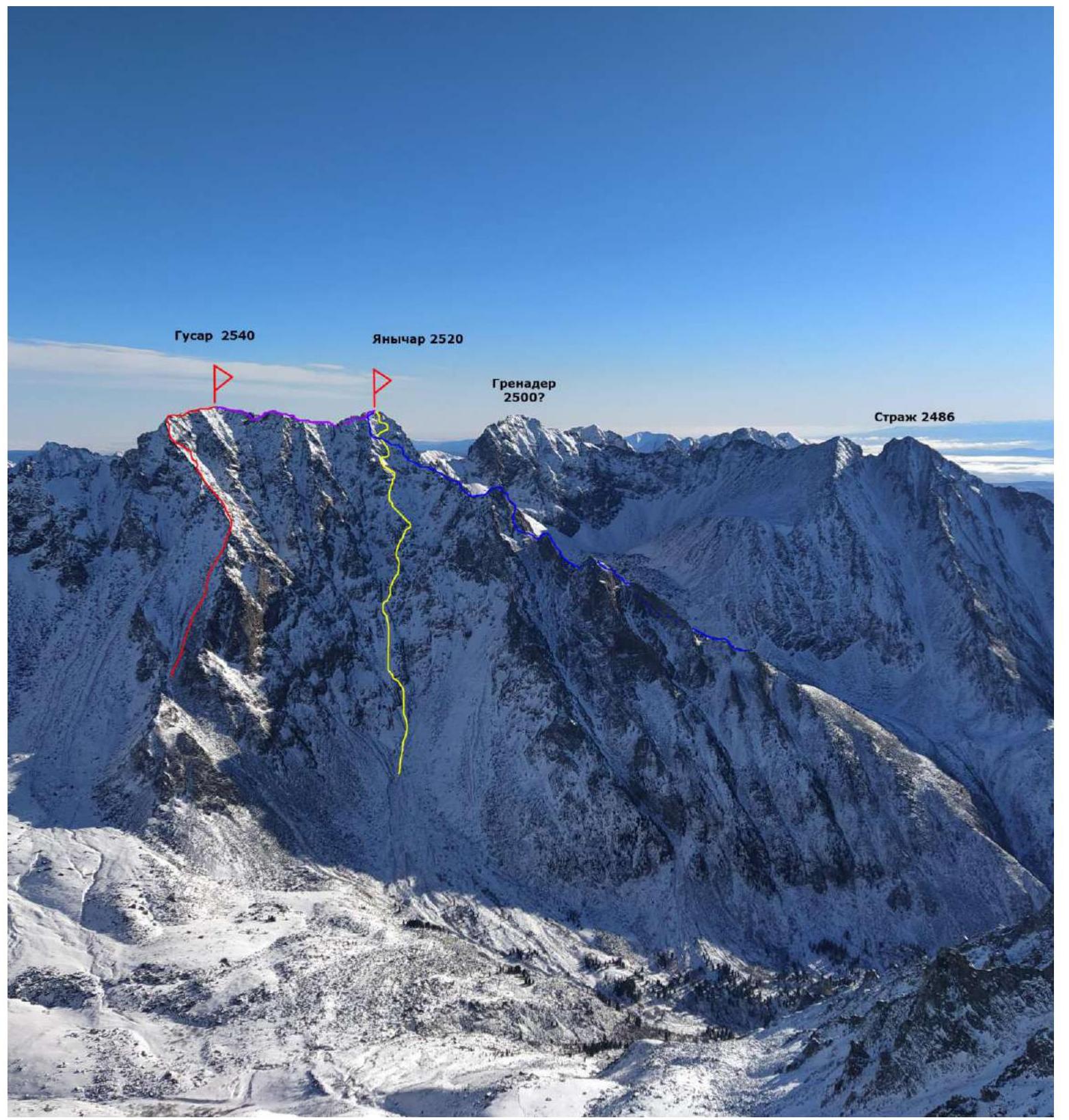 The photo was taken from the Southern ridge of Doktor mountain, shooting height about 2450 m, distance from the object 2000–2500 m.
RED — team's route 2A.
BLUE — route SW ridge 3A cat. diff., n/k (Klepikov A. A., 2022).
PURPLE — route 3A traverse Gusar–Yanichar (Klepikov A. A., 2022).
YELLOW — descent path from Yanichar peak, 3 couloir.
Profile of the route (visible part)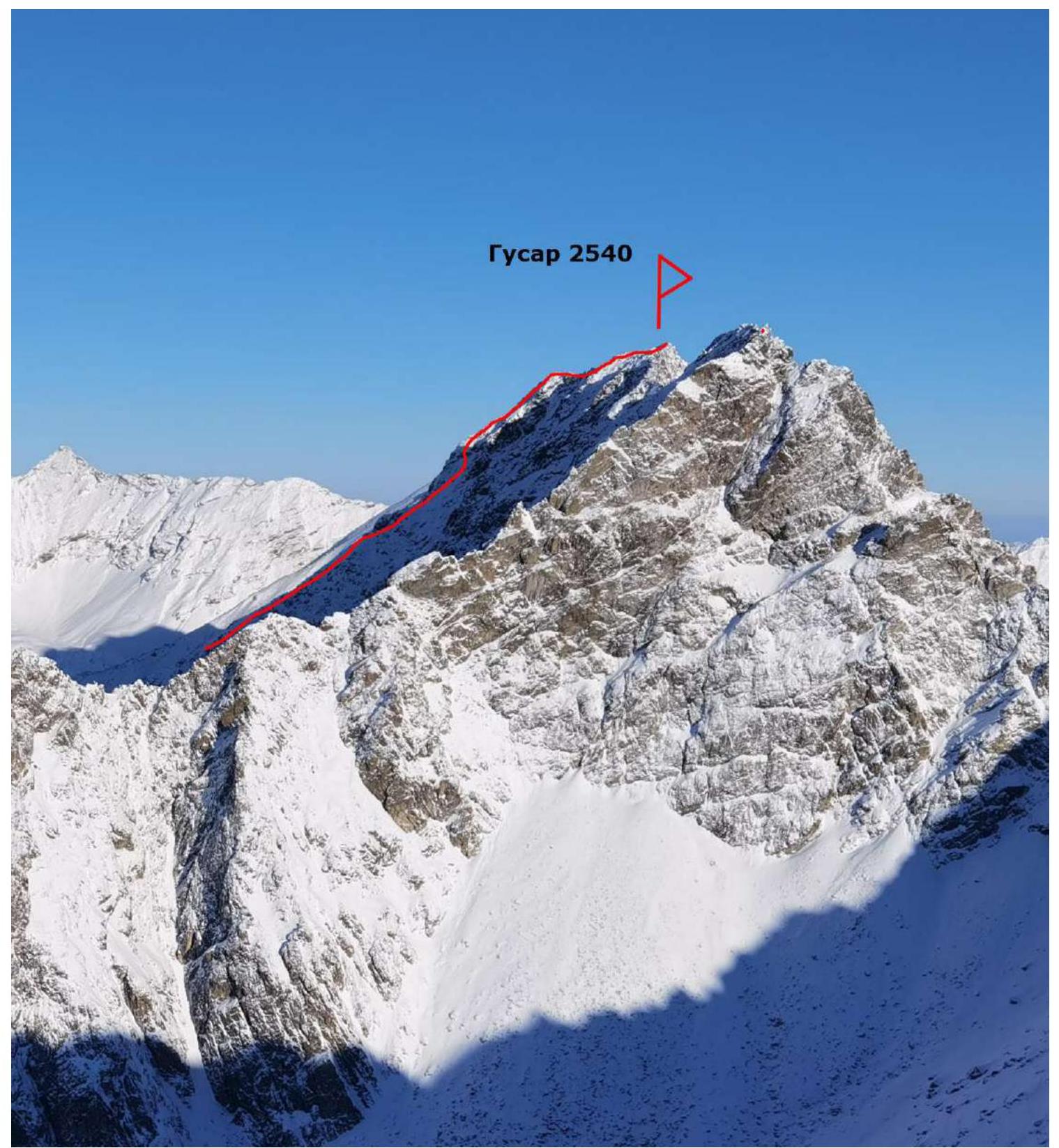
The photo was taken from the Western slope of Strazh peak, shooting height about 2350 m, distance 2000–2500 m.
Panorama of the peaks of the Tunka Goltsy ridge in the area of the Kharimta valley. (The photo was taken from the Tunka valley, distance about 10 km, shooting height 550 m).
Map-scheme of the approach to the Kharimta valley.
(The photo was taken from the Tunka valley, distance about 10 km, shooting height 550 m).
Map-scheme of the approach to the Kharimta valley.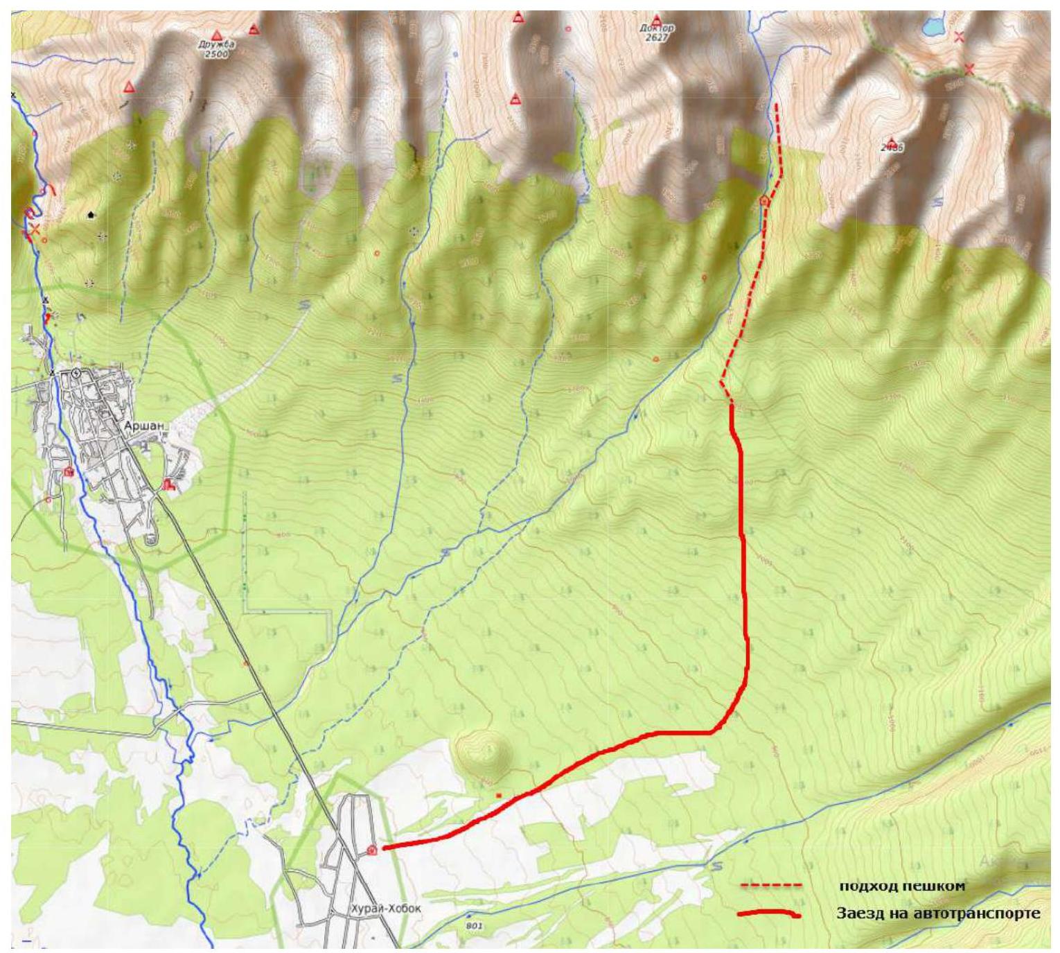 Map-scheme of the Kharimta valley.
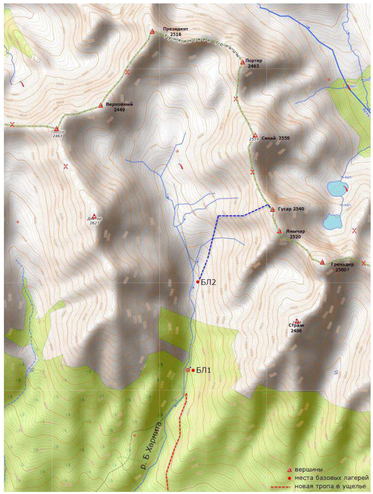 The Kharimta valley is located in the Tunka Goltsy ridge near the Arshan settlement and is facing the Tunka valley. The valley is a rather interesting polygon for alpine development, due to its rich relief, size, and height differences of about 1000 m, as well as transport accessibility. The Kharimta valley is the only true valley in the Tunka Goltsy ridge to the right of the Arshan settlement and mountain; the other valleys are actually hanging valleys — cirques, breaking off into the Tunka valley. Kharimta has a deeply incised valley with a branched system of cirques in the upper reaches and along the left side in the middle part.
The nearest major settlement is Arshan. The approach is made by driving to the entrance of the valley. A car can take you to the 1200 m mark. The time from Arshan to the trail is no more than 1 hour. The time from the trail to the base camp near the forest boundary is about two to three hours.
The average time to approach the described route can be estimated as follows:
- Arshan settlement — trail: 1 hour;
- trail — hunter's lodge BL1: 2 hours;
- hunter's lodge BL1 — start of the technical part of the route: 1.5 hours.
The valley has potential for ascents and classification of routes up to 4B/5A cat. diff. As of the end of 2022, more than 10 routes from 1B to 4A cat. diff. have been laid in the valley.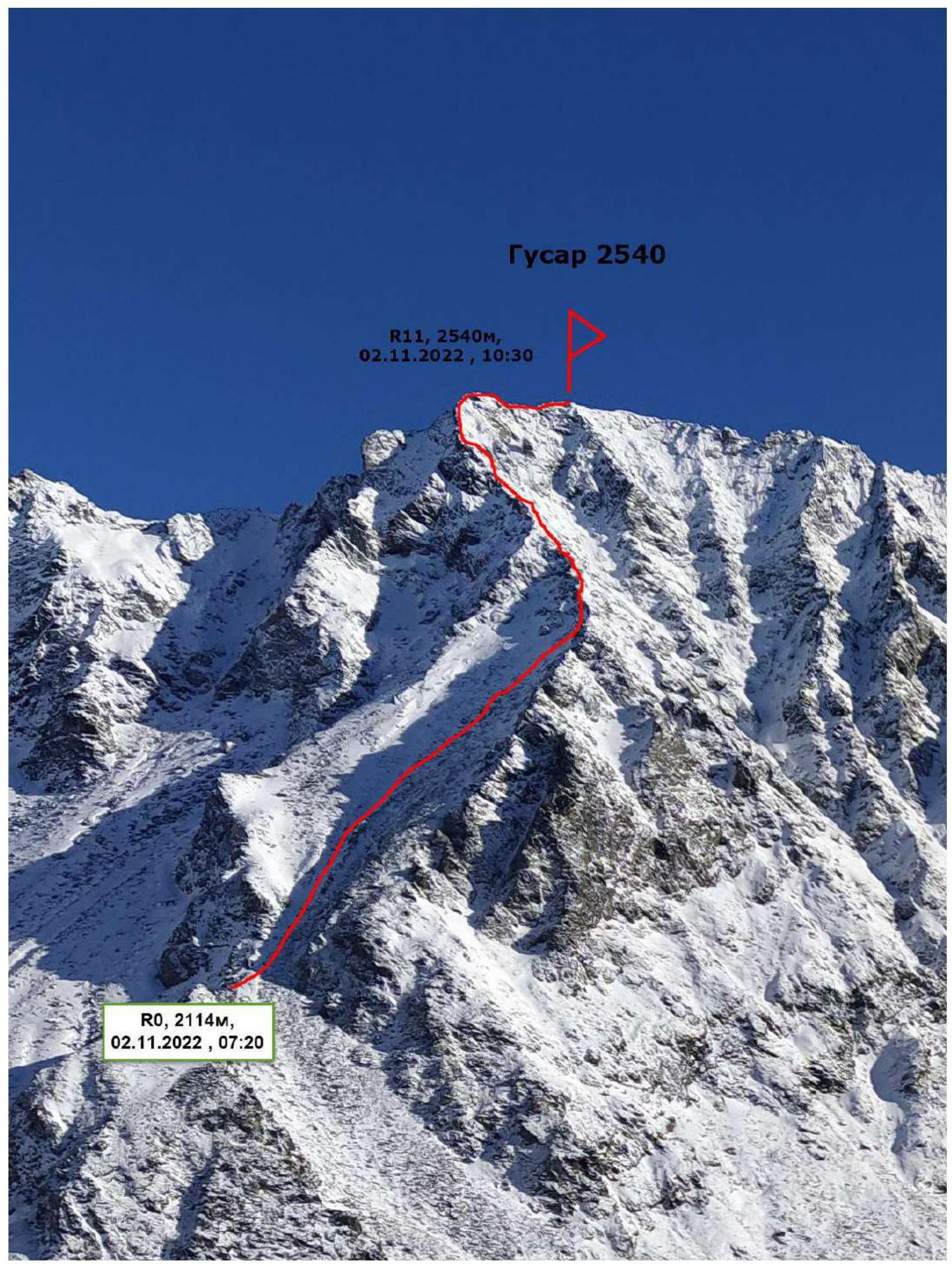
The photo was taken from the Eastern slope of Doktor mountain 2627 m, shooting height about 2100 m, distance 1000–1500 m.
Description and characteristics of the relief
The start of the route is the Western ridge, which has a simple access from below the valley as well as from above; further, straight from the first link upwards, the ridge branches out and expands, the ascent is made along the couloir between these ridges with further entry onto the larger right-hand one. The start of the route is at an altitude of 2114 m.
R0–R1 400 m, 40°, 1, along the couloir of the forked ridge with exit to the right-hand one. R1–R2 150 m, 45°, 2, along the ridge. Photo 1. R2–R3 50 m, 45°, 2, bypassing the gendarme on the right. R3–R4 40 m, 45°, 1, to the right of the ridge, entering a large hollow. R4–R5 40 m, 60°, 3, wall from the hollow to the left onto the ridge. Photo 2. Photo 3. R5–R6 60 m, 40°, 2, up the ridge. R6–R7 20 m, 30°, 2, crossing along large-block relief, over the ridge, even a small overhanging block, but not difficult, exit to a horizontal ridge. Photo 4. R7–R8 30 m, 0°, 2, horizontal ridge. R8–R9 100 m, 25°, 2, to Gusar peak along the ridge. Photo 5. Photo 6.
Characteristics of the route and the team's actions
The route taken by the team is the first route to be made to the Gusar peak. The most logical and simple line was chosen for the ascent.
The 3 ridge on Gusar peak is technically quite simple, except for the key section of 40 m in the middle of the ridge. The route is quite safe in terms of rockfall; the line goes along the external forms of the relief, the relief is quite strong and relatively monolithic. In winter, rockfall hazard is extremely minimal in the entire area. The avalanche hazard of the route is an objective factor only:
- at the very beginning of the route, when approaching the ridge;
- in the area of the key section in the hollow.
Descent from the peak is easiest along the ascent route of the 3rd ridge towards the Kharimta valley; belaying is necessary, and a rappel will be required on the key section in the hollow.
The author's experience with 2A routes: 13 ascents on 10 routes in the Sayan Mountains, in the Caucasus, and in Transbaikalia.
In terms of technical difficulty, the route takes a middle position among them, standing out with a rather complex key section for 2A.
There is practically cellular communication (Tele2) throughout the entire route.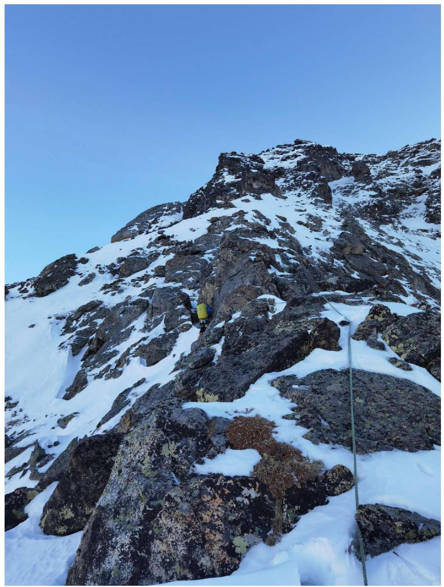
Photo 1. Section R1–R2. Movement along a simple ridge.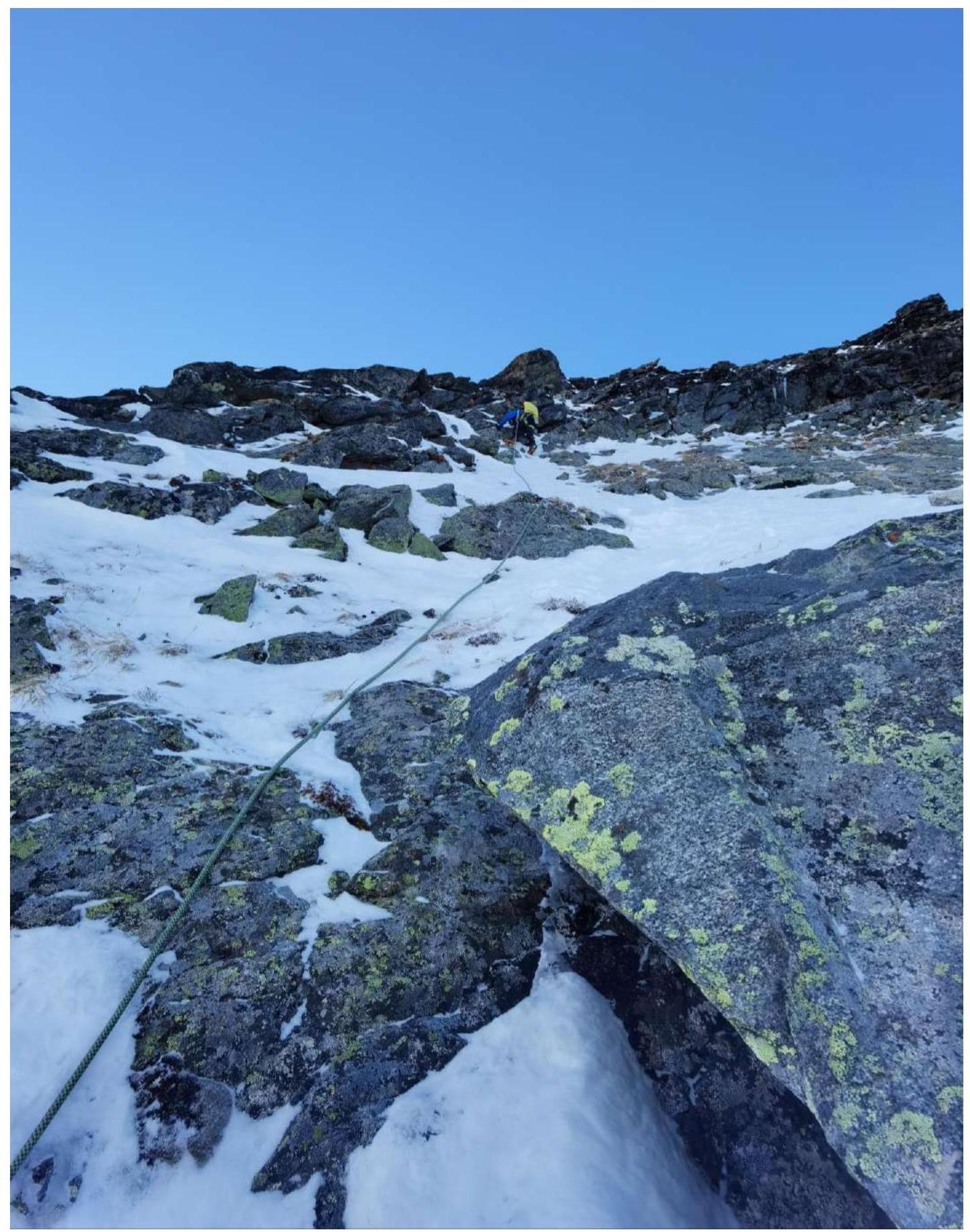
Photo 2. Section R4–R5. Start of the key section. Exit from the hollow to the left onto the ridge. Climbing category 3, the relief is mainly slab-type with holds in the "reverse" direction. The steepness of the section is characterized by the presence of icing and icicles to the right of the leader in the photo.
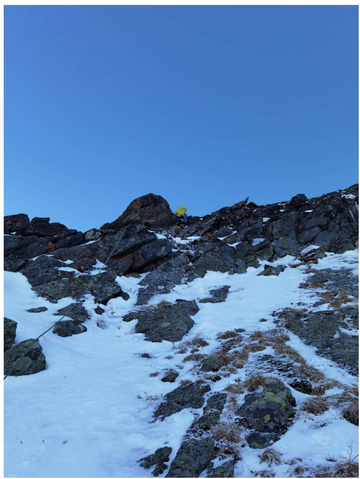
Photo 3. Section R4–R5. First half of the key section. Exit from the hollow to the left onto the ridge. Climbing category 3, the relief is mainly slab-type with holds in the "reverse" direction.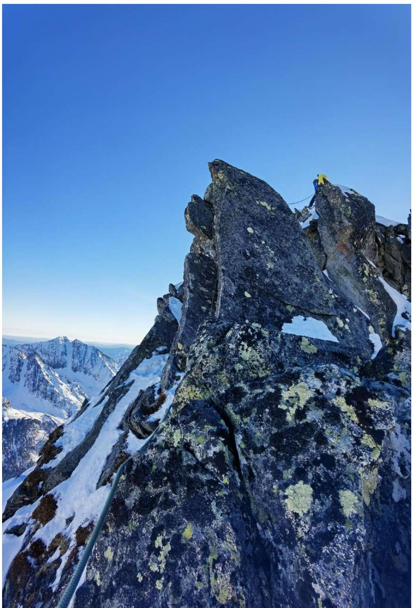 Photo 4. Section R6–R7. Movement along the ridge from large-block relief, with even a small overhanging block (passed easily).
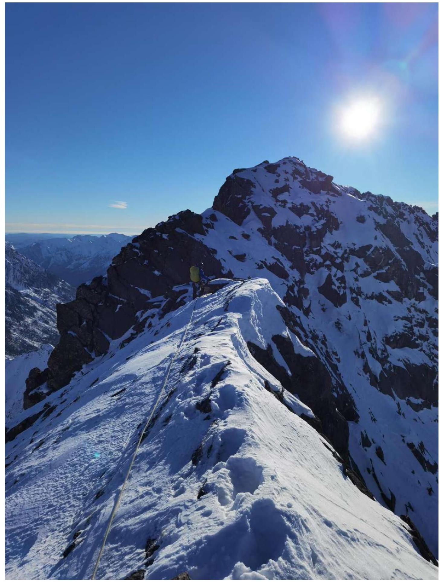
Photo 5. Section R8–R9. Beginning of the section, movement along the ridge to the peak along the Northern ridge, with fairly steep slopes on both sides.
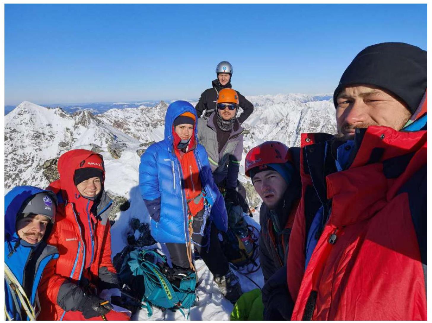
Photo 6. On Gusar peak 2540 m. In the foreground (from left to right): Pechenin K. V., Lipchenko A. V., Matveychuk E. O., Oseyev D. N. In the background (from left to right): Buinevich A. A., Drulis A. M., Klepikov A. A. In the background on the left, Sipay peak 2559 m is visible (present on the map-scheme).