
ALPINISM FEDERATION OF THE REPUBLIC OF BURYATIA
Report on the First Ascent
Peak Domashnyaya (2350 m). Via the South-Eastern Ridge. Route 1B cat. diff. (proposed). Eastern Sayan, Tunka Goltsy, Zun-Khandagai valley 6.1.2.
2023
Climbing Passport
| 1. General Information | ||
|---|---|---|
| 1.1 | Full name of the leader, sports qualification | Kravtsov Artyom Yuryevich, 1st sports category |
| 1.2 | Full names of participants, sports qualification | Rudman A.P., 1st sports category; Prokhorov A.S., 3rd sports category; Aleksminsky V.I., 3rd sports category; Dikalo P.N., 3rd sports category; Ivantsova Yu.V., 3rd sports category; Spasov T.B., 3rd sports category. |
| 1.3 | Full name of the coach, sports qualification | Ayusheev Dashi Valeryevich, Master of Sports |
| 1.4 | Organization | Alpinism Federation of the Republic of Buryatia |
| 2. Characteristics of the Climbing Object | ||
| 2.1 | Climbing area | Eastern Sayan, Tunka Goltsy |
| 2.2 | Valley | Zun-Khandagai |
| 2.3 | Section number in the classifier | 6.1.2. |
| 2.4 | Name and height of the peak | Domashnyaya 2350 m |
| 3. Route Characteristics | ||
| 3.1 | Route name | Via the South-Eastern Ridge |
| 3.2 | Proposed category of difficulty | 1B |
| 3.3 | Route exploration level | First ascent |
| 3.4 | Terrain characteristics | Rocky |
| 3.5 | Height difference | 700 m |
| 3.6 | Route length | 1080 m |
| 3.7 | Technical elements of the route | I cat. diff. rocks — 700 m. II cat. diff. rocks — 300 m. III cat. diff. rocks — 80 m. VI cat. diff. rocks — 0 m. V cat. diff. rocks — 0 m. |
| 3.8 | Average slope of the route | 30° |
| 3.9 | Descent from the summit | North along the damaged ridge 200 m, then right into the couloir 450 m. Further descent to the river 250 m, beyond the river is a trail to the base camp. |
| 4. Characteristics of the Team's Actions | ||
| 4.1 | Time in motion | Total hours: 11 hours, 1 day |
| 4.2 | Start of the route | 6:00 October 16, 2023 |
| 4.3 | Summit ascent | 13:30 October 16, 2023 |
| 4.5 | Return to base camp | 17:00 October 16, 2023 |
| 5. Responsible for the Report | ||
| 5.1 | Full name, e-mail | Kravtsov A.Yu., Artkravt-27@mail.ru |
Climbing Description
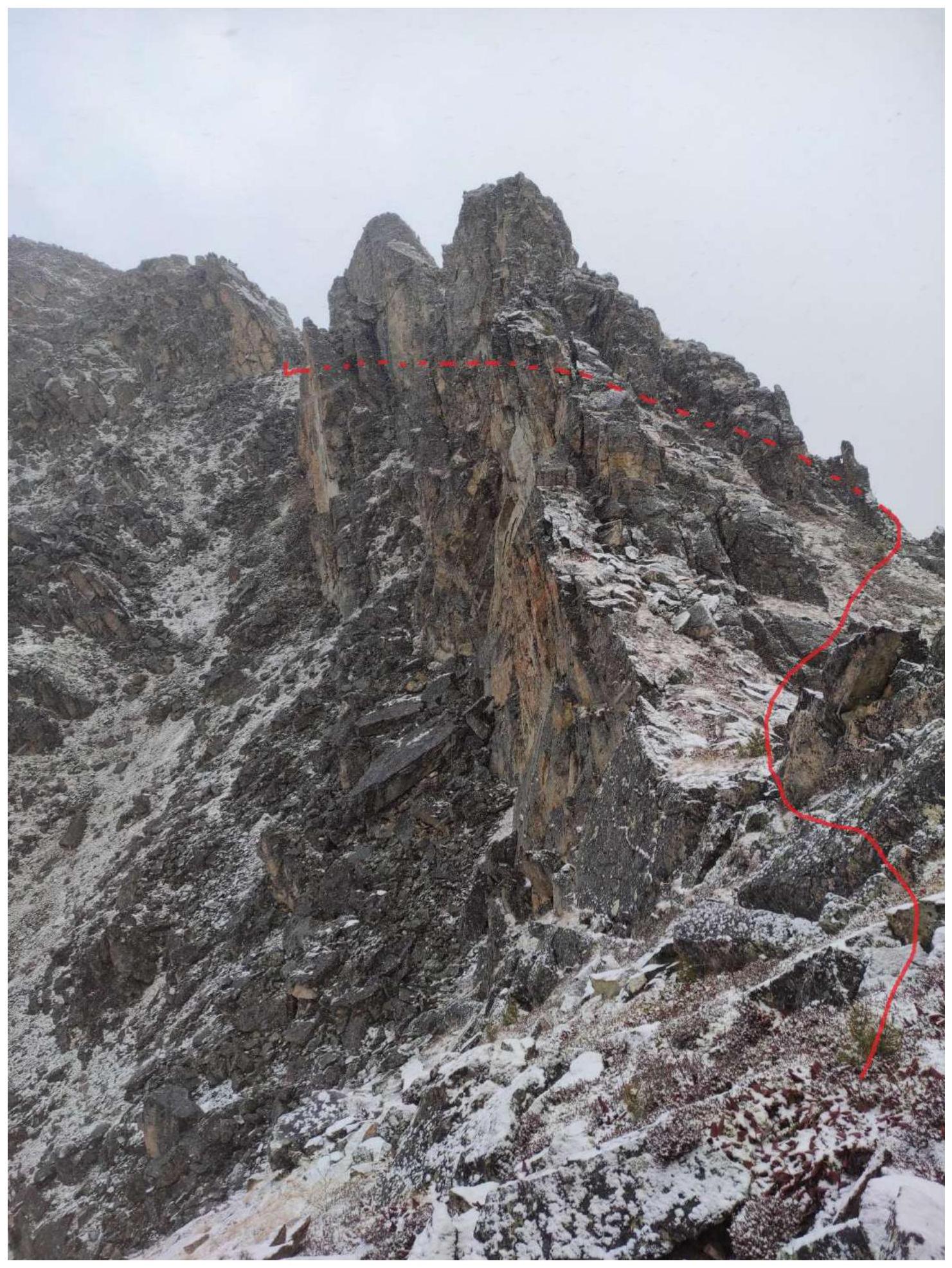
General photo of the peak
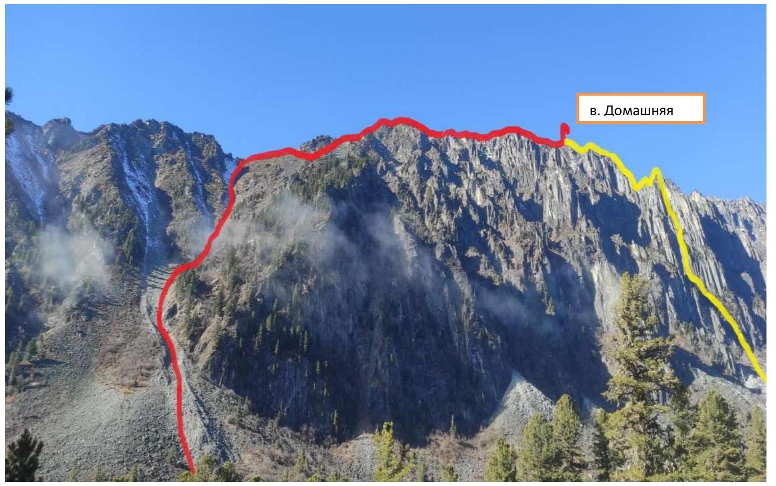
The team's route via the South-Eastern ridge is a first ascent (proposed 1B cat. diff.) Glazunov's route via the Eastern wall "Book" 5A
Description of the Climbing Area
Peak Domashnyaya is located in the South-Eastern spur of the Tunka ridge, Eastern Sayan, which is the watershed between the Zun-Khandagai and Barun-Khandagai valleys. The peak's height is 2350 m. Two classified routes have been laid to this peak:
- 4A via the Eastern counterfort — A. Afanasyev, 1982
- 5A via the Eastern wall "Book" — E. Glazunov, 2011
The valley has been well explored by climbers since the 1970s and has numerous routes to peaks ranging from 1B to 5A.
The most favorable months for climbing:
- from late May to mid-October.
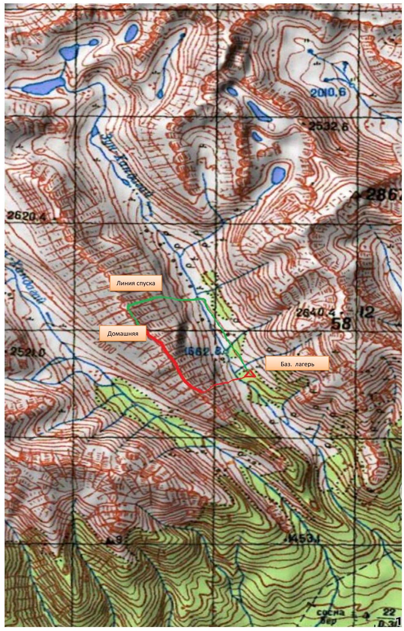
Approach to the base camp:
- starts from the clearing where the road from the village of Tagarhay ends;
- the trail to the valley is well visible, partly marked;
- many tourists in the summer.
Base camp:
- located on the left orographic bank of the Zun-Khandagai river;
- 6 hours walk from the clearing;
- opposite Peak Domashnyaya;
- 30 minutes before the forest boundary.
The forest boundary is at an altitude of 1700 m above sea level.
Weather and climate:
- the weather in the area is unstable;
- the climate is harsh, sharply continental;
- the summer is short.
Map of the Zun-Khandagai valley
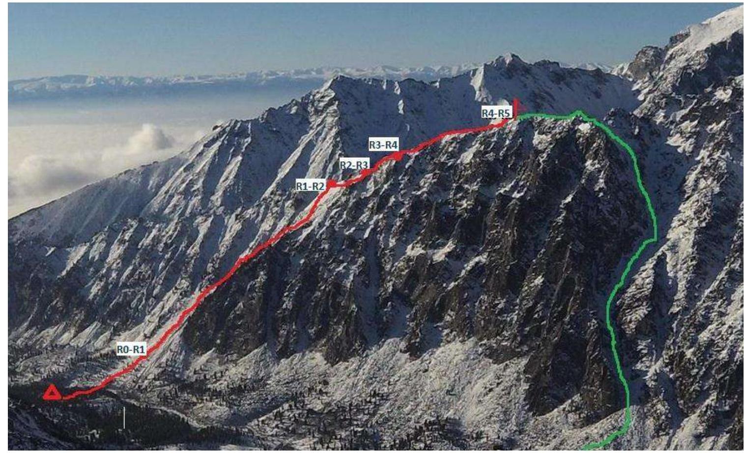
Technical photo of the route
Description and Characteristics of the Terrain
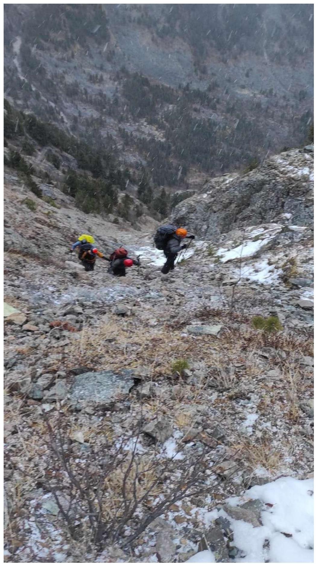
The route starts directly opposite the base camp, crossing the Zun-Khandagai river, entering a wide, scree-filled couloir. The ascent through the couloir does not pose technical difficulties.
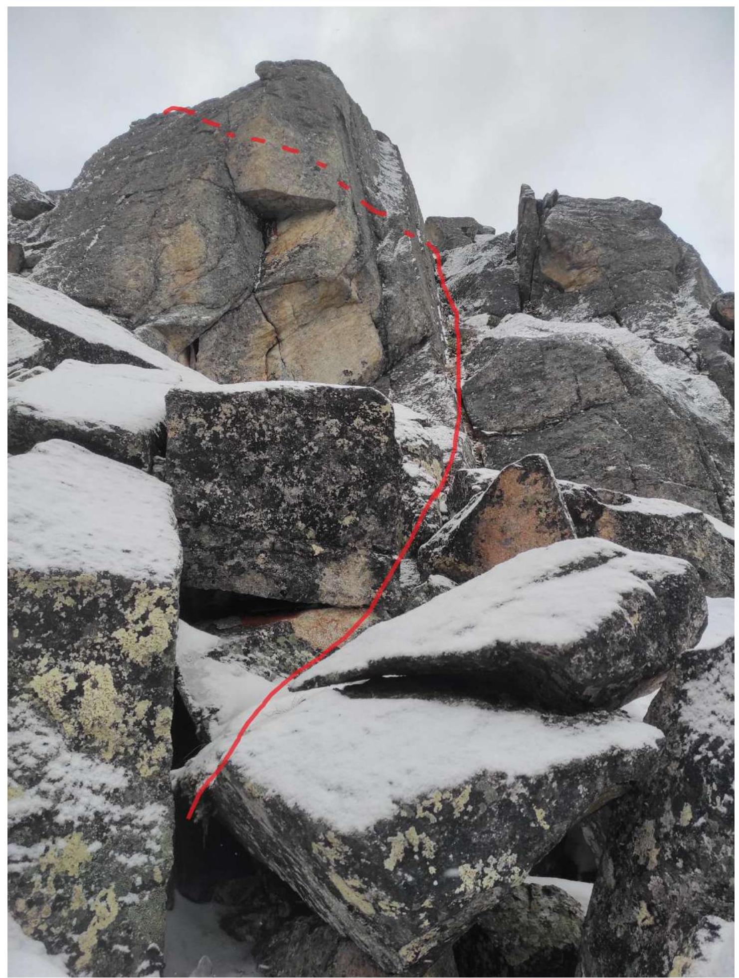
R0–R1 450 m, 30°, 1. Wide couloir, narrowing in the middle, with small, gentle walls of 1.5–2 m, simultaneous movement, exit to the ridge. R1–R2 180 m, 20°, 2. Along the ridge, simultaneously, bypassing a large gendarme on the right, exit to a small saddle on the ridge. R2–R3 120 m, 35°, 2. Movement along the right part of the ridge, slabs and small walls, simultaneous movement. R3–R4 80 m, 45°, 3. Inner corner 8 m is climbed by all participants, then left along the slabs, descent along large blocks 2 m, narrow passage on the right, alternate movement. R4–R5 250 m, 20°, 1. Further along the simple ridge, simultaneous movement to the summit.
Descent from the summit to the northwest along the ridge 120 m, then right into the descent couloir, which ends with a wide scree cone.
Section R0–R1
Section R1–R2
Section R2–R3
Section R3–R4
Section R4–R5
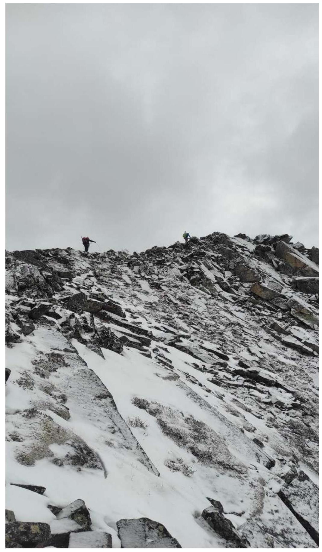
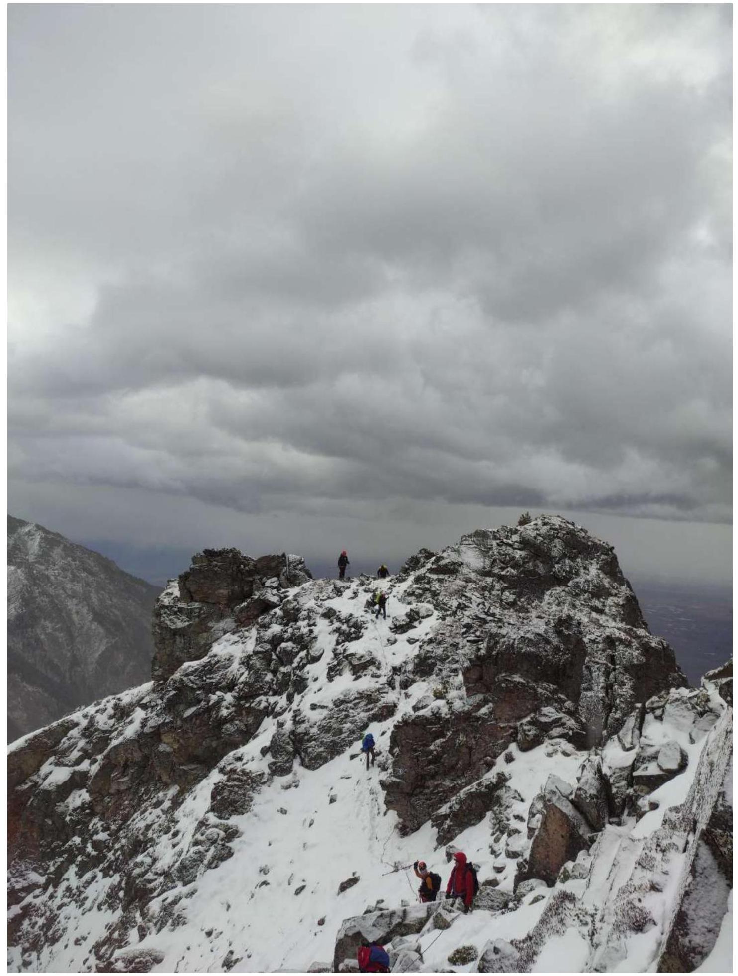
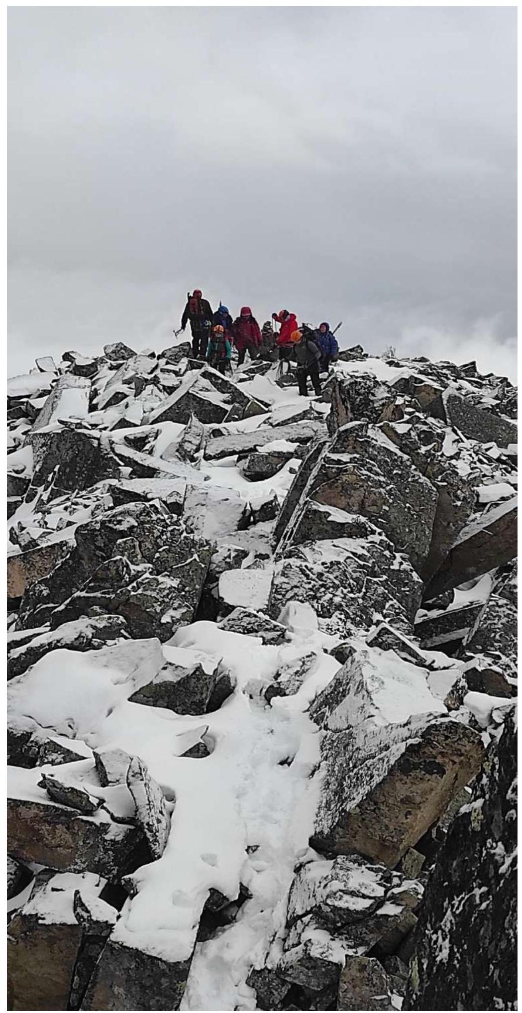
Photo at the Summit
Comments
Sign in to leave a comment