
Report on the First Ascent
About the First Ascent
Yanichar Peak (2520 m) — South face of the Southwest ridge. The name of the route is “Щель” (Gap). The route is 4A category of difficulty (proposed), first ascent. Eastern Sayan, Tunkinskiye Goltsy ridge, Kharimta valley, 6.1.2.
Team leader: Klepitov A.A. Participants:
- Kuzmenko I.M.
- Kolosov A.D.
- Kazantseva E.V.
The ascent was made on August 13, 2022.
I. Ascent Passport
| № п.п. | 1. General Information | |
|---|---|---|
| 1.1 | Full name, sports rank of the team leader | Klepitov Aleksandr Aleksandrovich, Master of Sports, 3rd sports rank |
| 1.2 | Full name, sports rank of the participants | Kuzmenko Ivan Mikhailovich (Candidate for Master of Sports), Kolosov Aleksandr Dmitrievich (2nd sports rank), Kazantseva Evgeniya Vasilyevna (2nd sports rank) |
| 1.3 | Full name of the coach | Afanasiev Andrei Evgenievich, Master of Sports, 1st sports rank |
| 1.4 | Organization | Baikal Alpine School |
| 2. Characteristics of the Ascent Object | ||
| 2.1 | Region | Eastern Sayan, Tunkinskiye Goltsy ridge |
| 2.2 | Valley | Kharimta valley |
| 2.3 | Section number according to the 2020 classification table | 6.1.2 |
| 2.4 | Name and height of the peak | Yanichar (2520 m) |
| 2.5 | Geographical coordinates of the peak (latitude/longitude), GPS coordinates *(1) | 51°57′02.81″N 102°34′16.11″E |
| 3. Characteristics of the Route | ||
| 3.1 | Name of the route | S face of SW ridge |
| 3.2 | Proposed category of difficulty | 4A |
| 3.3 | Degree of route development | first ascent |
| 3.4 | Relief characteristics of the route | Rock |
| 3.5 | Height difference of the route and the main part | 415 m |
| 3.6 | Length of the route and the main part | 805 m |
| 3.7 | Technical elements of the route (total length of sections of different categories of difficulty with indication of relief type (ice-snow, rock)) | I cat. rock — 30 m. II cat. rock — 355 m. III cat. rock — 225 m. IV cat. rock — 180 m. V cat. rock — 15 m. Rappelling (on descent) — (1 rope 30 m) |
| 3.8 | Average steepness of the main part of the route | |
| 3.9 | Descent from the peak | Down the western couloir to Kharimta valley. |
| 3.10 | Additional characteristics of the route | In summer, there is no water on the route under normal conditions |
| 4. Characteristics of the Team's Actions | ||
| 4.1 | Time of movement (team's walking hours, indicated in hours and days) | 9 h 15 min walking hours to the peak, 1 day |
| 4.2 | Overnight stays | No |
| 4.3 | Start of the route | 9:30 August 13, 2022 |
| 4.4 | Reaching the peak | 18:45 August 13, 2022 |
| 4.5 | Return to the base camp | 21:30 August 13, 2022 |
| 5. Responsible for the Report | ||
| 5.1 | Full name, e-mail | Klepitov A.A., Baikalteam@gmail.com |
Photo of the general view of Yanichar peak (2520 m). (Photo taken from the ridge between Strazh and Grenader peaks, approximately 2400 m a.s.l., distance from the object 1500–2000 m)
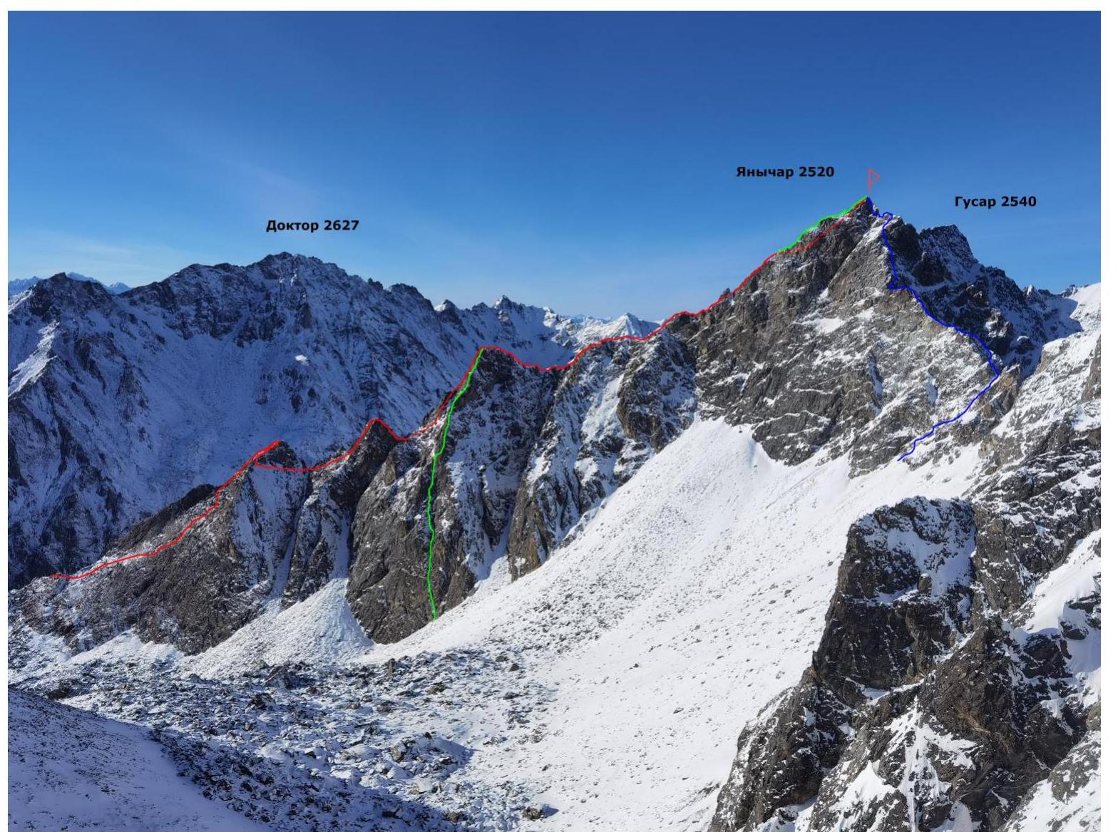
GREEN — team's route. 4A cat. RED — SW ridge route, 3A cat. (Klepitov A.A., 2022) BLUE — SE ridge route, 3B cat. (Klepitov A.A., 2022)
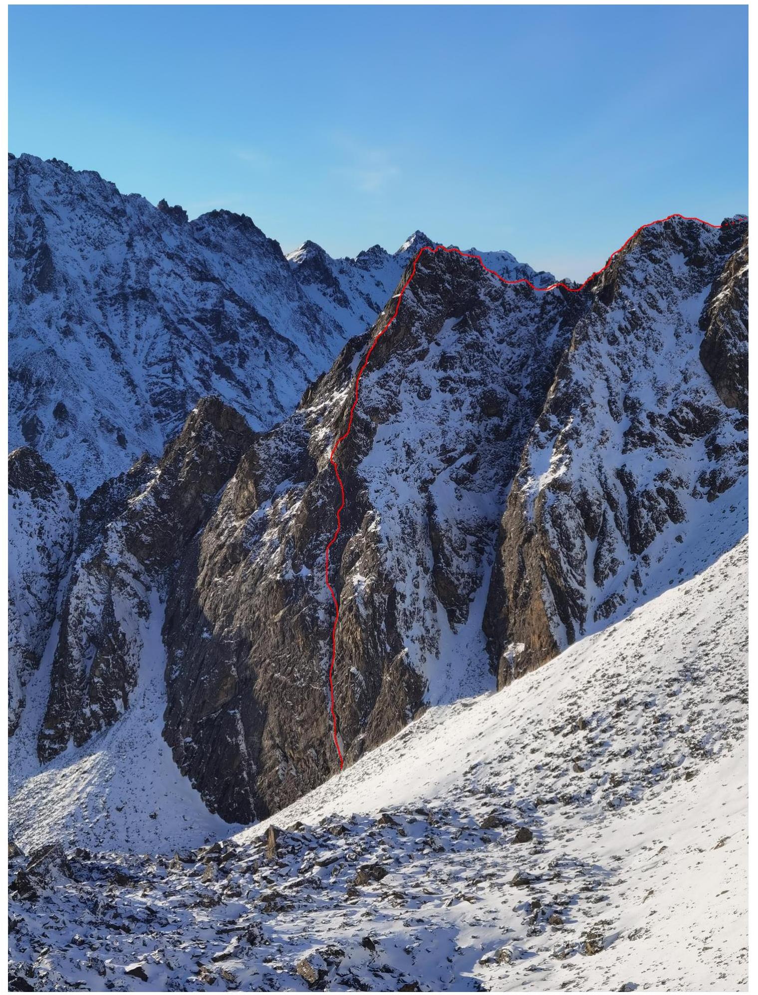
Half-profile of the main part of the S face of SW ridge route on Yanichar peak (2520 m).
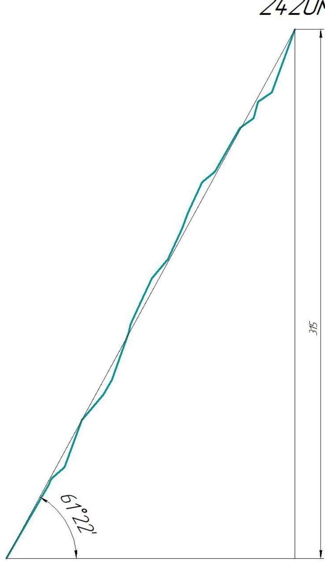
 Drawn profile of the main part of the route
 Panorama of the Tunkinskiye Goltsy ridge peaks in the Kharimta valley area. (Photo taken from the Tunkinskaya valley, distance approximately 10 km)
 Map-scheme of Kharimta valley
 Map-scheme of Kharimta valley
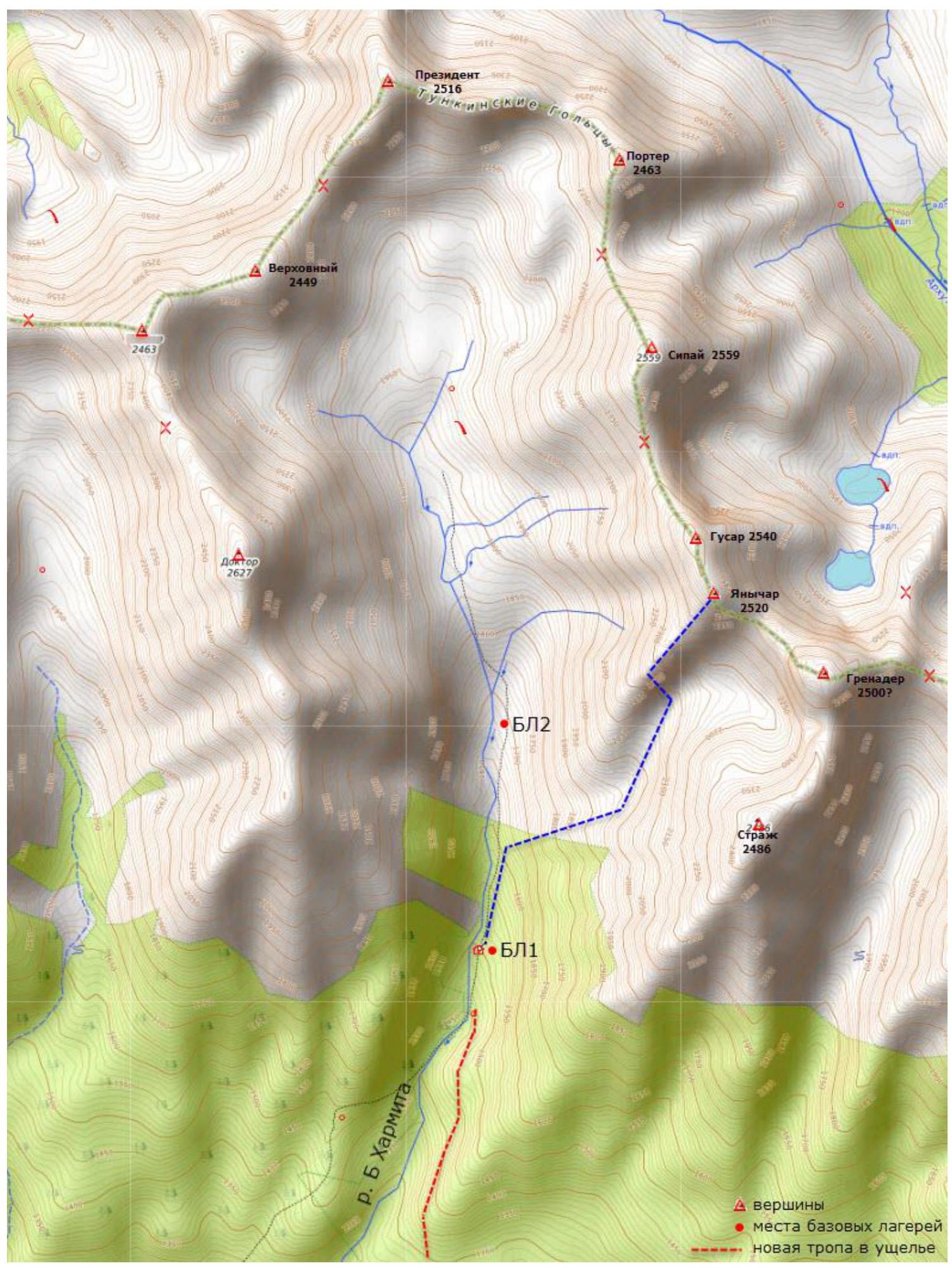
Kharimta valley is located in the Tunkinskiye Goltsy ridge near the Arshan settlement and faces the Tunkinskaya valley. The valley is a rather interesting polygon for alpine development due to its rich relief, size, and height differences of about 1000 m, as well as its transport accessibility. Kharimta valley is the only true valley in the Tunkinskiye Goltsy ridge to the right of the Arshan settlement and mountain; the other valleys are actually hanging valleys — cirques, breaking off into the Tunkinskaya valley. Kharimta has a deeply incised valley with a branched system of cirques in the upper reaches and on the left side in the middle part.
The nearest large settlement is Arshan. The approach is made by driving to the entrance of the valley. A car can deliver to an elevation of 1200 m a.s.l. The time from Arshan to the trail is no more than 1 hour. The time from the trail to the base camp near the forest boundary is about 2–3 hours.
The average time to approach the described route can be broken down as follows: Arshan settlement — trail: 1 hour; trail — hunter's hut BC1: 2 hours; hunter's hut BC1 — start of the technical part of the route: 1.5 hours. The valley has potential for ascents and classification of routes up to 4B/5A category of difficulty. As of the end of 2022, more than 10 routes from 1B to 4A category of difficulty have been laid out in the valley.
Technical Photo of the Route
Photo taken from the Strazh peak (2486 m), distance 1500 m.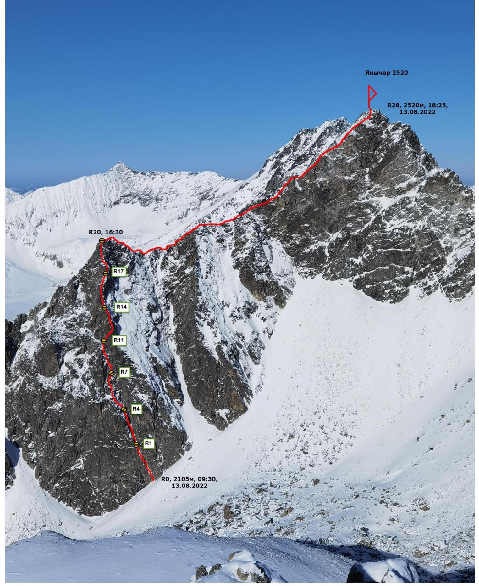 Scheme of the main part of the route, made in UIAA symbols, scale 1:2000. Sheet 1
| Section | Protection elem. | Friends | Rock hook | Rock X, Fifi hook | Bolts | Scheme of the route in UIAA symbols M 1:2000 Sheet 1 | Length (m) | Steepness (°) | Climbing | Aids |
|---|---|---|---|---|---|---|---|---|---|---|
| R19–R20 | 4 | 2 | Photo 9, Photo 8 | 40 | 70 | 4+ | ||||
| R18–R19 | Photo 7 | 10 | 35 | 2+ | ||||||
| R17–R18 | 1 | 1 | 10 | 75 | 5– | |||||
| R16–R17 | 2 | 1 | 10 | 35 | 2– | |||||
| R15–R16 | 3 | 2 | Photo 6 | 30 | 60 | 4– | ||||
| R14–R15 | 10 | 40 | 2– | |||||||
| R13–R14 | 2 | 2 | 20 | 65 | 4+ | |||||
| R12–R13 | 2 | 10 | 70 | 4– | ||||||
| R11–R12 | 1 | 2 | Photo 5 | 20 | 65 | 4– | ||||
| R10–R11 | 2 | 1 | 15 | 50 | 2– | |||||
| R9–R10 | 1 | 15 | 65 | 3+ | ||||||
| R8–R9 | 2 | 15 | 65 | 3– | ||||||
| R7–R8 | 1 | Photo 4 | 5 | 80 | 5– | |||||
| R6–R7 | 3 | 4 | 30 | 70 | 4+ | |||||
| R5–R6 | 1 | 1 | Photo 3 | 10 | 60 | 3+ | ||||
| R4–R5 | 1 | Photo 3 | 20 | 50 | 2+ | |||||
| R3–R4 | 4 | 3 | Photo 2 | 30 | 70 | 4– | ||||
| R2–R3 | 10 | 40 | 2– | |||||||
| R1–R2 | 1 | 5 | 65 | 3+ | ||||||
| R0–R1 | 3 | 6 | Photo 1 | 50 | 60 | 3+ |
Description and Characteristics of the Relief
The starting point of the route is the right part of the lower wall of the SW ridge, specifically — a huge inclined chimney more than three meters wide, cutting through the entire wall diagonally. The most obvious form of relief and the most logical line along this wall.
Rope 1. R0–R1: 50 m, 60°, 3+. Start along the huge chimney, the right wall overhangs, the left lies. 3 friends, 6 rock hooks.
Rope 2. R1–R2: 5 m, 65°, 3+. Wall in the chimney from the station. Shelf in the chimney. R2–R3: 10 m, 40°, 2–. R3–R4: 30 m, 70°, 4–. Wall. 3 rock hooks, 5 friends.
Rope 3. R4–R5: 20 m, 50°, 2+. Grassy shelves. R5–R6: 10 m, 60°, 3+. Climbing along a wide internal form. R6–R7: 30 m, 70°, 4+. Wall and internal corner up slightly to the right.
Rope 4. R7–R8: 5 m, 80°, 5–. Wall from the station. R8–R9: 15 m, 65°, 3–. Rocks with grassy shelves. R9–R10: 15 m, 65°, 3+/4–. Internal corner. R10–R11: 15 m, 50°, 2–. Along a wide ridge. 2 rock hooks, 5 friends.
Rope 5. R11–R12: 20 m, 65°, 3+/4–. To the outer corner to the right. 2 rock hooks, friends. R12–R13: 10 m, 70°, 4–. Along a broken wide internal corner. R13–R14: 20 m, 65°, 4+. Along a wide ridge, bypassing an overhang. Exit to a small saddle above a jendarme.
Rope 6. R14–R15: 10 m, 40°, 2–. Down from the jendarme. R15–R16: 30 m, 60°, 4–. Complex ridge. R16–R17: 10 m, 35°, 2–. Simple approach.
Rope 7. R17–R18: 10 m, 75°, 5–. Rock wall. R18–R19: 10 m, 35°, 2+. Gentle ridge. R19–R20: 40 m, 70°, 4+. Wall, exit to jendarme №3. 3 rock hooks, 5 friends.
R20–R21: 20 m, 0°, 2+. Horizontal ridge. R21–R22: 60 m, 55° down, 2+. Descent from the ridge to a saddle, turning the ridge. R22–R23: 30 m, 0°, 1+/2–. 15 m to the right, then 15 m to the left of the ridge. R23–R24: 90 m, 45°, 2+. Ridge leading to a small jendarme. R24–R25: 20 m, 40°, 2–. Down from the jendarme. R25–R26: 40 m, 45°, 2–. Traverse, bypassing the next jendarme. R26–R27: 150 m, 50°, 2+/3–. Along the SW ridge, either on the ridge or to the left of it. R27–R28: 30 m, 10°, 3–. Ridge to the left, to the peak.
Characteristics of the Route and the Team's Actions
The route taken by the team is the second route to Yanichar peak and the first 4A category route. The most logical line along the South wall was chosen for the ascent. At first glance, attention is drawn to a huge chimney cutting through the wall from right to left. After examining the lower and middle parts and convincing themselves of its relative safety and simplicity compared to neighboring areas, the team decided to ascend via the chimney.
The route in the lower part requires careful passage due to movement along the internal form and the possibility of dropping stones on the participants below. The relief is quite solid and relatively monolithic; in winter, rockfall danger is minimal in the entire area. The avalanche danger of the route in winter is insignificant; the route does not cross any significant snow accumulation areas.
The route has a key section in the middle and upper parts of the wall. The wall part consists of 7 ropes with sections up to 5th category of difficulty. Station locations are quite convenient; in the middle and upper parts, they are safe due to relief protection, while in the lower part, they require attention and caution during the rockfall season.
Descent from the peak is made to the west towards Kharimta valley via the western couloir; the descent is made on foot along shelves, requiring insurance, with places to fall and organize insurance even in winter. In the lower part of the descent, there is a 25 m rappel, followed by a relatively safe descent on foot without insurance. Special attention should be paid to:
- Rockfall danger on the descent in the absence of snow — the team took the tactic of descending in such a way that the rope teams were not one above the other in hazardous areas;
- Avalanche danger of the descent couloir in winter — by "probing" it beforehand.
The author's experience with 4A routes: 8 ascents on 7 routes in the Sayan Mountains. In terms of technical complexity, this route ranks among the highest in the author's experience, standing out for its length of technically complex wall sections; it falls short of 4B due to the lack of a clear key and climbing complexity. Undoubtedly, it is significantly more challenging than any 3B in the author's record.
Cellular connection "Tele2" is available throughout almost the entire route.
Photo 1. Section R0–R1, first rope, leader in the upper third of the section.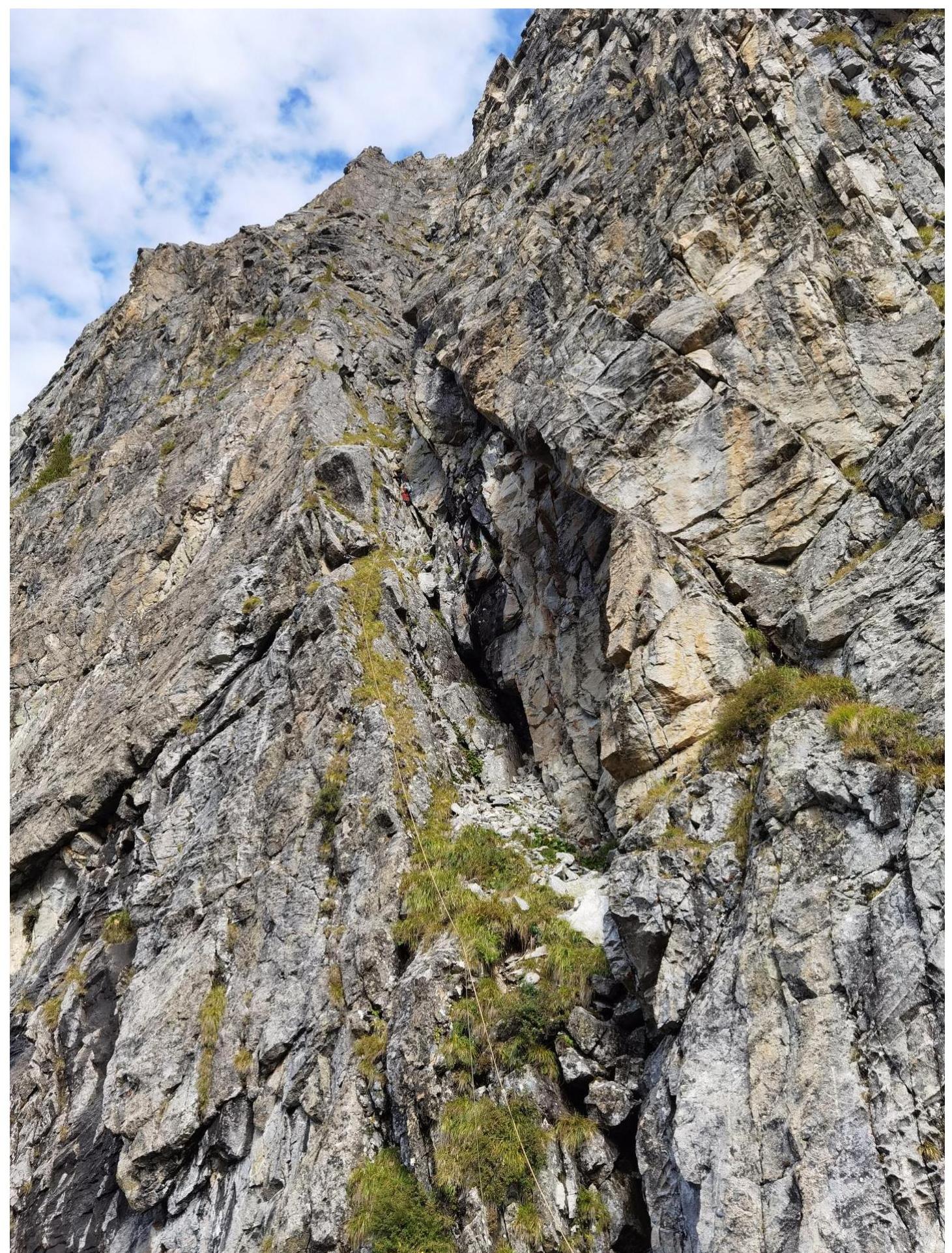
Photo 2. Section R3–R4. Second rope, leader reached the second station.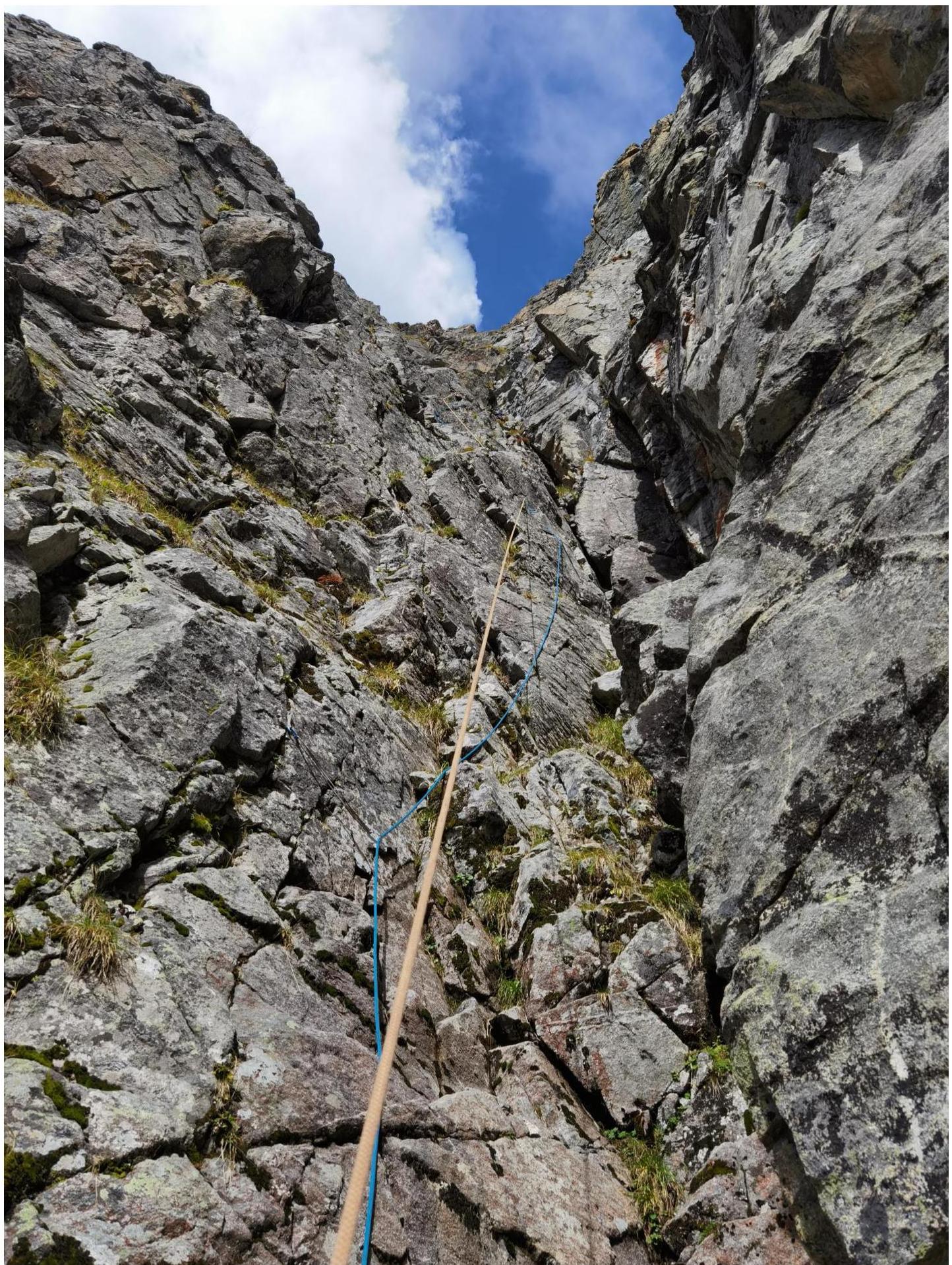
Photo 3. Section R4–R6. Sections leading to the first key part of the route.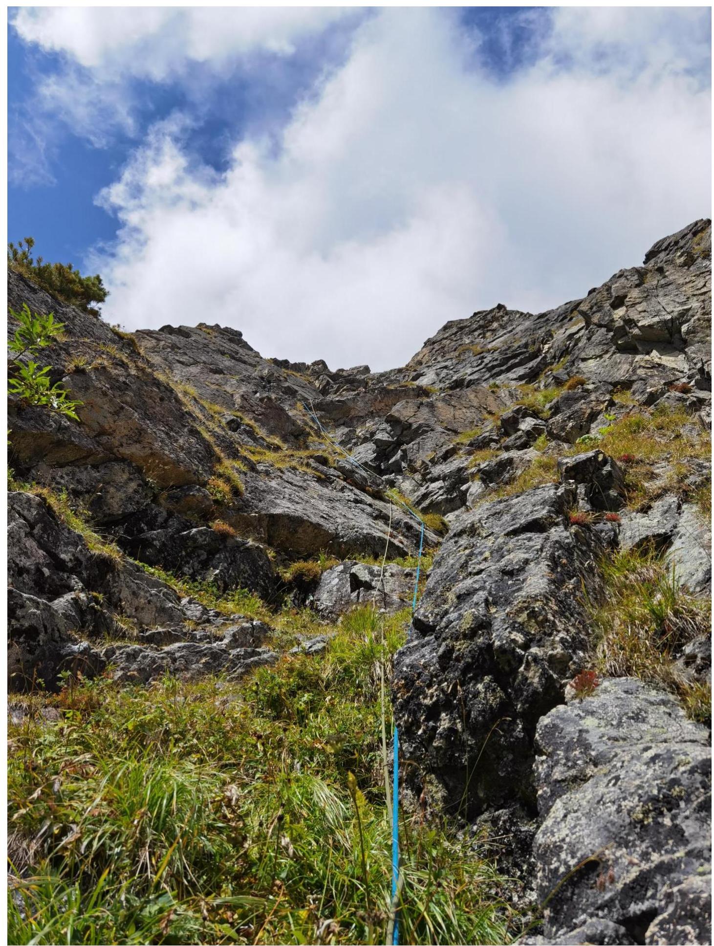
Photo 4. Leader on section R6–R7. Start of the key part of the route. To the right and above the leader, a small wall is visible — section 7–8, start of the 4th rope.
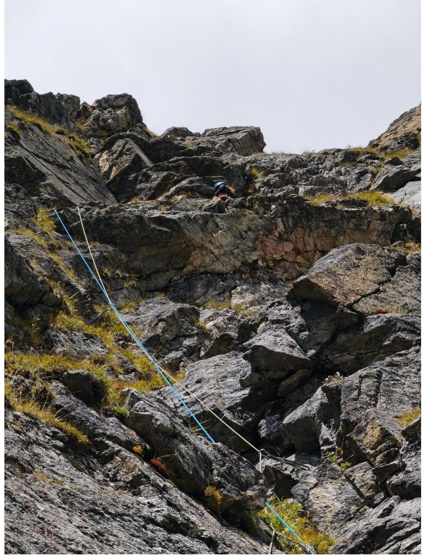
Photo 5. Section R11–R12. Transition to the outer corner, above which the route moves to the edge leading to the jendarme peak.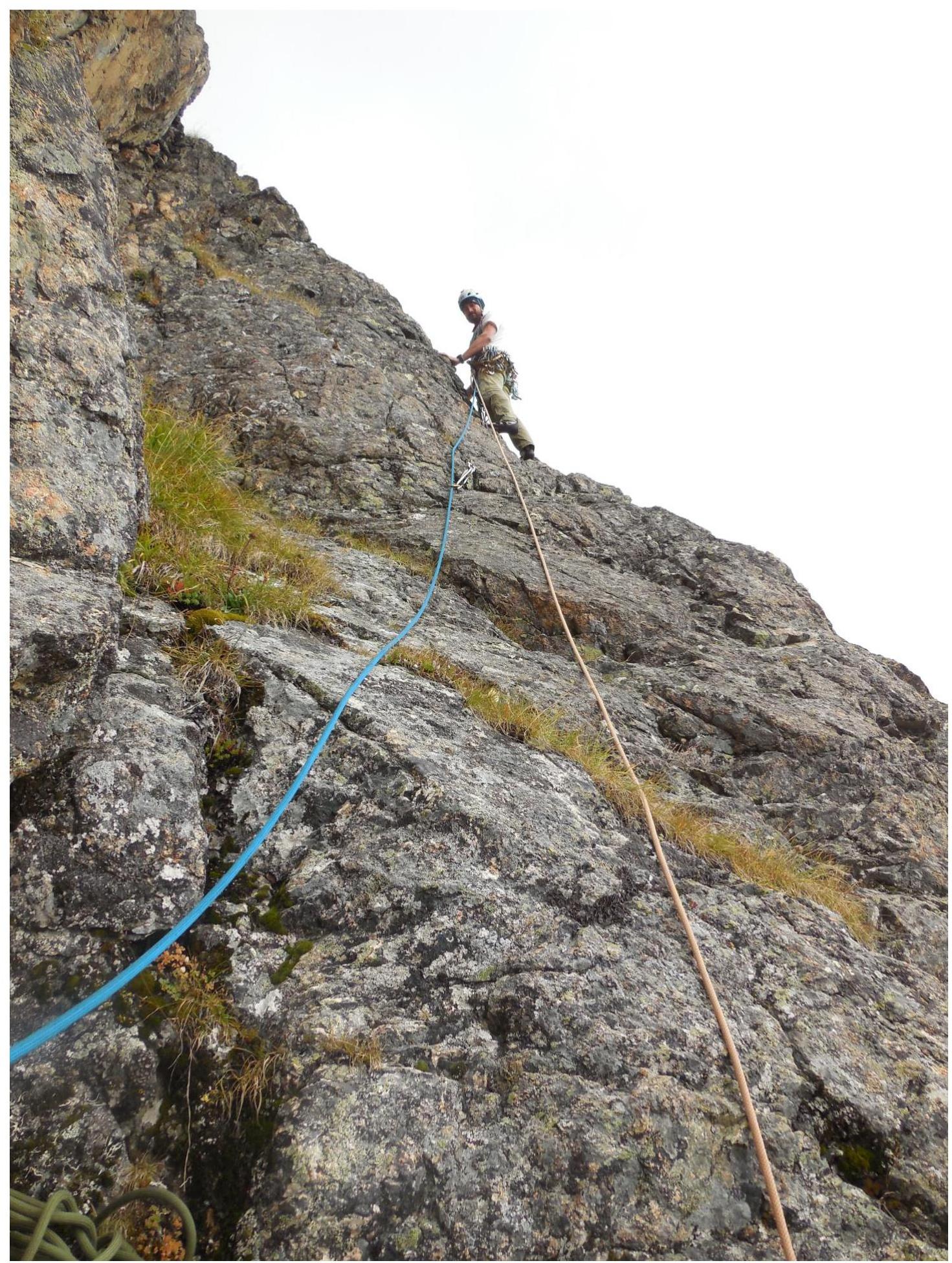
Photo 6. Ridge/edge on section R15–R16. Quite complex climbing on monolithic relief.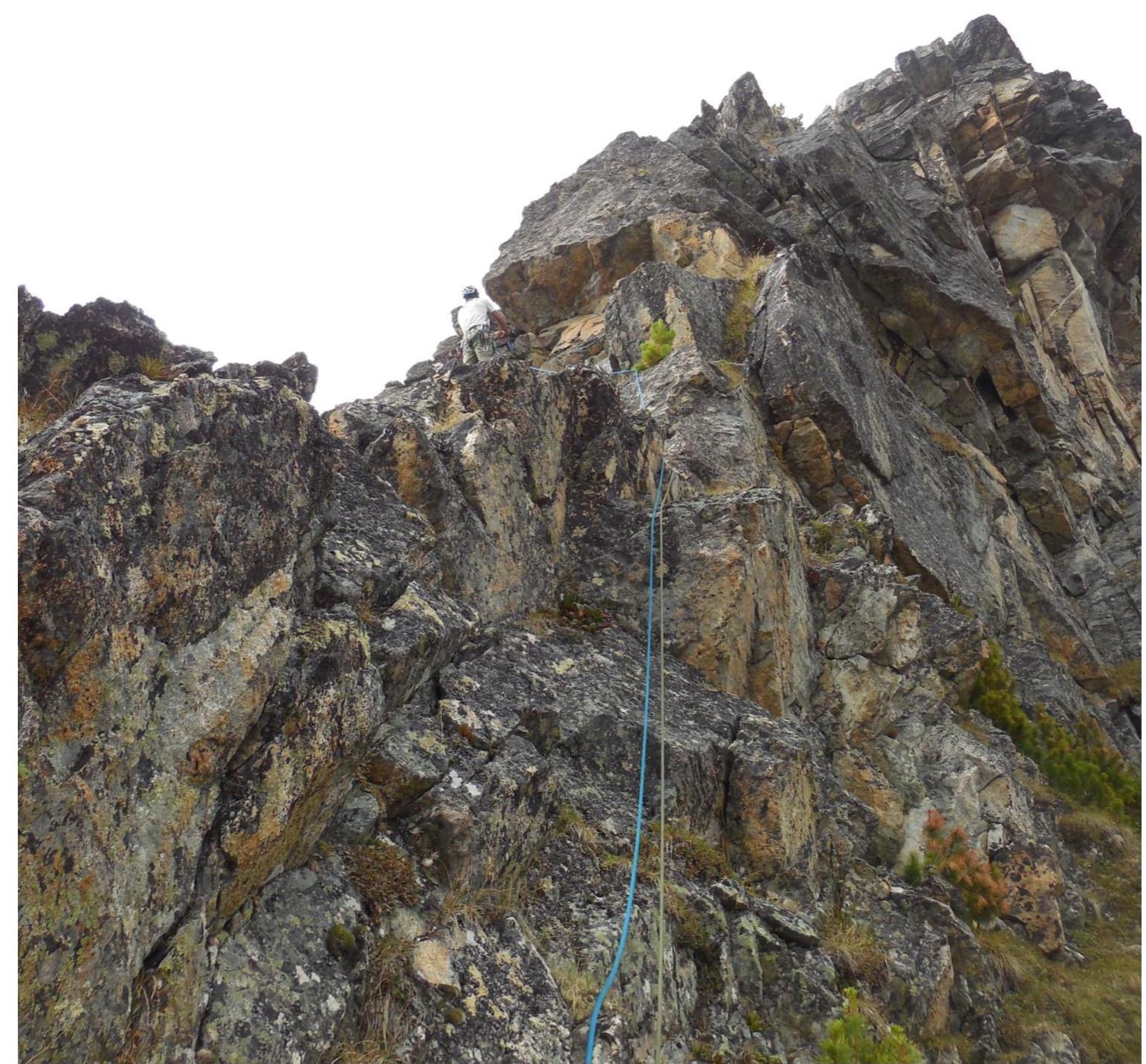
Photo 7. Photo looking down from the middle of section R19–R20. Complex climbing on wet rocks.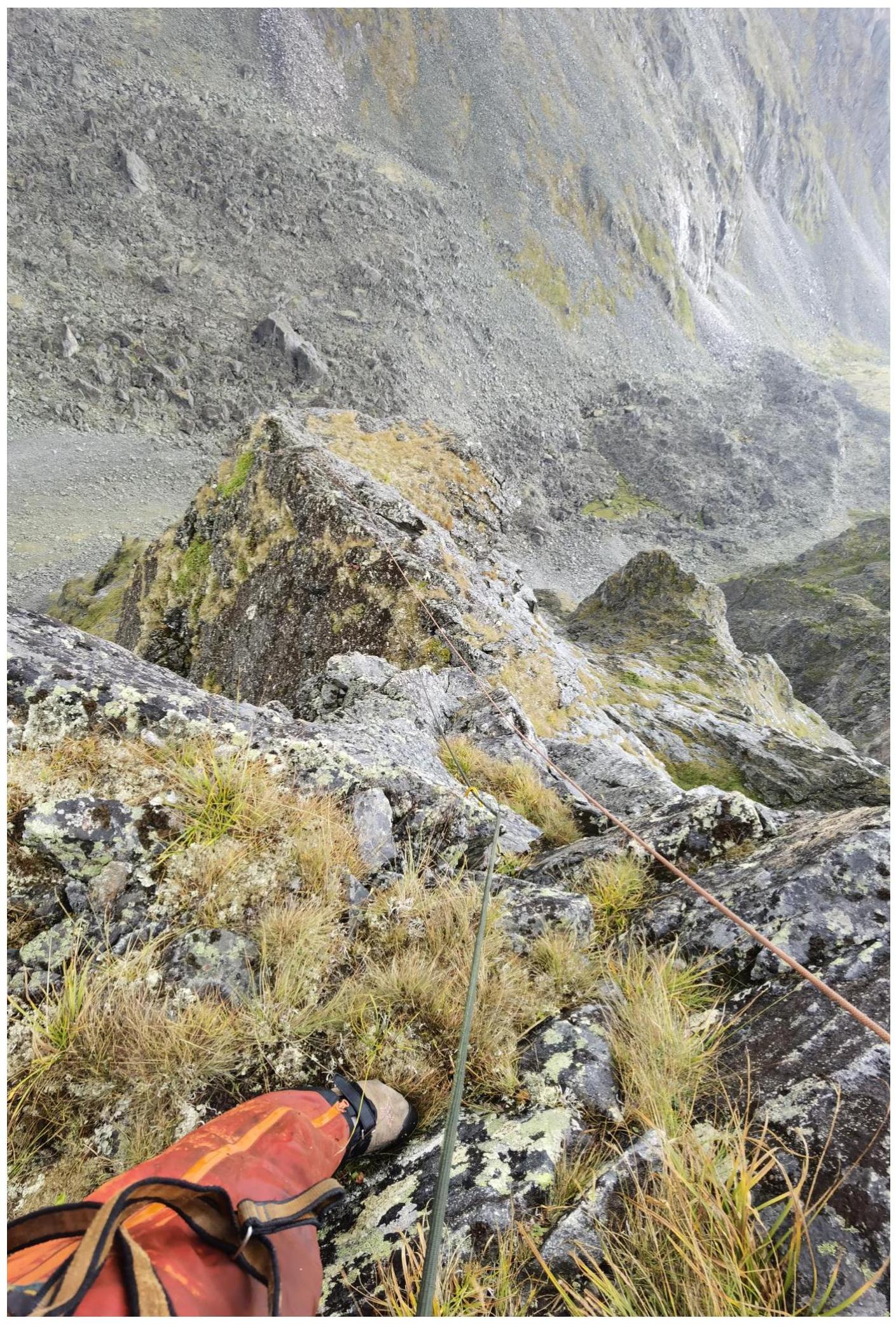
Photo 8. Photo looking up from the middle of section R19–R20. From the same point as the previous photo. Complex climbing on wet rocks.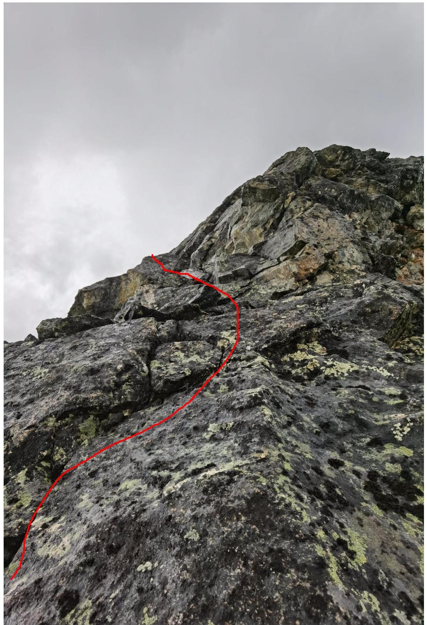
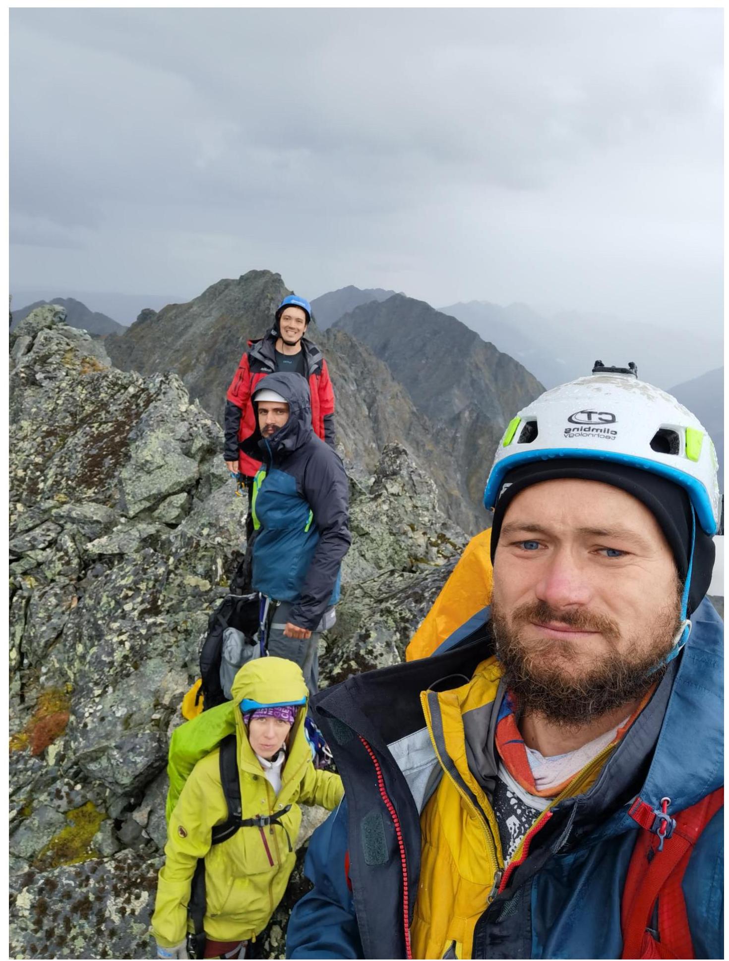
Photo 9. Photo on the peak, from left to right:
- Kolosov A.D.
- Kuzmenko I.M.
- Kazantseva E.V.
- Klepitov A.A.
Comments
Sign in to leave a comment