
Report
On the first ascent
Tortuga Peak (2770 m) – eastern ridge, route 3A cat. diff. (proposed), first ascent – Eastern Sayan, Tunkinskiye Goltsy ridge, Moigota valley, 6.1.2
Leader: Klepikov A.A. Participants: Tokmachev A.A., Lipchenko A.V.
The ascent was made on June 22, 2022.
2022
I. Ascent Passport
| № | 1. General Information | |
|---|---|---|
| 1.1 | Full name, sports rank of the leader | Klepikov Alexander Alexandrovich, Master of Sports, 3rd category |
| 1.2 | Full name, sports rank of the participants | Tokmachev Andrey Andreevich (3rd sports rank) Lipchenko Anastasia Vyacheslavovna (3rd sports rank) |
| 1.3 | Full name of the coach | Afanasiev Andrey Evgenievich, Master of Sports, 1st category |
| 1.4 | Organization | Baikal School of Alpinism (BSA) |
| 2. Characteristics of the ascent object | ||
| 2.1 | Region | Eastern Sayan, Tunkinskiye Goltsy ridge |
| 2.2 | Valley | Moigota valley |
| 2.3 | Section number according to the 2020 classification table | 6.1.2 |
| 2.4 | Name and height of the peak | Tortuga (2770 m) |
| 2.5 | Geographic coordinates of the peak (latitude/longitude), GPS coordinates * (1) | 51° 53' 58.08" N 102° 05' 35.37" E |
| 3. Route Characteristics | ||
| 3.1 | Route name | Along the E ridge |
| 3.2 | Proposed category of difficulty | 3A |
| 3.3 | Degree of route development | First ascent |
| 3.4 | Relief characteristics of the route | Rocky |
| 3.5 | Height difference of the route and main part | 170 m |
| 3.6 | Length of the route and main part | 683 m |
| 3.7 | Technical elements of the route (total length of sections of various difficulty categories with indication of relief type (ice-snow, rocky)) | I cat. diff. rocks – 230 m. II cat. diff. rocks – 320 m. III cat. diff. rocks – 65 m. IV cat. diff. rocks – 50 m. V cat. diff. rocks – 3 m. |
| 3.8 | Descent from the peak | Along the W ridge towards the Double V Dash pass, down the S couloir to the Moigota valley. |
| 3.9 | Additional route characteristics | No water on the route in normal summer conditions |
| 4. Characteristics of the team's actions | ||
| 4.1 | Time of movement (team's walking hours, indicated in hours and days) | 6 walking hours to the peak, 1 day |
| 4.2 | Overnights | No |
| 4.3 | Entry onto the route | 13:00 on June 22, 2022 |
| 4.4 | Reaching the peak | 18:50 on June 22, 2022 |
| 4.5 | Return to the base camp | 22:00 on June 22, 2022 |
| 5. Responsible for the report | ||
| 5.1 | Full name, e-mail | Klepikov A.A., Baikalteam@gmail.com |
Photo of the general view of the first ascent route on Tortuga. (Photo taken from the lake in the Moigota valley, shooting height 2150 m)
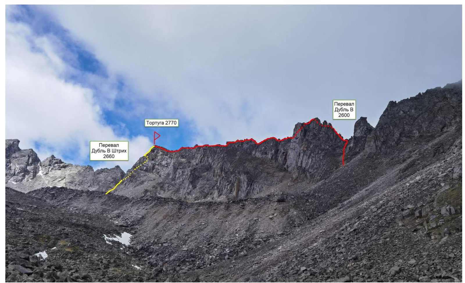
RED – team's 3A route on Tortuga
Yellow – 1B category descent route
Panorama of the peaks of the Tunkinskiye Goltsy ridge in the Moigota valley. (Photo taken from the right Bilyuta river valley.)
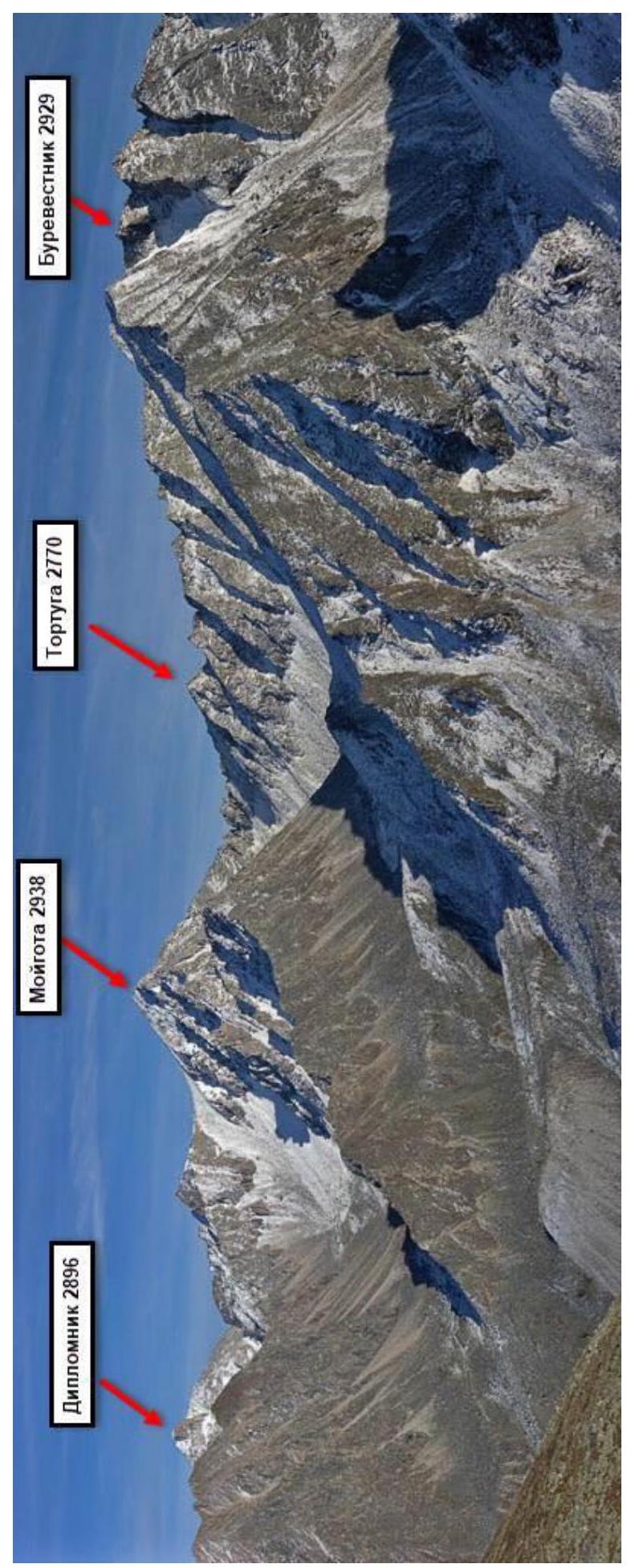
The Moigota valley is located in the Tunkinskiye Goltsy ridge near the Arshan settlement and is oriented towards the Tunkinskaya valley. The valley is formed in the shape of a trough, with multiple signs of glacial activity: lateral, terminal, and bottom moraines, and the slopes have widespread glacially scoured "ram's forehead" features. In the upper reaches, the valley branches into tributaries, which in turn divide into cirques containing lakes. The slopes of the valley have height differences of over 1000 m in some places.
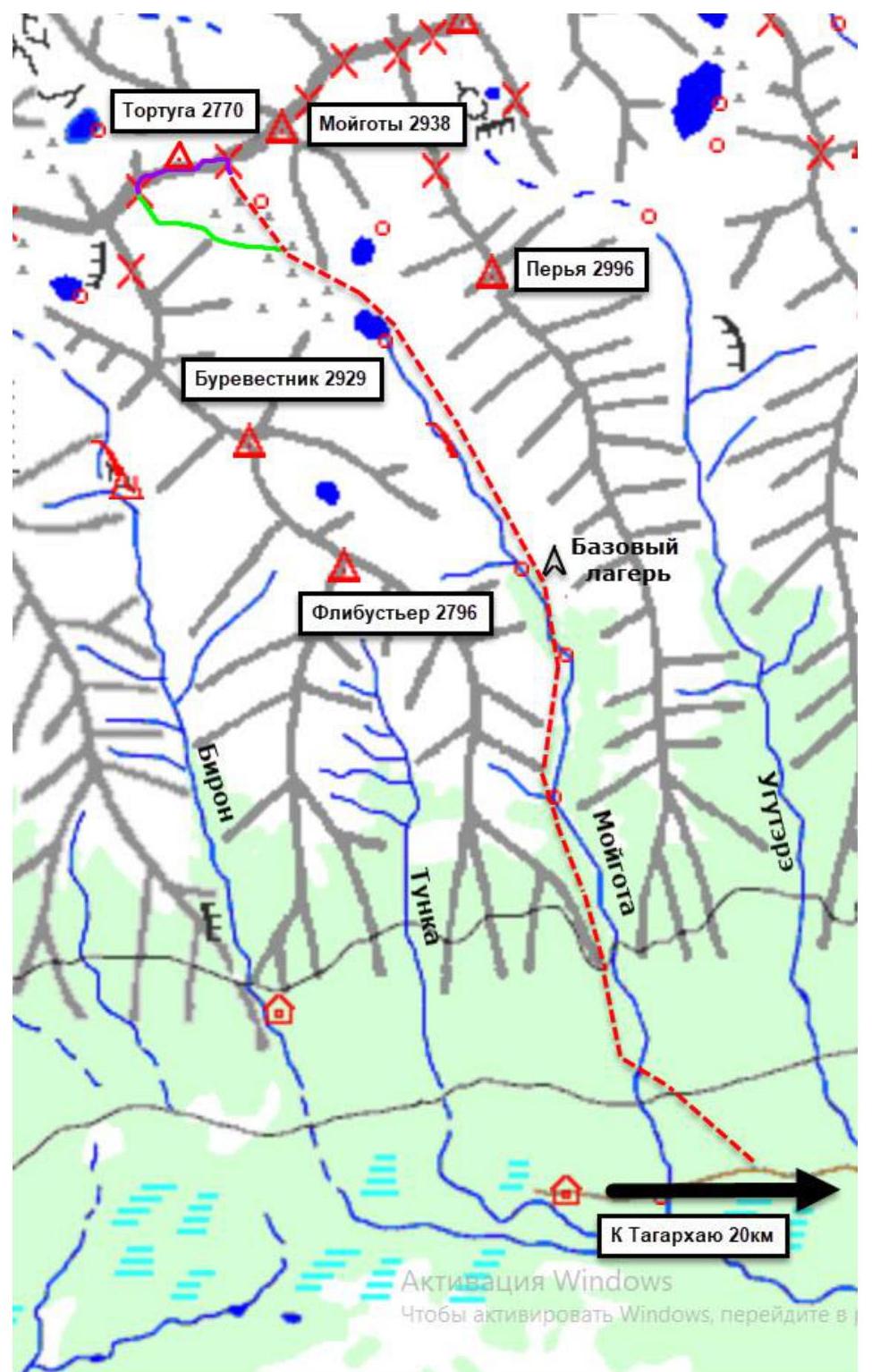
The nearest major settlement is the Arshan settlement. From Arshan, it's possible to reach the entrance to the valley, known as Pidorina Zaimka, by a high-clearance vehicle; the distance is about twenty-five kilometers. Further on, there's a trail leading into the valley. The time taken to reach the base camp in the valley from Arshan settlement is between 8 to 10 hours. The average time to approach the described route can be broken down as follows:
- Arshan settlement – Pidorina Zaimka: 2 hours
- Pidorina Zaimka – base camp in the valley: 6 hours
- Base camp – start of the route: 3 hours
Technical photo of the route
(Photo taken from the lake in the Moigota valley, shooting height 2150 m)
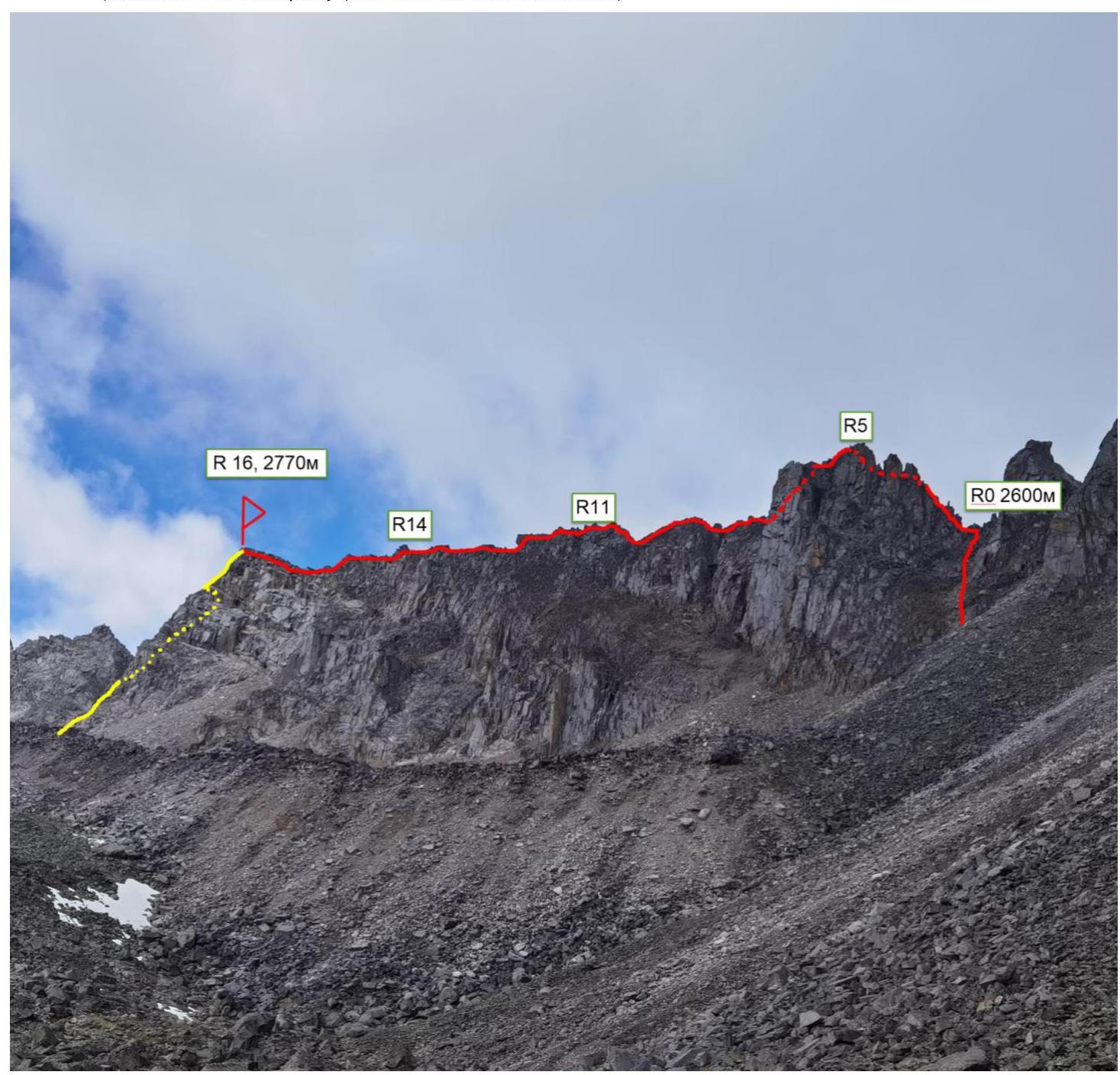
Description and relief characteristics
The start of the route, ascent to the Double V pass, into the left fork of the pass, does not present significant technical difficulties, only the final meters to the saddle require climbing on relatively simple rocks.
R0–R1 50 m, 60°, 4, Rocky wall with internal corners, first key part of the route.
R1–R2 15 m, 50°, 3, Descent into a gap along the ridge.
R2–R3 15 m, 30°, 2, Traverse along a ledge to the right.
R3–R4 3 m, 90°, 5, Wall climb to the right, exit onto a ledge. Can be climbed directly or with a pendulum move to the right. Alternatively, two simple movements on artificial holds (IT). Second key section.
R4–R5 35 m, 40°, 2, Along ledges to the right, bypassing a large pinnacle.
R5–R6 40 m, 45°, 2, Descent along the ridge to a saddle between two pinnacles. There's a wall section requiring climbing (category 3) or rappelling.
R6–R7 40 m, 0°, 2, Along the ridge, on the "knife-edge".
R7–R8 15 m, 50°, Rappelling, descent to a saddle between pinnacles.
R8–R9 20 m, 40°, 1, Descent from the saddle to the right, bypassing an unnecessarily complex pinnacle.
R9–R10 30 m, 55°, 3, To the left, along the simplest relief, onto a counterfort of the ridge.
R10–R11 50 m, 45°, 2, Traverse towards the main ridge.
R11–R12 50 m, 0°, 2, Horizontal ridge.
R12–R13 100 m, 20°, 2, Along the ridge, gradual ascent on large-block relief.
R13–R14 10 m, 60°, 3, Wall climb onto a pinnacle.
R14–R15 10 m, 30°, 1, Descent from the pinnacle.
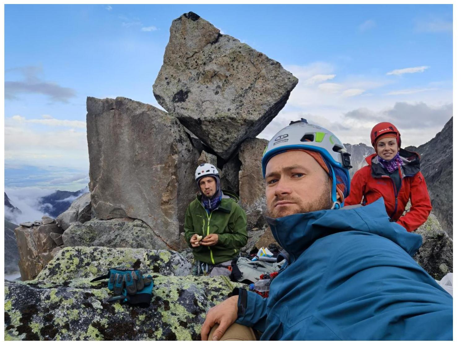
R15–R16 200 m, 20°, 1, Simple ridge ascent to the peak. A large boulder at the summit. Control cairn beneath it.
Route characteristics and team actions
The route taken by the team was scouted by the leader during an ascent of Moigota peak via a 3A category route. It's a logical line of similar complexity, going in the opposite direction to an unclimbed peak between the Double V and Double V Dash passes.
The route is characterized by movement on large-block relief, which is reliable and monolithic. There are no issues with selecting locations for belays.
The route is straightforward to navigate, following the ridge while bypassing the most complex and illogical pinnacles. The most technically challenging part is located in the first third of the route and consists of:
- the first full key rope length;
- a small wall on the second rope length.
The descent from the peak is made in a westerly direction along a simple ridge (category 1B) to the saddle of the Double V Dash pass.
There was no cairn at the summit, and based on available information, no one had previously reached the peak; no signs of human presence were found in the vicinity.
The author has experience with over 30 ascents on 28 routes of category 3A in the Sayan Mountains, Caucasus, and Transbaikalia. The technical complexity of this route is among the highest, but considering the overall length and accompanying features of the ascent, the author believes it falls slightly short of category 3B due to the limited number of sections corresponding to the key sections of a 3B route.
To avoid easing the category of routes in the area, it's recommended to assign a category of 3A.
In terms of technical complexity, it's similar to:
- 3A on Archimedes
- 3A – traverse of Uktyu peaks
It's more challenging than a route like 3B on Shogentsukov (start of the route).
Start of the route. Work at the beginning of section R0–R1: alternating walls and ledges in the first half of the section.
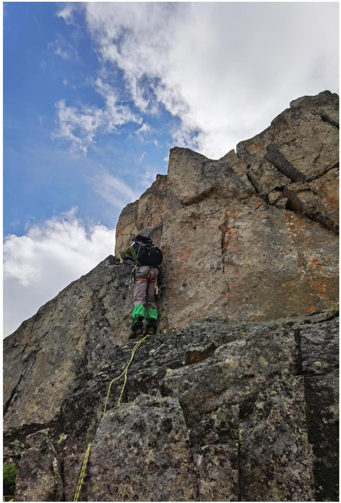
Internal corner at the top of section R0–R1: moss-covered rocks.
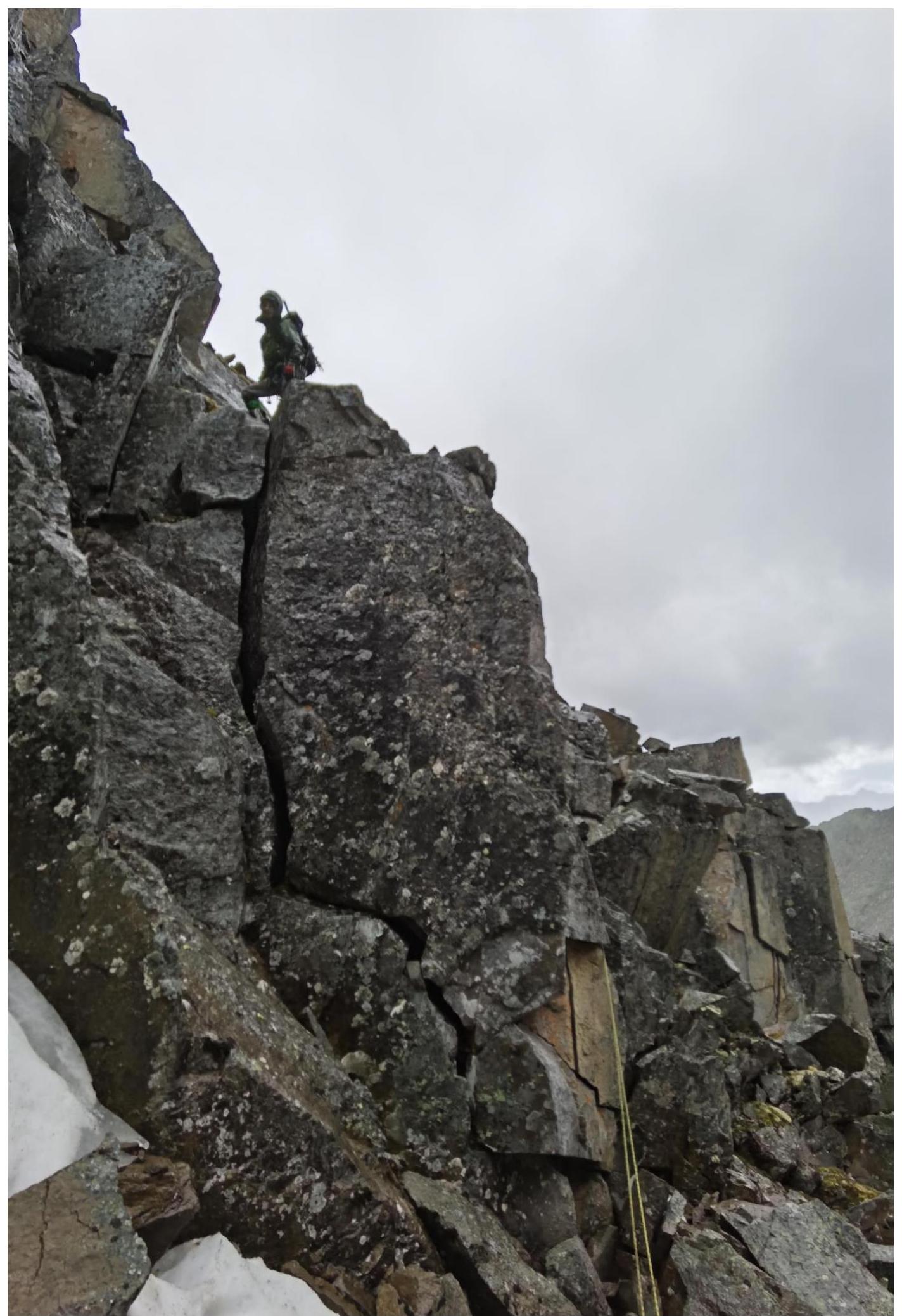
Internal corner at the top of section R0–R1: moss-covered rocks. Leader at point R1.
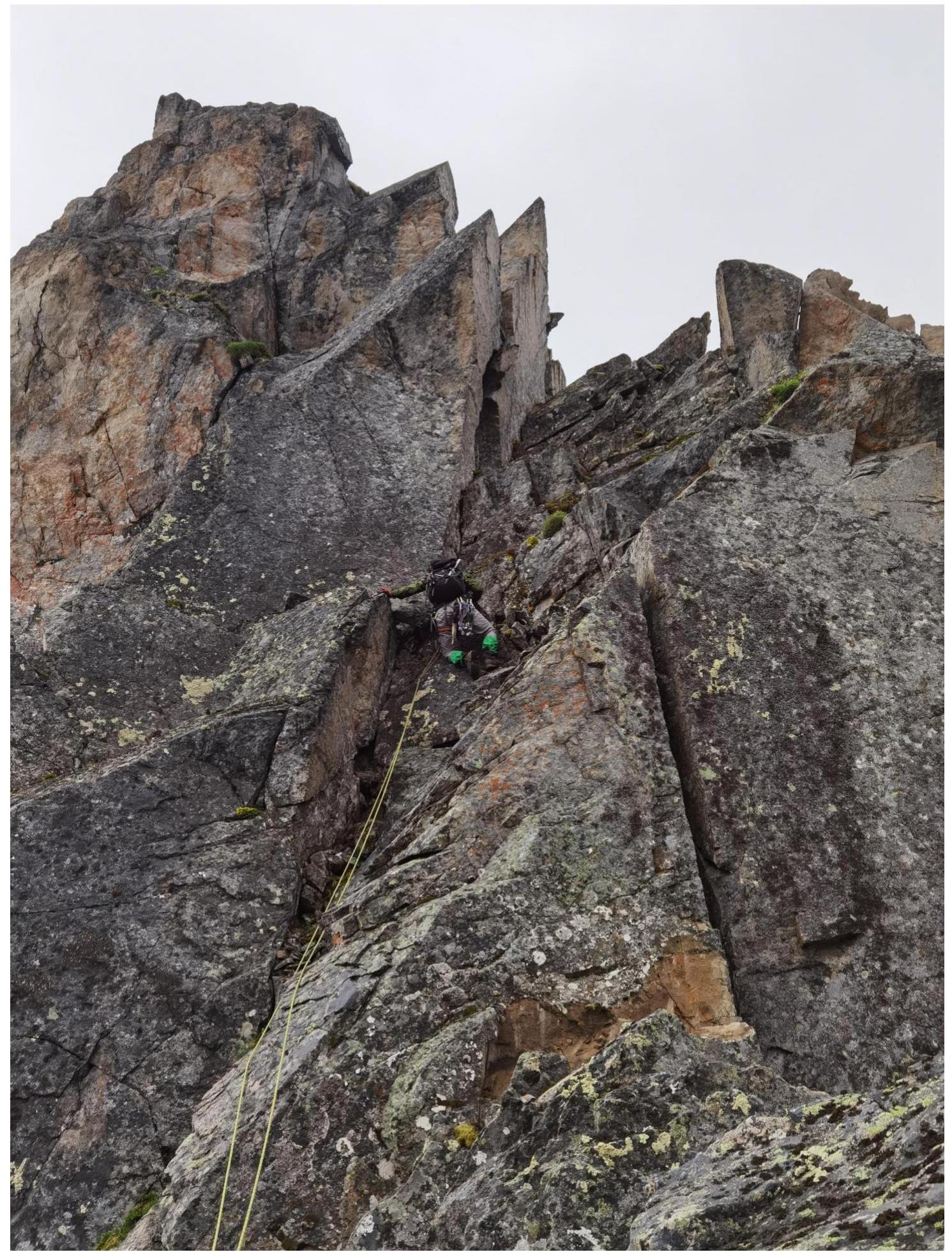
End of section R2–R3, and the second key section of the route R3–R4.
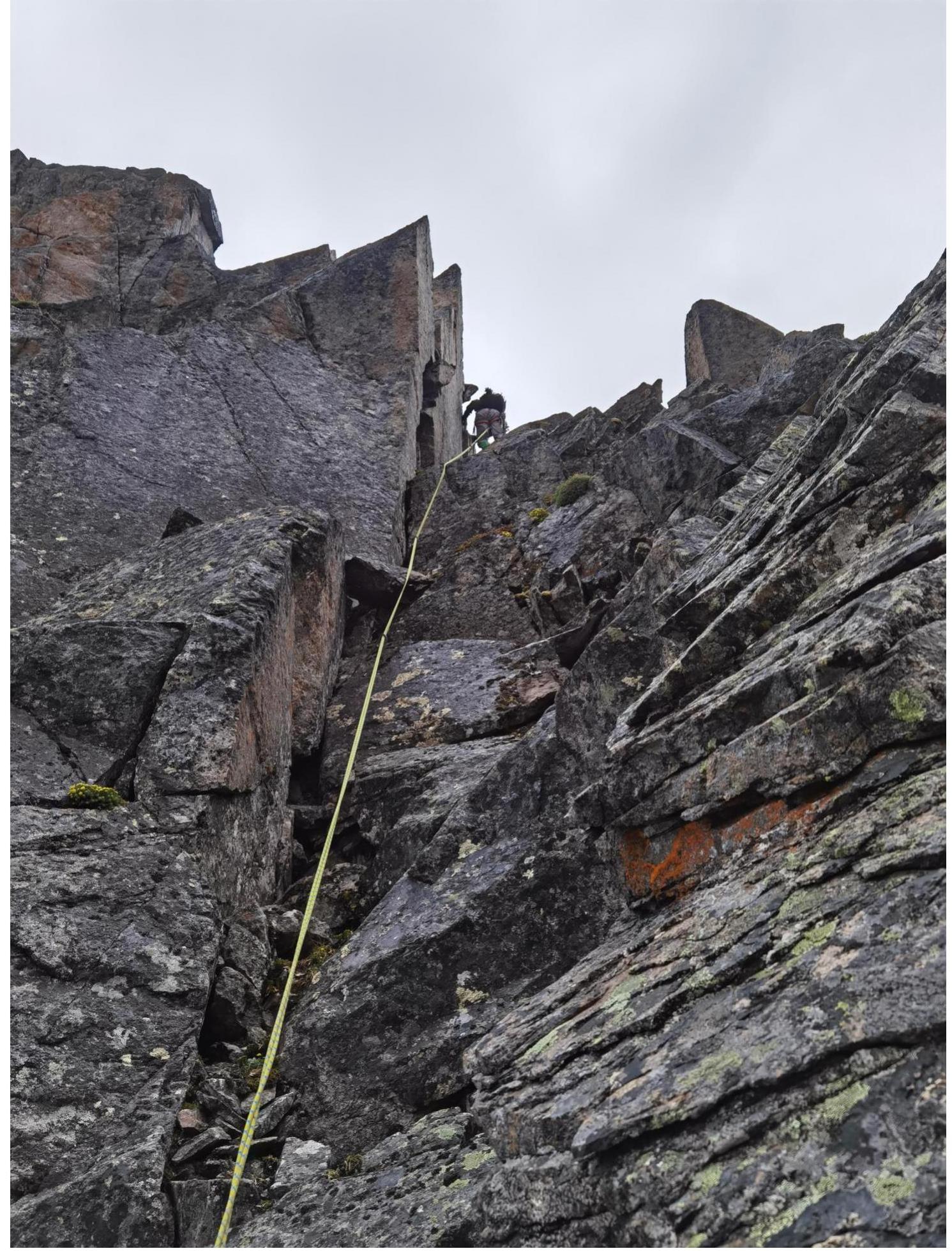
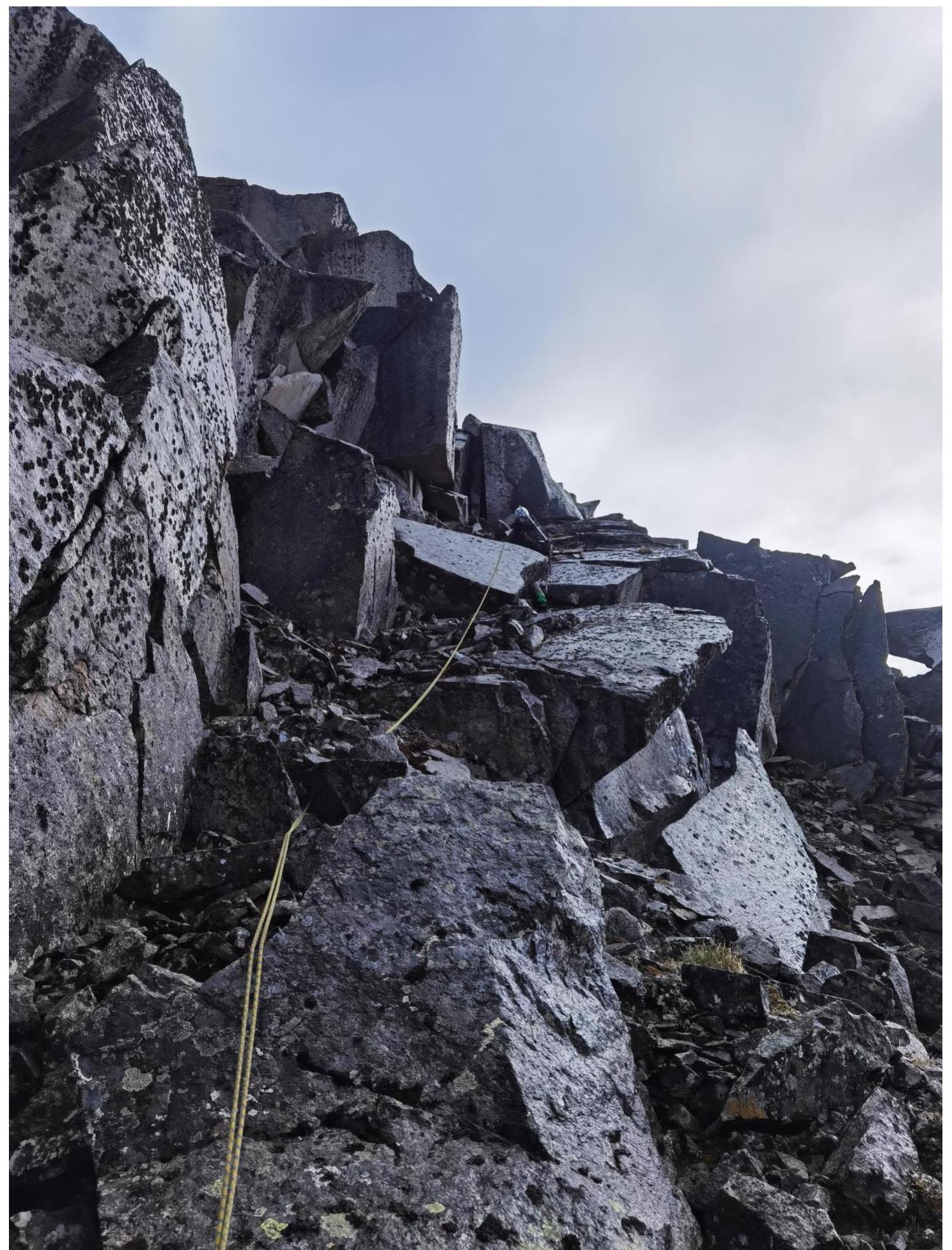
Section R6–R7. Ridge with no height gain.

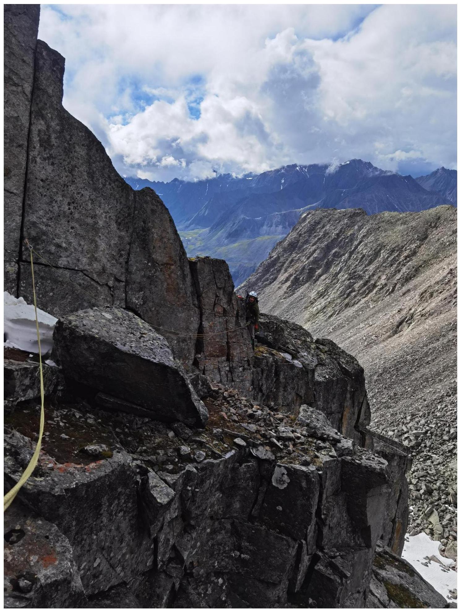
Section R9–R10. Climbing after rappelling, bypassing a complex part of a pinnacle.
Section R10–R11.
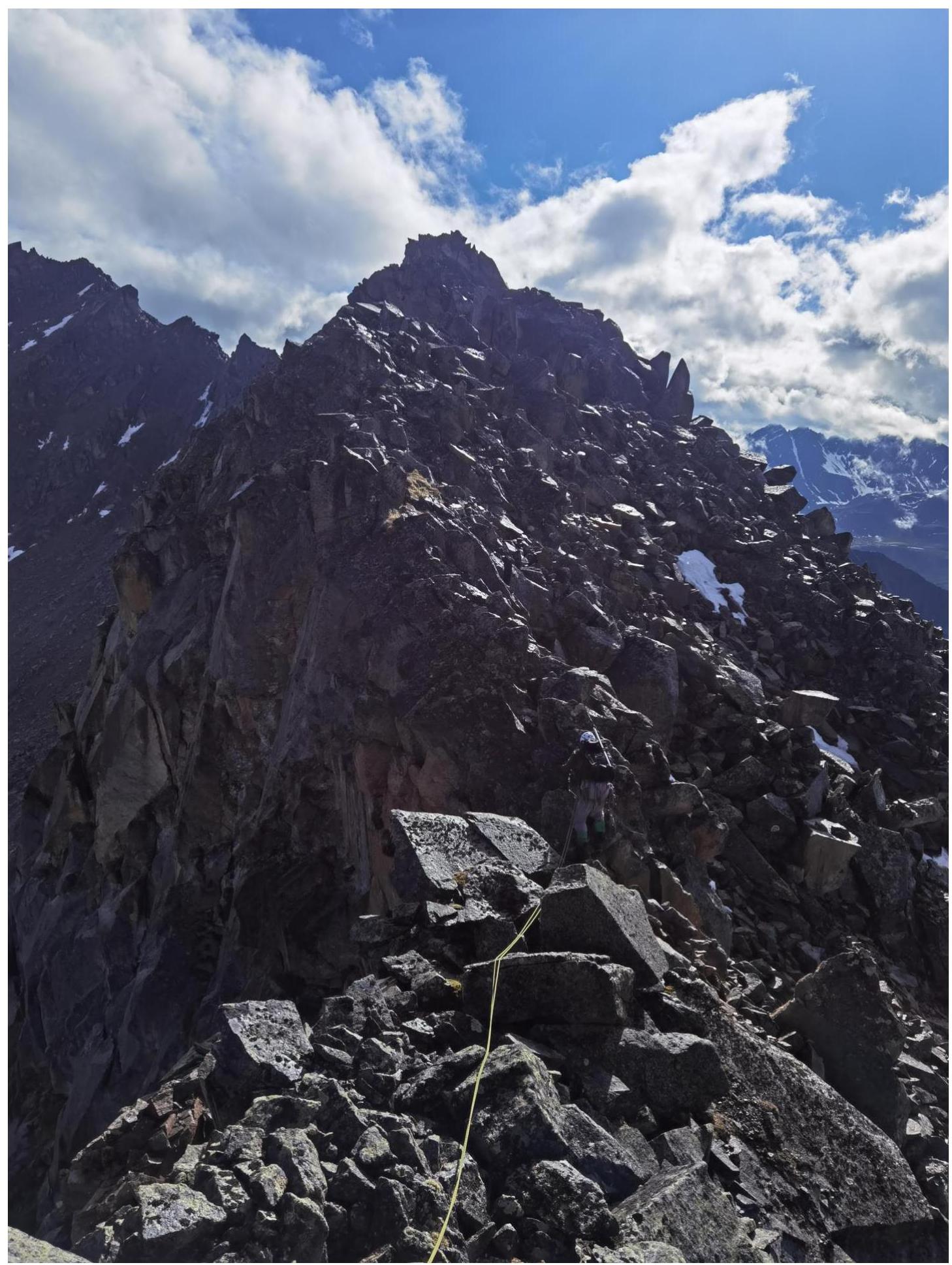
On section R15–R16. Simple ridge ascent to the peak.
At the summit, from left to right: Tokmachev A.A., Klepikov A.A., Lipchenko A.V.
Comments
Sign in to leave a comment