Report
ON THE FIRST ASCENT TO THE SUMMIT OF RADISHCHEV VIA THE WESTERN RIDGE ROUTE, CATEGORY 2A, BY THE TEAM: NEVOZMOZHNO ETO NE NAVSEGDA, MARCH 27, 2019
I. Climbing Report
| № | 1. General Information | |
|---|---|---|
| 1.1 | Full name, sports rank of the team leader | Panova Alena Mikhailovna, CMS |
| 1.2 | Full name, sports rank of the participants | Kalashnikov Andrey Yurievich, 3rd sports rank; Petko Andrey Pavlovich; Tsalman Igor Viktorovich, 3rd sports rank; Tsalman Polina Viktorovna, 3rd sports rank; Maslova Anna Alexandrovna, 3rd sports rank; Nikolaev Evgeny Alexandrovich, 3rd sports rank; Kurushin Alexander Yurievich, 3rd sports rank |
| 1.3 | Full name of the coach | Glazunov Evgeny Vladimirovich |
| 1.4 | Organization | Gory Baikala |
| 2. Characteristics of the Climbing Object | ||
| 2.1 | Region | Eastern Sayan, Tunkin Goltsy Ridge |
| 2.2 | Valley | Barun-Khandagai |
| 2.3 | Section number according to the 2013 classification table | 6.1.2 |
| 2.4 | Name and height of the summit | Radishchev, 2920 m |
| 2.5 | Geographical coordinates of the summit (latitude/longitude), GPS coordinates | 51°48′19.60″ N, 101°28′0.33″ E |
| 3. Characteristics of the Route | ||
| 3.1 | Name of the route | Via the Western Ridge |
| 3.2 | Proposed category of difficulty | 2A |
| 3.3 | Degree of route exploration | First ascent |
| 3.4 | Nature of the route terrain | Rocky |
| 3.5 | Height difference of the route (altimeter or GPS data) | 480 m |
| 3.6 | Length of the route (in meters) | 960 m |
| 3.7 | Technical elements of the route (total length of sections of varying difficulty with indication of terrain type: ice-snow, rocky) | Category 1 rocky terrain – 250 m. Category 2 rocky terrain – 640 m. Category 3 rocky terrain – 70 m. Category 4 rocky terrain – 0 m. |
| 3.8 | Descent from the summit | Into the Ula-Gol valley via the NE ridge to the saddle, then down the NW couloir towards the summit 3032 (General Koryakov) |
| 3.9 | Additional characteristics of the route | Lack of water |
| 4. Characteristics of the Team's Actions | ||
| 4.1 | Time of movement (team's walking hours, in hours and days) | 2 hours 30 minutes |
| 4.2 | Overnights | No |
| 4.3 | Departure onto the route | 5:00 AM, March 27, 2019 |
| 4.4 | Reaching the summit | 9:30 AM, March 27, 2019 |
| 4.5 | Return to the base camp | 2:40 PM, March 27, 2019 |
| 5. Person responsible for the report | ||
| 5.1 | Full name, e-mail | Panova Alena Mikhailovna, aljonchik1905@mail.ru, 8-999-686-20-78 |
II. Description of the Ascent
1. Characteristics of the Climbing Object
1.1. General photo of the summit
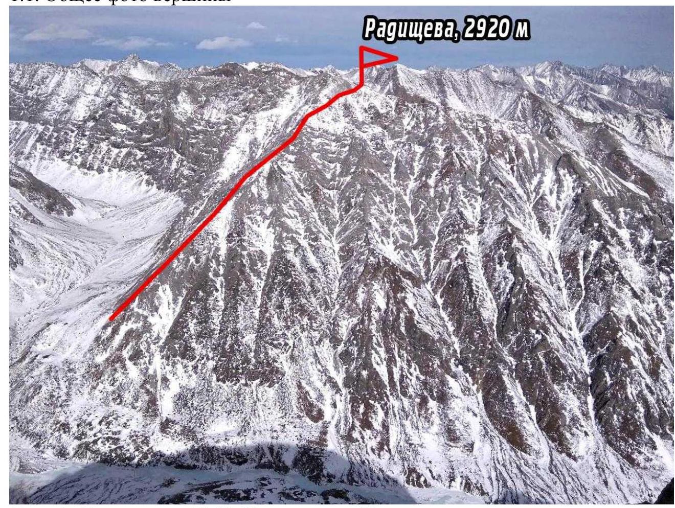
Photo 1. Taken on March 28, 2020, from the summit of Ula-Gol
1.2. Photo of the route profile
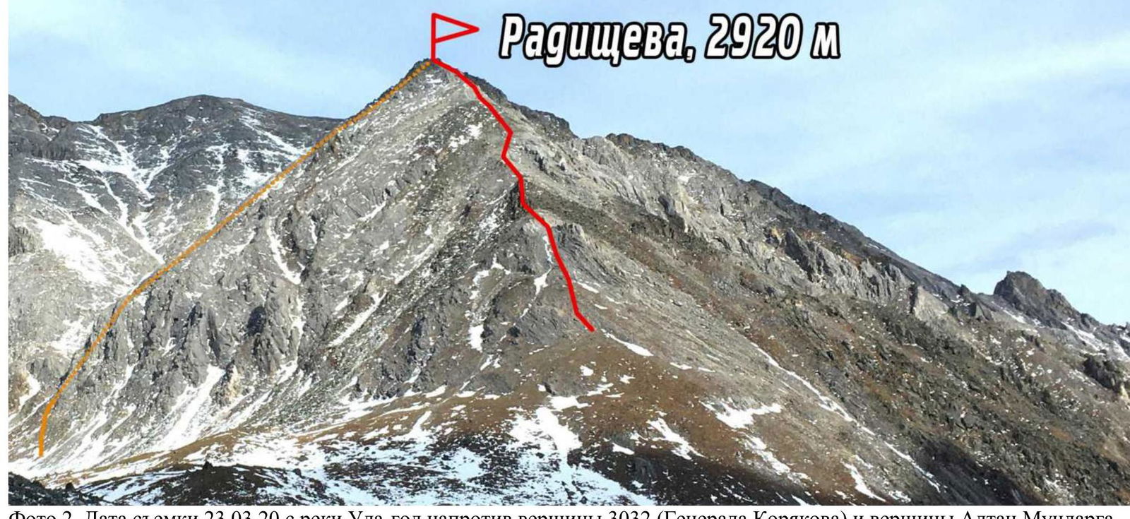
Photo 2. Taken on March 23, 2020, from the Ula-Gol river opposite the summit 3032 (General Koryakov) and the summit Altan Mundarga
1.3. Photopanorama of the area

Photo 3. Taken on March 25, 2019, from the summit of Tunkinskaya
1.4. Map of the area
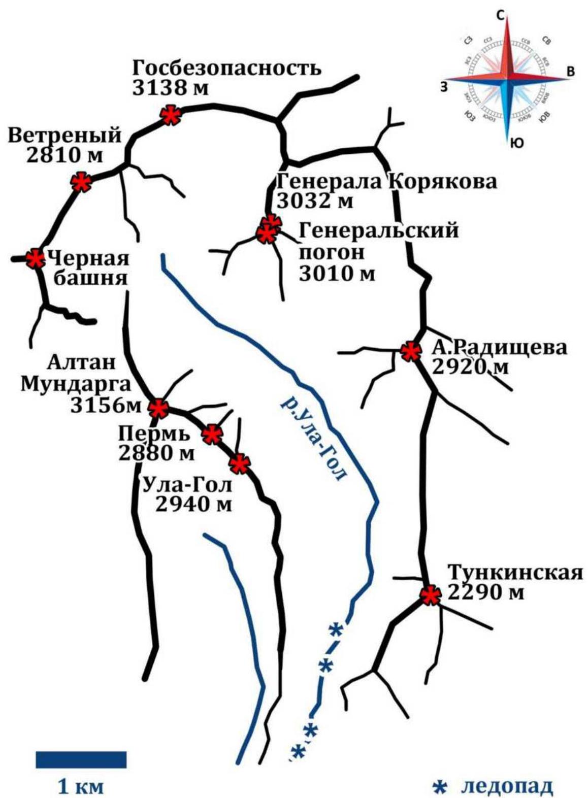
Photo 4. Diagram of the valley
Approach: from the settlement of Nilova Pustyn (Tunkinsky district, Buryatia Republic (district center — settlement Kyren)) to the village of Khoito-Gol, then along the forest road by car (preferably high-clearance) or on foot to the point of direct visibility on Mt. Altan-Mundarga, from where the trail to the valley is visible. Movement on foot to the Ula-Gol river. Then upstream along the river. In winter, the approach is more comfortable along the frozen river, the icefall is bypassed to the left towards the valley.
2. Characteristics of the Route
2.1. Technical photograph of the route
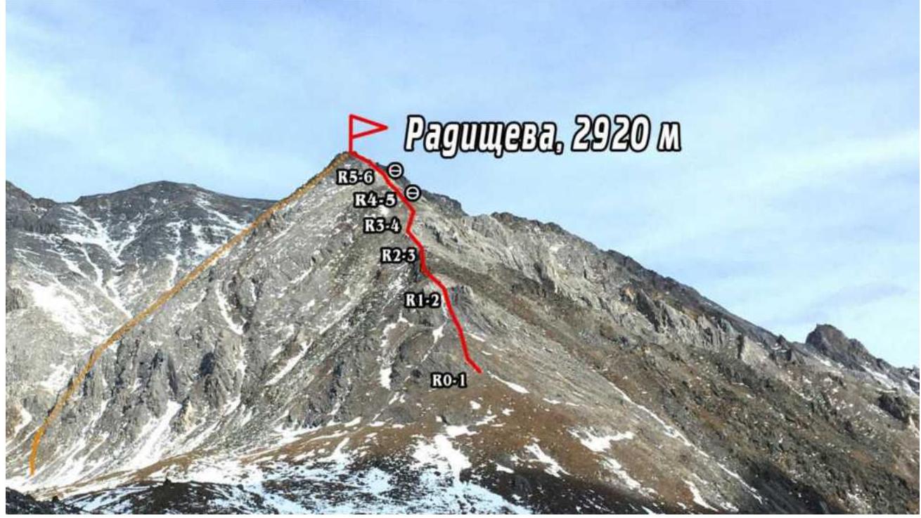
Photo 5.
2.2. Numbers of sections on the technical photograph correspond to.
| Section | Nature of the terrain | Category of difficulty | Length, m, angle ° | Type and number of hooks |
|---|---|---|---|---|
| R0–R1 | Grassy slope of the ridge | 1 | 250 m, 30° | |
| R1–R2 | Rocky outcrops | 2 | 50 m, 45° | |
| Wide rocky ridge | 2 | 150 m, 30° | ||
| R2–R3 | Wide rocky ridge with "sheep's foreheads" | 2 | 150 m, 40° | |
| Narrow ridge of "sheep's foreheads" | 3 | 40 m, 60° | ||
| R3–R4 | "Sheep's foreheads" with snow | 2 | 50 m, 40° | |
| R4–R5 | Live rubble to the right of the ridge | 2+ | 80 m, 15° | |
| Exit to the ridge along the destroyed rock | 3– | 30 m, 60° | ||
| R5–R6 | Narrow ridge. "Sheep's foreheads". | 2+ | 160 m, 20° |
3. Characteristics of the Team's Actions
3.1. Brief description of the route passage.
| Section | Description | Photo number |
|---|---|---|
| R0–R1 | Movement along a gentle grassy slope to the rocks – "sheep's foreheads" | Photo 7 |
| R1–R2 | Simultaneous movement in rope teams across the rocks, exit to the wide ridge | |
| R2–R3 | The ridge changes terrain to "sheep's foreheads", movement is simultaneous due to the gentle slope. Transitions to a narrow ridge, movement along the gully between the "foreheads", climb onto a narrow (about 1 m) bridge of "sheep's foreheads", careful movement with friction, passive holds, minimal belaying off the terrain | Photo 8 – Photo 9 |
| R3–R4 | Exit to a slope without relief for belaying off the terrain, snow lies on the slab, need to watch where it's better to pass, if there's a lot of snow. Belaying is organized at the start of the section, and there are no points for belaying when moving on the slab. | Photo 10 |
| R4–R5 | Approach under the wall on the ridge, bypass to the right along the slope of live stones. Very careful movement, belaying off natural relief, sometimes alternating with the choice of reliable stones. The section ends with climbing along large-block rubble of category 3 difficulty with alternating belaying. | |
| R5–R6 | Simultaneous movement along the ridge, belaying off the relief, live stones. Exit to the summit along "sheep's foreheads" | Photo 11 |
3.2. Photo of the team on the summit with the control tour.
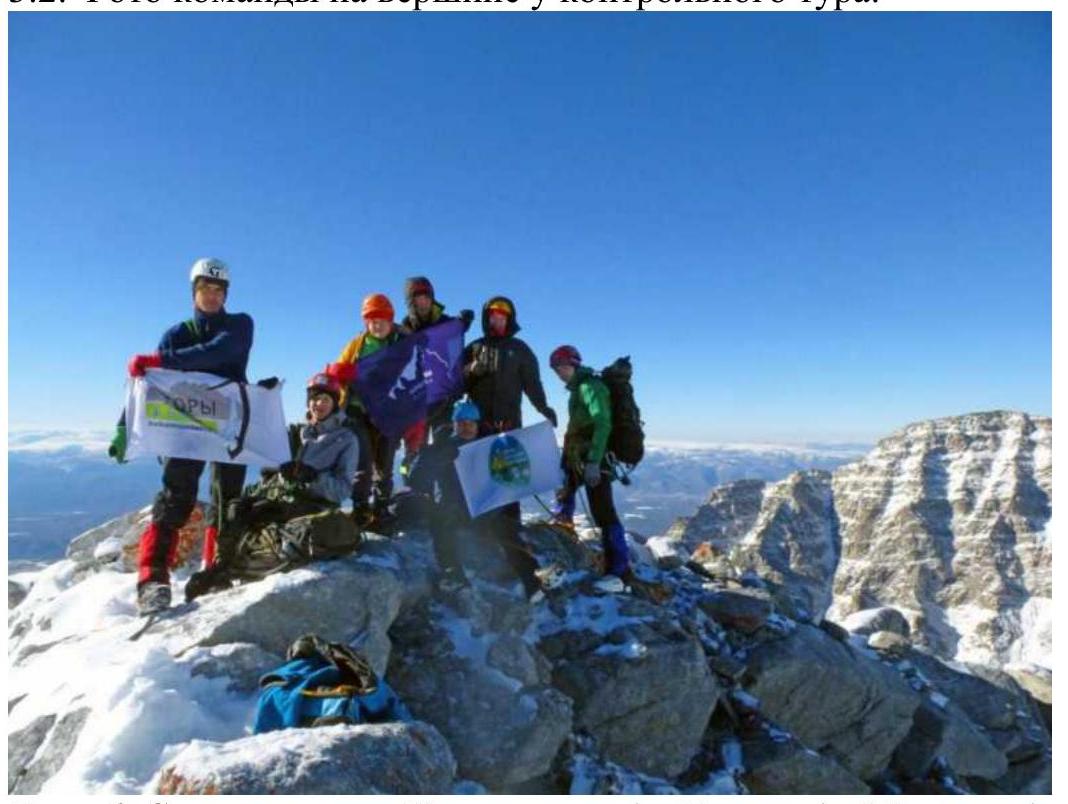
Photo 6. From left to right: Kalashnikov A., Petko A., Maslova A., Nikolaev E., Tsalman I., Tsalman P., Kurushin A.
3.3. Additional information.
The route is simple in terms of movement logic; the presence of a section with live rubble adds complexity to belaying and movement, but since the movement is near the ridge and not very steep, there is no probability of stones falling on the climbers. The area is windy, and during the winter, snow does not accumulate on the wind-swept slopes, but it is blown to the leeward side, affecting the passage across the "sheep's foreheads". If one goes after a snowfall and without wind, there may be difficulties on the slabs. Radio communication with the camp, located between the 2nd and 3rd icefalls, is constant; there is also communication on the summit: MTC and Tele2 operators. The team assesses the route's complexity as 2A due to the route's length, average difficulty of movement, and the presence of key sections of category 3 difficulty.
Descent from the summit is carried out along the eastern ridge, across "sheep's foreheads" with snow, to the saddle between Radishchev and the adjacent unnamed summit. From the saddle, down a very wide northeast couloir towards the summit 3032 (General Koryakov).
Movement:
- Very close group due to small and medium live rubble.
- Move left.
- When moving down, carefully pass snowy sections, as the right part of the couloir's side is smooth slabs.
Features of passing the couloir:
- Approximately in the middle of the couloir, there is a division by a rocky outcrop into left and right parts.
- It is necessary to move towards the rocky outcrop on the left, leaving the narrow couloir of smooth slabs with snow to the right.
- After the rocky outcrop, there is also a narrow couloir, convenient to clear with stones.
- The beginning of the couloir is next to the outcrop, movement under the rocks at the very top of the couloir.
- Further similar sections are passed in the same manner.
Completion of the descent:
- At the bottom, there is an exit to the inner radius of the couloir along the rocks to the left.
- Exit from the couloir.
Photos from the ascent:

Photo 7. Beginning of the route. Section R1–R2. Movement towards the gray rocks.
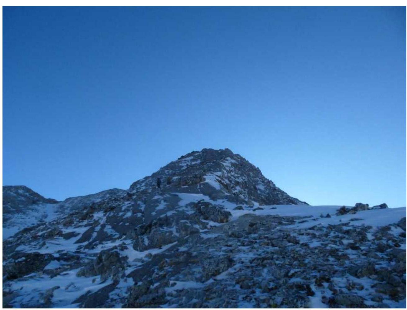
Photo 8. Beginning of section R2–R3, wide ridge.
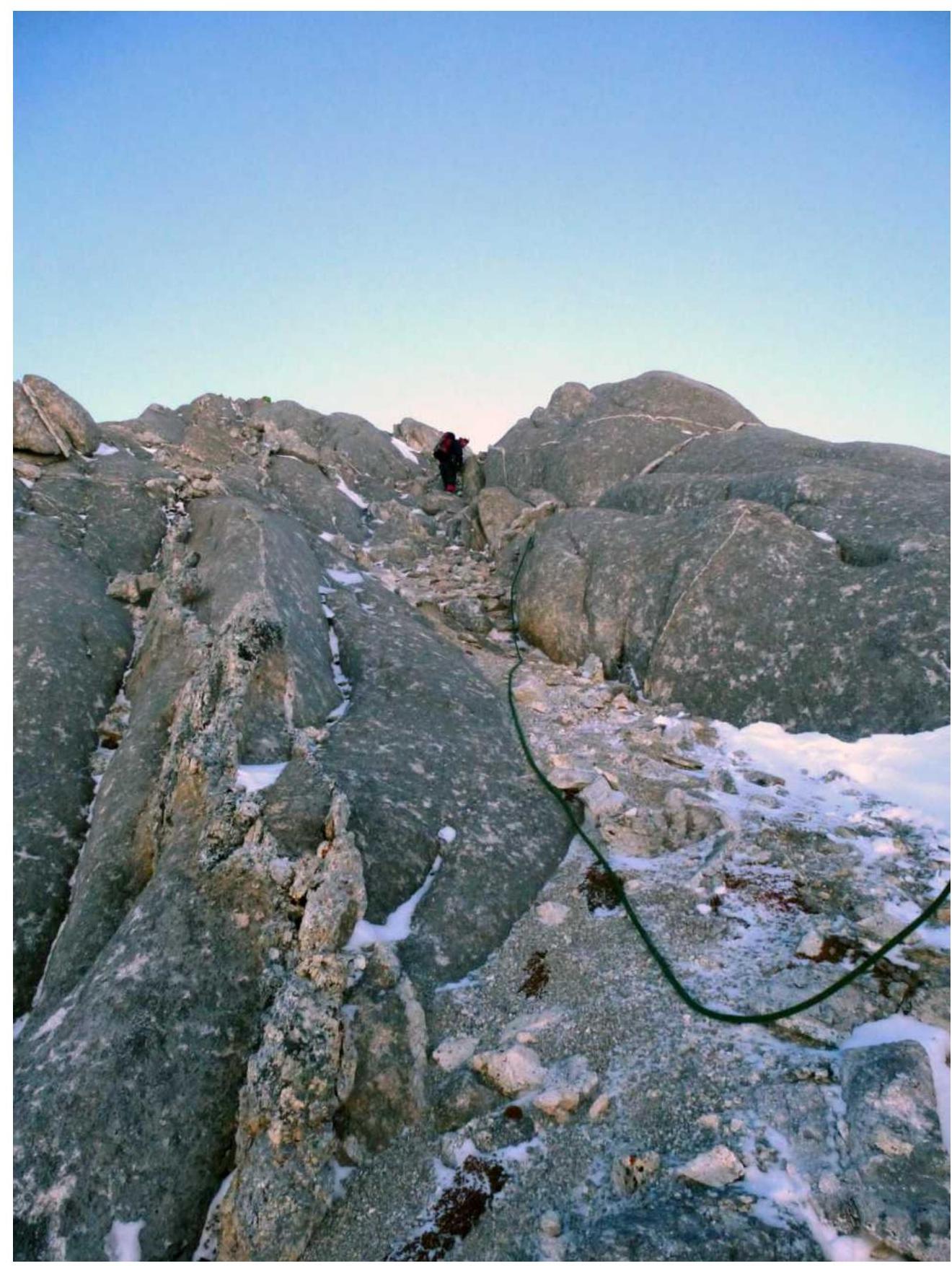
Photo 9. Section R2–R3, movement along the gully between "sheep's foreheads".
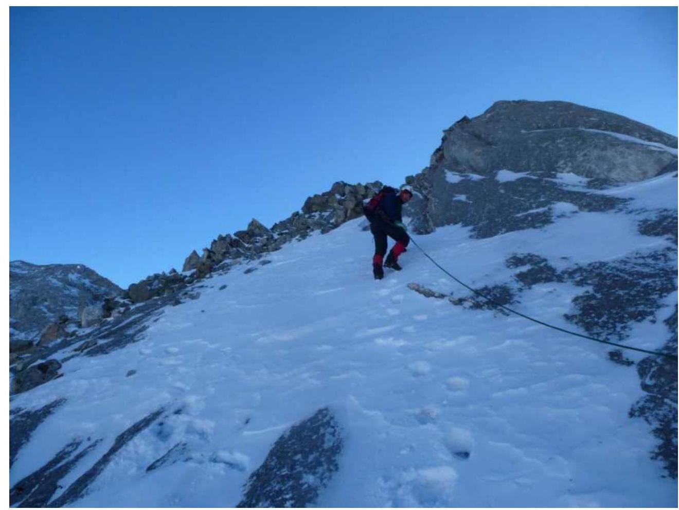
Photo 10. Beginning of section R3–R4, slab with snow.
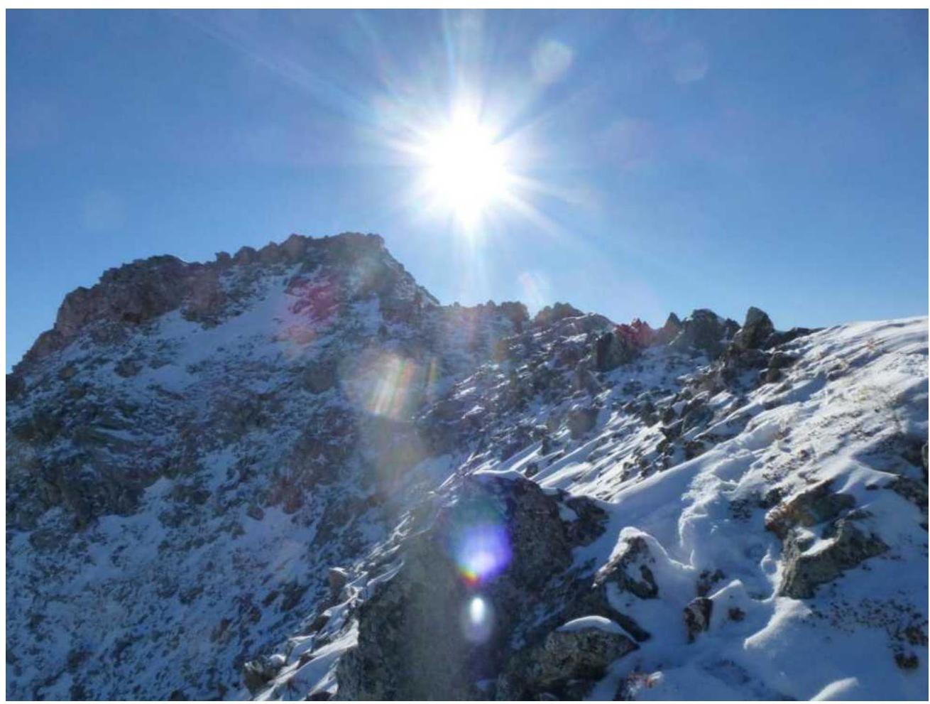
Photo 11. Section R5–R6, movement along the ridge to the summit.