
Report
On the first ascent
The peak Bronenosets (2430 m) - Right part of the Western wall - Route 3B cat. diff. (proposed), first ascent - Eastern Sayan, Tunskinskie Goltsy ridge, Dождевое valley, 6.1.2
Leader: Klepikov A.A. Participants:
- Anisovets S.Yu.
- Valiev V.O.
- Vasin I.K.
- Marzaev A.Yu.
- Tsynguev B.Ts.
The ascent was made on October 30, 2016.
I. Ascent passport
| № | 1. General information | |
|---|---|---|
| 1.1 | Full name, sports rank of the leader | Klepikov Alexander Alexandrovich, Master of Sports, 3rd cat. diff. |
| 1.2 | Full name, sports rank of the participants | Anisovets S.Yu. (3rd sports rank) Valiev V.O. (3rd sports rank) Vasin I.K. (3rd sports rank) Marzaev A.Yu. (3rd sports rank) Tsynguev B.Ts. (3rd sports rank) |
| 1.3 | Full name of the coach | Afanasiev Andrey Evgenievich, Master of Sports, 1st cat. diff. |
| 1.4 | Organization | Baikal Alpine School |
| 2. Characteristics of the ascent object | ||
| 2.1 | Region | Eastern Sayan, Tunskinskie Goltsy ridge |
| 2.2 | Valley | Dождевое valley |
| 2.3 | Section number according to the 2020 classification table | 6.1.2 |
| 2.4 | Name and height of the peak | Bronenosets (2430 m) |
| 2.5 | Geographical coordinates of the peak (latitude/longitude), GPS coordinates (1) | |
| 3. Characteristics of the route | ||
| 3.1 | Route name | Along the right part of the Western wall |
| 3.2 | Proposed category of difficulty | 3B |
| 3.3 | Degree of route development | First ascent |
| 3.4 | Nature of the route terrain | Rocky |
| 3.5 | Height difference of the route and main part | 330 (246) |
| 3.6 | Length of the route and main part | 600 (350) |
| 3.7 | Technical elements of the route (total length of sections of various difficulty categories with indication of terrain type (ice-snow, rocky)) | I cat. diff. rocks - 270 m II cat. diff. rocks - 115 m III cat. diff. rocks - 105 m IV cat. diff. rocks - 100 m Descent by rappel (on descent) - (number of ropes and total meters) |
| 3.8 | Descent from the peak | By 1B cat. diff. to Dождевое valley |
| 3.9 | Additional characteristics of the route | In summer, there is no water on the route under normal conditions |
| 4. Characteristics of team actions | ||
| 4.1 | Time of movement (team's walking hours, indicated in hours and days) | 8.5 hours to the peak, 1 day |
| 4.2 | Overnights | No |
| 4.3 | Exit to the route | 10:00 October 30, 2016 |
| 4.4 | Exit to the peak | 18:30 October 30, 2016 |
| 4.5 | Return to the base camp | 23:00 October 30, 2016 |
| 5. Responsible for the report | ||
| 5.1 | Full name, e-mail | Klepikov A.A., Baikalteam@gmail.com |
Photo of the general view of the Western wall of Bronenosets peak. (Photo taken from v. p. Arshan 2546 m)
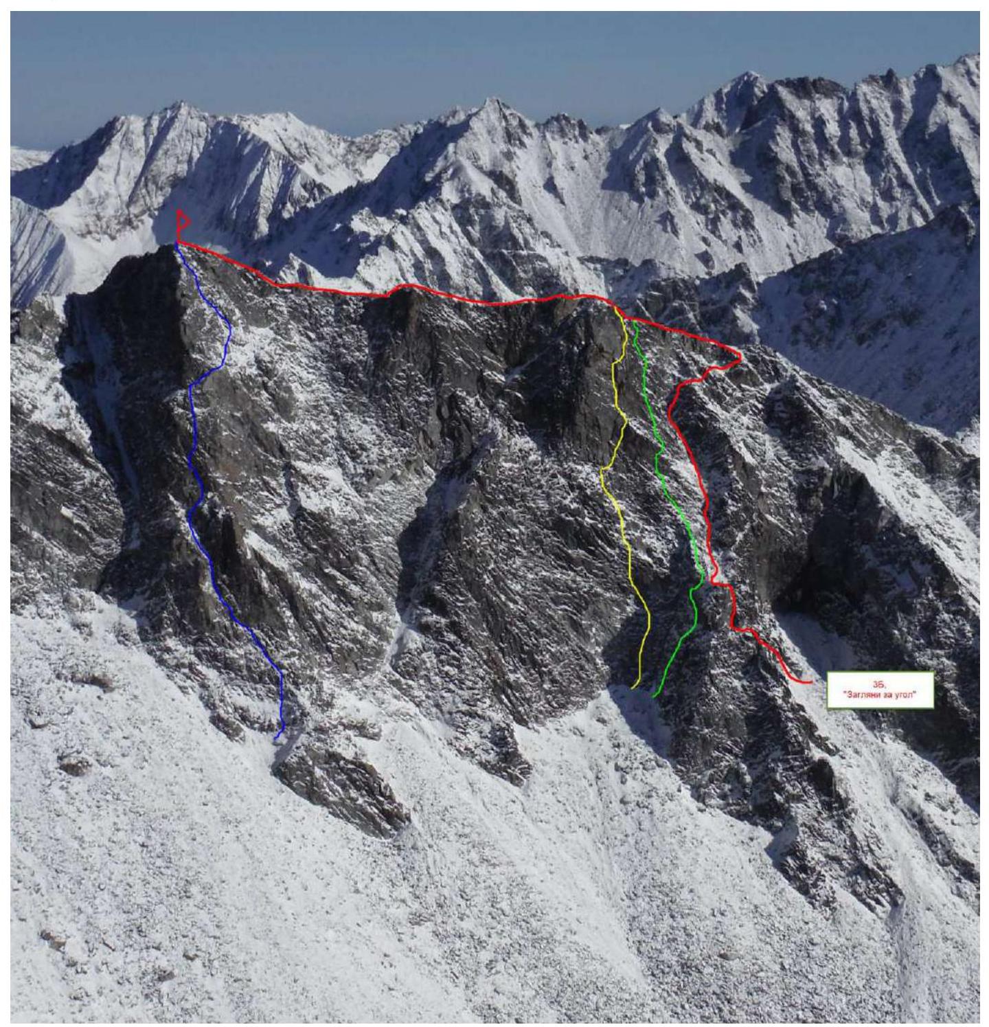
BLUE - Kikina's route 2005 4A cat. diff.
YELLOW - Afanasiev's route 2006 5A cat. diff.
GREEN - Afanasiev's route 2006 4B cat. diff.
RED - Team's route 3B
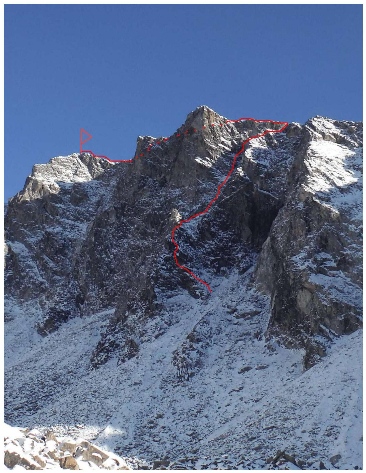
Photo of the route profile from the right.
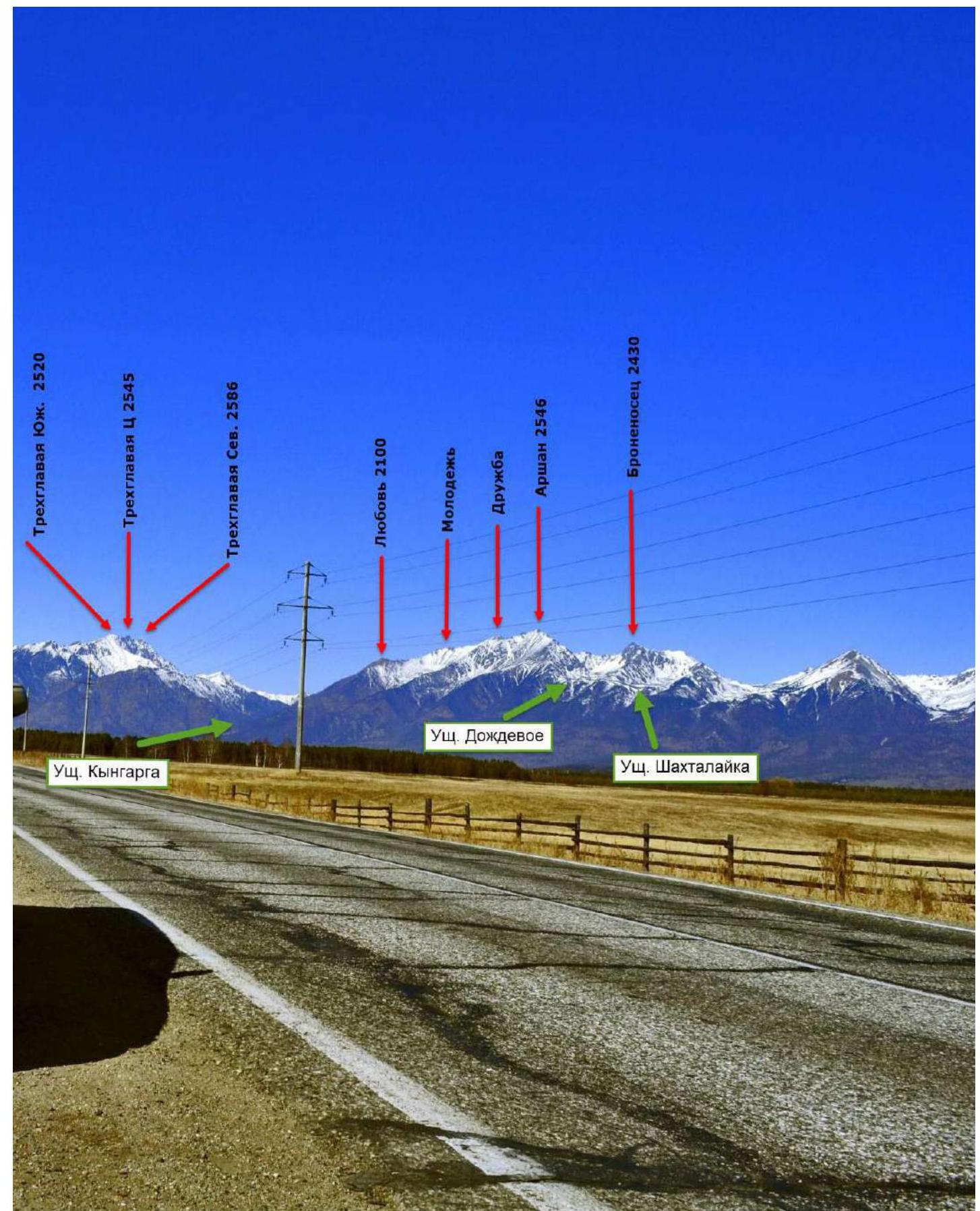
Panorama of the peaks of the Tunskinskie Goltsy ridge near Bronenosets peak. (Photo taken from the Tunskinskaya valley, at a distance of 15 km)
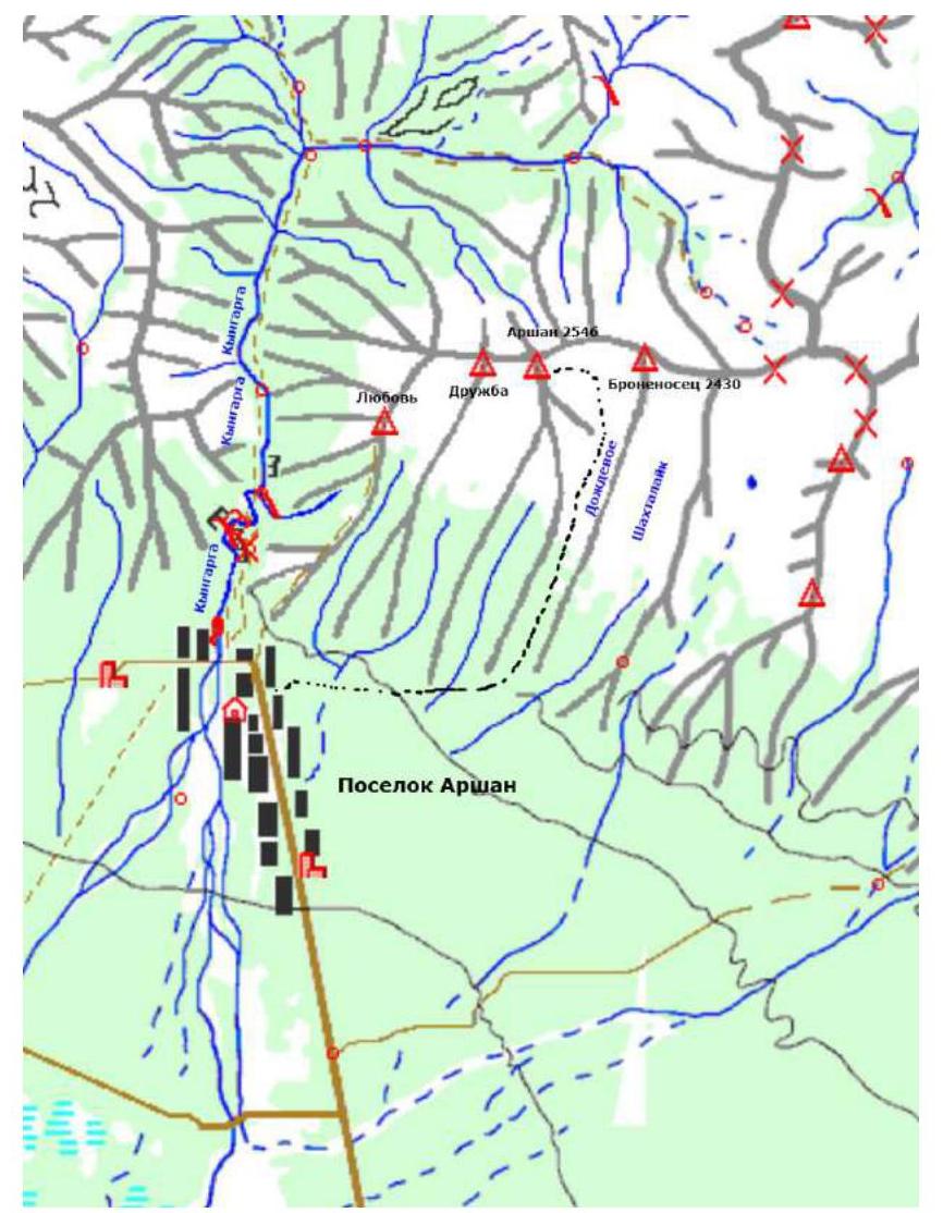
Dождевое valley is located in the Tunskinskie Goltsy ridge near the Arshan settlement and faces the Tunskinskaya valley. Morphologically, the valley is essentially a long cirque, or hanging valley, lying between:
- Bronenosets peak
- Arshan peak
and breaking off with a steep, weakly incised stream towards the Tunskinskaya valley.
The surface of the valley above the forest zone is gently sloping, and when viewed in section, it appears as a trough. The bottom of the valley and part of its slopes are composed of moraine deposits (bottom, surface, and lateral), with coarse-grained material, averaging 0.5 to 5 m in diameter.
The rocks are of intrusive character, mainly granite, and less often sedimentary metamorphic rocks. The valley floor has been weakly altered by post-glacial erosion.
It is the most accessible valley for mountaineering ascents in the Eastern Sayan. The time required to reach the base camp in the valley from the Arshan settlement is 3 to 5 hours. Even in winter, the approach is not complicated, as the height of the snow cover is very low due to the slope exposure, and it becomes significant only half an hour to an hour before reaching the base camp.
The average time to approach the described route can be broken down as follows: Arshan settlement - base camp in the valley - 4 hours, base camp - start of the route - 2 hours. The valley is bounded by only two peaks and their ridges: to the west, it is Arshan peak, and to the east, it is Bronenosets peak. Currently, there are routes of various difficulty categories in the valley, including:
- 1B - 1 route
- 2A - 3 routes
- 2B - 1 route
- 3A - 2 routes
- 3B - 2 routes
- 4A - 3 routes
- 4B - 2 routes
- 5A - 1 route
Technical photo of the route
Photo taken from the peak Arshan 2546 m
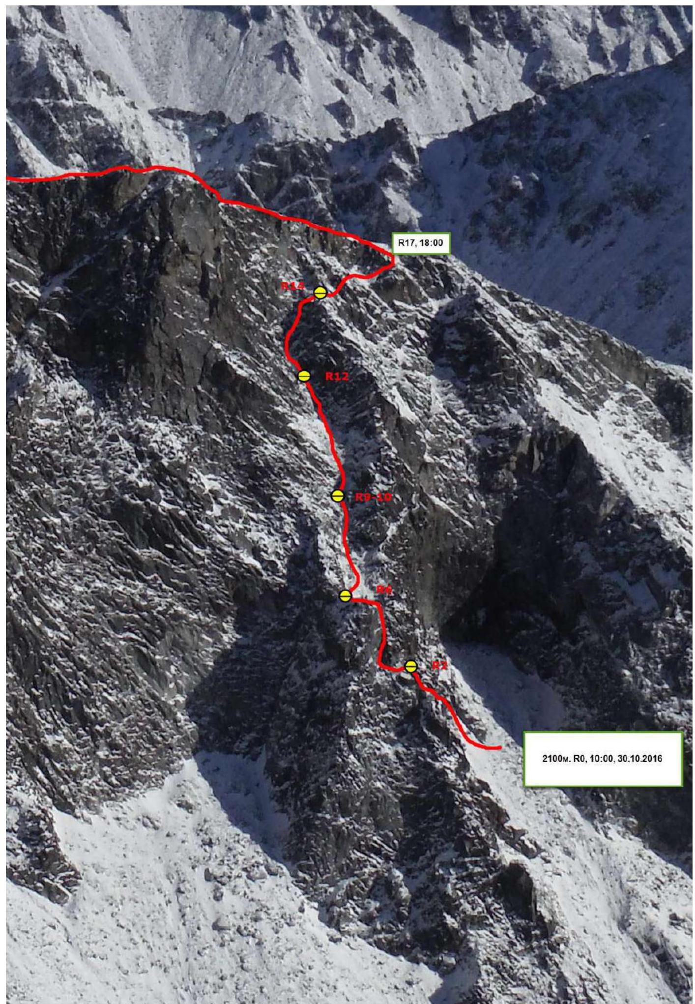
Scheme of the main part of the route, made in UIAA symbols at a scale of 1:1500, sheet 1
| Section | Stop. elem. | Friend | Rock hook | Rock X, cams | Bolts | Scheme of the route in UIAA symbols M 1:2000 Sheet 1 | Length (m) | Steepness (°) | Climbing | Aids |
|---|---|---|---|---|---|---|---|---|---|---|
| R17–R18 | - | - | - | - | 250 | 10 | 1- | - | ||
| R16–R17 | - | 1 | - | - | - | 15 | 50 | 3- | - | |
| R14–R16 | - | - | - | - | - | 35 | 55(20) | 2+(2-) | - | |
| R13–R14 | 1 | 3 | - | - | - | 20 | 65 | 4- | - | |
| R11–R13 | 1 | 2 | 1 | - | - | 20 15 | 35 55 | 2- 4- | - | |
| R9–R11 | - | - | 4 | - | - | 15 | 35 | 2- | ||
| 60 | 55 | 3+ | ||||||||
| R8–R9 | - | - | 2 | - | - | 30 | 45 | 2+ | - | |
| R6–R8 | 1 | 2 | 3 | - | - | 15 | 60 | 3+ | - | |
| R5–R6 | - | 1 | 1 | - | - | 15 | 75 | 4+ | - | |
| R4–R5 | - | - | - | - | - | 15 | 50 | 3+ | - | |
| R3–R4 | 1 | 1 | - | - | 10 | 70 | 4+ | - | ||
| R1–R3 | 1 | 1 | 1 | - | - | 5 | 70 | 4+ | - | |
| R0–R1 | 2 | 1 | 2 | - | - | 45 | 65 | 4- | - |
Relief description
The start of the route is under a huge black spot on the vertical rock in the right part of the wall, to the right of the 4B route.
R0–R1 45 m, 65°, 4–. Move left and up along the left inner corner to the ridge.
R1–R2 5 m, 70°, 4+. Wall to the left and up to the ridge shelf. Station is behind the corner on the shelf.
R2–R3 15 m, 60° slope, 20° ridge, 2+. Traverse left under the inner corner.
R3–R4 10 m, 70°, 4+. Inner corner - chimney, leading back to the ridge.
R4–R5 15 m, 50°, 3+. To the ridge.
R5–R6 15 m, 75°, 4+. Inner corner - chimney to the right of the ridge.
R6–R7 15 m, 60°, 3+ - Diagonal shelf, ledge on the shoulder.
R7–R8 20 m, 0°, 1– - Ridge, shoulder, move right into a wide inner form/couloir.
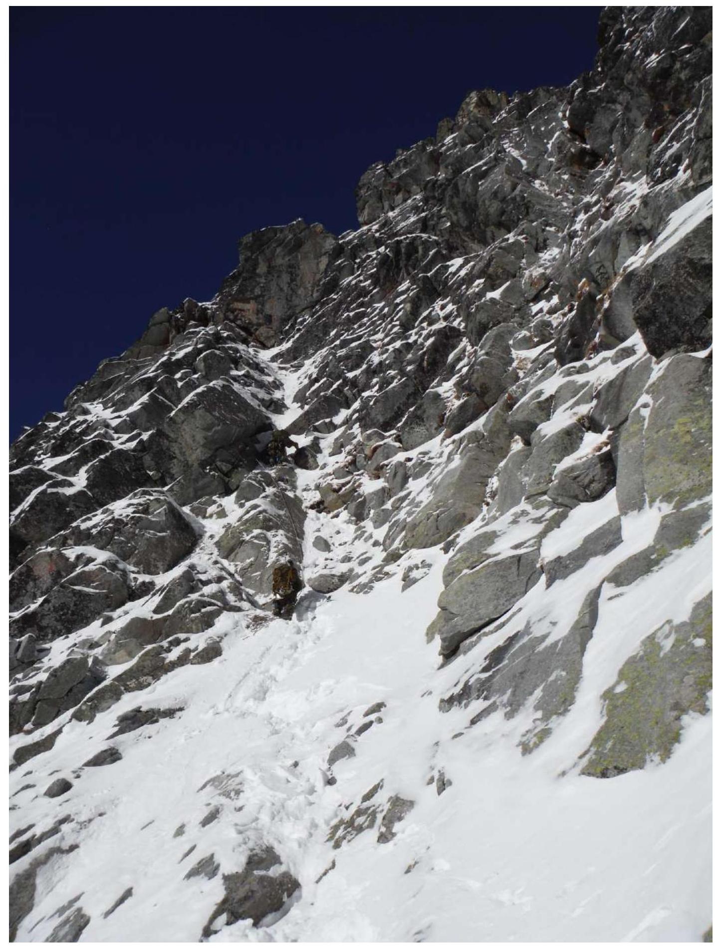
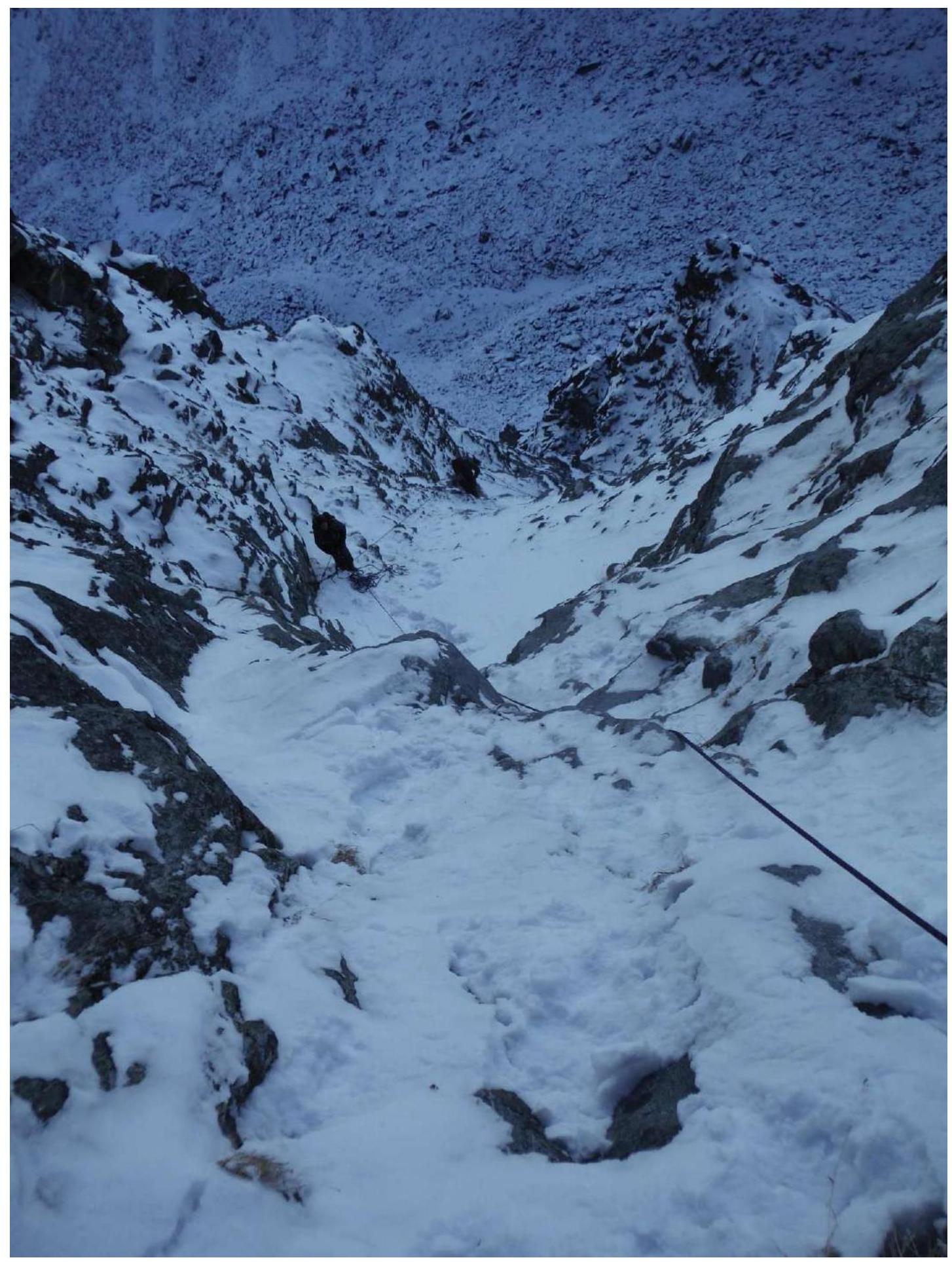
R8–R9 30 m, 45°, 2+ - Couloir up.
R9–R10 60 m, 55°, 3+ - Inner corner - couloir, beware of loose rocks.
R10–R11 15 m, 35°, 2– - Couloir up.
R11–R12 15 m, 55°, 4–. Inner corner.
R12–R13 20 m, 35°, 2– - Couloir up.
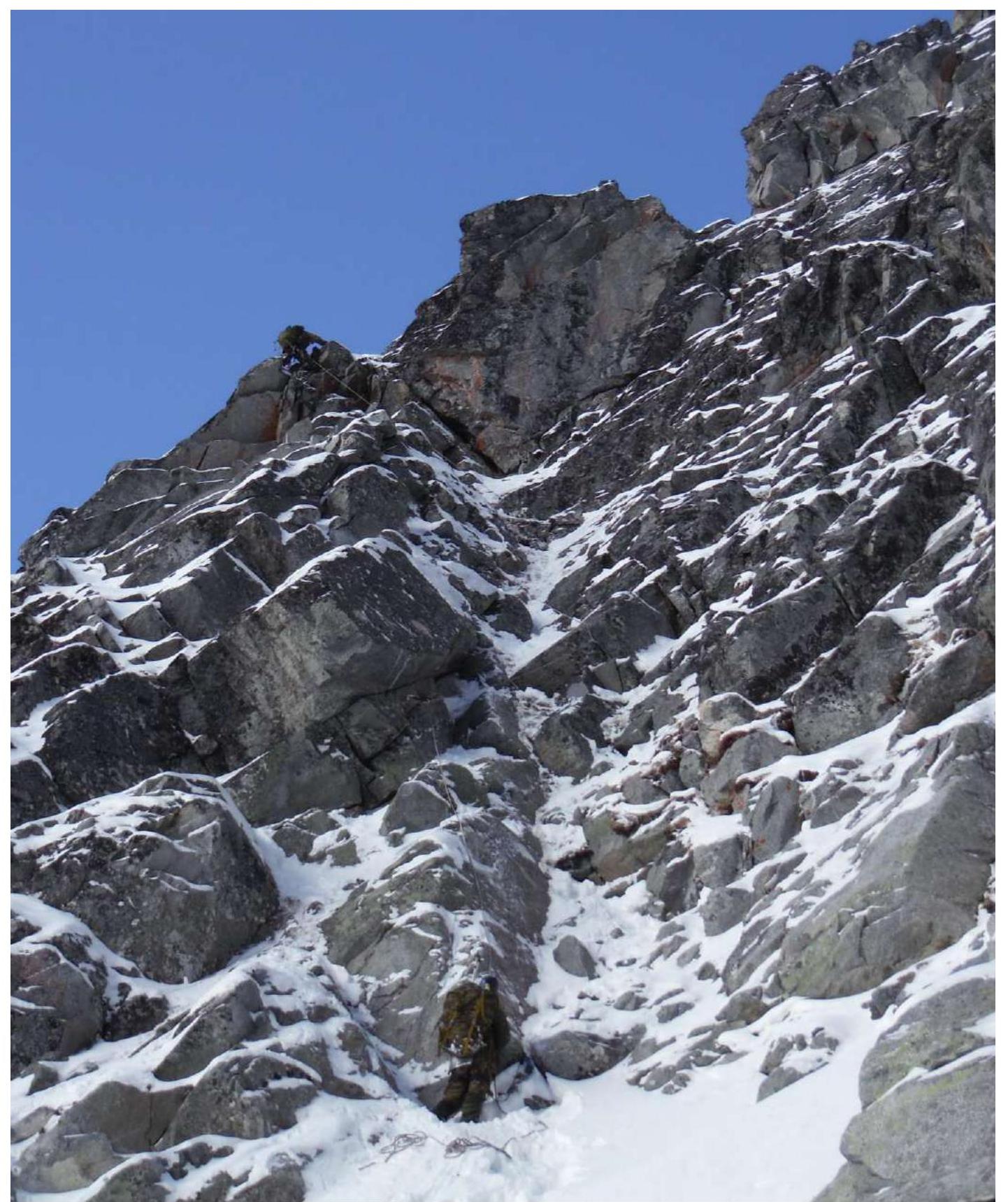
R13–R14 20 m, 65°, 4–. Inner corner to the right, beware of large rocks, avoid stretching the team in the couloir.
R14–R15 20 m, 55° slope, 20° direction, 2+. To the right along the terrain with a slight ascent through a ridge into the adjacent couloir.
R15–R16 15 m, 0°, 2– - Traverse of the couloir.
R16–R17 15 m, 50°, 3– - Inner corner to the right to the South ridge of Bronenosets peak.
R17–R18 250 m, 10°, 1– - Along the ridge to the peak of Bronenosets.
Characteristics of the route and team actions on the wall. The Western wall of Bronenosets peak 2430 m has numerous routes from 4A to 5A cat. diff. The wall, despite its relatively small height difference, presents a rather complex obstacle, and finding a simple and logical route line on it is a doubly interesting task. Our goal was to attempt to pass the right part of the wall, unraveling the complex terrain and creating a beautiful and relatively simple route.
The route has two key sections:
- the first is located in the lower part of the route, the first two ropes;
- the second key is almost at the very top of the wall, where the terrain has a large-block character and even appears to overhang at first glance, but everything is logically resolved, leading to the ridge along moderately complex and steep rocks.
The route is relatively simple to navigate; there is no simpler path along this part of the wall.
It is necessary to pay close attention to the passage of the middle and upper parts: the route follows the inner forms of the terrain, and accordingly, there is a risk of dislodging loose rocks by participants; avoid stretching the team. Avoid group sizes of more than 6 people.
The descent from the peak is carried out in the direction of the Tunskinskaya valley along the ridge. The ridge is traversed by climbing and represents a route of 2A cat. diff. in complexity. There is another descent option - through the 1st Shakhtolayka valley, to the left of the descent route from the South ridge. This descent route may narrowly be an avalanche hazard in winter.
Start of the route. R0–R1
First rope. Leader passes section R1–R2.
Section R3–R4.
Inner corner - chimney, view from the middle down

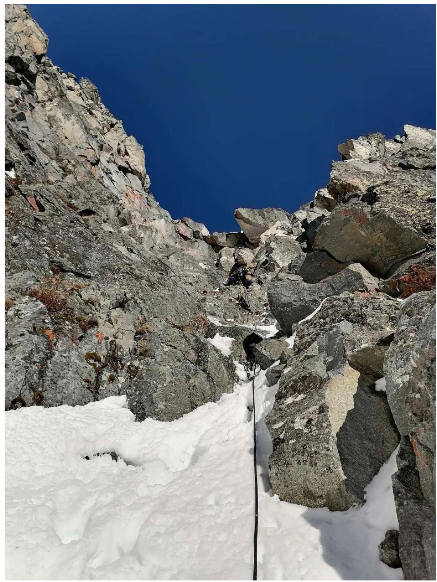
Section R10–R11. Station. View down. Behind the bend, a participant working on the steeper part is visible.

View down! From point R12
2nd key section of the route, R13–R14. (Photo used from a later ascent of this route)
View up! From point R13
There is no photo from the peak due to the late arrival at the peak - it was already dark!
Comments
Sign in to leave a comment