
Report
ON THE FIRST ASCENT TO THE SUMMIT TRENIROVOCHNAYA VIA THE CHIMNEY ON THE EASTERN WALL, APPROXIMATELY CATEGORY 3A, BY THE TEAM OF THE BAIKAL ALPINISM SCHOOL ON OCTOBER 10, 2020
I. Ascent Log
| №№ | 1. General Information | |
|---|---|---|
| 1.1 | Full Name, Sport Rank of the Leader | Afanasyev A.E. — MS |
| 1.2 | Full Name, Sport Rank of the Participants | Vasiliev V.P., Gordov A.V., Nikonov A.A., Plotnikov D.A., Ryazantsev M.S., Tkachev V.Y. |
| 1.3 | Full Name of the Coach | Afanasyev A.E. — MS |
| 1.4 | Organization | Baikal Alpine School |
| 2. Characteristics of the Ascent Object | ||
| 2.1 | Region | Eastern Sayan, Tunkin Goltsy Ridge |
| 2.2 | Valley | Dождевое (Dozhdevoe) |
| 2.3 | Number according to the 2013 Classification Table | 6.1.2. |
| 2.4 | Name and Height of the Summit | Trенировочная (Trenirovochnaya) ЗК, 2213 m |
| 2.5 | Geographic Coordinates of the Summit (Latitude/Longitude), GPS Coordinates | |
| 3. Route Characteristics | ||
| 3.1 | Route Name | Камин В ст. (Kamin V st.) |
| 3.2 | Proposed Category of Difficulty | 3А |
| 3.3 | Degree of Route Exploration | First Ascent |
| 3.4 | Relief Character of the Route | Rock |
| 3.5 | Elevation Gain of the Route (altimeter or GPS data) | 150 m |
| 3.6 | Route Length (in meters) | 270 m |
| 3.7 | Technical Elements of the Route (total length of sections of varying difficulty with indication of relief character) | I cat. diff. ice/rock/combination — 150 m. II cat. diff. ice/rock/combination — 15 m. IV cat. diff. ice/rock/combination — 30 m. V cat. diff. ice/rock/combination — 75 m. Dülfer descent (on descent) — no |
| 3.8 | Descent from the Summit | Along the South ridge and into the 2nd Шихтолайка (Shikhtolayka) valley |
| 3.9 | Additional Route Characteristics, Water Availability | Tea in thermoses |
| 4. Characteristics of Team Actions | ||
| 4.1 | Time of Movement (team's walking hours, in hours and days) | 4 hours; 1 day |
| 4.2 | Overnight Stays | no |
| 4.3 | Departure to the Route | 7:30, September 10, 2020 |
| 4.4 | Reaching the Summit | 11:30, September 10, 2020 |
| 4.5 | Return to Base Camp | 13:30, September 10, 2020 |
| 5. Responsible for the Report | ||
| 5.1 | Full Name, e-mail | Afanasyev A.E., anevg09@mail.ru |
II. Ascent Description
1. Characteristics of the Ascent Object
1.1. General photo of the summit.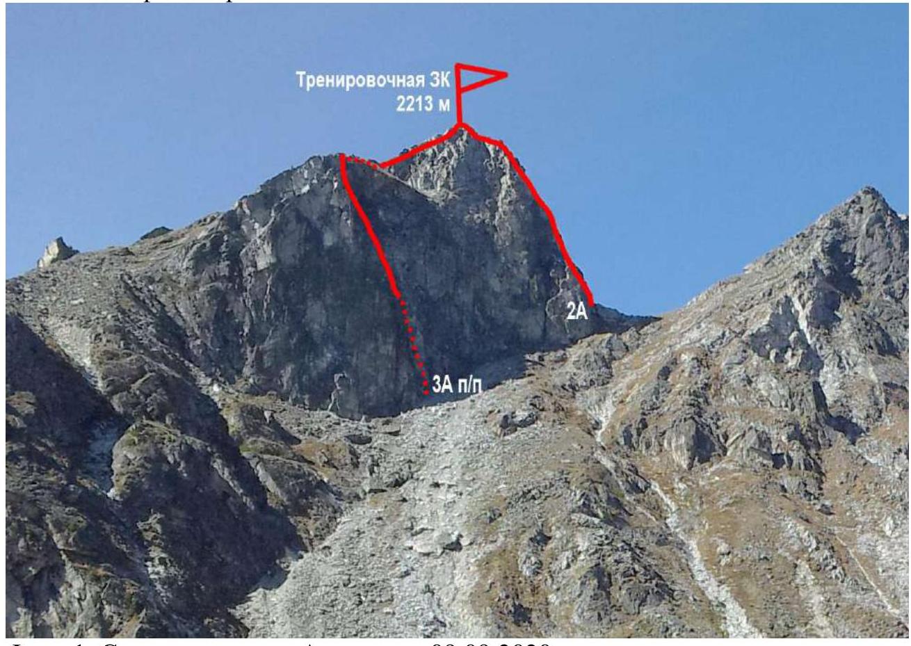
Photo 1. Taken from Артемьева (Artemyeva) valley on September 9, 2020.
1.2. Photo of the route profile.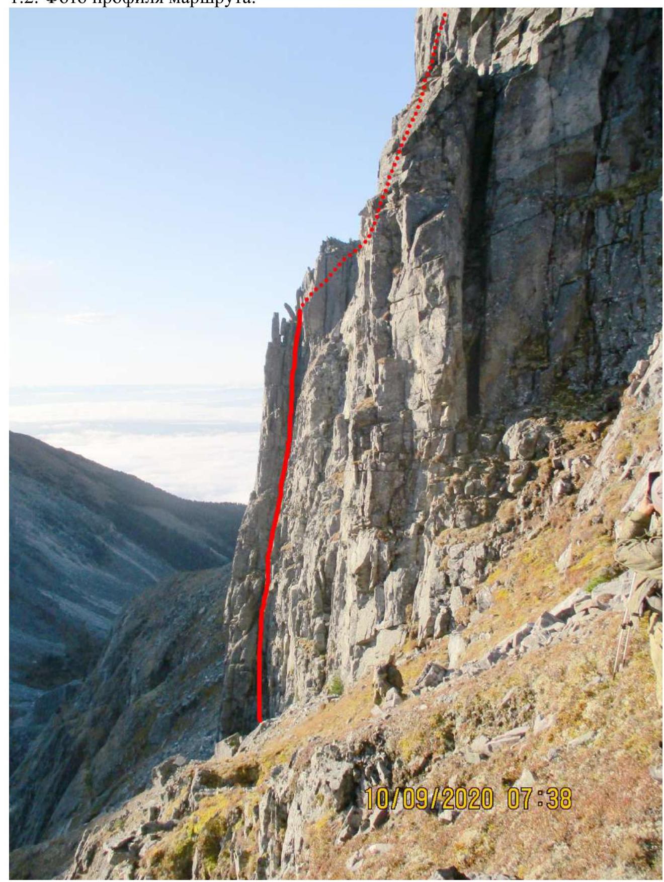
Photo 2. Taken from Зачётный (Zachetny) pass between Артемьева (Artemyeva) and 2-я Шихтолайка (2nd Shikhtolayka) valleys. September 9, 2020.
1.3. Photopanorama of the region.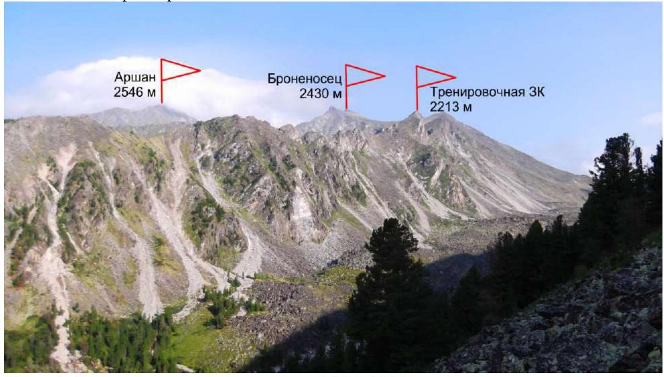
Photo 3. Taken from Артемьева (Artemyeva) valley. September 9, 2020.
1.4. Map of the region.
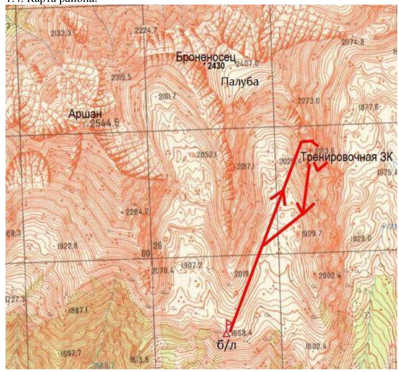
Photo 4.
2. Route Characteristics
2.1. Technical photograph of the route.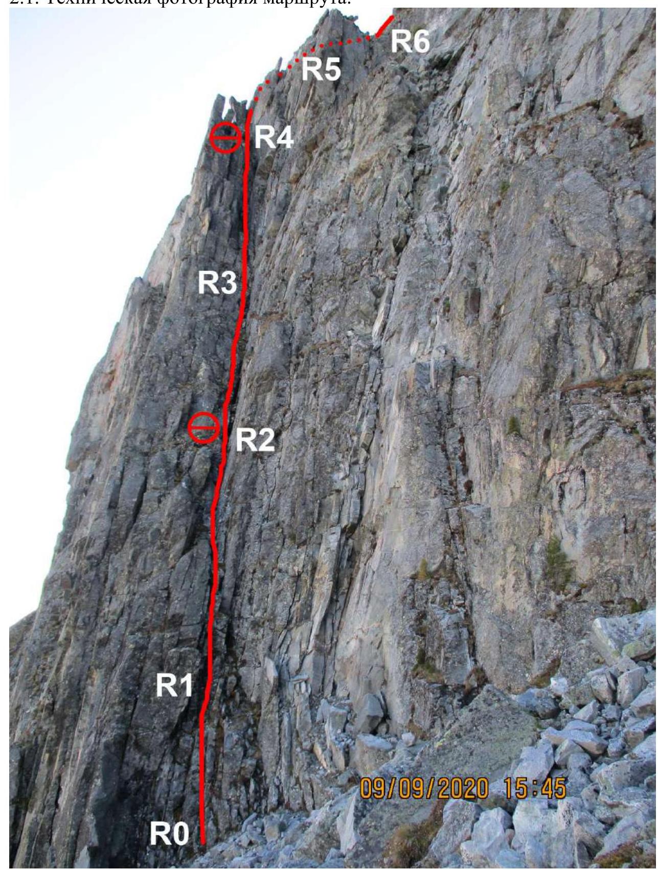
Photo 5.
2.3. Technical characteristics of route sections.
| Section | Relief Character | Cat. Diff. | Length, m, Steepness ° | Number of Pitons |
|---|---|---|---|---|
| R0–R1 | Destroyed slab facing north into a chimney. | 4 | 15, 75 | 3 |
| R1–R2 | Chimney. Station on the left on a ledge. | 5 | 30, 85 | 6 |
| R2–R3 | Inner corner. | 5 | 20, 90 | 4 |
| R3–R4 | Wide chimney. Second station at the exit. | 5 | 25, 95 | 5 |
| R4–R5 | Inner corner. Exit from the chimney. | 4 | 15, 80 | 2 |
| R5–R6 | Rock slab. To the ridge. | 2 | 15, 10 | |
| R6–R7 | Wide ridge. Summit. | 1 | 150, 30 |
3. Characteristics of Team Actions
3.1. Brief description of the route passage.
The approach to the route from the base camp takes 1.5–2 hours. First, through the 2nd Шихтолайка (Shikhtolayka) valley to the Зачётный (Zachetny) pass, then from there along the Eastern slope under the walls, 150 m to the chimney, which is open to the north and runs along the Eastern wall from bottom to top.
| Section | Description | Photo Number |
|---|---|---|
| R0–R1 | Destroyed slab facing north into a chimney. | 6 |
| R1–R2 | Chimney. Station on the left on a ledge. | 7 |
| R2–R3 | Inner corner. | 8 |
| R3–R4 | Wide chimney. | 9, 10 |
| R4–R5 | Inner corner. Exit from the chimney. | 11, 12 |
| R5–R6 | Rock slab. To the ridge. | 13 |
| R6–R7 | Wide ridge. Summit. | 14 |
Photos by sections:
Photo 6. Section R1.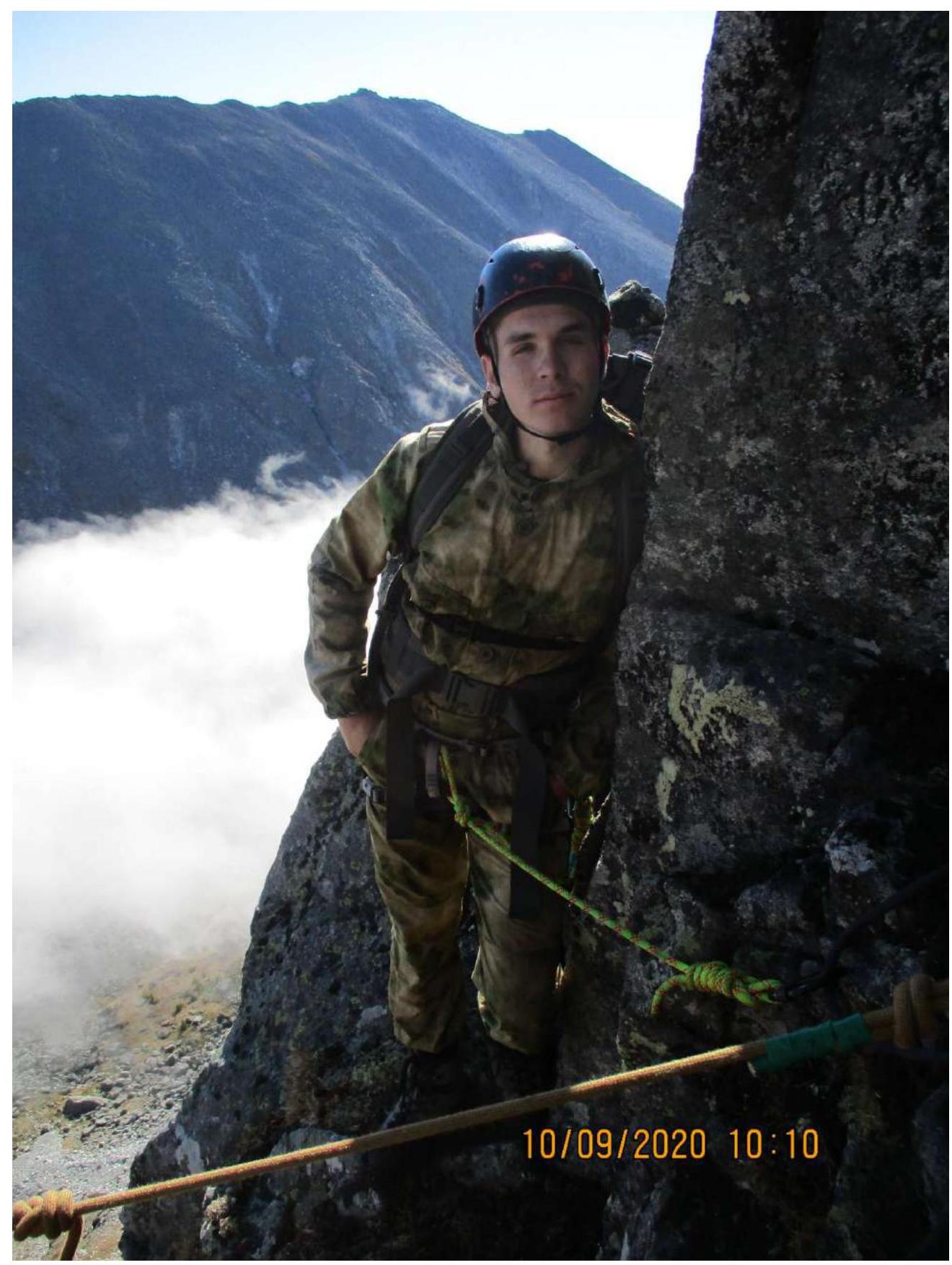
Photo 7. Section R2. 1st station.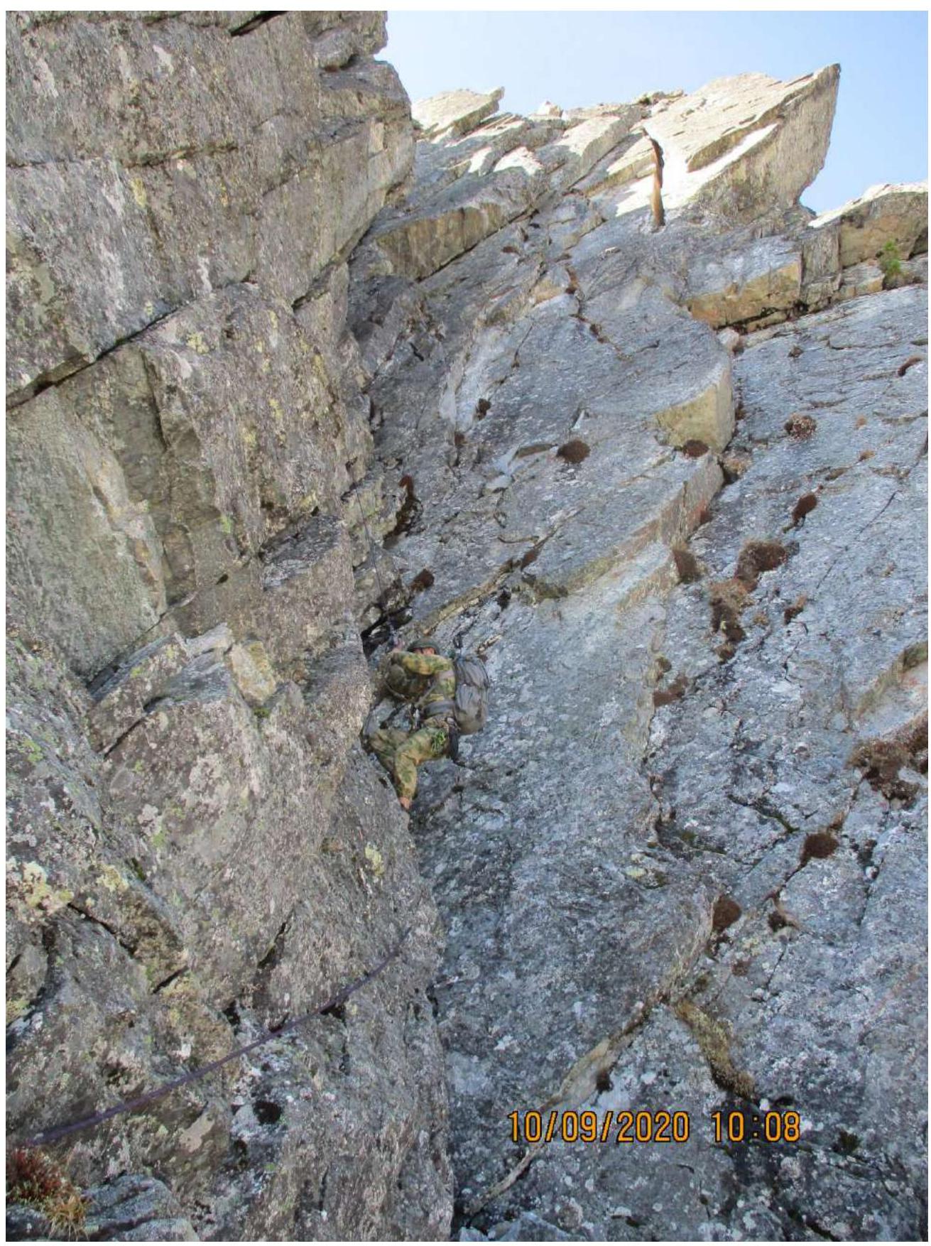
Photo 8. Section R2–R3.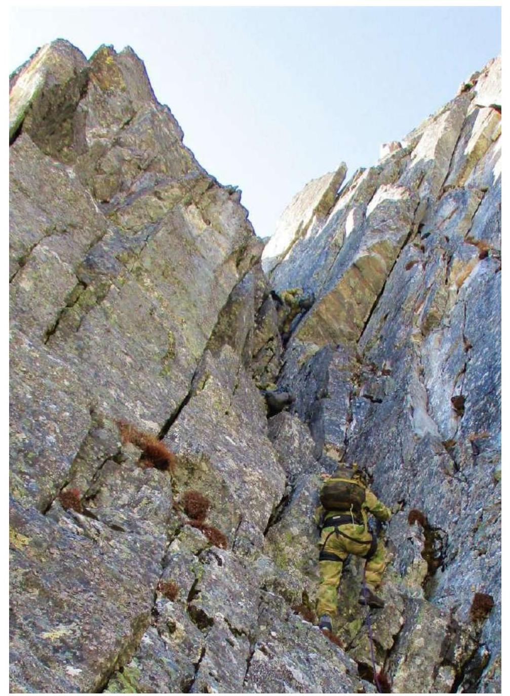
Photo 9. Section R3–R4.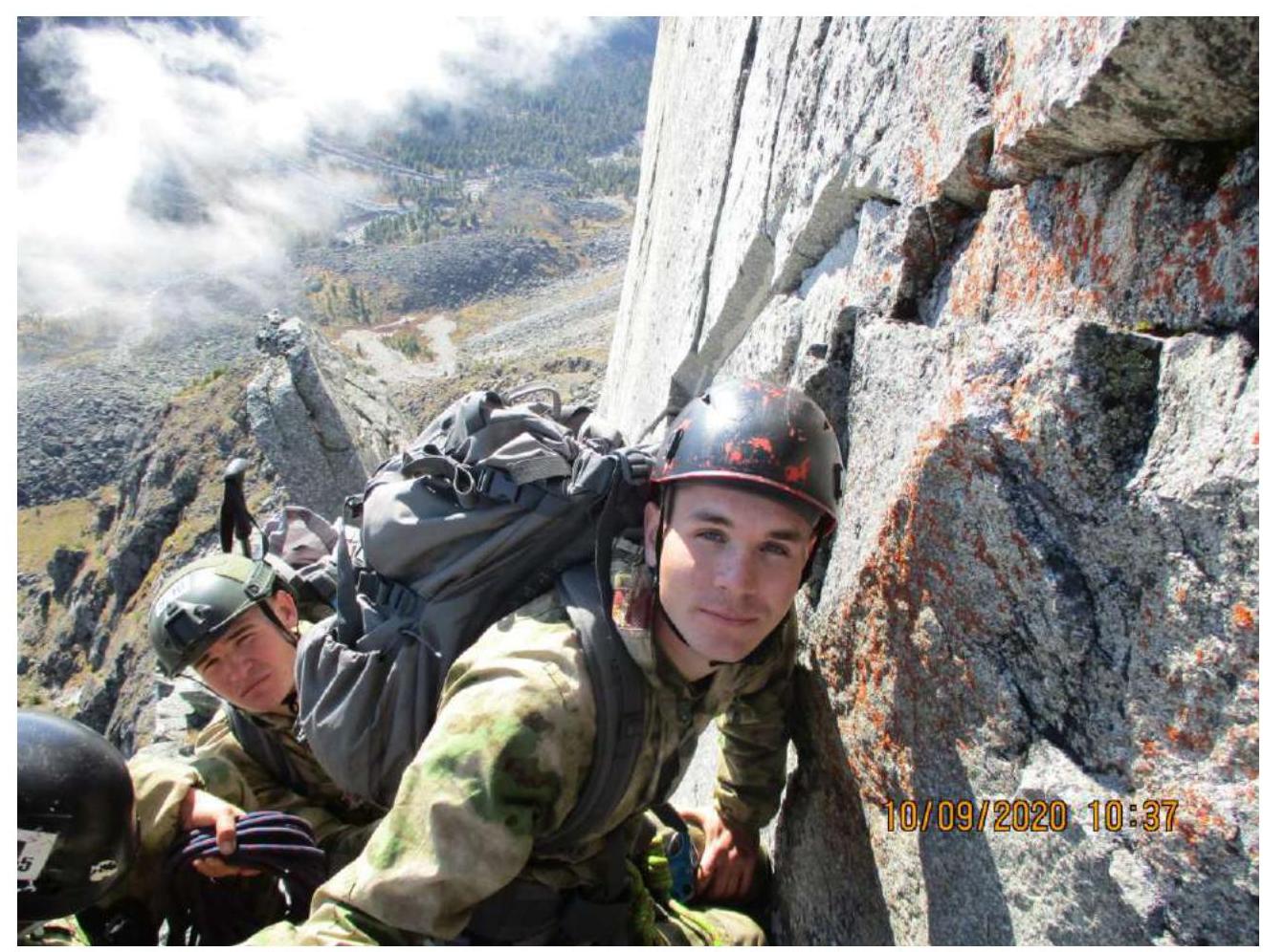
Photo 10. Section R4. 2nd station.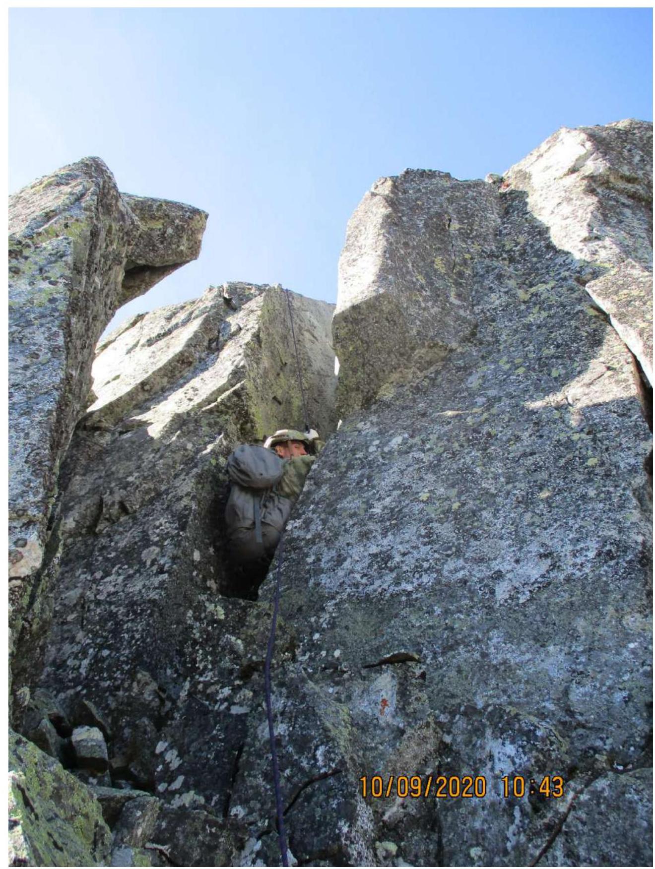
Photo 11. Section R4–R5.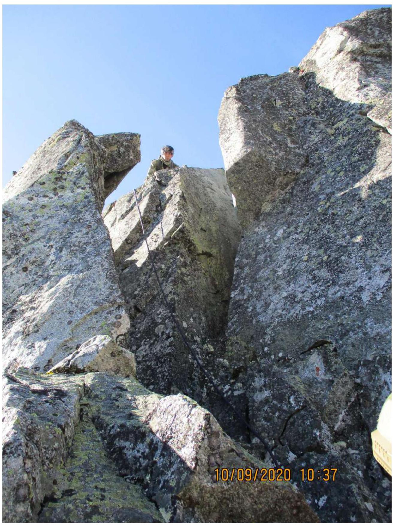
Photo 12. Section R5 from below.
Photo 13. Section R5–R6.
3.2. Photo of the team on the summit.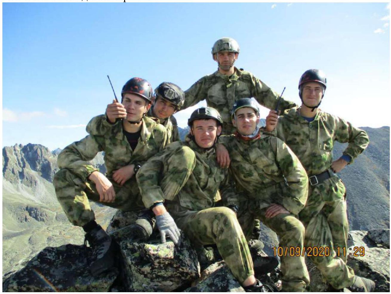
Photo 14.
3.3. The route is prone to rockfall. During the event, four ascents were made with clearing — the danger of falling rocks from participants decreased. Places for organizing stations are located at a safe distance from the path above. There is cell phone coverage throughout the route. The descent from the summit is straightforward and does not require rope protection; in the middle part, it passes over a cliff where one must be cautious. Overall, it corresponds to category 3A. The steepness and complexity of the route are significant, but the length is short. It complements the 2A category route to the same summit, which justifies its name "Тренировочная (Trenirovochnaya)".