Report
On the first ascent to the peak Obmanchivaya via the route Left Buttress of the Eastern wall 4B cat. by the team of the club "Gory Baikala" for the period from October 15, 2018 to October 15, 2018.
I. Climbing Report
| 1. General Information | ||
|---|---|---|
| 1.1 | Full name, sports rank of the team leader | Tkachenko Pavel Valentinovich 1st sports rank |
| 1.2 | Full name, sports rank of the participants | Repina Ekaterina Viktorovna 1st sports rank, Oleneva Nadezhda Alexandrovna CMS |
| 1.3 | Full name of the coach | Glazunov Evgeny Vladimirovich (MS) |
| 1.4 | Organization | Irkutsk regional public organization "Club of active recreation and mountaineering "Gory Baikala" |
| 2. Characteristics of the Climbing Object | ||
| 2.1 | Region | Eastern Sayan, Bolshoy Sayan ridge |
| 2.2 | Valley | Chertolen-Gorkhon |
| 2.3 | Number of the section according to the classification table of 2013 | 6.1.2 |
| 2.4 | Name and height of the peak | Peak Obmanchivaya |
| 2.5 | Geographical coordinates of the peak (latitude/longitude), GPS coordinates | 51°51′14.11″ N, 101°36′29.97″ E |
| 3. Characteristics of the Route | ||
| 3.1 | Name of the route | Via the left buttress of the eastern wall |
| 3.2 | Proposed category of difficulty | 4B |
| 3.3 | Degree of route development | first ascent |
| 3.4 | Relief characteristics of the route | Rock |
| 3.5 | Height difference of the route (data from altimeter or GPS are indicated) | 500 |
| 3.6 | Length of the route (indicated in meters) | 660 m |
| 3.7 | Technical elements of the route (total length of sections of various difficulty categories is indicated with the character of the relief (ice-snow, rock)) | 1st cat. rock — 150 m. 2nd cat. rock — 180 m. 3rd cat. rock — 60 m. 4th cat. rock — 120 m. 5th cat. rock — 30 m. 6th cat. rock — 120 m. Rock 6, A3 — M. Rock 6, A4 — M |
| 3.8 | Average steepness of the route, ° | ----- |
| 3.9 | Average steepness of the main part of the route, ° | ----- |
| 3.10 | Descent from the peak | Via 1B cat. to the Chertolen-Gorkhon valley |
| 3.11 | Additional characteristics of the route | Lack of water |
| 4. Characteristics of the Team's Actions | ||
| :--: | :----------------------------------------------------------------------------------------------------: | :------------------------------------------------------------------------------------------------: |
| 4.1 | Time of movement (team's walking hours, indicated in hours and days) | 14:30 |
| 4.2 | Overnights | ---- |
| 4.3 | Time of route development | ---- |
| 4.4 | Departure on the route | 5:30 October 15, 2018 |
| 4.5 | Arrival at the peak | 17:00 October 15, 2018 |
| 4.6 | Return to the base camp | 20:00 October 15, 2018 |
| 5. Characteristics of Weather Conditions | ||
| 5.1 | Temperature, °C | ----- |
| 5.2 | Wind speed, m/s | ----- |
| 5.3 | Precipitation | ----- |
| 5.4 | Visibility, m | ----- |
| 6. Responsible for the Report | ||
| 6.1 | Full name, e-mail | Tkachenko Pavel Valentinovich, WandererPavel@yandex.ru |
II. Description of the Ascent
1. Characteristics of the Climbing Object
1.1. General photo of the peak Obmanchivaya.
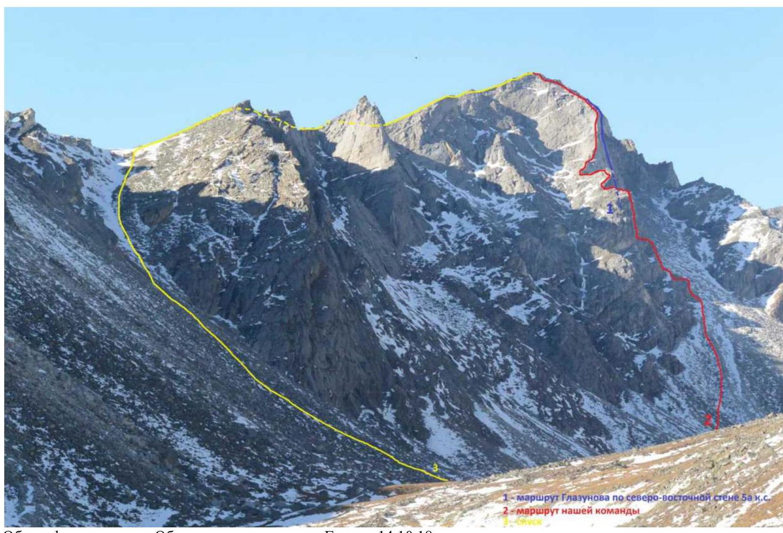
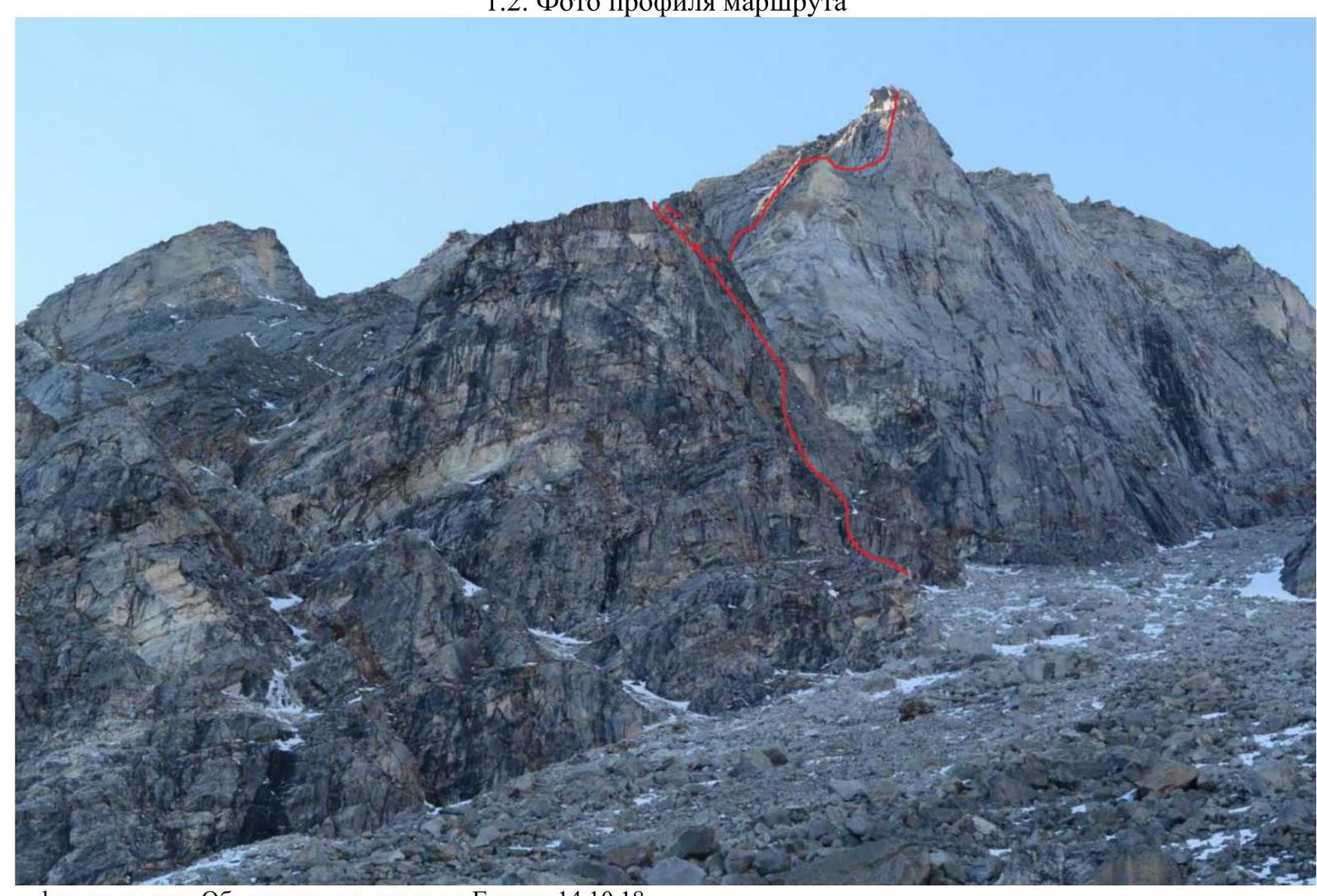
Photo of the peak Obmanchivaya from the Chertolen-Gorkhon valley on October 14, 2018. 1 — Glazunov's route via the north-eastern wall 5A cat., 2 — our team's route.
1.4. Photopanorama of the area
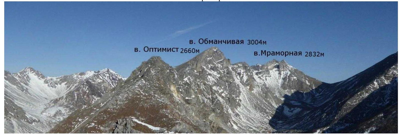 Mt. Obmanchivaya 3004 m, Mt. Optimist 2660 m, Mt. Mramornaya 2832 m.
1.5. Map of the area
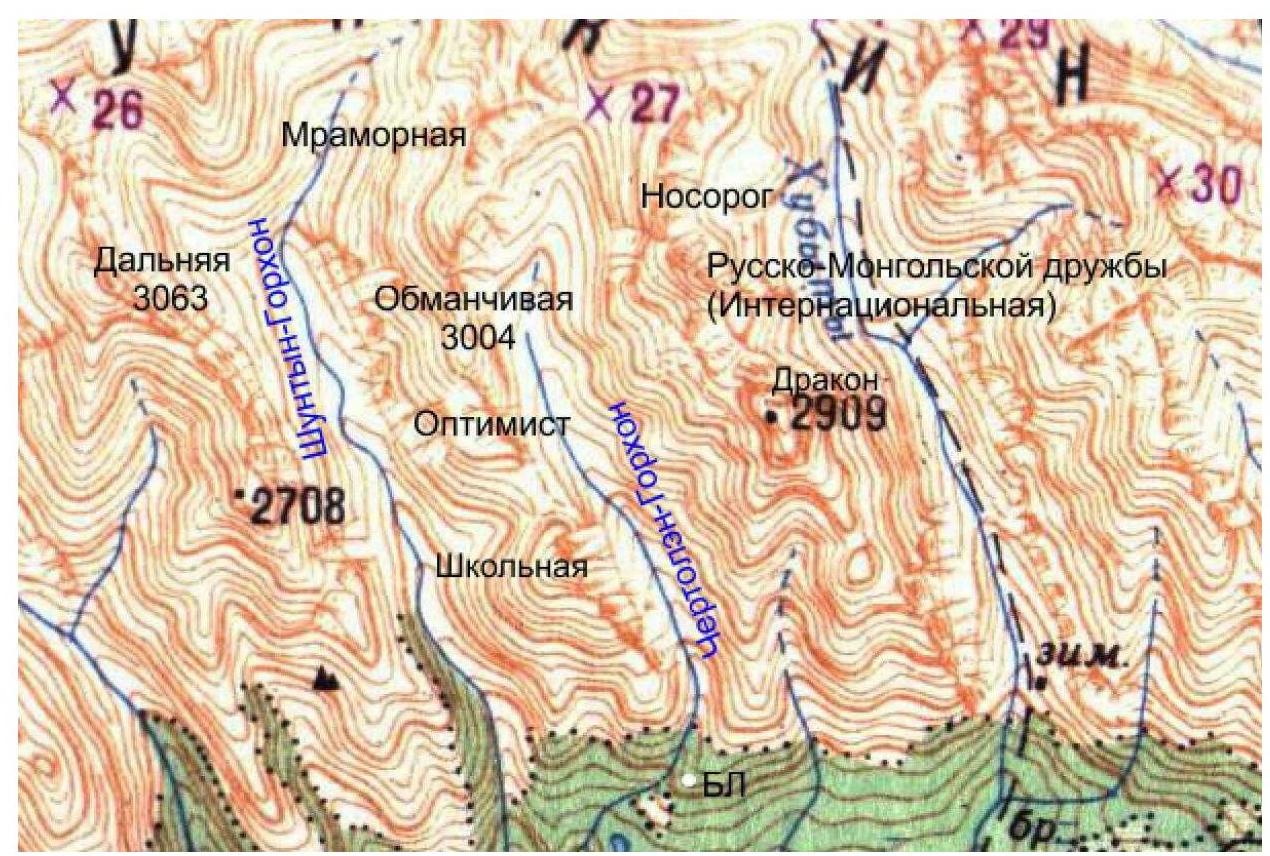
The peak Obmanchivaya is located in the upper reaches of the Chertolen-Gorkhon valley, Tunkin ridge of the Eastern Sayan, to the west of the Khubuta river valley, along which the trail leads to the Shumak mineral springs — a popular tourist route in our region. The nearest settlement: Nilova Pustyn and Khoito-Gol village of the Tunkinsky district of the Republic of Buryatia (district center — Kyren village). From them, you need to move along the old road to the "Sukhoy Ruchey" tourist center, then — by a high-passability vehicle up the road or on foot to the Chertolen-Gorkhon river, from where a good trail leads into the valley.
The valley is a dead end, regularly visited by local herb and wild food gatherers, and has a very simple approach. It is possible to make a horseback ride to the base camp along the trail. In terms of mountaineering, the valley is practically undeveloped and is not visited by tourists.
Our ascent took place within the framework of the festival of first ascents organized by the club "Gory Baikala" and the project "Nevozmozhno — eto ne navsegda".
Before the alpine event, there were only two classified routes in this valley: 2A cat. to the peak Optimist and 5A cat. to the peak Obmanchivaya via the north-eastern wall.
The first ascent route we chose is logical and immediately catches the eye, and also has a good reference to the relief. According to the team's estimates, the route corresponds to similar routes in the Eastern Sayan 4B cat.
To complete the route, we recommend having:
- a full set for ITO in case of unfavorable weather conditions;
- a large amount of snow on the route.
2. Characteristics of the Route
2.1. Technical photo of the route
 peak Obmanchivaya, R0, R4, R5, R7, R8.
2.3. Scheme of the route in UIAA symbols
 peak Obmanchivaya 3004 m via the left buttress of the eastern wall, assumed 4B cat.
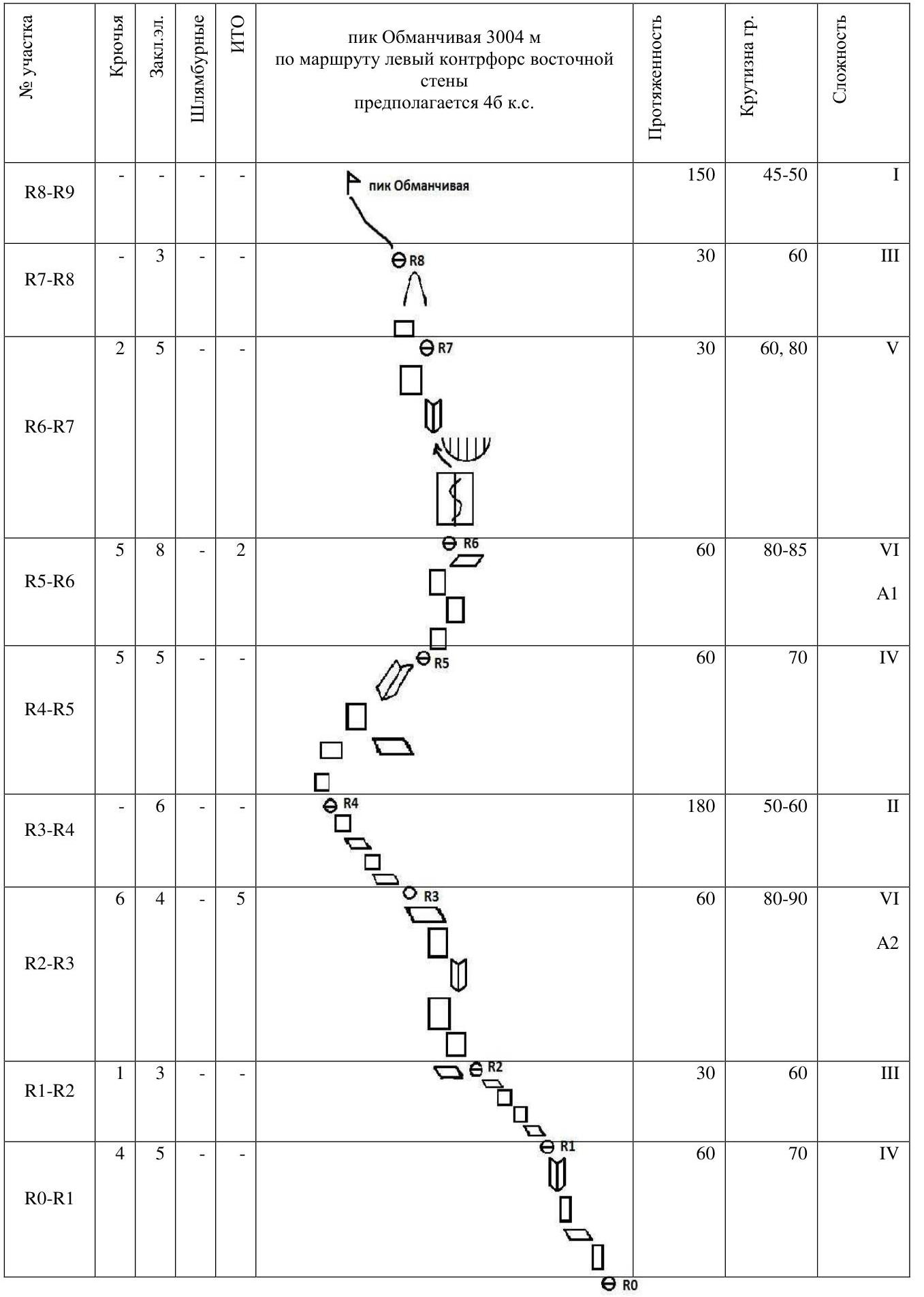
| Section # | Anchors | Stopper nuts | Bolt anchors | ITO | Length, m | Steepness, ° | Difficulty |
|---|---|---|---|---|---|---|---|
| R8–R9 | 3 | 150 | 45–50 | 1 | |||
| R7–R8 | 2 | 5 | 30 | 60 | 3 | ||
| R6–R7 | 5 | 8 | 2 | 30 | 60–80 | 5 | |
| R5–R6 | 5 | 5 | 60 | 80–85 | 6 | ||
| R4–R5 | 6 | 60 | 70 | 4 | |||
| R3–R4 | 6 | 4 | 5 | 180 | 50–60 | 2 | |
| R2–R3 | 1 | 3 | 60 | 80–90 | 6 | ||
| R1–R2 | 4 | 5 | 30 | 60 | 3 | ||
| R0–R1 | 60 | 70 | 4 |
3. Characteristics of the Team's Actions
Approach via scree to the buttress in its lower part and then up to the right. Pass by a wide couloir-shelf that intersects the lower part of the buttress and goes to the left, and then under the right wall of the buttress with simple rocks.
| Section # | Description | Photo # |
|---|---|---|
| 0–1 | The first rope is climbed to the right along a series of shelves and slabs, leading to an inner corner. Climbing 3+, 4. Lots of "live" rocks. For belay organization, camalots of medium and small sizes, anchor hooks, including those with a bend, were used. There is a lot of relief. Section length 60 m, average angle — 70°. | Photo 1 |
| 1–2 | The second section is quite simple and short — easy climbing along the ridge, leading to an inner corner. Climbing is not difficult 2–3. Leads to a wide shelf, from which the next section begins. 30 m, average angle — 60°. | none |
| 2–3 | The third rope is the first key section of the route. 60 m. A marble wall with many live rocks and small slots filled with moss leads to an inner corner, which in turn leads to slabs again. The section was passed using ITO. Mainly anchor hooks, anchor hooks with a bend, and small-sized camalots were used. The first part of the section is definitely 6, average angle — 80–90°. The second half of the rope is 5, average angle — 70–80° — free climbing, camalots of small and medium sizes were used for belaying. | Photo 2 |
| 3–4 | The fourth section is easy climbing 2, it is possible to work according to a simultaneous scheme (we worked with alternate belaying). Belaying is done through the relief. 180 m, average angle — 50–60°. At the end of the section, there is a sharp ridge of about 20 m, leading to a wide shelf. | Photo 3 |
| 4–5 | Quite interesting climbing along the southern exposure of the buttress, leading to a rib just under the bastion wall. Lots of friction work. The relief is scarce, but still allows for a fairly reliable belay organization. In poor weather conditions or without rock shoes, it may cause some problems. It is logical to divide the section into two parts — when reaching the full length of the rope, problems with pulling the last rope due to the curvature of the section were encountered. Belaying is done using camalots and anchor hooks. Climbing 4. 60 m, average angle — 70°. | Photo 4 |
| 5–6 | The second key section of the route is the bastion wall. Difficult climbing along the left wall of the bastion, representing a series of slabs and flakes with a shift to the rib of the buttress. Many large live rocks. The line is not straight, so it is highly recommended to lengthen the points in time and take into account the danger of pulling down live rocks with the belay rope. 60 m. Climbing — 6, average angle — 80–85°. For belay organization, camalots, including large sizes, and anchor hooks were used. Station is on a wide, comfortable shelf. | Photo 5 |
| 6–7 | About 30 m. The section starts with a flat slab lying at an angle of about 60°. Along the left part of this slab, there is a crack that rests against the wall. Traverse it a bit and come to a small inner corner, to the right of which there is a wide crack — it is climbed by jamming a fist. Interesting section approximately 5–6. | Photo 6 |
| 7–8 | The section is small — approximately 30 m. A rock tooth. It is bypassed to the right. Climbing is fairly easy — 2–3. Leads to the right side of the buttress. | Photo 7 |
| 8–9 | The pre-summit ridge. We work in a rope team according to a simultaneous scheme for approximately 150 m. It is mostly walked on foot. Exit to the summit. | Photo 8 |
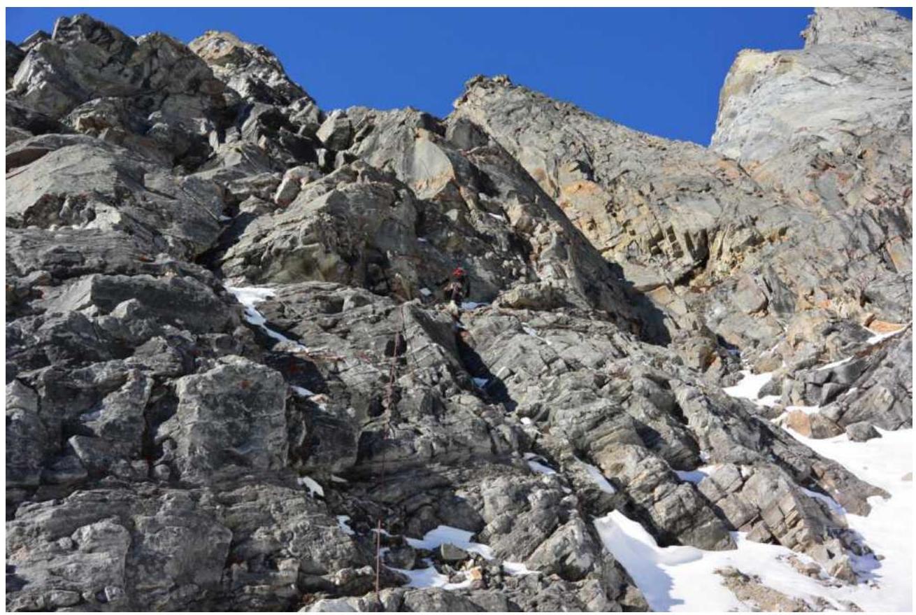
Photo #1 R0–R1

Photo #2 R2–R3
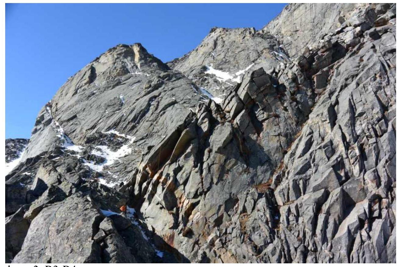
Photo #3 R3–R4
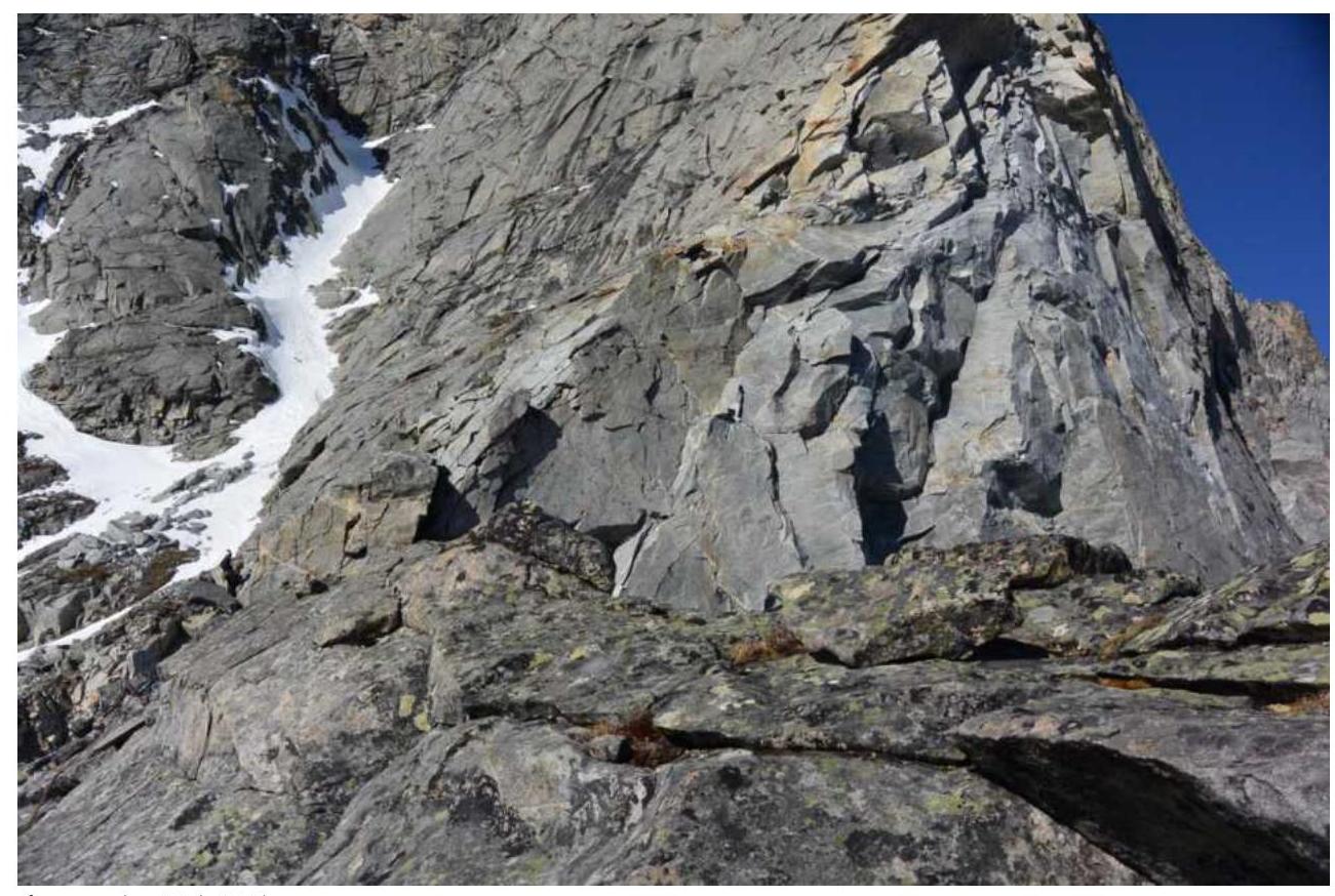
Photo #4 R4–R5
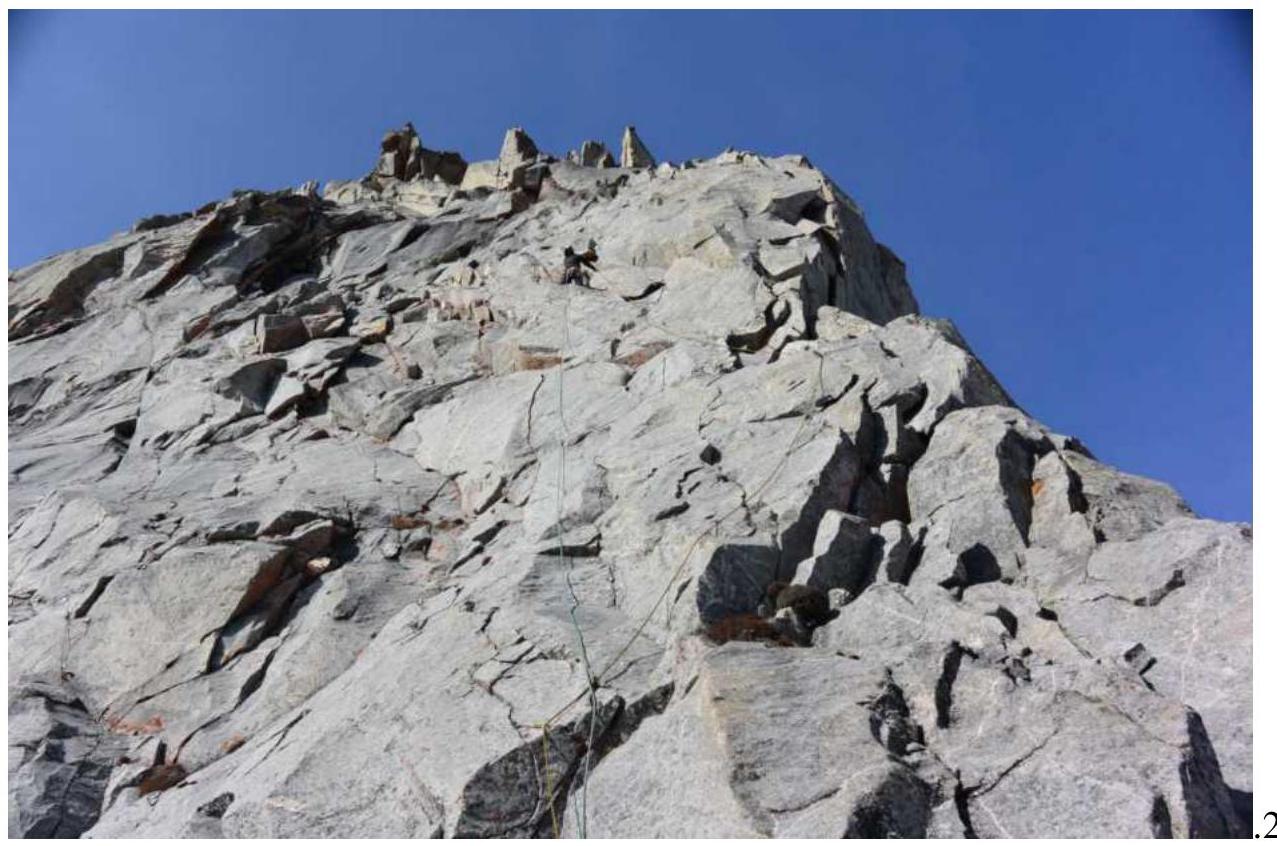
Photo #5 R5–R6
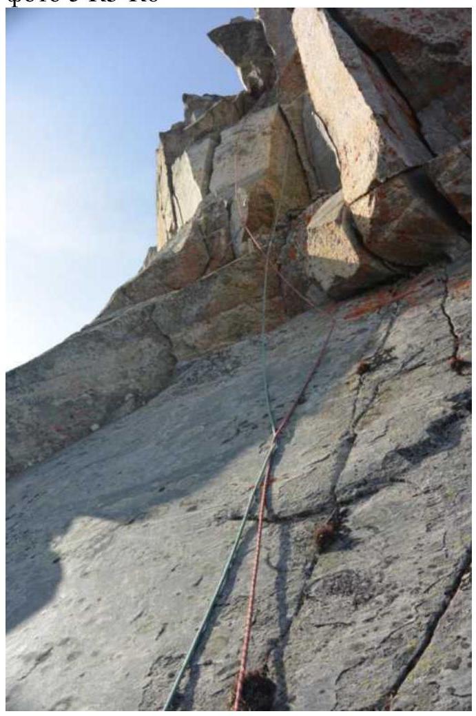
Photo #6 R6–R7
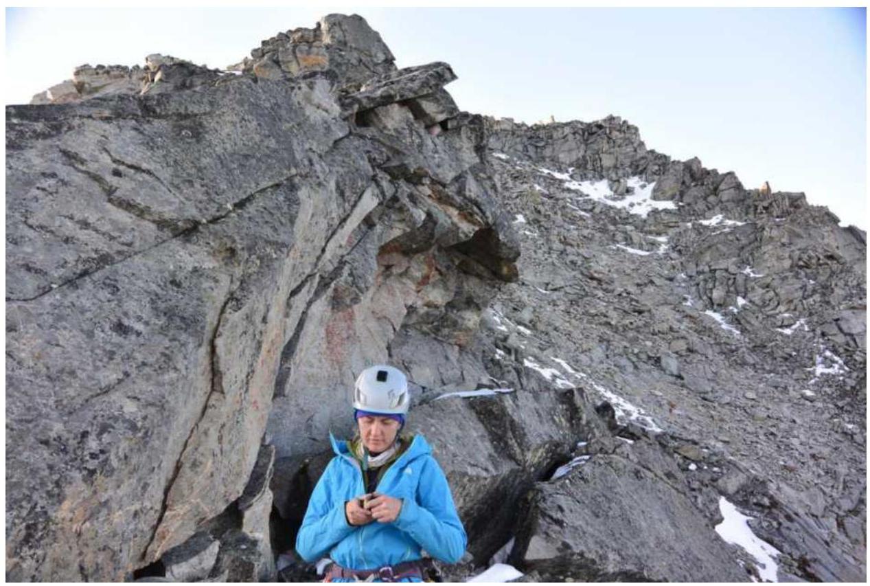
Photo #7 R7–R8
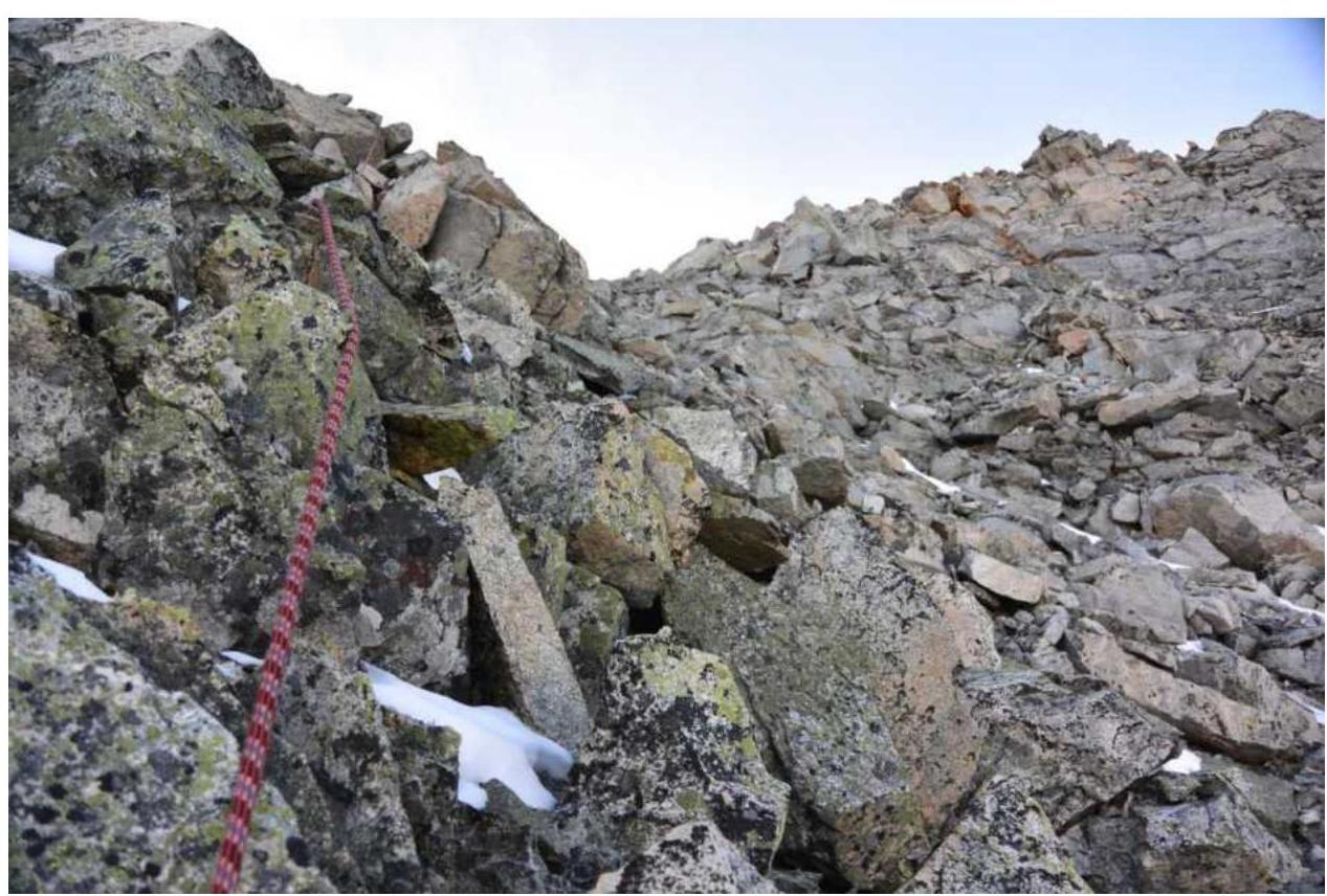
Photo #8 R8–R9
3.2. Photo of the team on the summit with the control tour

3.3. The route was assessed by the team as a classic 4B. Our team was very lucky with the weather, so almost the entire route was climbed in rock shoes. ITO technique was used sparingly. It should be noted that in more severe weather conditions, many sections of this route may cause serious difficulties, especially:
- those places that were climbed "on friction".
There are quite a few "live" stones on the route, but with due caution, they do not cause problems.