Report on the First Ascent to General'sky Pogon Peak via the "Da B" Route on the Central Western Counterfort, Category 3B, by the Team "Nevozmozhno eto ne navsegda" from March 27, 2020, to March 27, 2020.
I. ASCENT DOCUMENTATION
| Item No. | 1. General Information | |
|---|---|---|
| 1.1 | Full Name, Sports Rank of the Team Leader | Kalashnikov Andrey Yurievich, 2nd sports rank |
| 1.2 | Full Name, Sports Rank of the Participants | Kozyreva Alena Timofeevna, 3rd sports rank, Lavelina Natalia Vladimirovna |
| 1.3 | Full Name of the Coach | Panova Alena Mikhailovna |
| 1.4 | Organization | Gory Baikal |
| 2. Characteristics of the Ascent Object | ||
| 2.1 | Region | Eastern Sayan, Tunkin Range |
| 2.2 | Valley | Ula-Gol |
| 2.3 | Number of the Section According to the 2013 Classification Table | 6.1.2 |
| 2.4 | Name and Height of the Peak | General'sky Pogon, 3010 m |
| 2.5 | Geographical Coordinates of the Peak (Latitude/Longitude), GPS Coordinates | 51°49′4.09″ N 101°26′42.17″ E |
| 3. Characteristics of the Route | ||
| 3.1 | Name of the Route | "Da B" |
| 3.2 | Proposed Category of Difficulty | 3B |
| 3.3 | Degree of Route Exploration | First Ascent |
| 3.4 | Character of the Route Relief | Rock |
| 3.5 | Height Difference of the Route (Data from Altimeter or GPS) | 690 m |
| 3.6 | Length of the Route (in meters) | 1000 m |
| 3.7 | Technical Elements of the Route (Total Length of Sections of Various Difficulty Categories with Indication of Relief Character) | Category I rocks — 380 m. Category II rocks — 460 m. Category III rocks — 100 m. Category IV rocks — 60 m. Rappel Descent (on descent) — 40 m |
| 3.8 | Descent from the Peak | Non-category difficulty down to Ula-Gol Valley via a couloir towards Radishchev Peak |
| 3.9 | Additional Characteristics of the Route | Absence of Water |
| 4. Characteristics of the Team's Actions | ||
| :--: | :--: | |
| 4.1 | Time of Movement (Team's Walking Hours, in Hours and Days) | 11 hours |
| 4.2 | Overnights | no |
| 4.3 | Start of the Route | 5:00 AM, March 27, 2020 |
| 4.4 | Arrival at the Peak | 7:00 PM, March 27, 2020 |
| 4.5 | Return to the Base Camp | 12:00 AM, March 28, 2020 |
| 5. Person Responsible for the Report | ||
| 5.1 | Full Name, e-mail | Kozyreva Alena Timofeevna, ally9090baikal@mail.ru, 8-999-643-05-11 |
II. ASCENT DESCRIPTION
1. Characteristics of the Ascent Object
1.1. General Photo of the Peak
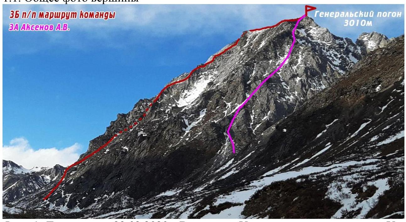
Photo 1. Taken on March 23, 2020. View from the Ula-Gol River, between Ula-Gol and Radishchev Peaks.
1.2. Photo of the Route Profile

Photo 2. Taken on March 23, 2020. View from the Ula-Gol River, between Ula-Gol and Radishchev Peaks.
1.4. Map of the Area
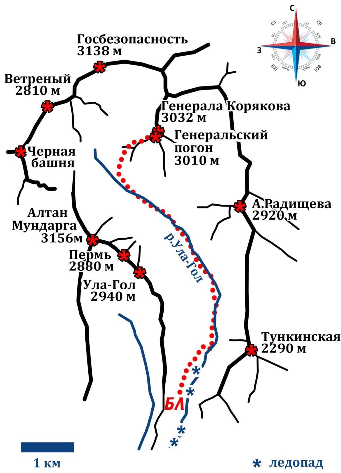
Approach: from Nilova Pustyn settlement (Tunkinsky district, Buryatia Republic, district center — Kyren settlement) to Khoito-Gol village, then along a forest road — transportation by car (preferably high-clearance) or on foot to a point with a direct view of Altan-Mundarga Mountain, from where a horse trail is visible towards the valley.
Movement on foot to the Ula-Gol River. Then upstream along the river. In winter, the approach is more comfortable along the frozen river, with the icefall bypassed on the left towards the valley.
Approximate time from "point with a direct view of Altan-Mundarga Mountain" to Base Camp: 7–10 hours. Distance about 14 km.
For transportation, it is also possible to arrange with locals for horseback riding.
From Base Camp along the horse trail towards the valley to the start of the route: about 2–3 hours, approximately 4.5 km.
Photo 3. Diagram of the Valley
2. Characteristics of the Route
2.1. Technical Photograph of the Route
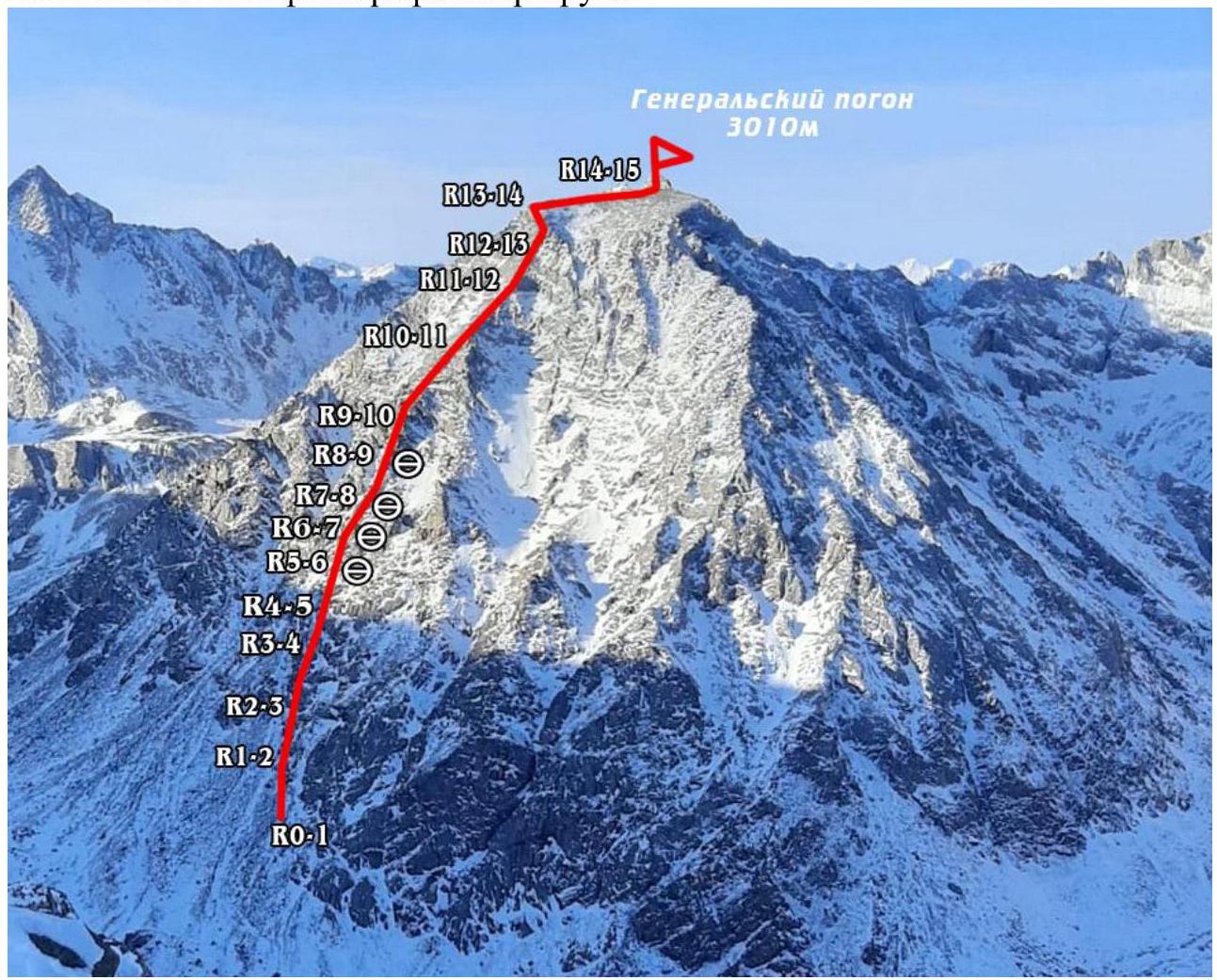
Photo 4. Taken on March 28, 2020, from Ula-Gol Peak.
2.2. Numbers of Sections on the Technical Photograph Correspond to.
| Section No. | Character of Relief | Category of Difficulty | Length, m, Angle ° | Type and Number of Pitons |
|---|---|---|---|---|
| R0–R1 | Grassy-rocky slope. | Non-cat. | 100 m, 25°–30° | |
| R1–R2 | Rocky. | 1 | 50 m, 30°–35° | |
| R2–R3 | Rocky. | 1 | 80 m, 30°–35° | |
| R3–R4 | Rocky. | 2 | 30 m, 40° | |
| R4–R5 | Rocky. | 2 | 50 m, 35°–40° | 2 friends, 1 anchor piton |
| R5–R6 | Rocky. | 4 | 30 m, 60° | 3 friends, 1 anchor piton. Station on 2 friends and a sling on a boulder |
| R6–R7 | Rocky. | 4 | 30 m, 80° | 4 friends, 1 anchor piton |
| R7–R8 | Rocky. | 3 | 30 m, 70° | 2 friends |
| R8–R9 | Rocky. | 3 | 40 m, 60° | |
| R9–R10 | Rocky. | 3 | 30 m, 60° | |
| R10–R11 | Rocky. | 2 | 150 m, 35° | |
| R11–R12 | Wide ridge with "ram's foreheads". | 2 | 150 m, 30° | |
| R12–R13 | Rocky scree, narrow ridge. | 2 | 80 m, 30° | |
| R13–R14 | Narrow ridge. | 3 | 40 m, 40° | |
| R14–R15 | Summit plateau. | (Non-cat.) | 150 m, 15° |
3. Characteristics of the Team's Actions
3.1. Brief Description of the Route Passage.
| Section No. | Description | Photo No. |
|---|---|---|
| R0–R1 | Movement towards the first grey rocks of the counterfort. | |
| R1–R2 | Movement under the grey rocks to the exit onto the ridge of the counterfort. Simultaneous movement in a rope team. | Photo 6 |
| R2–R3 | Movement up the ridge of the counterfort to the largest gendarme, bypassing it on the right, then moving to a pronounced inner corner. Simultaneous movement. | Photo 7 |
| R3–R4 | Movement along the inner corner with alternate protection, exiting onto a ledge. | |
| R4–R5 | Movement from the ledge up the ridge, staying on the right side, not exiting onto "ram's foreheads". Movement with alternate protection. | |
| R5–R6 | Movement towards the top of the gendarme: through a crack going right; passage through the ridge; subsequent movement up to the red rock. Station under an overhang. | Photo 8 |
| R6–R7 | Movement towards the top of the gendarme: up a 3-meter wall with passive holds; no protection until exiting the wall; then movement up along holds; station on a large rock. | Photo 9 |
| R7–R8 | Movement left and up to a ledge, station on a rock. | |
| R8–R9 | Traverse along "ram's foreheads" to the left, minimal protection using the terrain, station under an overhanging rock. | Photo 10 |
| R9–R10 | Movement up rocky terrain to a large ledge. | |
| R10–R11 | Movement up a wide, destroyed ridge towards a red bastion on the left. Exit onto a wide ridge with "ram's foreheads". | |
| R11–R12 | Movement along the wide ridge with "ram's foreheads", oriented towards the red bastion. | Photo 11 |
| R12–R13 | Movement left under the red bastion, along rocky scree, exiting onto a narrow ridge. | |
| R13–R14 | Movement along the narrow ridge, exiting onto the summit plateau. | |
| R14–R15 | Movement across the plateau to the summit. | Photo 12 |
3.2. Photo of the Team on the Summit.

Photo 5. From left to right: Lavelina N., Kozyreva A., Kalashnikov A.
3.3.
The route is not prone to rockfall. There are loose rocks, but the probability of dislodging them with careful movement is low.
Communication is maintained via radio with the camp, located between the 2nd and 3rd icefalls. Communication is available up to the summit. It is absent during the descent until exiting to the river. It makes sense for neighboring groups to relay information from the group to the Base Camp and, if possible, observe their descent.
Descent from the summit is done towards a saddle to the northeast, with a 40-meter rappel to the saddle. On the saddle, there may be a snow cornice; one should be cautious when "landing". Then down a couloir towards Radishchev Peak. In winter, the couloir is filled with snow and is prone to avalanches. During descent, it is necessary to take safety measures, descending along rocky outcrops.
The team rates the route as Category 3B. The route is comparable to other Category 3B routes in the Sayan Mountains in terms of length and climbing of Category III–IV difficulties, and is slightly more challenging than some Category 3B routes.
Photos from the Ascent:
Photo 6. R1–R2. Movement under the grey rocks to the exit onto the ridge of the counterfort.
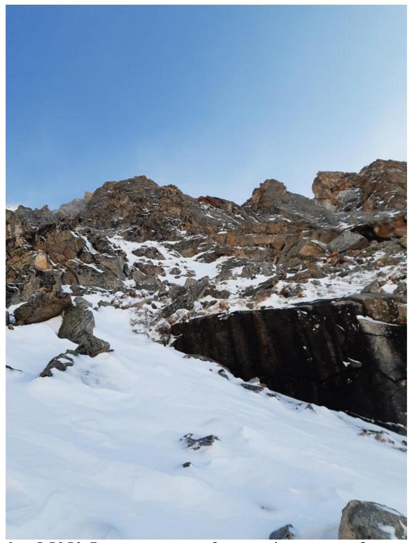
Photo 7. R2–R3. Movement up the ridge of the counterfort to the largest gendarme, bypassing it on the right, then moving to a pronounced inner corner.
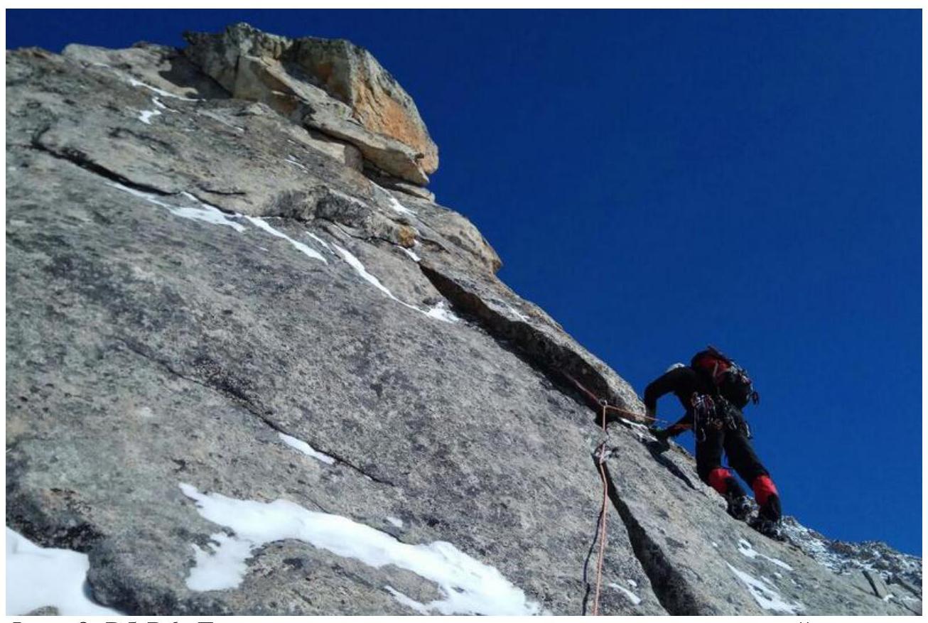
Photo 8. R5–R6. Movement towards the top of the gendarme:
- through a crack going right;
- passage through the ridge;
- subsequent movement up to the red rock. Station under an overhang.
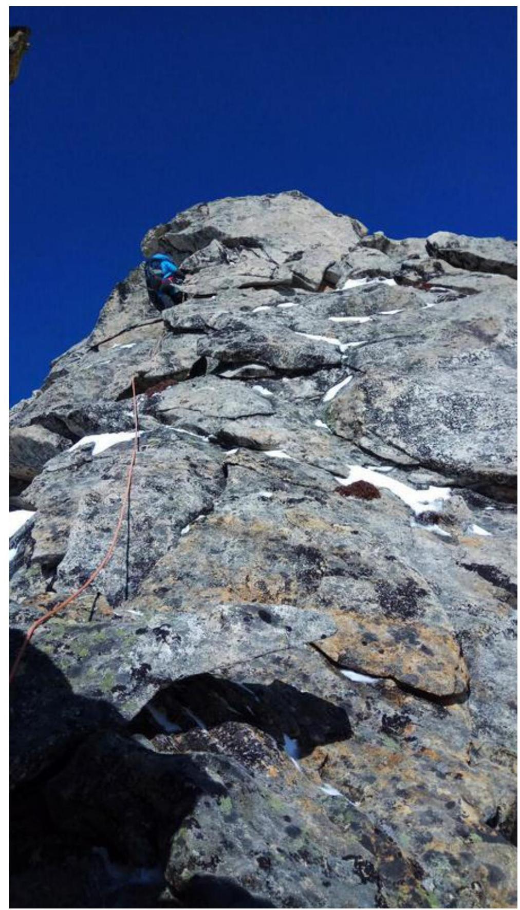
Photo 9. R6–R7. Movement towards the top of the gendarme:
- up a 3-meter wall with passive holds;
- no protection until exiting the wall;
- then movement up along holds;
- station on a large rock.
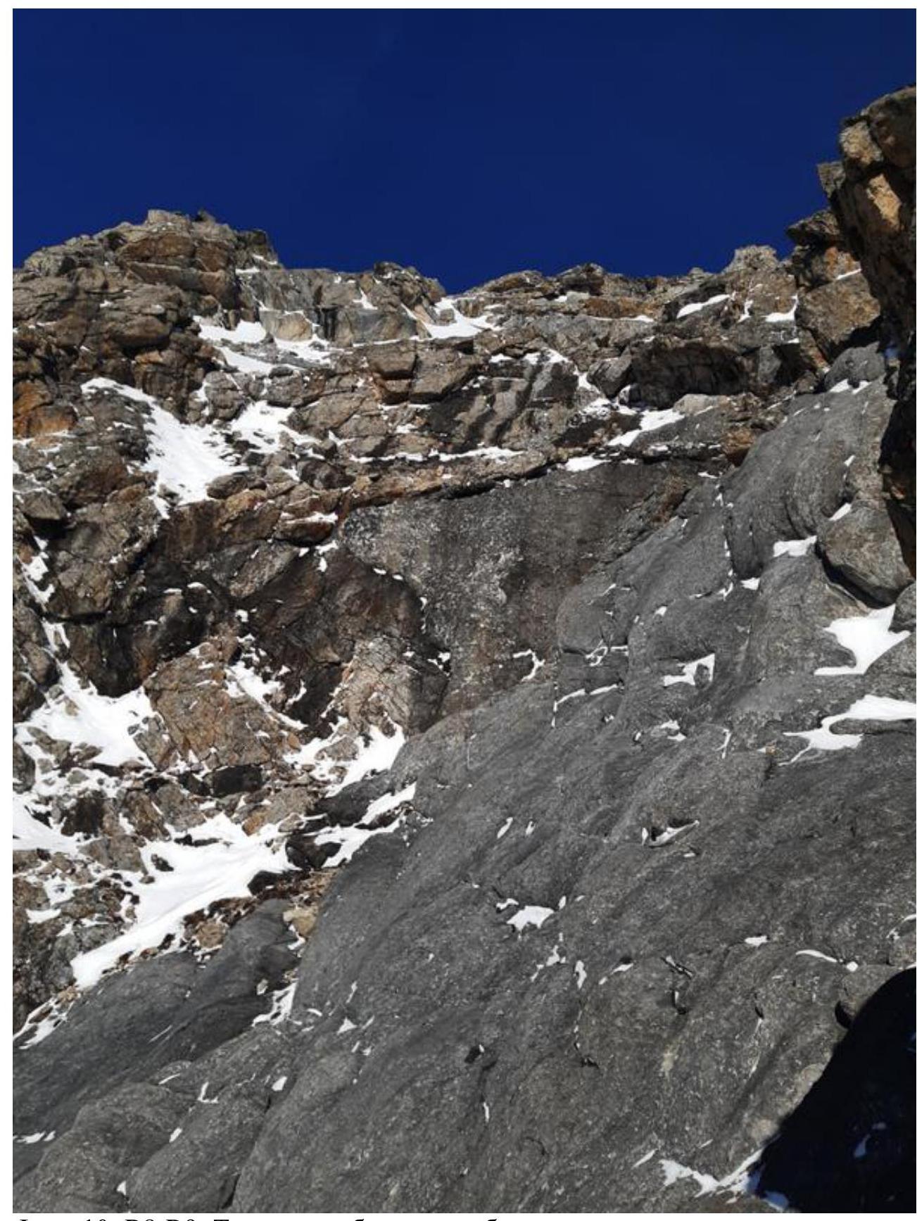
Photo 10. R8–R9. Traverse along "ram's foreheads" to the left, minimal protection using the terrain, station under an overhanging rock.
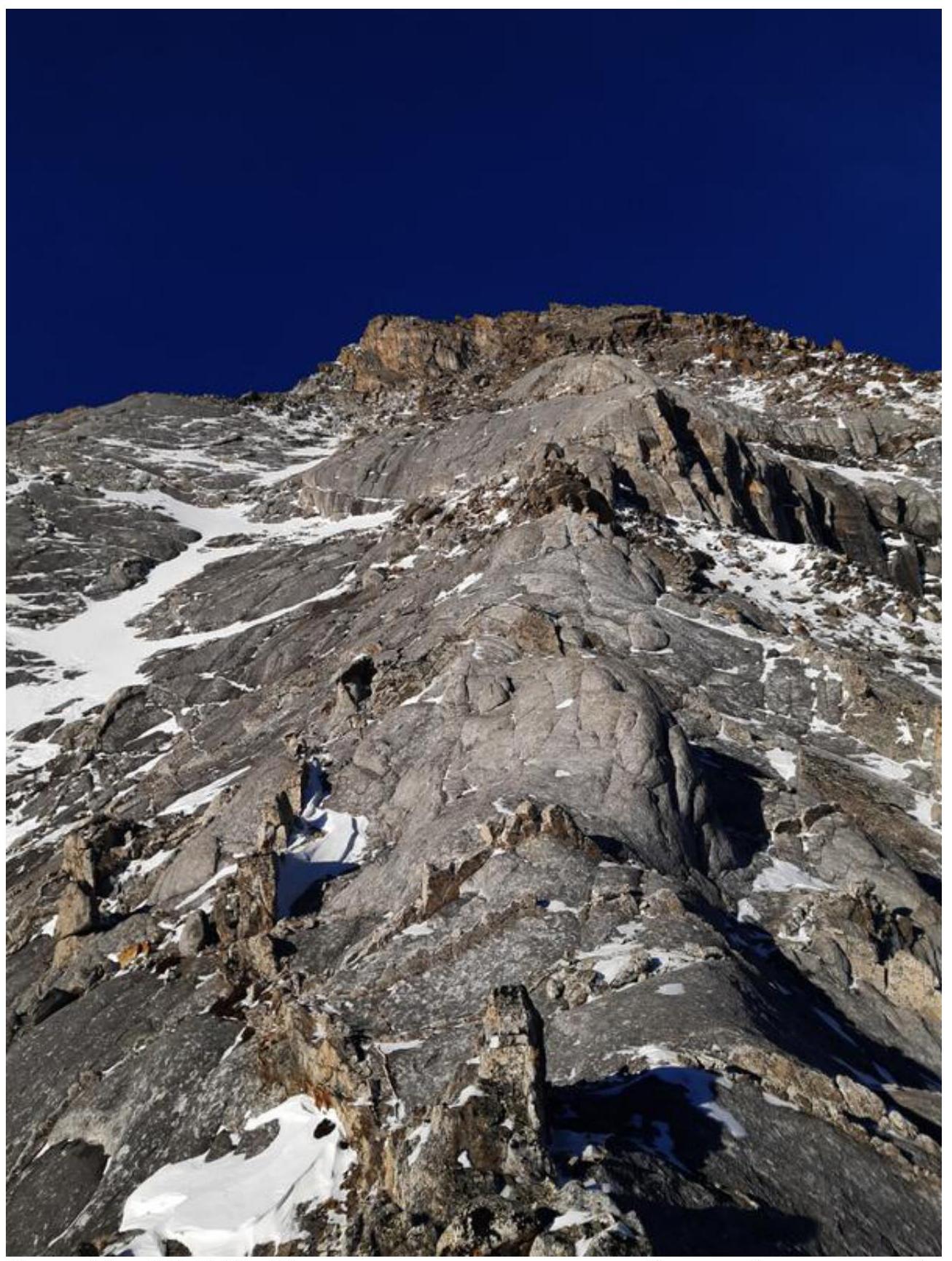
Photo 11. R11–R12. Movement along the wide ridge with "ram's foreheads", oriented towards the red bastion.
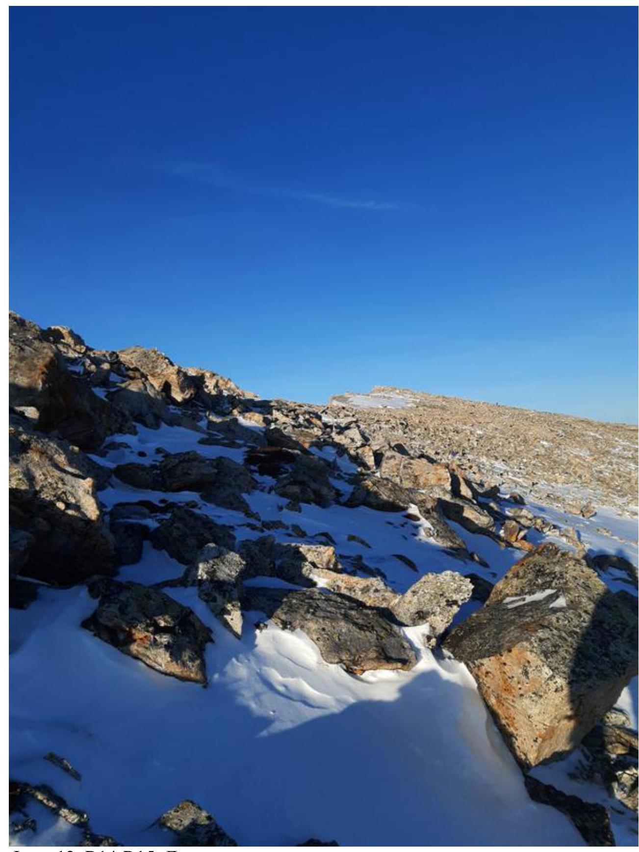
Photo 12. R14–R15. Movement across the plateau to the summit.