
Report
on the first ascent to the peak Charskie Zori 2920 m via the "Dядя Саня" route on the wall of the North-Eastern ridge, approximately 5A category of difficulty, for the period from June 28, 2019 to June 28, 2019.
2019
I. Climbing Passport
| 1. General Information | ||
|---|---|---|
| 1.1 | Full name, sports rank of the leader | Boyko Aleksey Andreevich, CMS |
| 1.2 | Full name, sports rank of the participants | Glazunov Evgeny Vladimirovich, MS — Boyko Aleksey Andreevich, CMS |
| 1.3 | Full name of the coach | Glazunov Evgeny Vladimirovich (MS) |
| 1.4 | Organization | Irkutsk Regional Public Organization Club of Active Recreation and Alpinism "Gory Baikala" |
| 2. Characteristics of the Climbing Object | ||
| 2.1 | Region | Eastern Sayan, Tunkin Goltsy ridge |
| 2.2 | Valley | Barun-Khandagai |
| 2.3 | Section number according to the 2013 classification table | 6.1.2 |
| 2.4 | Name and height of the peak | Charskie Zori 2920 m |
| 2.5 | Geographical coordinates of the peak (latitude/longitude), GPS coordinates | 51°55′24.54″ N 102°10′90″ E |
| 3. Characteristics of the Route | ||
| 3.1 | Name of the route | Along the wall of the North-Eastern ridge |
| 3.2 | Proposed category of difficulty | 5A |
| 3.3 | Degree of route exploration | First ascent |
| 3.4 | Nature of the route terrain | Rock |
| 3.5 | Height difference of the route (data from altimeter or GPS) | |
| 3.6 | Length of the route (in meters) | 905 m |
| 3.7 | Technical elements of the route (total length of sections of various difficulty categories with indication of the nature of the terrain (ice-snow, rock)) | Rock I category — 0 m Rock II category — 0 m Rock III category — 250 m Rock IV category — 415 m Rock V category — 180 m Rock VI category — 60 m Rock VI, A1 – 0 m Rock VI, A2 – 0 m |
| 3.8 | Descent from the peak | Descent along the ridge to the saddle between the peak Sibir and Charskie Zori, then down the couloir to the Alyaska cirque to the South. |
| 3.9 | Additional characteristics of the route | Lack of water |
| 4. Characteristics of the Team's Actions | ||
| 4.1 | Time of movement (team's working hours) | 6 |
| 4.2 | Overnights | No |
| 4.3 | Time at control points | Departure from BL at 6:00, Start on R0 – 8:00, Summit – 14:00, Descent to the valley – 16:00, Return to BL – 17:30 |
| 5. Characteristics of Weather Conditions | ||
| 5 | Partly cloudy. | |
| 6. Person responsible for the report | ||
| 6.1 | Full name, e-mail | Boyko Aleksey Andreevich alexeiboiko1@mail.com |
II. Climbing Report
1. Characteristics of the Climbing Object
1.1. General photo of the peak Charskie Zori from the Vityaz cirque, taken on June 28, 2019 from the Vityaz cirque, Barun-Khandagai valley.
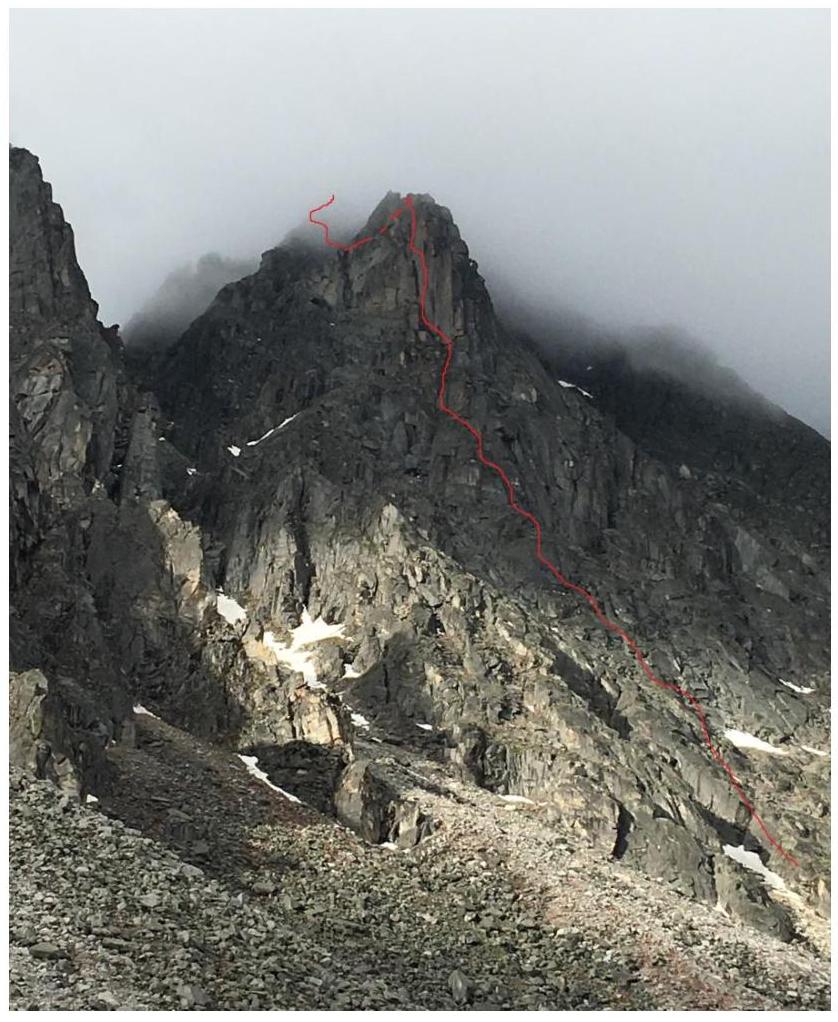 General photo of the North-Eastern ridge wall
 1.2. Photo of the route profile. Taken from the end of the Vityaz cirque
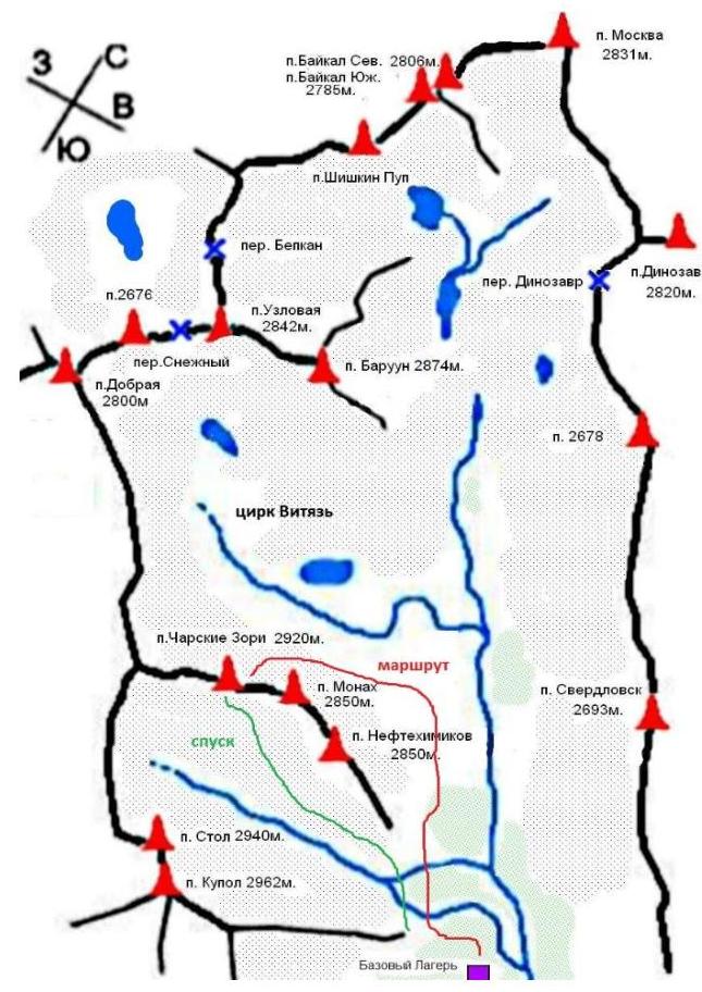
 1.3. Map of the area
2. Characteristics of the Route
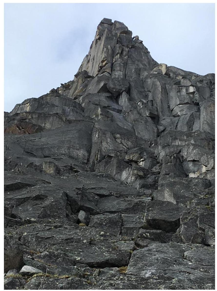
2.1. Technical photograph of the route
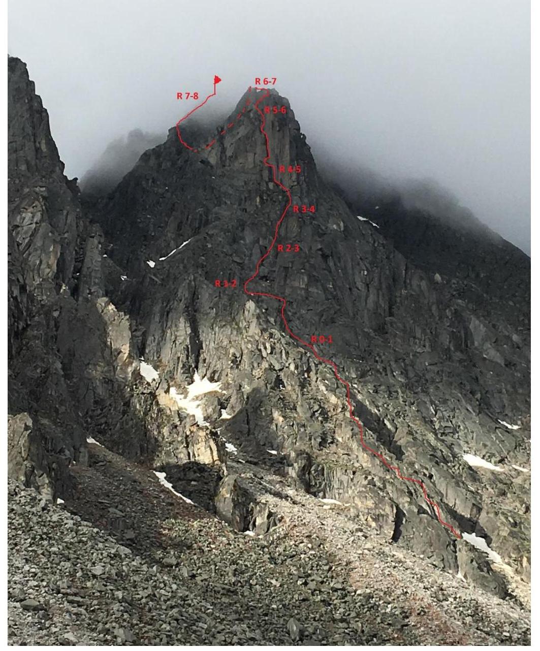
2.2. Section numbers on the technical photograph correspond to section numbers on the route diagram in UIAA symbols.
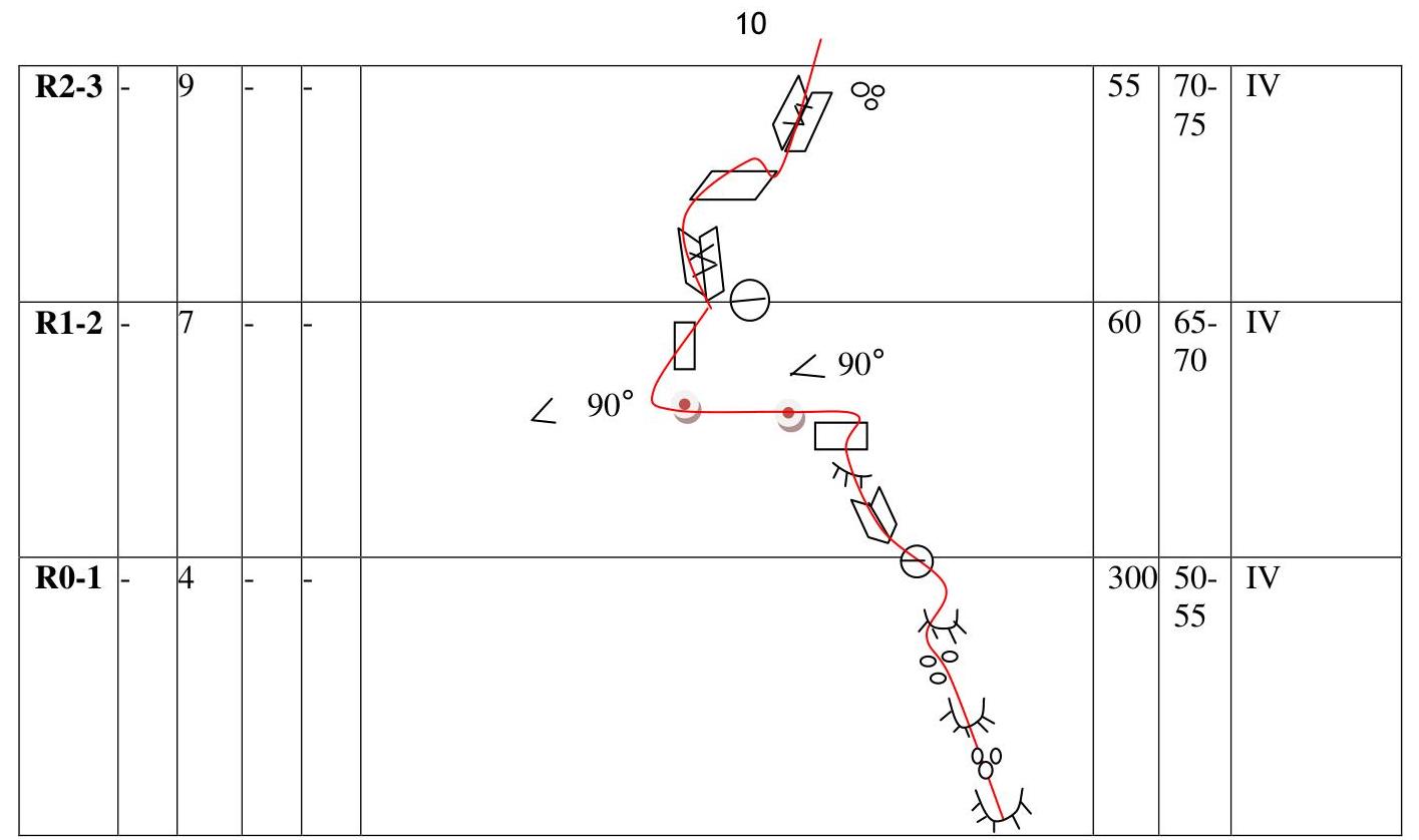
2.3. Route diagram in UIAA symbols.
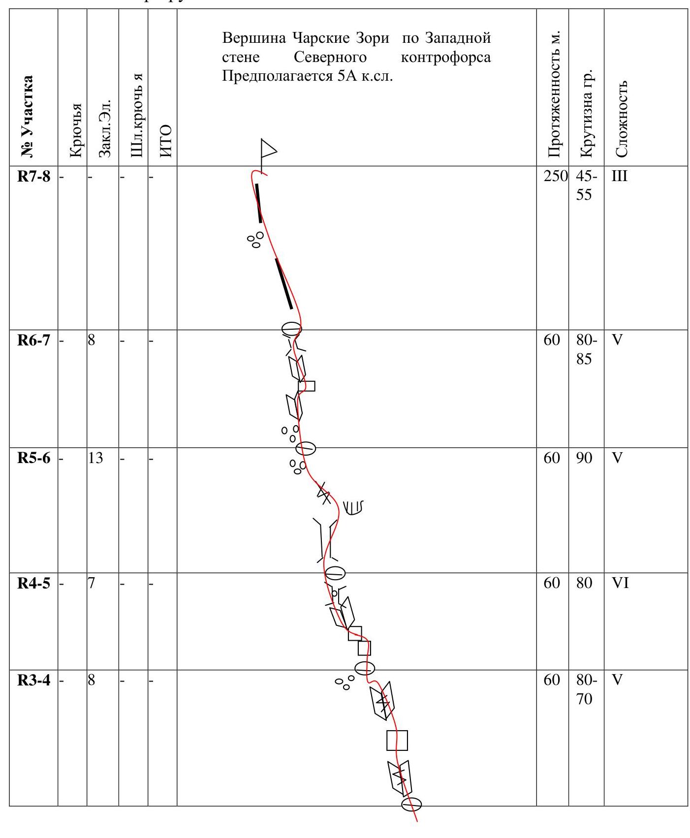
Peak Charskie Zori via the Western wall of the Northern buttress. Presumed 5A category.
| Section | Pitons | Nuts | Bolts | ITO | Length, m | Steepness, deg | Difficulty |
|---|---|---|---|---|---|---|---|
| R7–R8 | 250 | 45–55 | 3 | ||||
| R6–R7 | 8 | 60 | 80–85 | 5 | |||
| R5–R6 | 13 | 60 | 90 | 5 | |||
| R4–R5 | 7 | 60 | 80 | 6 | |||
| R3–R4 | 8 | 60 | 80–70 | 5 | |||
| R2–R3 | 9 | 55 | 70–75 | 4 | |||
| R1–R2 | 7 | 60 | 65–70 | 4 | |||
| R0–R1 | 4 | 300 | 50–55 | 4 |
3. Characteristics of the Team's Actions
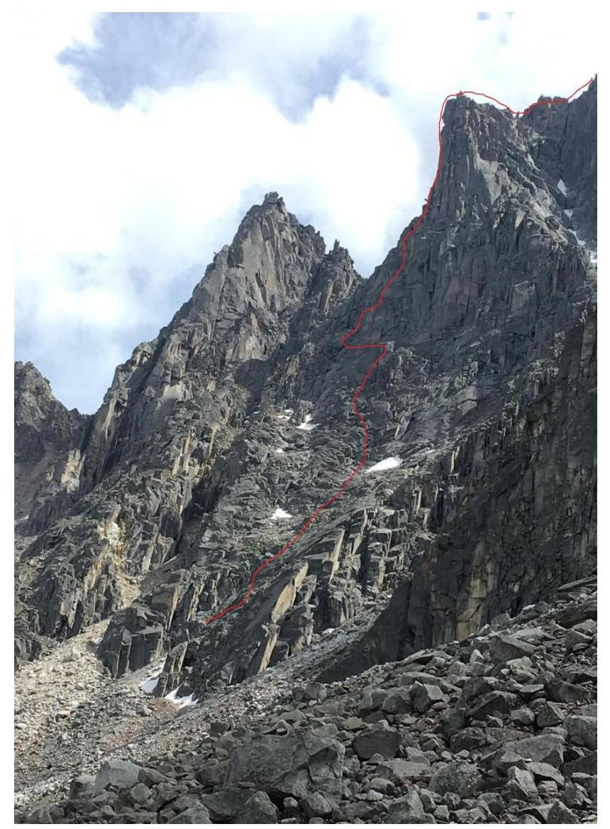
3.1. The peak Charskie Zori is located in the upper reaches of the Barun-Khandagai valley, Tunkin ridge, Eastern Sayan, between the massifs of peaks Sibir (to the West) and Monakh (to the East). The approach to our route to the peak Charskie Zori is made from the Vityaz cirque from the hut or from the "summer" BL in the forest zone opposite the entrance to the Alyaska cirque. The peak Charskie Zori has a distinct northern aspect; when viewed from the Vityaz cirque, it is on the left; the route taken by our team is fully visible from the cirque. Move deeper into the cirque, ascend to the pad, then move parallel to a small stream, then opposite the peak, move along the large-block slope in the direction of the buttress, which is in the middle of three and has the smallest protrusion compared to the buttresses on the sides — this is the start of the route. The route is named in honor and memory of our deceased friend Razorvin Alexander.
| Section | Description | Photo Number |
|---|---|---|
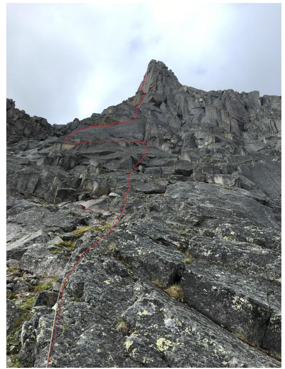
| R0–R1 | Move up the sloping slabs with a series of cracks, continue moving in the direction of the pronounced summit bastion, on the section move by unwinding many grassy ledges, internal corners, large-block relief, approach under a large internal corner with a wide crack and stones in it. Station on a block. | Photo 1 |
| R1–R2 | Move up the corner (may be wet and slippery after rain), then climb through several blocks onto a large sloping ledge, before a one-sided internal corner with a thin crack — traverse left 90°, around the corner, bend 90°, station at the base of a one-sided monolithic internal corner with a wide crack. | Photo 2 |
| R2–R3 | Move up the corner, then exit onto a large sloping ledge, then along a one-sided internal corner with a medium crack, then along steep blocks and scree, approach under a large internal corner. Station on the relief. | Photo 3 |
| R3–R4 | Move up the corner, may be damp and wet, with a medium crack, at the end of the corner pass through wedged blocks, then take a little to the right through a small corner, take to the left along the scree of blocks, approach under huge blocks standing at the base of the pre-summit bastion. Station on a beam wedged in a crack. | Photo 4, 5 |
| R4–R5 | Move to the right, climb onto a large block, then among large blocks approach the base of a huge "cucumber" standing in the middle at the base of the pre-summit bastion, move up a wide crack (requires cam № 5), then along a pair of wedged blocks enter a small "corridor", pass through it, through several large blocks exit onto the top of the cucumber, station a little to the left of the chimney on a huge beam leaning against the wall. | Photo 6 |
| R5–R6 | Move up the pronounced chimney in opposition, then not reaching a large internal cornice 7–8 meters. Traverse left onto the wall along a crack (bend 90°), on the wall move up a medium crack under a large wedged hanging block, climb onto the block, then move along large-block relief, then along scree in the direction of an internal corner. Station on the left on "feathers", on the middle feather — a loop. | Photo 7, 8 |
| R6–R7 | Short traverse to the right under the corner, move along wedged blocks, then along the corner, then exit onto a large ledge made of a slab, then move along the corner — first along a crack that turns into a small chimney, then unwinding coils and large blocks, exit onto the top of the pre-summit bastion, station on a large oblong beam. | Photo 9, 10, 11 |
| R7–R8 | Move in a rope team, unwinding the top of the bastion, descend into a niche, then taking to the left along the easiest path, ascend to the ridge, then along the ridge — to the summit. | Photo 12 |
3.2. Photo of the team on the summit by the control tour.

3.3. Descent from the summit in the southern direction to the Alyaska cirque via the couloir between the peaks Charskie Zori and Sibir.
3.4. Photo Report by Sections
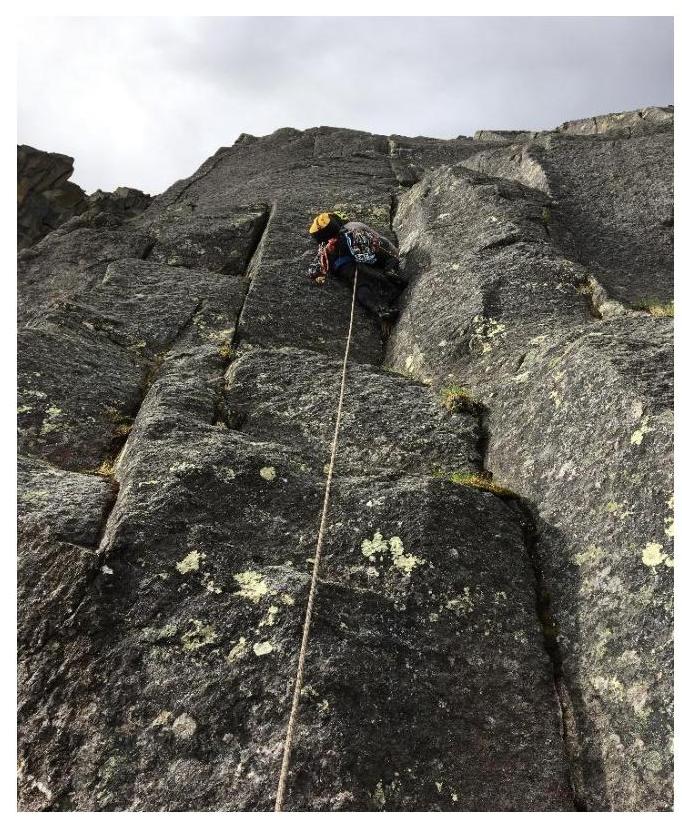
Photo 1. Section R0–R1 from the starting point of the route

Photo 2. Section R1–R2
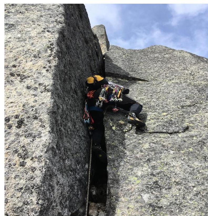
Photo 3. Section R2–R3
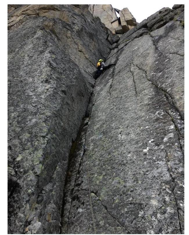
Photo 4. Section R3–R4
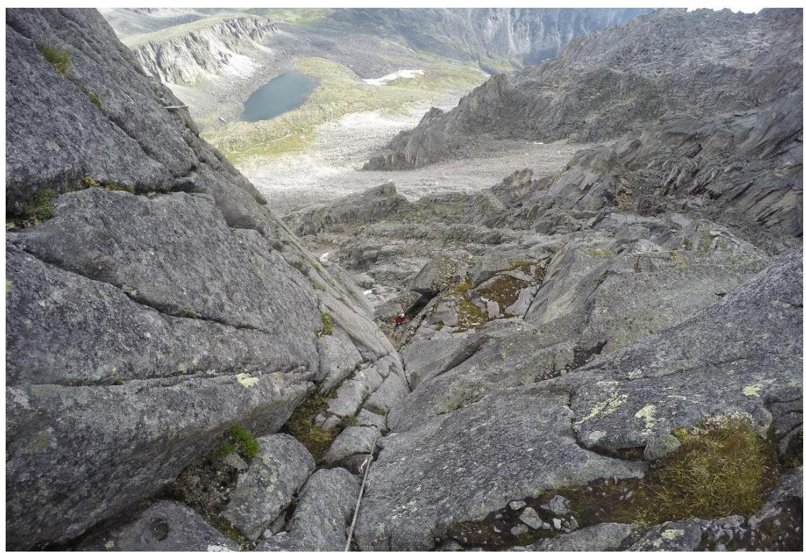
Photo 5. View of the internal corner from section R3–R4
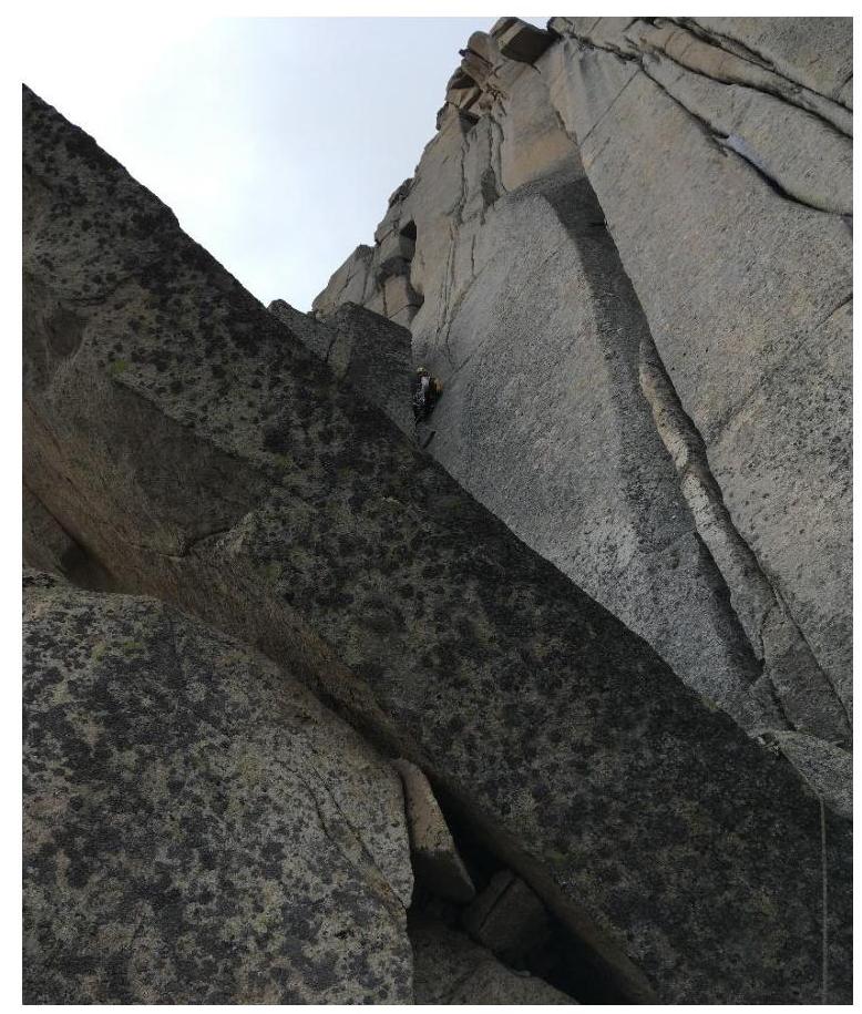
Photo 6. Section R4–R5, "Cucumber"
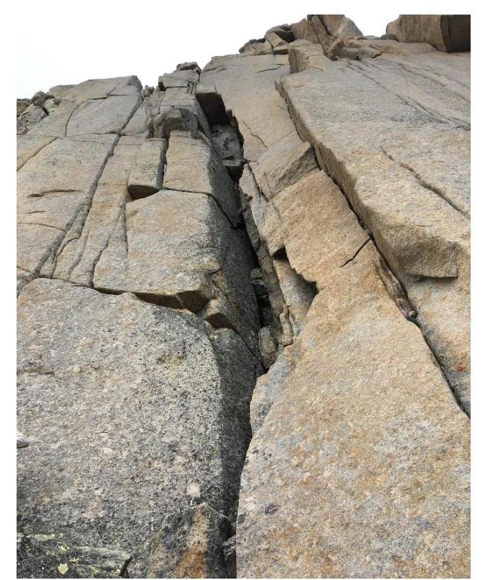
Photo 7. Section R5–R6. Chimney, crux.
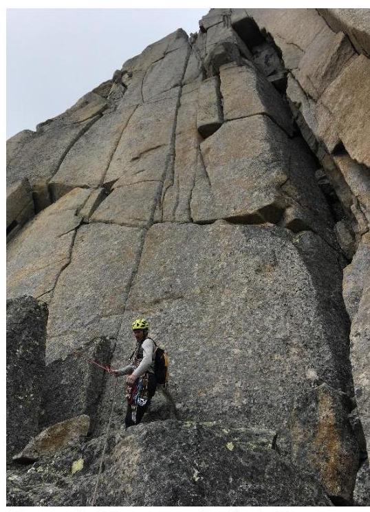
Photo 8. Section R5–R6. View of the station before the chimney.

Photo 9. Section R6–R7. Blocks, internal corner.
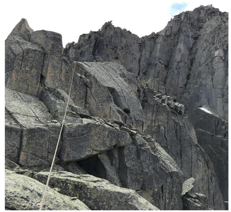
Photo 10. Section R6–R7. Roof of the pre-summit bastion.
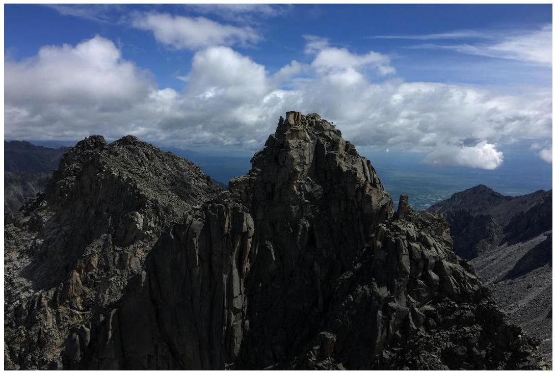
Photo 11. View of the peak Monakh from the end of section R6–R7.
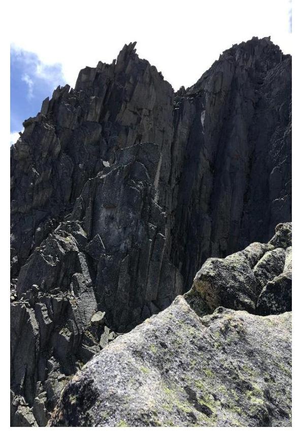
Photo 12. View of section R7–R8 from section R6–R7. View of the ridge and summit.
Comments
Sign in to leave a comment