Uzel Rebyonka 2798 m, via North-East Ridge, Category III
6.1.2.
Irkutsk 2008. Scheme of the route to Uzel Rebyonka 2798 m, via North-East Ridge, Category III.
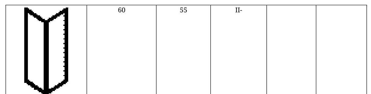
| Uzel Rebyonka | Length m | Steepness ° | Difficulty | Number of pitons | |
|---|---|---|---|---|---|
| 20 | 30 | IIIБ | |||
| 40 | 60 | IIIБ | |||
| 30 | 40 | I- | |||
| 15 | 55 | IIIБ | |||
| 10 | V- | ||||
| 35 | 10 | IVБ | 2 | 1 | |
| 70 | 70 | IVБ | 3 | 2 | |
| 70 | 60 | IIIБ | 1 | 1 | |
| 20 | 60 | IIIБ | |||
| 180 | 55 | I+ | |||
| 20 | 45 | IIIБ | 1 | 1 |
Passport of the ascent to Uzel Rebyonka 2798 m via North-East Ridge, Category III. 1. East Sayan, Tunka Goltsy ridge, Barun-Khandagai valley, section 6.1.2. 2. Uzel Rebyonka (2798) via North-East Ridge. 3. Proposed Category III, first ascent. 4. Route type - rock. 5. Height difference 360 m, length 570 m, average steepness 50°. 6. Pitons used: rock and chock stones 12 pieces. 7. Team's walking hours - 7 hours. 8. No overnight stays on the route. 9. Group:
Afanasiev A.E. MS, Volodov A.N. 3rd sports category, Vinogradov N.N. 3rd sports category
10. Coach Afanasiev A.E. MS
- Ascent to the summit and return on August 17, 2008.
Description of the ascent route to Uzel Rebyonka 2798 m via North-East Ridge, Category III. Geographical coordinates: N 51°55'40" E 102°08'56".
Approach via Vityaz cirque (right orographically to Barun-Khandagai valley) to the end. Then along a snow-covered large talus slope of eastern exposure to the lower point of the counterfort descending from the summit to the northeast. Bypass the lower "claw" from the left to a convenient ledge at the start of the route. Section 0-1, 80 m, 55°, II-. A winding internal angle under a monolithic wall. Bypass the monolith from the left. Section 1-2, 180 m, 55°, I+. Upwards to the left along large snow-covered blocks. Section 2-3, 20 m, 60°, III+. A rocky monolithic outcrop, with a sharp ridge to the right, ascended via shattered rocks upwards. Control cairn. Section 3-4, 30 m, 60°, III+. To the right via shattered rocks, exit onto the ridge. Section 4-5, 25 m, III-. To the right of the ridge along narrow snow-covered ledges under overhangs. Section 5-6, 75 m, 70°, IV+. To the right of the ridge along the wall via vertical cracks. Northern side, heavily snow-covered even on steep rocks. Rockfall hazard! Key section. In the upper part, exit onto the ridge. Section 6-7, 35 m, 10°, IV-. Monolithic narrow ridge. Section 7-8, 10 m, IV-. Vertical rappel to the right of the ridge. Section 8-9, 15 m, II+. To the right of the ridge along a 55° slope. Exit onto a ridge saddle under a monolithic vertical reddish wall. Section 9-10, 30 m, 40°, I-. From the saddle to the left along a snowy slope. Section 10-11, 40 m, 60°, III-. Along the wall to the left of the summit, exit onto the summit ridge. Section 11-12, 7 m, 60°, III+. To the right along the ridge, exit onto the summit tower. On the summit ledge, two boulders: one slightly below human height, the second large, 2.5 m high, a sharp boulder. Cairn constructed.
Descent to the south, initially along a flat field and then along the southern ridge to a saddle with Dobraja peak, and to the left down a steep snowy couloir with piton protection.
The flat summit area is at the same height as the summit tower, possibly even slightly higher. However, visually, the group did not find a specific spot for the cairn on the field (weather was good), so they decided that constructing a cairn on the tower and finding it would be easier.
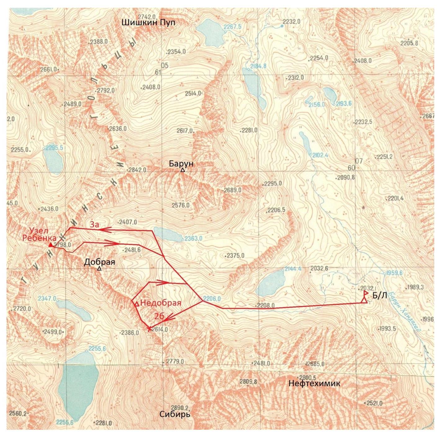
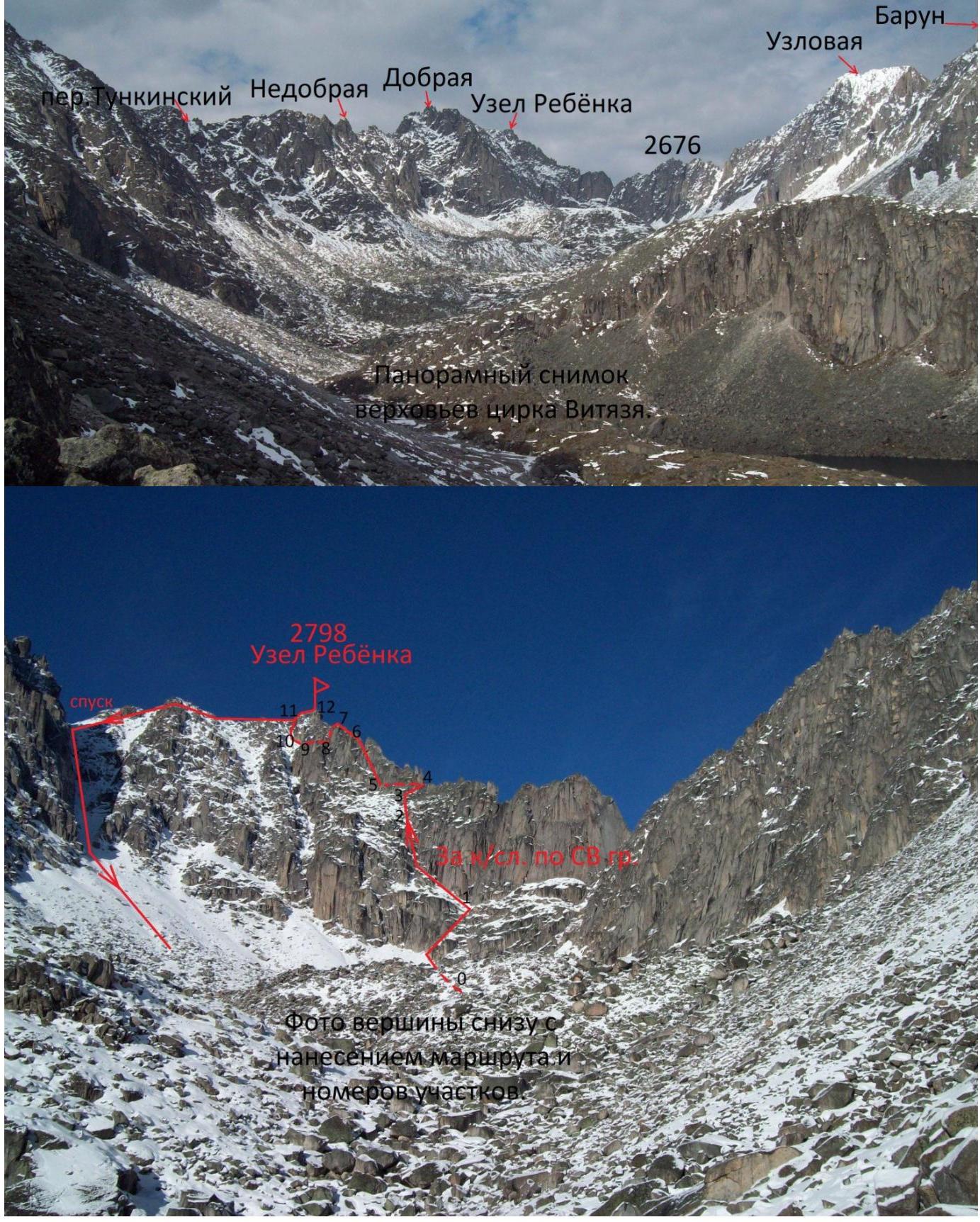
Photo of the summit from below. "Naves Miyem", "Korivuga", and "Nomerov" feelings.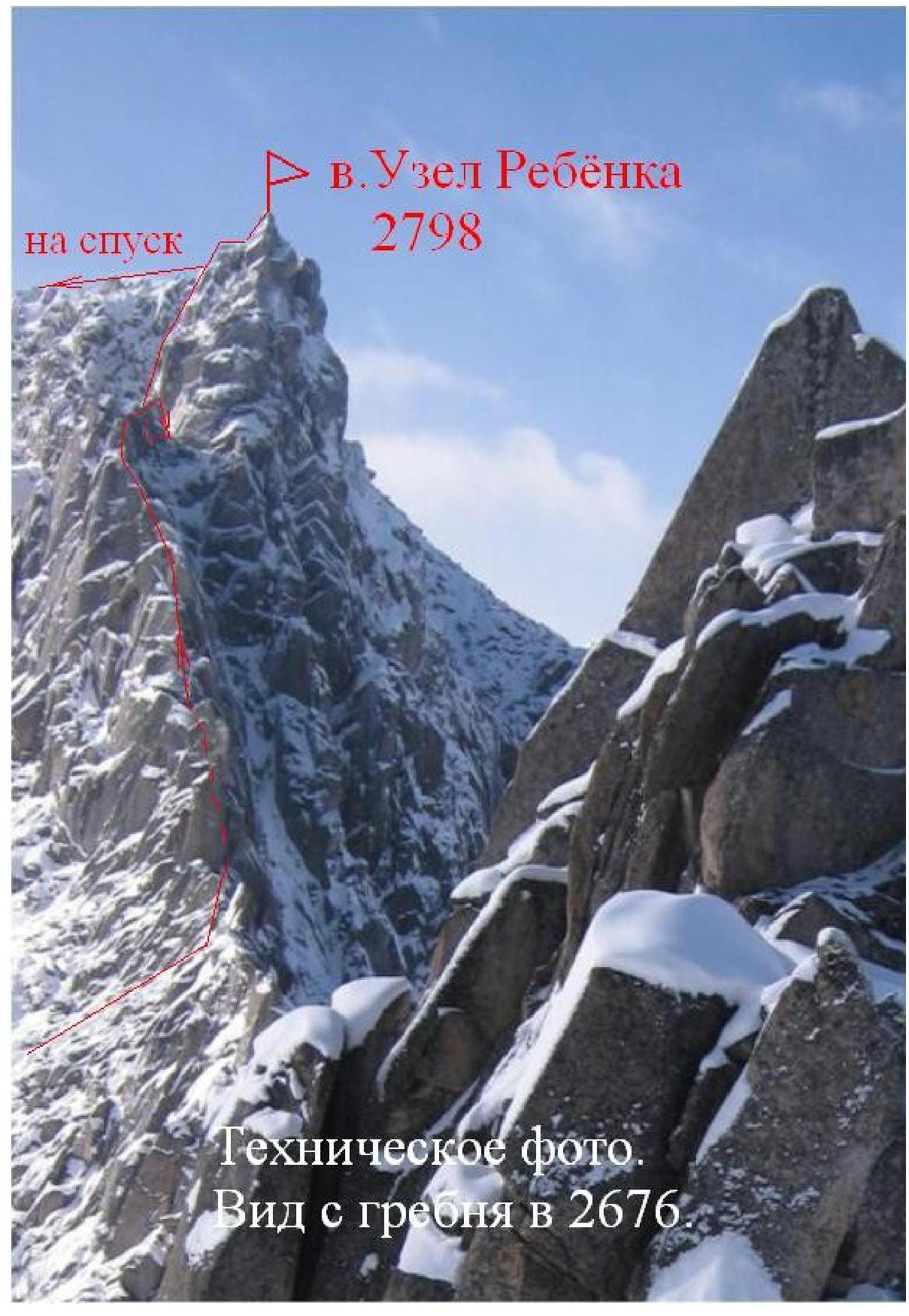 Uzel Rebyonka
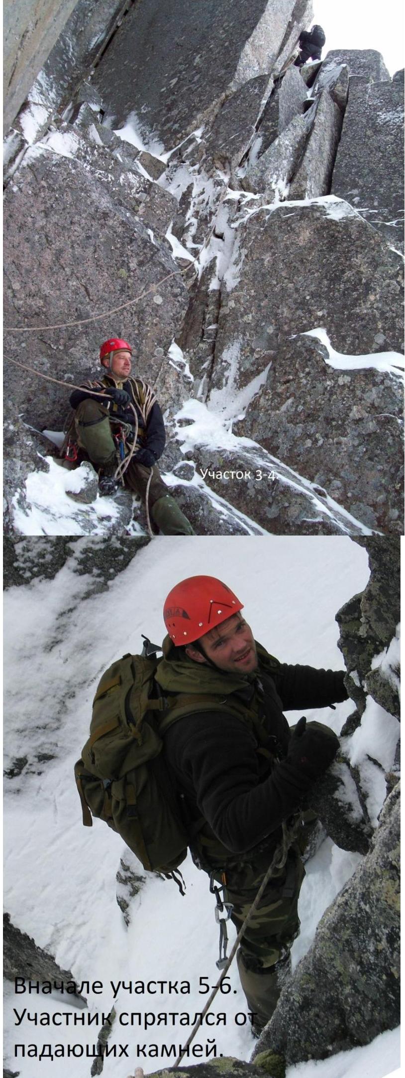
Start of section 5-6. Climber hiding from falling rocks.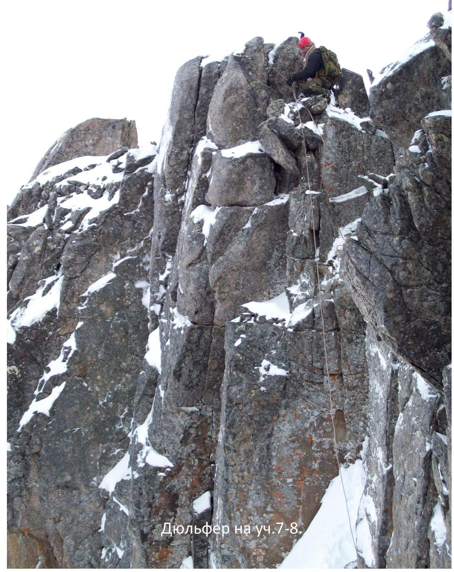
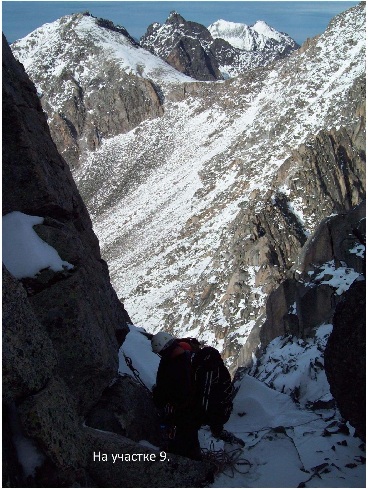
On section 9.
Footnotes
-
Section ↩