
Route Description
Via the south-eastern buttress of the Central peak of Trekhglavaya (2511 m)
Group composition: leader Laptev N.K., Belousov V.M., Vorobyova N.P., Boyarkina Z.M. Date of ascent — 2–3 May 1972
The group set out on the route at 6:00 from the base camp in the direction of the huge canyon separating the Central and Southern peaks of Trekhglavaya. The base camp is conveniently located on the edge of the forest on the southern side of the cirque under the peak. The path initially goes with a slight gain in height, and then turns into a steep fine and medium scree.
To start the route, it is necessary to:
- Enter the canyon
- Ascend along it, alongside the wall of the buttress, to a huge boulder protruding from under the snow (in summer — from under the scree)
See photo I.
The protruding boulder, having a diameter of 8 meters, is located 40–50 m from the lower point of the buttress and is not covered by snow even in winter. At this point, the altitude reading was 1900 m.
The walking time from the base camp (from the edge of the forest) to the protruding boulder is about one and a half hours.
From here, the route transitions to the left wall of the buttress. First (section R0–R1), it is necessary to:
- Move upwards along the scree rocks to a gentle terrace,
- Along which it is necessary to move somewhat to the right.
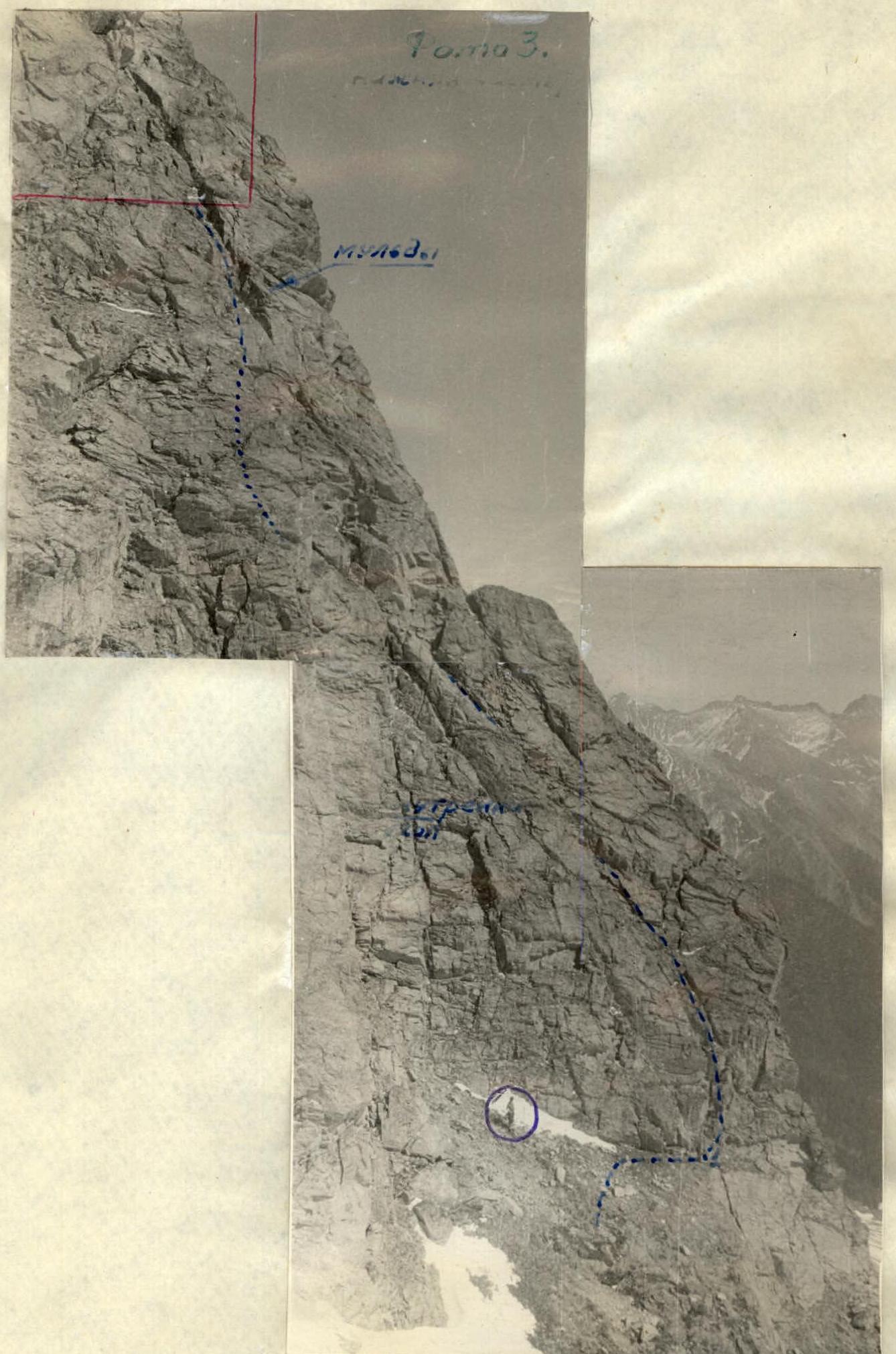
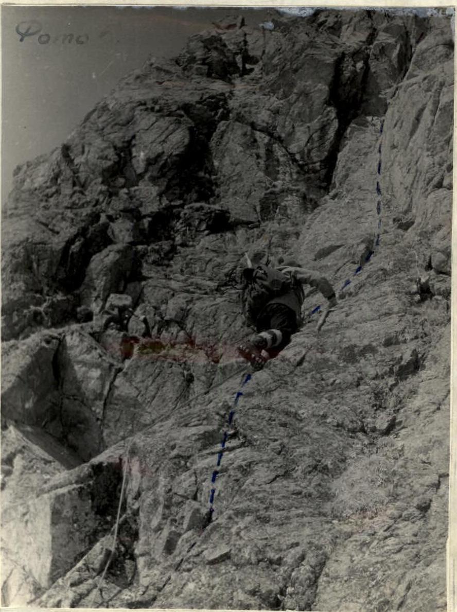
From here, upwards to the left, for the greater part of the left side of the buttress, a cleft runs. See Photo 2.
The cleft has a depth in some places of up to 0.8–1 meter and, thanks to its jagged edges, provides the possibility of good forward movement with reliable belaying. See photo 3.
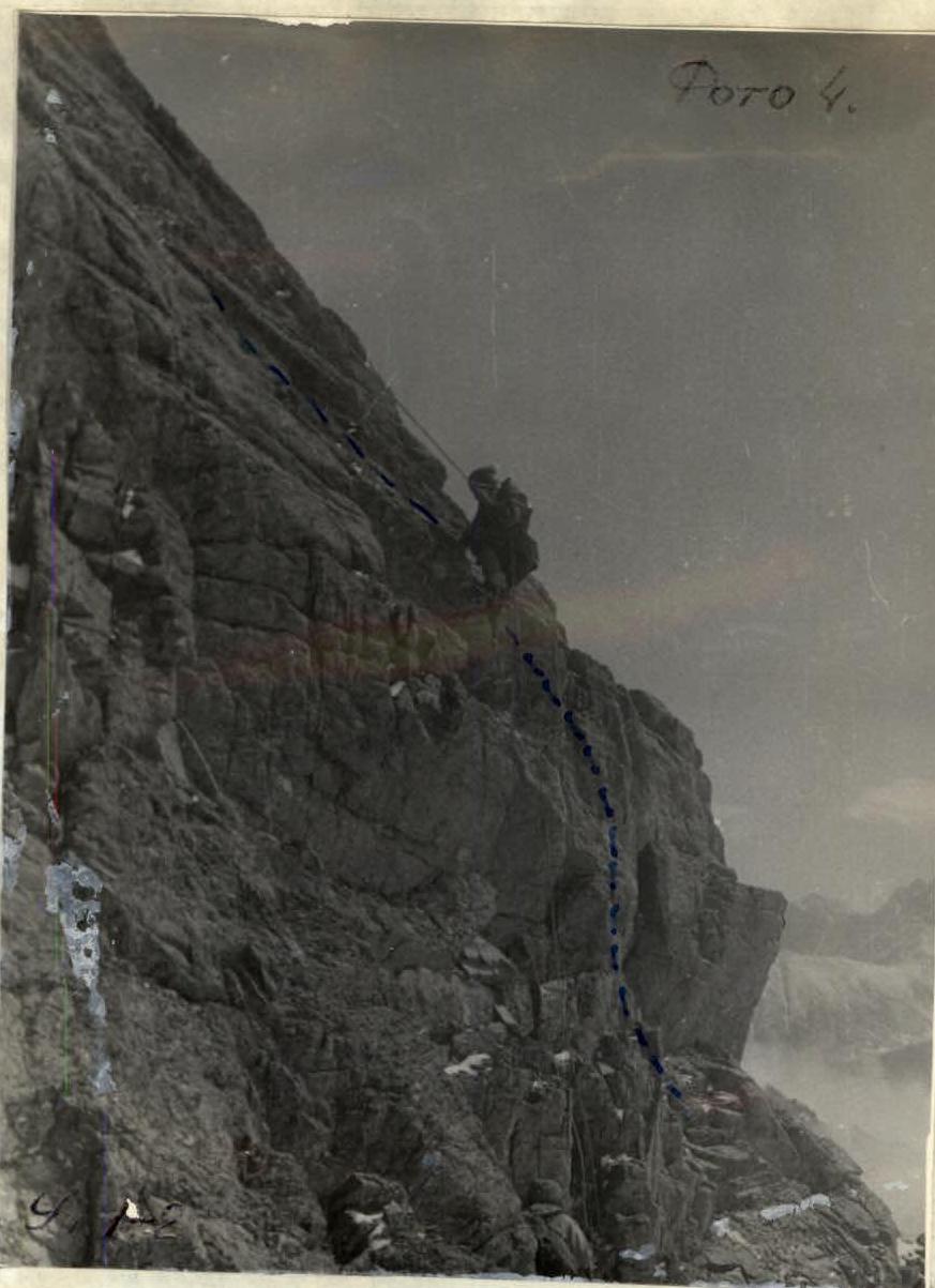
From point R1, the route goes to a vertical wall 12 meters high, and then becomes somewhat gentler to a steepness of 50°. The rocks here are of medium difficulty, with firm holds. The entire lower part of the route is not prone to rockfall, as rocks fall to the sides of the route being laid. See photo 4.
Further, it is necessary to move along the jagged cleft, running parallel to the ridge of the buttress, 10–15 meters away.
The rocks are overcome mainly by climbing of medium difficulty with alternate piton belaying. In the presence of even a small amount of verglas on the rocks, the difficulty of passing this section increases sharply.
To the left of the route (in its lower part) runs an internal corner with a vertical left side. See photo 2.
Having passed 80 meters along the left side of the buttress along the cleft, it is necessary to approach the upper part of the vertical internal corner, located to the left of the route and having a rusty colour on its left side.
In this part, it is easier to pass a couple of meters away from the internal corner, rather than through the cleft, which has turned into a crevice at this point. The section becomes steep and difficult to traverse. Belaying on this section of the route is exclusively piton, and climbing is difficult.
Then the route transitions again into a cleft (to the right), having the appearance (from the other side of the canyon) of a chain of elongated rock muldas.
See photo 3.
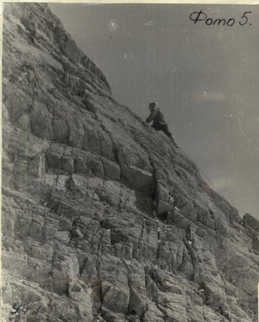
Further, the group continued on the route in the same direction to the apparent "bulge" on the ridge itself (point R2). The steepness of the rocks is 45–50°. The rocks are monolithic with good holds. There are many places for piton placement. See photo 5.
After emerging onto the ridge, the route:
- Transitions to a slab inclined to the right by about 30°,
- And from it goes upwards to a wall.
See photo 3. Section R2–R3.
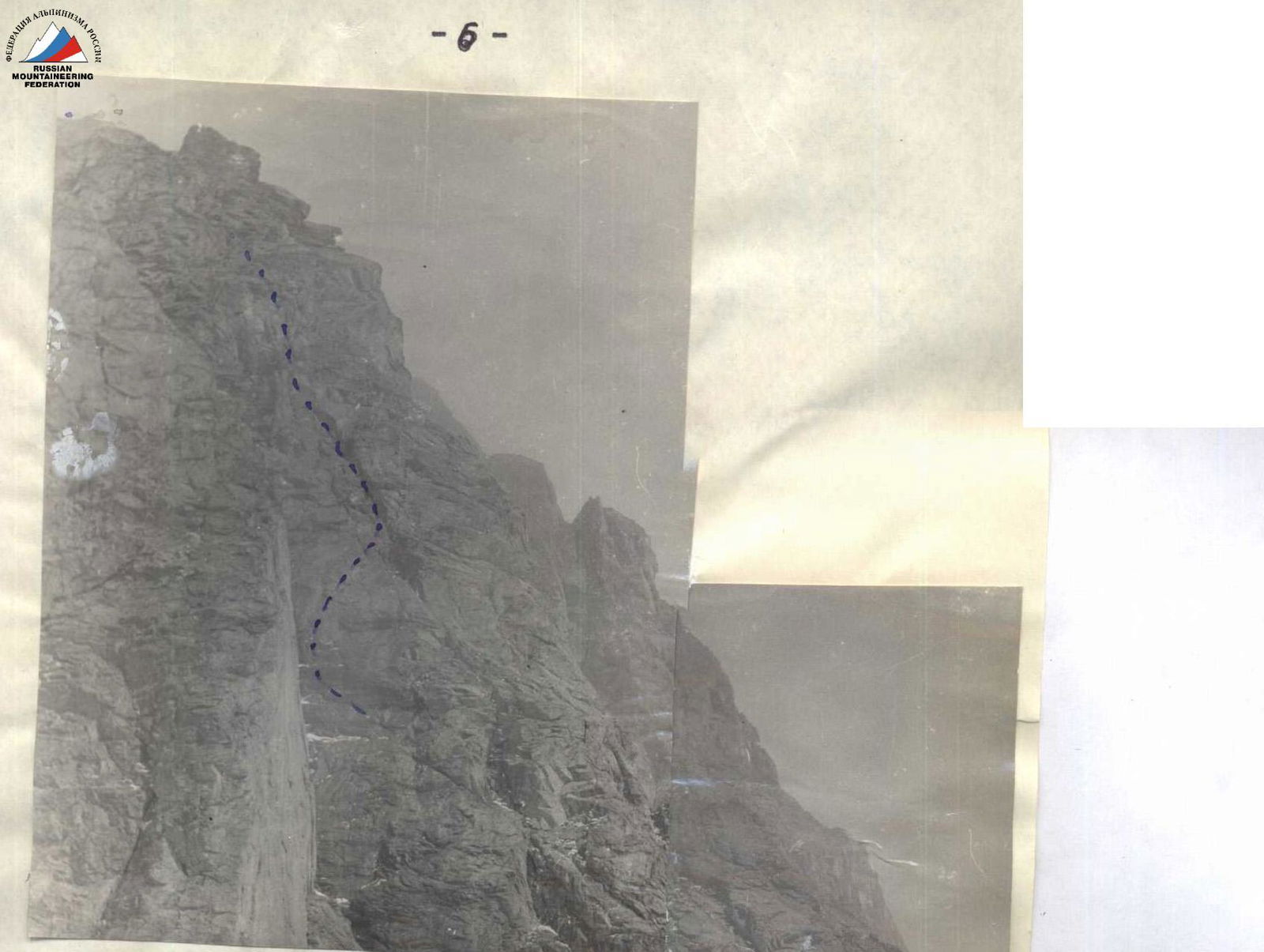
The wall has a wide internal corner in its lower part, along which it is necessary to move, sticking to the right side (See photo 6), and then transitions in its upper part to a vertical monolith.
The vertical wall is taken head-on, staying 2–3 meters away from the right edge of the wall. Climbing the wall is very difficult, especially the upper part, which required excellent rock climbing technique from the lead climber. The group passed this section by pure climbing, as the rocks were dry and the weather was good. After snowfall, the upper part of the wall will require the use of ladders or ledges.
There are few cracks for piton placement, but the rocks are monolithic and firm. From the inclined ledge under the wall, the group ascended up the slab and wall for 20–25 meters and emerged onto a small ridge running to the left. The ridge is almost horizontal and at its very beginning has a rock outcrop in the form of a boulder, behind which it is very convenient to organize belaying (handrail) for the ascent of the remaining participants up the wall.
On the horizontal ridge behind the boulder, Control Cairn №1 is built. It is much more difficult to pass by the cairn by another route. If necessary, an overnight camp can be organized on the ridge with the setup of a tent, but it will require:
- Significant clearing;
- Leveling of the site.
The horizontal ridge, after 50 meters, becomes steep again, with powerful walls. From here, it is necessary to transition to the left side of the entire buttress and move upwards only after moving 30–40 meters horizontally along easy ledges.
The left side of the buttress, after passing the control cairn, is composed of powerful monolithic slabs, running upwards to the very ridge. The degree of fissuring is average. The steepness of all the slabs is on average equal to 45°. There are many cracks for piton placement, but a wide range of thicknesses is required. The slabs are overcome by climbing of medium difficulty and are complicated only by a small amount of rime ice and lying snow. Piton belaying and belaying through outcrops are used. The general direction of the route on section R4–R5 is to the left and upwards, staying to the left of the ridge of the buttress, 30 meters away.
Before emerging onto the ridge, it is possible to deviate further to the left to shorten the path. Climbing in all directions on these slabs is roughly the same, and the group traversed the entire slope with the hanging of vertical handrails until emerging onto the ridge.
The horizontal ridge is sharp and snow-covered. It is traversed along the very crest with simultaneous, and in places alternate, belaying.
100 meters after emerging onto the ridge, it broadens, and the route transitions to the right slope of the entire massif of the peak, while the left slope of the ridge abuts against the walls. See photo I.
At the end of the already broadened ridge, there is a section of a gentle slope, where the group organized their first overnight camp. A site is leveled under the tent. The place is not prone to rockfall, and there is nowhere for snow to accumulate for avalanches. The only inconvenience is the constant wind. There is no more convenient site for a tent closer to this place.
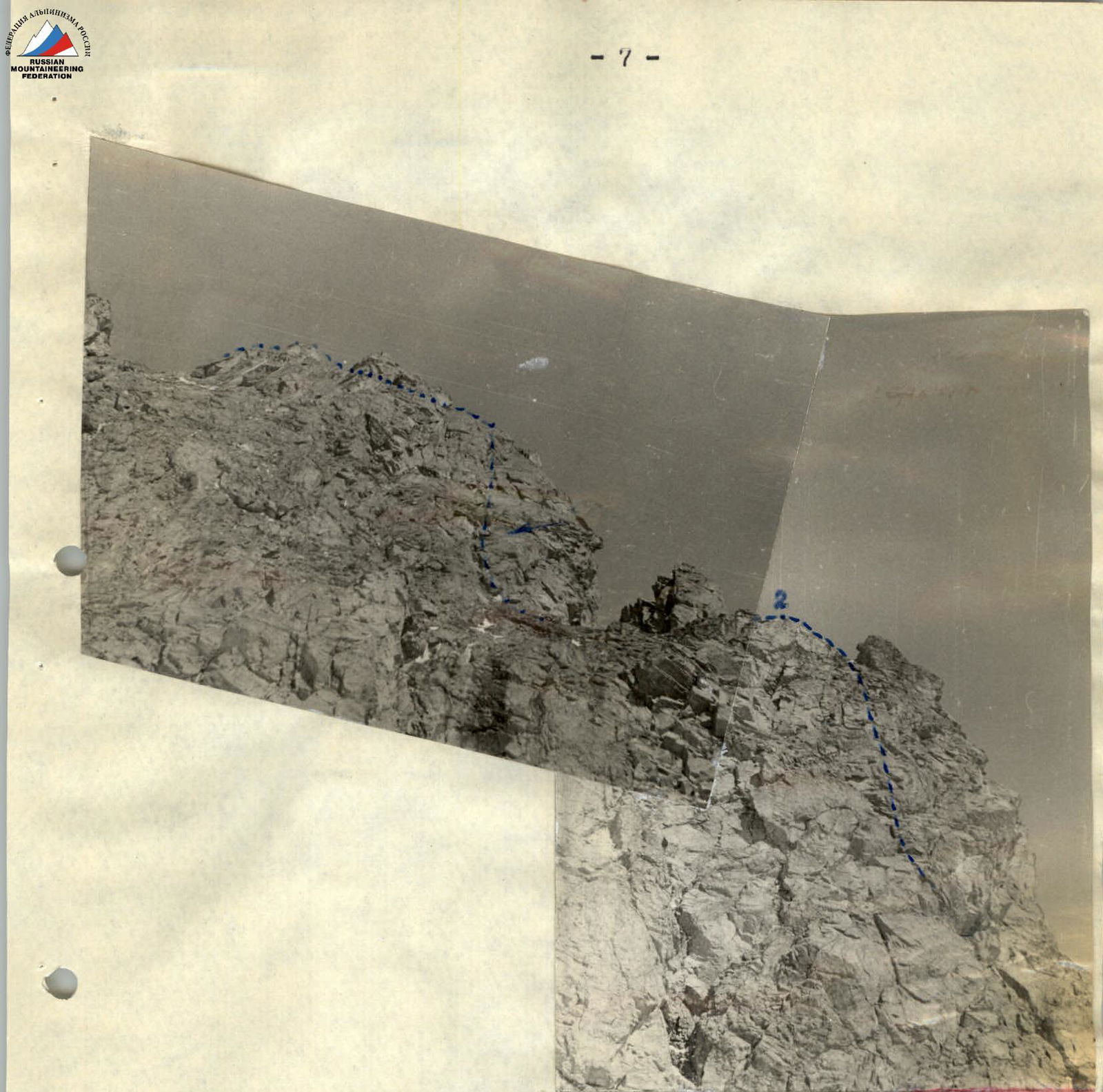
From the start of the route, the group took 11 hours to complete it. After the overnight camp, the group set out on the route along a snow couloir running along the right side of the massif of the peak, upwards to the right. To the left and above the snow couloir, numerous rock outcrops run in the form of rock walls and gendarmes, and to the right, the slope drops off in a wall into a steep rock-ice couloir. See photos 1, 7.
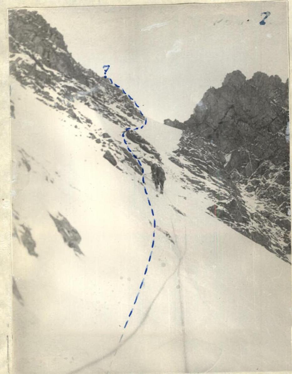

The steepness of the snow-firn couloir is 40–45°, and progress is made only with belaying through pitons and ice axe. There is a possibility of the snow couloir or firn slab sliding after being loaded. Pitons are driven into outcrops of ice-covered rocks, under which the route passes. See photo 8.
The general movement along the snow-firn couloir is maintained in the direction of the left side of the huge gendarme located between the Northern and Central Peaks. See photo I.
100 meters before reaching the gendarme, on the way, a steep couloir is encountered; turning from it to the left and upwards, the group emerged onto the main ridge connecting the peaks.
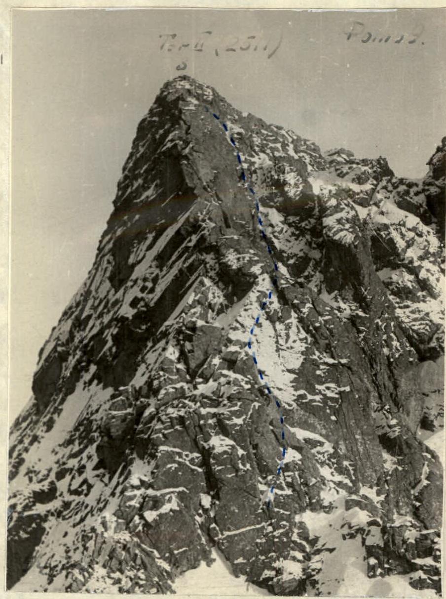
On the main ridge, the group's route converged with the route of category 2B difficulty and was traversed to the peak, slightly to the right of the ridge, and then upwards along the rocks. Climbing is easy. In the upper part, there are sections of medium difficulty.
The group used:
- Initially simultaneous belaying,
- In the upper part (before reaching the peak) — alternate belaying through outcrops.
See photo 9.
The descent route also follows the descent route of category 2B difficulty. From the peak — towards the Southern peak, staying on the right side of the steep ridge.
Belaying is applied:
- Alternately,
- Group belaying through outcrops.
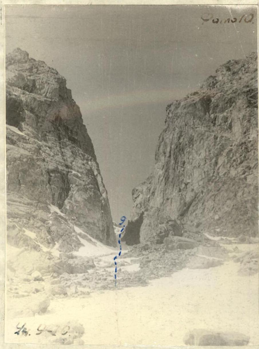
From the col between the Central and Southern peaks, the descent route goes down along the canyon, and it is necessary to go first with alternate belaying through ice axe (3 ropes), and then simultaneously down to the base camp. See photo №10.
The route of the second day took 8 hours. A total of 44 working pitons were driven. If necessary, the group can organize a descent from the middle of the route (from points R4, R5, R6) to the left and down the slope of slabs with a steepness of 45° to a steep snow slope emerging into the canyon between the Central and Southern peaks. The forced descent route will be 300–350 meters.
Recommendations to Climbers
- Group composition not more than 4–6 people.
- Have a wide range of rock pitons.
- Have ladders (especially in case of fresh snowfall or when climbing in winter).
- When climbing from September to the end of May, have at least two ice axes per group.
- Have a good rock climber in the group.
In terms of difficulty, length, and climbing conditions, the group evaluates the route via the South-Eastern buttress as a route of category 4B difficulty.
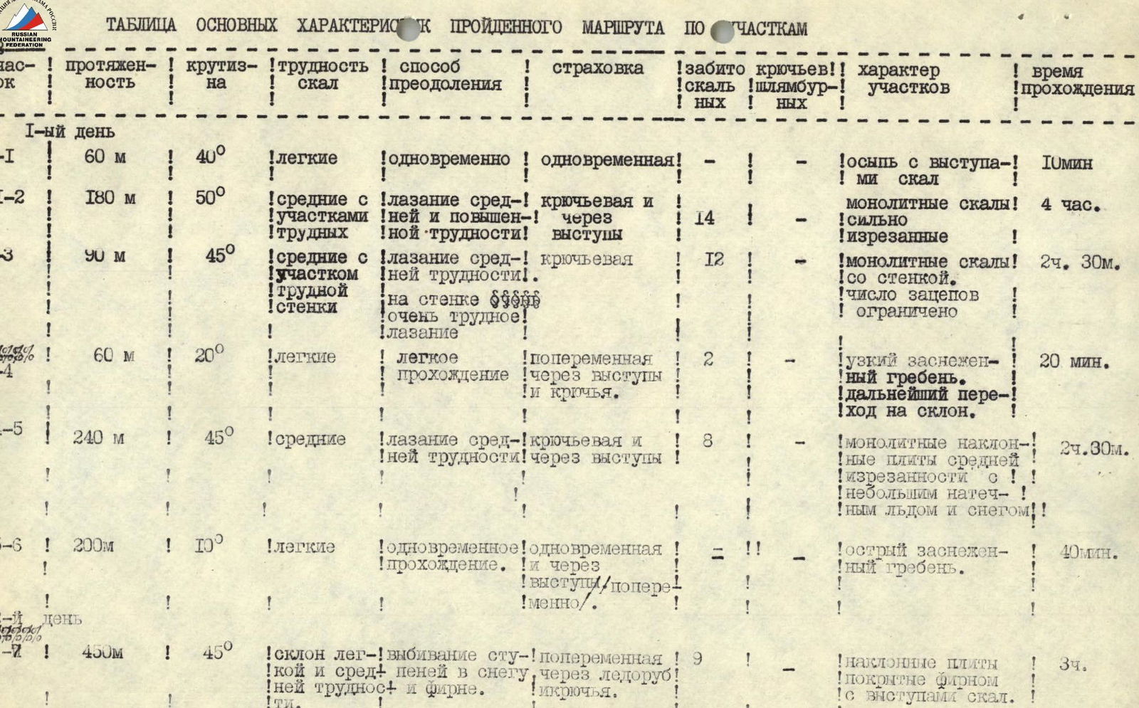
Table of Main Characteristics of the Route by Sections
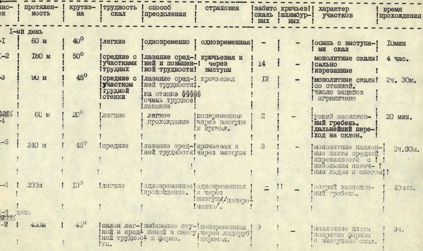
| Section | Length | Steepness on rocks / Direction | Rock Difficulty | Method of Overcoming | Belaying | Pitons Driven (rock/bolts) | Character of Sections | Time Taken |
|---|---|---|---|---|---|---|---|---|
| Day I | ||||||||
| R0–R1 | 60 m | 40° | Easy | Simultaneous | Simultaneous | - / - | Scree with protruding rocks | 10 min |
| R1–R2 | 180 m | 50° | Medium, with sections of hard | Climbing of medium and increased difficulty | Piton and through outcrops | 14 / - | Monolithic rocks, heavily fissured | 4 h |
| R2–R3 | 90 m | 45° | Medium, with sections of hard | Climbing of medium difficulty. On the wall very hard | Piton | 12 / - | Monolithic rocks with a wall. Number of holds limited | 2 h 30 min |
| R3–R4 | 60 m | 20° | Easy | Easy passage | Alternate through outcrops and pitons | 2 / - | Narrow snow-covered ridge. Further transition to the slope | 20 min |
| R4–R5 | 240 m | 45° | Medium | Climbing of medium difficulty | Piton and through outcrops | 8 / - | Monolithic inclined slabs of medium fissuring, with some rime ice and snow | 2 h 30 min |
| R5–R6 | 200 m | 10° | Easy | Simultaneous passage | Simultaneous and through outcrops/alternate | = / - | Sharp snow-covered ridge | 40 min |
| R6–R7 | 450 m | 45° | Easy and medium | Cutting steps in snow and firn | Alternate through ice axe and pitons | 9 / - | Inclined slabs covered with firn, with rock outcrops | 3 h |
| Day II | ||||||||
| R7–R8 | 600 m | 120° | Easy, with small sections of medium rocks | Climbing | Simultaneous and alternate through outcrops | - / - | Monolithic, heavily fissured rocks with snow | 2 h |
| R8–R9 | 600 m | 145° | Easy climbing and descent on handrails | Alternate, simultaneous, group | - / - | Heavily fissured rocks. In couloirs scree and snow | 1 h 30 min | |
| R9–R10 | 1400 m | 145° ± 20° | Easy | Descent on handrails, then simultaneous | Simultaneous | - / - | Steep firn couloir, gradually becoming gentler | 1 h 20 min |
| Total | 18 h |
Comments
Sign in to leave a comment