Ascent passport to the summit of Tamara (Gadzhi) 3141 m, via the Eastern slope, cat. 2B
-
East Sayan, Tunkinskie Goltsy ridge, Gang Hairym valley, section 6.1.2. 2. Tamara (Gadzhi) peak, 3141 m, via the Eastern slope. 3. Proposed cat. 2B, third ascent. 4. The route is rockify. 5. Height difference 350 m, length 580 m, average steepness 45°. 6. Pitons driven: rock and stoppers 27 pcs. 7. Team's moving hours — 10 h. 8. No overnight stays on the route.
-
First group: Stanevich A. M. 2nd sports class
Plotnikov N. K. 2nd sports class
First ascent performed on 7 August 1973.
Second group:
- Stanevich A.M. CMS
- Stanevich E.A. 3rd sports class
Second ascent performed on 16 August 1998.
Third group:
| Afanasyev A.E. MS | |
|---|---|
| Mordovin A. 3rd sports class | |
| Nomokonov D. 3rd sports class | |
| Sirotenko R. 3rd sports class | |
| Chuguev R. 3rd sports class |
- Coach Afanasyev A.E. MS
- Ascent to the summit and return on 5 September 2014.
The first ascenders and pioneers of this route are considered:
- Stanevich A.M.
- Plotnikov N.K.
Description of the ascent route to the summit of Tamara (Gadzhi), 3141 m, via the Eastern slope, cat. 2B
Approach along the Gang Hairym valley from the base camp at Biryuzovoe Lake Ganga straight north and circumventing from the south through tundra moss and simple talus to the Eastern ridge and further under the rocks of the Eastern slope takes 2 hours. The beginning of the route is at 2790 m. The slope consists of destroyed gneiss rock slabs with an overall steepness of 45° with a ledge in the middle section on the left — up to the right.
Sec. 0–1 150 m. 40° I+ Destroyed rocks up to 2875 m. Sec. 1–2 55 m. 50° III– Gneiss rocks with sharp edges. Along the inner corner, in the upper part transition left to the external corner. Further, the general direction is upwards to the right through a system of ledges and rocks practically before the Eastern slope. If there is snow, overcoming the transverse path may become easier.
Sec. 2–3 15 m. 40° II+ From the corner to the right along the ledge.
Sec. 3–4 30 m. 55° IV– Rocks upwards. Piton protection.
Sec. 4–5 15 m. 45° III– Slab to the right.
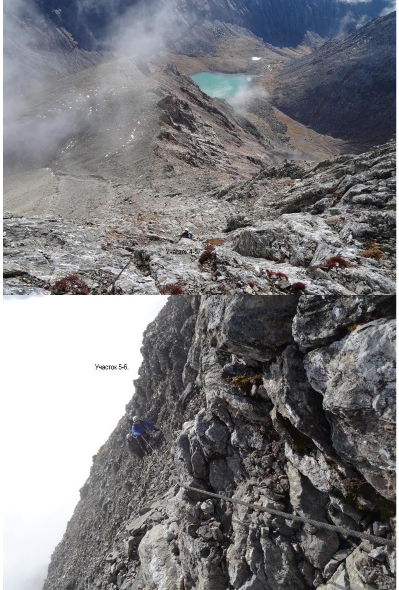
Sec. 5–6 35 m. 45° II+ Rocks up to 2956 m.
Sec. 6–7 30 m. 50° III– Upwards through rocks. Piton protection.
Sec. 7–8 30 m. 40° II– Ledge to the right up to 2989 m. Alternate movement. Protection through outcrops and stoppers.
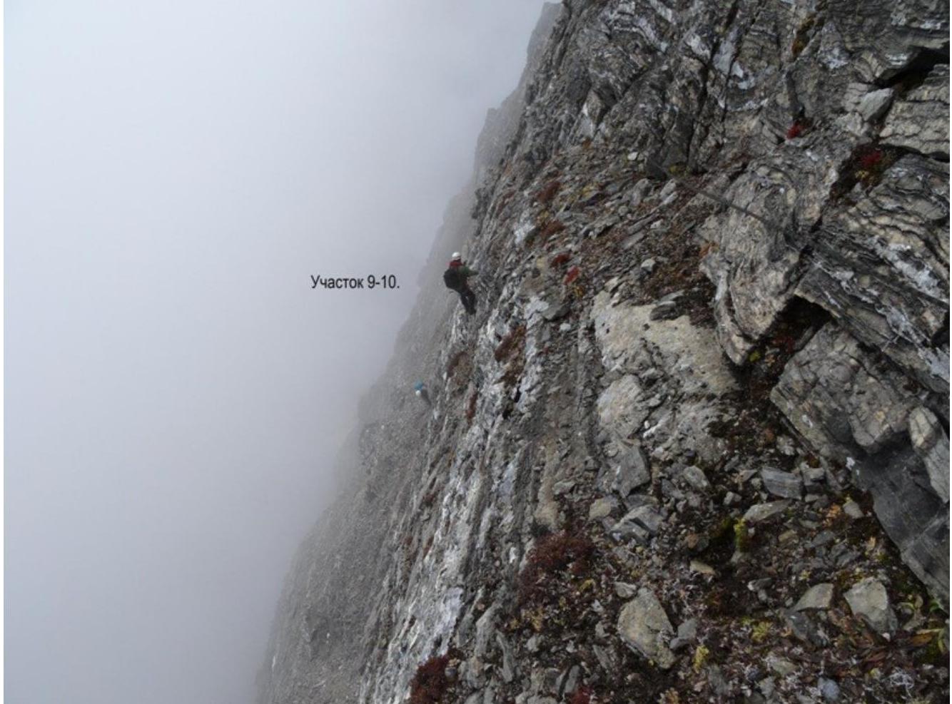
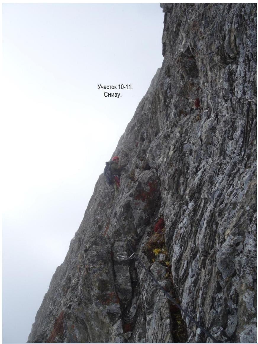
Sec. 8–9 40 m. 45° III– Slabs upwards to the right. Alternately. Sec. 9–10 40 m. 40° II – Talus ledge to the right. Alternately. Sec. 10–11 80 m. 60° IV+ – From the ledge, not reaching the ridge by 30 metres, left upwards with exit to the North-Eastern ridge, located towards the summit of Starkov.
Sec. 11–12 70 m. 5° III– Along the ridge between the W slope and N wall to the summit.
Exit to the summit. Summit height:
- QPS – 3088
- by altimeter — 3105 m
- on M 1:25 000 map — 3141 m
Descent via the ascent path: 2 abseils and 6 sport descent. On the sport descent the last one climbed down.
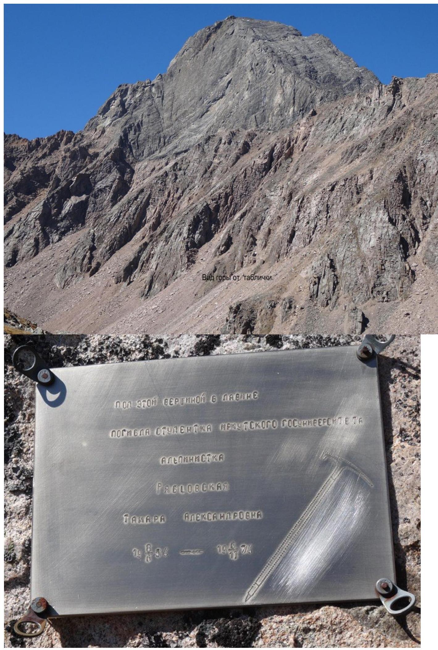
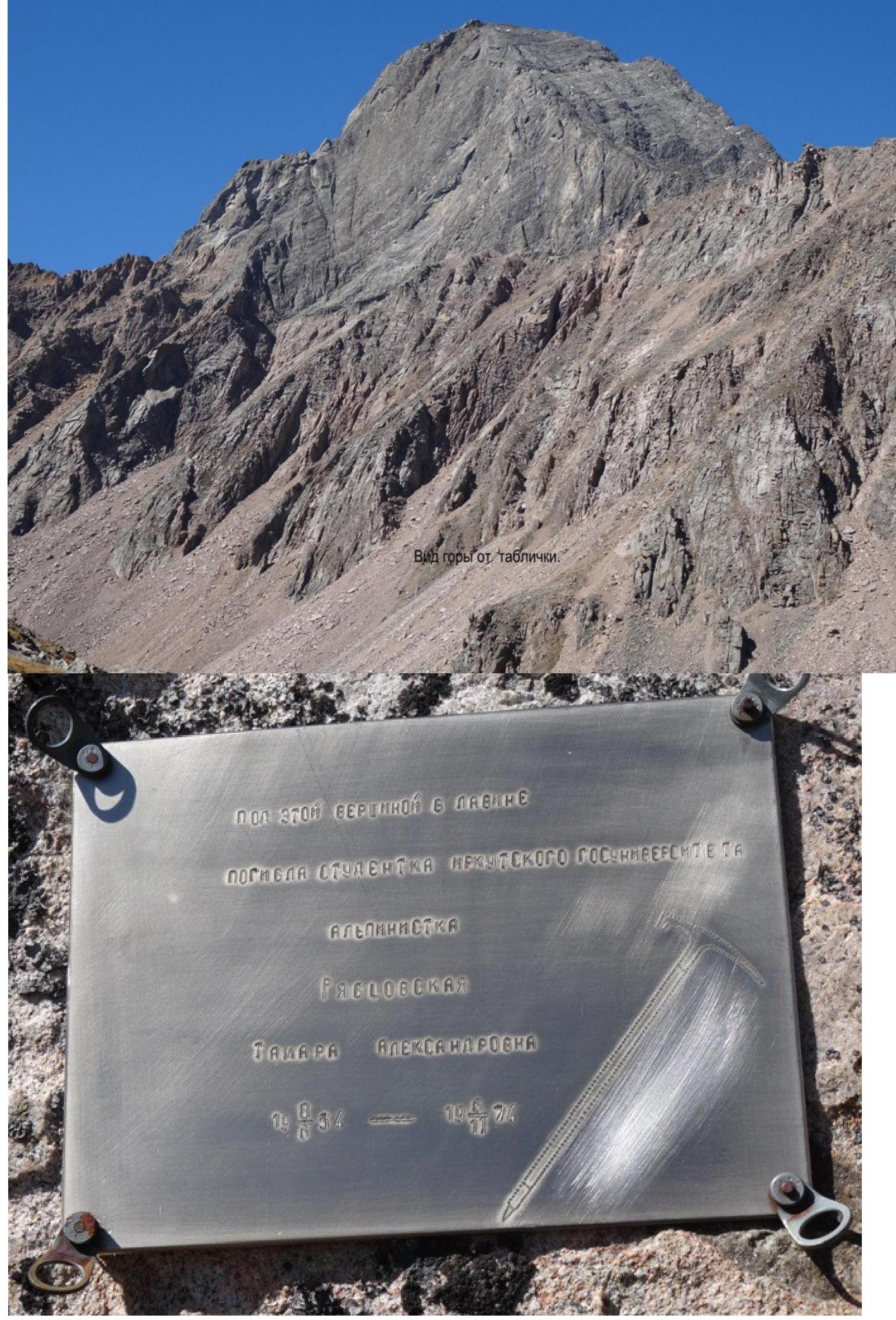
In 1970–1979, a group of Irkutsk mountaineers, including Stanevich, Nemirovskiy, Egorov and others, gave the peak the working name Gadzhi, similar to the name of the Gadzhir mountain in the area of the Dugoba alpine camp. On 6 November 1974, during an alpiniad, Ryabtsovskaya Tamara died on the described route. We propose to name this mountain Tamara in memory of the tragically deceased 20-year-old climber from Angarsk.
The complexity and danger of the route changes depending on the presence and condition of the snow cover. Snow increases the danger but reduces the complexity of this route. In the 2014 season, the route seemed to the climbers as cat. 3B. The first ascenders, due to the distance in time, remembered that the route corresponds to cat. 2A. We propose to accept for classification in section 6.1.2.
Tamara (Gadzhi) via E slope 2B rock. Stanevich, 1973.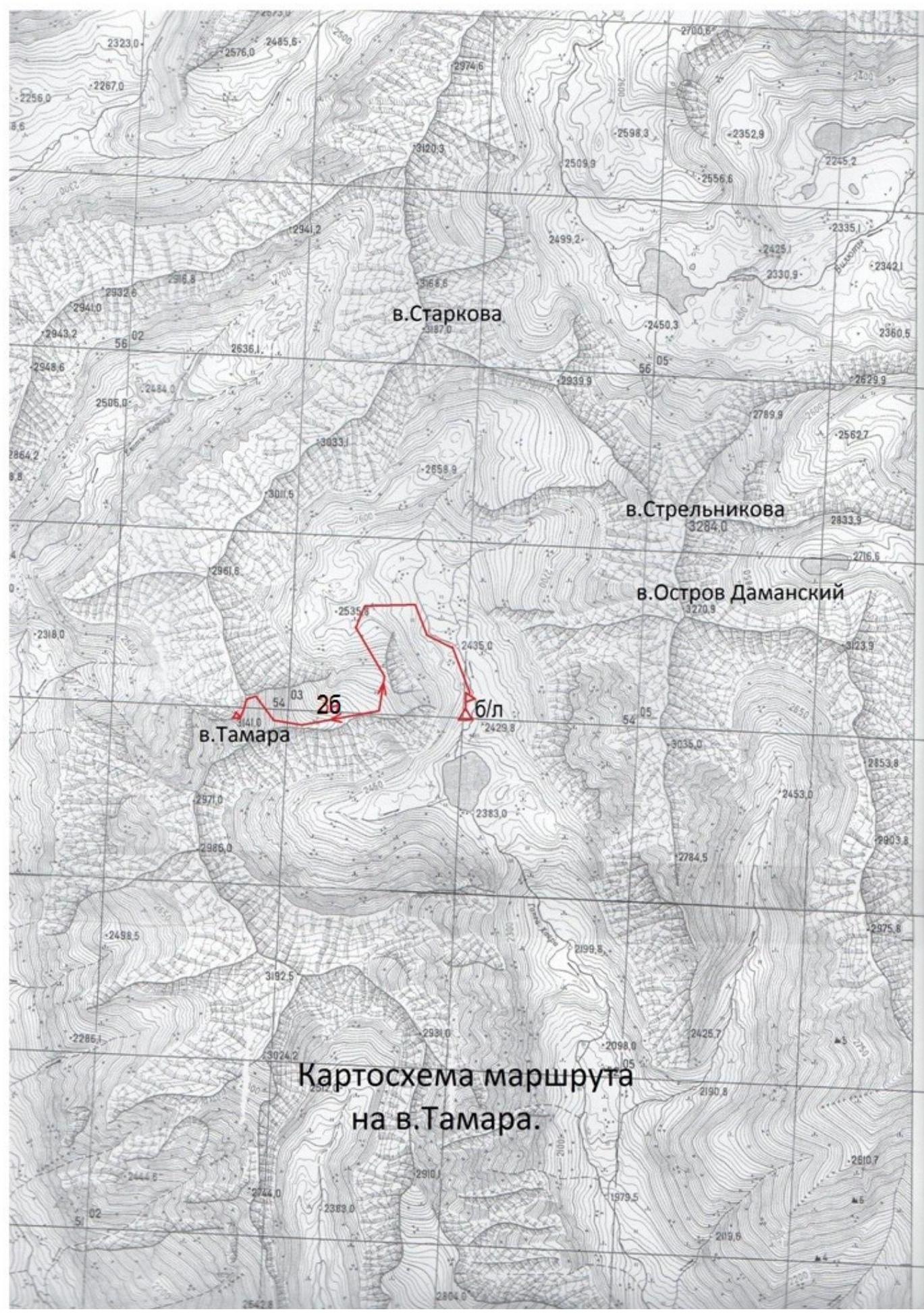
Route map to peak
Tamara.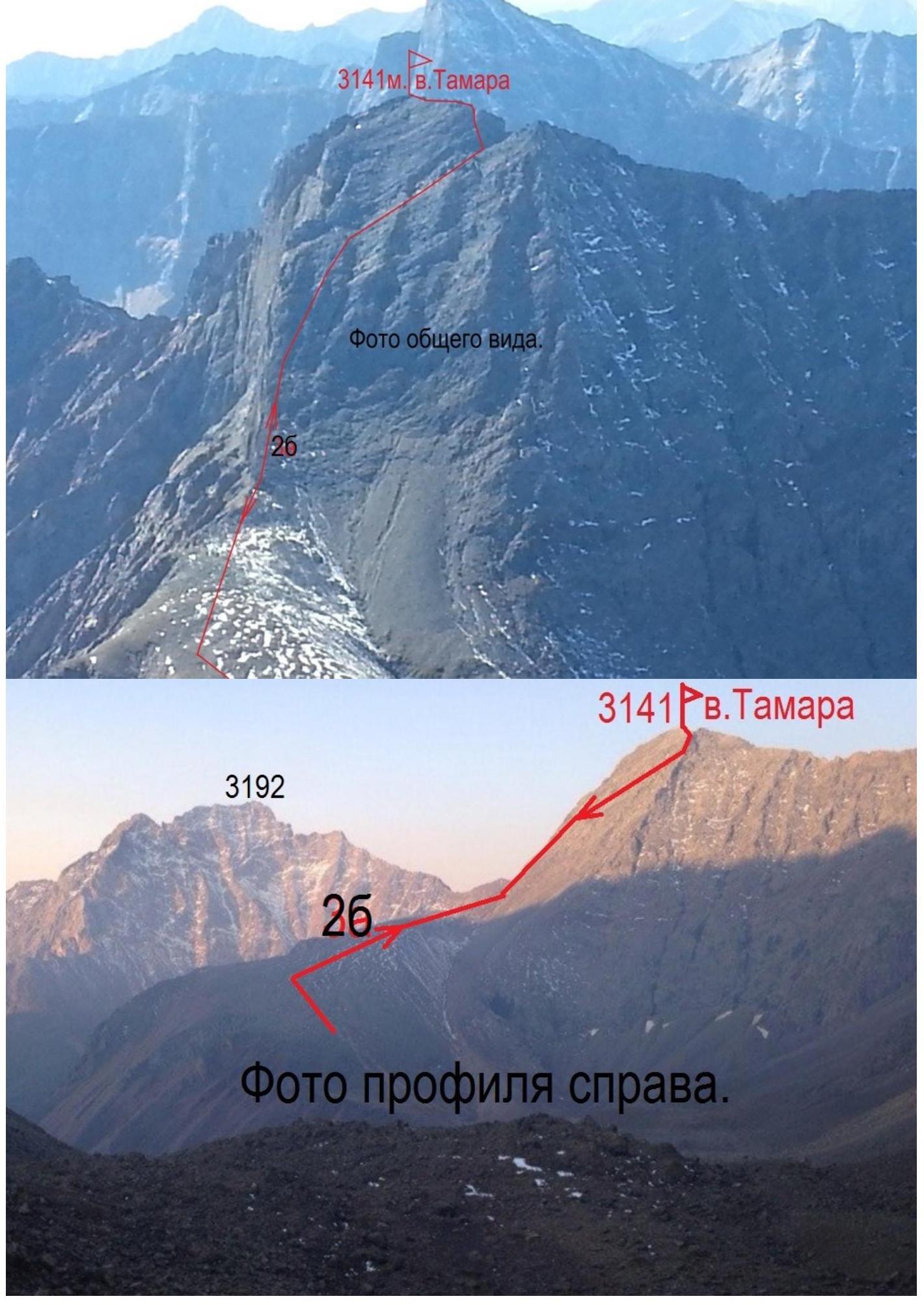
Profile photo
right.
Panoramic view of Gang from south-east from a helicopter.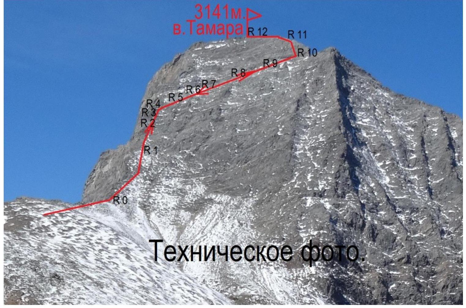
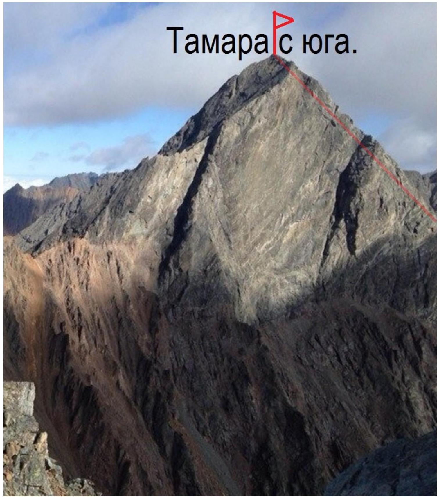
Tamara from the south.
Section
R2–R3.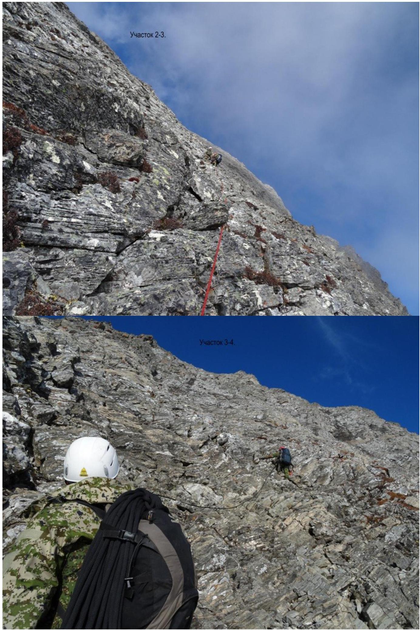
Section
R5–R6.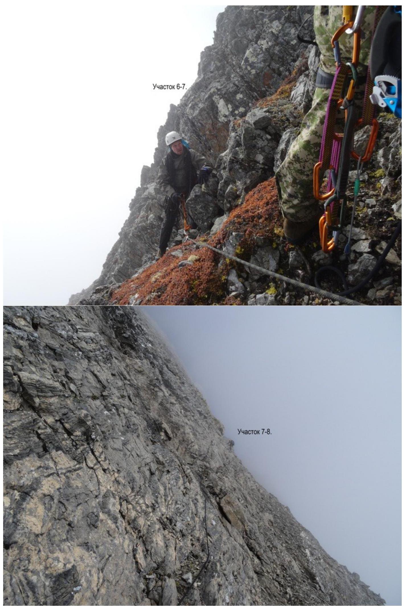
Section
R7–R8.
Section R8–R9
Section R9–R10
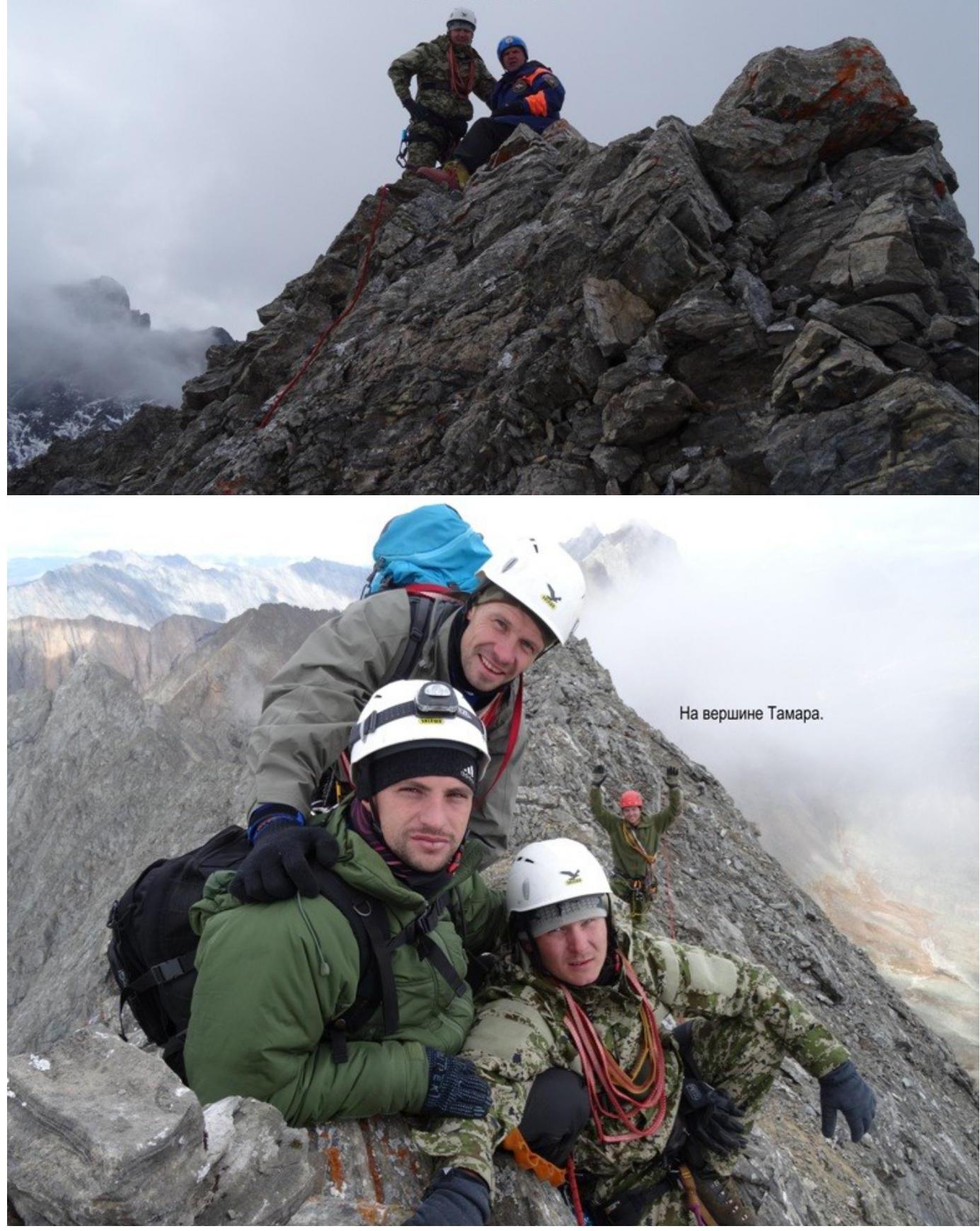
From above. Section R10–R11. On the summit of
Tamara.