Irkutsk Regional Public Organization "Club of Active Leisure and Alpinism Gory Baikala"
Report on the First Ascent
To v. Sibir' 2870 m via the Eastern ridge. Approximately 2A category of difficulty.
Climbing Passport
-
Eastern Sayan, Tunkinskie goltsy, Baruun-Khandagai river gorge. Section number according to the classification table 6.1.2.
-
Sibir' 2870 m (summit coordinates: 51°54′48.53″N, 102°10′13.40″E) via the Eastern ridge.
-
Category of difficulty: proposed 2A first ascent.
-
Nature of the route — rocky.
-
Route elevation gain: 324 m. Route length: 460 m. Length of sections: II–III category of difficulty — 100 m. Average steepness:
- Total route — 40°.
-
Pitons left on the route: total 0. Used on the route: chocks 0/0.
-
Team's climbing hours: 5 h 50 min, overnight stays: none.
-
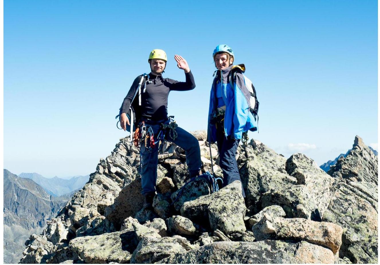
Leader: Glazunov Sergey Vladimirovich (CMS). Participants: Yashin Mikhail (zn.), Rozhina Elvira (zn.).
-
Coach: Glazunov Evgeny Vladimirovich (MS). Departure to the route: 06:00, August 31, 2016. Summit — 11:50, August 31, 2016. Return to BL — 16:15, August 31, 2016.
-
Irkutsk Regional Public Organization "Club of Active Leisure and Alpinism Gory Baikala".
Overview of the Climbing Area, Sports Characteristics, and Tactical Actions of the Team
Map of the area, approach path to the route.
General Information about the Area
The Barun-Khandagai gorge is one of the most promising areas of the Eastern Sayan in terms of sports mountaineering. The Sibir' summit is located in the Tunkinsky district of the Republic of Buryatia. The nearest major settlement is the Arshan village.
From Arshan, you can reach the gorge entrance by a high-clearance vehicle, so-called Barunovskaya "clearing" — a path of about fifteen kilometers. Further — entry into the gorge, there is a trail, the area is popular with tourists in the summer. The length is approximately 10 km, elevation gain on the approach — 1100 m.
Departure to the route from the base camp, located opposite the Domashnaya summit. The approach takes about two hours under the couloir; the Alaska cirque is located on the left along the gorge.
General view of the Sibir' summit. Panorama.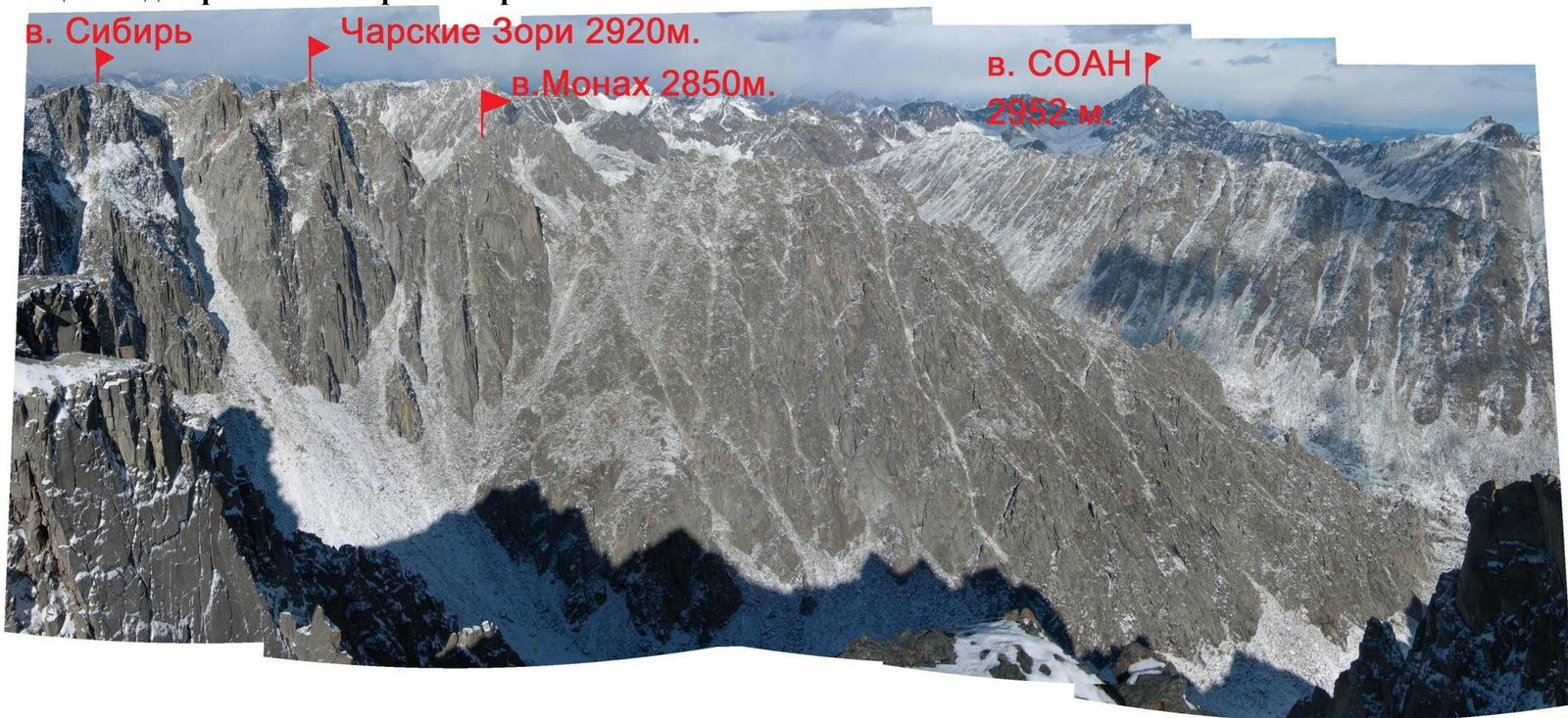
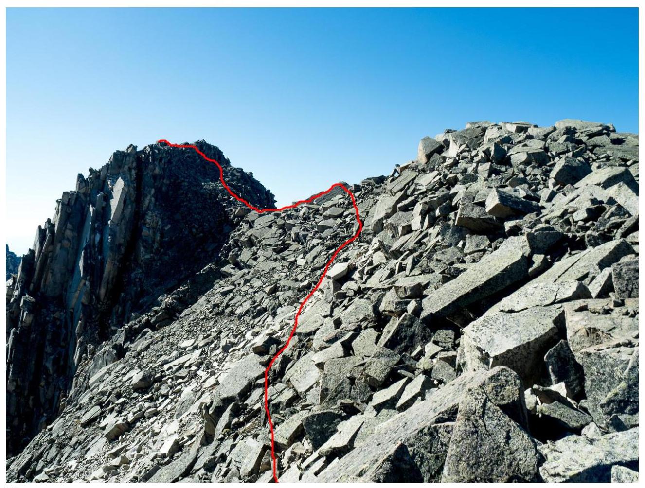
Route profile with the ascent line.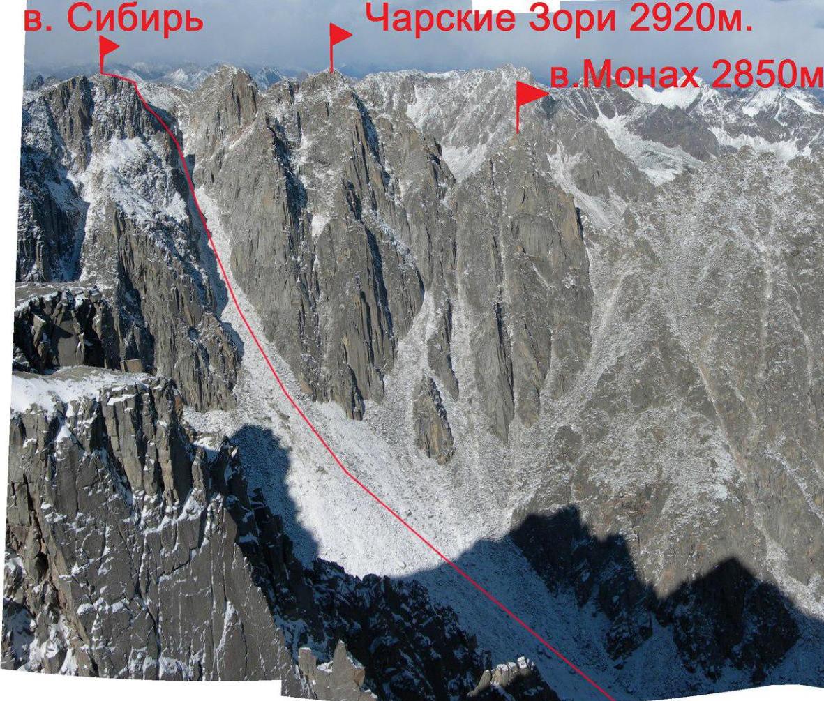
UIAA Scheme
Sibir', 2870 m.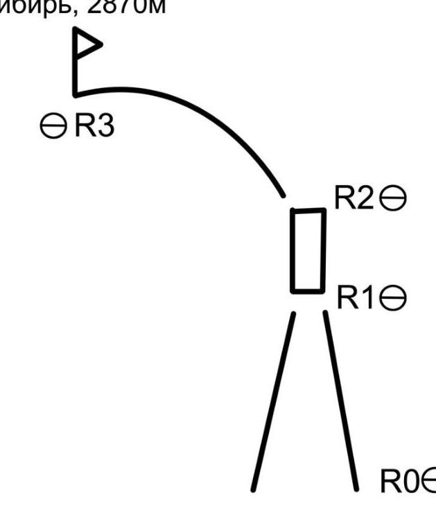
Description of the Route by Sections
Approach to the start of the route from BL to the Alaska cirque, move towards the couloir between the Sibir' summit and the Charskie Zori summit.
R0–R1. Couloir, large scree in the lower part, small scree in the upper part. 160 m. 40° I.
R1–R2. Rocks, alternating movement. Exit to the saddle. 100 m. 60° II–III.
R2–R3. From the saddle to the left along simple rocks. Exit to the summit. 200 m. 45° I–II.
Descent along the ascent line.
Couloir, start of the route.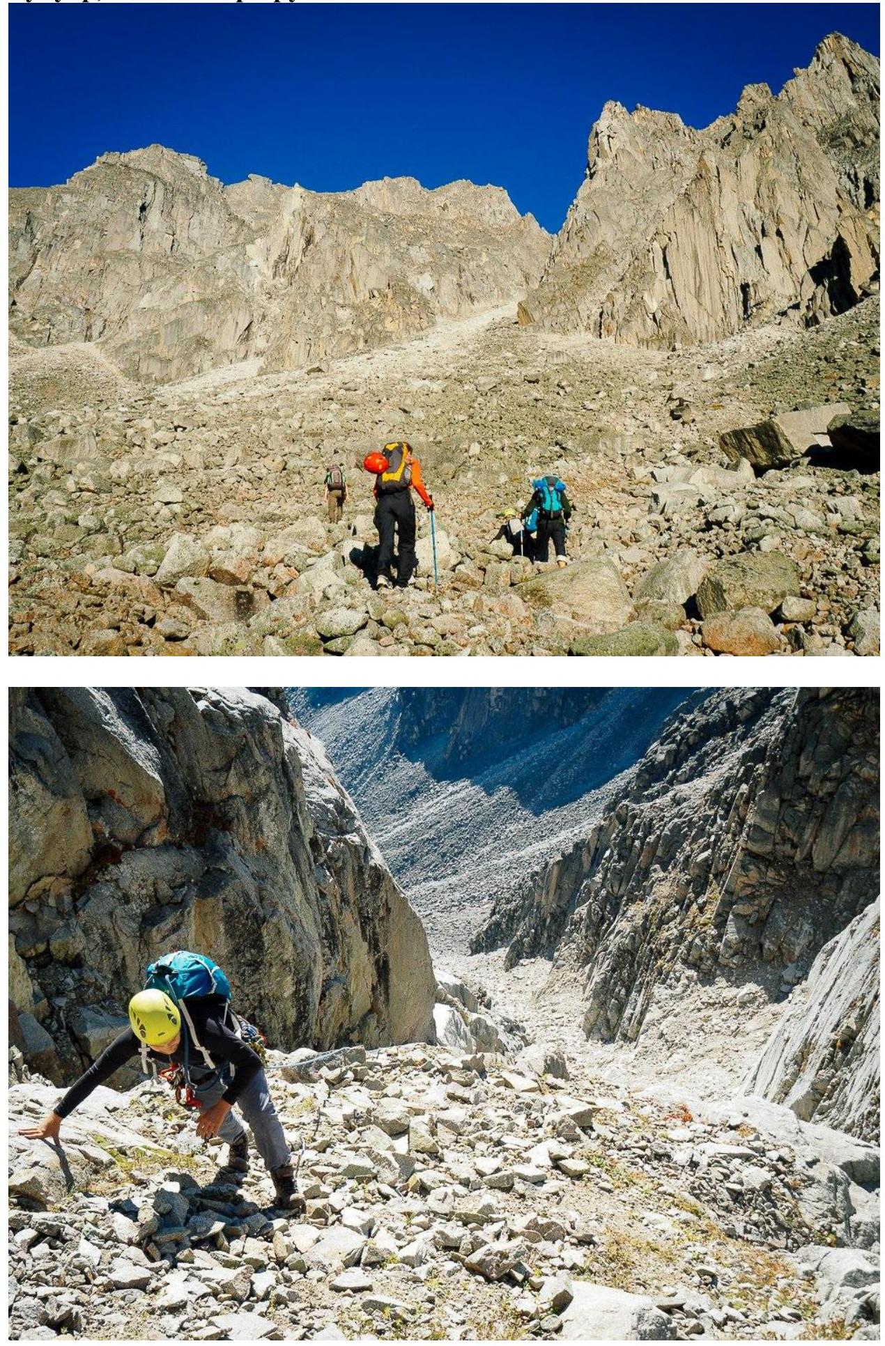
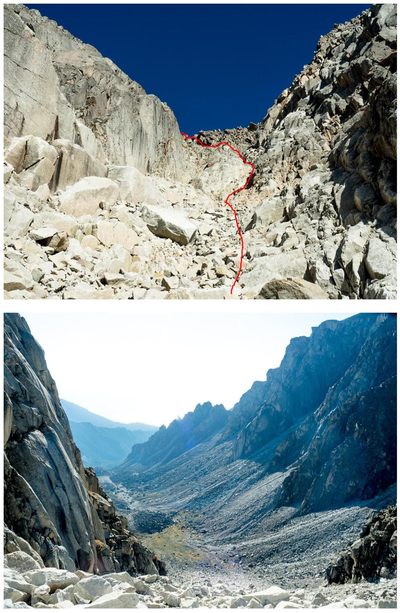 Saddle.
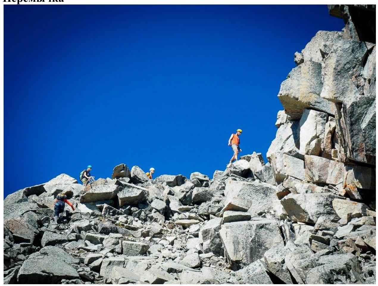
Section R2–R3.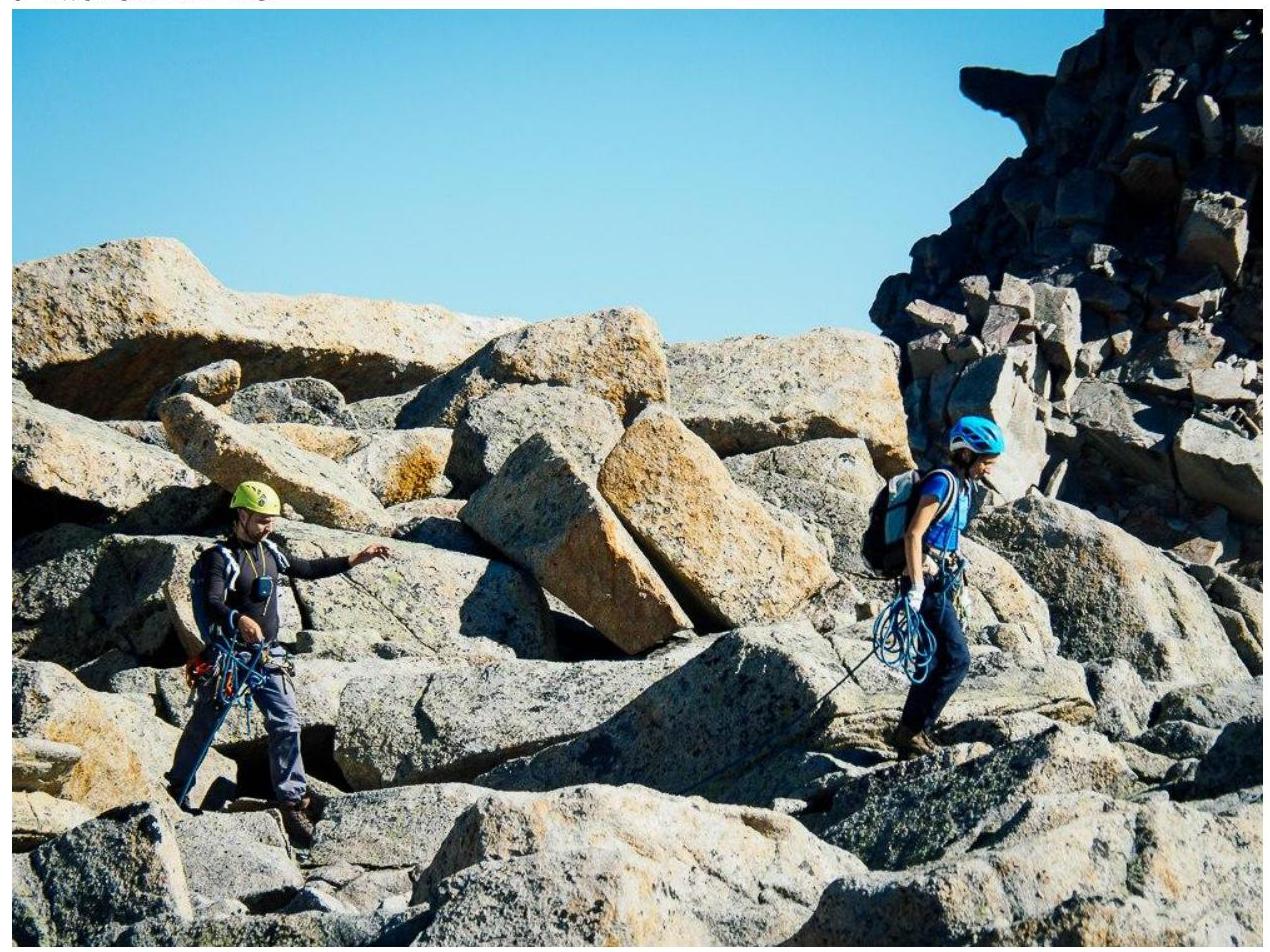
Summit.