Report on the First Ascent
Peak Sever (2830 m?) North-West ridge, route 3A cat. diff. (proposed), first ascent. Eastern Sayan, Tunkinskie Goltsy ridge, Barun-Khandagai valley, 6.1
Team Leader: Klepikov A.A. Team Members:
- Ometov A.A.
- Putko K.V.
2013
Climbing Report
- Eastern Sayan, Tunkinskie Goltsy ridge, Barun-Khandagai valley, 6.1.
- Peak Sever (2830 m?), NW ridge.
- Proposed - 3A - first ascent.
- Route type: rock.
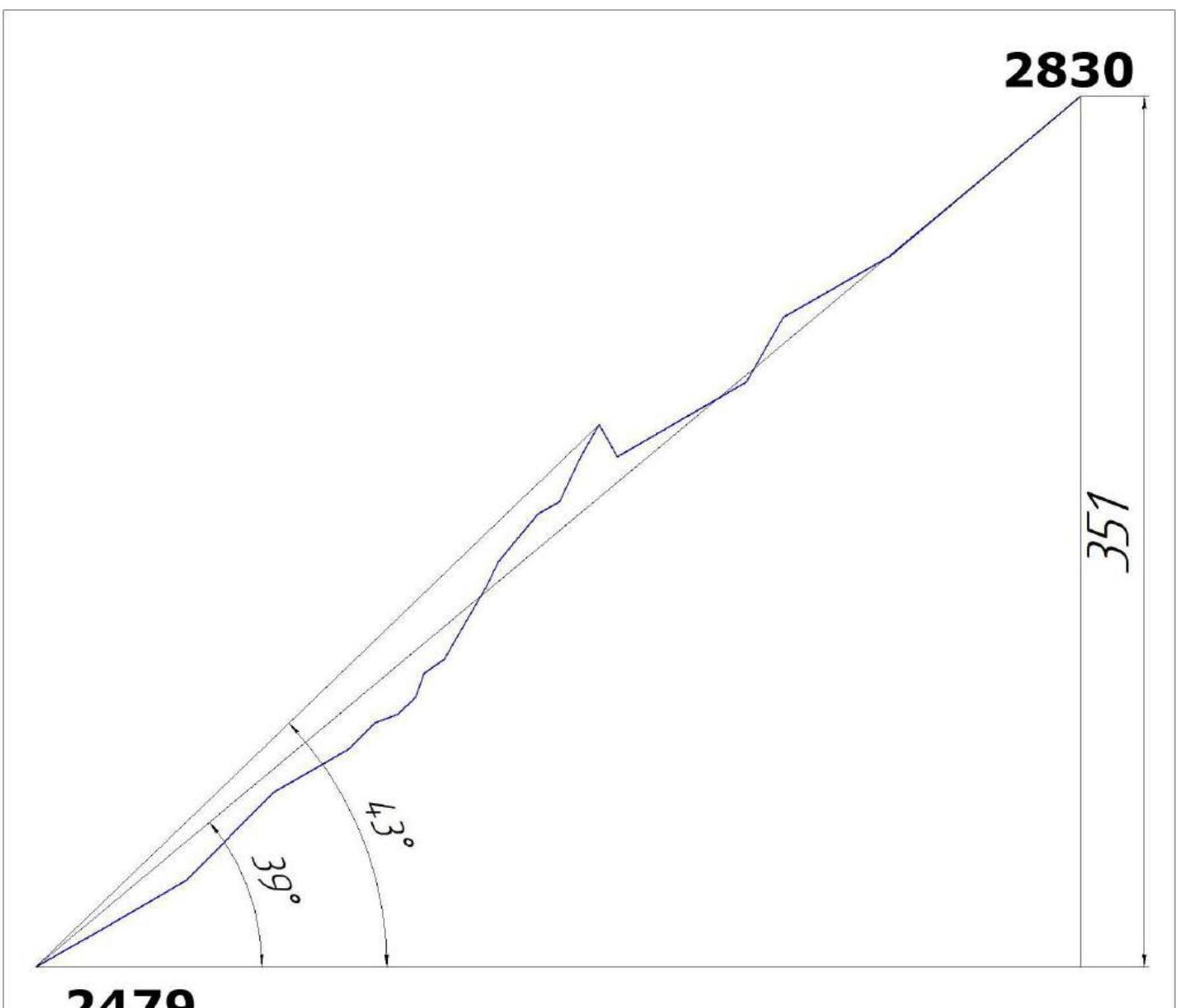
- Route elevation gain: 351 m.
Route length: 620 m.
Main part elevation gain: 351 m.
Main part length: 620 m.
Section lengths:
- IV cat. diff. - 110 m.
- III cat. diff. - 140 m. Average steepness of the main part: 43°.
- Pitons left on the route:
total: 0; including bolted: 0.
Total used on the route:
- bolted pitons - 0
- rock pitons (including anchors) - 9
- nuts - 0
- friends - 26
- skyhooks (including skyhooks on micro-ledges) - 0 Total number of artificial support points: 0
- Team's total climbing time (to the summit) - 6:00; days - 1. Number of nights on the route - 0.
- Team Leader: Klepikov Alexander Alexandrovich (MS).
Team Members:
- Ometov Alexander Alexandrovich (2nd sports category).
- Putko Konstantin Vladimirovich (2nd sports category).
- Team Coach: Afanasiev Andrey Evgenievich (MS), 1st cat. diff.
- Start of the climb: 8:00, August 3, 2013. Summit reached: 14:00, August 3, 2013. Return to Base Camp: 17:00, August 3, 2013.
- Report responsible: Klepikov A.A. (Baikalteam@Gmail.com)
General View Photo of Peak Sever's North Wall
The photo was taken from under the summit of Charskie Zori, at a height of 2900 m. Distance to the object is 1500-2000 m.
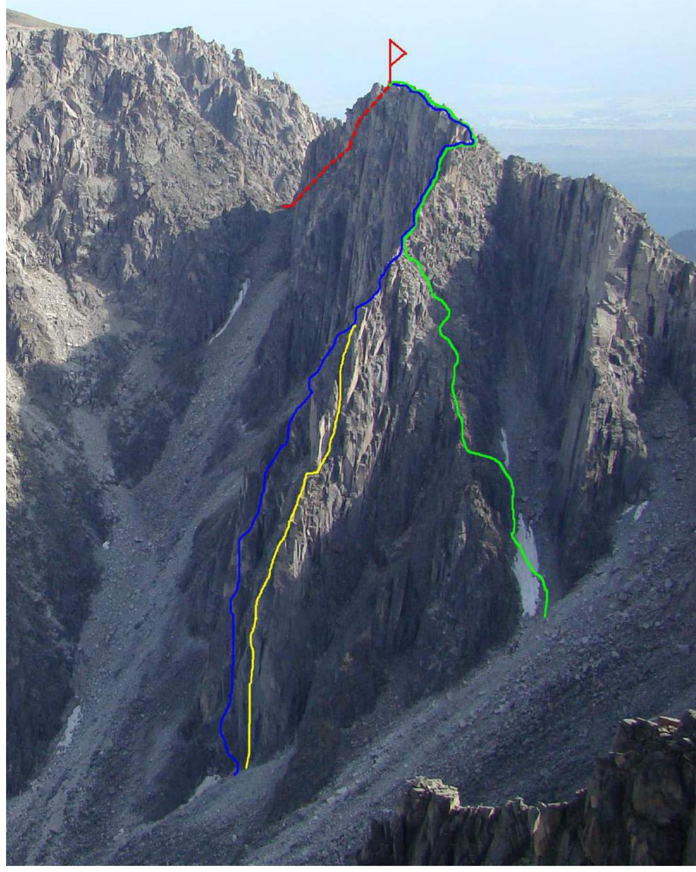
Route Profile Photo from the Left (Main Part of the Route)
The photo was taken on July 29, 2012, during the first ascent of 4A cat. diff. on Peak Monakh, from the lower part of the route.
Hand-Drawn Route Profile
Panorama of the Alaska Cirque Peaks

Map-Scheme of Barun-Khandagai Valley
Barun-Khandagai valley is one of the most promising areas in Eastern Sayan for sports climbing.
Peak Kupol (2954 m) is the dominant peak in the area. Located in the Tunkinsky district of the Republic of Buryatia. The nearest large settlement is the village of Arshan.
From Arshan, you can reach the entrance to the valley by a high-clearance vehicle - a journey of about 15 kilometers. Further, there is a path along the valley, the area is popular with tourists in the summer.
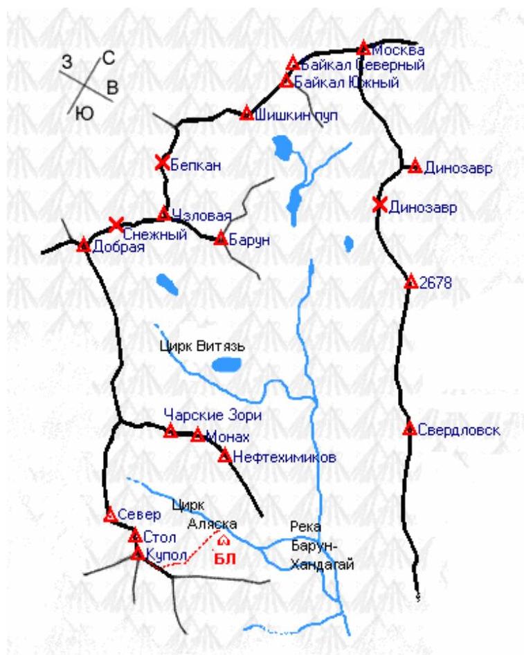
The Alaska Cirque is located on the left side of the valley, with an elevation gain of 1400 m and a length of approximately 15 km.
In the summer, it takes 6-8 hours to reach the wall, while in winter, it may take 5-6 days due to the large amount of snow.
The area is visited by 2-3 climbing and mountaineering groups per year.
Peak Sever (2830 m) is located in the upper part of the Alaska Cirque, on the left side, behind Peak Stol (2850 m). The approach from the camp takes about two hours at a good pace.
In recent years, several routes have been established on the mountain, some of which have become quite popular.
Ascent Graph
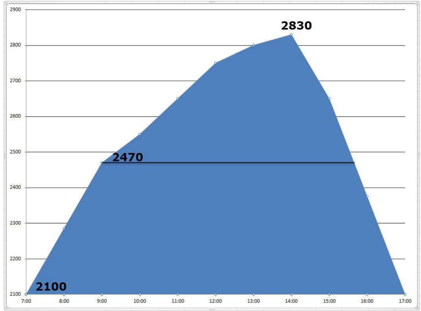
Team's movement graph on the route:
- August 3, 2013 - from 8:00 to 14:00, the route was completed to the summit.
- August 3, 2013 - from 14:00 to 17:00, descent to Base Camp.
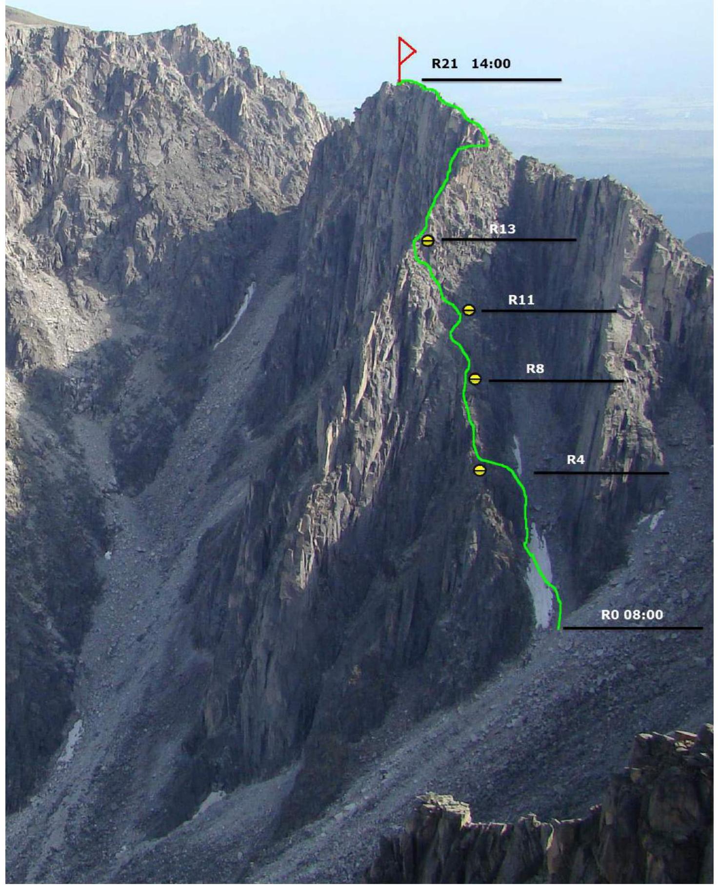
Main Part of the Route Diagram, in UIAA Symbols, Scale 1:2000, Sheet 1
| Section | Nuts | Friends | Rock Pitons | Skyhooks | Bolts | Route Diagram in UIAA Symbols M 1:2000 Sheet 1 | Length (m) | Steepness (°) | Grade | AID |
|---|---|---|---|---|---|---|---|---|---|---|
| R20–R21 | - | 5 | - | - | - | 100 | 30/50 | 1+/4 | - | |
| R19–R20 | - | - | - | - | - | 50 | 30 | 2- | - | |
| R18–R19 | - | 3 | 1 | - | - | 30 | 60 | 4- | - | |
| R17–R18 | - | 2 | - | - | - | 60 | 30 | 2+ | - | |
| R16–R17 | - | - | 1 | - | - | 15 | 65 | 4- | - | |
| R15–R16 | - | 1 | 1 | - | - | 15 | 65 | 3+ | - | |
| R14–R15 | - | - | 2 | - | - | 20 | 65 | 3+ | - | |
| R13–R14 | - | 2 | - | - | - | 50 | 30 | 3- | - | |
| R12–R13 | - | 2 | 1 | - | - | 25 | 50 | 4- | - | |
| R11–R12 | - | 2 | 1 | - | - | 10 | 65 | 4+ | - | |
| R10–R11 | - | 3 | 1 | - | - | 35 | 60 | 3+ | - | |
| R9–R10 | - | - | - | - | - | 10 | 35 | 2- | - | |
| R8–R9 | - | 2 | - | - | - | 10 | 70 | 4+ | - | |
| R6–R8 | - | - | - | - | - | 20 | 20/45 | 2+ | - | |
| R4–R6 | - | 1 | - | - | - | 25 | 40 | 2+ | - | |
| R3–R4 | - | 1 | - | - | - | 25 | 30 | 2+ | - | |
| R2–R3 | - | 2 | 1 | - | - | 50 | 45 | 2+ | - | |
| R1–R2 | - | - | - | - | - | 40 | 30 | 2- | - | |
| R0–R1 | - | - | - | - | - | 30 | 30 | 1+ | - |
Terrain Description
- R0–R1 30 m, 30°, 1+: Steep snow slope, main couloir.
- R1–R2 40 m, 30°, 2–: Along the left wall of the main couloir.
- R2–R3 50 m, 45°, 2+: From the couloir to the rocky slope on the left. Moving from right to left onto the ridge.
- R3–R4 25 m, 30°, 2+: Ledge - exit onto the ridge.
- R4–R5 10 m, 30°, 2–: Along the ridge.
- R5–R6 15 m, 45°, 2+: Along the ridge.
- R6–R7 10 m, 20°, 1+: To a wide crack.
- R7–R8 10 m, 45°, 2+: To a wide crack.
- R8–R9 10 m, 70°, 4+: Up the crack to the right of the outer corner.
- R9–R10 10 m, 35°, 2–: Along the ledge to the right.
- R10–R11 35 m, 40° (loop), 60°, 3+: Traverse left to a large flake.
- R11–R12 10 m, 65°, 4+: Up from the flake.
- R12–R13 25 m, 50°, 4–: Exit onto the "Iroquois" ridge.
- R13–R14 50 m, 30°, 3–: Start along the ridge, then left of it for the entire rope length.
- R14–R15 20 m, 65°, 3+: Gully with grass - exit onto the ridge.
- R15–R16 15 m, 60°, 3+: Move left of the ridge.
- R16–R17 15 m, 60°, 4–: Descent via climbing.
- R17–R18 60 m, 30°, 2+: Along the ledges.
- R18–R19 30 m, 60°, 4–: Exit onto the ridge.
- R19–R20 50 m, 30°, 2–: Traverse onto the ridge connecting Peaks Sever and Sibir.
- R20–R21 100 m, 30-50°, (1+)–(4+): Exit along the ridge to the summit.
The difficulty of the sections is given for summer climbing in ideal weather. In winter, expect an increase of half a category or a full category.
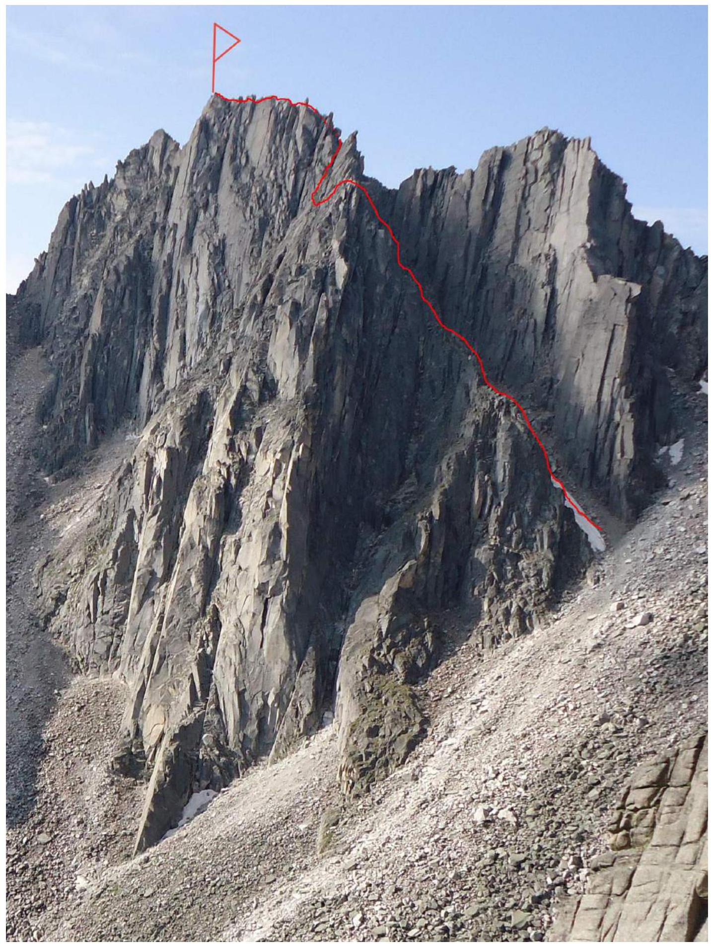
Technical Photo of the Route
Route Characteristics and Team Actions
The route taken by our team follows the North-West ridge of Peak Sever. This part of the mountain did not have straightforward lines before our ascent, and we were not limited in choosing a safe and logical route.
Route characteristics:
- Maximum difficulty of sections climbed free: 5A (FR).
- Route length: 620 m.
- 4 intermediate belay stations were set up.
- The rest of the route was climbed with alternate and simultaneous protection.
The most challenging part of the route is located in the lower half. The cumulative difficulty of the sections corresponds to a 3A category route, and in winter, it will feel like 3B.
The route was used for training purposes. Ometov A.A. and Putko K. took turns working on the rope.
The first person worked on a dynamic rope that meets UIAA requirements. To speed up the work, we mainly used:
- friends
- anchor pitons
During simultaneous movement, the number of intermediate protection points was at least four per team of three.
In 2014 and 2015, the route was repeated by training groups, confirming the category.
Photo 1. Start of the Route
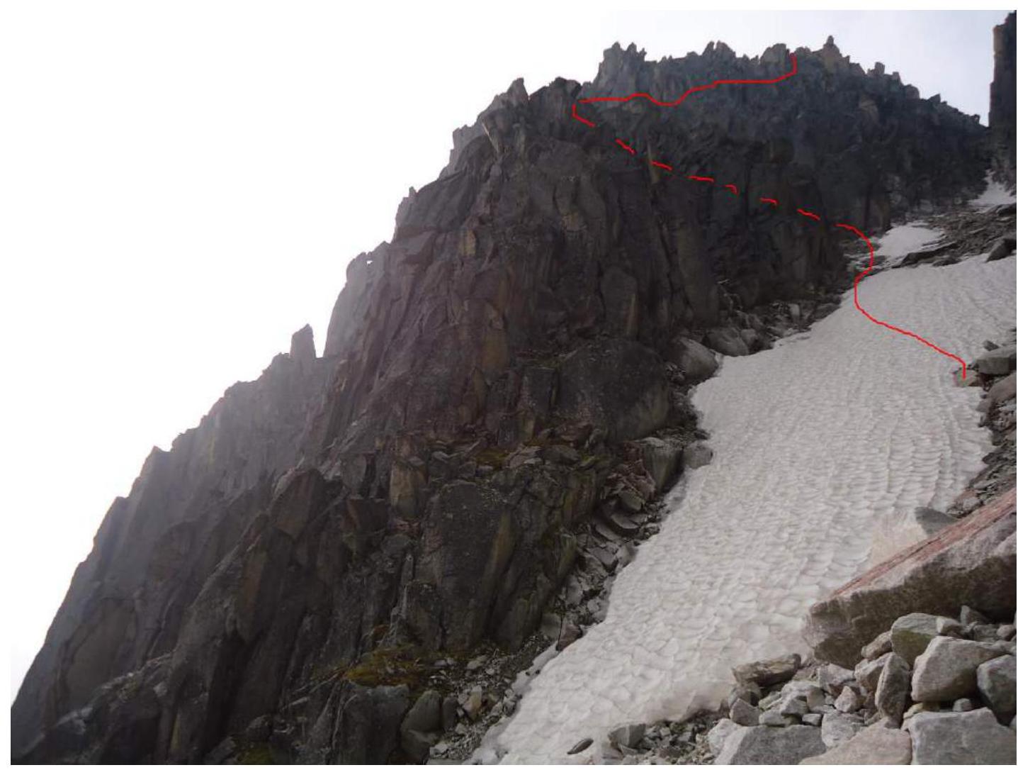
Photo 2. Ridge
Taken from point R6, looking down, the third participant is at point R5.
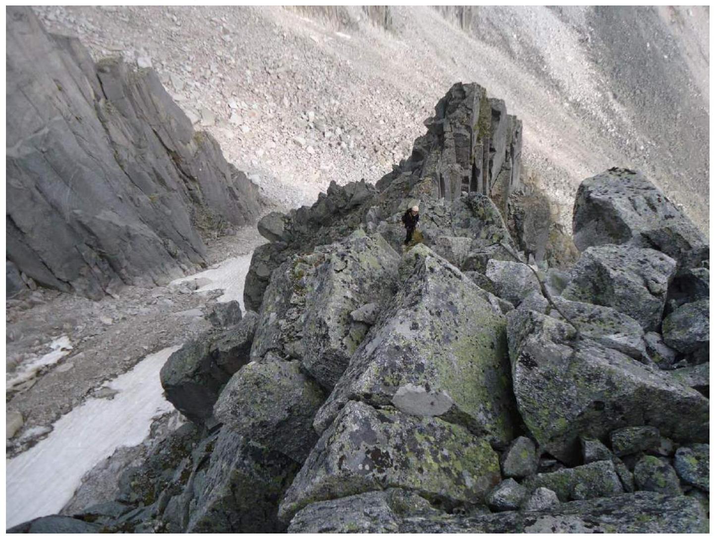
Photo 3. Start of the Key Section 8–R9
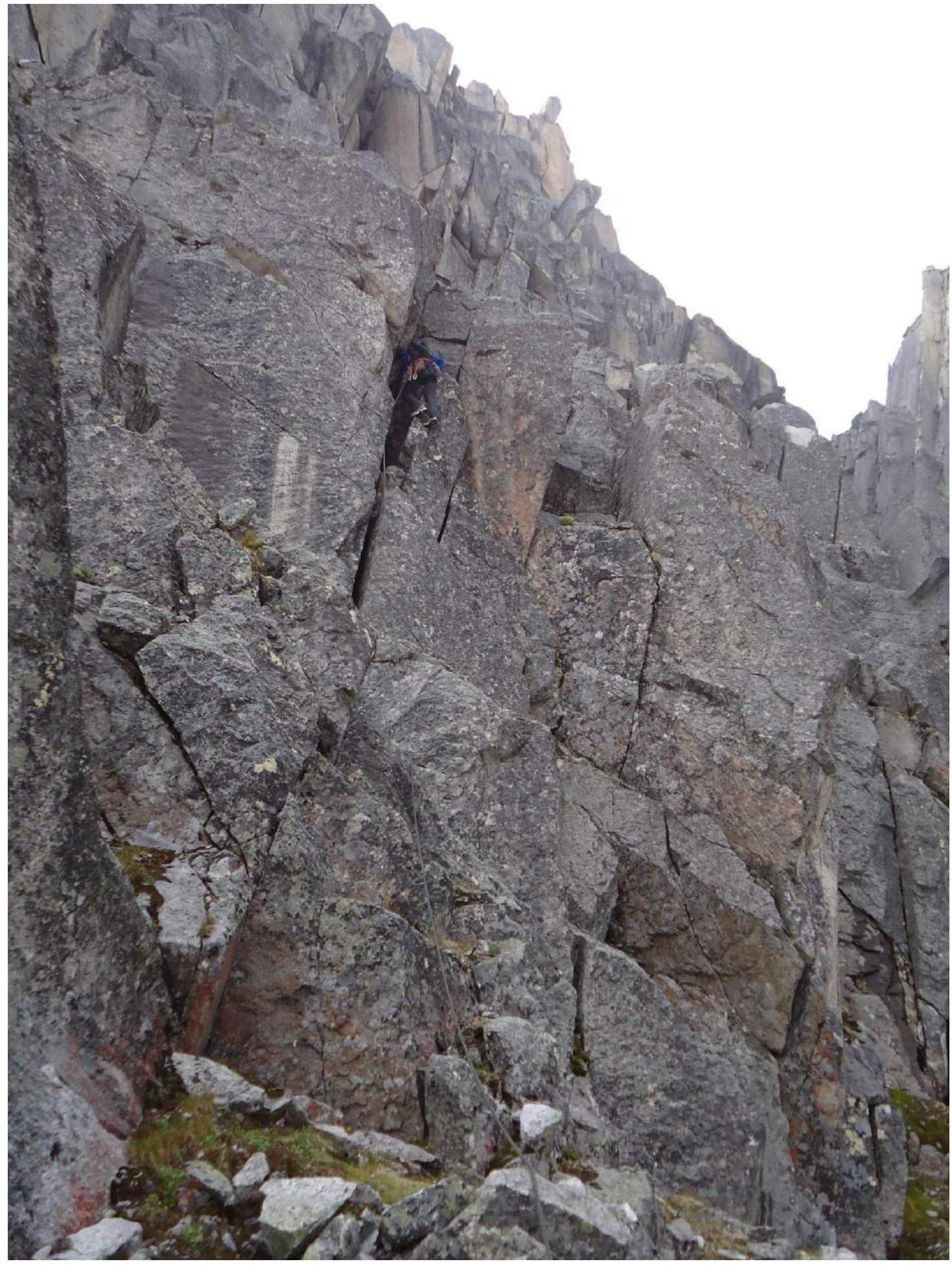
Photo 4. Continuation of the Key Section
Leader on section R10–R11.
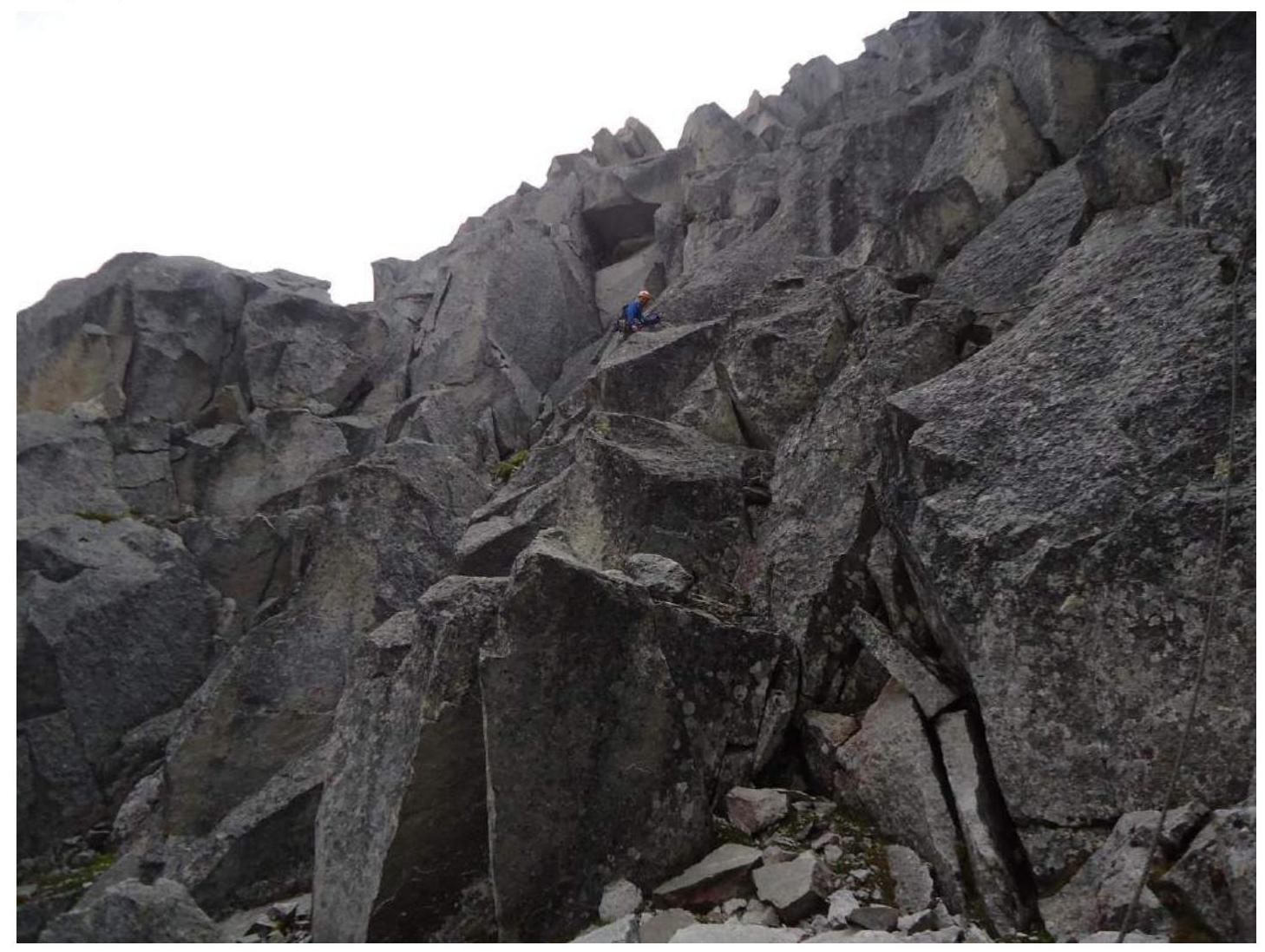
Photo 5. Continuation of the Key Section
The photo was taken from section R10–R11, leader at the start of section R11–R12.
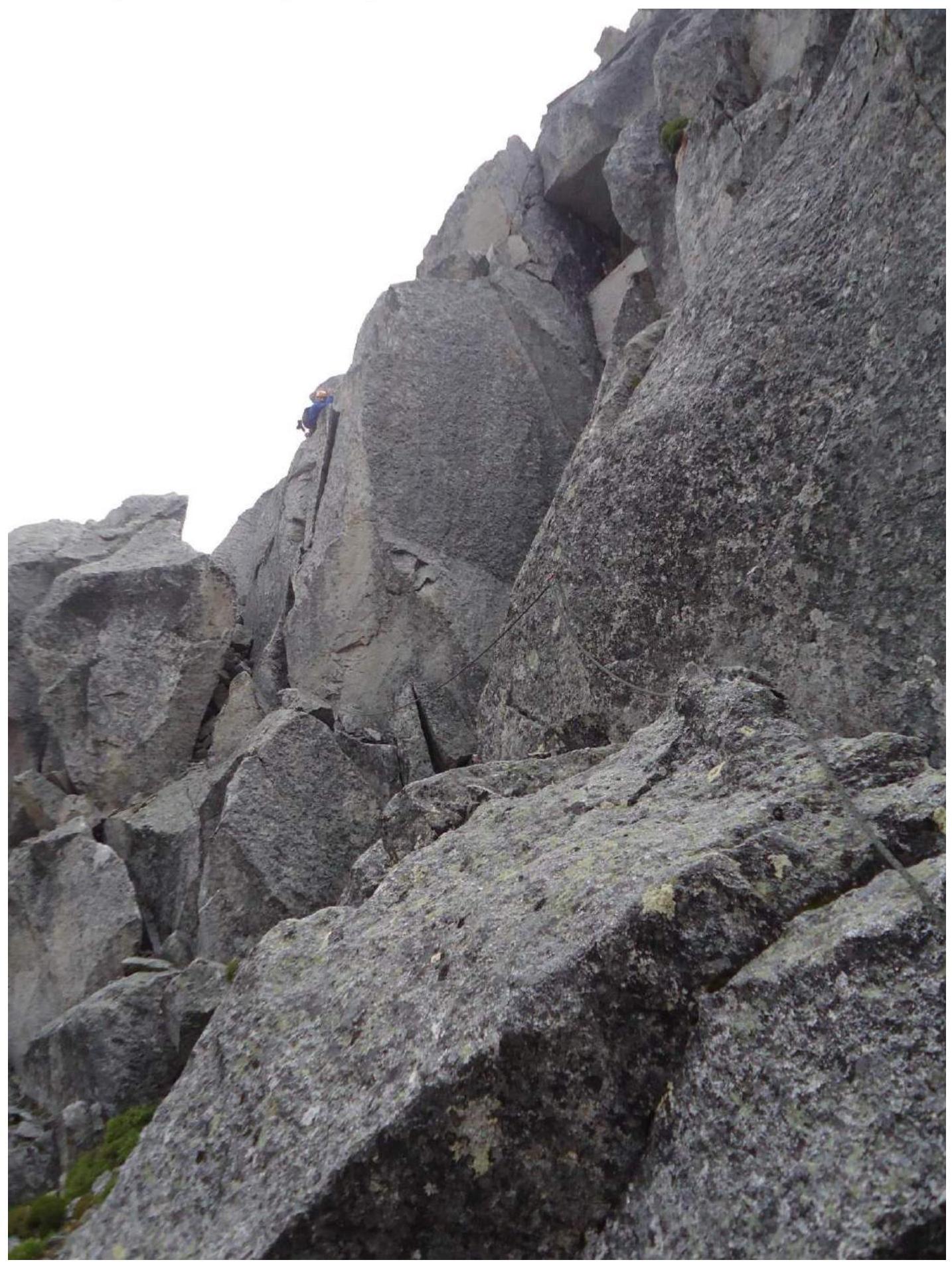
Photo 6. End of the Key Section
Section R11–R12.
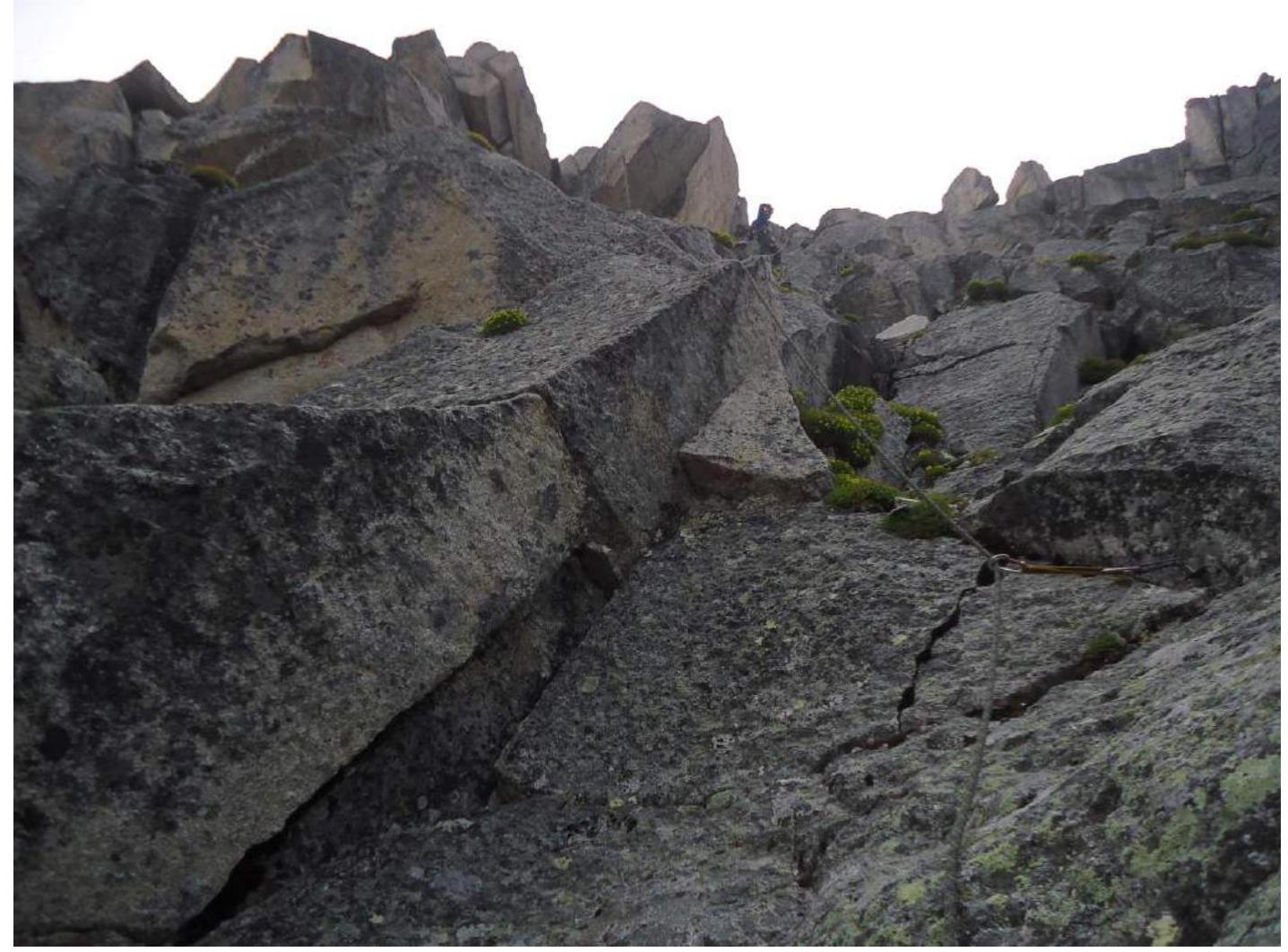
Photo 7
Section R17–R18.

Photo 8. Pre-Summit Ridge
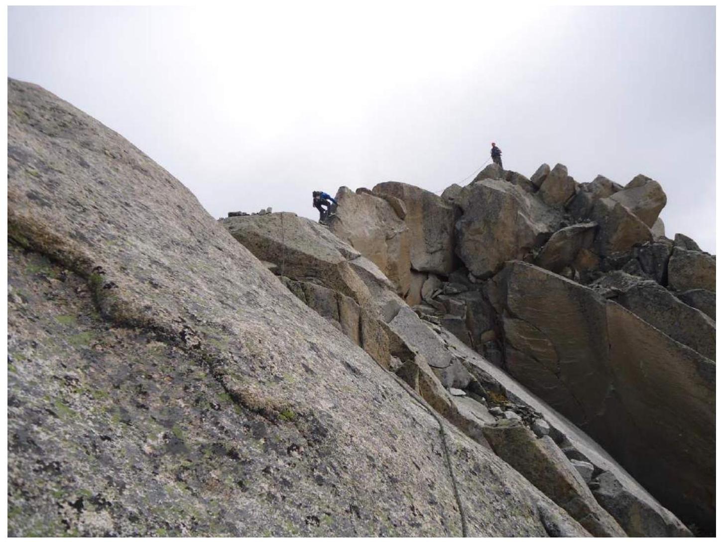
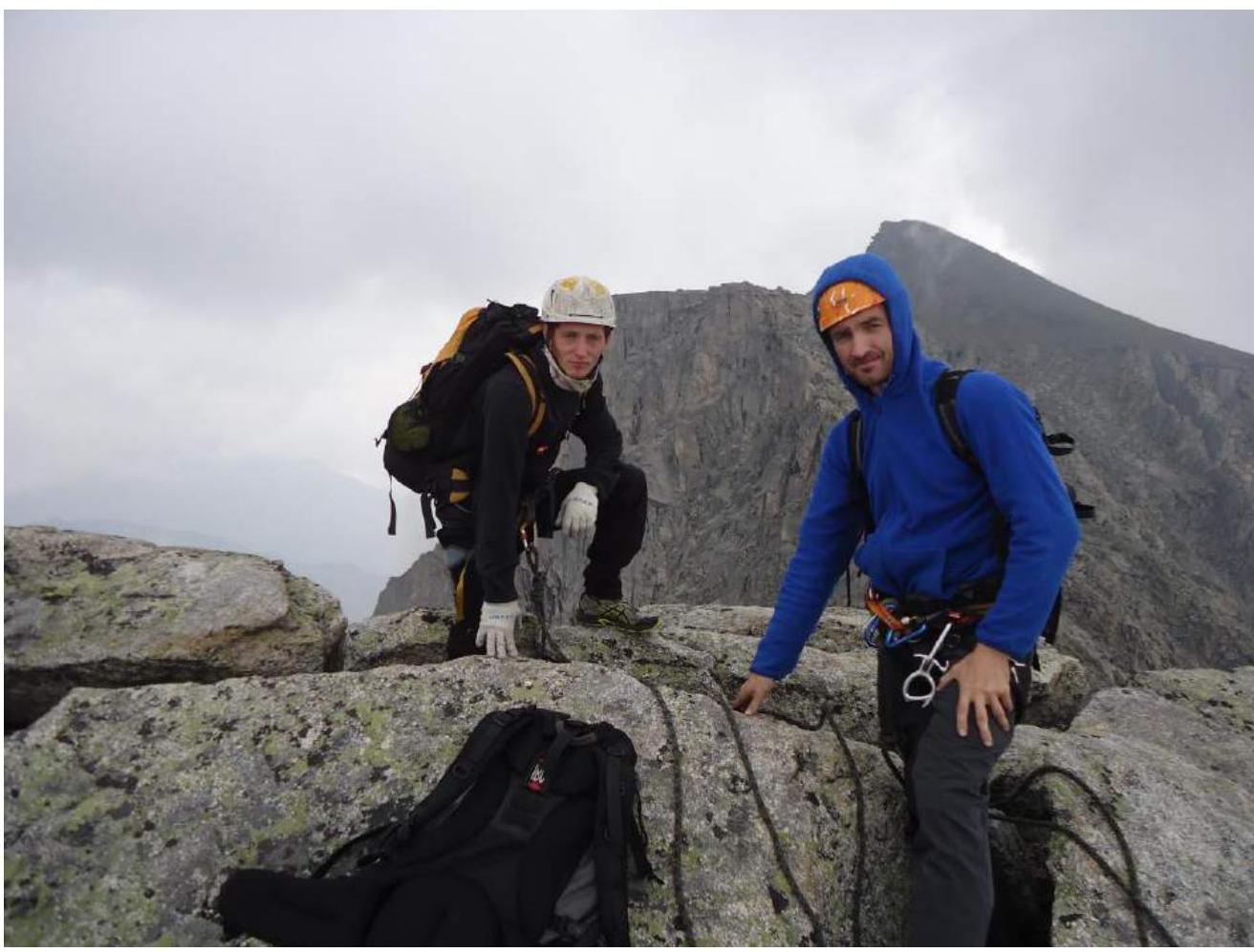
Photo 9. Summit. Ometov A.A., Klepikov A.A.
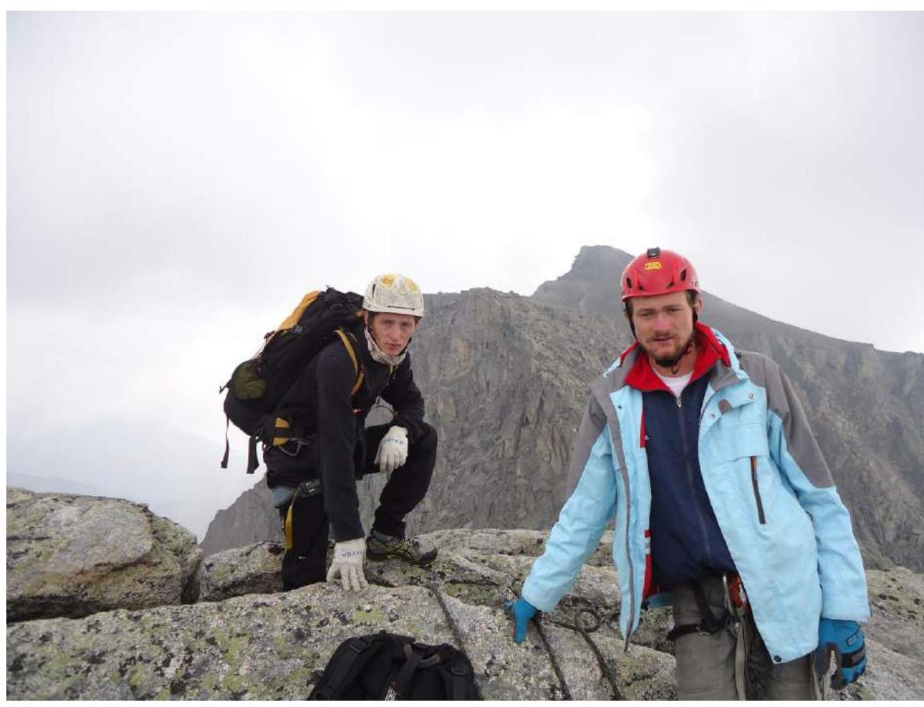
Photo 10. Summit. Ometov A.A., Putko K.V. (Find the 10 differences)