Ascent Passport
Area — Eastern Sayan, Tunka Goltsy, Baruun-Khandagai gorge
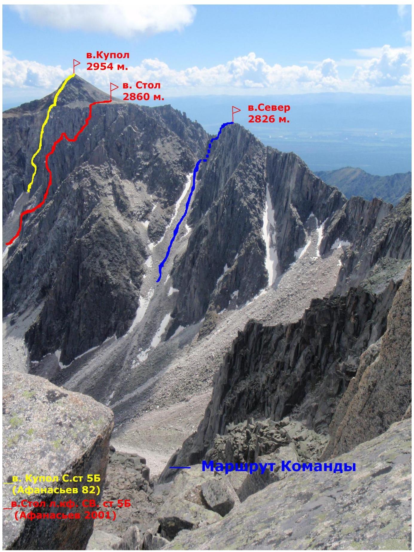
Peak — Sever 2826 m. GPS coordinates — 51°54′35.76″N 102°0′3.11″E
Route:
- Via the Southeast ridge, proposed category 2B.
Route characteristics — rock climbing.
Route description:
- Height difference 320 m.
- Route length approximately 400 m.
- Average steepness of the route 52°.
Equipment left on the route — 0 pitons. Pitons used on the route: 12, including
- " закладок" (passive protection) — 11
- including ИТО (artificial climbing aids) — 0
Climbing time — 5 hours.
Leader — Glazunov Evgeny Vladimirovich — Candidate Master of Sports
Participants:
- Rudykh Dmitry Alexandrovich, mountaineer rank
- Serebryansky Alexander Evgenievich, mountaineer rank
- Rassadin Konstantin, mountaineer rank
- Korolenko Olga, 3rd rank
Departure dates:
- On the route — July 5, 2010, at 7:00
- On the summit — July 5, 2010, at 12:00
- Return — July 5, 2010, at 15:00
This route was climbed in the 90s by climbers from the "Vityaz" Club, who pioneered several routes in this gorge, but none of them were classified by them. (Unfortunately, there are no exact data on the group and its composition), the route has an unofficial category 3A, it was climbed several times, but not described or submitted for classification.
Route Description by Sections
The approach to the route from the wide couloir between the peaks Stol and Sever takes about an hour. Then, from the saddle between the mentioned peaks, we move to the right, bypassing a gendarme, and then we descend along slippery slabs for about 50–70 m to the base of a pronounced internal corner.
Sect. 0–1: Up the internal corner until it becomes less steep via a system of cracks and blocks. 50 m. 60° 4+
Sect. 1–2: Along the slabs, move in the direction of a wide chimney. 50 m. 50° 3–
Sect. 2–3: The chimney is overcome directly, then a transition along the chimney wall to the right, followed by an exit to the NE ridge of peak Sever. Key section. 45 m. 65° 4+
Sect. 3–4: Exit along the ridge via a system of fractures to the sub-summit (control cairn). 50 m. 60° · 4−
Sect. 4–5: Descent to the saddle between the sub-summit and the summit. 60 m. 40° 3−
Sect. 5–6: Exit to the summit along the ridge. On the summit, there is a cairn. 100 m. 50° 3+
| Section Number | Pitons/Placed Protection | UIAA Scheme | Length Steepness Difficulty |
|---|---|---|---|
| 5-6 | 1 | peak Sever 2826 m. | 100 m. 50° 3+ |
| 4-5 | 60 m. 40° 3− | ||
| 3-4 | 3 | 50 m. 60° · 4− | |
 | |||
| :--: | :--: | :--: | :--: |
| 2-3 | 4 |  | 45 m. 65° 4+ |
| 1-2 | 1 |  | 50 m. 50° · 3− |
| 0-1 | 3 |  | 50 m. 60° · 4+ |
General view of peak Sever and nearby peaks with classified routes.
Route photo illustrations

Bypassing the gendarme and descending to the start of the route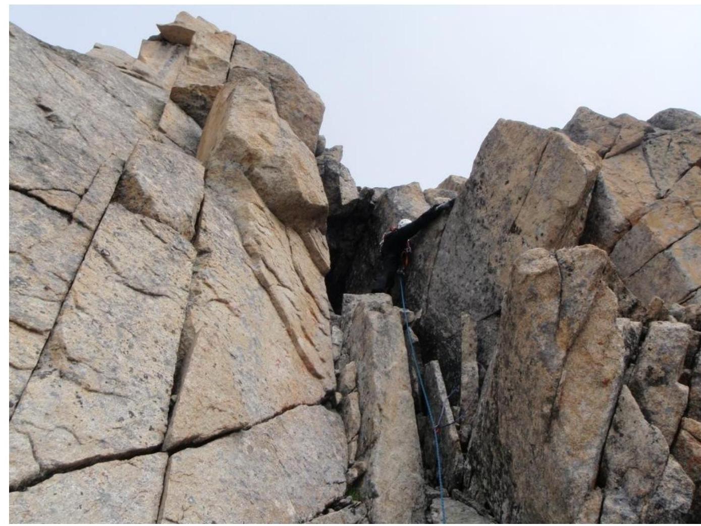 (Sect. 2–3)
Key rope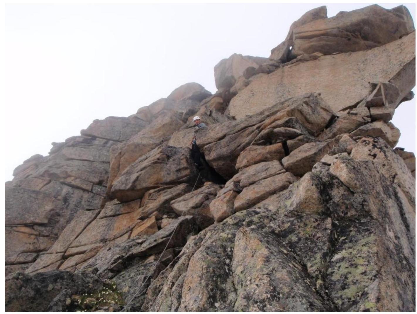 (Sect. 3–4)
Climbing through fractures to the sub-summit (Sect. 5–6)
Exiting along the ridge to the summit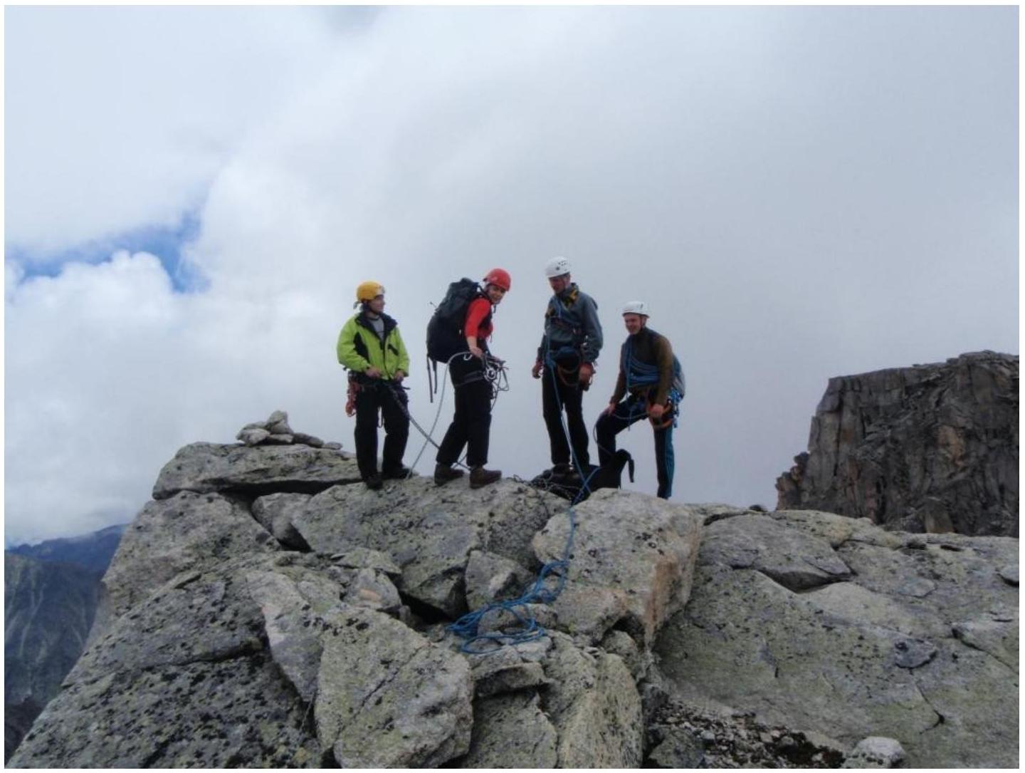
The summit (in the background, peak Stol)