REPORT
ON THE FIRST ASCENT TO THE SUMMIT SVERDLOVSK VIA THE "1000 LETIYA GORODA BRESTA" ROUTE ALONG THE CENTRAL WESTERN COUNTERFORT, CATEGORY 3B, BY THE TEAM: BREST REGIONAL PUBLIC ASSOCIATION OF ALPINISM AND ROCK CLIMBING "VERSHINA" FOR THE PERIOD FROM JUNE 26, 2019 TO JUNE 26, 2019
I. Climbing Report
| № | 1. General Information | |
|---|---|---|
| 1.1 | Full name, sports rank of the team leader | Dedushko Nikita Gennadyevich, 1st sports rank |
| 1.2 | Full name, sports rank of the participants | Panova Alyona Mikhailovna, Candidate Master of Sports, Marchuk Nikita Ivanovich, 3rd sports rank, Andreev Grigory Alekseyevich, 3rd sports rank |
| 1.3 | Full name of the coach | Dedushko Nikita Gennadyevich |
| 1.4 | Organization | Brest Regional Public Association of Alpinism and Rock Climbing "Vershina" |
| 2. Characteristics of the Climbing Object | ||
| 2.1 | Region | Eastern Sayan, Tunkin Goltsy ridge |
| 2.2 | Valley | Barun-Khandagai |
| 2.3 | Section number according to the 2013 classification table | 6.1.2 |
| 2.4 | Name and height of the summit | Sverdlovsk, 2693 m |
| 2.5 | Geographical coordinates of the summit (latitude/longitude), GPS coordinates | 51°55′36.84″ N, 102°12′58.61″ E |
| 3. Characteristics of the Route | ||
| 3.1 | Name of the route | "1000-letiya goroda Brest" |
| 3.2 | Proposed category of difficulty | 3B |
| 3.3 | Degree of route development | First ascent |
| 3.4 | Nature of the route terrain | Rocky |
| 3.5 | Height difference of the route (altimeter or GPS data) | 493 m |
| 3.6 | Length of the route (in meters) | 742 m |
| 3.7 | Technical elements of the route (total length of sections of varying difficulty with terrain description) | Category 1 rocky terrain — 20 m. Category 2 rocky terrain — 330 m. Category 3 rocky terrain — 360 m. Category 4 rocky terrain — 32 m. |
| 3.8 | Descent from the summit | Down the n/k category slope into the Barun-Khandagai valley |
| 3.9 | Additional characteristics of the route | Lack of water |
| 4. Characteristics of the Team's Actions | ||
| 4.1 | Time of movement (in hours) | 6 hours |
| (indicated in hours and days) | ||
| 4.2 | Overnights | None |
| 4.3 | Start of the route | 6:00, June 26, 2019 |
| 4.4 | Reaching the summit | 13:00, June 26, 2019 |
| 4.5 | Return to the base camp | 16:30, June 26, 2019 |
| 5. Responsible for the Report | ||
| 5.1 | Full name, e-mail | Panova Alyona Mikhailovna, aljonchik1905@mail.ru, 8-999-686-20-78 |
II. Description of the Ascent
1. Characteristics of the Climbing Object
1.1. General photo of the summit
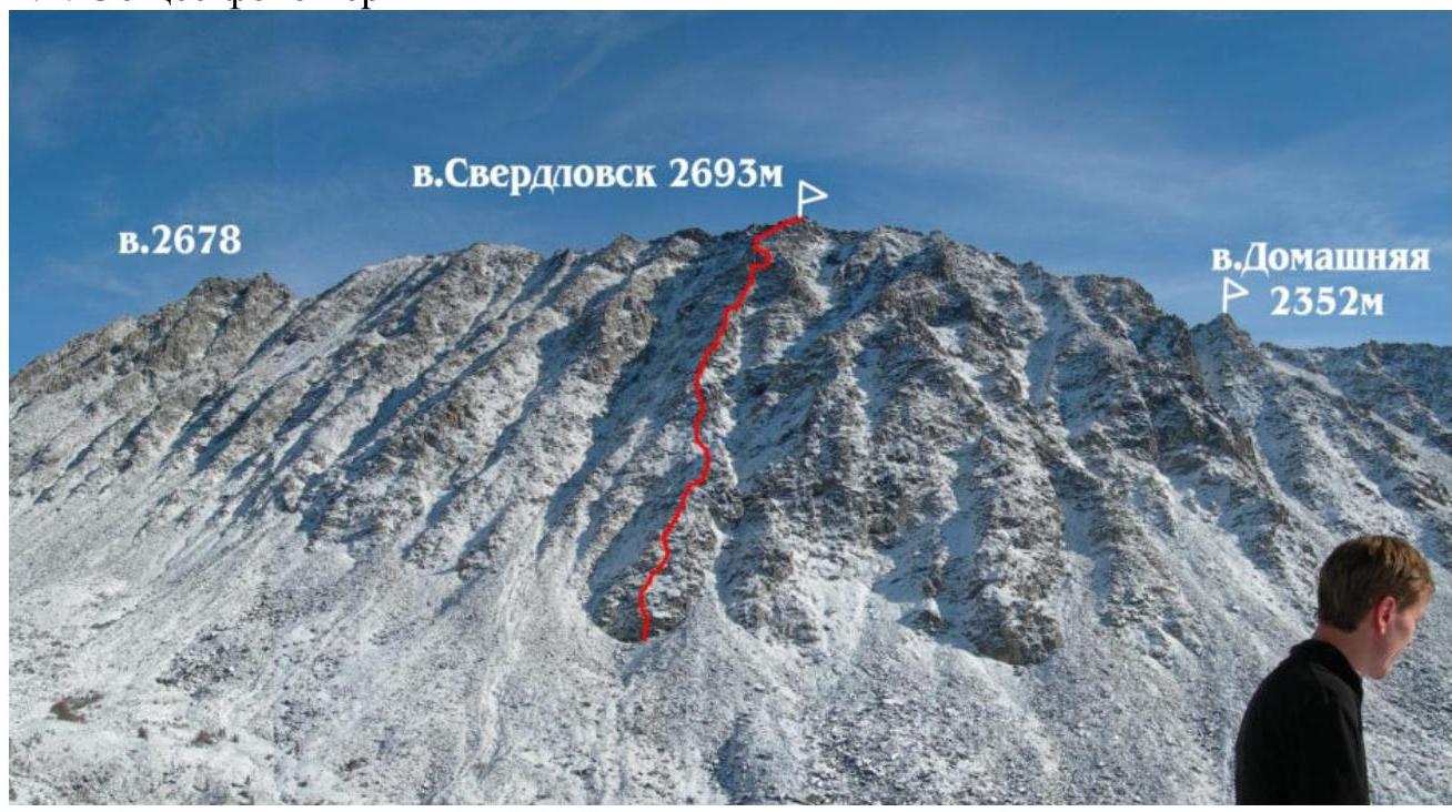
Photo 1. Taken on October 16, 2006, from the ascent to the Kulol cirque. 1.2. Photo of the route profile
3B first ascent
Descent Route
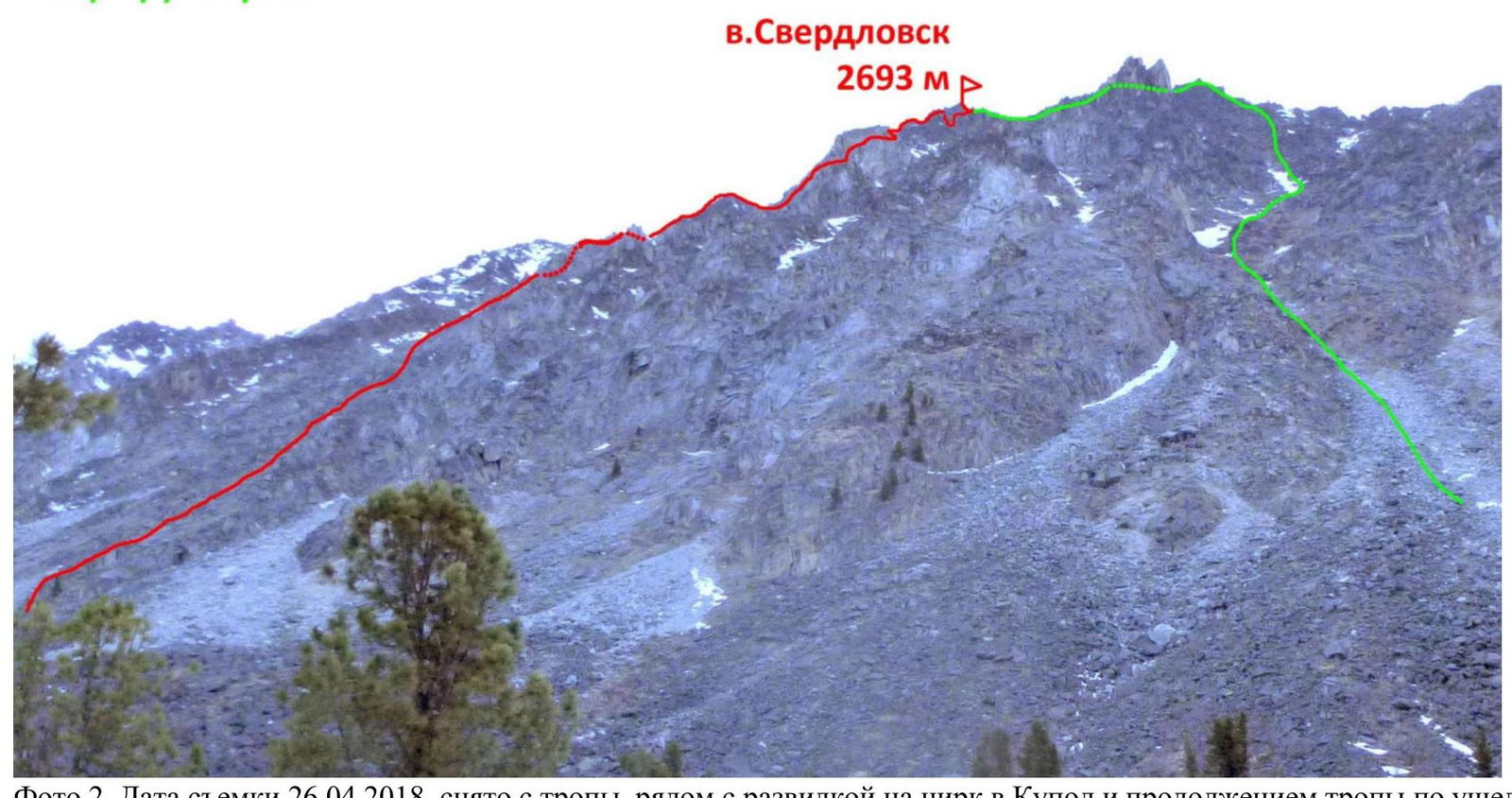
Photo 2. Taken on April 26, 2018, from the trail near the fork to the Kulol cirque and the continuation of the trail along the valley.
1.4. Map of the area
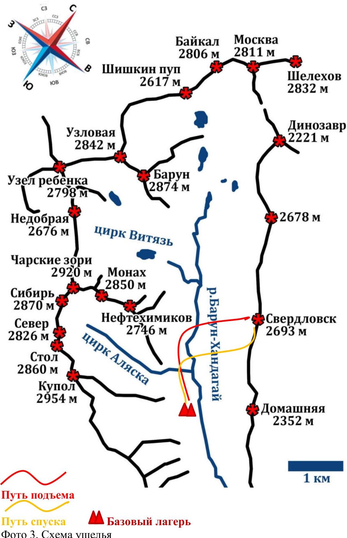
Photo 3. Schematic of the valley
2. Characteristics of the Route
2.1. Technical photograph of the route

Photo 4. 2.2. Section numbers on the technical photograph correspond to the following.
| Section | Terrain characteristics | Category of difficulty | Length, m, angle ° | Type and number of hooks |
|---|---|---|---|---|
| R0–R1 | Wall with a cleft. Series of grassy ledges alternating with gentle slabs. | 4 3 | 6 m, 70°; 54 m, 50° | 2 camalots, 1 anchor, 1 stopper, 2 camalots |
| R1–R2 | Simple slope. Inner corner. Rocky scree. Station on own points. | 1–2, 3, 2 | 20 m, 40°; 4 m, 70°; 30 m, 40° | 1 camalot |
| R2–R3 | Rocky scree. Station on a boulder. | 1–2 | 150 m, 45° | |
| R3–R4 | Wall. Green ledge. | 3–1–2 | 3 m, 45°; 50 m, 40° | |
| R4–R5 | Wall with a series of narrow earth ledges. Rocky scree. | 3–2 | 7 m, 60° – 50 m, 45° | |
| R5–R6 | Ledge. Broken corner to the right. Wall. Station on a boulder. Sloping corner. External corner with an overhanging snow cornice below. Inner sloping corner. Wall to the right. Diagonal ledge. Station on a boulder. | 3–4–3–4–4–2 | 7 m, 50° – 2 m, 90° – 10 m, 30° – 3 m, 80° – 2 m, 90° – 14 m, 45° | 2 camalots |
| R6–R7 | Rocks. Descent to a saddle. Chimney with a plug. | 3 | 7 m – 15 m – 4 m, 90° | |
| R7–R8 | Rocky scree, rocky ridge. | 3 | 120 m, 40° | |
| R8–R9 | Traverse of the gray wall to the right along gentle slabs and grassy diagonal ledges. Further left under a large-block overhanging scree along narrow cracks and fissures, exit to the ridge. | 3 | 60 m, 50° | |
| R9–R10 | Move diagonally to the right along cracks under the wall. Further traverse to the right along an inclined slab. Station on a boulder. | 3 4 | 50 m, 50°; 15 m, 0° | 1 stopper, 3 camalots |
| R10–R11 | Ledge. Ridge. | 2 3 | 100 m, 50°; 100 m, 40–60° | |
| R11–R12 | Rappelling from a boulder. Grassy ledge to the right upwards. Ridge to the left. | 2 2 | 20 m; 50 m; 50 m |
3. Characteristics of the Team's Actions
3.1. Brief description of the route passage.
| Section | Description | Photo number |
|---|---|---|
| R0–R1 | Start of the route along the center of the rusty wall at the base of the central western counterfort. The first section begins with a cleft, passable along the outer part of an overhanging block. Movement along a series of grassy ledges alternating with gentle slabs. Station on a convenient ledge on own points to the right of a chimney with a plug. | Photo 6 |
| R1–R2 | Movement along a simple slope to an inner corner. Further along the rocky scree. On wet rocks, it's slippery, movement is alternating, with protection on natural relief. | |
| R2–R3 | Holding to the left part of the counterfort, movement upwards along the rocky scree. | |
| R3–R4 | Wall, a "finger" pinnacle is visible, an orientation point to it, exit to a green ledge, a couloir is visible to the right – move to the left of it. | Photo 7 |
| R4–R5 | Wall with a series of narrow earth ledges, passed along the left part. Further along the rocky scree. | |
| R5–R6 | Ledge. Exit to the ridge before the "finger" along a broken corner to the right. Wall. Station on a boulder. Movement along a sloping corner to the left of the "finger" on slippery grass. Traverse to the left across an external corner with an overhanging snow cornice below. Traverse to an inner sloping corner, movement along the right wall with an exit to the ridge. Along a diagonal ledge to the left upwards, station on a boulder. | Photo 8 |
| R6–R7 | From the station, traverse to the right downwards, protection on relief. Descent to a saddle after the "finger" pinnacle. Further along the left chimney with a plug, beware of loose rocks! | Photo 9 – Photo 10 |
| R7–R8 | Along the rocky scree, moving to the right, along the ridge. The terrain is monolithic, pleasant climbing. | Photo 11 |
| R8–R9 | Traverse of the gray wall to the right along gentle slabs and grassy diagonal ledges. Further left under a large-block overhanging scree along narrow cracks and fissures, exit to the ridge. | Photo 12 |
| R9–R10 | Movement diagonally to the right, orientation point – a straight vertical inner corner. Along cracks to the right of it under the wall. Further traverse to the right along an inclined slab, holding onto a horizontal crack at the junction of the wall and slab, feet working on friction. Station on a boulder. | Photo 13 |
| R10–R11 | Along a ledge to the right, further to the left onto the ridge along the rocky scree. Movement along the ridge to the rappel. | Photo 14 |
| R11–R12 | Rappelling from a boulder. Movement along a diagonal grassy ledge to the right upwards, exit to the ridge, to the left onto the summit. | Photo 15 |
3.2. Photo of the team on the summit with the control tour.
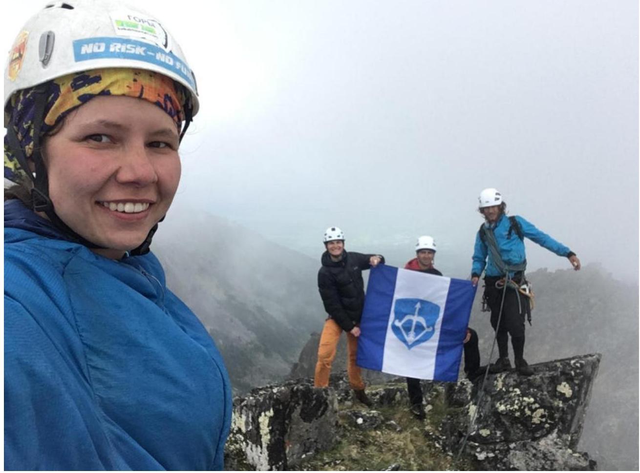
Photo 5. From left to right: Panova A., Dedushko N., Andreev G., Marchuk N.
3.3. The route is not considered rockfall-prone as it passes along a counterfort, but there are loose rocks that need to be navigated carefully. Communication on the route with the base camp was conducted via radio station without interference, as the summit is close to the base camp; there is also cell phone coverage on the summit. The team descended along the southern ridge to a couloir of moderate steepness. The landmark for the correct couloir is the rocky outcrops that need to be traversed when moving along the southern ridge, as the ridge drops off with sheer rocks at this point and there's a bypass to the right into the correct couloir. The team explored a descent to the saddle between Domashnaya peak and Sverdlovsk peak:
- it is necessary to organize two rappels of full rope length directly to the saddle;
- it was decided to descend via the couloir where Panova's team in 2018 made a hiking descent. We recommend exploring a descent along the northern ridge. The length of the route, the complexity of key sections, and the terrain as a whole suggest, in the team's opinion, a category 3B difficulty, and the route is comparable in technical characteristics to routes of the same category of complexity in the Eastern Sayan.
Photos from the ascent:
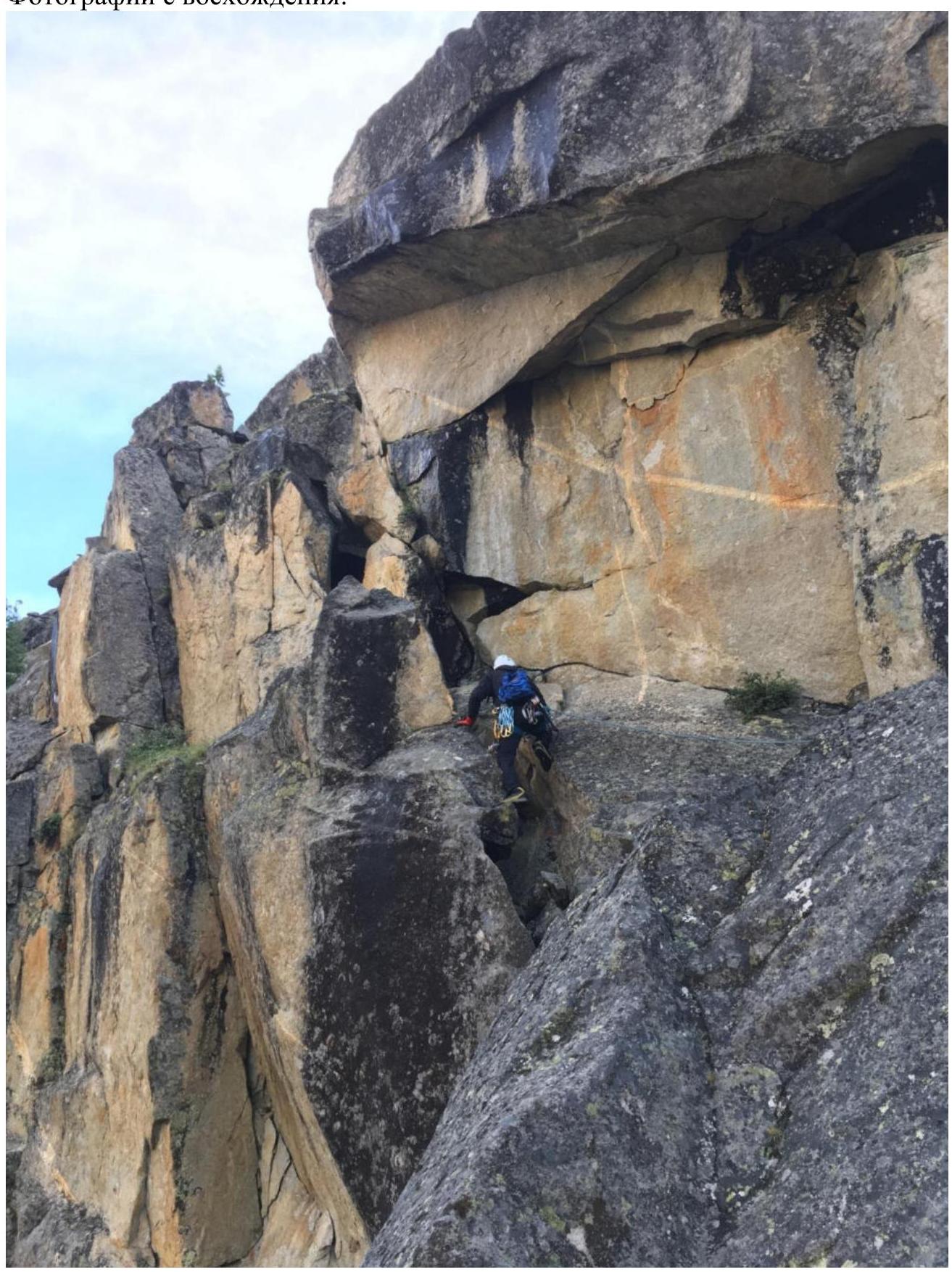
Photo 6. Start of the route. Section R1–R2.
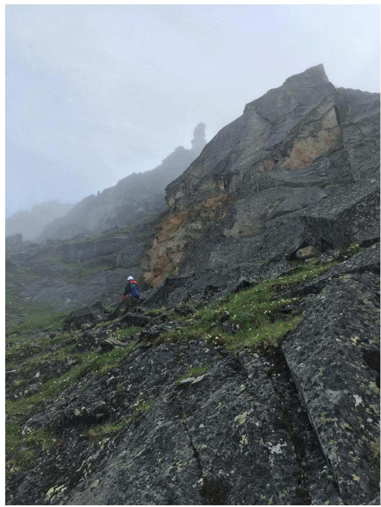
Photo 7. Green ledge, movement to the left. Orientation point is the "finger" pinnacle.
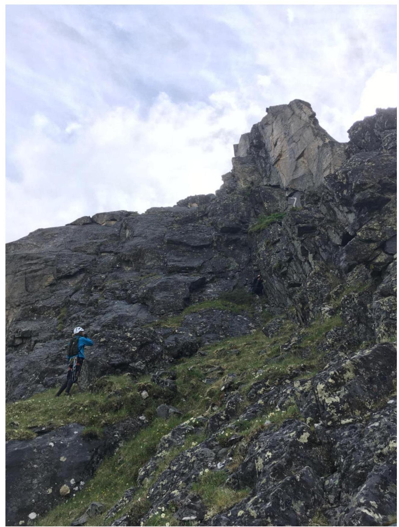
Photo 8. "Finger" pinnacle.
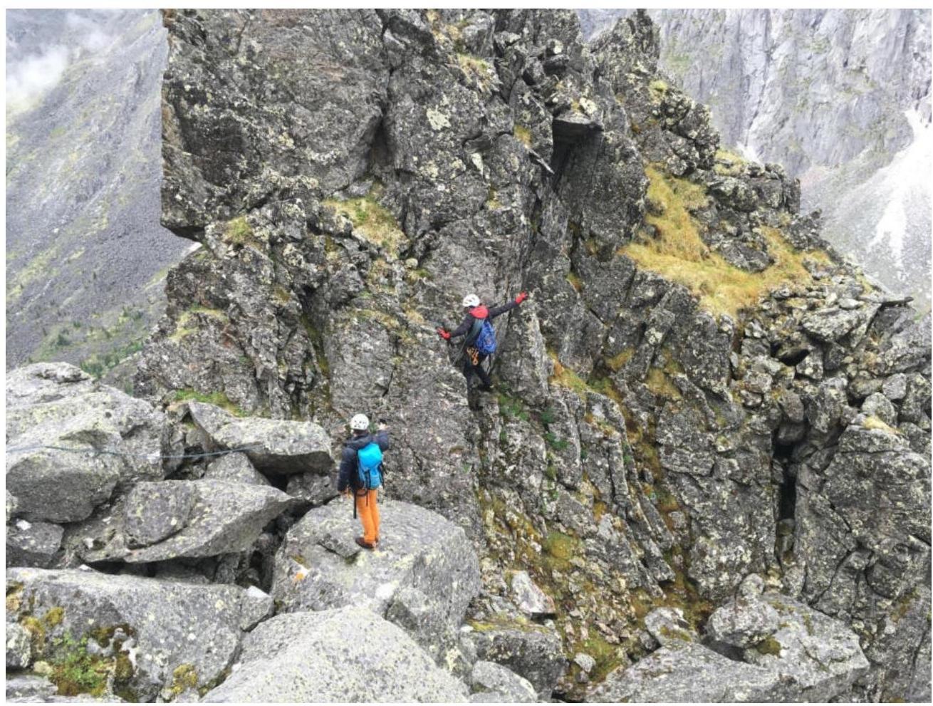
Photo 9. Movement to the right downwards after climbing the "finger". View of the station on the "finger" after descent and further ascent along the route.
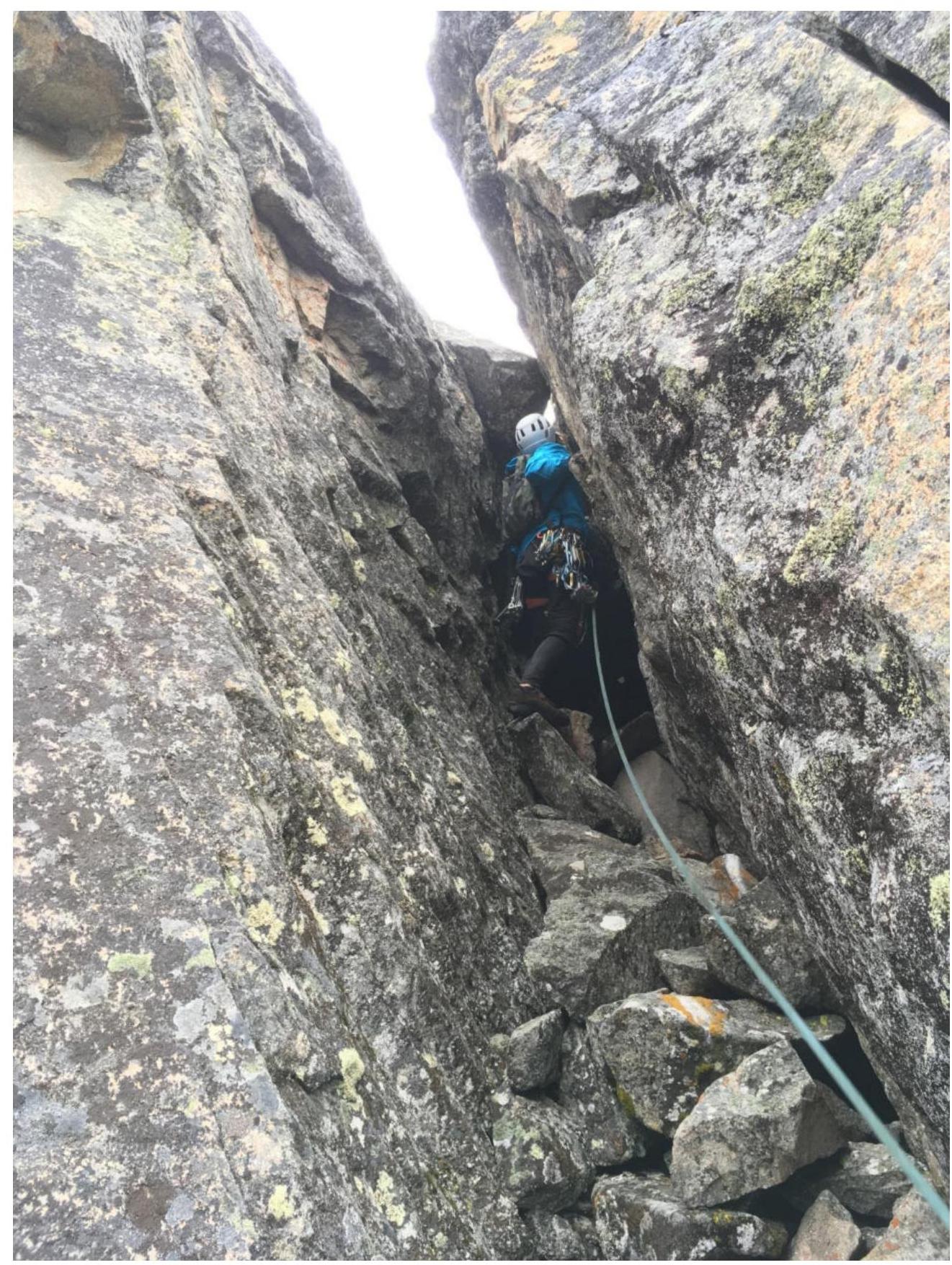
Photo 10. Chimney with a plug and loose rocks after descending from the pinnacle.
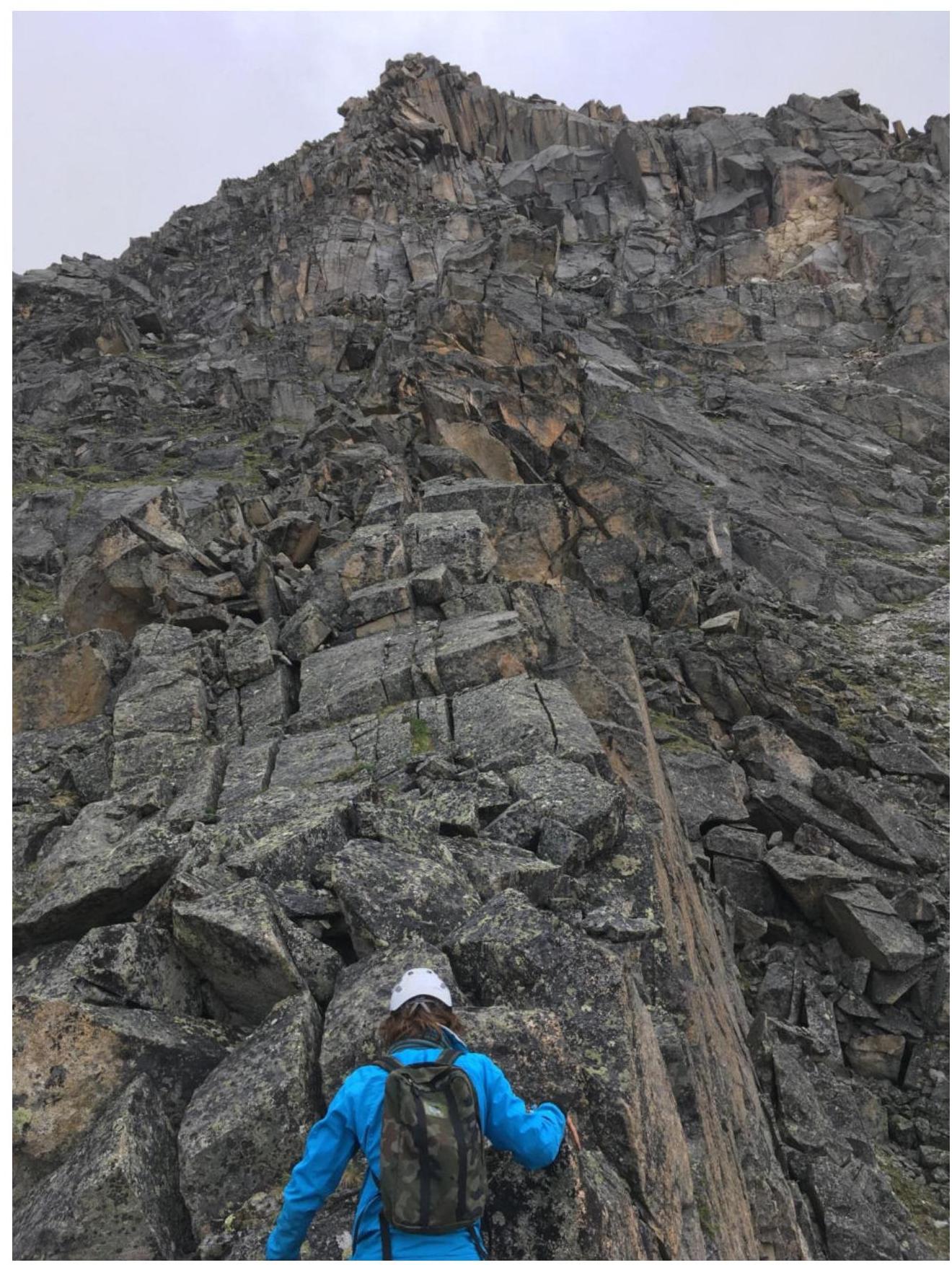
Photo 11. Movement along the ridge. 
Photo 12. To the left under the large-block overhanging scree along narrow cracks and fissures. Orientation point on the straight vertical inner corner, to the right of it.
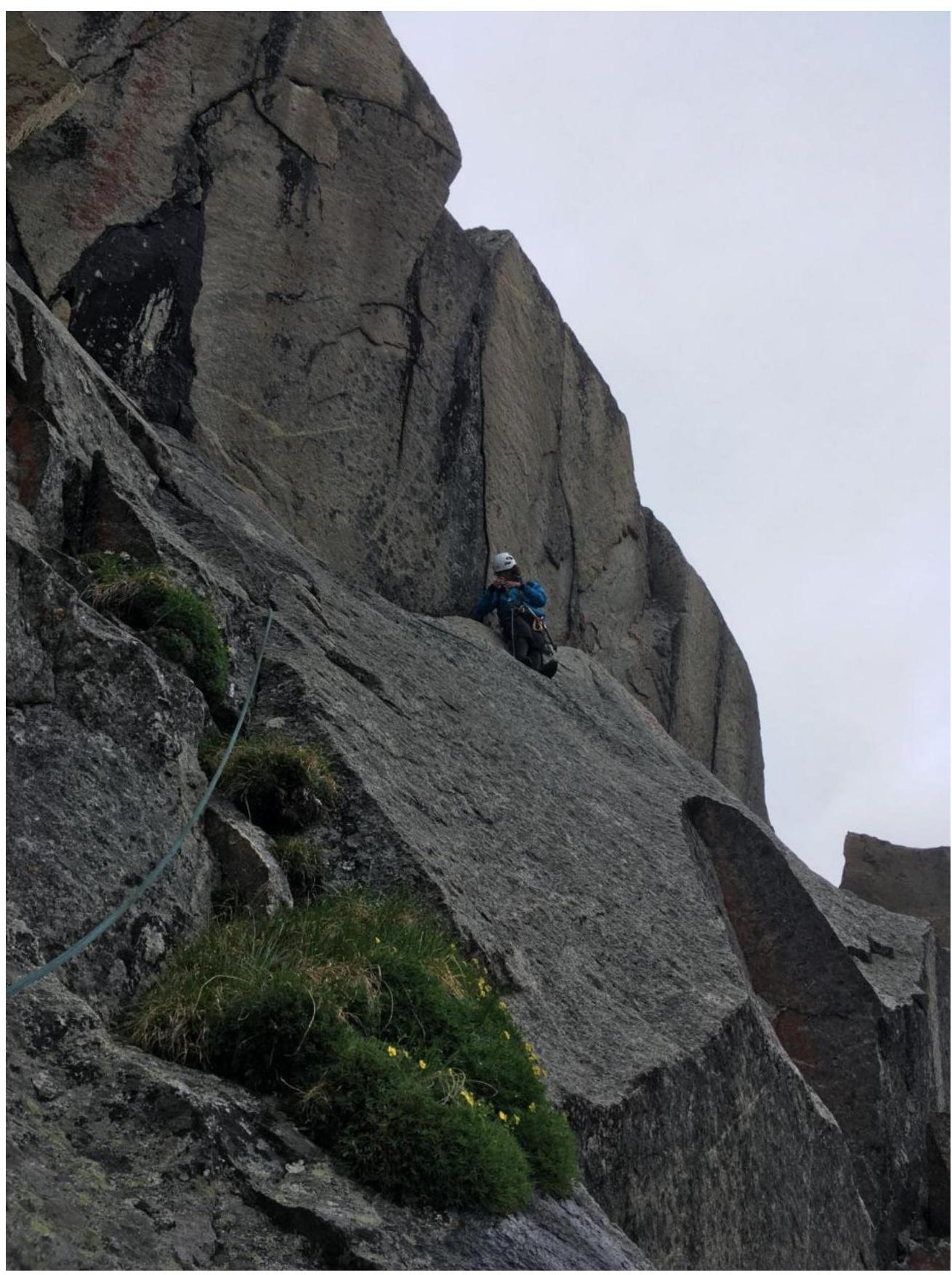
Photo 13. To the right of the vertical corner along a horizontal crack.
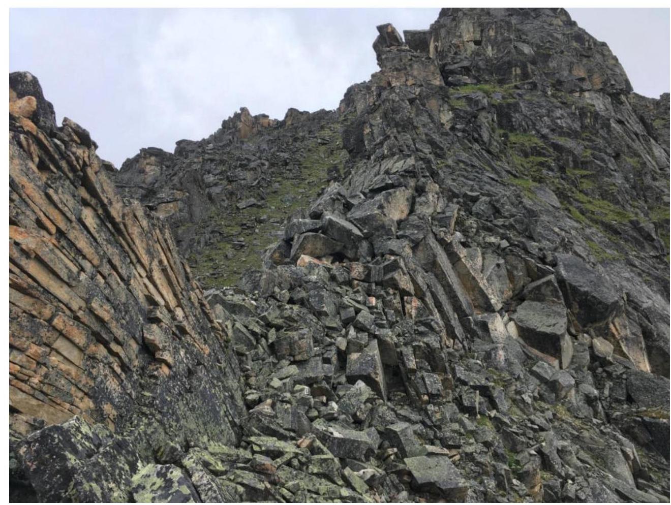
Photo 14. Movement along the ridge.
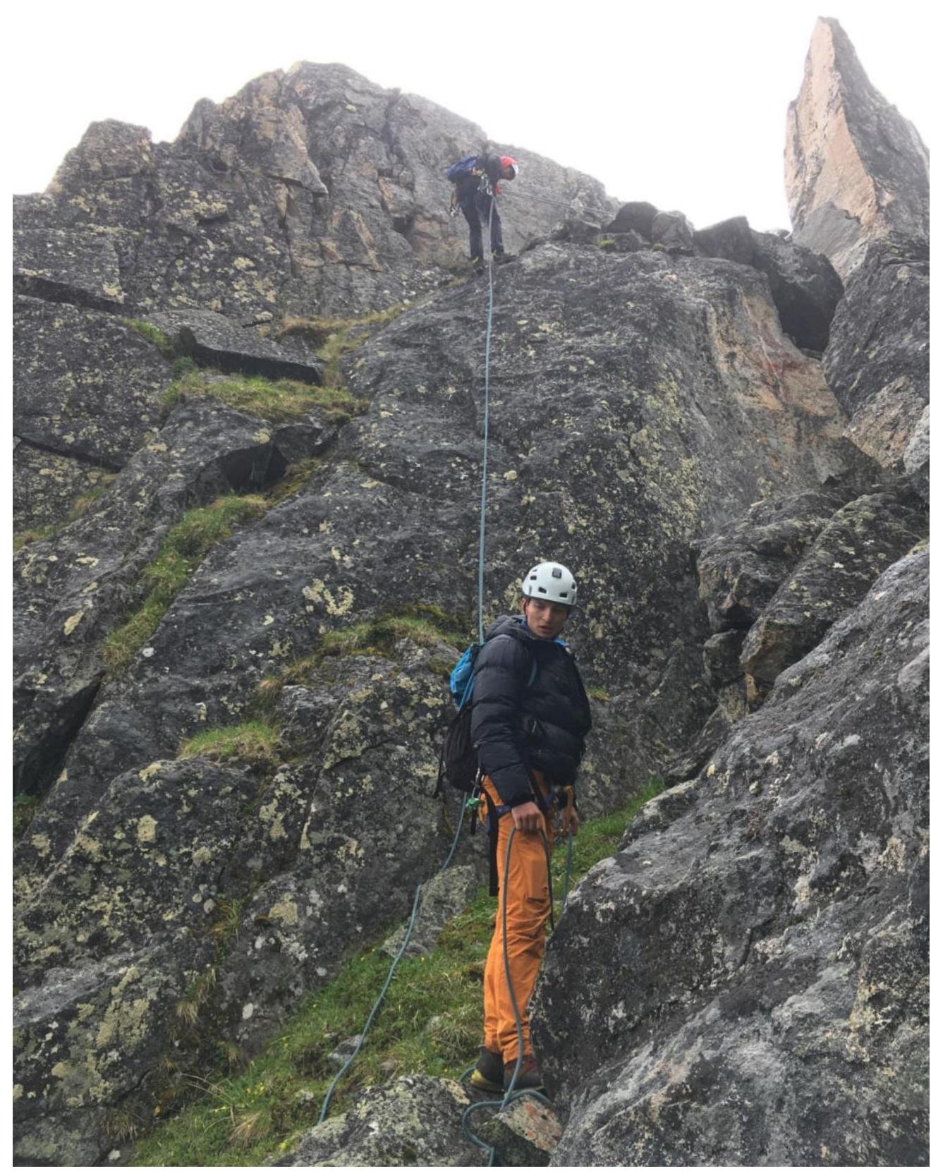
Photo 15. Rappelling before ascending to the summit.