Arkhangelsk Region Climbing and Rock Climbing Federation
REPORT
On the first ascent to the summit of Aikuayvenchorr Central (1075 m) via the "3D" route, category 4A, by the Arkhangelsk Region team on March 23, 2018.
Leader: Dmitry Alexandrovich Shpilevoy
Participants:
- Dmitry Andreevich Rybalchenko
- Dmitry Olegovich Dolzhenkov
Coach: Sergey Konstantinovich Penzov
Responsible for the report: D. A. Rybalchenko rybalchenko92@yandex.ru
Severodvinsk 2018
1. Ascent Passport
- Region: Kola Peninsula. Khibiny mountain range. VMF Cirque. Classification table section number: 8.6.2.
- Summit name: Aikuayvenchorr Central. 1075 m
- Route name: "3D"
- Summit coordinates: 67°36′32″ N 33°46′17″ E
- Route: via the seventh rib of the northern wall. Proposed category: 4A.
- Route type: rock
- Route height difference: 606 m. Route length: 1163 m. Wall height difference: 400 m. Wall section length: 453 m. Section lengths: category I: 710 m, category II: 30 m, category III: 298 m, category IV: 75 m, category V: 50 m. Average wall section steepness: 68°. Anchors used: 24. Friends: 25. Stoppers: 14. Artificial support points used: 0. Bolts: 0. Hooks left on the route: 0.
- Team's total climbing hours: 10 h 02 min. Days: 1.
- Leader: Dmitry Alexandrovich Shpilevoy CMS.
Participants:
- Dmitry Andreevich Rybalchenko CMS.
- Dmitry Olegovich Dolzhenkov 2nd sports category.
- Coach: Sergey Konstantinovich Penzov MSMS.
- Route start: 8:35 AM, March 23, 2018. Summit arrival: 6:37 PM, March 23, 2018. Return to base camp: 8:10 PM, March 23, 2018.
2. General Photo of the Area
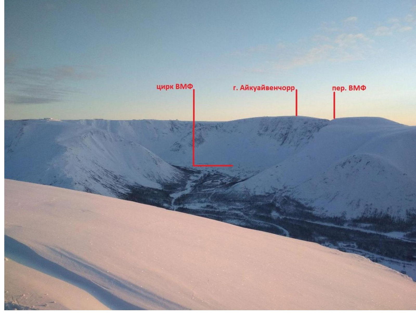
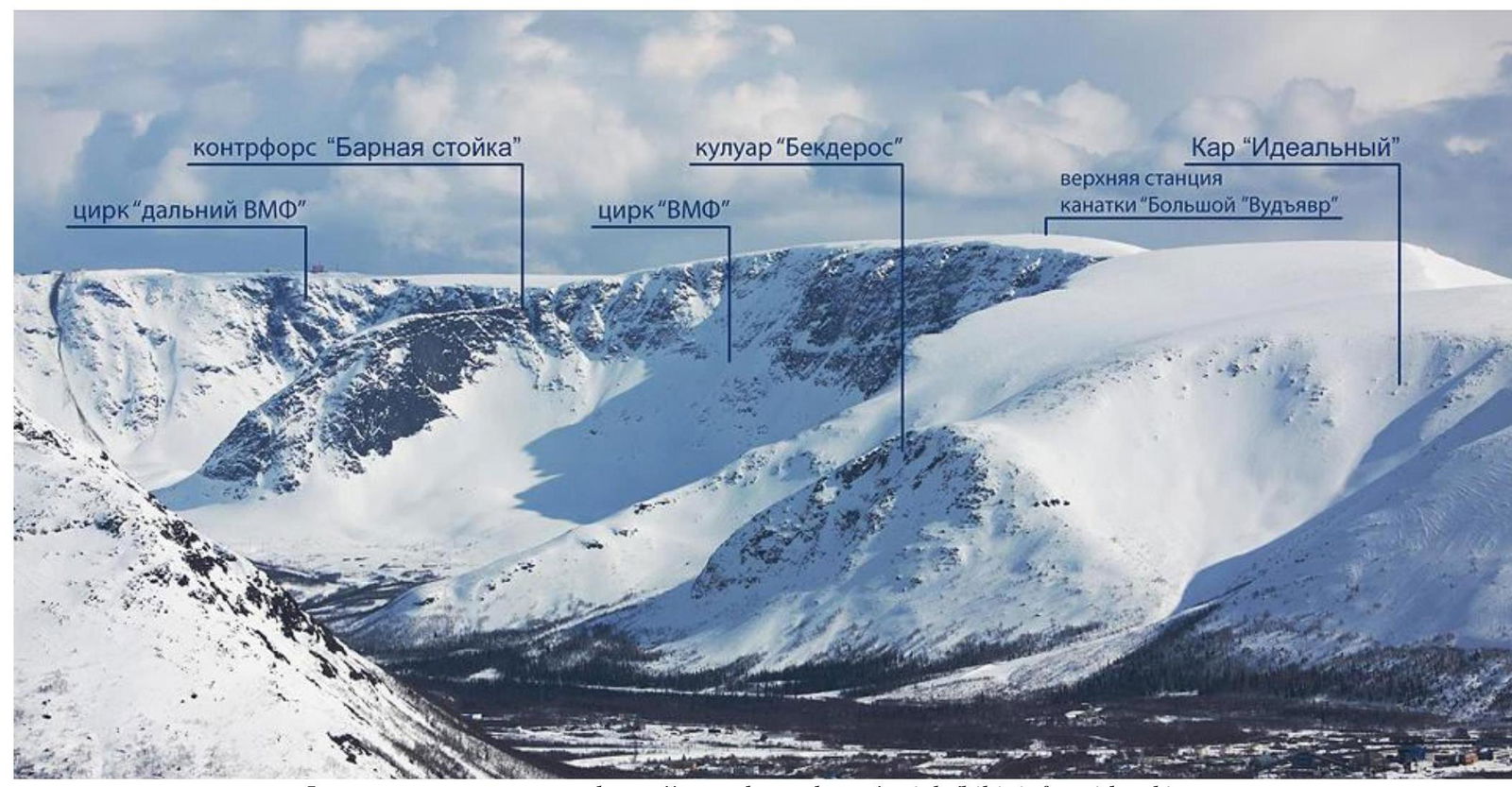
Photo taken from the article: https://www.densurka.ru/article/hibini\_freeride\_ski-tour↗
3. Area Overview
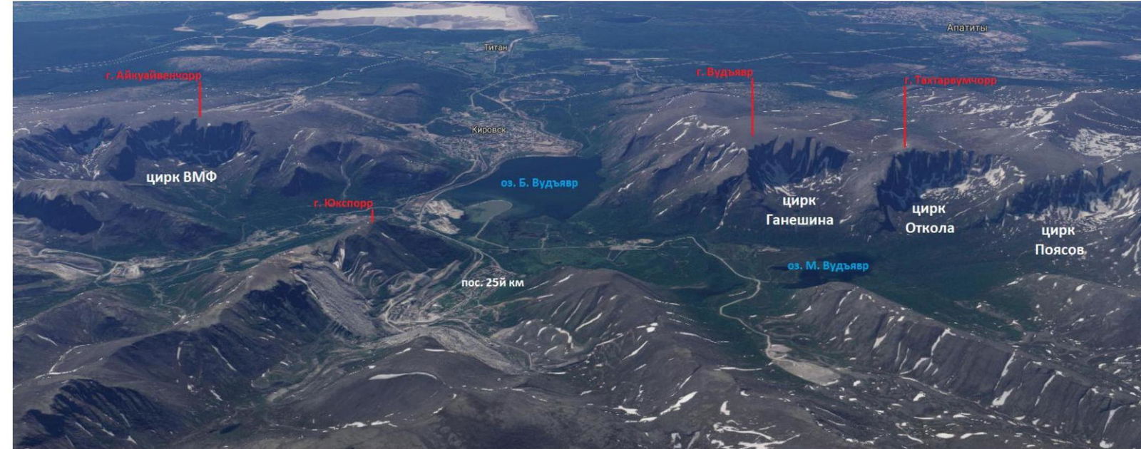
The Khibiny Mountains are the largest mountain range on the Kola Peninsula, located 150 km north of the Arctic Circle. They are a major mountaineering and skiing destination in northwestern Russia. The highest point is Mount Yudyachvumchorr (1200 m). The prevailing heights of the plateau-like peaks range from 900 to 1100 m, with steep slopes covered in glaciers and snowfields. The Kuniyok — Kukisiyok — Bolshaya Belaya valley divides the range into Western (Lesser) and Eastern (Greater) Khibiny. The eastern edge of this valley, consisting of the Lyavochorr, Rischorr, Kukisvumchorr, Yukspor, Rasvumchorr, and Aikuayvenchorr plateaus, is the main watershed of the Khibiny, from which other watersheds branch off, delimiting the main valleys: Vuonemiyok, Tulok, Kaskasnyuyok, Mayvaltiok, and Kalyok to the east, and Malaya Belaya and Goltsovka to the west. The upper reaches of the valleys end in one or a system of cirques, which, along with numerous corries, are the most characteristic features of the Khibiny Mountains. Another feature of the Khibiny is the presence of gorges — cracks with sheer walls, reaching 60–70 m in width and several tens of meters in depth. The slopes are smoothed, almost devoid of sharp ridges and protrusions, a result of glacial relief-forming processes. The compact mountain area is close to populated areas. The Khibiny Mountains are currently the world's largest deposit of apatite-nepheline ores. A large industrial complex for mining and processing apatite ore has been built in the southern part of the range. The cities of Apatity and Kirovsk are located at the foot of the mountains. At the foot of Mount Vudyavrchorr lies the Polar-Alpine Botanical Garden-Institute.
One can reach Apatity by train from Moscow, St. Petersburg, and other cities. Apatity also has an airport. Another option is the E105 highway towards Murmansk.
The Khibiny Mountains have a mix of regional and local mountain climate characteristics. The outer slopes of the mountains experience a significant moderating influence from the surrounding plains' climate, while the microclimate of the central part of the range is considerably harsher. The average annual temperature in the Kirovsk-Apatity area is -0.1 °C, with an average annual precipitation of 481 mm.
Precipitation increases with altitude:
- at the Khibiny weather station — 650 mm per year;
- on the Yukspor plateau — 1340 mm;
- on the Rasvumchorr plateau — 1600 mm.
On the plateaus, the average annual wind speed exceeds 5 m/s. Gusty winds prevail; instantaneous wind gusts:
- on the Yukspor plateau — up to 60 m/s;
- on the Rasvumchorr plateau — up to 80 m/s.
The polar day lasts from May 31 to July 13, and the polar night from December 10 to January 3.
A stable snow cover forms in early October, lasting 240–280 days; 80% of snow accumulation in the Khibiny occurs in February. The weather in the Khibiny is unstable, and a sunny period can be followed by a snowstorm (even in summer!), wet snow, wind, and fog. Visibility during a blizzard is minimal, and the wind can sweep a person off the edge of a plateau. The Khibiny are quite avalanche-prone in winter. From August to mid-April, one can observe the Northern Lights.
Favorable periods for ascents:
- winter season — March and early April;
- summer season — August and early September.
In the Khibiny, more than 37 routes are classified, ranging from category 1B to 5A. Many routes have been climbed but not yet classified, and there are also many opportunities for first ascents. Classified routes are mainly concentrated in three cirques:
- Ganechina
- Otkola
- Poyasov
They lead to the peaks of Vudyavrchorr and Takhtarvumchorr. One can reach these cirques on foot in 1–1.5 h from the Tirvas sanatorium or the Botanical Garden, which is located nearby. The sanatorium can be reached by car from:
- Kirovsk (30 min)
- Apatity (1 h)
- 25th km settlement (10 min)
It is also possible to walk from the 25th km settlement by following a path at the bottom of the settlement towards Mount Vudyavrchorr, which leads to the Botanical Garden. Accommodation can be easily found in Apatity, Kirovsk, the 25th km settlement, and the Botanical Garden.
The VMF Cirque was previously closed due to mining activities, but now the operations have ceased, and the cirque is accessible to climbers. The cirque is located close to Kirovsk and the 25th km settlement, and the Khibiny UNS base of the MSU Geography Department (MSU base) is nearby, where accommodation can be rented. The cirque offers numerous opportunities for first ascents of almost all complexity categories. The logical and convenient approach (2 h from the MSU base) and the powerful and diverse terrain make this corner of the Khibiny very promising for mountaineering, both for sports teams and training groups.
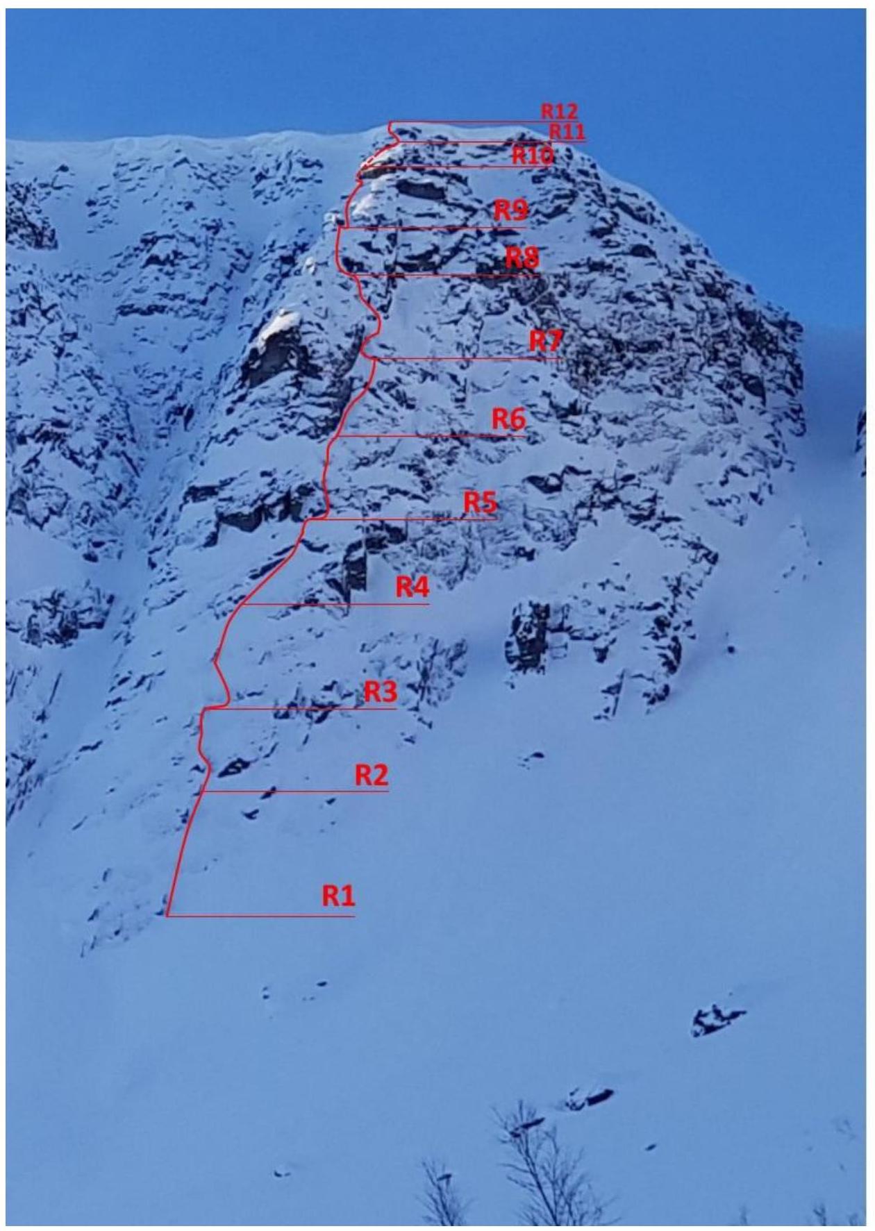
4. General View Photo with the Route
5. Wall Section Profile
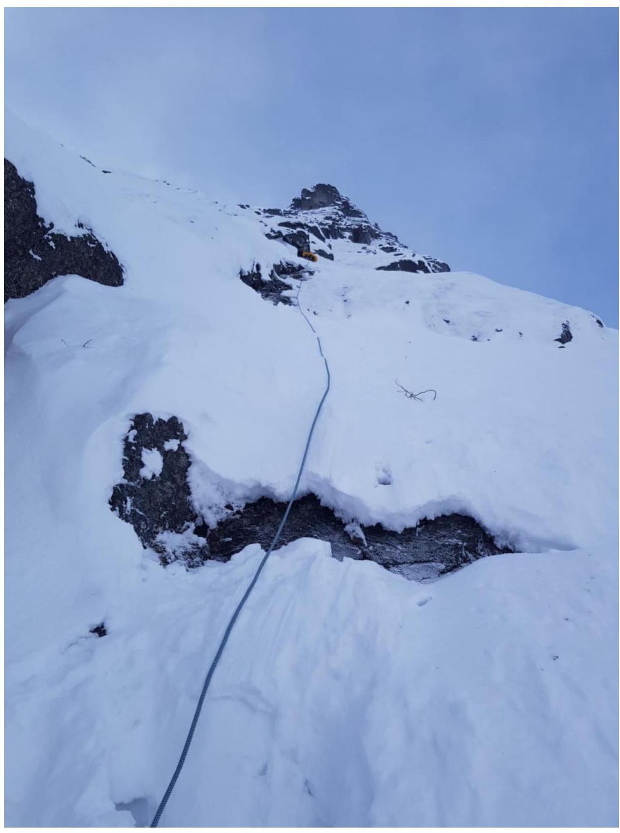
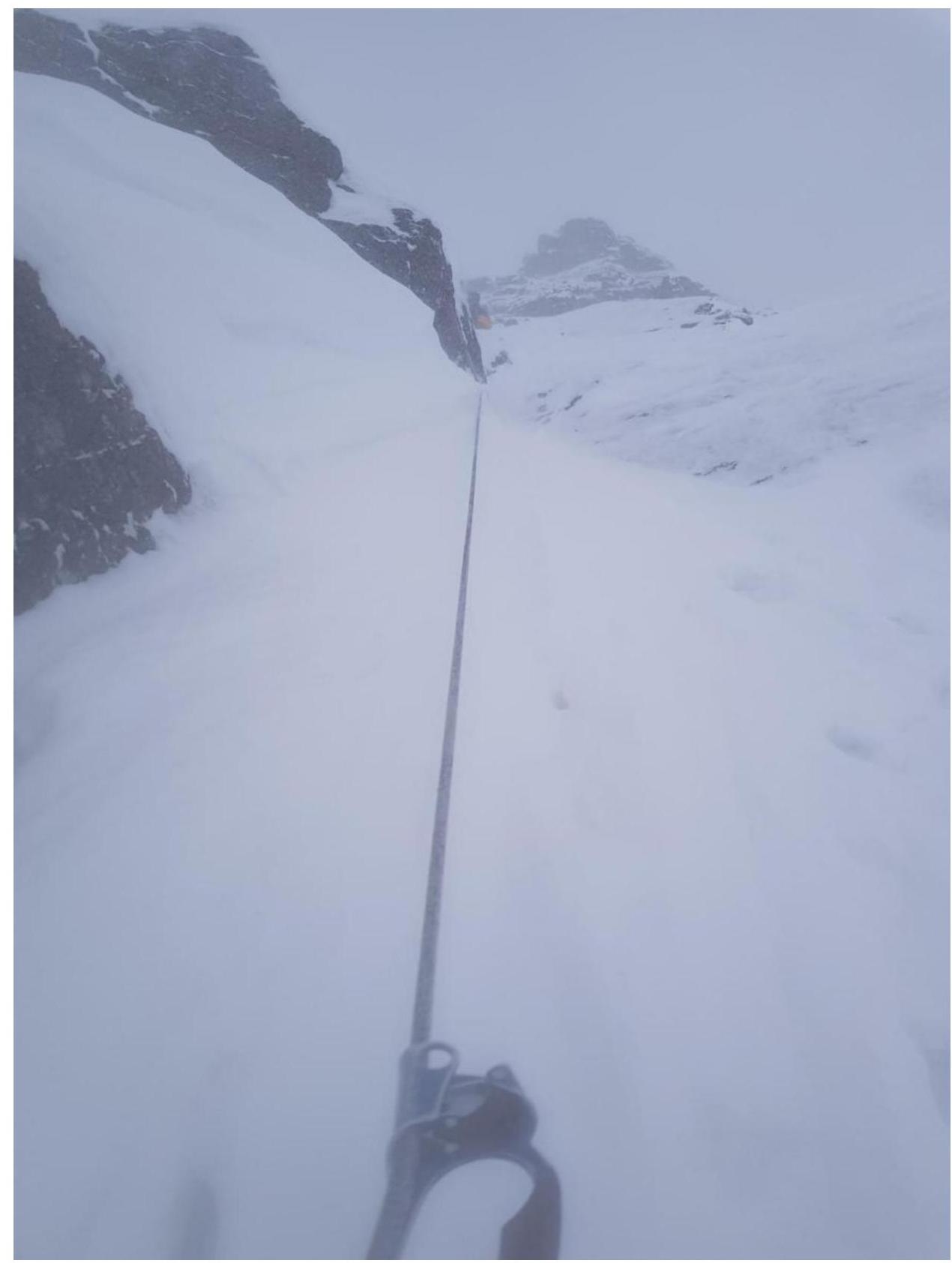
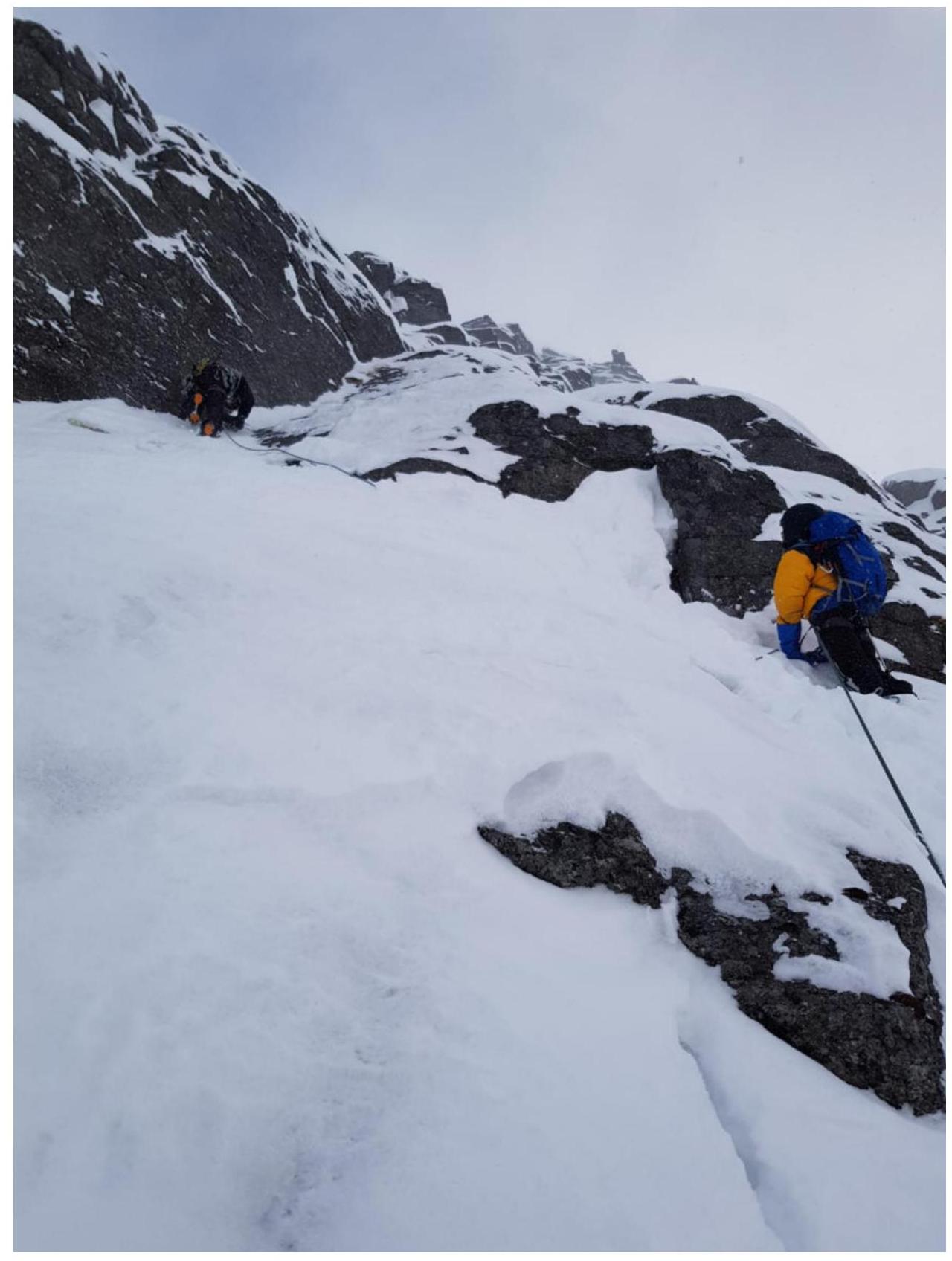
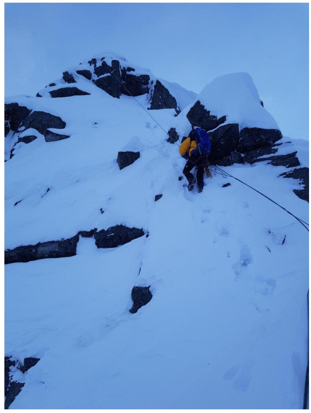
6. Technical Photo of the Route
7. UIAA Symbol Scheme
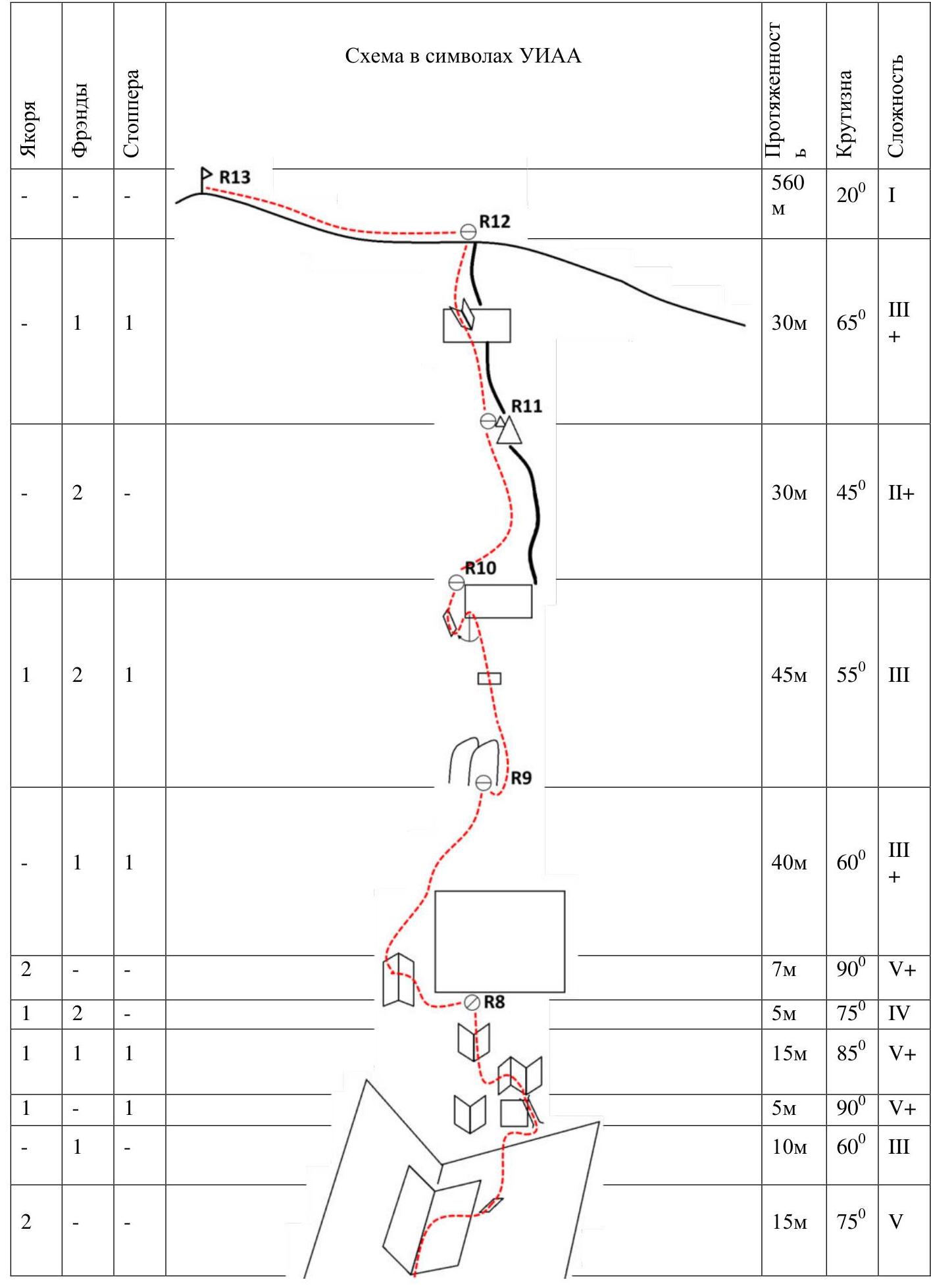
| Anchors | Friends | Stoppers | Section | Length | Steepness | Difficulty |
|---|---|---|---|---|---|---|
| R13 | 560 m | 20° | I | |||
| 1 | 1 | 1 | R12 | 30 m | 65° | III+ |
| 2 | R11 | 30 m | 45° | II+ | ||
| 1 | 2 | 1 | R10 | 45 m | 55° | III |
| 1 | 1 | R9 | 40 m | 60° | III+ | |
| 2 | R8 | 7 m | 90° | V+ | ||
| 1 | 2 | 5 m | 75° | IV | ||
| 1 | 1 | 1 | 15 m | 85° | V+ | |
| 1 | 5 m | 90° | V+ | |||
| 1 | 10 m | 60° | III | |||
| 1 | 2 | R7 | 10 m | 75° | III | |
| 1 | 1 | 5 m | 90° | V | ||
| 1 | 1 | R6 | 20 m | 65° | III+ | |
| 3 | 15 m | 60° | III | |||
| 2 | 2 | 1 | R5 | 15 m | 80° | IV+ |
| 1 | 2 | 15 m | 65° | III | ||
| 2 | 3 m | 90° | V+ | |||
| 1 | R4 | 30 m | 60° | III | ||
| 3 | 1 | 45 m | 75° | III+ | ||
| 1 | 1 | 2 | R3 | 5 m | 75° | III |
| 2 | 1 | 40 m | 75° | IV+ | ||
| 1 | R2 | 3 m | 75° | III | ||
| 2 | 1 | 20 m | 75° | III+ | ||
| 1 | 1 | R1 | 15 m | 75° | IV+ | |
| 1 | 1 | 10 m | 70° | III | ||
| R0 | 150 m | 45° | I+ |
8. Route Description by Sections
R0–R1. Approach the start of the route via a steep snow-firn slope to a pronounced internal corner. Set up the first station here.
R1–R2. Climb up the internal corner, then traverse a smoothed slab with cracks. Enter the next internal corner, and set up a station at the exit.
R2–R3. From the station, move slightly right and then up into a small internal corner. Then, tackle a challenging smoothed wall. Initially, climb straight up, then traverse right and upwards, and finally move left into the direction of the next internal corner. Climbing is difficult, with poor relief. Set up a station here.
R3–R4. Then, climb up and right via "ram's foreheads" (barrantsi lbi) to a vertical wall.
R4–R5. Continue up and right along a steep snowy slope (ram's foreheads) to approach a vertical wall and traverse along it towards a small internal corner (a chimney). Pass a complex vertical internal corner and move along an inclined ledge to a vertical wall. Set up a station here.
R5–R6. From the station, move right into an internal corner. Climbing is difficult. Then, climb straight up to the base of a huge internal corner. Set up a station here.
R6–R7. From the station, climb up the large internal corner, then move right towards a chimney. Pass the chimney — climbing is challenging. Then, climb up to a wall, and set up a station here.
R7–R8. Key pitch. Move left into a large internal corner, climb straight up, then traverse right. Climbing is difficult, with poor relief. Then, exit onto an inclined ledge.
Bypass:
- Left — a complex, slightly overhanging internal corner — avoid it.
- Bypass it by climbing right up a chimney, enter a smoothed internal corner, and from there, via the left edge of the corner, move left and upwards into the adjacent internal corner.
- Climbing here is also challenging, with poor relief.
- Continue upwards via a series of internal corners under a vertical, slightly overhanging wall.
- Set up a station.
R8–R9. Then, move left into an internal corner, and after that, left and upwards through the left edge of the corner, transfer onto an inclined ledge. Traverse a vertical wall to exit onto a gentler terrain. Move towards the "Sails" rocks. Set up a station here.
R9–R10. Continue straight up through a small wall and approach a large vertical wall. Here, it's necessary to descend left and downwards onto an inclined ledge. Climb up the ledge to a pronounced ridge. Set up a station.
R10–R11. From the station, follow the ridge to a large gendarme, and behind it, an offset — set up a station on it.
R11–R12. Then, climb up to a vertical wall, which is passed left and upwards via an internal corner. After that, follow the ridge to the "roof." Set up a station on ice axes.
R12–R13. Move left along the ridge to the summit. Be cautious! Powerful cornices are forming on the left.
Descent: initially follow the ridge via the ascent route, then continue down the ridge along the metal poles to the VMF Pass. From the pass, descend right along the line of water fall (potentially avalanche-prone!) and exit onto the ascent tracks.
9. Group Tactics
Departed from the MSU base on March 23, 2018, at 6:30 AM, reached the route at 8:35 AM. The approach was through knee-deep snow. Reached the pre-summit ridge at 5:54 PM, and were on the summit at 6:37 PM. Descended via the VMF Pass and returned to the base at 8:10 PM. The weather was favorable in the morning but started to deteriorate from R3 onwards:
- Snowfall began,
- Wind strengthened.
The team had the following equipment: 6 anchors, a set of stoppers, a set of friends, quickdraws and slings with carabiners, and ice tools — which turned out to be an insufficient kit for reliably completing this route. We strongly recommend subsequent climbers to add:
- Anchor hooks,
- Friends,
- A kit for artificial aid.
The R7–R8 section, where we bypassed a slightly overhanging internal corner on the right, might be worth climbing "head-on." Climbing is more difficult, but the line is somewhat shorter. For strong sports teams.
Radio communication via "Baofeng" on the wall section of the route with the MSU base was not possible due to the ridge of Mount Aikuayvenchorr Eastern intervening. However, "Megafon" mobile phone coverage was excellent throughout the route.
The descent from the VMF Pass can be avalanche-prone! One should consider:
- Weather conditions,
- Avalanche danger level (can be checked with the Kirovsk Emergency Ministry).
The route is logical. Orientation issues may arise on the pre-summit ridge and during the descent to the VMF Pass when visibility on the plateau is less than 100 m.
Despite the relatively high speed of ascent, the route turned out to be very challenging and labor-intensive. The overall slope of the wall is quite high at 68°. On this route, it's very difficult to find and clear reliable anchor points, as all cracks are either in moss, in rime ice, or covered with a layer of frost and snow. Our team did not use artificial support points, and completing such a complex route via free climbing was only possible due to the high individual skill and experience of its members. The participants of the first ascent, comparing this route with other climbed routes in the area:
- 4A "Honest Girl," 4B "Hammer," 3B "Gendarmerie," 3B via the 4th couloir on Mount Vudyavrchorr;
- 4B "Gulf Stream" (ascent time 10 h in a pair), 3B "Reindeer Herders" on Mount Takhtarvumchorr unanimously agree that the route undoubtedly corresponds to category 4A.
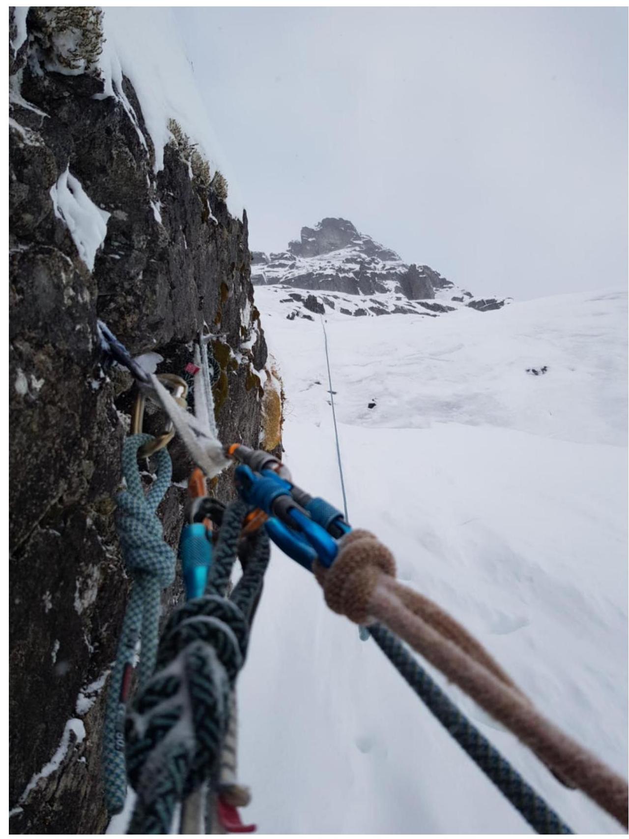
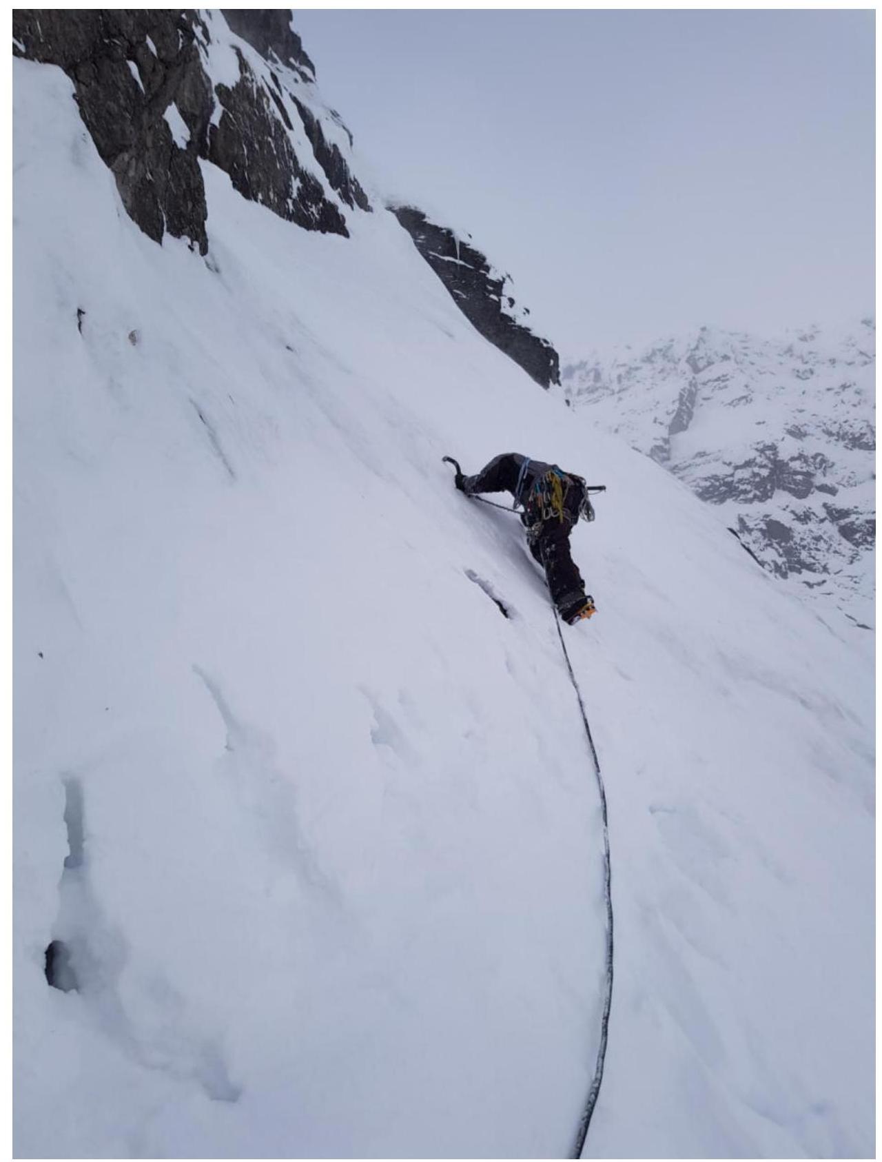
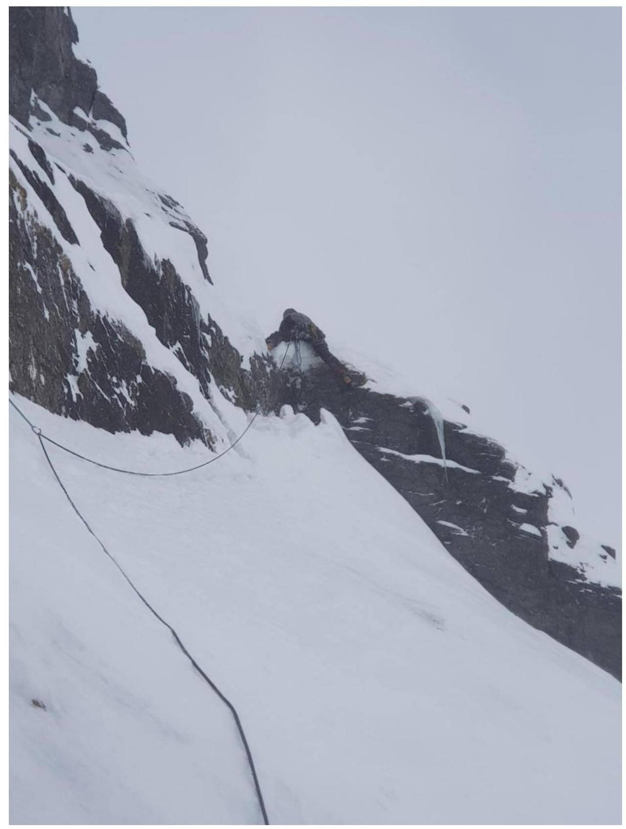
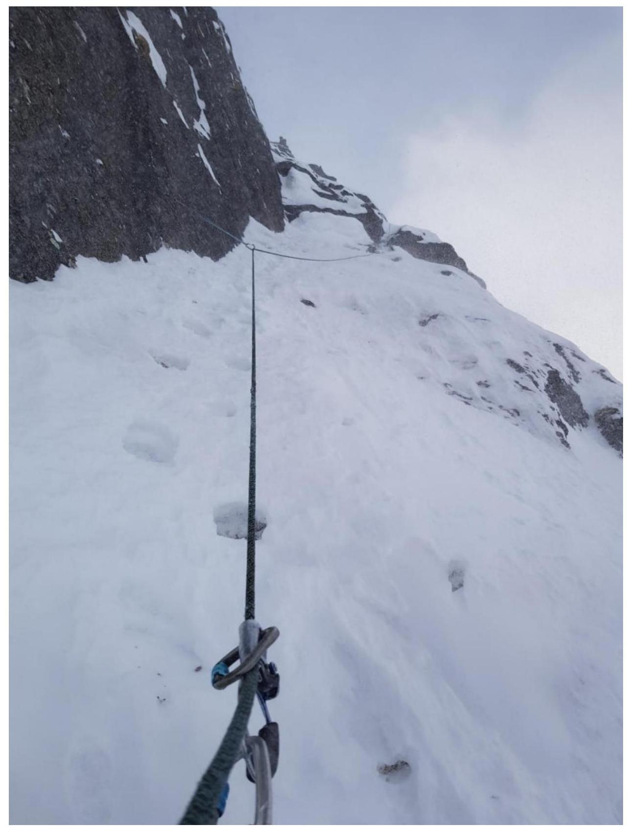
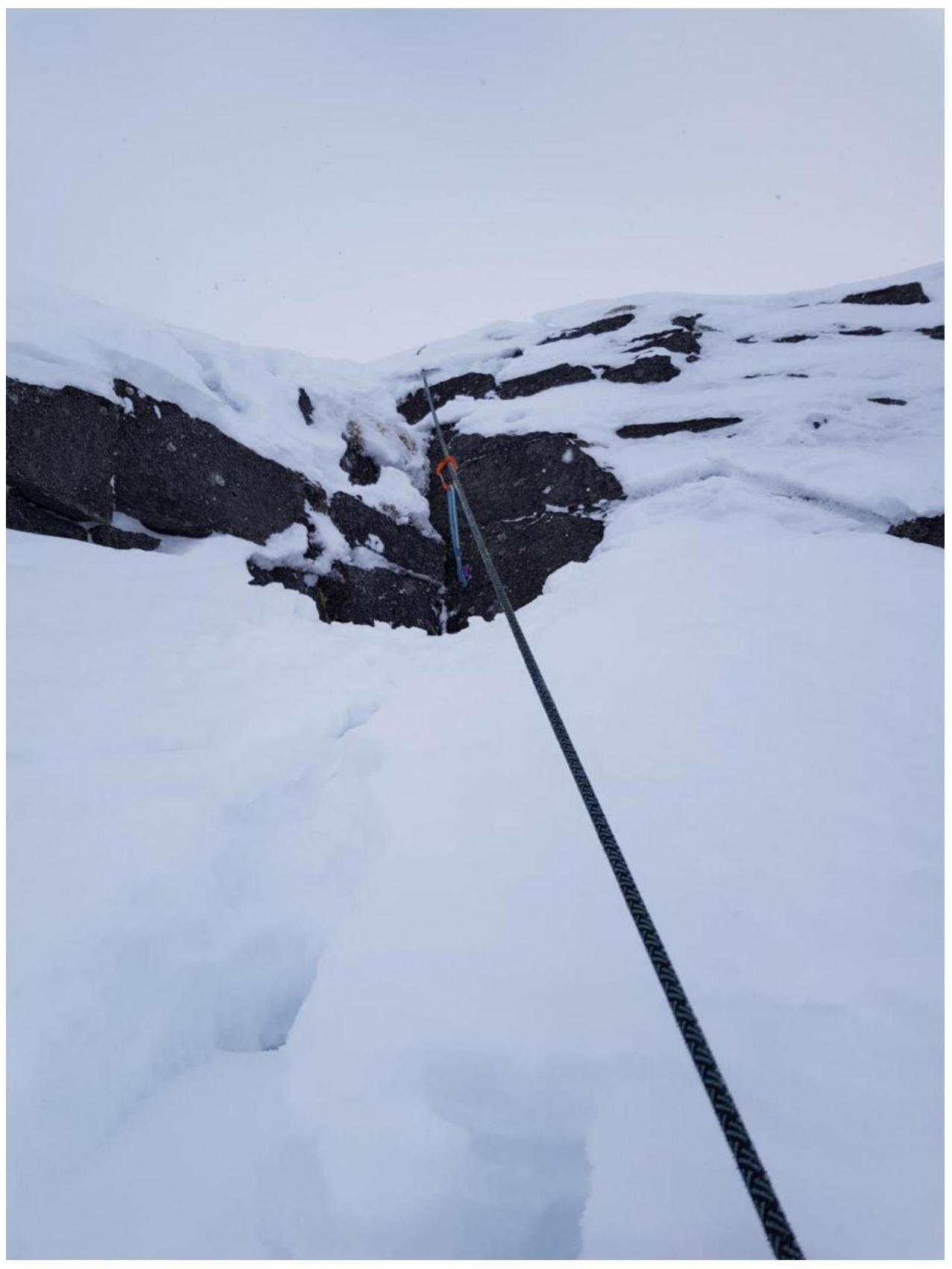
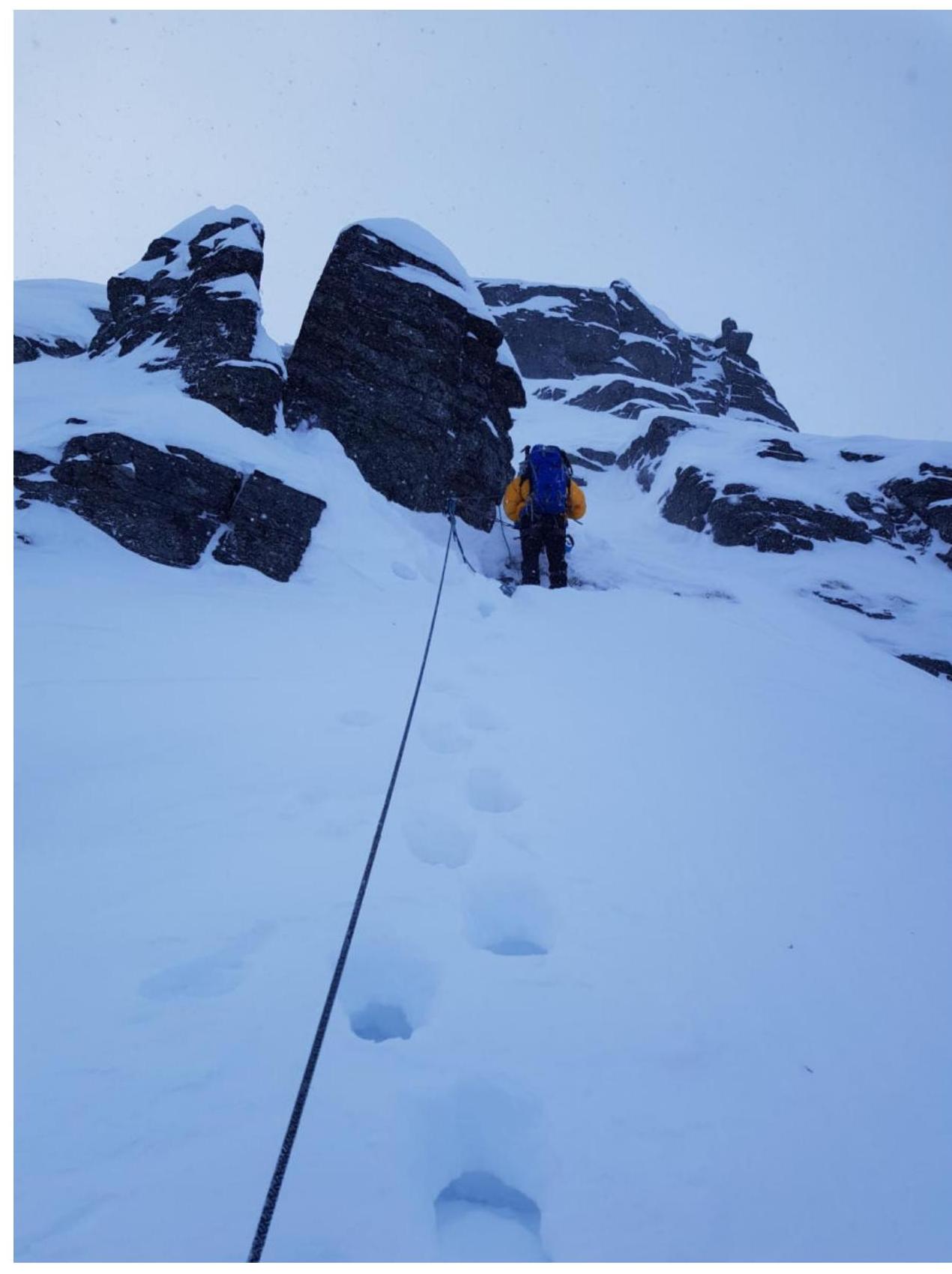
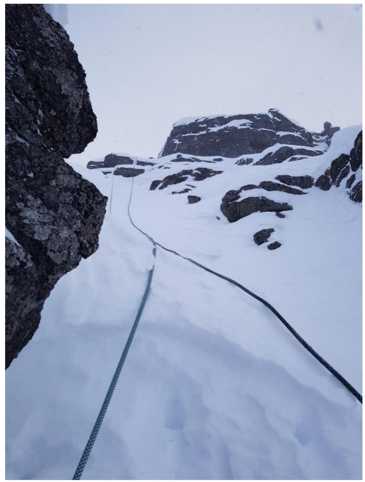
10. Photo Appendix
View from R1
Section R2–R3
View from R3
View from R4
Section R4–R5

Section R5–R6
Section R6–R7
View from R7

Section R7–R8
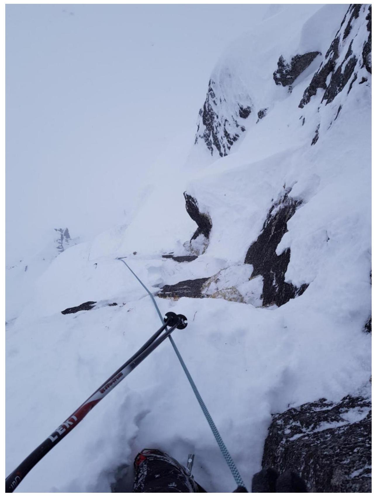
Section R7–R8
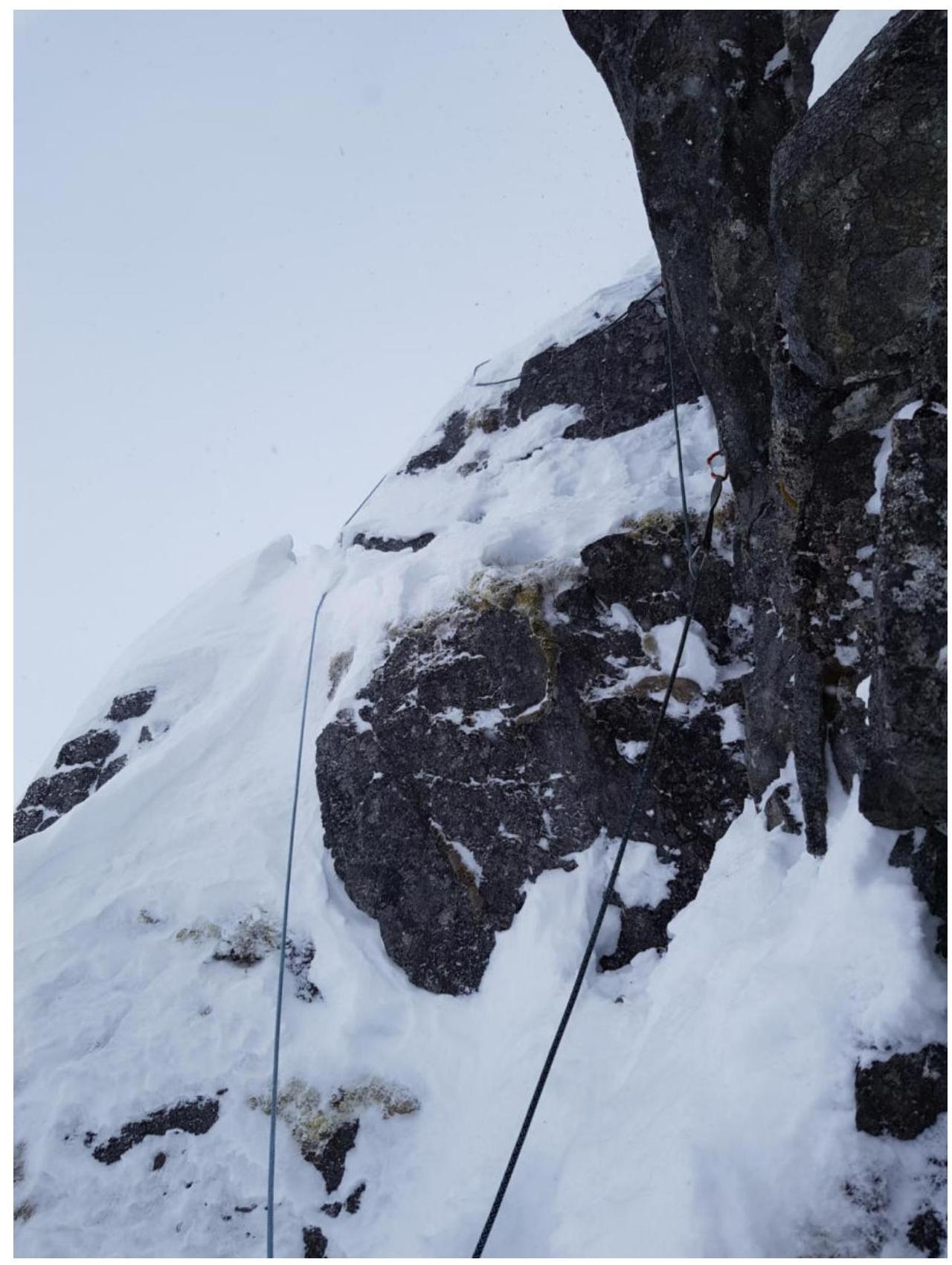
View from R8
Section R8–R9
On R9
Section R9–R10
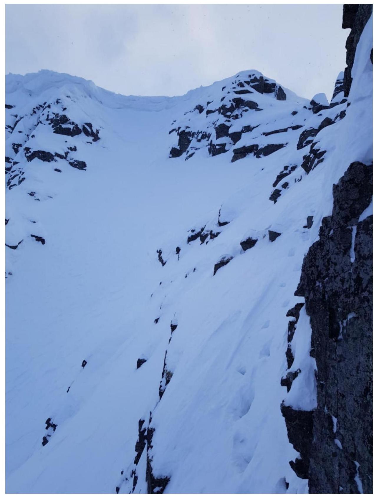
Ledge on section R9–R10, which needs to be pendulumed onto
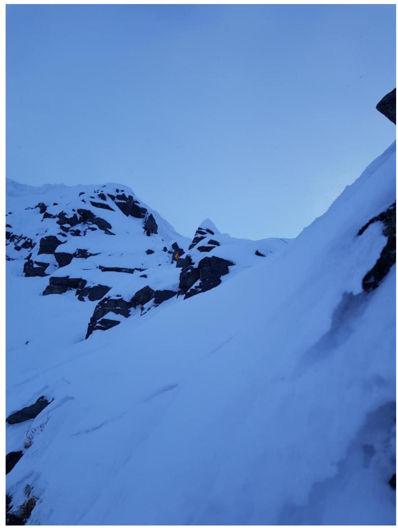
View from R10
View from R11
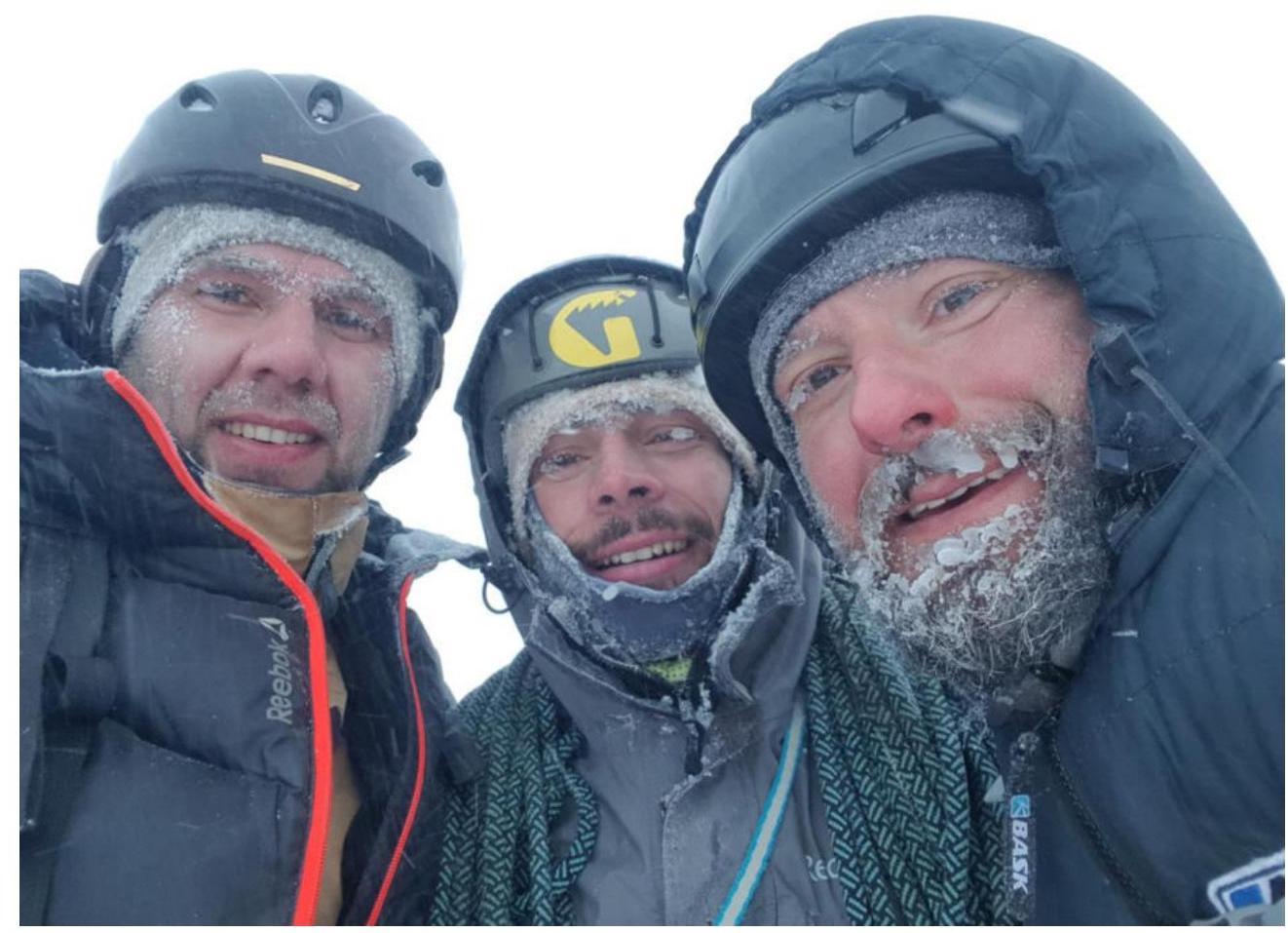
On the summit