Ascent Certificate for v. Partizan, 2428 m, via the Western ridge, cat. 2A
- Eastern Sayan, Tunkinskie Goltsy ridge, terrace of two cirques (Vetryany region), section 6.1.2.
- Partizan peak (2428), via the Western ridge.
- Proposed cat. 2A, first ascent.
- The nature of the route is rocky.
- Height difference 50 m, length 240 m, average slope 20°.
- Pitons driven: rock and wired 15 pcs.
- Team's walking hours — 4 hours.
- No overnight stays on the route.
- Group: Rozhin A.Yu. leader
Afanasyev A.E. MS, Vasilyev M.Yu. leader, Volodov A.N. leader, Pospelov A.S. leader, Trubin S.V. leader.
- Coach Afanasyev A.E. MS
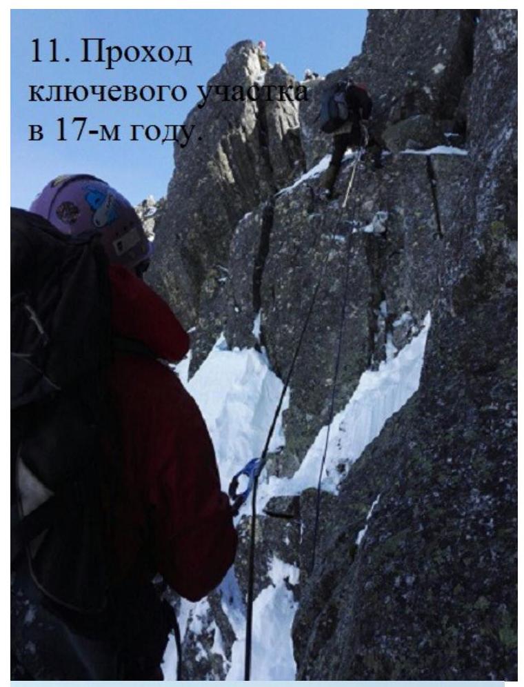
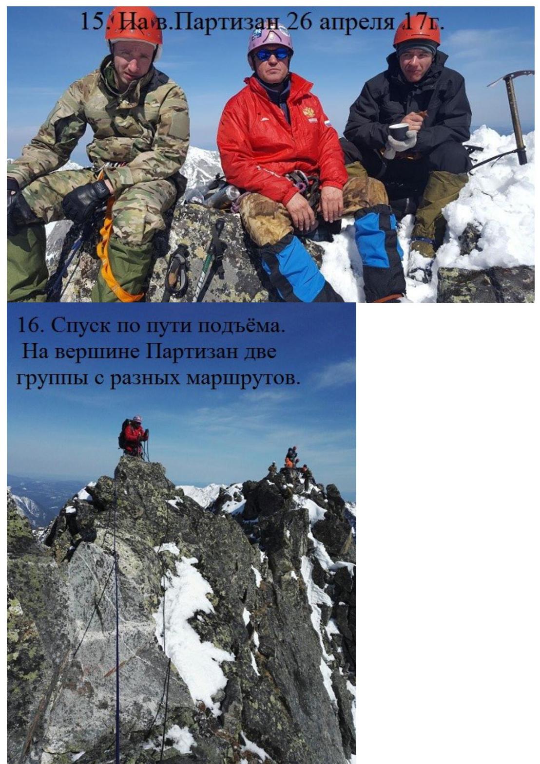
- Ascent to the summit and return on August 4, 2007. Second ascent made on April 26, 2017. The report includes photographs from different years.
Description of the route to v. Partizan 2428 m via the Western ridge, cat. 2A
From the base camp on Serebryanoe Lake, east along the terrace of Two Cirques to the southern ridge of Ulyabor mountain. Along the gentle grassy wide ridge, move left upwards to Ulyabor mountain 2420 m, where an old wooden triangulation point is located. This peak is marked on geographic maps but is not a dominant height or a separate peak. It is located on the watershed of the Tunkinskie Goltsy ridge.
Partizan peak:
- is located to the right of Ulyabor mountain, i.e., east along the ridge;
- is the highest point of the Ulyabor — Partizan massif;
- has a cirque with Ser'ga Sirotskaya Lake to the south;
- has a steep slope on the northern side, which forms the right border of the Arkhut gully.
The route starts from the triangulation sign. Since the ascent to v. Ulyabor cannot be included in the route, the route itself is short, but saturated and quite satisfactory for training groups, although more difficult than a standard cat. 2B.
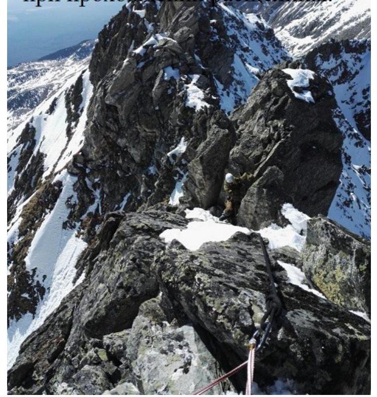
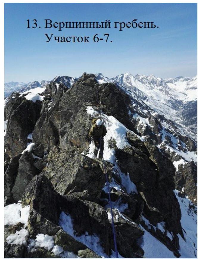
Sec. 0–1 40 m, I+ cat. To the east, left and down, along a 40° slope, bypassing the 1st sentinel. Sec. 1–2 50 m, II– cat. Left of the ridge, along a 55° slope, below a white rocky outcrop. 3 pitons. Sec. 2–3 30 m, III– cat. Further left, bypassing a rocky bastion, up and down along snow-covered inclined shelves on large rocks near a 90° wall. Piton belay. Sec. 3–4 8 m, 90°, V– cat. Wall with cracks. At the top, a 1.5 m traverse to the left. 3 pitons. Sec. 4–5 7 m, 5°, IV– cat. Passage between rocks with a crevice. Backpack is removed and passed forward. 2 pitons. Outlet onto the ridge. Sec. 5–6 15 m, 60°, III+ cat. Snow-covered wall. Outlet onto a sentinel. Station behind a protrusion. Sec. 6–7 90 m, II+ cat. Traverse of a sharp ridge. Belay on protrusions and 1 piton. Outlet onto Partizan peak 2428 m (GPS) from the west.
Descent via the ascent route. One rappel. The report is compiled based on descriptions and photographs of two ascents: 2007 and 2017.
| v. Partizan 2A | Length M | Slope ° | Difficulty B | Number of pitons V | |
|---|---|---|---|---|---|
| pitons V | placements E | ||||
| 90 | 0 | II– | 1 | ||
| + | 15 | 60 | III– | 1 | |
| :--: | :--: | :--: | :--: | :--: | :--: |
| + | 7 | 5 | IV– | 1 | 1 |
| 8 | 90 | V- | 2 | 1 | |
| + | 30 | 90 | III– | 3 | |
| + | 50 | 55 | II– | 3 | |
| + | 40 | 45 | I+ | 1 |
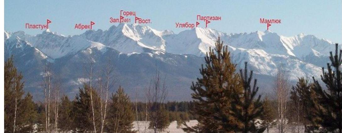
- Panorama of Vetreny, from the Tunkin valley to the right.
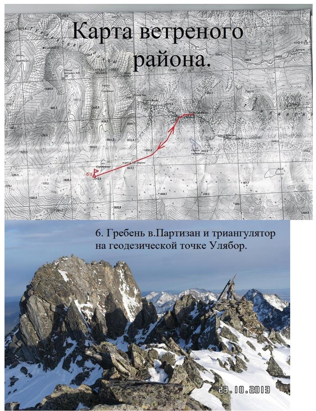
- Ridge of v. Partizan and triangulator on the geodesic point Ulyabor.

Fig.
10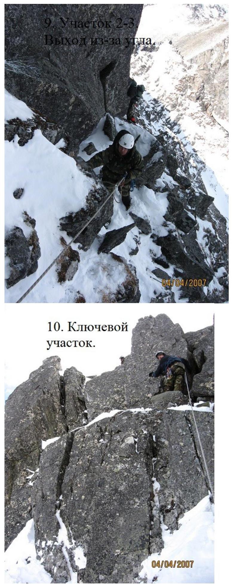
- Key section.
- On section 5. A participant demonstrates removing a backpack when passing through a crevice.
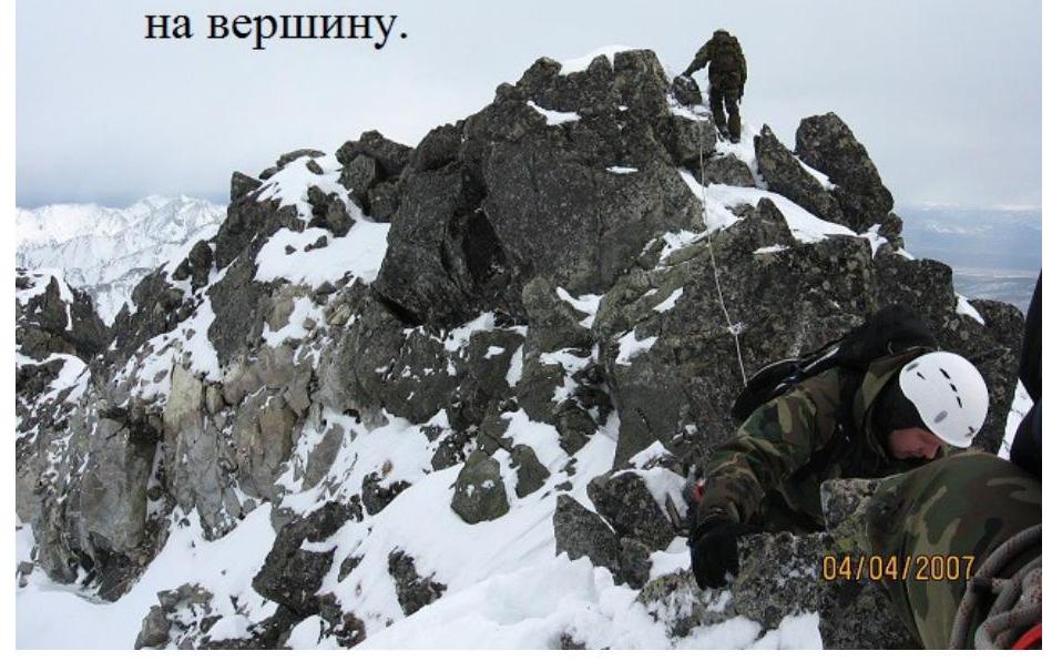
- First ascender reaching the summit.
- Descent via the ascent route.
Two groups on the summit of Partizan, having ascended via different routes.