REPORT
ON THE FIRST ASCENT TO THE SUMMIT OF OBMANCHIVAYA VIA THE SOUTHEAST COUNTERFORT OF THE SOUTH RIDGE, CATEGORY 3B ROUTE, BY THE TEAM OF GORY BAIKALA/NEVOZMOZHNO - ETO NE NAVSEGDA FROM 16.10.2018 TO 16.10.2018
Penza 2018
I. Ascent Passport
| 1. General Information | ||
|---|---|---|
| 1.1 | Full Name, Sports Rank of the Leader | Strokhov Maxim Sergeevich, 2nd sports rank |
| 1.2 | Full Name, Sports Rank of the Participants | Akhmetov Maxim Andreevich, 1st sports rank |
| 1.3 | Full Name of the Coach | Glazunov Evgeny Vladimirovich (Master of Sports) |
| 1.4 | Organization | Irkutsk Regional Public Organization "Club of Active Recreation and Climbing 'Gory Baikala'", project "Nevozmozhno - eto ne navsegda" |
| 2. Characteristics of the Ascent Object | ||
| 2.1 | Region | Eastern Sayan, Tunkinskie Goltsy ridge |
| 2.2 | Valley | Chertolen-Gorkhon |
| 2.3 | Number from the 2013 Classification Table | 6.1.2 |
| 2.4 | Name and Height of the Summit | Obmanchivaya, 3004 m |
| 2.5 | Geographical Coordinates of the Summit (latitude/longitude), GPS Coordinates | |
| 3. Characteristics of the Route | ||
| 3.1 | Route Name | Via the southeast counterfort of the south ridge |
| 3.2 | Proposed Category of Difficulty | 3B |
| 3.3 | Degree of Route Exploration | First ascent |
| 3.4 | Relief Character of the Route | Rocky |
| 3.5 | Height Difference of the Route (altimeter or GPS data) | 550 m |
| 3.6 | Route Length (in meters) | 1120 m |
| 3.7 | Technical Elements of the Route (total length of sections with different categories of difficulty, indicating the relief character) | non-cat. rocks 400 m. Category I rocks — 340 m. Category II rocks — 250 m. Category III rocks — 100 m. Category IV rocks — 28 m. Category V rocks — 0 m. Category V-VI rocks — 0 m. Category VI rocks — 0 m. Rocks VI, A3 — 0 m. Rocks VI, A4 — 0 m. |
| 3.8 | Descent from the Summit | Down the south slope and south ridge towards the saddle with the summit Optimist. Before reaching the limestone arch on the saddle, turn left and descend down the snowy, large-block and medium-block talus slope into the Chertolen-Gorkhon river valley. |
| 4. Characteristics of the Team's Actions | ||
| 4.1 | Time of Movement (team's working hours) | 6 hours |
| 4.2 | Overnights | No |
| 4.3 | Time of Route Preparation | — |
| 4.4 | Departure onto the Route | 8:00, October 16, 2018 |
| 4.5 | Summit Ascent | 14:00, October 16, 2018 |
| 4.6 | Return to Base Camp | 17:00, October 16, 2018 |
| 5. Characteristics of Weather Conditions | ||
| 5.1 | Temperature, °C | — |
| 5.2 | Wind Strength, m/s | — |
| 5.3 | Precipitation | — |
| 5.4 | Visibility, m | — |
| 6. Person Responsible for the Report | ||
| 6.1 | Full Name, e-mail | Strokhov Maxim Sergeevich macsimus.58@mail.ru |
II. Ascent Description
1. Characteristics of the Ascent Object
1.1. General Photo of Obmanchivaya Summit
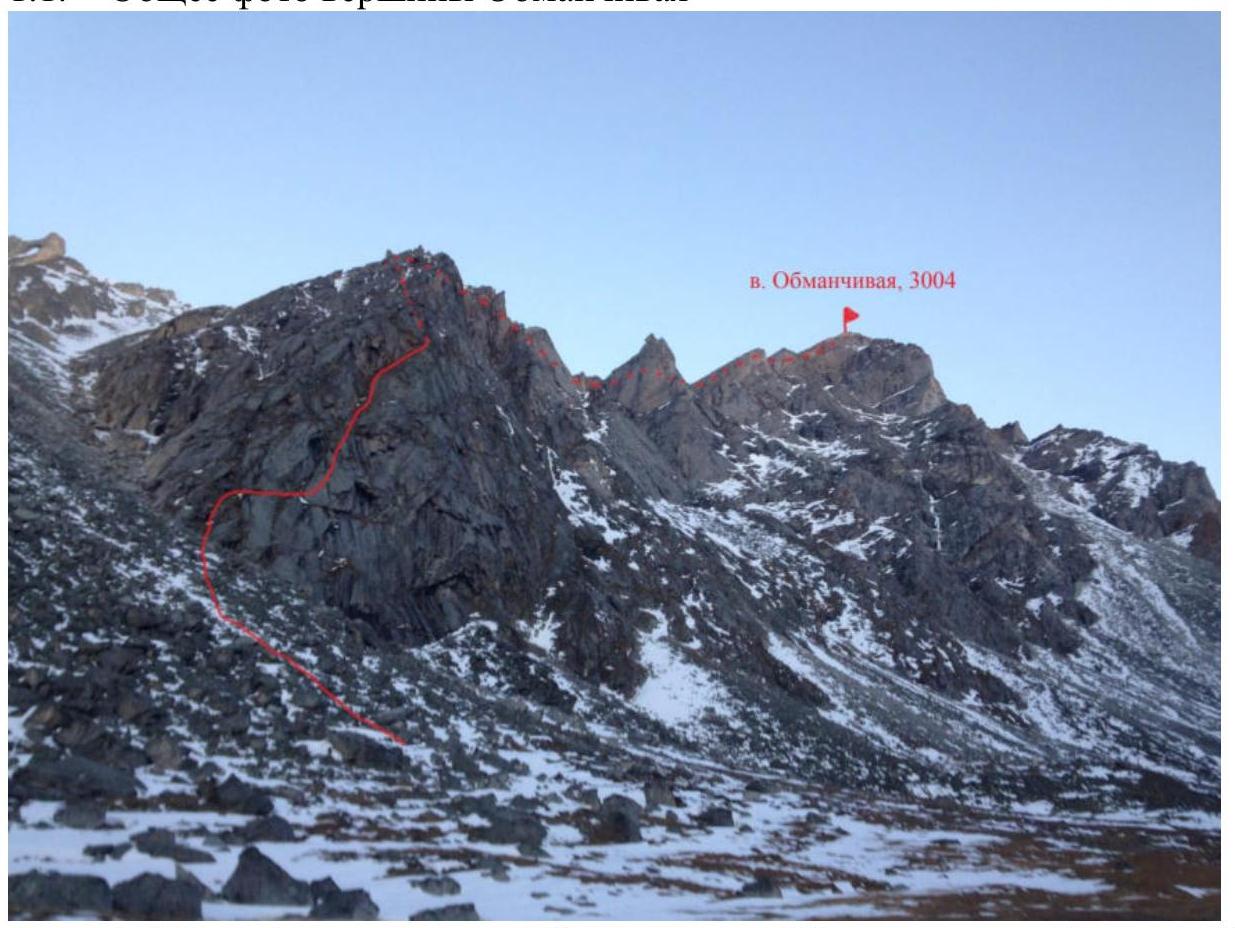
Photo 1. General photo of Obmanchivaya summit from the southeast from the Chertolen-Gorkhon river valley, showing the route taken, October 16, 2018.
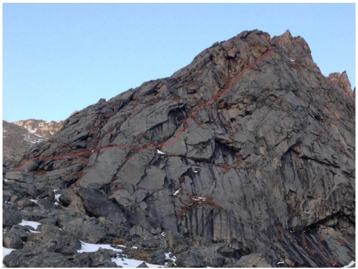
Photo 2. Obmanchivaya summit from the east, close-up.
1.2. Route Profile
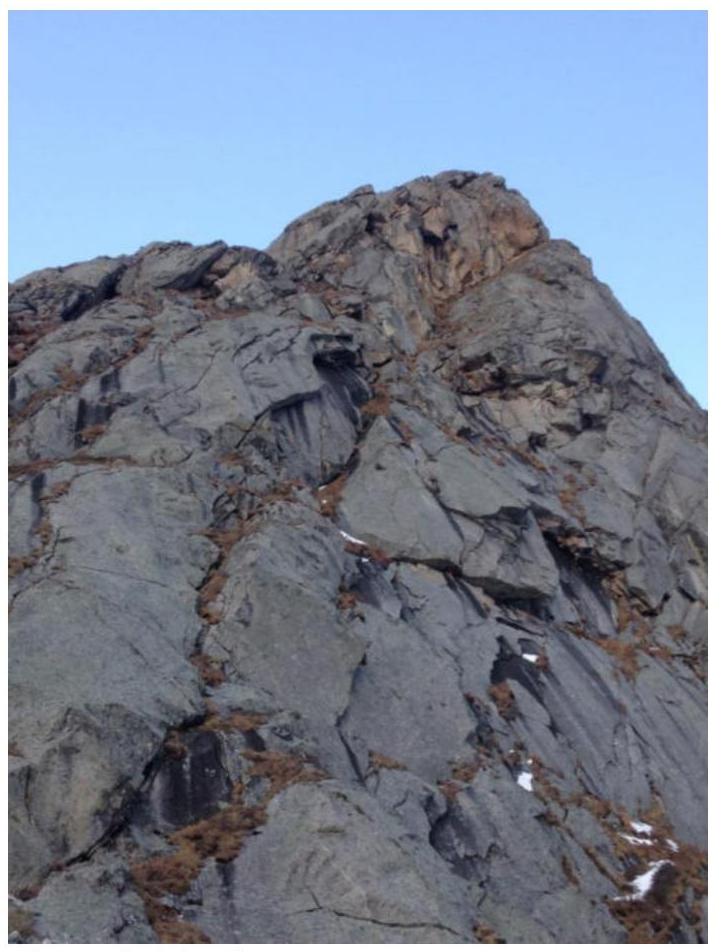
Photo 3. Route profile.
1.3. Photopanorama of the Area

Photo 4. Photopanorama of the upper Chertolen-Gorkhon valley from Shkolnaya summit.
1.4. Area Map
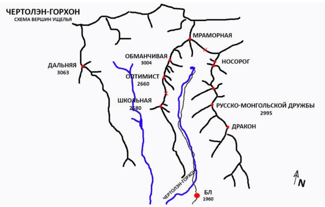
Photo 5. Map of Chertolen-Gorkhon valley.
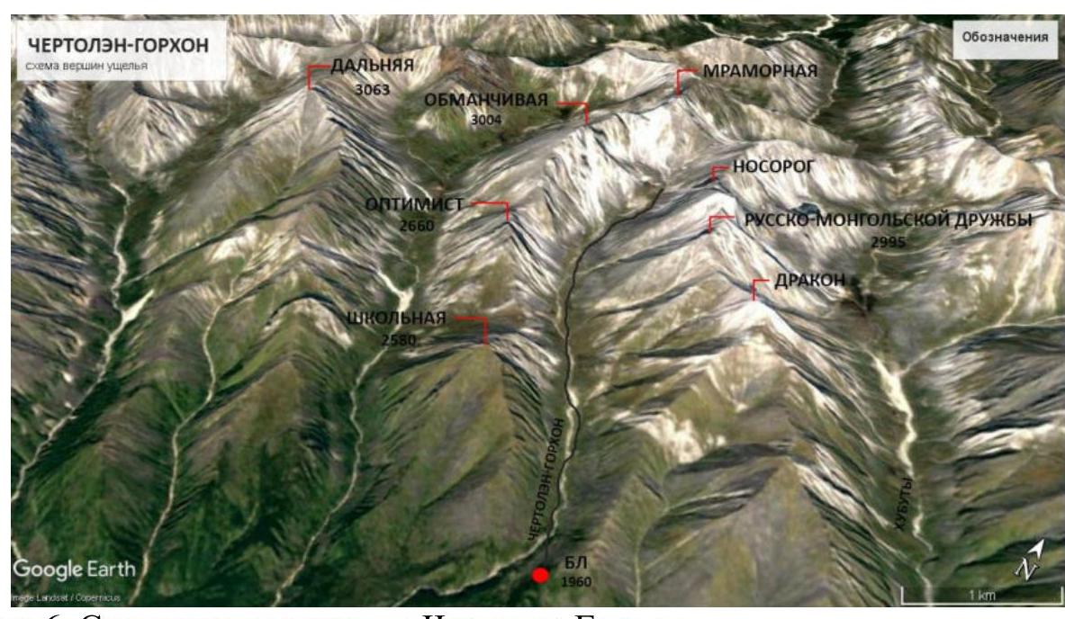
Photo 6. Schematic map of the summits in Chertolen-Gorkhon valley.
Obmanchivaya summit is located in the upper reaches of Chertolen-Gorkhon valley, Tunkinskie Goltsy ridge, Eastern Sayan region, west of the Khubuta river valley, which has a trail leading to Shumak mineral springs, a popular tourist route in our region. The nearest settlement is Nilova Pustyn and Khoito-Gol village in Tunkinsky district of Buryatia Republic (district center — Kyren village). From there, travel along the old road to "Sukhoy Ruchey" tourist base, then take a high-clearance vehicle or hike up the road to Chertolen-Gorkhon river, from where a good trail leads into the valley. The valley is a dead end and is regularly visited by local herb gatherers; it has a very straightforward approach. Horseback riding is possible along the trail to base camp. The valley's climbing potential allows for climbing events with ascents ranging from category 1B to 5A. The route follows a distinct internal angle formed by the southeast wall of the counterfort, leading to the south ridge. The chosen line is obvious and logical, visible upon approaching the summit, and will be of interest for future ascents. The approach to the route from base camp takes 2 hours. The route consists of ascending the internal angle (4 sections of medium/difficult climbing), traversing the ridge (500 m), and ascending a talus slope to the summit (250 m).
2. Characteristics of the Route
2.1. Technical Photograph of the Route
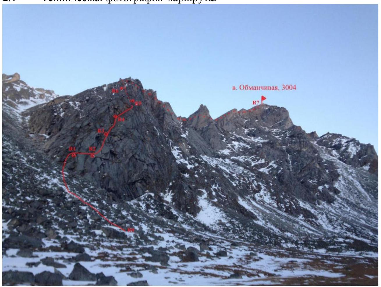
Photo 7. Technical photograph of the route.
2.2. Technical Characteristics of Route Sections
| Section # | Relief Character | Category of Difficulty | Length, m | Type and Number of Anchors |
|---|---|---|---|---|
| R0–R1 | Talus slope 30° | non-cat. | 130 m | 0 |
| Simple rocks 45° | I | 20 m | — | |
| R1–R2 | Horizontal grassy ledge 5° | I | 20 m | loop on a ledge × 1 |
| R2–R3 | Internal angle 55° | IV+ | 15 m | friend × 2, anchor hook × 1, stopper × 2 |
| Internal angle 55° | III | 20 m | — | |
| R3–R4 | Internal angle 50° | III | 55 m | friend × 1, anchor hook × 1, stopper × 2 |
| R4–R5 | Internal angle 55° | III | 15 m | friend × 3, loop on a block × 1, stopper × 1 |
| Internal angle 50° | II– | 20 m | — | |
| Wall 80° | IV | 3 m | — | |
| Internal angle 50° | II– | 15 m | — | |
| R5–R6 | Internal angle 45° | II– | 15 m | loop × 1, stopper × 2, friend × 1 |
| Inclined ledge 55° | III | 10 m | — | |
| Chimney 65° | IV+ | 10 m | — | |
| Slope 30° | non-cat. | 20 m | — | |
| R6–R7 | Ridge 10°–35° | I/II+ | 500 m | 0 |
| Talus slope 30° | non-cat. | 250 m | — |
3. Characteristics of the Team's Actions
3.1. The approach to the start of the route from base camp takes 2 hours. Follow the trail upstream along the river. The trail alternates between the left and right banks and leads into the valley. In the valley, bypassing Optimist summit, approach the southeast counterfort of Obmanchivaya summit and ascend the slope composed of medium and large blocks to the base of the counterfort. The starting point of the route is marked by a horizontal grassy ledge.
| Section # | Description | Photo # |
|---|---|---|
| R0–R1 | Ascend a talus slope and simple rocks to reach a horizontal ledge. 130 m 30° non-cat. 20 m 45° I. | — |
| R1–R2 | Traverse a horizontal grassy ledge to the start of the internal angle. Station on 2 friends. 20 m 5° I. | — |
| R2–R3 | Ascend a smooth inclined slab with minimal holds 15 m. 15 m 55° IV+. Then ascend an inclined slab with holds 20 m. Some sections have grass. Station on a block in the internal angle. 20 m 55° III. | Photo 9 |
| R3–R4 | Ascend an inclined, fractured slab with grassy sections. Station on friends in the angle. 55 m 50° III. | Photo 10 |
| R4–R5 | Ascend an inclined slab with grassy sections 25 m 55° III. Traverse a narrow grassy ledge left to a gap. 15 m 50° II–. The gap is passed via a wall above or below the ledge. 3 m 80° IV. Continue on the grassy ledge. Station on a block. 15 m 50° II–. | Photo 11, 12 |
| R5–R6 | Ascend a grassy ledge 15 m 45° II–. Traverse an inclined slab to the base of a chimney. 10 m 55° III. Ascend the chimney to the ridge. Climbing is difficult; protection in the upper part is problematic. Crux of the route. 10 m 65° IV+. Traverse the ridge. Station on a rock. 20 m 30° non-cat. | Photo 13 |
| R6–R7 | Traverse the south ridge 500 m, 10°–35° I/II+. Then ascend a large-block talus slope to the summit 250 m, 30° non-cat. | — |
3.2. Photo of the Team on the Summit with the Control Tour
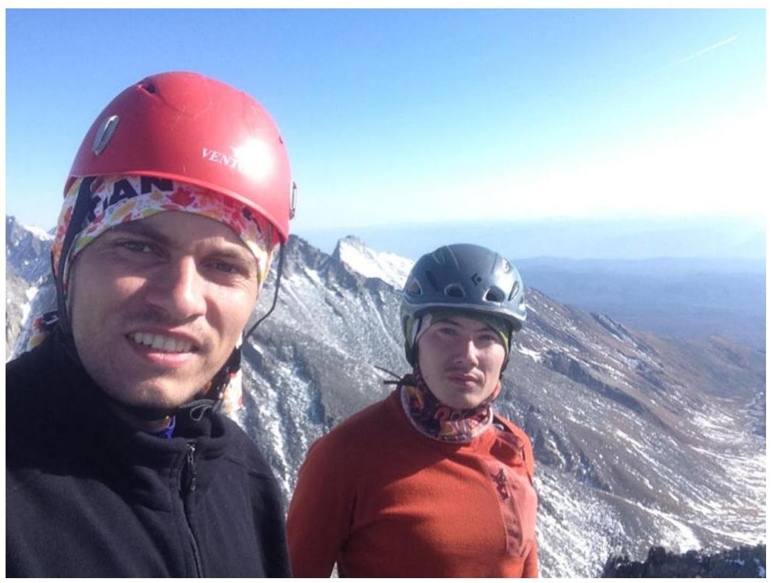
Photo 8. Team on Obmanchivaya summit.
3.3. Descent from the summit follows the ascent route down the south slope and south ridge towards the saddle with Optimist summit. Before reaching the limestone arch on the saddle, turn left and descend down a snowy, large-block and medium-block talus slope into Chertolen-Gorkhon river valley. The route is situated in an objectively safe area and is generally monolithic in its technical sections. Key sections of the route may pose difficulties after bad weather (ice, snow). Depending on snow conditions, crampons are recommended for participants. Communication with base camp is possible via radios.
3.4. Photo Report by Sections
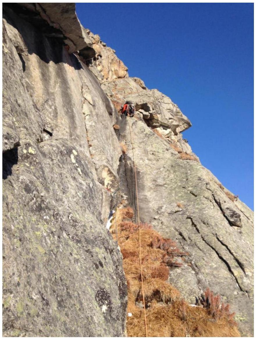
Photo 9. M. Akhmetov on section R2–R3.
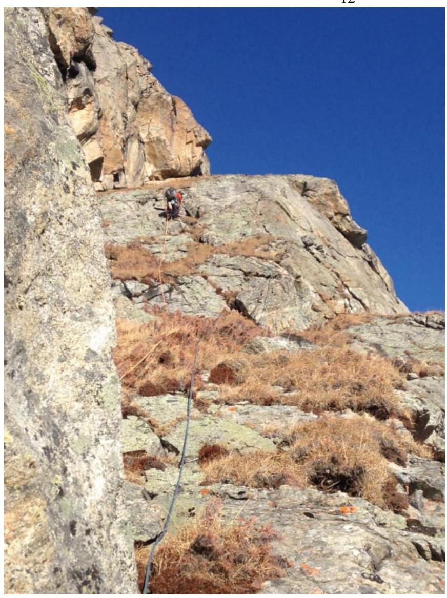
Photo 10. M. Akhmetov on section R3–R4.
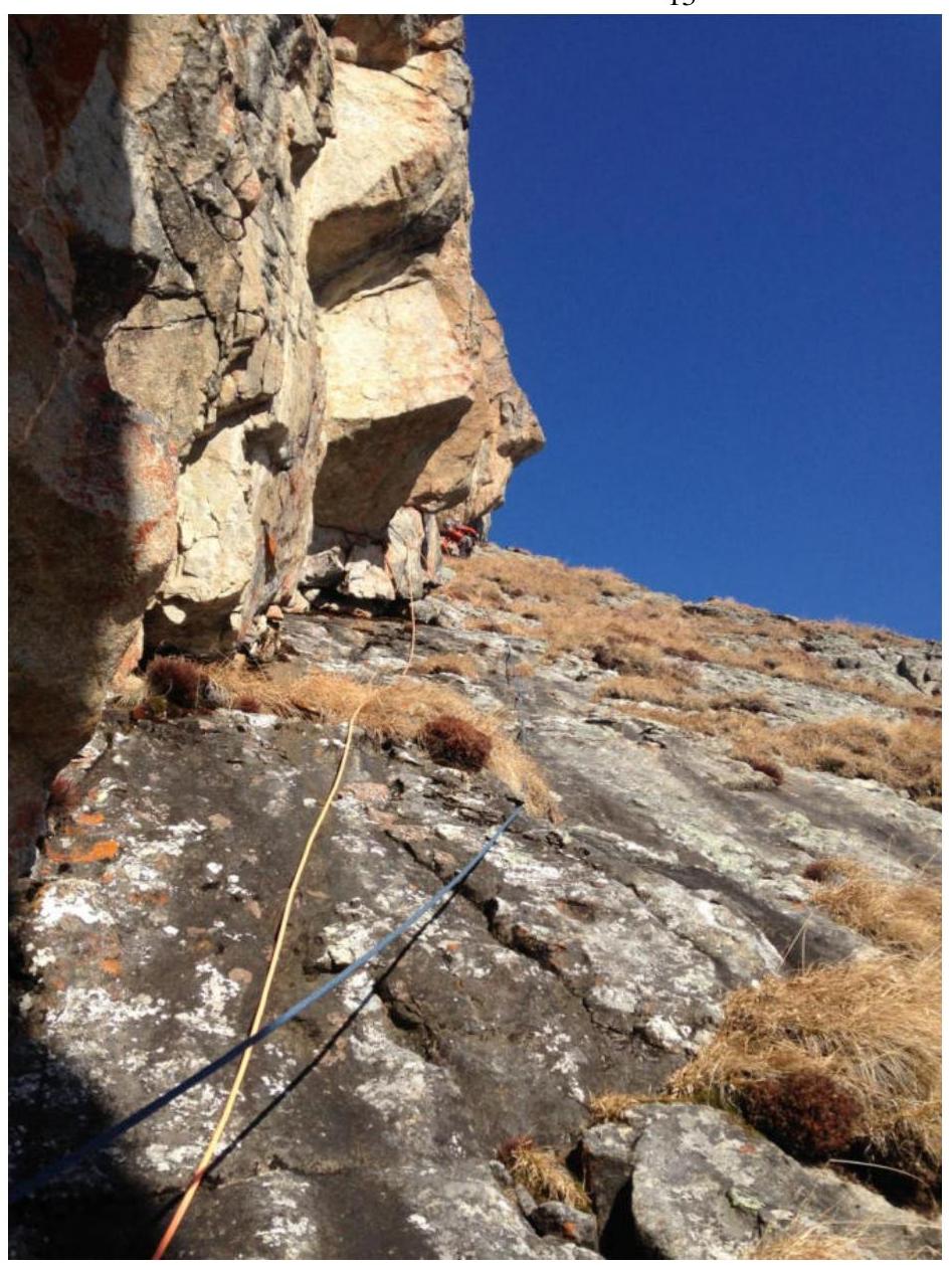
Photo 11. M. Akhmetov on section R4–R5.
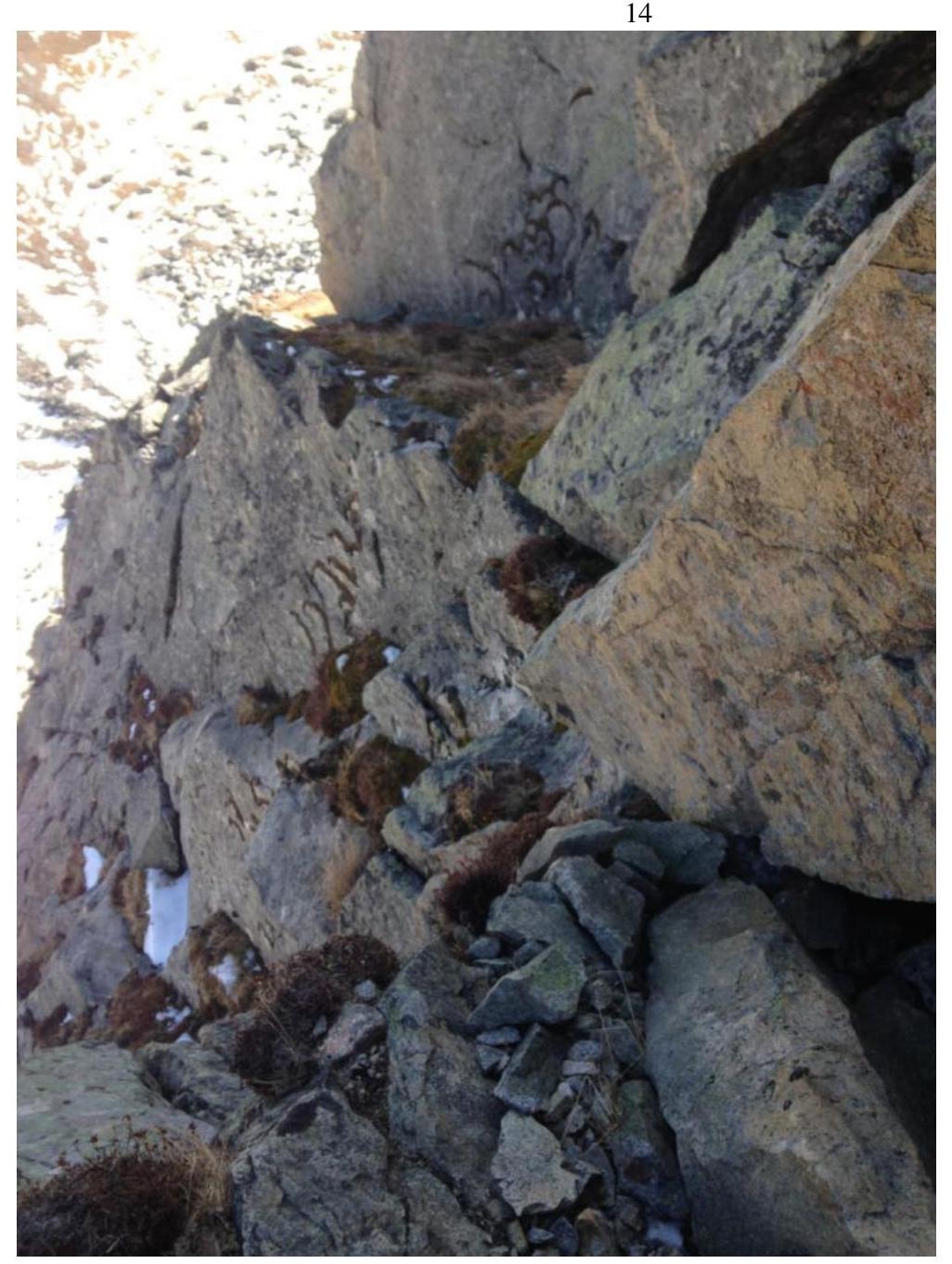
Photo 12. Gap in the grassy ledge on section R4–R5.
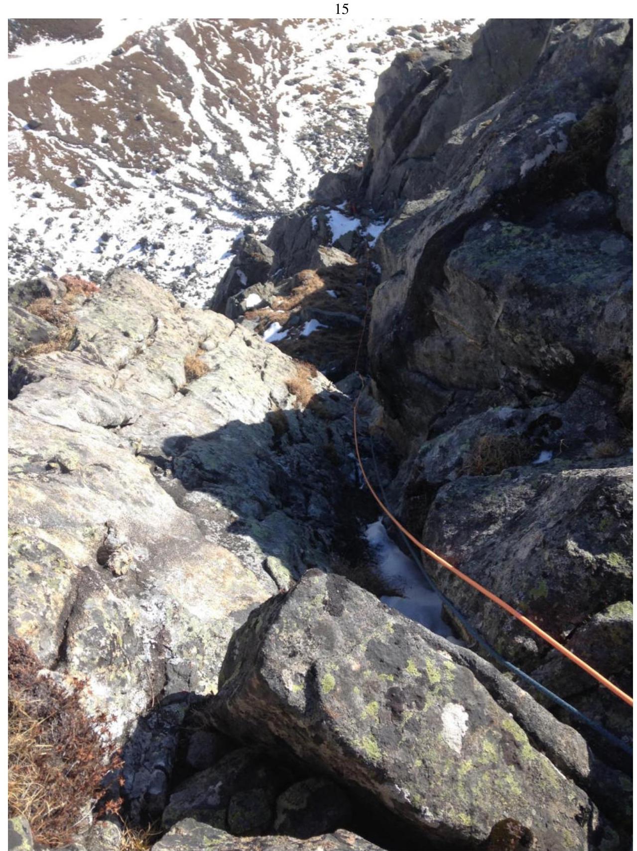
Photo 13. Section R5–R6. View from the top of the chimney.