Report
ON THE FIRST ASCENT TO THE SUMMIT OF NOSOROG VIA THE FIRST NORTH-WEST COUNTERFORT OF THE NORTHERN RIDGE, CATEGORY 4B DIFFICULTY BY THE GORY BAIKALA TEAM WITHIN THE FRAMEWORK OF THE PROJECT "IMPOSSIBLE IS NOT FOREVER" FOR THE PERIOD FROM OCTOBER 18, 2018 TO OCTOBER 18, 2018 Tomsk, 2018
I. Ascent Report
| No. | 1. General Information | |
|---|---|---|
| 1.1 | Full Name, Sports Rank of the Team Leader | Akhmetov Maxim Andreevich, 1st sports rank |
| 1.2 | Full Name, Sports Rank of the Participants | Strochkov Maxim Sergeevich, 2nd sports rank |
| 1.3 | Full Name of the Coach | Glazunov Evgeny Vladimirovich (Master of Sports) |
| 1.4 | Organization | Irkutsk Regional Public Organization "Club of Active Leisure and Alpinism 'Gory Baikala'" |
| 2. Characteristics of the Ascent Object | ||
| 2.1 | Region | Eastern Sayan, Tunkin Range |
| 2.2 | Valley | Chertolen-Gorkhon |
| 2.3 | Number of the Section According to the Classification Table 2013 | 6.1.2 |
| 2.4 | Name and Height of the Summit | Nosorog, 2950 m |
| 2.5 | Geographical Coordinates of the Summit (latitude/longitude), GPS Coordinates | 51°51′11.2″ N 101°37′53.9″ E |
| 3. Characteristics of the Route | ||
| 3.1 | Name of the Route | via the first north-west counterfort of the northern ridge |
| 3.2 | Proposed Category of Difficulty | 4B |
| 3.3 | Degree of Route Exploration | First Ascent |
| 3.4 | Character of the Route Terrain | Rock |
| 3.5 | Height Difference of the Route (altimeter or GPS data) | 300 m |
| 3.6 | Length of the Route (in meters) | 365 m |
| 3.7 | Technical Elements of the Route (total length of sections of various difficulty categories indicating the terrain character) | Category I ridge — 80 m, Category II rocks — 30 m, Category III rocks — 165 m, Category IV rocks — 50 m, Category V rocks — 40 m |
| 3.8 | Descent from the Summit | 100 m along the SE ridge, rappel 25 m to a saddle, descent into the Gorkhon river valley along a scree slope |
| 3.9 | Additional Characteristics of the Route | Lack of water, the route is illuminated late, 60 m ropes, rock shoes are mandatory |
| 4. Characteristics of the Team's Actions | ||
| 4.1 | Time of Movement (team's working hours) | 6 hours |
| 4.2 | Overnight Stays | none |
| 4.3 | Departure onto the Route | 10:00, October 18, 2018 |
| 4.4 | Arrival at the Summit | 16:00, October 18, 2018 |
| 4.5 | Return to the Base Camp | 19:00, October 18, 2018 |
| 5. Person Responsible for the Report | ||
| 5.1 | Full Name, e-mail | Akhmetov Maxim Andreevich, mizenok-max@mail.ru |
II. Description of the Ascent
1. Characteristics of the Ascent Object
1.1. General photo of the Nosorog summit (taken from Optimist peak on October 19, 2018)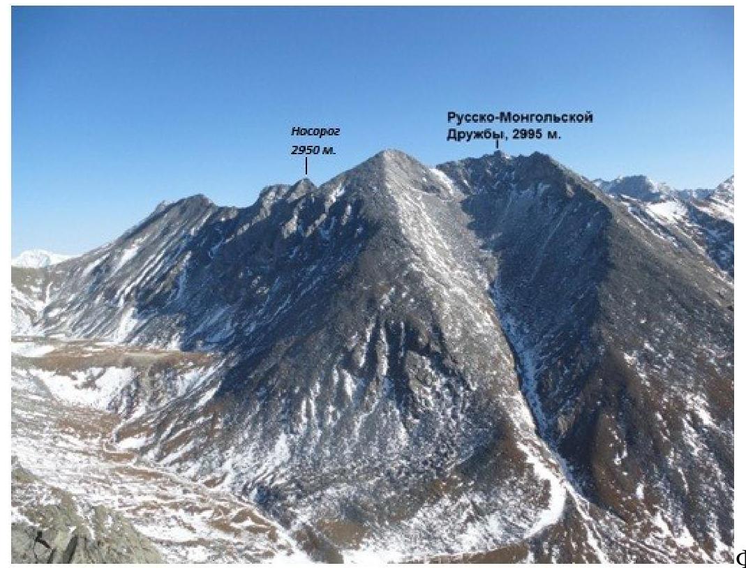
Photo 1.
1.2. Photo of the route profile (taken from Obmanchivaya peak on October 15, 2018)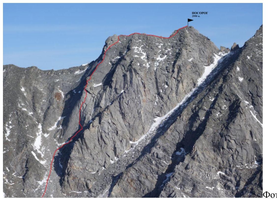
Photo 2.
1.3. Photopanorama of the area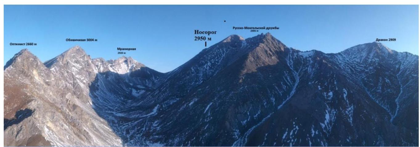
Photo 3.
1.4. Map of the area.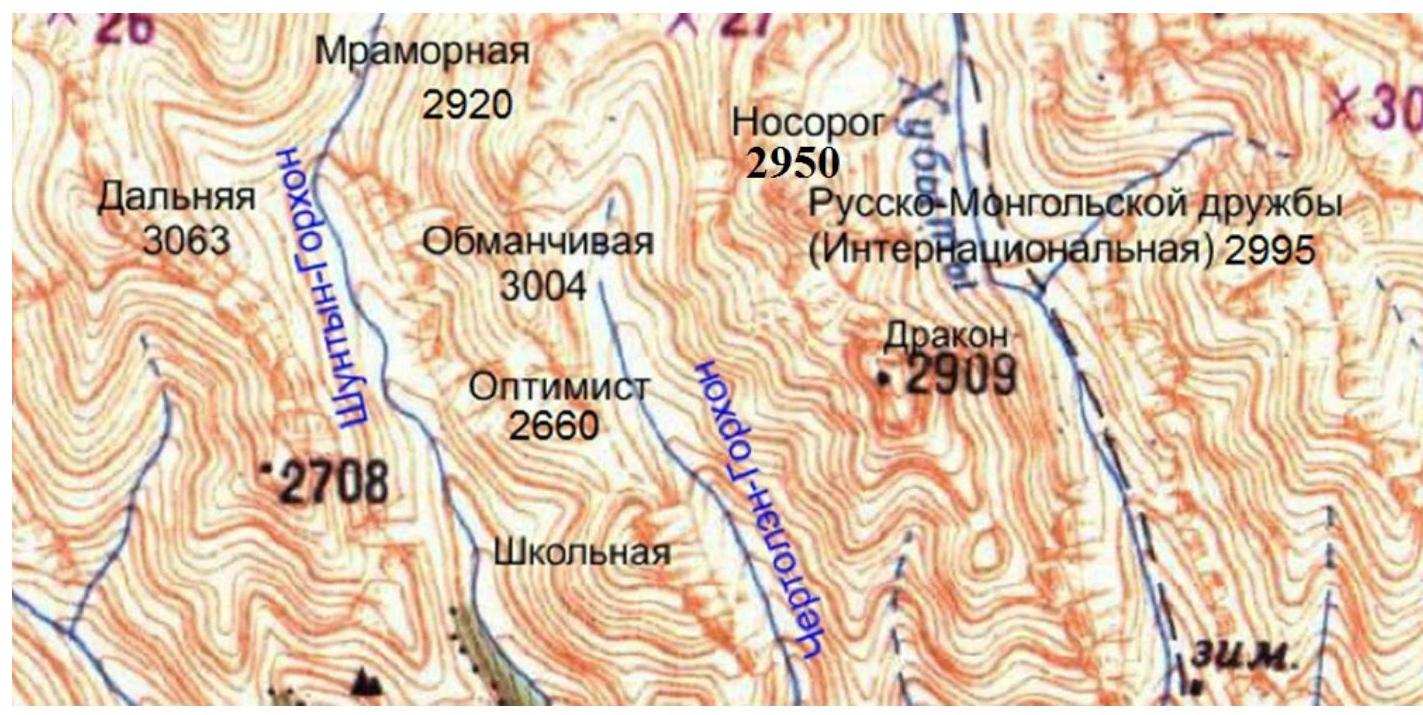
Photo 4. The Nosorog summit is located in the upper reaches of the Chertolen-Gorkhon valley of the Tunkin Range in the Eastern Sayan, to the west of the Khubuty river valley, along which a trail leads to the Shumak mineral springs, a popular tourist route in the region.
Nearest settlements:
- Nilova Pustyn settlement
- Khoito-Gol village, Tunkinsky district, Buryatia Republic (district center - Kyren settlement)
Route:
- travel along the old road to the "Sukhoy Ruchey" tourist base;
- further transportation by a high-passability vehicle up the road, or on foot to the Chertolen-Gorkhon river, from where a good trail leads into the valley.
Characteristics of the valley:
- dead-end;
- regularly visited by local herb and wild food gatherers;
- has a very simple approach;
- horseback transportation to the base camp is possible along the trail.
In terms of mountaineering, the valley's potential allows for mountaineering events with ascents from Category 1B to 5A difficulty.
The ascent to the Nosorog summit is also a second ascent. There are no classified routes to the summit. The approach to the route from the base camp takes 2–2.5 hours.
2. Characteristics of the Route
2.1. Technical photograph of the route.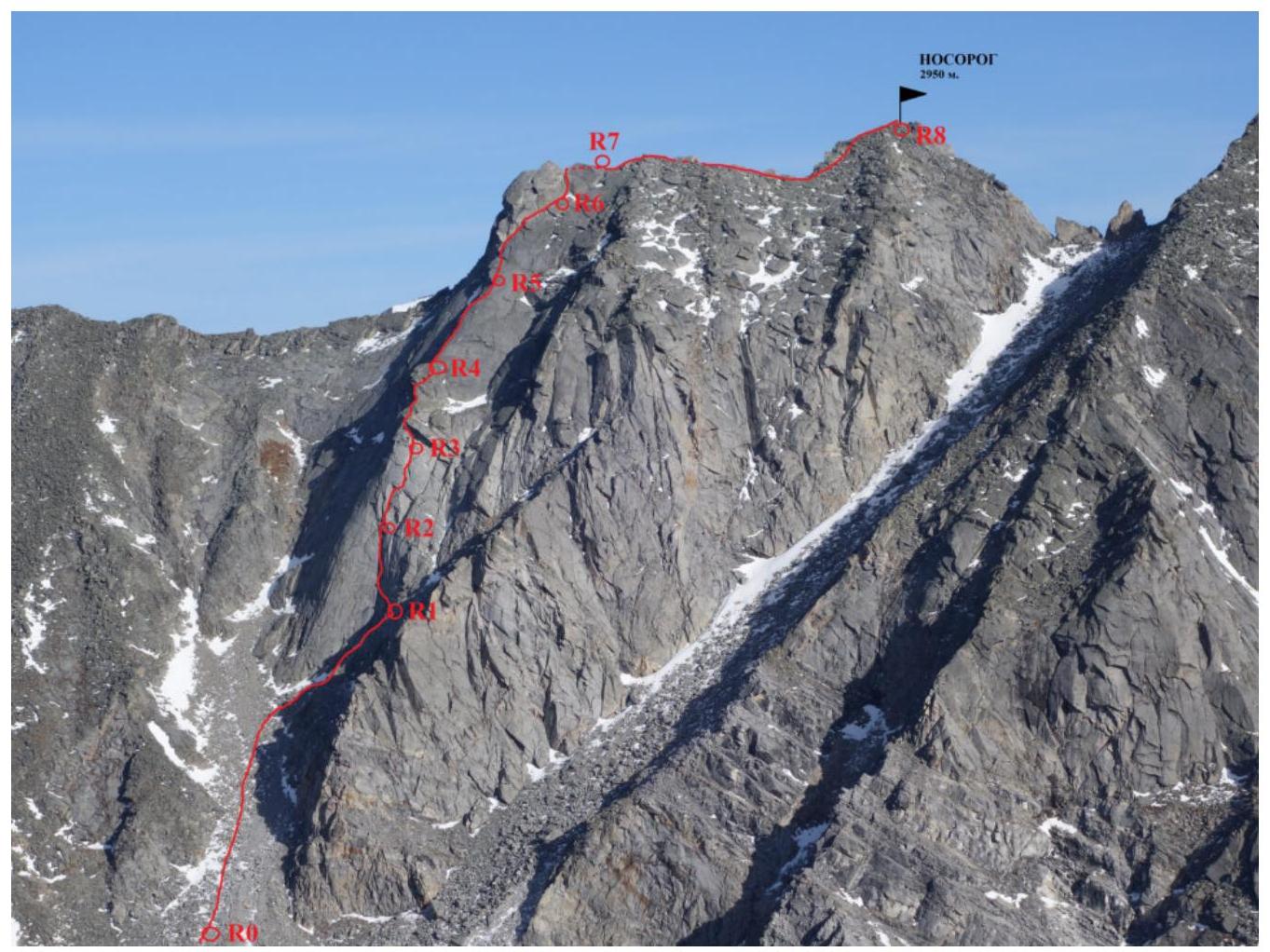
Photo 5. The start of section R0 is not visible in the photo.
Route Diagram in UIAA Symbols
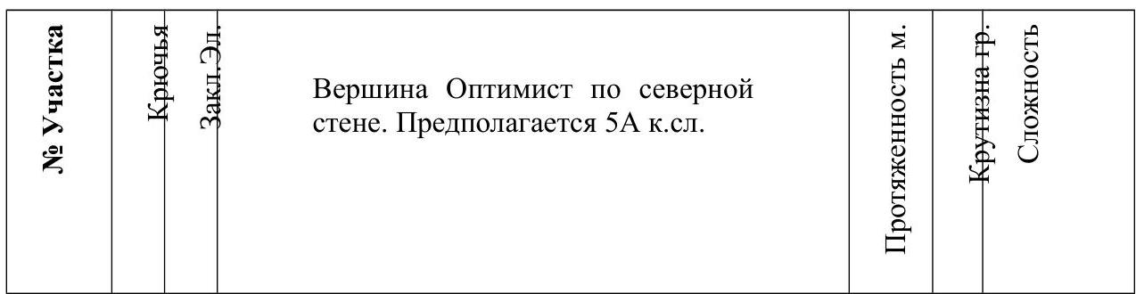
The Optimist summit via the northern wall. Assumed Category 5A difficulty.
| Section No. | Pitons | Cams | Image | Length, m | Steepness, degrees | Difficulty |
|---|---|---|---|---|---|---|
| R6–R7 | 1 | 2 | 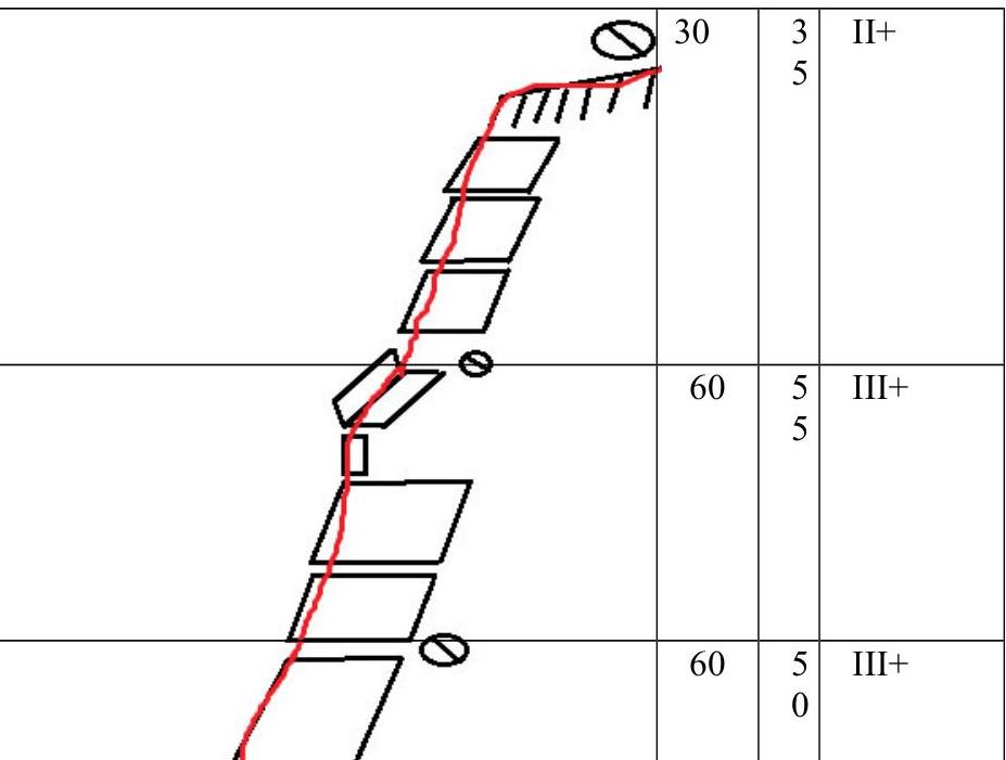 | 30 | 35° | II+ |
| R5–R6 | 0 | 2 |  | 60 | 55° | III+ |
| R4–R5 | 0 | 3 | 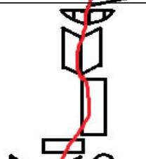 | 60 | 50° | III– |
| R3–R4 | 1 | 4 | 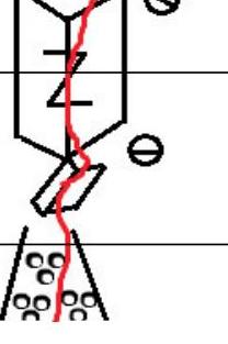 | 45, 10 | 50–95° | III, IV |
| R2–R3 | 2 | 6 |  | 40 | 70° | IV |
| R1–R2 | - | 6 |  | 40 | 70° | V+ |
| R0–R1 | - | - |  | 10, 30, 0 | 50°, 30° | II– |
3. Characteristics of the Team's Actions
3.1. Brief description of the route passage:
Approach to the route:
- Exit from the base camp into the main valley;
- Approach along the trail alongside the riverbed to its source — a lake located at an elevation of ~20 m;
- Movement along the plain alongside the scree on the right side;
- After passing 2-meter boulders, we find ourselves opposite the route (to the right, northeast);
- 300 m ascent up a medium-block scree to the base of the left counterfort.
| Section No. | Description | Photo No. |
|---|---|---|
| R0–R1 | Approach along the scree to the base of the counterfort, on the right plane an internal corner is visible, transitioning into a system of cracks, we move 30 m along the scree to its beginning. 10 m of несложного лазания. Station on anchor pitons to the right of the line of falling stones. | 7 |
| R1–R2 | Movement 40 m along a fragmented internal corner, belay with cams. Key section of the route. Station on friends. | 8 |
| R2–R3 | Movement 40 m. Transition along a system of cracks to the right into a parallel crack going under a large cornice. Station — friends, pitons, on a ledge 10 m before the cornice. | 9 |
| R3–R4 | Movement 55 m. 10 m along the cornice to its right part, where it narrows. A small chimney leads to the roof of the cornice. From here, 45 m along inclined slabs along the line of the ridge (an unfolded external corner) on the right part. A non-obvious jendarme is bypassed on the right, and we arrive at a convenient mulda in the ridge. Station on cams. It is desirable to exit onto the entire rope and attempt to make a station a bit further. | 9, 10 |
| R4–R5 | Movement 60 m. 7 m of несложного лазания towards the ridge. Belay with cams. Further movement 55 m along "катушкам" on good friction (rock shoes), virtually without the possibility of organizing belay (1 anchor in the middle). At the end — the only place for a station. Station on anchor pitons. | 10 |
| R5–R6 | Movement 60 m. 25 m along "катушкам" to overhanging rocks, bypassed on the right closely. Movement along the rocks via an internal corner towards the pre-summit ridge. Station on friends. | 11 |
| R6–R7 | Movement 60 m. 25 m несложного лазания to exit onto the pre-summit scree ridge. Exit onto the entire rope along the ridge, upper belay through oneself or via the terrain. | 11 |
| R7–R8 | 100 m несложного osypnogo гребnya to the summit. The summit is gentle, convenient. | - |
3.2. Photo of the team on the summit with the control tour.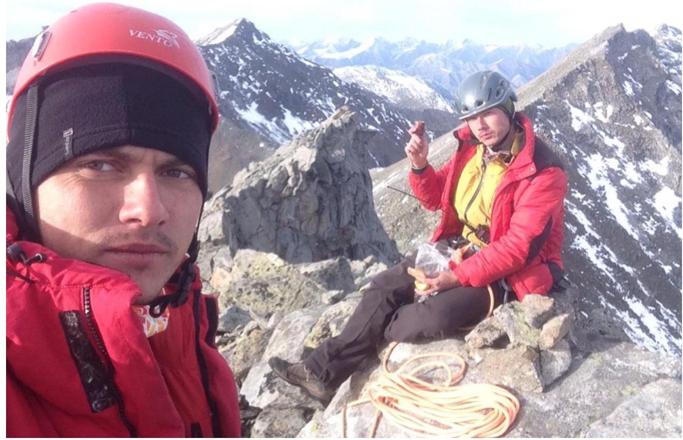
Photo 6. On the summit "Nosorog" Strochkov M. and Akhmetov M.
3.3. Descent from the summit along the SE ridge to the pass:
- 50 m along the scree ridge to rocky outcrops.
- 10 m before the outcrops, bypass the rocky spires in the ridge on the left (NE) side.
- A hanging spare loop is visible.
- Rappel 25 m.
- Pedestrian descent along a medium-block scree to the lake in the Chertolen-Gorkhon river valley.
The route has hazardous sections in the technical part — infrequent live rocks and even blocks. Key sections of the route, as well as sections traversed on friction, may present difficulty after bad weather (rime ice, snow, wet rocks). The use of IT is possible. It is recommended to ascend the route.
According to the ascendants' assessments, the route corresponds to similar Category 4B difficulty routes in the Western Sayan.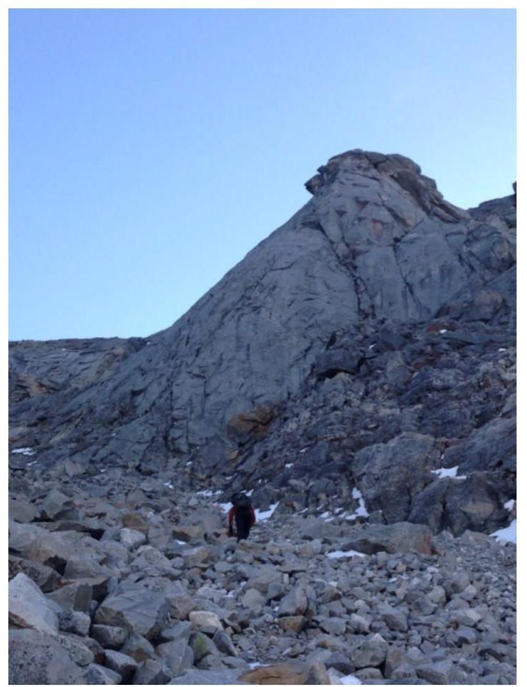
Photo Report by Sections
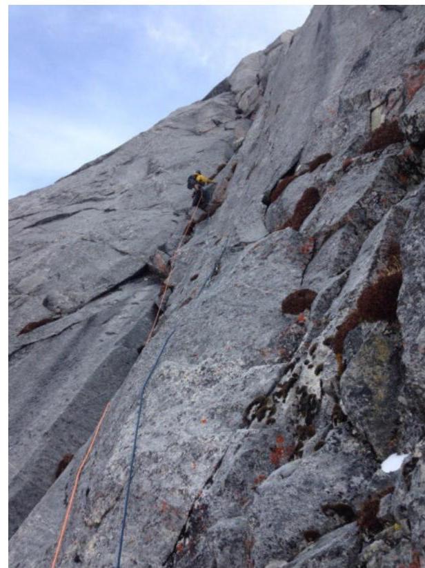
Photo 7. Section R0–R1. Ascent along the scree, 10 m несложного лазания.
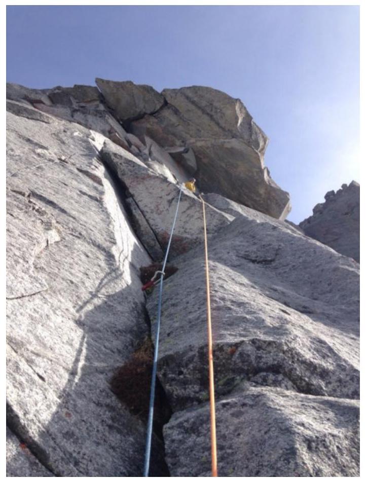
Photo 8. Section R1–R2. Akhmetov M. working.
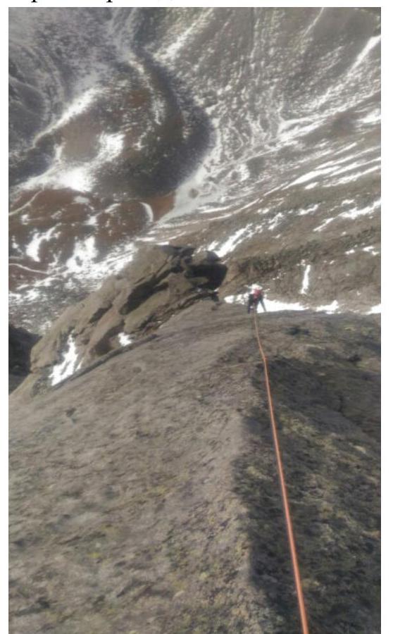
Photo 9. End of section R2–R3. The start of section R3–R4 — a cornice, passable on the left part, is visible. Akhmetov M. on station.
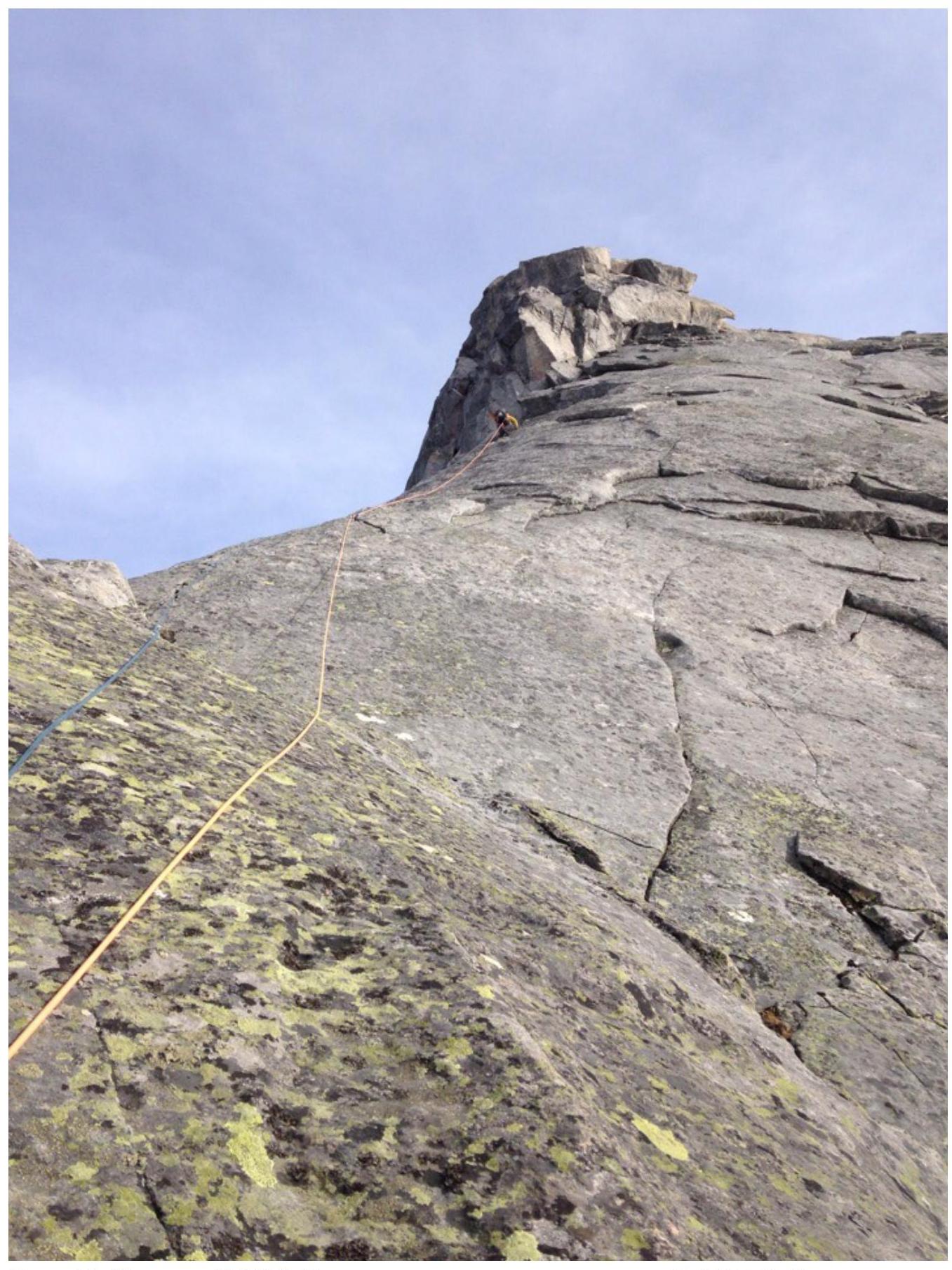
Photo 10. Section R4–R5. Strochkov M. working second. The end of section R3–R4 is visible.

Photo 11. Section R5–R6. Part of section R6–R7 is visible. Akhmetov M. working.
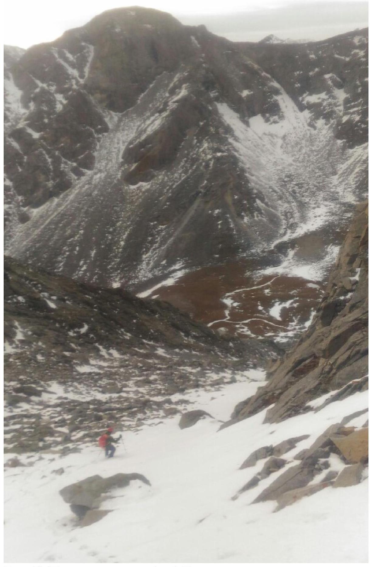
Photo 12. Start of descent from the summit along the SE ridge. Strochkov M. on photo.
Photo 13. (After the rappel section) Start of descent along a wide scree couloir into the Chertolen-Gorkhon river valley. Strochkov M. on photo.