Report on the First Ascent
Peak Neftekhimik (2850 m) Right South Counterfort of the Eastern Ridge Route 3A cat. diff. (proposed), first ascent Eastern Sayan, Tunkinskie Goltsy ridge, Barun-Khandagai valley, 6.1
Team Leader: Ometov A.A. Participants:
- Klepikov A.A.
- Putko K.V.
-
Eastern Sayan, Tunkinskie Goltsy ridge, Barun-Khandagai valley, 6.1.
-
Peak Neftekhimik (2850 m), right South counterfort of the Eastern ridge.
-
Proposed - 3A - first passage.
-
Route type: rock climbing.
-
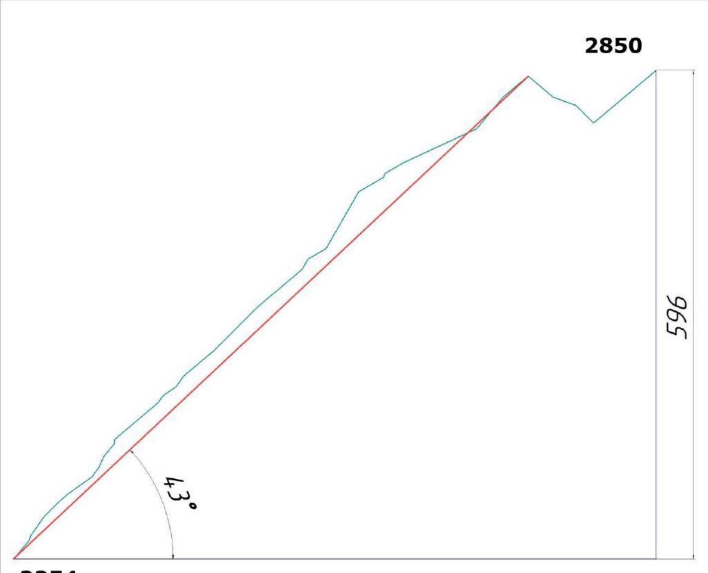
Route elevation gain: 596 m Route length: 1065 m Main part elevation gain: 596 m Main part length: 1065 m Section lengths:
- V cat. diff. - 5 m
- IV cat. diff. - 20 m
- III cat. diff. - 215 m Average steepness of the main part: 43°
-
Pitons left on the route: total: 0; including bolted: 0 Total used on the route:
- bolted pitons - 0
- rock pitons (including anchors) - 18
- chocks - 2
- friends - 31
- sky-hooks (including sky-hook moves) - 0 Total number of artificial support points: 0
-
Team's total climbing hours (to the summit) - 7:00; days - 1 Number of bivouacs on the route - 0
-
Team Leader: Ometov Alexander Alexandrovich (2nd sports category) Participants:
- Klepikov Alexander Alexandrovich (Master of Sports)
- Puntko Konstantin Vladimirovich (2nd sports category)
-
Team Coach: Afanasiev Andrei Evgenievich (Master of Sports), 1st cat. diff.
-
Departure to the route: 7:00, August 2, 2013. Summit arrival: 14:00, August 2, 2013. Return to Base Camp: 16:00, August 2, 2013.
-
Report author: Klepikov A.A. (Baikalteam@Gmail.com)
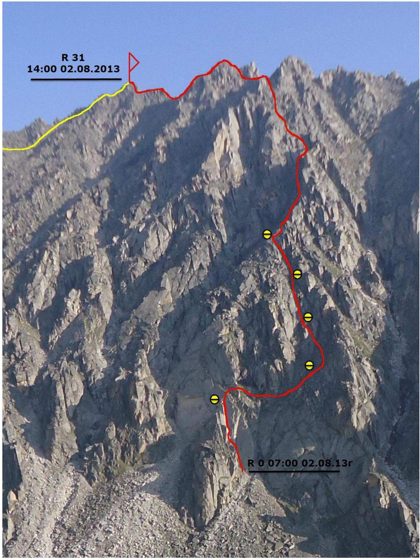
General View Photo of the South Slope of Neftekhimik Mountain
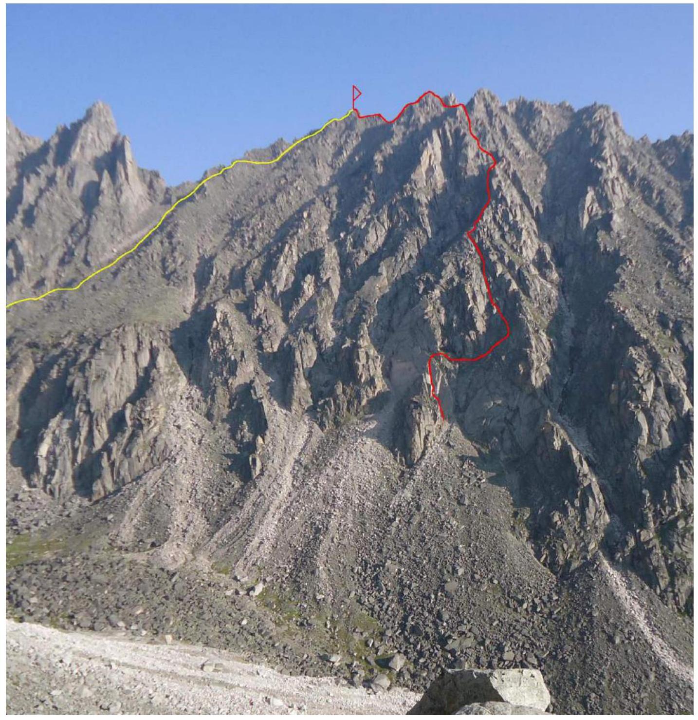
The photo was taken from under the base of the North wall in the Kupol, at a height of 2300 m, distance to the object 1.5 km
YELLOW - Suvorkina's route 1B (descent path).
RED - team's route. Profile photo of the route is on the left (Main part of the route).
The photo was taken on July 30, 2012 during the first ascent of 4B cat. diff. on the peak Sever, from the peak Sever 2835 m.
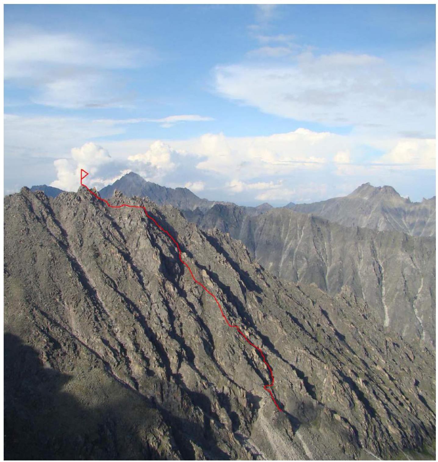
Drawn Profile of the Route
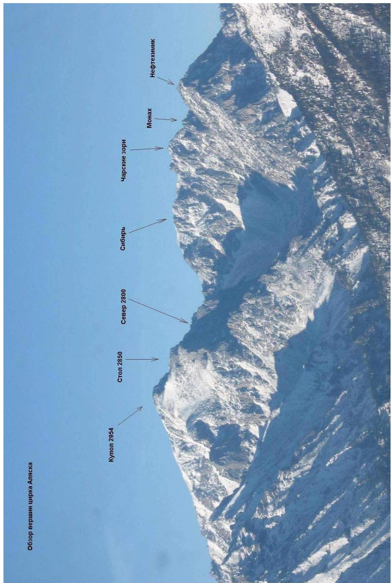
2254 Panorama of the Alaska Cirque peaks
Map-Scheme of the Barun-Khandagai Valley
The Barun-Khandagai valley is one of the most promising areas in the Eastern Sayan for sports mountaineering.
The Kupol peak (2954 m) is dominant in this region. Located in the Tunkinsky district of the Republic of Buryatia. The nearest large settlement is the village of Arshan. From Arshan, you can reach the entrance to the valley by off-road vehicle, about 15 kilometers. Then, follow the valley; there is a trail; the area is popular with tourists in the summer.
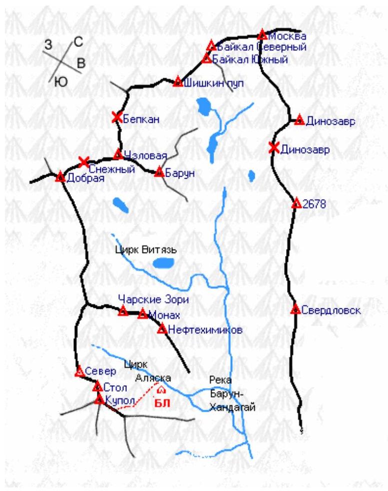
The Alaska Cirque is located on the left side of the valley, with an elevation gain of 1400 m and a length of approximately 15 km. In the summer, you can reach the wall in 6-8 hours, while in winter it may take 5-6 days due to the large amount of snow. The area is visited by 2-3 climbing and mountaineering groups per year.
Neftekhimik mountain, like most peaks in the Barun-Khandagai valley, is not very popular due to the greater interest of climbers in the north wall of Kupol mountain. However, the counterforts and walls on the southern and northern sides of the mountain are quite interesting climbing objects and serve as a good training ground for methodological purposes.
Significant elevation gains combined with high steepness and rock solidity provide great prospects for mastering the mountain and using the routes for methodological purposes. Many ascents have been made on the mountain via various routes, but only two have been classified: from the north side - 4B and the classic route to the summit 1B via the Western ridge.
Ascent Graph
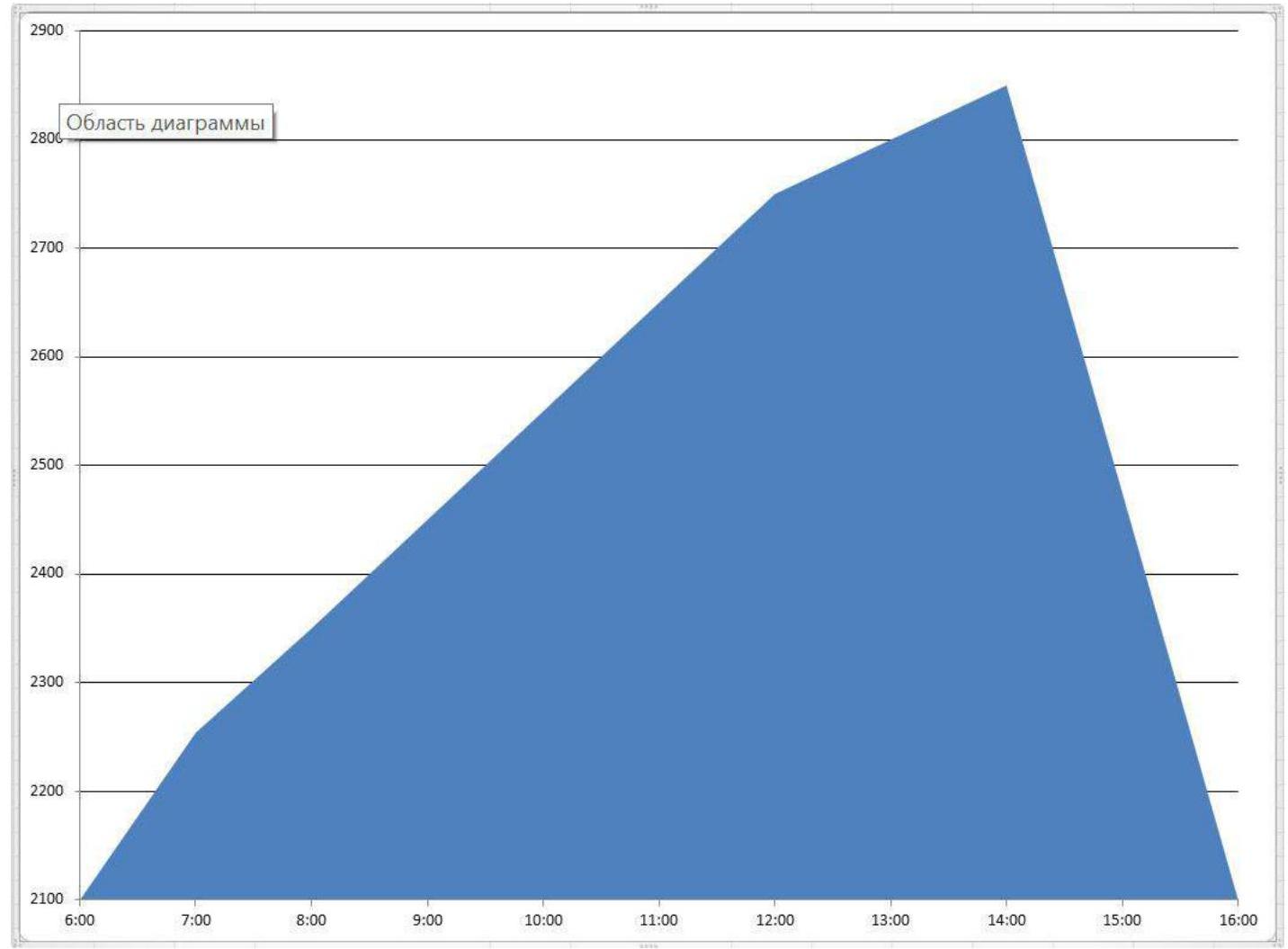
Team's movement graph on the route:
- August 2, 2013 - from 7:00 to 14:00 the route to the summit was completed
- August 2, 2013 - from 14:00 to 16:00 descent to Base Camp.
Scheme of the main part of the route, made in UIAA symbols at a scale of 1:2000, sheet 1
| Section | Chocks | Friends | Rock Pitons | Sky Hooks | Bolts | Route Scheme in UIAA symbols M 1:2000 Sheet 1 | Length (m) | Steepness (°) | Climbing | Aids |
|---|---|---|---|---|---|---|---|---|---|---|
| R20–R21 | - | 3 | 2 | - | - | 80 | 60 | 3+ | - | |
| R19–R20 | - | - | - | - | - | 25 | 30 | 2- | - | |
| R18–R19 | - | 1 | 1 | - | - | 15 | 60 | 3- | - | |
| R17–R18 | - | 2 | - | - | - | 70 | 40 | 2- | - | |
| R15–R17 | - | 2 | 2 | - | - | 75 | 45 | 2+ | - | |
| R14–R15 | - | - | - | 50 | 40 | 2- | - | |||
| R13–R14 | - | 2 | 1 | 15 | 55 | 3+ | ||||
| R12–R13 | - | 1 | - | - | - | 20 | 35 | 2- | - | |
| R11–R12 | - | 2 | - | 10 | 55 | 2+ | ||||
| R10–R11 | - | 3 | 1 | - | - | 70 | 40 | 2- | - | |
| R9–R10 | - | - | 1 | - | - | 5 | 90 | 5- | - | |
| R8–R9 | - | 2 | - | 20 | 50 | 3+ | ||||
| R7–R8 | - | 1 | 2 | - | - | 15 | 65 | 4+ | - | |
| R6–R7 | 1 | 2 | - | 15 | 55 | 3- | ||||
| R5–R6 | - | 2 | - | - | - | 35 | 35 | 2- | - | |
| R4–R5 | - | - | 1 | - | - | 15 | 40 | 3- | - | |
| R3–R4 | - | 1 | 1 | - | - | 25 | 45 | 2+ | - | |
| R2–R3 | - | 3 | 1 | - | - | 30 | 55 | 3- | - | |
| R1–R2 | - | - | 1 | - | - | 5 | 75 | 4+ | - | |
| R0–R1 | 1 | 2 | 2 | - | - | 25 | 50 | 3- | - |
Description of the Relief
R0–R1: 25 m, 50°, 3-. Internal corner. R1–R2: 5 m, 75°, 4+. Plug. R2–R3: 30 m, 55°, 3-. Internal corner. R3–R4: 25 m, 45°, 2+. Traverse right along the slope. R4–R5: 15 m, 40°, 3-. Right. R5–R6: 35 m, 35°, 2-. Couloir up, then left. R6–R7: 15 m, 55°, 3-. Along the internal corner. R7–R8: 15 m, 65°, 4+. Wet internal corner. R8–R9: 20 m, 50°, 3+. Destroyed internal corner. R9–R10: 5 m, 90°, 5-. Wall in the internal corner. R10–R11: 70 m, 40°, 2-. Along the couloir on the right. R11–R12: 10 m, 55°, 2+. Along the couloir. R12–R13: 20 m, 35°, 2-. Couloir narrows. R13–R14: 15 m, 55°, 3+. Internal corner to the shoulder. R14–R15: 50 m, 40°, 2-. Along the smeared ridge with scree. R15–R16: 25 m, 45°, 2-. Left of the ridge along the ledges under the tower. R16–R17: 50 m, 45°, 2+. Traverse of the tower on the left. R17–R18: 70 m, 40°, 2-. Along the couloir under the saddle. R18–R19: 15 m, 60°, 3-. Under the saddle and beyond. R19–R20: 25 m, 30°, 2-. Right. R20–R21: 80 m, 60°, 3+. Along the wide internal form. R21–R22: 35 m, 30°, 1+. Behind the overhanging slab to the left. R22–R23: 5 m, 70°, 2+. R23–R24: 25 m, 30°, 1+. R24–R25: 100 m, 45°, 25°. Left of the ridge to the pre-summit tower. R25–R26: 50 m, 50°, 2+. Pre-summit tower. R26–R27: 40 m, 40°, 1+. To the pre-summit tower. R27–R28: 30 m, 40°, 2+. Descent towards the summit. R28–R29: 30 m, 20°, 1+. Descent. R29–R30: 30 m, 45°, 2+. Saddle. R30–R31: 100 m, 40°, 2+. To the summit.
The difficulty of the sections is given for summer climbing in perfect weather. In winter, add half a category or a category.
Technical Photo of the Route
Characteristics of the Route and Team Actions
The route taken by our team follows the right South counterfort of the Eastern ridge. Before us, this side of the mountain had not been climbed, and we had no restrictions in choosing the route. When selecting the route, we were guided by the following parameters:
- the appearance of the wall/slope suggested that the approximate category of difficulty would be 3A/3B.
- the route should be used for methodological purposes, so it should be as safe as possible.
- logical and beautiful line.
- uniformity of the line's complexity.
The route was climbed using free climbing. The maximum difficulty of sections climbed using free climbing was 5 (French rating). The route length is over 1000 m. Five intermediate anchors were set up on the route, and the rest of the route was climbed with alternating and simultaneous belays. The most challenging part of the route is located in the lower half. Based on our experience, we can say that this route will be one of the longest and most challenging 3A category routes in the Eastern Sayan. It falls short of 3B due to the lack of sections with 4th category difficulty and feels like a good 3A.
The route was used for training purposes. On the route, Ometov A.A. and Putko K. took turns working. The first worked on two ropes, one of which is a dynamic rope meeting UIAA requirements. To speed up the work, friends and anchor pitons were mainly used. During simultaneous movement, the number of intermediate protection points was not less than four per team of three.
In autumn 2015, the route was repeated by a training group in winter conditions.
Photo 1. Start of the Route
Start of the route, belayer at point R0, leader on section R2–R3. The route is visible up to point R3. Putko K.V. is leading.
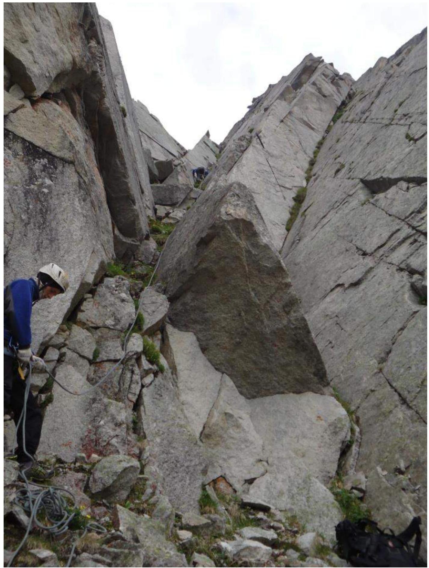
Photo 2. Second Rope
Taken from point R3, leader on section R3–R4.
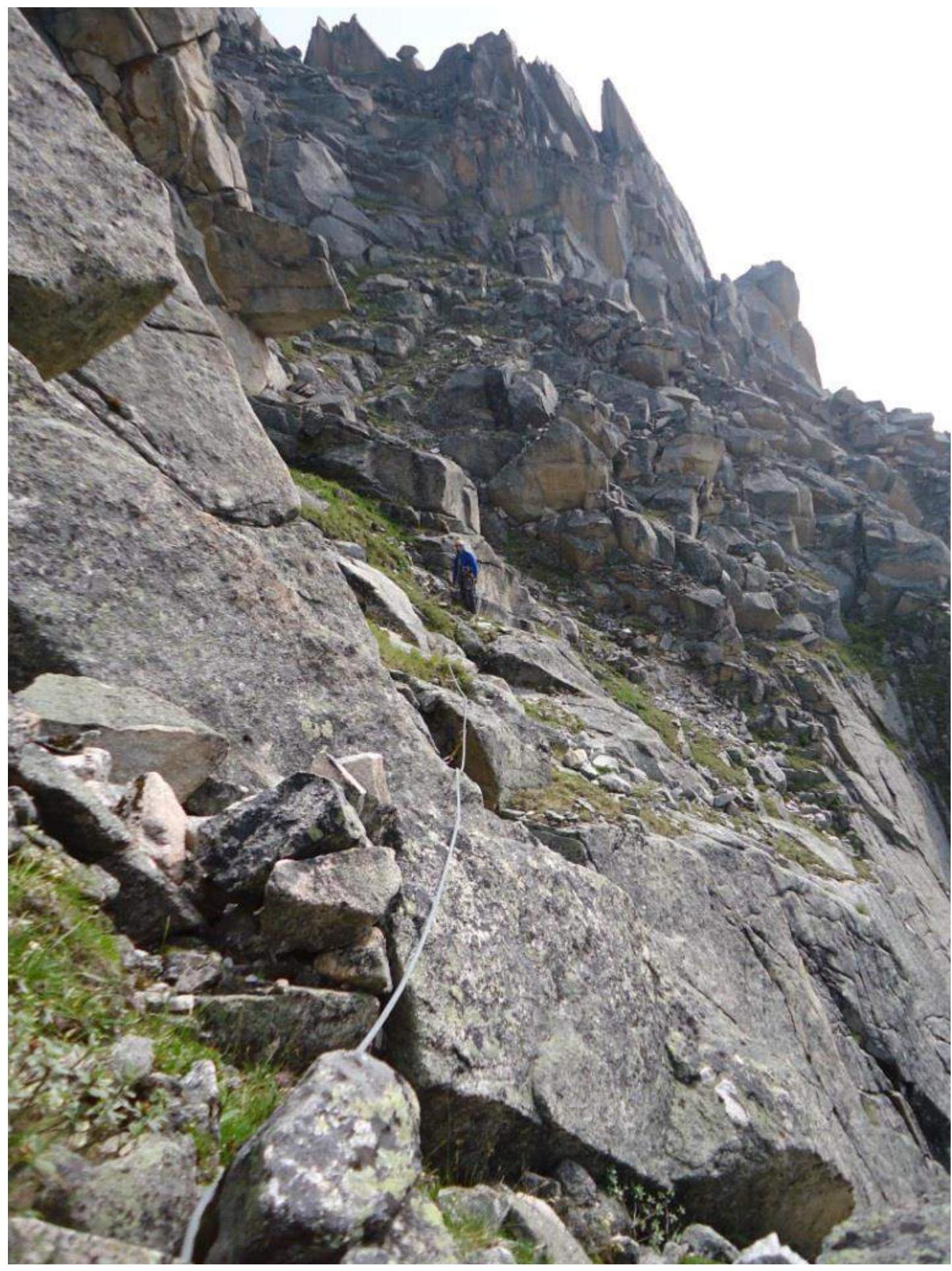
Photo 3. Key to the Route
Sections R7–R10.
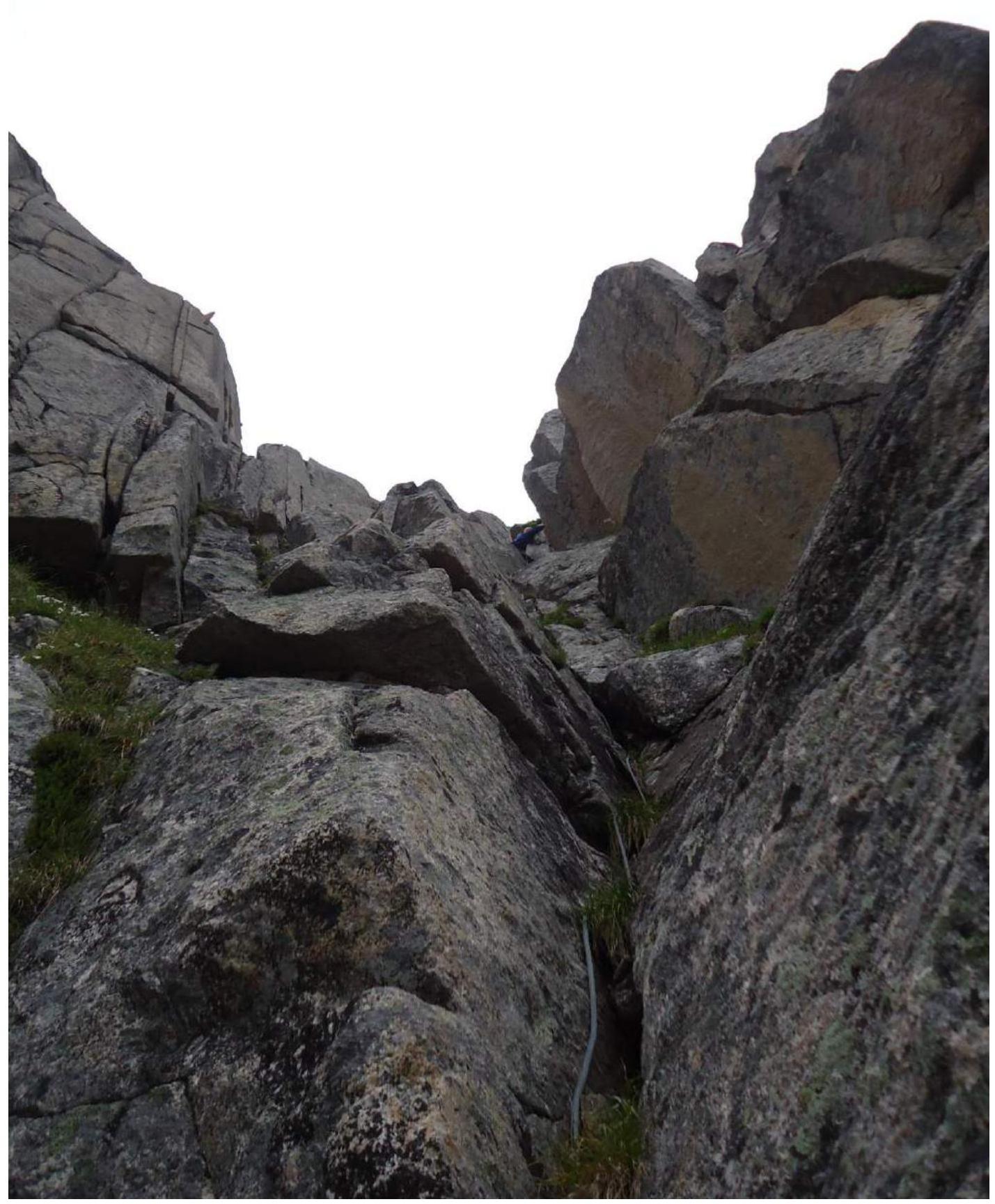
Photo 4. Continuation of the Internal Form
Leader on section R11–R12.
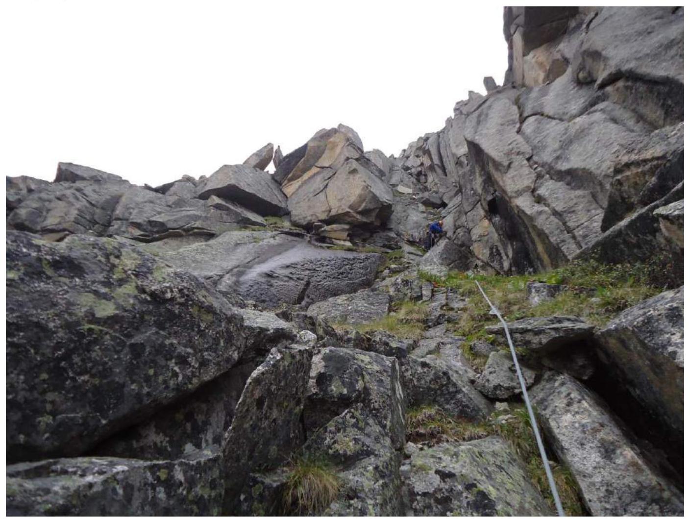
Photo 5
Photo taken from point R15, section R15–R16 is visible. Bypassing the rock bastion on the left along a series of ledges.

Photo 6
Section R15–R16.

Photo 7
Start of section R20–R21.
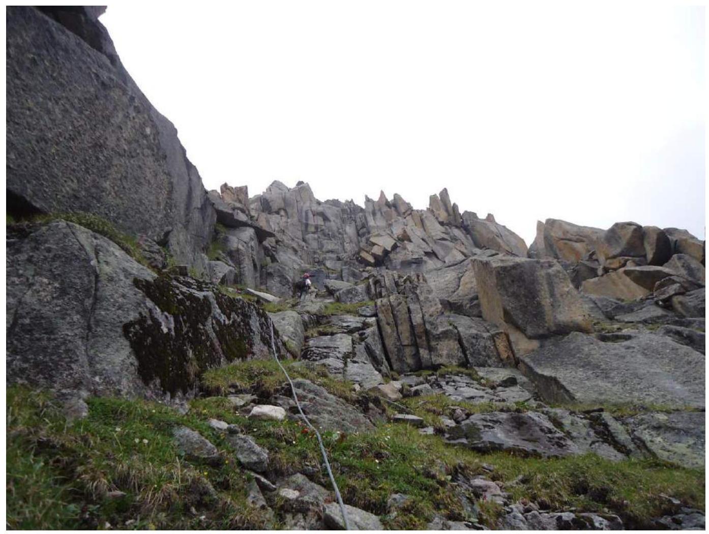
Photo 8
Section R20–R21
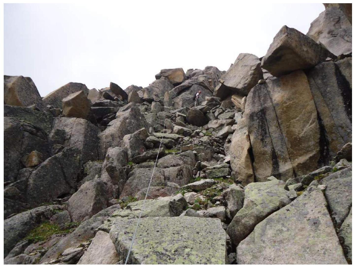
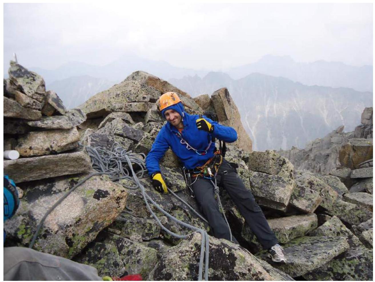
Photo 9. Summit. Ometov A.A. Klepikov A.A.
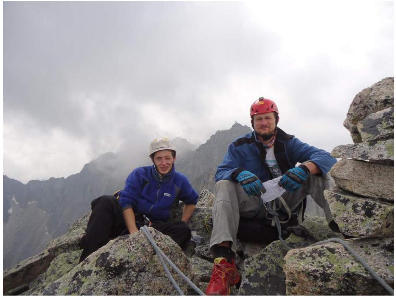
Photo 10. Summit. Putko K.