Ascent Passport
Area — Eastern Sayan, Tunka Goltsy, Barun-Khandagai gorge
Peak — Monakh 2640
GPS coordinates — 51°54′58.15″N, 102°0′51.79″E
Route — from the north via the western ridge, proposed category 2B.
Route character — rock.
Route characteristics:
elevation gain — 500 m, length — 940 m, section lengths:
- I difficulty grade — 680 m
- II difficulty grade — 170 m
- III difficulty grade — 47 m
- IV difficulty grade — 42 m, average steepness of the main part of the route — 50°. Used for belaying:
- rock pitons — 0
- chocks — 11. Climbing hours: 7 days — 1. Overnight stays: none.
Leader: Popov Valery Nikolayevich — Master of Sports of the USSR Participants:
- Otmakhov Alexander — badge holder
- Anikin Artem — badge holder
- Parilova Elena — badge holder Departure from base camp: July 8, 2010 Departure on route — 8:00 Arrival at the summit — 13:00 Return — 15:00 Organization: FAIО
General view of p.
Monakh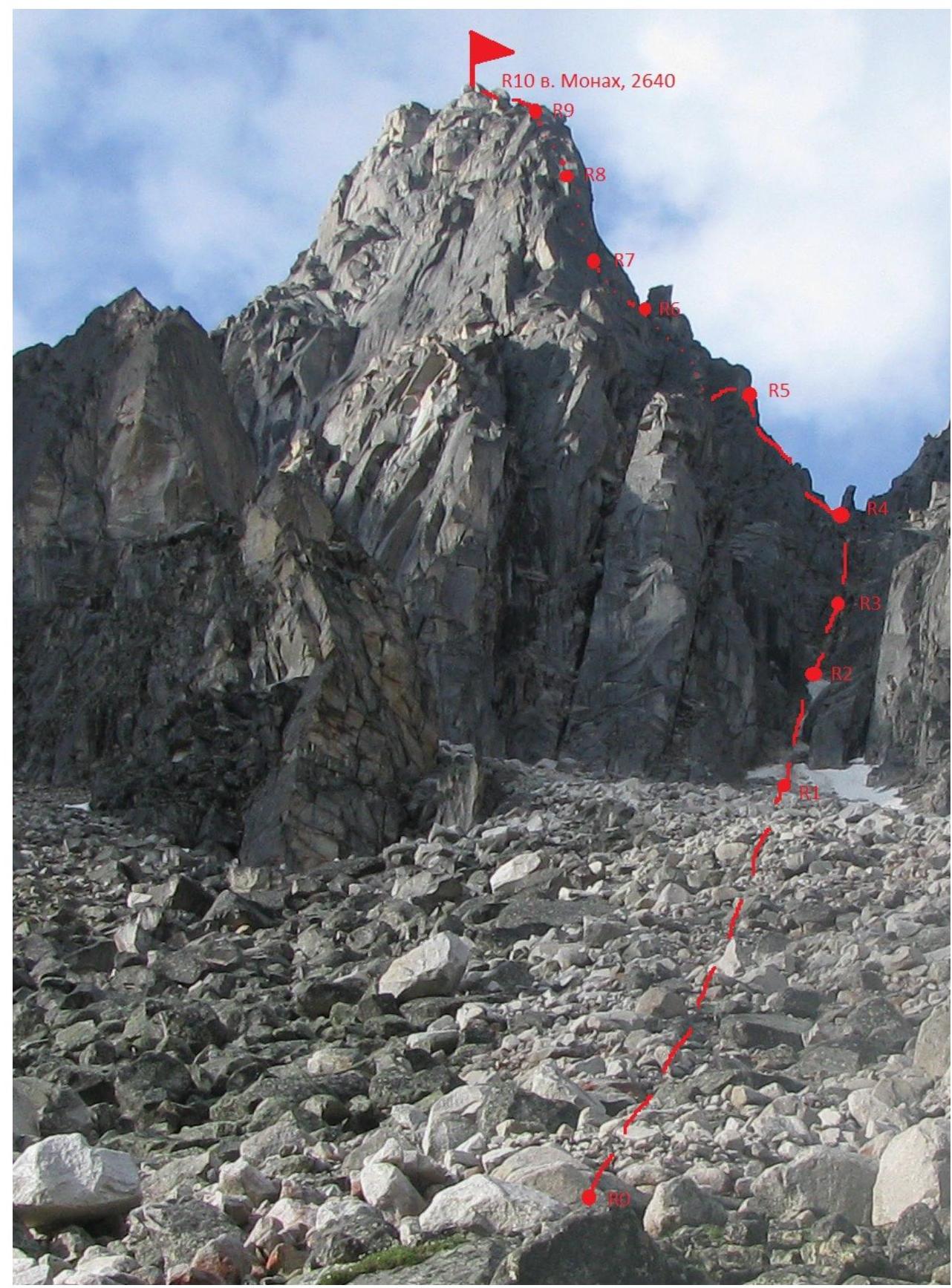 810
m p. Monakh, 2640 Scheme of Barun–Khandagai
gorge
810
m p. Monakh, 2640 Scheme of Barun–Khandagai
gorge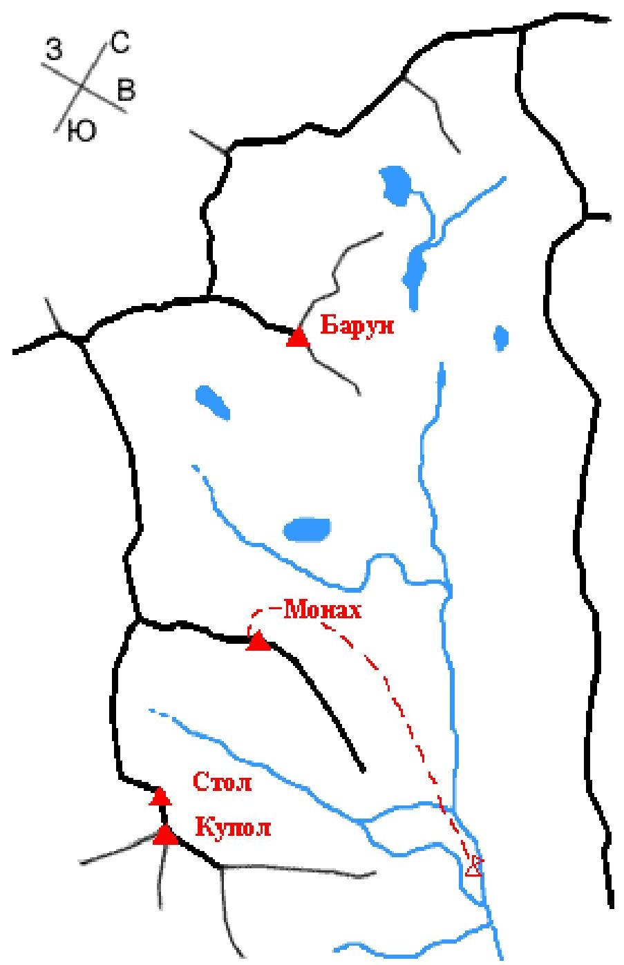 Scheme
UIAA
Scheme
UIAA
| Section # | Rock pitons | Chocks | Route | difficulty grade | Section length, m | Steepness, degrees |
|---|---|---|---|---|---|---|
| 20 | - | - | p. Monakh 2640 R10 | |||
| 19 | - | - | R9 | 3 | 4 | 60 |
| 18 | - | - | 2 | 15 | 0 | |
| 17 | - | 1 | (R8 | 4 | 6 | 80 |
| 16 | - | - | 3 | 15 | 45 | |
| 15 | - | 1 | (R7 | 3 | 4 | 60 |
| 14 | - | - | Photo 4 | 2 | 15 | 15 |
| 13 | - | - | Photo 3 R6 | 4 | 6 | 80 |
| 12 | - | - | 3 | 6 | 70 | |
| 11 | - | - | 2 | 20 | 30 | |
| 10 | - | 2 | 4 | 10 | 70 | |
| 9 | - | - | 2 | 50 | 50 | |
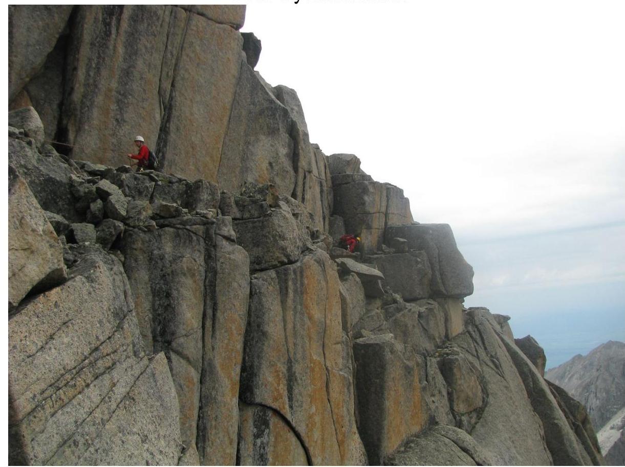
| 8 | - | - | Photo 2 | 2 | 10 | 60 |
| 7 | - | - | 1 | 30 | 40 | |
| 6 | - | - | 2 | 10 | 50 | |
| 5 | - | - | 1 | 30 | 40 | |
| 4 | - | 4 | Photo 1 | 4 | 20 | 75 |
| 3 | - | 3 | 3 | 20 | 60 | |
| 2 | - | - | 1 | 120 | ||
| :--: | :--: | :--: | :--: | :--: | :--: | :--: |
| 1 | - | - | 500 |
Approach to the route
Departure from base camp into the main gorge to the left part of the moraine and then along p. Neftekhimik until the entire massif is visible.
Route description
R0–R1 Ascend up the large talus 500 m, 40° (to the beginning of the right couloir leading to the col between p. Monakh and p. Charskie Zori) /1.5 hours/.
R1–R2 Up the couloir, sticking to the left side 120 m, 50°, I difficulty grade, snow, to the rock wall blocking the couloir.
R2–R3 The wall is passed on the left side 20 m, 60°, III difficulty grade, then 20 m, 75°, IV difficulty grade. Key section of the route. Convenient belay points.
R3–R4 Further along the talus and rocks 30 m, 40°, I difficulty grade, and 10 m, 50°, II difficulty grade. Again along the couloir 30 m, 40°, I difficulty grade, and along the rocks 10 m, 60°, II difficulty grade to the col.
R4–R5 Move along the western ridge 50 m, 50°, II difficulty grade, abut against a wall 10 m, 70°, IV difficulty grade, then along the ridge 20 m, 30°, II difficulty grade to the "Head" gendarme.
R5–R6 The gendarme is bypassed on the left, for which we descend 6 m, 70°, III difficulty grade, to the ridge and the next gendarme is bypassed on the right via an internal corner 6 m, 80°, IV difficulty grade.
R6–R7 Further along an inclined shelf on the right of the ridge 15 m, 15°, II difficulty grade, to a small chimney 4 m, 60°, III difficulty grade.
R7–R8 Then along inclined stepped shelves without holds 15 m, 45°, III difficulty grade, to the ridge via a chimney 6 m, 80°, IV difficulty grade.
R8–R9 Move along a shelf 15 m, 0°, II difficulty grade, and into an internal corner 4 m, 60°, III difficulty grade.
R9–R10 Then move along a shelf to the right of the ridge to a narrow passage. To the left onto the ridge and move towards the summit of Monakh. Descent is made via the ascent route with organized rappels on difficult sections and a rappel in the couloir.
Photo 1 section
#4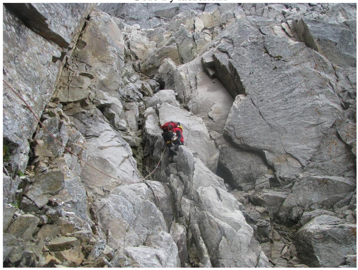
Photo 2 section
#8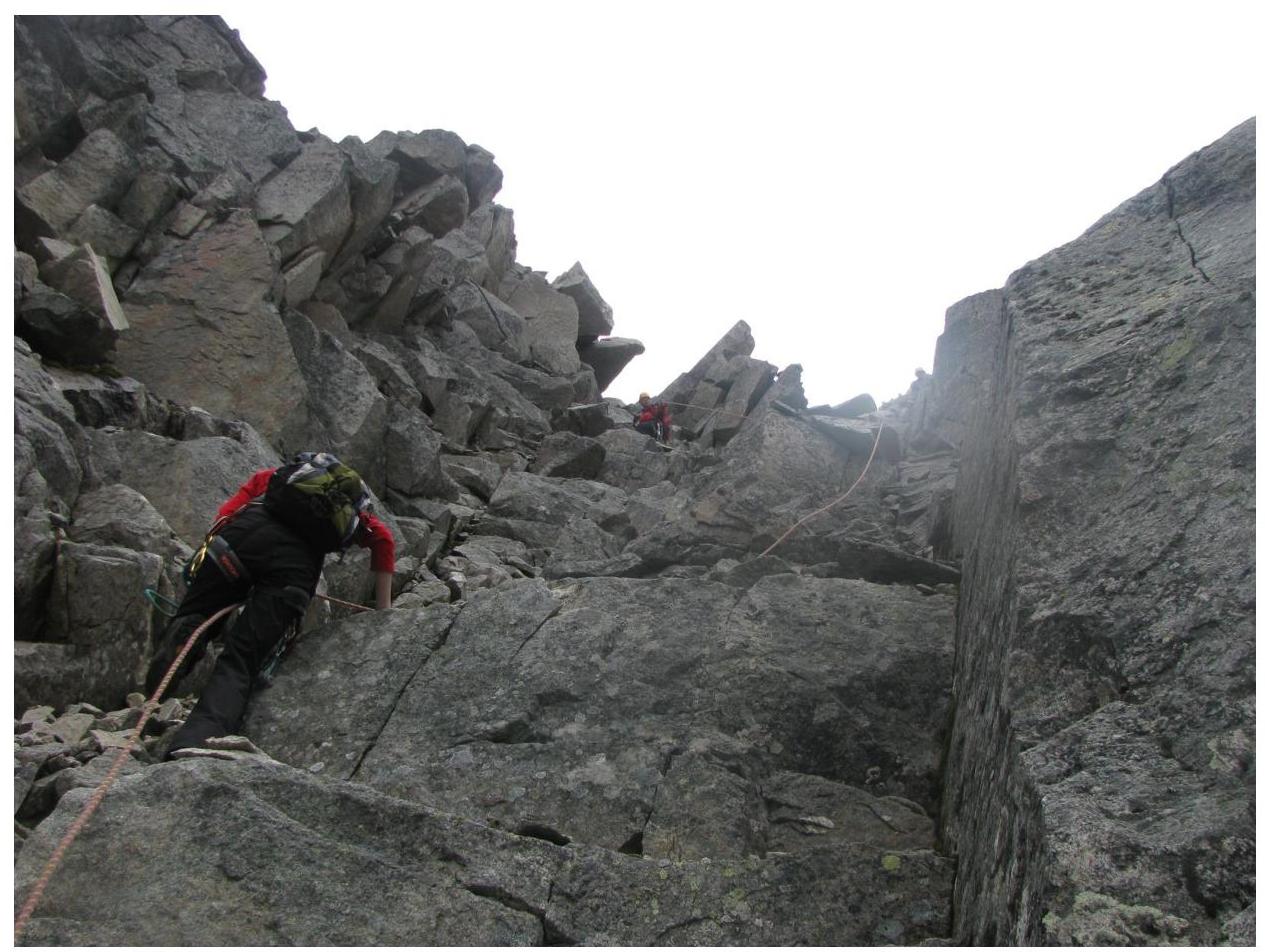
Photo 3 section
#13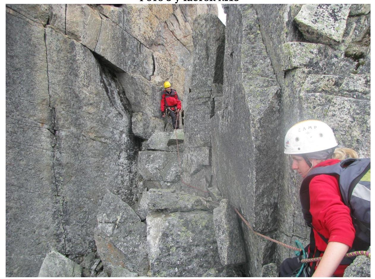 Photo
4 section
#14
Photo
4 section
#14