Ascent Certificate for Mt. Mamlyuk, 2410 m, via the Western slope, cat. 1B, diff. cat.
- East Sayan, Tunkinskie Goltsy ridge, Serga cirque (Veter region), section
6.1.2. 2. Mt. Mamlyuk (2410) via the Western slope. 3. Proposed category: 1B, first ascent. 4. Route type: combined. 5. Height gain 350 m, length 860 m, average slope 20°. 6. Pitons used: rock and chocks — 7. 7. Team's walking time — 4 hours. 8. No bivouacs on the route. 9. Team:
Afanas'eva A.A. CMS Geydarov K.G. 2nd sports class Karelov P.S. 3rd sports class Kuchumov S.N. novice Mordovin A.A. 3rd sports class Nomokonov D.V. 3rd sports class Potapov R.A. badge Rasskazov D.V. 3rd sports class Rozhin A.Yu. 2nd sports class Uvarovskiy S.V. novice Shabanov A.V. novice Afanas'ev A.E. MS
Description of the ascent route to Mt. Mamlyuk 2410 m via the Western ridge, cat. 1B diff. cat.
From the base camp at Vesennie Lake to Serga Sirotskaya Lake — 2 hours walking. The lake is passed on the left through talus in the direction of the couloir descending from the saddle between the 1st and 2nd craggy peaks from the massif of Mt. Partizan, or the 3rd and 4th craggy peaks from Mt. Mamlyuk. The route begins at the foot of the slope.
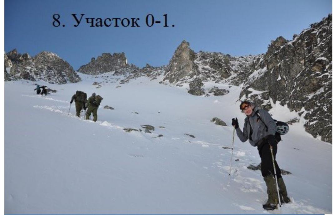
R0–R1, 400 m, 35°, 1st cat. diff. Scree slope of southwest exposure onto the saddle in the ridge of the main Tunkinskie Goltsy ridge.
Sect. 1–2 30 m, slope 40°, II cat. diff. Snow-rock slope upwards to the left from the ridge of the 3rd craggy peak, counting from Mt. Mamlyuk. At section 2, a station with 3 pitons for belays on the ascent and further rappelling.
Sect. 2–3 10 m, 70°, III+ cat. diff. Rappelling down a chimney on the left side of the middle part of the craggy peak's bypass.
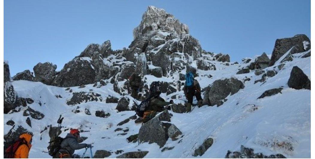
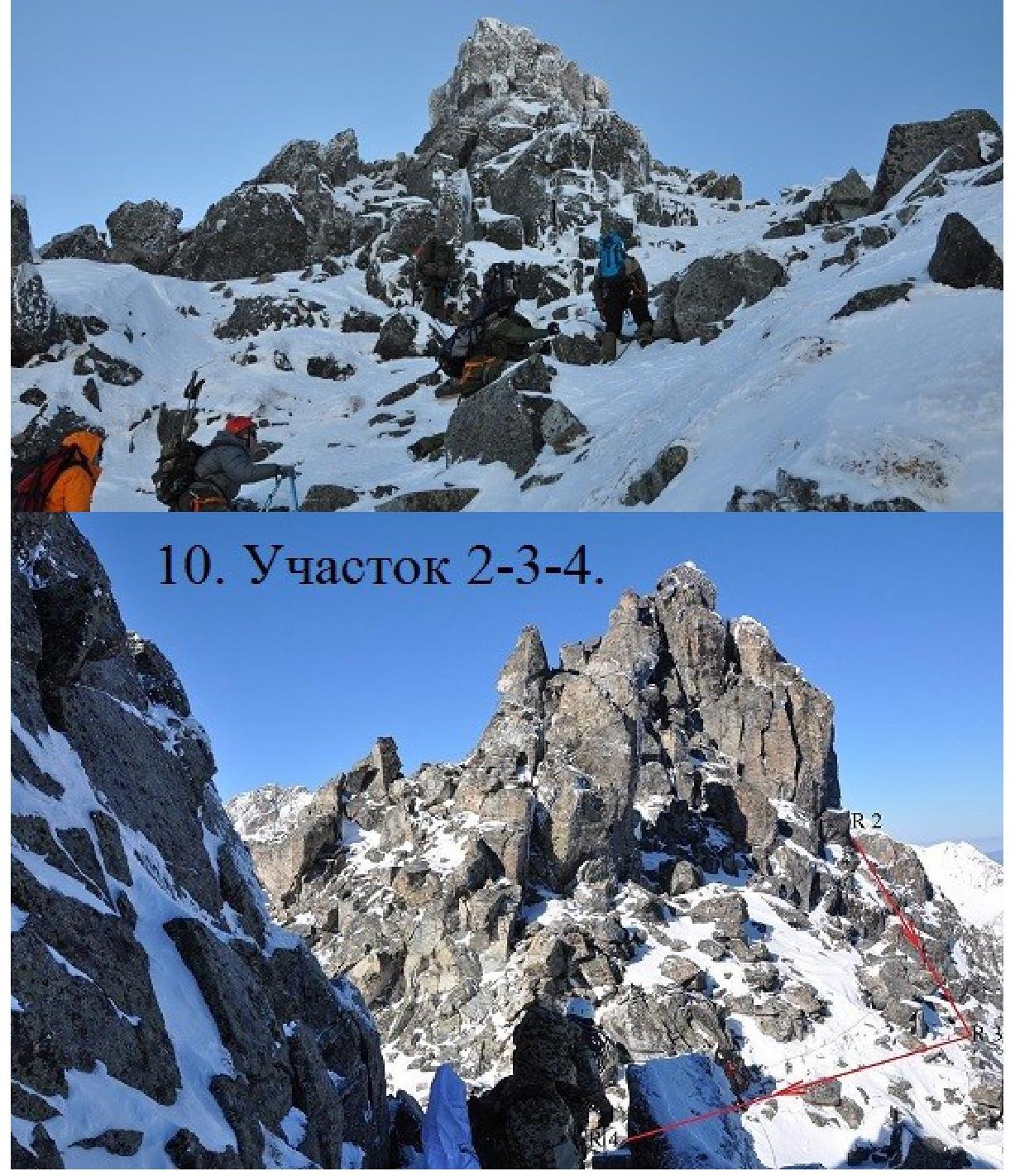
Sect. 3–4 40 m, 40°, I+ cat. diff. Traverse to the saddle between the 3rd and 2nd craggy peaks from Mt. Mamlyuk.
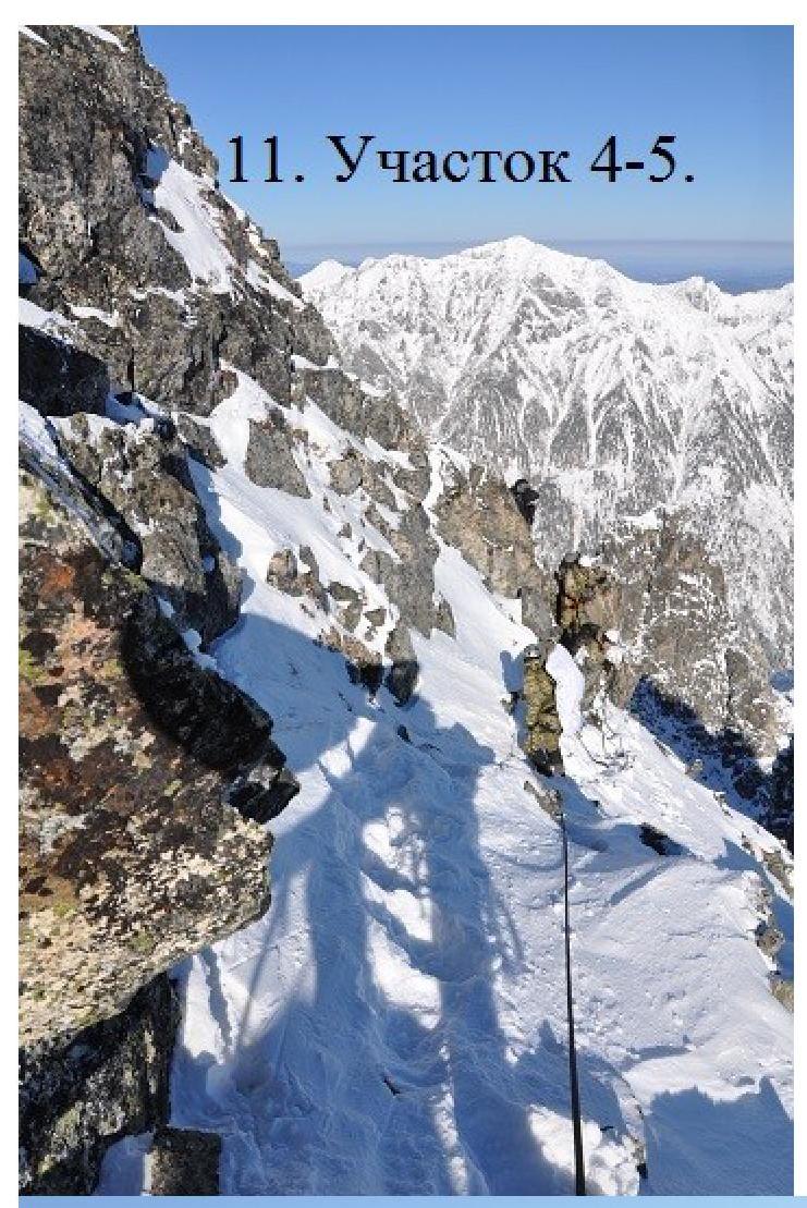
Sect. 4–5 70 m, slope 45°, II cat. diff. The 2nd craggy peak is also bypassed on the left. Belaying through protrusions and chocks.
Sect. 5–6 30 m, 5°, I+ cat. diff. Ridge between the 2nd and 1st craggy peaks from Mt. Mamlyuk.
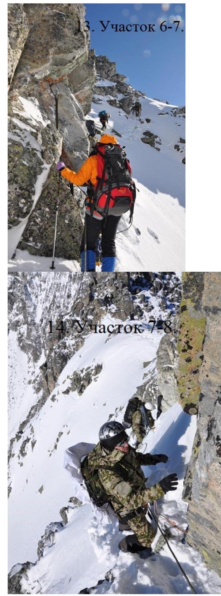
Sect. 6–7 55 m, 40°, I+ cat. diff. To the right of the 1st craggy peak. Transition to the slope of southern exposure. Piton belay.
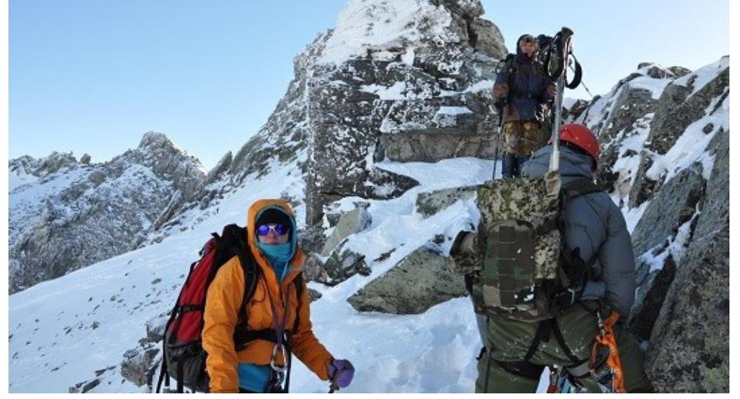
Sect. 7–8 15 m, 20°, I– cat. diff. Ascent to the summit of the 1st craggy peak. Here it appears as a preliminary summit of Mt. Mamlyuk.
Sect. 8–9 40 m, descent 20°, I– cat. diff. Simple descent to the saddle between the preliminary summit and the main summit.
Sect. 9–10 50 m, 20°, I– cat. diff. Talus slope to the right of the ridge. Ascent to the summit of Mt. Mamlyuk 2410 m from the west.
Descent follows the ascent route to the preliminary summit and then down the snowy and scree slopes and couloirs of southwest exposure.
The route is considered educational for preparation for the first stage.
Depending on the condition of the snowy slopes, weather conditions, time of year, and educational goals, the number of craggy peaks planned to be traversed can be adjusted.
| Mt. Mamlyuk | Length b m | Steepness a° | Difficulty b | Number of pitons B | |
|---|---|---|---|---|---|
| pitons B | chocks e | ||||
| 50 | 20 | I- | |||
| 15 | 20 | I- | |||
| :--: | :--: | :--: | :--: | :--: | :--: |
 | 55 | 40 | I+ | 2 | |
 | 30 | 5 | I+ | ||
 | 70 | 45 | II– | 2 | |
 | 40 | 40 | I+ | ||
 | 10 | 80 | III+ | 2 | |
 | 30 | 40 | II– | 1 | |
 | 400 | 35 | I- |
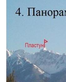
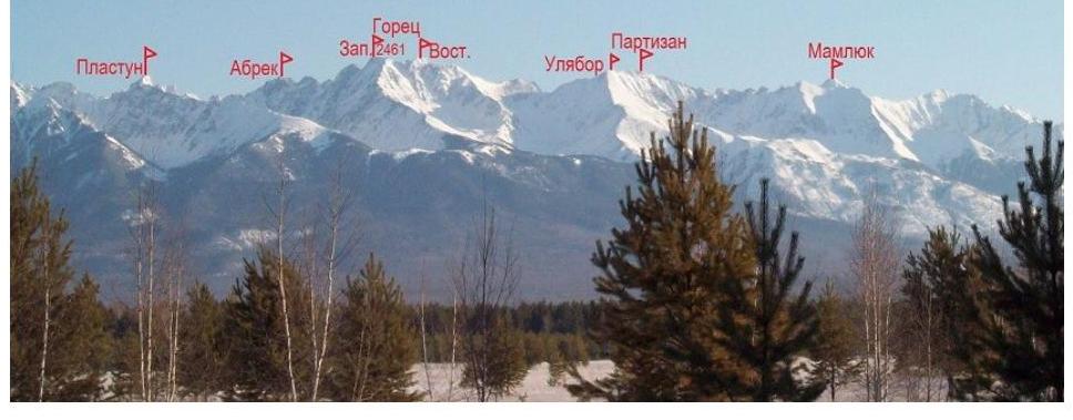
- Panorama of Veter region, from Tunkinskaya valley to the right.
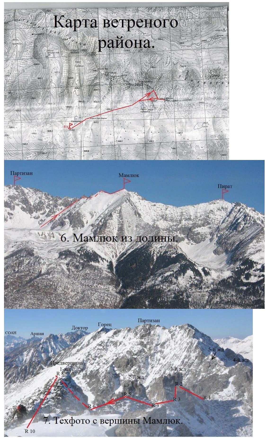
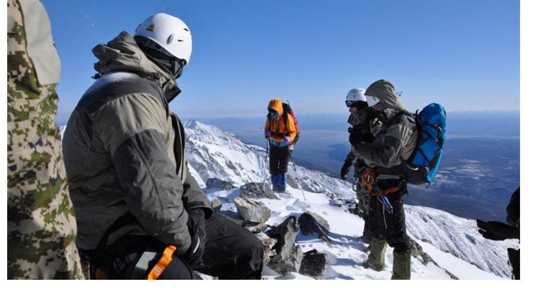
Tech photo from the summit of Mamlyuk.
-
Section R0–R1.
-
Section R1–R2.
9. Section R1–R2.
-
Section R5–R6.
-
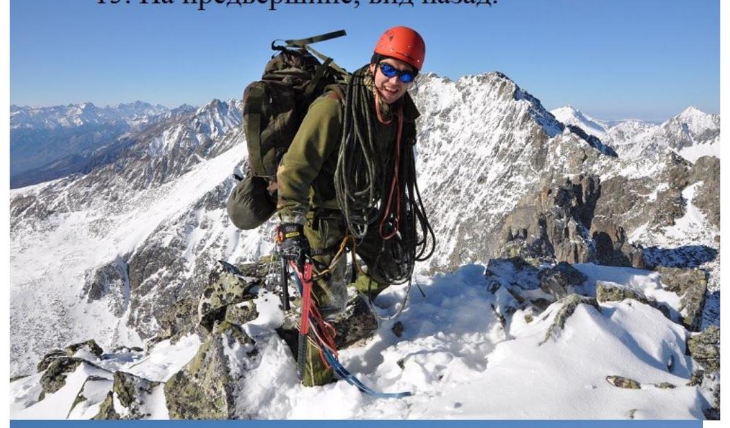
On the preliminary summit, view back.
-
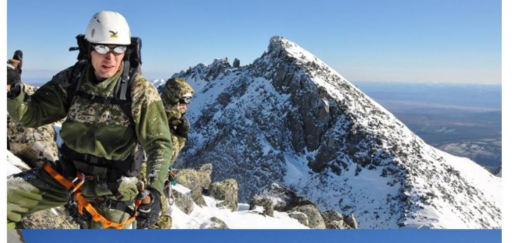
On the preliminary summit. Summit ahead.
-
On Mt. Mamlyuk 2410 m.