Climbing passport for v. Bronenosets 2430 m, 1 western wall, original.
- Eastern Sayan, Tunkinsky ridge, Dождевое, section 6.1.2. 2. The summit Bronenosets (2430) of the Western wall. 3. Proposed category of difficulty, first ascent 4. The nature of the route is combined. 5. Height difference 220 m, length 300 m, average steepness 45°. 6. Driven pitons: rock and stopper. 7. Team's walking hours — 6 hours
v. Bronenosets (2430 m) via the couloir of the West wall,
original. Category of difficulty.
From the base camp on the forest border between the gorges Dождевое and 2-я Шихтолаика to the foot of the mountain 1.5 hours walk.
The start of the route is below the mountain at the foot of the couloir of western exposition below the rocks left "spur" of the 3rd wall at an altitude of 2200 m above sea level.
Section 0–1 30 m, 35°, I category of difficulty. Slope of the snow cone of the Couloir in winter can be avalanche-prone.
Section 1–2 10 m, 50°, I+ category of difficulty. Rocks in the groove of the couloir.
Section 2–3 30 m, 40°, I+ category of difficulty. Snow-ice couloir.
Section 3–4 12 m, 45°, II+ category of difficulty. Smoothed rocks to the right and left. 3 pitons.
Section 4–5 50 m, 45°, II– category of difficulty. Snow-ice groove with a small step in the middle part.
Section 5–6 10 m, 60°, IV– category of difficulty. Rocky inner corner. 1 piton.
Section 6–7 20 m, 50°, II+ category of difficulty. Snow on rocks.
Section 7–8, 10 m, 60°, IV category of difficulty. Right wall of the inner corner. Exit to the place of branching of the path variants.
Section 8–9, 15 m, 90°, V+ category of difficulty. Overhanging inner corner. To the right along the vertical wall with formations. 1 piton.
Section 9–10, 17 m, 50°, II category of difficulty. Snowy crust on the rock. Exit to the grotto. 1 piton.
Section 10–11, 8 m, 50°, II category of difficulty. Shelf to the right.
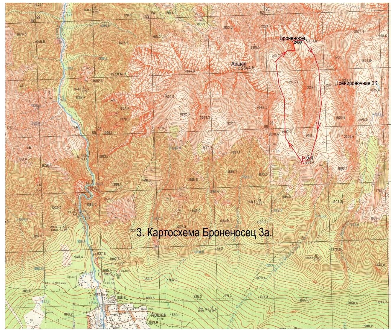
∵ 3. Map-schema Bronenosets 3А.
-
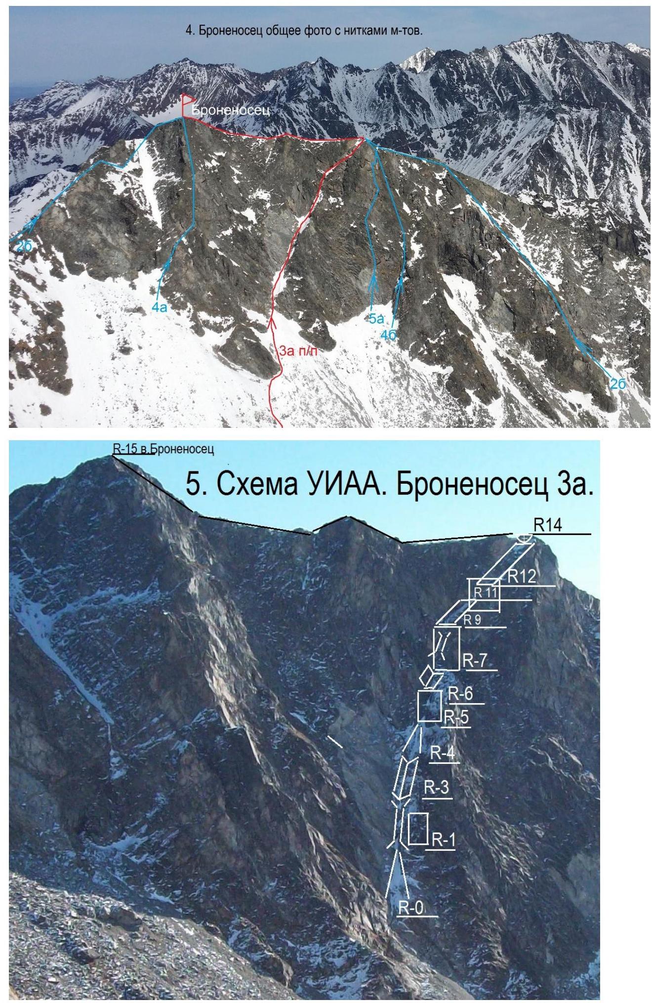
Scheme UIAA. Bronenosets 3А.
-
Section 2–3.
7. Section 7–8.
-
Section 8–9.
-
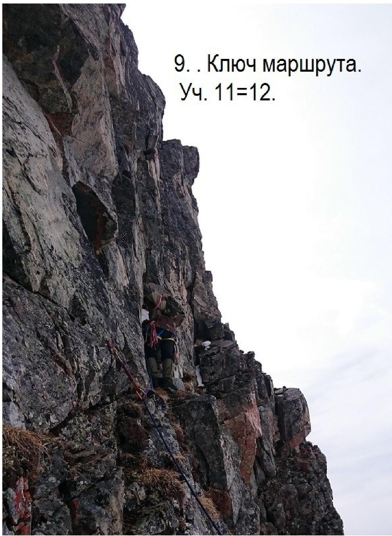
The key of the route. Section 11–12.