Climbing Report
on the summit of Bronenosets (2411 m) via the right buttress of the Southwest wall (first ascent) Eastern Sayan range, August 2009
Irkutsk — 2009. Ascent Passport
Area — Eastern Sayans, Tunkinskie Goltsy, Kyngarga gorge.
Summit — Bronenosets 2411 m
Route — right buttress of the Southwest wall, proposed category 2B, first ascent
Route type — rock climbing.
Route characteristics — height difference 420 m, route length about 720 m, average slope 45°.
Hooks left on the route — 0.
Hooks used on the route: 12, including " закладок" — 8, bolted hooks — 0, including ITO — 0.
Number of walking hours — 8 hours, days — 1
Leader — Perepechin Alexander Alexandrovich — 1st category.
Participants:
- Karavaev Andrey Valerievich — 2nd category.
- Krivosheev Konstantin Pavlovich — 2nd category.
Departure date:
- On the route: June 12, 2009 8:00
- On the summit: June 12, 2009 14:00
- Return to the base camp: June 12, 2009 16:00
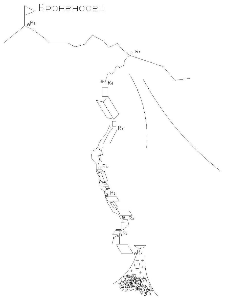
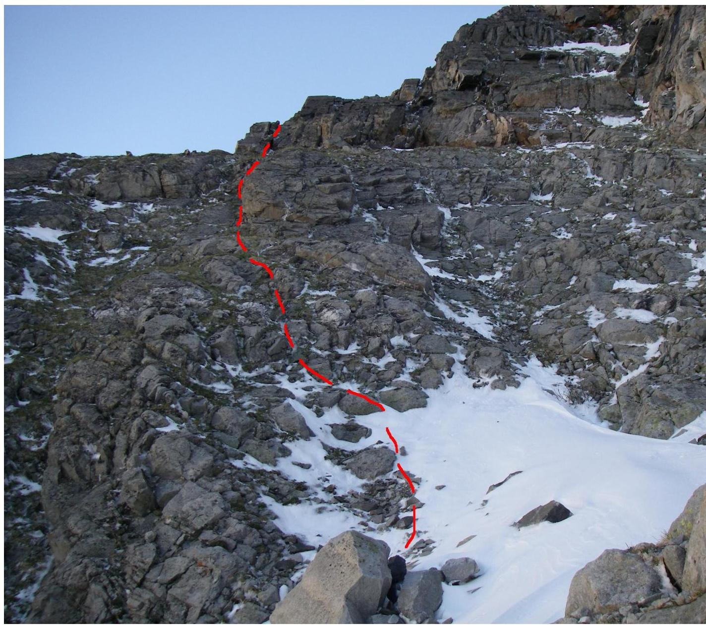
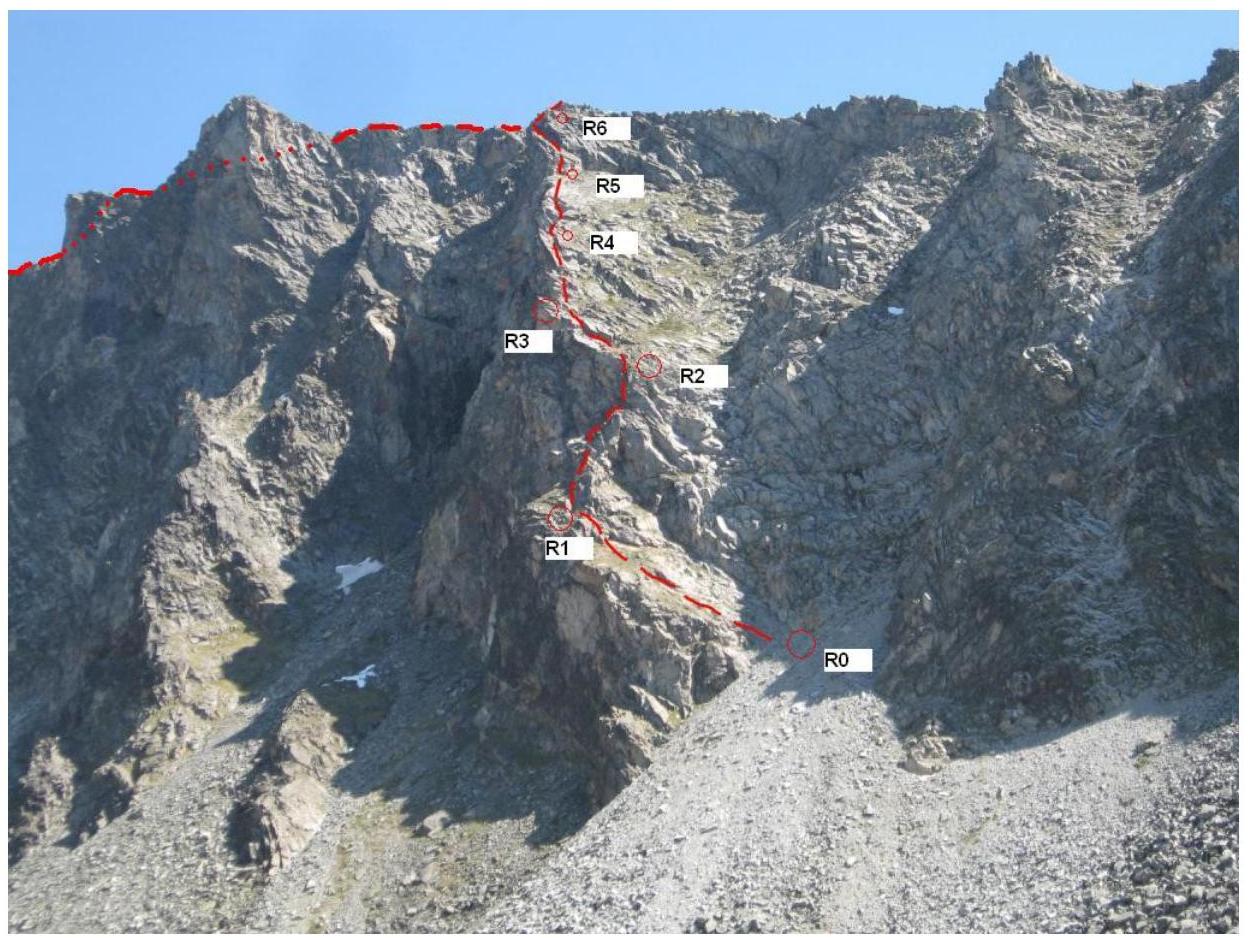
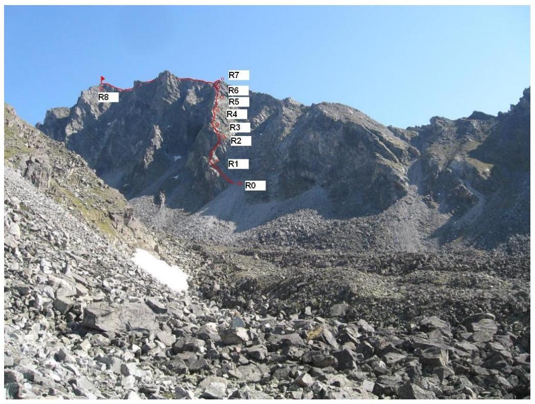
Route description.
Approach to the route via a scree slope on the left (as seen from below) of a large descent couloir, start of the route at the base of the right side of the buttress on an inclined ledge leading to the edge of the buttress.
Sec. 0–1. Along the inclined ledge 40° left upwards under a small vertical wall 4 m 70°, to the edge of the buttress. 50 m.
Sec. 1–2. Along the weakly expressed edge of the buttress 30 m, under a destroyed wall, then to the right of the destroyed rocks via an internal corner 6 m, 65°, to an inclined slab, along the slab left upwards 15 m. 45°, 2+
3+ Sec. 2–3 Slab 5–7 meters, then internal corner 10 m, after the corner continue movement to the right of the ridge of the buttress along inclined slabs 30 m 45°, 2+
Sec. 3–4 Along steep inclined slabs and ledges to a large ledge on the ridge of the buttress, 50 m, 45°, 2–
Sec. 4–5 From the ledge up 15 m along the ridge, then again along steep inclined slabs under the upper bastion of the buttress 35 m, 45°, 2+
Sec. 5–6 Further along a clearly expressed internal corner, under a vertical wall 3 m, along the wall exit to the edge of the buttress 50 m, 55°, 3+
Sec. 6–7. Movement along the edge to the junction of the edge of the buttress with the South ridge, along which the 1B category route passes. 50 m, 30°, 2–
Sec. 7–8. Movement along the South ridge to the summit 370 m, 20°, 1+
Descent from the summit:
- Via the 1B route and further along the large descent couloir into the Dождевое gorge,
- Or, in case of increased avalanche danger — via the classified 2A route (North ridge) to the pass between the summits Bronenosets and Arshan, further from the pass along the slope into the Dождевое gorge, which is less avalanche-prone.
 Route scheme in UIAA symbols