Ascent Passport
- Ascent class — rock.
- Ascent areas — Eastern Sayan, Tunkin Goltsy ridge.
- Peak, its height, ascent route — p. Bashnya, 2800 m, via the northern counterfort.
- Proposed difficulty category — 2A.
- Route characteristics: height difference — 150 m; average steepness — 45°.
- Pitons driven: for belaying — 0; for Aids — 0.
- Number of travel hours — 1.
- Number of overnight stays and their characteristics — none.
- Full name of participants and their qualification: Aleksashin L.V. — MS; Ivanov N.V. — MS.
- Team coach — Aleksashin L.V.
- Date of departure on the route and return — May 4, 1981
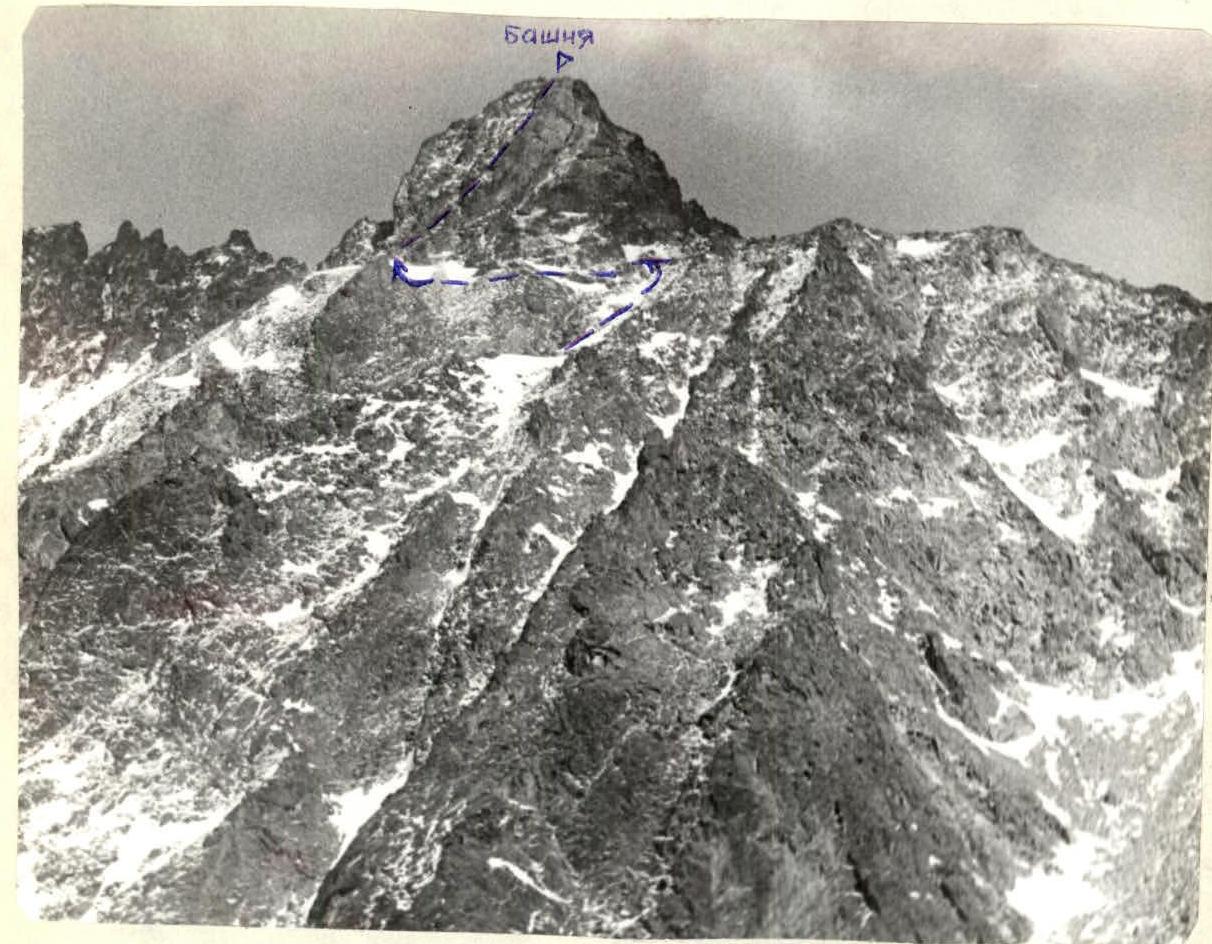
TABLE OF MAIN CHARACTERISTICS OF THE ASCENT ROUTE

| Designation | Average steepness, degrees | Length, m | Relief characteristic | Difficulty | Condition | Weather conditions | Rock pitons | Note |
|---|---|---|---|---|---|---|---|---|
| O–1 | 20 | 200 | Talus shelf | 1 | Fine talus, snow | Good | - | - |
| 1–2 | 30 | 20 | Easy rocks | 1 | Many loose stones | " | - | - |
| 2–3 | 45 | 40 | Inclined shelf | 2 | Dry rocks | " | - | - |
| 3–4 | 80 | 3 | Wall | 4 | " | " | - | - |
| 4–5 | 45 | 80 | Couloir | 2 | Rock slabs, snow, ice | Strong wind | - | - |
| 5–6 | 60 | 3 | Bend | 3 | Rocks like ram's foreheads | - | - | - |
| 6–7 | 30 | 40 | Rocks | 1–2 | Easy rocks | - | - | - |
Explanations for the table of ascent route characteristics
From the Base camp in the Zuun-Khandagai gorge, approach along the slopes to the right of the couloir with waterfalls, or along the large couloir leading from the north from the valley, bounded by the peaks Zuun and SOAN, to the western shoulder of p. Bashnya.
To the left of the shoulder under the summit tower, there are two inclined talus shelves. After traversing the shelves for 50–100 m, a steep ridge is visible, with a steepness of 45°, dropping off with smooth sheer walls.
In the lower part of the ridge, a cairn is built, and a characteristic jagged edge is visible, to which the talus and easy rocks lead. On the saddle between the jagged edge and the ridge is a control cairn.
After reaching the ridge, a system of steep shelves becomes visible, going up to the right of the ridge. After the shelves, it is necessary to climb a steep 3 m section with a transition to the left side of the ridge.
Further movement goes along the couloir, which is gentle in the lower part and then turns into steep slabs. In the inner corner, there is a steep snowy tie-in. If there is ice here due to weather conditions, it is possible to pass along the slabs on the left part of the couloir. In this case, it is necessary to drive a piton for belaying in the middle part. The couloir ends with a smooth bend with an exit to a horizontal shelf. Up and to the left from the shelf, there are easy rocks with shelves and an inner corner. Movement is simultaneous. These rocks lead to the summit. Descent is to the south, via the route 1B cat. sl.

